Interstate 787 New York

Overview
Interstate 787 runs north along the Hudson River from I-87 (New York State Thruway) and U.S. 9W (Southern Boulevard) through Albany, Menands and Watervliet. Turning east alongside NY 7 at Green Island, I-787 spans the Hudson River on the Collar City Bridge into Troy. NY 787 spurs northward from the cloverleaf interchange with I-787 and NY 7 to the city of Cohoes.
The I-787 Exit 1 Connector extends west from the wye interchange linking I-787 with the New York State Thruway at Exit 23. Inventoried by the New York State Department of Transportation (NYSDOT) as NY 912S, the freeway spur connects I-787 with U.S. 9W (Southern Boulevard) at Hoffman Avenue in south Albany.
 History
Interstate 787 was planned as The Riverfront Route along the Hudson River in Albany during the early 1950s.1 I-787 was part of the proposed urban Interstate numerology for New York approved by the American Association of State Highway Officials (AASHO) on November 10, 1958. The number was the result of being the 4th spur branch in order from south to north in the state as the numbering plan developed:
- I-187 – proposed Crosswestchester Expressway east from I-87 (New York Thruway) to I-95 at Port Chester, revised to I-487, and ultimately became a part of I-287.
- I-387 – proposed New York Thruway west from I-87 at Elmsford across the Tappan Zee Bridge to Suffern, became part of I-287 and ultimately part of a westward realignment of I-87 off what became I-684.
- I-587 – spur into Kingston.
Route Information
North End – Troy, NY
South End – Albany, NY
Mileage – 10.16
Cities – Albany, Troy, Watervilet
- Junctions –

Source: December 31, 2021 Interstate Route Log and Finders List
I-787 Annual Average Daily Traffic (AADT)
Source: 2019 AADT NYSDOT Traffic Data Viewer

Interstate 787 extended north to NY 32 (Green Street) in Albany by 1970.

Interstate 787 was initially completed north from I-87/NYS Thruway to NY 32 (S Pearl Street) by 1966.
 Photo Guides
North End  / Hoosick Street – Troy, New York
![]()
![]() East at Collar City Bridge / Hoosick Street
East at Collar City Bridge / Hoosick Street

NY 7 extends 3.6 miles east from Interstate 87 (Exit 7) along a freeway to become part of I-787 across the Collar City Bridge at Green Island. 08/04/07

Although not marked, Interstate 787 accompanies NY 7 east across the Collar City Bridge to Hoosick Street in Troy. 08/04/07

Traffic partitions at the north end of I-787 and the Collar City Bridge for NY 7 east on Hoosick Street toward Bennington, Vermont and an exit ramp to 6th Avenue south and Hutton Street west to U.S. 4 (River Street) and Downtown Troy. 08/04/07
![]() West at
West at ![]()

NY 7 lowers 130 feet in elevation along Hoosick Street westbound through Troy to Interstate 787 and the Collar City Bridge. 08/04/07

Opened to traffic in 1981, the Collar City Bridge crossing the Hudson River is a part of Interstate 787. Ramps link the east end of the span with U.S. 4 (River Street). 08/22/21

The first confirming marker for Interstate 787 appears along the Collar City Bridge westbound ahead of the directional cloverleaf interchange with NY 787 in Green Island. 08/22/21
South End – Albany, New York
![]() South at
South at ![]()
![]()

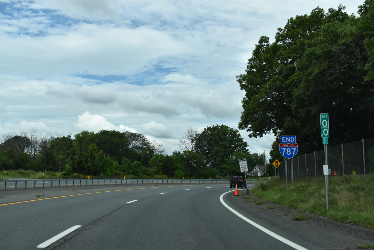
I-787 turns west away from the Hudson River beyond Exit 2 for NY 32 (S Pearl Street) toward I-87 (New York Thruway). 08/22/21

I-787 shifts southward via a wye interchange (Exit 1) to the New York Thruway at Exit 23. The I-787 Exit 1 Connector continues the freeway west to U.S. 9W (McCarty Avenue) in south Albany. 08/22/21

Two lanes separate for the continuation of I-787 at Exit 1 to the New York Thruway. 08/22/21

Traffic partitions at the south end of I-787 for I-87 south along the New York Thruway to Kingston and New York and I-87 north to western reaches of Albany. There I-87 shifts to the Adirondack Northway toward Plattsburgh and Montréal, Quebec and I-90 takes over along the Thruway west to Utica and Syracuse. Photo by Douglas Kerr (06/01).
![]() Exit 1 Connector – South at
Exit 1 Connector – South at ![]() Hoffman Ave
Hoffman Ave
Linking I-787 with U.S. 9W (Southern Boulevard) at Hoffman Avenue, the I-787 Exit 1 Connector is inventoried as NY 912S. 08/22/21

U.S. 9W travels south from Albany to the town of Bethlehem and north through residential areas of south Albany to Lincoln Park and the Center Square / Hudson-Park Historic District. 08/22/21
![]() North at
North at ![]() Exit 1 Connector
Exit 1 Connector

U.S. 9W (Southern Boulevard) curves west from a half diamond interchange with the south end of I-787 leading to the New York Thruway. The succeeding traffic light is with the I-787 Exit 1 Connector (NY 912S) at Hoffman Avenue. 08/04/07
![]() South at
South at ![]() Exit 1 Connector
Exit 1 Connector

U.S. 9W (Southern Boulevard) runs east from McAlpin Street through a residential area of south Albany to the beginning of I-787 north at Hoffman Avenue. 08/04/07

The I-787 Exit 1 Connector (NY 912S) initially heads east to NY 32 (S Pearl Street) before turning north along the Hudson River toward Green Island and Troy. U.S. 9W (Southern Boulevard) south meets I-787 south to the New York Thruway in a third of a mile. 08/04/07
Hoffman Ave – South at ![]() Exit 1 Connector
Exit 1 Connector ![]()

Hoffman Avenue runs along the Plumeri Sports Complex south to the signalized intersection joining U.S. 9W (Southern Boulevard) with the I-787 Exit 1 Connector (NY 912S). 08/22/21

I-787 stems east from U.S. 9W (Southern Boulevard) and Hoffman Avenue) toward the Hudson River and north toward the Albany city center. 08/22/21
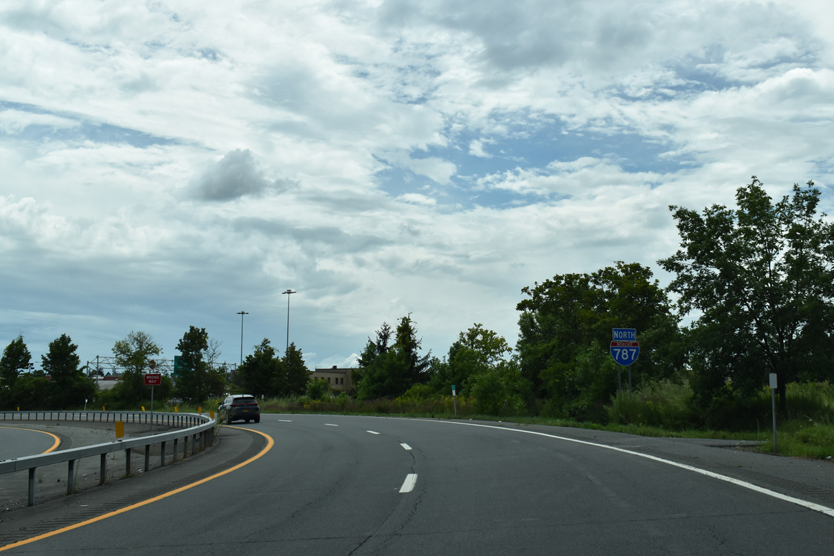
An Interstate 787 north confirming marker stands just beyond the intersection of U.S. 9W (Southern Boulevard) and Hoffman Avenue along NY 912S. 08/22/21
![]()
![]() North at
North at ![]()

I-87/New York Thruway heads north from the town of Bethlehem into the city of Albany at Exit 23 for Interstate 787 to U.S. 9W (Southern Boulevard). 10/05/14

Northbound I-87 (New York Thruway) enters the trumpet interchange (Exit 23) with Interstate 787 north. U.S. 9W (Southern Boulevard) ties into I-787 at adjacent ramps. 10/05/14
![]()
![]() South at
South at ![]()

I-87/New York Thruway travels through southern Albany from the Capital Hills at Albany golf course to the trumpet interchange (Exit 23) with Interstate 787 north. 10/10/14

NY 443 (Delaware Avenue) spans I-87 southbound ahead of Exit 23 for I-787. The New York Thruway was expanded to six lanes here in 2011/12. 10/10/14

U.S. 9W (Southern Boulevard) meets I-787 at Exit 1 nearby between south Albany and the town of Bethlehem. 10/10/14

Interstate 787 north links I-87/New York Thruway with U.S. 9/20 across the Hudson River to the city of Rensselaer. 10/10/14

I-87 south at Interstate 787 when the New York Thruway was just four lanes wide. Photo by Chris Jordan (12/27/02).
Sources:
- Capital Highways – Interstate 787 (Chris Jordan).
http://www.capitalhighways.8m.com/highways/787i/
Page updated April 5, 2023.