Interstate 675 Georgia

Overview
Interstate 675 (Georgia State Route 413) provides an alternate route to I-75 northward from Stockbridge in Henry County to the Perimeter Highway (I-285) in southwest DeKalb County. The freeway doubles as a commuter route for unincorporated suburbs in Clayton County while serving redevelopment of Fort Gillem to the west. I-675 appears rural with a wide median and only four lanes north from I-75 to the Double Bridge Road overpass, and six lanes from Forest Parkway north to I-285.
Road work scheduled for 2023 will modify the exchange joining Interstate 285 with Bouldercrest Road into a parclo interchange. Associated work adds a new distributor roadway from Bouldercrest Road to Interstate 675 south, separating weaving traffic movements from the Perimeter Highway westbound mainline.
 History
Interstate 675 was originally planned to be part of a longer route, as part of a proposed I-475 / State Route 400 freeway that would have extended north of I-285 through the east side of Atlanta. The route was envisioned to run to the south end of U.S. 19/SR 400 (North Fulton Expressway) at I-285 in Sandy Springs. The northern third of this highway was constructed as the tolled extension of SR 400. The remainder between I-285 in DeKalb County and I-85 at Lindbergh in Atlanta was never built.

1979 map showing the proposed routes of Interstate 675 and I-420 in the Atlanta metropolitan area.
Interstate 675 was applied to the route between I-75 at Stockbridge and I-285 in DeKalb County as approved by the American Association of State Highway and Transportation Officials (AASHTO) on June 17, 1975. Construction of I-675 commenced in December 1982, but was halted when a subcontractor defaulted on work in 1985, resulting in a new bidding process and other complications. These events delayed completion of I-675 until October 30, 1987. The freeway cost $61.6 million to complete.1
Route Information
North End – Conley, GA
South End – Stockbridge, GA
Mileage – 11.04
Cities – Atlanta
- Junctions –


Source: January 26, 2022 Interstate Route Log and Finders List

The adjacent diamond interchange between I-285 (Perimeter Highway) and U.S. 23/SR 42 (Moreland Avenue) was modified with construction of the directional T interchange with Interstate 675. Ramps were added to consolidate movements from I-675 north and I-285 west to U.S. 23 and from U.S. 23 north to I-285 north and I-675 south.
Construction of the I-75 South Metro Express Lanes included new ramps joining the managed lanes along Interstate 75 with the south end of I-675 at Stockbridge. Construction on the overall $176 million project kicked off in October 2014. A ribbon cutting ceremony preceded the January 28, 2017 opening of the toll lanes. They run 12 miles along I-75 southeast from SR 138 (Stockbridge Highway) to SR 155 (McDonough Road).2
 Photo Guides
North End  – near Conley, Georgia
![]() North at
North at ![]()

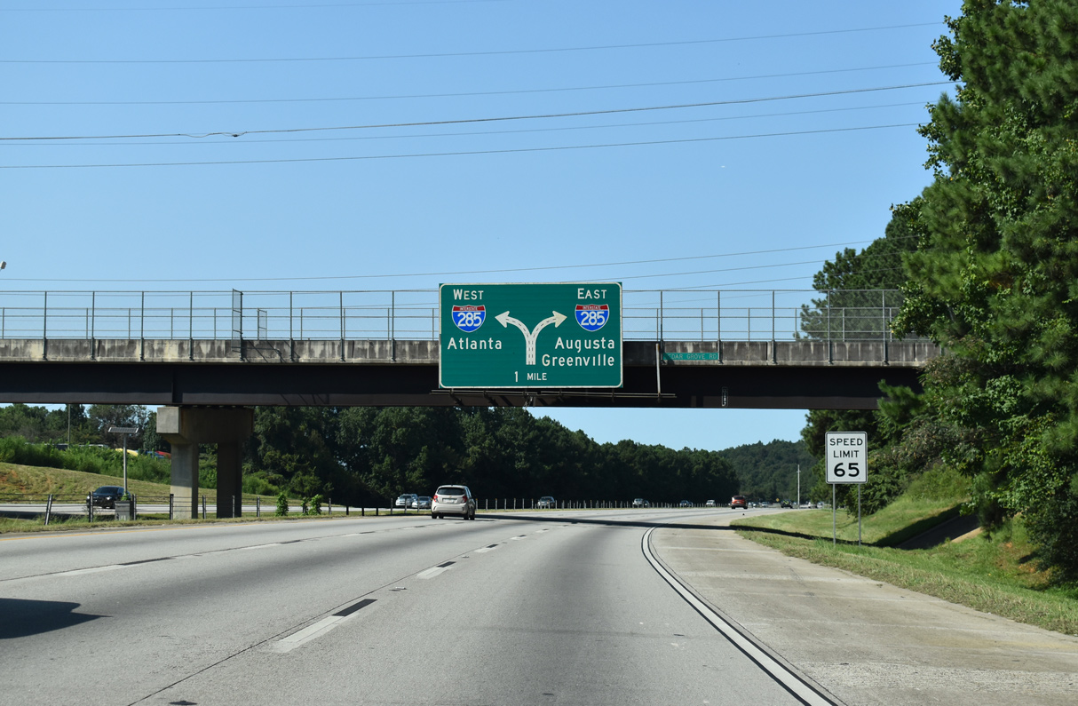
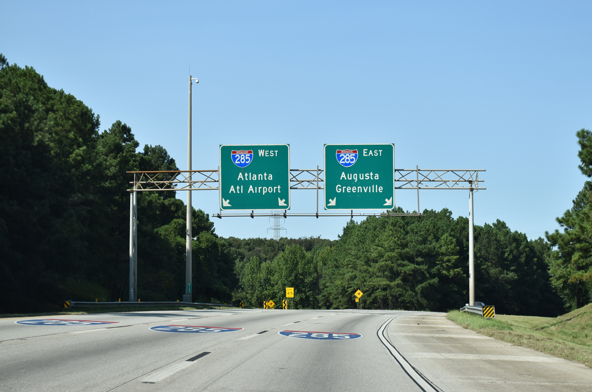
Interstate 675 extends four miles north from the final mainline interchange at Anvil Block Road to I-285 beyond the Cedar Grove Road overpass. 09/22/22

Interstate 285 serves regional traffic to I-20 east for Augusta and I-85 north for Greenville. The outer loop of I-285 reaches the Tom Moreland Interchange with Interstate 85 in 19 miles. 09/22/22

A pair of end shields are posted beyond where the roadways of Interstate 675 separate toward I-285 at the Henrico Road underpass. 09/22/22

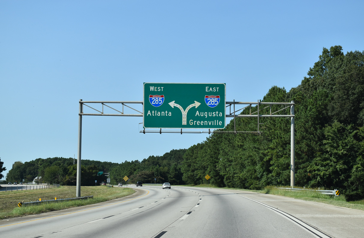
Two lanes part ways for I-285 west toward Hartsfield-Jackson Atlanta International Airport (ATL) and I-285 east and north toward Decatur and Stone Mountain. 09/22/22

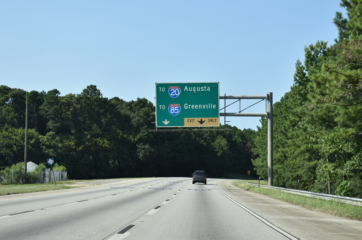
The exit from I-675 north to I-285 west includes a slip ramp for the nearby exchange with U.S. 23/SR 42. 09/22/22

U.S. 23/SR 42 (Moreland Avenue) parallel I-675 south to Conley and extend north from I-285 along the Atlanta city line. 09/22/22
![]() East at
East at ![]()

Two miles ahead of Interstate 675 south (Exit 52) on I-285 east at the South River Gardens neighborhood in southeast Atlanta. 09/11/20

Succeeding ramps depart from Interstate 285 east, 0.75 miles beyond the Forest Park Road SE overpass for U.S. 23/SR 42 (Moreland Avenue) and Interstate 675 south. 09/11/20

The diamond interchange with U.S. 23/SR 42 (Moreland Avenue) includes ramp connections with the adjacent exchange for Interstate 675. 09/11/20

A long sweeping ramp (Exit 52) departs Interstate 285 east for I-675 south to the Clayton County suburbs. I-285 progresses eastward with four lanes toward the communities of Gresham Park and Panthersville. 09/22/22
![]() West at
West at ![]()

I-285 advances one mile west from the diamond interchange (Exit 51) with Bouldercrest Road to meet I-675 south. 07/02/17

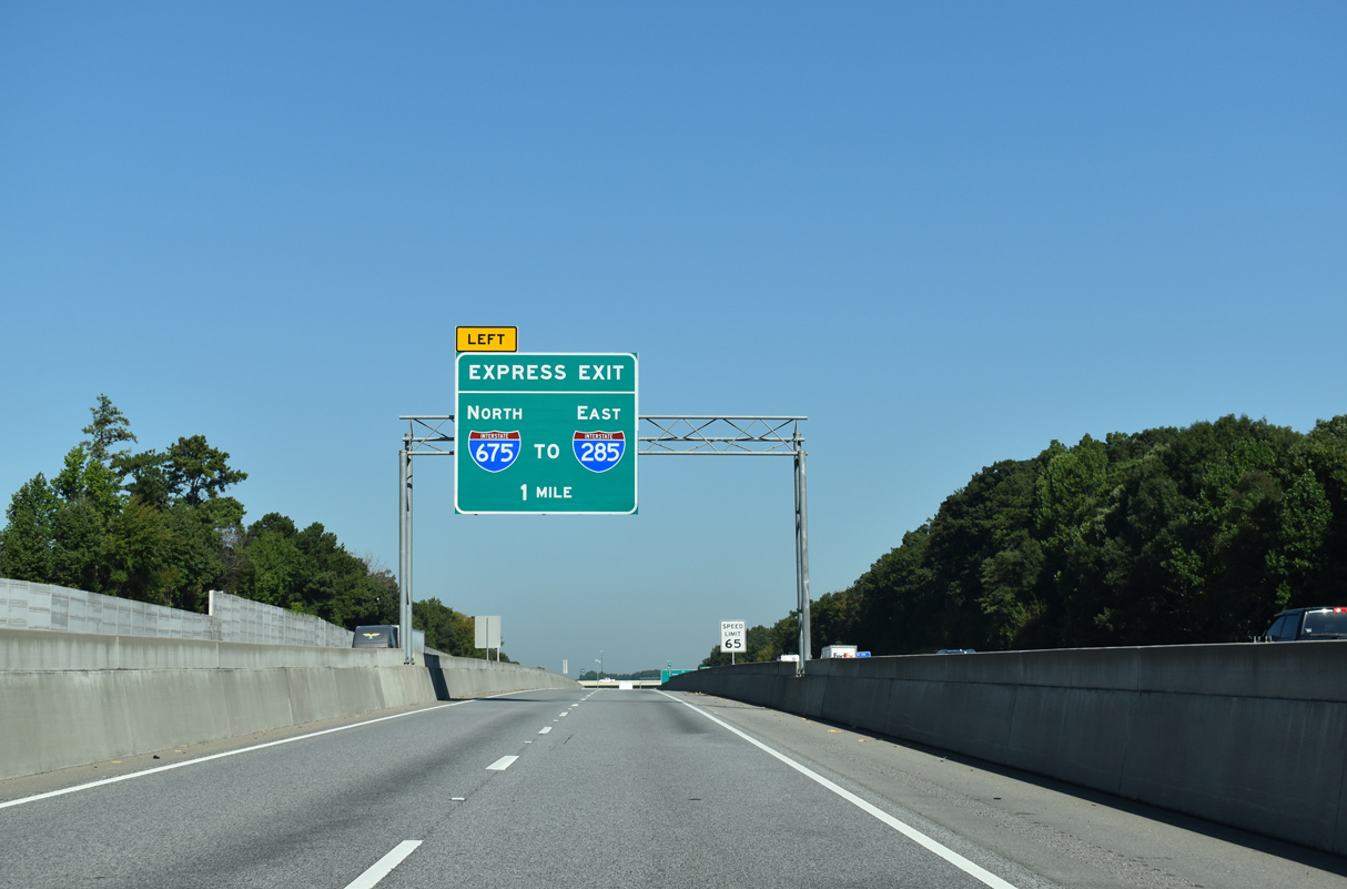
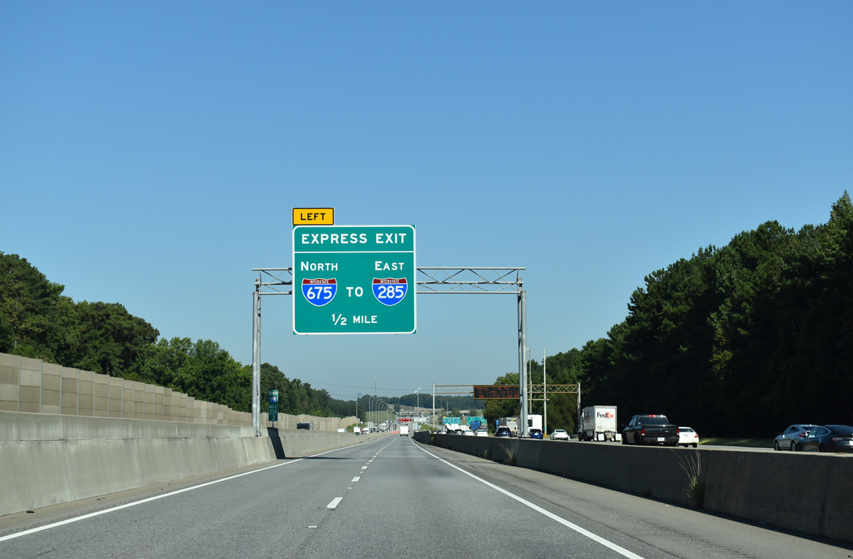
A sign bridge installed in 2016 included the first of two arrow per lane (APL) signs for the two-lane off-ramp (Exit 52) to Interstate 675 south. 07/02/17

Interstate 675 branches southeast from a directional T interchange (Exit 52) with I-285 to Ellenwood and Stockbridge. 07/02/17
North End Throwback
![]() North at
North at ![]()


The original button copy signs for Interstate 285 on I-675 north were carbon copied by 2003. Photos by Jim K. Georges (05/29/99).
The bridge mounted guide sign for Interstate 285 at the Ceder Grove Road overpass was replaced with a new sign bridge by 2023. 09/06/20
Arrow per lane overheads replaced all diagrammatic signs for Interstate 285 on I-675 north by 2023. 09/06/20
The supplemental sign referencing I-20 east to Augusta and I-85 north to Greenville at the north end of I-675 was removed by 2023. 09/06/20
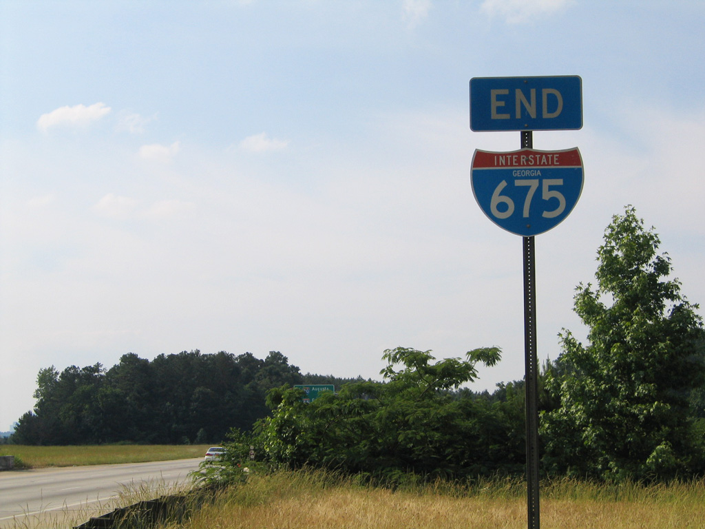
A previous end shield for Interstate 675 north. 05/28/05
Sign replacements made at the north end of I-675 by 2023 removed ATL Airport for I-285 west. 09/06/20
![]() West at
West at ![]()

Two miles ahead of Exit 52 for Interstate 675 south on I-285 west (inner loop) at the Clifton Springs Road overpass. 07/31/11

Signs added to the Bouldercrest Road overpass by August 2016 include an advance sign for U.S. 23/SR 42 and a replacement overhead for Interstate 675. Macon is located 71 miles away via I-75. 07/05/14

An auxiliary lane from Bouldercrest Road defaulted onto Interstate 675 south beyond the South River and this sign bridge. 07/05/14

This sign bridge at Exit 52 was replaced by 2016 with a new assembly. Montgomery emerges as a control city for Interstate 285 here. The Atlanta Beltway reaches I-75 in six miles and I-85 in nine miles. 07/05/14
![]() East at
East at ![]()

Two mile advance sign for Interstate 675 (Exit 52) on I-285 east at the SR 54 (Jonesboro Road) overpass. 01/16/04

This set of overheads on I-285 east for Interstate 675 south and U.S. 23 at the Forest Park Road overpass was replaced in early 2017. Photo by Chris Patriarca (02/23/03).

U.S. 23/SR 42 (Moreland Avenue) pass over the Perimeter Highway one quarter mile west of I-675. This overhead assembly preceded the Moreland Avenue overpass along eastbound I-285. It was replaced by 2017. Photo by Chris Patriarca (02/23/03).

Former overheads at the split of traffic from I-285 east for Interstate 675 south toward Macon. Photo by Chris Patriarca (02/23/03).
South End  – Stockbridge, Georgia
![]() South at
South at ![]()

U.S. 23/SR 42 switch sides with Interstate 675, two miles north of the merge with I-75. Dynamic message signs advise commuters of the status for the reversible I-75 South Metro Express Lanes. 09/11/20

Interstate 675 south meets SR 138 at diamond interchange (Exit 1) just prior to I-75 southbound through south Stockbridge. 09/11/20

Toll rates for the I-75 South Metro Express Lanes vary depending upon traffic congestion. 09/11/20


Two lanes default onto the southbound mainline of Interstate 75 from I-675 while a left exit ramp joins the Express Lanes to McDonough. 09/11/20 and 06/30/17
![]() North at
North at ![]()

Interstate 75 proceeds north with four general travel lanes toward the wye interchange (Exit 227) and split with I-675 north. 12/20/23

Traffic bound for the Perimeter Highway west is advised to take I-75 north for College Park and East Point. 05/06/22

Interstate 675 provides a direct route to I-285 east for the Dekalb County suburbs of Clarkston and Tucker. 12/20/23

Exit 227 separates from I-75 north with two lanes for Stockbridge, Ellenwood and Gresham Park. Birmingham joins Atlanta as a control city for I-75 north, referencing the I-285 inner loop to I-20 in West Atlanta. 12/20/23
![]() South Metro Express Lanes at
South Metro Express Lanes at ![]()
Completed in January 2017, the reversible I-75 South Metro Express Lanes accompany Interstate 75 northward to the suburban route of I-675. 09/22/22
The north end of Interstate 675 ties into I-285, six miles west of I-20 near Panthersville. 09/22/22
The I-75 South Metro Express Lanes conclude with ramps to both the I-75 mainline ahead of Morrow and Forest Park and Interstate 675 north to Dekalb County. 09/22/22
South End Throwback
![]() South at
South at ![]()

Like the south end of I-575, Interstate 675 concludes at a wye interchange with no return access to northbound I-75. SR 138 (Lake Spivey Parkway) provides a connection to I-75 north to Morrow via a diamond interchange located 0.6 miles to the west. 07/05/14

End shields were posted on the transition ramp from I-675 south to I-75 south until 2007. 01/17/04
![]() North at
North at ![]()

Two miles south of the I-75/675 split (Exit 227) at the Flippen Road underpass. Photo by Chris Patriarca (02/23/03).

This diagrammatic overhead was removed when the Walt Stephens Road overpass was replaced to accommodate widening of Interstate 75. An arrow per lane sign took its place just to the south. 05/28/05

Two lanes were available for Interstate 675 north from I-75, while the freeway mainline north toward Atlanta retained three through lanes. This overhead was replaced by 2005. 01/17/04

Interstate 675 north began as I-75 turned northwest for the 20 mile drive to Downtown Atlanta. 01/17/04


A forested median previously separated the Interstate 75 roadways to Exit 227. Trees were eventually cleared to accommodate the I-75 South Metro Express Lanes. 10/22/15
Sources:
- I-675 open to traffic. (1987, November 5). The Atlanta Journal and The Atlanta Constitution.
- Georgia Department of Transportation (GDOT). (2017, January 26). GDOT Celebrates the Completion of the I-75 Express Lanes at Ribbon Cutting. [Press release]. https://www.dot.ga.gov/AboutGeorgia/Pages/GDOTAnnouncementDetails.aspx?postID=83″>
Page updated January 27, 2024.