
Interstate 57


Overview
Interstate 57 is one of two major corridors joining the Chicago area with downstate Illinois. It provides an alternative to Interstate 55 between Sikeston and Chicago by avoiding St. Louis. I-57 initially runs east from Sikeston to Charleston, Missouri before curving northeast to span the Mississippi River. The remainder of the freeway travels north though mostly rural areas.

South of Marion, Interstate 57 gains traffic from the west end of I-24 leading northwest from Nashville, Clarksville and Paducah. Some truck traffic diverges from I-57 for I-64 west from Mount Vernon to the St. Louis area. Through Mt. Vernon, I-57/64 share a five mile overlap.
Beyond Mount Vernon, I-57 ventures north to Salem before turning northeast to Effingham and an overlap with Interstate 70. I-70 carries a substantial amount of truck traffic between St. Louis and Indianapolis, adding to the busy cosigned section with I-57.
North from Effingham, Interstate 57 continues to Mattoon, Champaign, Kankakee and the south suburbs of Chicago. Within Chicago, I-57 is one of the few freeways that is referred to by its number rather than an expressway name.
Within Arkansas, Interstate 57 stretches 122 miles northeast from I-40 in North Little Rock to Walnut Ridge. Signs redesignating the freeway along U.S. 67 as Interstate 57 were installed by the Arkansas Department of Transportation (ARDOT) on March 17, 2025 (ARDOT, 2025a).
Mileage by State
| Arkansas | 122.34 mi |
| Missouri | 21.96 mi |
| Illinois | 364.16 mi |
Data Sources
ArDOT All Roads Linear Referencing System (ARNOLD). https://gis.ardot.gov/portal/apps/experiencebuilder/experience/?id=fd605a71a499436db1d07e8cbb34d2e1
December 31, 2021 Interstate Route Log and Finders List
Parallel U.S. Routes
Interstate 57 combines with U.S. 60 and parallels U.S. 62 from Sikeston to Charleston in Missouri. U.S. 51 ties into the I-57 corridor from Cairo in southern Illinois, with the two paired northward until Dongola. Between Dongola and Effingham, Interstate 57 parallels Illinois Route 37. U.S. 45 accompanies I-57 northward from Effingham to Kankakee. North of Kankakee, Interstate 57 replaced former U.S. 54, which became part of IL 50 and IL 1.
Within Arkansas, I-57 supersedes U.S. 67/167 northeast from I-40 in North Little Rock to Bald Knob. I-57 continues over U.S. 67 from Bald Knob to Walnut Ridge.
Interstate 57 in Arkansas
Language inserted into the Fiscal Year 2017 Transportation, Housing and Urban Development by U.S. Senator John Boozman on April 21, 2016 designated U.S. 67, between North Little Rock and Walnut Ridge, Arkansas as Future Interstate 57. The bill also included the option to officially designate any interstate standard stretch of the U.S. 67 freeway as I-57 (U.S. Senator John Boozman, 2016).

The orientation of the freeway northeast from Little Rock alludes to an eventual connection with Interstate 57 in southeastern Missouri. The designation of I-57 in Arkansas represents an important step to completing that link. Additional supporters of I-57 in Arkansas include communities throughout the corridor, the Newport Economic Development Commission and Chambers of Commerce in Bald Knob, Cabot, Jacksonville, Lawrence County, Newport, Sherwood and Searcy (U.S. Senator John Boozman, 2016).
The establishment of Future Interstate 57 along the U.S. 67 freeway, from I-40 in North Little Rock to U.S. 412 at Walnut Ridge, was approved by the American Association of State Highway and Transportation Officials (AASHTO) on September 24, 2017.
Part of the Connecting Arkansas Program (CAP), the 30 Crossing project reconstructing I-30 north from I-630 in Little Rock to I-40 in North Little Rock included improvements at the exchange joining I-40. Aimed to remove a weaving traffic issue along eastbound I-40 between I-30 and I-57, a new ramp structure was constructed taking traffic from I-30 east over I-40 east ahead of the left exit for I-57/U.S. 67-167 north. Construction on the project started in Summer 2020 and was completed by late 2024 (ARDOT, 2024).

A $24.9 million Rebuilding American Infrastructure with Sustainability and Equity (RAISE) grant awarded to ARDOT on February 3, 2025 provides funding for construction of a bypass along the west side of Corning. The four mile Corning Bypass is part of the Future I-57 corridor extending northeast from Walnut Ridge toward Poplar Bluff, Missouri. Upon completion of this section, the limited access bypass will be designated Arkansas Highway 657 (ARDOT, 2025b).
History
Within Chicago, Interstate 57 follows the Dan Ryan Extension, which extends from the split with I-94 southwest toward Kankakee. The first portion of I-57 to open in Chicago was a 1.1 mile long stretch leading west from the Dan Ryan and Calumet (Bishop Ford Freeway) Expressway exchange to Halsted Street on November 6, 1963 (Chicago Tribune, 1963). The remaining urban segments of I-57 in Chicago opened to traffic in phases between 1967 and 1970 (McClendon, n.d.).
The first section of Interstate 57 in Illinois was dedicated on September 26, 1961. The 30 mile long segment opened from Dongola (Exit 24) north to Marion. The next stretch completed, extended I-57 north from Marion to Johnston City on November 1, 1962. The route to West Frankfort followed in 1963 and by 1965, I-57 opened north to Mount Vernon (Mugrave, 2011).
An additional ten miles of Interstate 57 opened to traffic south from Ullin in May 1969. The following month another 14 miles of freeway were completed from IL 16 and Mattoon north to IL 133 at Arcola. Subsequent completion occurred in July 1969 on a five mile section of I-57 from Urbandale northward, and a 21.5 mile long stretch from a point south of Mount Vernon to IL 161 east of Centralia (Chicago Tribune, 1969).
Continuing work through Fall 1969 included opening an eight mile section of I-57 from Tuscola to Arcola. Additional portions finished that December of that year were seven miles from IL 161 north to Salem, 13 miles from Onarga to Ashkum and 13 miles from Champaign to Rantool (Chicago Tribune, 1969).
The Interstate 57 Mississippi River bridge was dedicated on June 23, 1978. Constructed over the course of six years at a cost of $25.4 million, the bridge opened as part of a $50 million, 11 mile link between Charleston, Missouri and U.S. 51 outside Cairo. This section was the last to open of the overall Interstate 57 corridor (The Southeast Missourian, 1978).
A $10.6 million project broke ground on July 16, 2013 to expand Interstate 57 to six lanes between Marion and Johnston City, Illinois. Related work included the conversion of the ramps with IL 13 to a single point urban interchange (SPUI) (Illinois Government News Network, 2013), as well as the addition of the first diverging diamond interchange (DDI) in southern Illinois. Work on the DDI at The Hill Avenue (formerly Morgan Avenue) was coupled with the adjacent SPUI at IL 13 in a $40 million project. The new exit opened on August 12, 2015 (The Southern Illinoisan, 2015).
Construction at Mount Vernon involved the overlap with Interstate 64. Started in July 2011, this project widened 4.7 miles of I-57 to six overall lanes through the city, with working underway to December 1, 2013 (Mt. Vernon Register-News, 2013). The Mount Vernon widening was the first of the overall I-57 Corridor plan to expand the freeway to six lanes southward to Marion and Interstate 24.
Further north at Effingham, $125 million in construction rebuilt the concurrent stretch of I-57/70. Work broke ground on October 5, 2010 to widen the freeway to six lanes, replace the Little Wabash River bridge on Interstate 70, and reconstruct the interchange with Fayette Avenue (Effingham Daily News, 2012). The four phase project ran through Fall 2016 (Effingham Daily News, 2015).


North End  (Dan Ryan Expressway) ‐ Chicago, IL
 North at
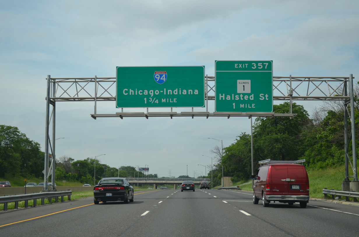
The first sign for I-90/94 (Dan Ryan Expressway) along I-57 north appears 1.75 miles out at the Washington Heights neighborhood. Exit 357 departs next for Illinois 1 (Halsted Street) at the Longwood Manor community. 06/20/15


East at
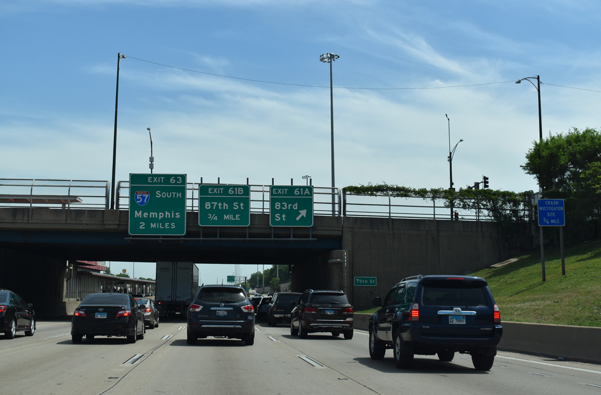
Two miles north of the three-wye interchange (Exit 63) with Interstate 57 on I-94 (Dan Ryan Expressway) east at the 79th Street overpass at Chatham. 06/24/22


North End – Past Views
Past Views Gallery (Tap to Expand / Collapse Section)
North at Dan Ryan Expwy
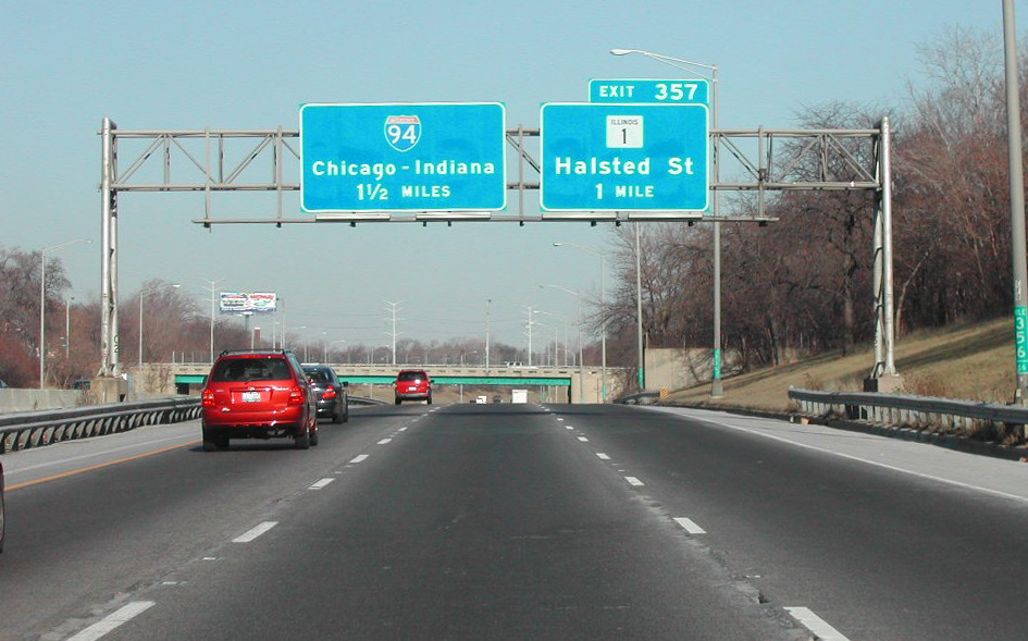
Replacements of button copy signs by 105th Street increased the distance for I-94 (Dan Ryan Expressway) to 1.75 miles. IL 1 (Halsted Street) is the last northbound exit from I-57. Photo by Brian Dowd (12/23/02).


Dan Ryan Expwy - East at
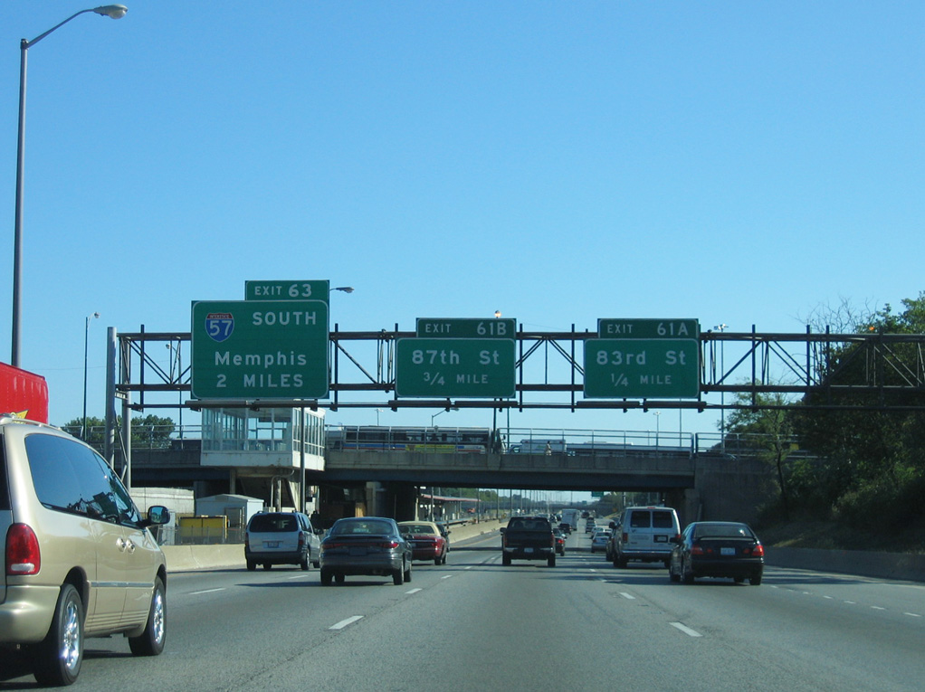
This sign bridge posted two miles north of I-57 was removed during reconstruction of the Dan Ryan Expressway in 2007. Three exits precede the split with Interstate 57 at Exit 63. 09/03/05


Dan Ryan Expwy - West at
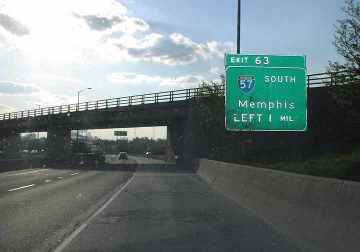
A wye interchange connects I-94 (Bishop Ford Freeway) with the Stony Island Avenue connector one mile east of I-57. This button copy sign was replaced by December 2002, and its replacement by 2012. Photo by Don Hargraves (04/02).


South
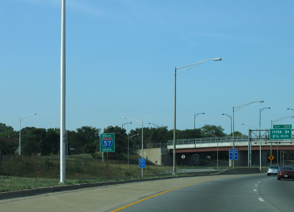
Removed during 2007 reconstruction, a begin I-57 sign was posted along the ramp leading south from the outbound Dan Ryan Expressway. after the transition from Interstate 94 east. I-57 (Dan Ryan Extension) connects Chicago with suburbs including Blue Island, Harvey and Matteson. 09/04/05
South End 
 ‐ Sikeston, MO
South West at
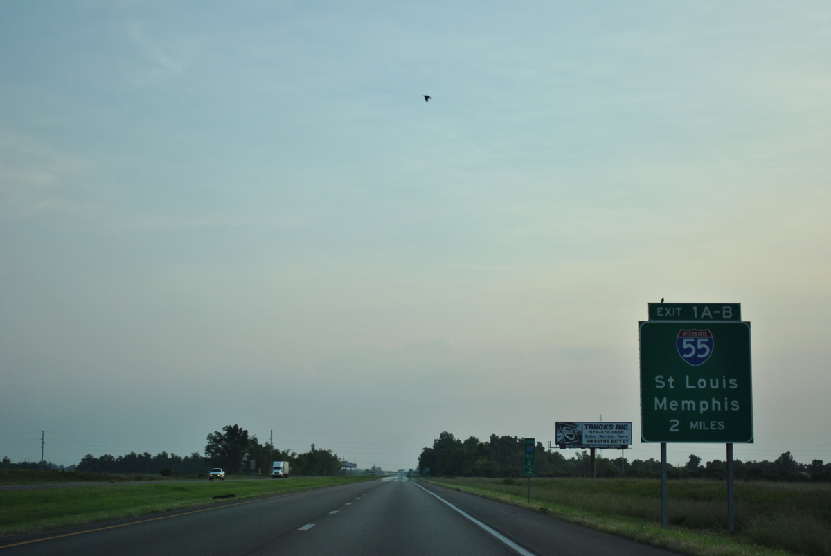
I-57 south / U.S. 60 west advance across the Scott County line within two miles of Exits 1 B/A to Interstate 55. 07/07/26


East at
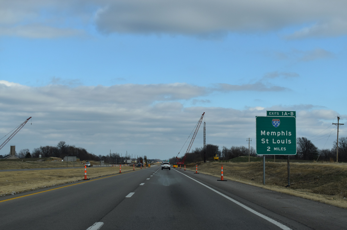
U.S. 60 runs along an expressway bypassing Sikeston to the south leading into the exchange (Exits 1 A/B) with I-55 and I-57. 12/31/23


North at
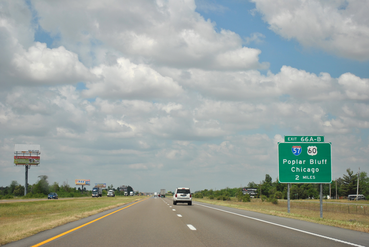
Paralleling Route AA, Interstate 55 traverses agricultural areas along a 7.7 mile long exit less stretch preceding Exit 66 with I-57/U.S. 60. 05/03/12


South at
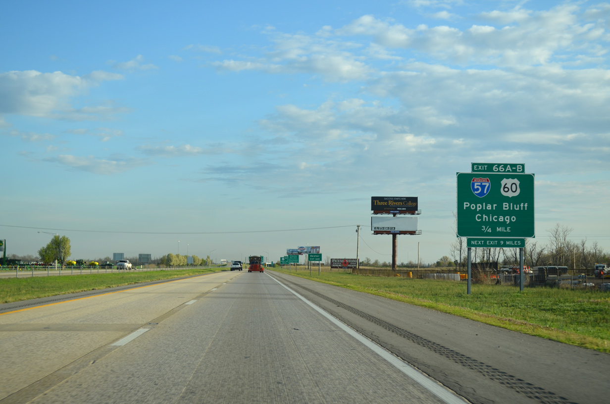
Interstate 55 advances three quarters of a mile south from U.S. 62 at east Sikeston to meet the south end of I-57 and U.S. 60. 04/13/13


North East
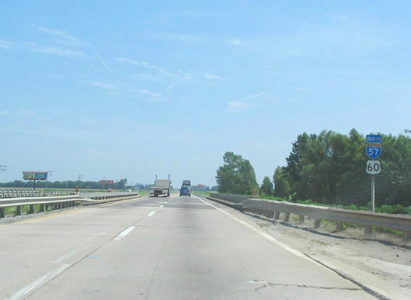
The first confirming marker for Interstate 57 north stood at the bridge across North Cut Ditch just east of I-55. Removed by 2007, it was never replaced. Photo by Steve Hanudel (08/19/05).
Arkansas North End 
 ‐ Walnut Ridge
South West
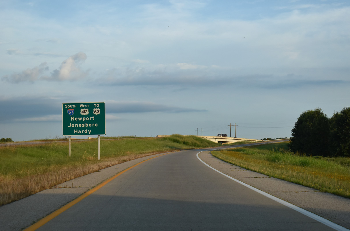
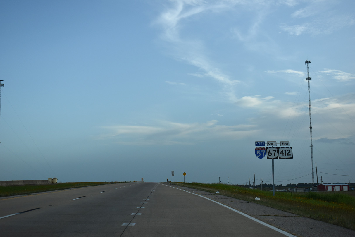
Interstate 57 in Arkansas commences south alongside U.S. 67/412 from a diamond interchange with U.S. 412B on the east side of Walnut Ridge. 07/07/26
Arkansas South End 
 ‐ North Little Rock
South at
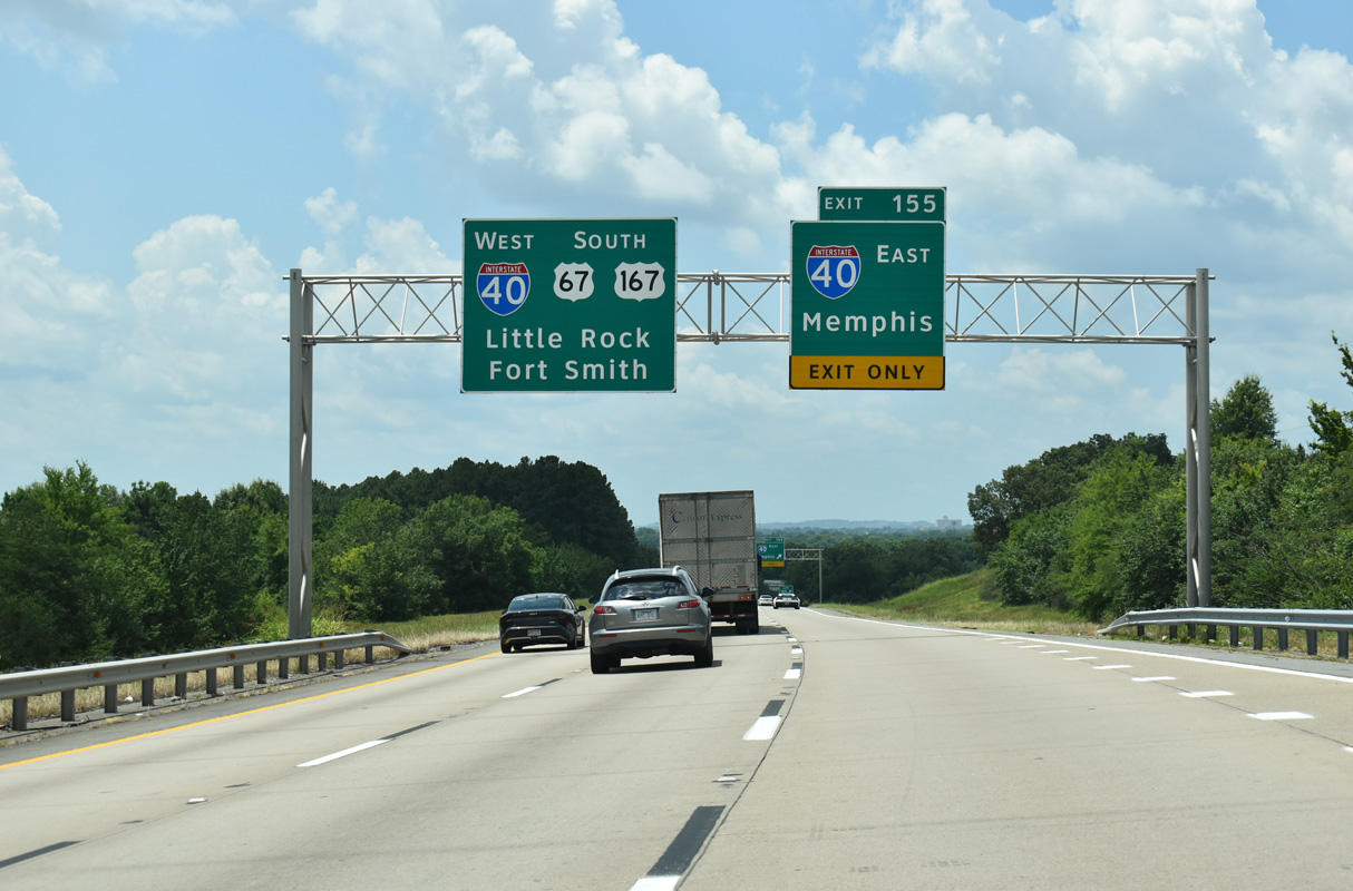
I-57 concludes at a two-wye interchange (Exit 155) adjacent to The Pointe North Hills apartment complex developed in 2019-20 and north of the Union Pacific Railroad - North Little Rock Terminal. 07/08/26


East North at
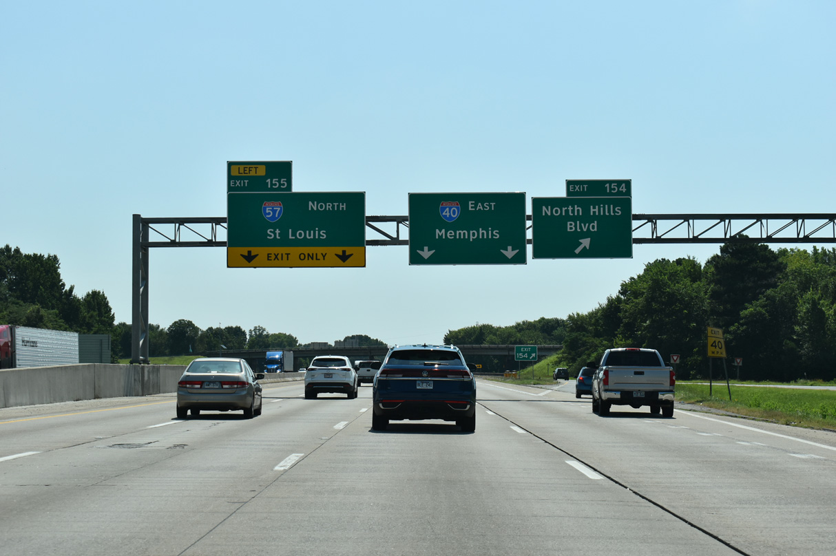
I-57/U.S. 67-167 travel northeast from North Little Rock to Jacksonville, Searcy and Walnut Ridge. 07/08/26


West at
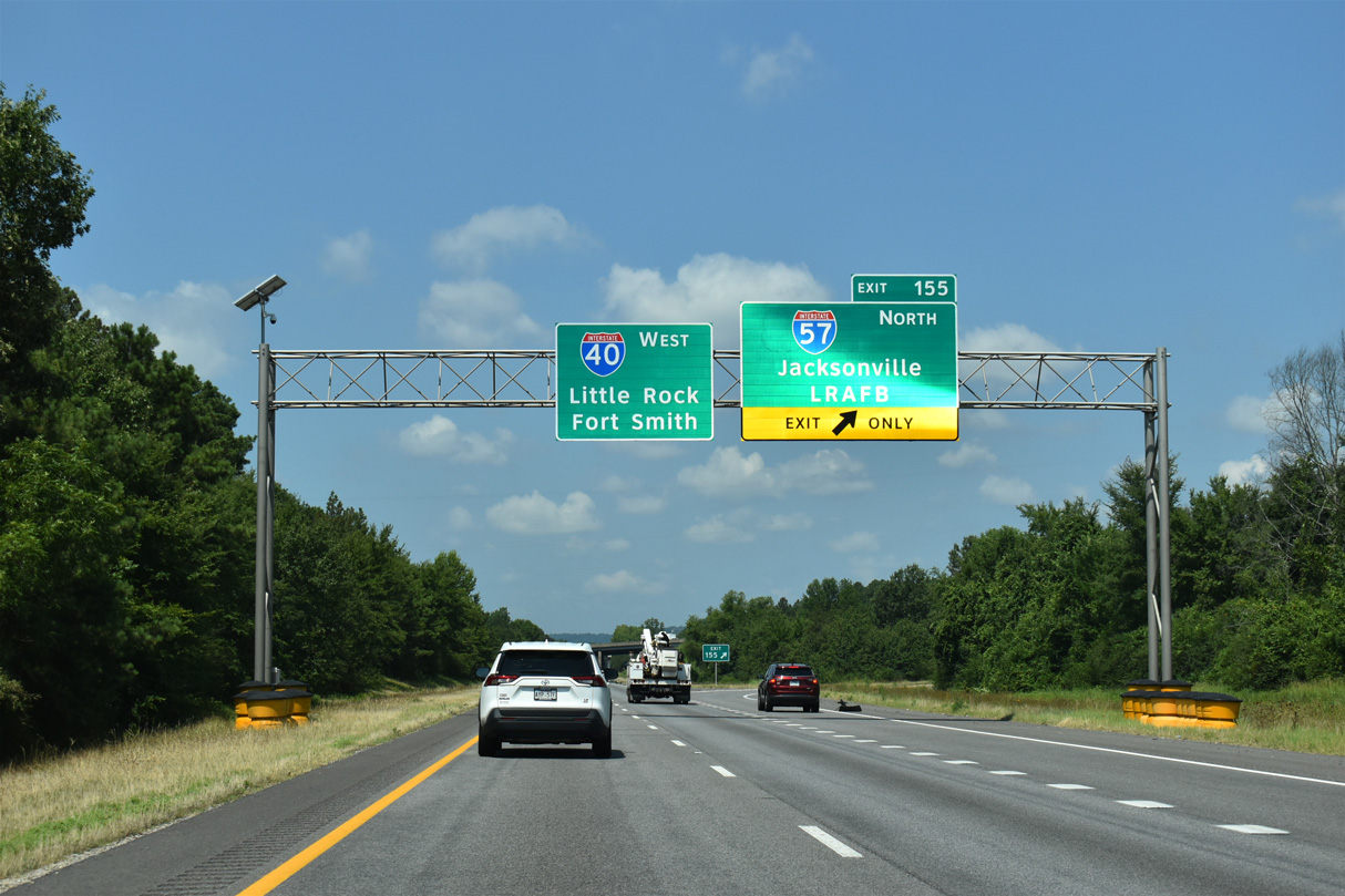
Interstate 40 west at I-57/U.S. 67-167 north to Sherwood, Jacksonville and Cabot. 07/08/26

