Interstate 290 Illinois


Looking down from the observation deck of Willis (Sears) Tower, the tallest building in Chicago, at the Jane Byrne (Circle) Interchange between I-90/94 (Kennedy and Ryan Expressways) and I-290/IL 110 (Eisehower Expressway). This view looks west, with I-290/IL 110 (CKC) bee lining toward the western suburbs. Photo by Steve Hanudel (05/14/06).
Overview
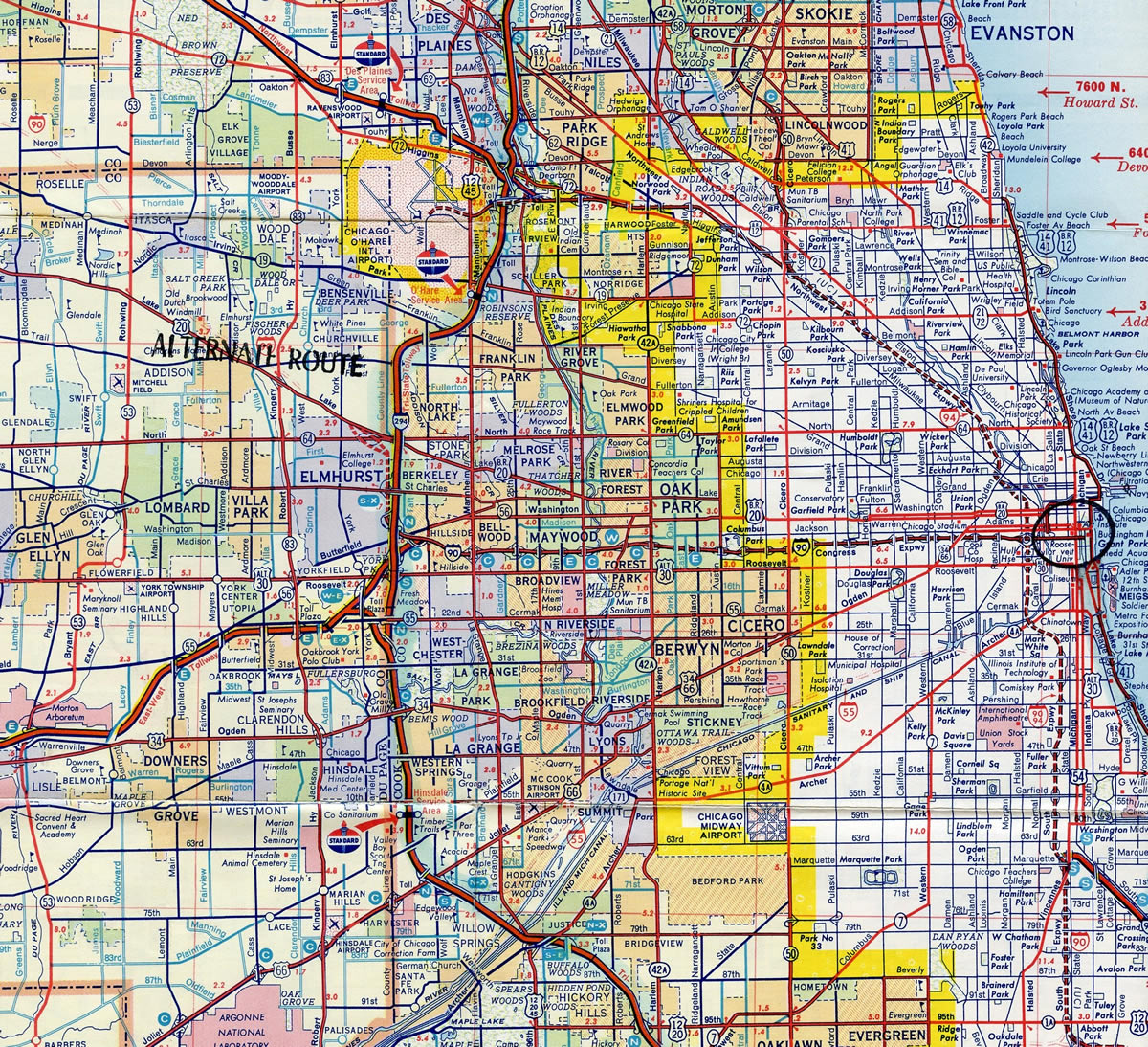
Interstate 290 is a conglomerate of several highways constructed in different eras. It begins at Interstate 90 in Schaumburg and heads south along the Eisenhower Extension toward Addison along the IL 53 corridor. The route turns southeast once it meets Interstate 355, the Veterans Memorial (North South) Tollway. I-355 parallels IL 53 south to Downers Grove and Joliet while I-290 continues to Elmhurst and Berkeley.
A southeasterly trajectory takes I-290 adjacent to U.S. 20 (Lake Street) to IL 64 (North Avenue) and I-294 (Tri State Tollway). I-290 and I-294 parallel one another south for 2.2 miles to the village of Hillside, where the I-290 forks eastward to converge with the east end of Interstate 88 (Ronald Reagan [East West] Tollway). The Tri State Tollway stays on a southern heading to Hinsdale and I-55, where it curves southeast to I-80 and South Holland.
Advancing toward Chicago, the wye interchange where I-88/IL 110 (Chicago Kansas City Expressway) combines with I-290 represents a bottleneck where five lanes of eastbound traffic reduce to three. Beyond the congested merge point, IL 110 (CKC) overlaps with I-290 along the Eisenhower Expressway as the route weaves east between the villages of Bellwood, Broadview and Maywood to IL 171. Following the original Congress Expressway, which was renamed the Dwight D. Eisenhower Expressway in 1964,1 I-290 separates Concordia and Forest Home Cemeteries at the Des Plains River in Forest Park. The below grade, six lane freeway extends east from there through the village of Oak Park to enter the city of Chicago at Austin Boulevard.
Opened to traffic in 1956,1 the Eisenhower Expressway is one of the oldest freeways in Chicago. It runs between the South Austin and Lawndale neighborhoods initially to Near West Side, the Illinois Medical District and University Village / Little Italy. I-290/IL 110 meet I-90/94 at the Jayne Byrne (Circle) Interchange just west of Downtown Chicago. The expressway continues a short distance east of the exchange as a city parkway into the Loop. Known as Ida B. Wells Drive and formerly as Congress Parkway, the limited access highway transitions into an at-grade boulevard beyond the tunnel below the Old Chicago Post Office. Ida B. Wells Drive ties into Columbus Drive at the foot of Buckingham Fountain in Grant Park, just shy of U.S. 41 (Jean-Baptiste Pointe DuSable Lake Shore Drive).
Route Information
East End – Chicago, IL
West End – Rolling Meadows, IL
Mileage – 29.84
Cities – Schaumburg, Elmhurst, Maywood, Cicero, Chicago
- Junctions –


Source: December 31, 2021 Interstate Route Log and Finders List
Early Interstate plans for Chicago took I-90 southeast along what is now I-290, I-94 along the Chicago Skyway to the Indiana Toll Road, and I-294 east from the Tri-State Tollway alongside I-80/90 to Lake Station, Indiana.

Had IL 53 been completed as a freeway north to U.S. 12 at Grays Lake, and U.S. 12 subsequently from there west to McHenry and north to Genona City, Wisconsin, the corridor might have been a candidate for a long distance extension of Interstate 290. This concept is purely speculative.
 History
Interstate 290 is very tightly routed through the western suburbs and through Chicago’s West Side, with very little room for any kind of expansion. Built prior to the Interstate System, Congress Expressway followed the route of I-290 from Downtown Chicago west to I-88 (Ronald Reagan Tollway) / IL 110 (CKC) and Interstate 294 (Tri-State Tollway).
Planning for a limited access freeway route along Congress Street has a long and rich history, with its initial inclusion in the 1909 Plan of Chicago by Daniel H. Burnham. The 1940 Comprehensive Superhighway System of Chicago (approved by the Chicago City Council) included the Congress Street Expressway on October 31, 1940, and construction was authorized with that action. Work on the road began on December 7, 1949, and the first section to open was between South Ashland Avenue and South Laramie Avenue on December 15, 1955. The remainder of the route between South Ashland Avenue and Grant Park in Downtown Chicago (The Loop) opened on August 10, 1956. The $100 million project was a joint effort between the city, county and state. The Congress Street Expressway (or West Expressway) was renamed on January 10, 1964, to honor former President Dwight D. Eisenhower by the Chicago City Council. The Eisenhower Extension, which led northwest from the Congress Expressway alignment toward Schaumburg, opened in 1971.1,2
The Eisenhower Expressway was numbered as part of transcontinental Interstate 90 once Interstate Highway System markers were placed on Chicago’s expressway network. However, during a major renumbering of the Chicago metropolitan expressways in 1978, as approved by the American Association of State Highway and Transportation Officials (AASHTO) on July 6, 1977, Interstate 290 replaced I-90. Interstate 90 was relocated to the John F. Kennedy Expressway and Jane Addams (Northwest) Memorial Tollway via Interstate 94 and Former IL 194. This renumbering also resulted in the redesignation of IL 594 (O’Hare Airport Spur of Kennedy Expressway) as Interstate 190. The idea was to provide a more direct Interstate 90 corridor from the Northwest Suburbs to Downtown Chicago.
Interstate 290 and IL 53 run concurrently from the village of Itasca, just north of the I-355 end, to I-90 (Jane Addams Memorial Tollway). IL 53 extends as a freeway north from the I-290 end through the city of Rolling Meadows, and around the village of Palatine, to Lake Cook Road. The remainder of the route northeast through the village of Long Grove travels at-grade.
Long standing plans for IL 53 included lengthening the freeway north to an extension of the U.S. 12 freeway southeast from Wisconsin. These plans however have met stiff opposition from community leaders in the affluent Lake County suburbs. One plan called for building a portion of the IL 53 route as a 45 mile per hour parkway, while others called for no build alternatives.
Expansion near the western terminus of Interstate 290 added a lane in each direction, bringing I-290 to eight overall lanes. Further construction completed in Fall 2003 widened I-290 to eight lanes between Woodfield Road (near Exits 1 A/B) and Thorndale Avenue (Exit 5). Auxiliary lanes were also constructed in this project.3
A ceremony took place on August 29, 2014 to formally rename the long standing Circle Interchange, where I-90, I-94 and I-290 and IL 110 (Chicago Kansas City Expressway) come together, after former Chicago Mayor Jane Byrne. Byrne was the successor to Richard J. Daley and Chicago’s first female mayor. She served one term in office that ended in 1983.4
Located just beyond the east end of Interstate 290 is the the 2.3 million square foot Old Chicago Post Office. Built in phases between 1921 and 1932, the world’s largest post office ceased operations in 1996. Design of the structure included a 40 foot wide opening through the center to accommodate the planned Congress Street extension from the South Loop to Chicago’s West Side. The Congress Expressway was completed below the post office building in 1955.5
The vacant Old Chicago Post Office was added to the National Register of Historic Places in 2001. An agreement between the city of Chicago and 601W, the building’s owner, in 2016 allowed work to commence on a $500 million plus renovation project. The planned three phase project remedied more than 20 code violations and included replacing the roof, repairing the facade and restoring the historic lobby.6 Work underway through 2017 involved replacing 2,200 windows and competing the full renovation of the lobby off Van Buren Street. Investment for the conversion of the art deco building into office space, restaurants, retail and park space topped $800 million, and over 23 tons of debris were hauled away by 2017. Work extended to March 2019.7,8 The Old Post Office opened for business in October 2019.
 Photo Guides
East End  / Congress Parkway – Chicago, Illinois
![]()
![]() East at
East at ![]()
![]()

I-290/IL 110 (Eisenhower Expressway) advances one mile east from the Paulina Street overpass at Near West Side to the Jane M. Byrne (Circle) Interchange with I-90/94. Photo by Peter Johnson (01/18/21).

Traffic partitions at the east end of I-290/IL 110 (Eisenhower Expressway) for Congress Parkway and I-90/94 on the outbound Kennedy and Dan Ryan Expressways. Photo by Peter Johnson (01/18/21).

I-90/94 combine through Chicago north to Irving Park and south to Greater Grand Crossing. Photo by Peter Johnson (01/18/21).

The exit for I-90/94 east includes access to Taylor Street at the University of Illinois Chicago. I-90/94 travel east from Chicago to Hammond and Gary, Indiana. I-90 leads northwest to Rockford while I-94 runs north to Milwaukee, Wisconsin. Photo by Peter Johnson (01/18/21).

Congress Parkway extends 0.58 miles east from I-290 at the Circle Interchange to Ida B. Wells Drive at Wells Street and the Chicago Loop. Photo by Peter Johnson (01/18/21).

Eisenhower Expressway passes below the Old Chicago Post Office between S Canal Street and the draw bridge spanning the Chicago River South Branch. Photo by Peter Johnson (01/18/21).

A loop ramp connects the east end of Eisenhower Expressway with Lower Wacker Drive north along the Chicago River South Branch to U.S. 41 (Lakeshore Drive). Ida B. Wells Drive extends as an at-grade boulevard below the Chicago Stock Exchange after Wells Street. Photo by Peter Johnson (01/18/21).
![]()
![]() Dan Ryan Expwy – West at
Dan Ryan Expwy – West at ![]()
![]()

I-90/94 (Dan Ryan Expressway) inbound meet I-55 a half mile south of the Jane Byrne (Circle) Interchange with I-290 (Eisenhower Expressway). 06/20/15
Eisenhower Expwy – West at ![]()
![]()
![]()
![]()

Ida B. Wells Drive west becomes the Eisenhower Expressway beyond Wells Drive and ramps with Lower Wacker Drive. Crossing the Chicago River South Branch, three lanes advance west toward the Jane Byrne (Circle) Interchange with I-90/94 and Interstate 290. Photo by Peter Johnson (01/18/21).

I-290/IL 190 (Chicago Kansas City Expressway) begins along the Eisenhower Expressway westbound at the turbine interchange with the Dan Ryan Expressway (I-90/94 east) and the Kennedy Expressway (I-90/94 west). The Eisenhower Expressway continues west in Chicago from the Near West Side neighborhood to I-88 at Hillside. Photo by Peter Johnson (01/18/21).
 East End Throwback
![]() East at
East at ![]()
![]()

These overheads for I-90/94 and Exit 29A at Paulina Street were replaced in kind. The Circle Interchange is unnumbered along I-290 east. 09/02/05

Congress Parkway east from the Eisenhower Expressway to Grant Park was renamed Ida B. Wells Drive by Chicago City Council in Summer 2018. Wells (1862-1931) was an investigative journalist and civil rights activist.9 09/02/05

The UIC-Halsted transit station along the Blue Line is located between the Eisenhower Expressway roadways on the west side of the Jane Byrne (Circle) Interchange. 09/02/05

The Circle Interchange was formerly the location where I-90 east combined with I-94 along the Dan Ryan Expressway outbound. 09/02/05

Leaving the Circle Interchange, the Eisenhower Expressway transitioned onto Congress Parkway. Photo by Dan Garnell (08/28/03).
Eisenhower Expwy – West at ![]()
![]()
![]()
![]()

Crossing the Chicago River South Branch, Eisenhower Expressway advances west toward the Jane Byrne (Circle) Interchange with I-90/94 and Interstate 290. Photo by Steve Hanudel (05/14/06).
Eisenhower Expressway emerges from below the Old Chicago Post Office with three westbound lanes leading into the Circle Interchange with I-90/94. Photo by Steve Hanudel (05/14/06).
![]()
![]() Dan Ryan Expwy – West at
Dan Ryan Expwy – West at ![]()
![]()

Interstate 55 (Stevenson Expressway) travels southwest from U.S. 41 (Lake Shore Drive) to Bolingbrook and Joliet. 09/02/05

Passing over several Metra transit lines, I-90/94 (Dan Ryan Expressway) west continues to Exit 52B for Roosevelt Road and Exit 51H for I-290/IL 110. Visible to the north is Willis (Sears) Tower, which through the latter part of the 1970s and 1980s held the distinction as the highest building in the world. 09/02/05

The Circle Interchange with I-290 (Eisenhower Expressway) marks the transition of the Dyan Ryan into the John F. Kennedy Expressway, which follows I-90 and I-190 northwest to O’Hare International Airport (ORD). 09/02/05

I-90/94 west continue north from I-290/IL 110 by the Chicago Loop (Downtown). IL 110 (Chicago Kansas City Expressway) overlaps with I-290 west to I-88 (Ronald Reagan East-West Tollway). 09/02/05

Exit 51H departs the inbound Dan Ryan Expressway for I-290/IL 110 (CKC) west and Eisenhower Expressway east to Ida B. Wells Drive (formerly Congress Parkway) at the Chicago Loop (Downtown). 09/02/05
![]()
![]() Kennedy Expwy – East at
Kennedy Expwy – East at ![]()
![]()

Exit 50A to Ogden Avenue (former U.S. 34-66) and Exit 50B to the Ohio Street freeway spur depart in quick succession from the inbound Kennedy Expressway. Seven off-ramps line I-90/94 eastbound to the Jane Byrne (Circle) Interchange with I-290/IL 110 at Exit 51H-I. 09/04/05

Prior to the reconstruction of the Kennedy Expressway, there were many exit and entrance ramps connecting with both sides I-90/94. The left exits were a design feature unique to the both the Kennedy and Dan Ryan Expressways in the immediate vicinity of the loop. Most of these were removed from the inbound Kennedy Expressway, though several left entrance ramps remain. 05/09/10

Exit 51G rises from the Kennedy Expressway inbound to Jackson Boulevard east just ahead of the turbine interchange joining I-90/94 with I-290 (Eisenhower Expressway). The Kennedy Expressway ends as the Dan Ryan Expressway carries I-90/94 outbound toward the South Suburbs and northwest Indiana. 09/04/05

Exit 51H separates from I-90/94 east for I-290/IL 110 (CKC) west to Hillside in Chicago and Elmhurst. Eisenhower Expressway extends east from Exit 51I to become Ida B. Wells Drive to the Chicago Loop and Grant Park. 09/04/05
West End – Rolling Meadows, Illinois
![]() West
West ![]() North at
North at ![]()

Interstate 90 (Jane Addams Memorial Tollway) lies 1.25 miles beyond the last mainline exit with IL 58 and IL 72 along Interstate 290 westbound. 05/09/10

Exit 1B leaves I-290/IL 53 (Eisenhower Expressway Extension) north for IL 72 (Higgins Road) and IL 58 (Golf Road) at Schaumburg. 05/09/10

Continuing north toward Interstate 90, I-290/IL 53 expand into a local/express lane configuration. IL 53 extends north as a freeway to the Cook-Lake County line. 05/09/10

The local lanes connect with I-90 (Jane Addams Memorial Tollway) and IL 62 (Algonquin Road). The express lanes bypass the cloverleaf interchange with I-90 north to Kirchoff Road. 05/09/10

Exit ramps from the local lanes to Interstate 90 are unnumbered. Departing first is the ramp for I-90 (Jane Addams Memorial Tollway) leading southeast to O’Hare International Airport (ORD) and Chicago. 05/10/10

An end shield for Interstate 290 west stands beside the bridge spanning the Northwest Tollway. 05/10/10

A loop ramp follows for I-90 west to Rockford and Madison, Wisconsin. 05/10/10
![]() West at
West at ![]()
![]()

Westbound Interstate 90 (Jane Addams Memorial Tollway) at Arlington Heights Road, 2.5 miles ahead of I-290 east and IL 53. 09/02/05

Interstate 90 runs along the north side of Ned Brown Preserve one mile ahead of I-290/IL 53 (Eisenhower Extension). 09/02/05

Crossing over IL 58 (Golf Road) and Salt Creek along I-90 (Northwest Tollway) west ahead of the collector distributor roadway to I-290 east and IL 53. 09/02/05

A two lane c/d roadway branches from Interstate 90 westbound for I-290/IL 53 south to Itasca and I-355 (Veterans North-South Tollway). IL 53 extends north along a freeway to the Cook-Lake County Line. 09/02/05

Traffic departs from the c/d roadway along I-90 west for IL 53 north to Rolling Meadows, Arlington Heights and Palatine. 09/02/05

Westbound at the loop ramp for I-290 east / IL 53 south to Schaumburg, Addison and Elmhurst. 05/10/10
![]() South at
South at ![]()
![]()

IL 53 advances south through the city of Rolling Meadows to succeeding exits for IL 62 (Algonquin Road) and I-90 (Jane Addams Memorial Tollway). 09/02/05

IL 53 partitions with a two lane collector distributor roadway for I-90 (Jane Addams Memorial Tollway) to Chicago and Rockford. Three lanes extend southward onto Interstate 290 and the Eisenhower Extension. 09/02/05

Interstate 90 follows the Jane Addams (Northwest) Tollway northwest from the cloverleaf interchange with I-290/IL 53 to Elgin and Rockford. 05/09/10

Interstate 290 begins as traffic departs for I-90 east to the John F. Kennedy Expressway and Chicago. I-290/IL 53 combine south through Schaumberg to Exit 4. The city of Schaumburg is locally famous for the three-level Woodfield Mall, one of the largest in Chicagoland. 05/09/10
![]() East at
East at ![]()
![]()

One mile ahead of the full cloverleaf interchange with I-290/IL 53 on Interstate 90 (Jane Addams Memorial Tollway) east. Photo by Peter Johnson (03/13/20).

Interstate 90 runs along the north side of Schaumburg to the exchange with I-290 (Eisehower Extension) east and IL 53. Photo by Peter Johnson (03/13/20).

Guide signs preceding the separation of the c/d roadway at Exit 68 partition traffic to Chicago along both I-290 southeast to the Loop and I-90 (Jane Addams Memorial Tollway) east for O’Hare International Airport (ORD). Photo by Peter Johnson (03/13/20).

Two lanes depart from the Northwest Tollway mainline for the c/d roadway to I-290 east and IL 53. IL 53 leads to the northwest suburbs and along the east side of Schaumburg to other western suburbs. Southbound IL 53 ultimately ties into Historic U.S. 66 and connects with Joliet, the seat of Will County. Photo by Peter Johnson (03/13/20).

A toll plaza lines the ramp (Exit 68A) from eastbound I-90 to Interstate 290 (Eisenhower Expressway) east, one of the oldest expressways in Chicago. Photo by Peter Johnson (03/13/20).
West End Throwback


I-90 (Northwest Tollway) eastbound at Interstate 290 east and IL 53. Photos by Don Hargraves (11/02).

The previous end sign for Interstate 290 west preceded the entrance ramp from I-90 westbound. Photo by Don Hargraves (11/02).
Sources:
- Chicago Public Library. (February 2006). 1956 Congress Expressway Opened–Renamed Dwight D. Eisenhower Expressway on January 10, 1964. http://www.chipublib.org/004chicago/timeline/eisenhowerx.html
- McClendon, D. Encyclopedia of Chicago: Expressways. Chicago Historical Society. http://www.encyclopedia.chicagohistory.org/pages/440.html
- Kuznicki, Scott. “I-290 update: OPENING SOON!” Online posting, misc.transport.road, September 24, 2003.
- “Circle Interchange renamed in honor of former Mayor Jane Byrne.” Chicago Tribune, August 29, 2014.
- Blasius, E. (2018, April 16). Old Chicago Main Post Office receives landmark designation. The Architects Newspaper. https://www.archpaper.com/2018/04/old-chicago-main-post-office-landmark-designation/
- Clark, L. (2016, July 21). $500M Makeover Plan For Old Post Office – Work to Begin Immediately. Gold Coast Realty Chicago. https://www.goldcoastrealty-chicago.com/blog/old-post-office-finally-gets-a-makeover-plan-work-to-begin-immediately.html#.V5da5KK4EYK
- “Inside the old main post office, a $600 million ‘blank canvas’.” Chicago Tribune (IL), September 27, 2017.
- “Old main post office owner lands $500 million construction loan.” Chicago Tribune (IL), December 19, 2017.
- “With Congress Parkway now renamed Ida B. Wells Drive Chicago has its first major street named for a black woman.” Chicago Tribune (IL), February 11, 2019.
Page updated June 29, 2022.