Interstate 82
Overview
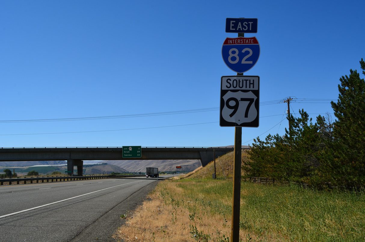
Interstate 82 is a rural freeway in the Pacific Northwest that links I-84 near Hermiston, Oregon with I-90 at Ellensburg, Washington. The highway originates in the Kittitas Valley, where it travels south with U.S. 97 across Manastash and Umtanum Ridges along the west side of Yakima Firing Range. Winding from Selah Valley directly along side the Yakima River, I-82/U.S. 97 pass through a gap west of Yakima Ridge into the city of Yakima.

Dedicated in November 1971, the concrete arch Fred G. Redmon Bridge takes I-82 and U.S. 97 over Selah Creek in a rural area north of Yakima. The top of the arch measures approximately 325 feet above the canyon floor and has a length of 1,336 feet. Each arch span measures 549 feet in length. When they were built, these two concrete arches were the largest of their type in the United States. 07/17/23
Yakima used to include a Business Loop for I-82 through Downtown, while I-82 combines with U.S. 12 and 97 through eastern reaches of the city adjacent to the river. South of Union Gap, U.S. 97 parts ways with the corridor for Wapato and Toppenish while I-82/U.S. 12 shift southeast along the Yakima River toward Snipes Mountain and Sunnyside.
Interstate 82/U.S. 12 remain paired through eastern reaches of Yakima Valley to Grandview and Prosser before ascending along the northern slopes of Horse Heaven Hills east to Benton City and the Tri-Cities area. U.S. 12 separates with I-82 for Interstate 182, a freeway spur leading east through Goose Gap to Richland and Pasco.
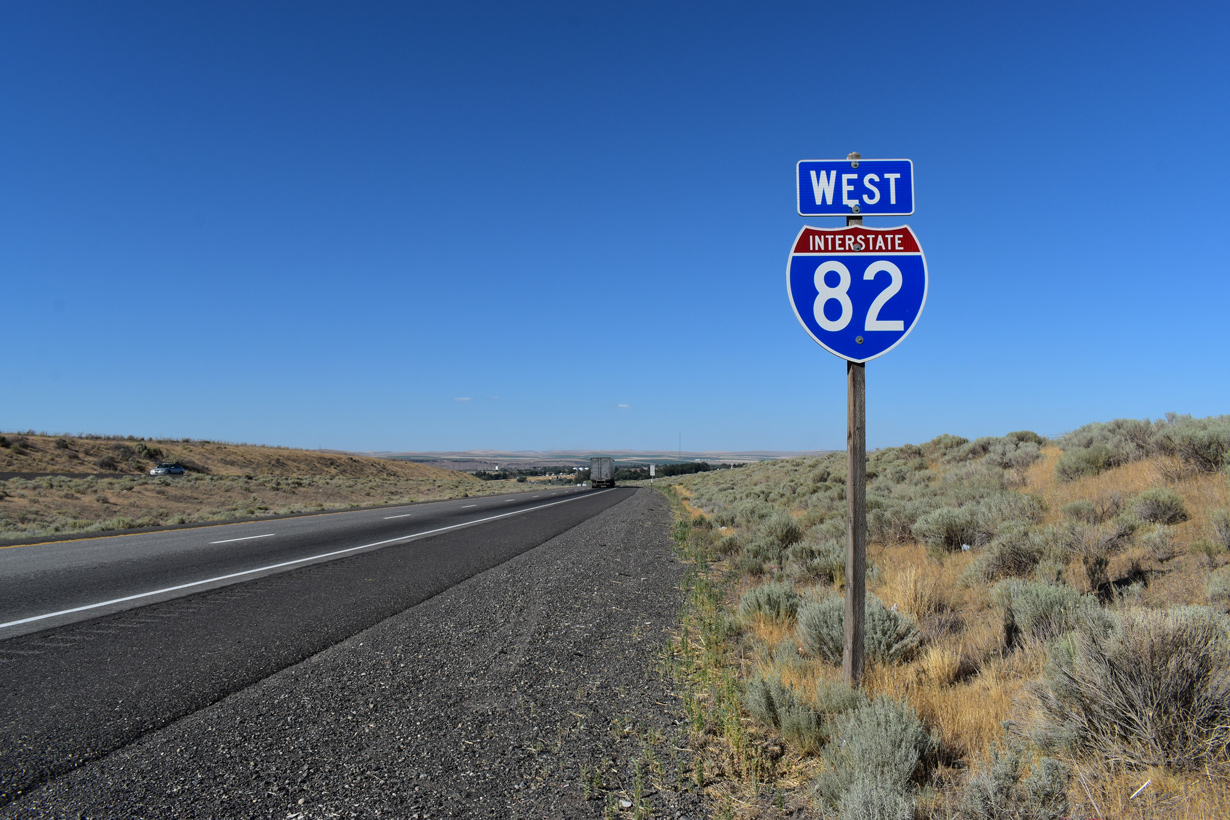
Staying south of Badger Mountain along the periphery of Horse Heaven Hills, Interstate 82 bypasses Kennewick to the merge with U.S. 395. The pair depart the Tri-Cities for a southerly route over Horse Heaven Hills along side Bofer and Fourmile Canyons. Once at Plymouth, the two meet the east end of Washington Route 14 and the Columbia River.
Spanning the Columbia along I-82/U.S. 395 is the Umatilla Bridge. The bridge consists of separate spans; the eastbound crossing opened in 1955 and the westbound was completed in 1987. U.S. 395 breaks away from the freeway at Umatilla just south of the state line to combine with U.S. 730 nearby. Known as McNary Highway Number 70 in Oregon, Interstate 82 stays to the west through agricultural areas outside Herimiston to end at I-84 adjacent to Umatilla Army Depot.
 Parallel U.S. Routes
Interstate 82 follows U.S. 97 from I-90 south to Yakima, U.S. 12 from Yakima east to the Tri-Cities, and an independent alignment from there southeast to the Columbia River and I-84. Although U.S. 395 is signed along Interstate 82 south of Kennewick, it used to follow a different route. Prior to the completion of I-82 between Umatilla and Kennewick, U.S. 395 went between Umatilla and Pasco through Wallula and Burbank. It also overlapped with U.S. 730 and U.S. 12.
Route Information
Mileage
Washington – 132.57
- Cities – Ellensburg, Yakima, Toppenish, Sunnyside, Grandview, Richland, Kennewick
- Junctions –


Oregon – 11.01
Cities – Hermiston
- Junctions –
Source: December 31, 2021 Interstate Route Log and Finders List
I-82 Annual Average Daily Traffic (AADT)
Sources: WSDOT Traffic GeoPortal 2018 AADT
OTMS Traffic Volumes 2018 AADT (ODOT)

Until 1966, the alignment of Interstate 82 was projected southeast across Horse Heaven Hills. Efforts from Senator Warren G. Magnuson helped shift the freeway eastward to better serve the Tri-Cities.4

The initial stretch of Interstate 82 constructed ran south from Ellensburg to Yakima. It was fully opened to traffic in November 1971.5
History
I-82 was an original route included in the Interstate Highway System by the federal Secretary of Commerce in 1956, based on a Department of Defense recommendation. The states of Washington and Oregon however did not agree on where to build the freeway, and the alignment of I-82 would remain incomplete and undergo several corridor studies.
Washington and Oregon disagreed on which cities would be served by the proposed route of I-82. The two major corridors considered for Interstate 82 were (1) the Umatilla route, beginning at I-84 in Stanfield, Oregon and traveling northwest through Umatilla toward Prosser, Washington or (2) from Interstate 84 at Pendleton, then northwest to Wallula and then northwest to Prosser in Washington. Alternative #1 was agreed upon by the two states, but it was protested by groups from the Tri-Cities concerned about an economic disadvantage by not being located on the Interstate. While Alternative #2 would have been longer, it would have allowed I-82 to connect more directly with the Tri-Cities (Richland, Pasco, and Kennewick) and Walla Walla. These routes were debated for the ensuing decade, and compromise was finally reached in 1973.
As part of the deal, an alignment similar to Alternative #1 (Umatilla Route) was chosen. Interstate 82 would cross the Columbia River on an existing bridge (this bridge at Umatilla was built in the 1950s but was not part of any highway route — not even U.S. 395 — until it became the eastbound lanes of I-82),1 and the new freeway would follow a largely north-south route between the Umatilla bridge and I-84 southwest of Hermiston. The impacted Washington cities (Tri-Cities and Walla Walla) were satisfied through the Federal Highway Administration’s 1972-1973 approval of a spur route, Interstate 182, to serve them. Although there was a final attempt to change the route of I-82 in 1978, construction of the project finally commenced shortly thereafter. So over 30 years after the route was conceptualized, Interstate 82 was completed and opened to traffic on September 20, 1988 near Hermiston, Oregon.2
Naches Pass Route
According to a Washington Highways article from the 1960s, Interstate 82 was at one time planned to be routed over the Naches Pass rather than due north to Interstate 90 at Ellensburg (thanks to Mark Bozanich for researching this proposal). This was never a definite routing; it was simply a “possible” routing. Naches Pass lies along the Naches River between Washington State Route 410 at Greenwater and SR 410 near Cliffdell. Routing Interstate 82 through this pass would alleviate traffic on I-90 over Snoqualmie Pass and provide easy access between Tacoma and Yakima.
The highway department proposed building a highway of some type over Naches Pass for several decades. One plan would include building a 9000 foot long tunnel under the summit. This corridor is officially designated under state law as Washington State Route 168. SR 168 would connect with existing SR 410 near Greenwater west of Naches Pass and near Cliffdell to the east. Naches Pass is in a more direct line between Tacoma and Yakima than Chinook Pass, the pass presently crossed by SR 410 (formerly U.S. 410). SR 410 cuts through the northeast corner of Mt. Rainier National Park. Commercial traffic is prohibited in the park. Also, Chinook Pass is closed in winter due to heavy snow accumulation.
A new highway over, or under, Naches Pass would provide a direct Tacoma-Yakima connection, be open year round, and be open to cars and trucks. Such a route would link the agricultural Yakima Valley with shipping facilities at the Port of Tacoma. The highway department has no active plans to build the Naches Pass highway but state legislators from the Yakima Valley bring up the issue from time to time. Even if such a route is built, it may be a two lane expressway for several years before being upgraded to four lane, divided freeway.
Eastern Oregon
A proposal surfaced in April 1999 to extend Interstate 82 south into Oregon. The State of Oregon was examining a possible north-south Interstate that would cost $1 billion and connect with the southern (eastern) end of I-82, as reported in “Eastern Oregon waits for new highway,” written by James Sinks, which appeared in The Bulletin. The possible alignments of the new highway would be:
- Madras route: From Umatilla through Heppner, Condon, Fossil and Antelope to Madras, where the interstate would replace Highway 97 south through Bend to the California border.
- Prineville route: From Umatilla through Heppner, Hardman, Spray, Prineville, Powell Butte to Highway 97 near Bend, then continue south to the border.
- Highway 395 route: From Umatilla through John Day, Burns and Lakeview.
According to the article, if the road was built someday, it would not be named Interstate 82, because north-south highways are odd numbered.3
 Photo Guides
East End  – Hermiston, Oregon
![]() East at
East at ![]()
![]()

The final shield for Interstate 82 eastbound stands south of Exit 5 (Power Line Road). The freeway angles southwest across agricultural areas on the ensuing stretch west of Hermiston. Photo by Daniel Tedford (06/18/06).

Running along the east side of Umatilla Army Depot, eastbound Interstate 82 reaches the penultimate exit at Westland Road. 07/17/23

Curving southwest from Wheatland Road, Interstate 82 advances 0.6 miles to the directional T interchange with I-84/U.S. 30. The forthcoming ramp for westbound leads travelers to The Dalles, Hood River and Portland. 07/17/23

The I-82 eastbound mainline defaults onto Interstate 84/U.S. 30 east to Pendleton, La Grande, Baker City, Ontario, Caldwell, and Boise, Idaho. 07/17/23
![]()
![]() East at
East at ![]()

The two-mile advance sign on I-84/U.S. 30 east for Interstate 82 precedes Exit 177 to Umatilla Army Depot. 08/28/06

Interstate 82 stems north from I-84/U.S. 30 east in one mile. The freeway passes between Umatilla Army Depot and the city of Hermiston northward to the east end of U.S. 730 at Umatilla. 08/28/06

A flyover ramp (Exit 179) leads onto Interstate 82 west from I-84/U.S. 30 east. I-82 forms part of the fastest route from Portland to Spokane, Washington via connections with U.S. 395 north from the Tri-Cities to I-90 east at Ritzville. 07/17/23
![]()
![]() West at
West at ![]()

Two miles ahead of Interstate 82 west to Umatilla, where U.S. 730 ties in from Irrigon, and McNary Dam on the Columbia River. Photo by Peter Johnson (09/14/20).

Westbound I-84/U.S. 30 meet I-82 three quarters of a mile beyond Exit 180 to Westland Road. I-82 represents one of six crossings of the Columbia River between Hermiston and Portland. The succeeding bridges are located at Biggs (U.S. 97) and The Dalles (U.S. 197). 08/28/06

A third westbound lane joins I-84/U.S. 30 between Westland Road and Exit 179 for I-82 north to the Tri-Cities of Washington (Richland, Pasco, and Kennewick), and Yakima. 07/17/23

I-82 initially travels north to the city of Umatilla, where it combines with U.S. 395 to cross the Columbia River. Once it enters Washington, I-82 arcs eastward across the Horse Heaven Hills to Kennewick, where U.S. 395 branches northeast to Pasco and Spokane. 07/17/23
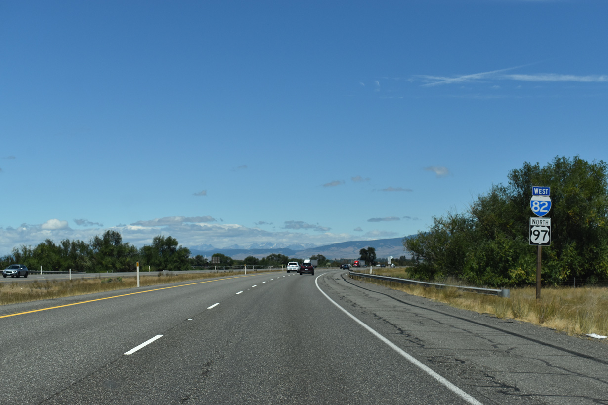
West End – Ellensburg, Washington
![]() West
West ![]() North at
North at ![]()
The final reassurance shield assembly for Interstate 82 appears beyond the exchange (Exit 1) with SR 821. 07/17/23

One mile from Interstate 90 on I-82 west / U.S. 97 north near Ellensburg. I-90 travels west to Seattle via Snoqualmie Pass and east to Spokane via Moses Lake. 07/17/23
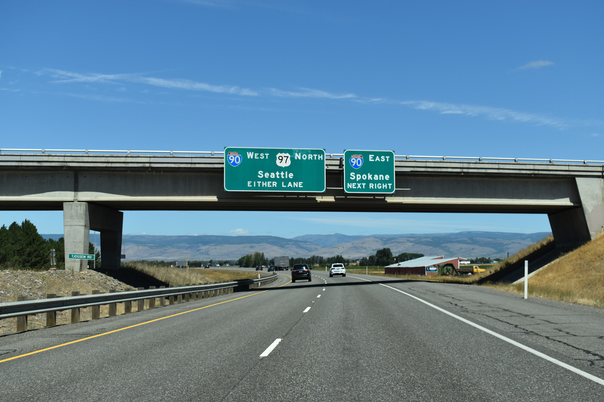
Tjossem Road spans Interstate 82 just ahead of the ramp separation for I-90. The freeway defaults onto I-90 west along the west side of Ellensburg. U.S. 97 combines with I-90 to Exit 106 for University Way. 07/17/23

Interstate 90 travels along a remote stretch east from I-82 and Ellensburg to cross the Columbia River at Vantage. Westward beyond U.S. 97, Interstate 90 continues to Cle Elum and metropolitan Seattle. 07/17/23
![]() East
East ![]() South at
South at ![]()

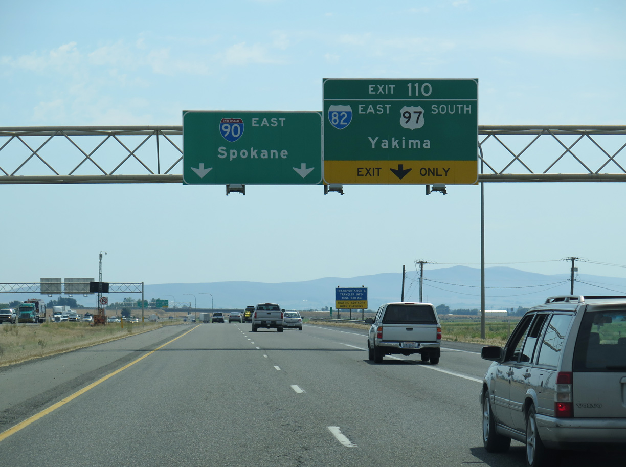
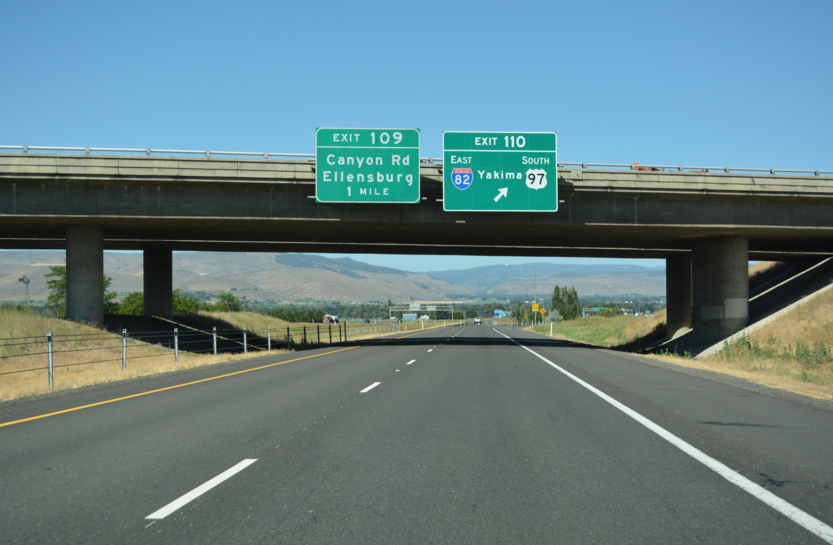
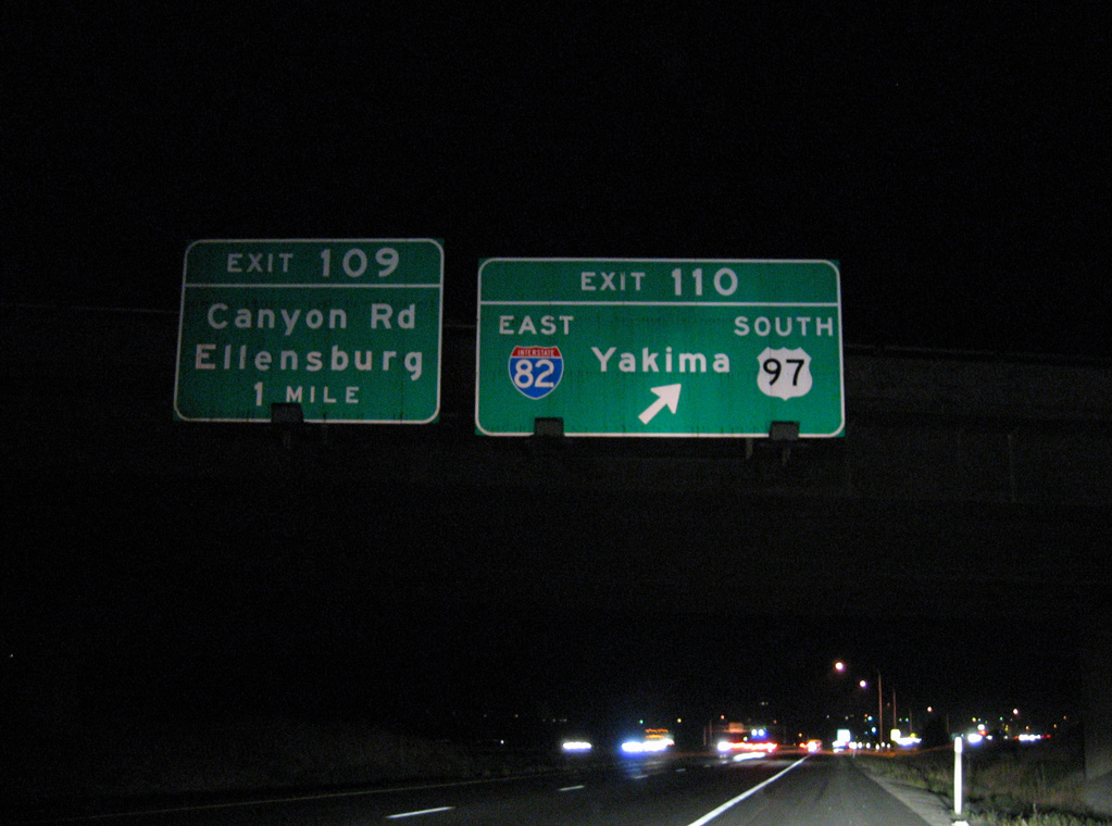
I-90 east and U.S. 97 south separate one mile east of the loop ramp (Exit 109) for Canyon Road (former U.S. 97 / Business Loop I-90) at Interstate 82. 07/17/23

An auxiliary lane opens east from the Canyon Road entrance ramp to Exit 110 with Interstate 82 east to Yakima. 07/17/23
The previous overhead for Exit 110 on Interstate 90 east. 06/28/15

I-90 east enters the trumpet interchange (Exit 110) with Interstate 82 east and the departing U.S. 97 south. 07/17/23
![]() West at
West at ![]()
![]()

I-90 converges with I-82/U.S. 97 west across a rural area beyond the city of Kittitas. 07/19/23
Interstate 90 west at I-82 east / U.S. 97 south to Yakima. This ramp shifts westward to merge on the right side of the entrance ramp from I-90 east. 07/19/23
Replaced overhead and removed luminaries for Exit 110 / Interstate 82 on I-90 westbound. 09/01/06
Sources:
- Andy Ransom, Personal Email (“AARoads feedback: I-82 historic routes”), Tuesday, May 16, 2006.
- Interstate 50th Anniversary: The Story of Oregon’s Interstates.
- “Eastern Oregon waits for new highway.” The Bulletin.
- “I-82 saga was 25-year freeway tug-of-war.” Tri City Herald, November 25, 1984.
- “113-Mile Road To Plymouth Given Routing.” Ellensburg Daily Record, May 22, 1963.
Page updated October 5, 2023.