Interstate 43

Overview
Interstate 43 connects the Milwaukee area with Beloit to the southwest and Green Bay to the north. Following the Rock Freeway, I-43 originates at I-39/90 and angles northeast from Beloit to Delavan, Elkhorn, Mukwonago and the southwestern Milwaukee suburbs. Once at the Hale Interchange with Interstate 41 and I-894 in Greenfield, I-43 joins the Airport Freeway east to south Milwaukee and the Airport Interchange with I-94.
Combining with Interstate 94 (North South Freeway), I-43 turns north through the Saveland Park and Walker’s Point neighborhoods of Milwaukee to the Marquette Interchange with the East West Freeway. There I-94 turns west through Menomonee River Valley while I-794 spurs east to Downtown and the Historic Third Ward. Interstate 43 meanwhile remains along the North South Freeway to Kilbourn Town, Harambee and an exit of Milwaukee at Grover Heights.
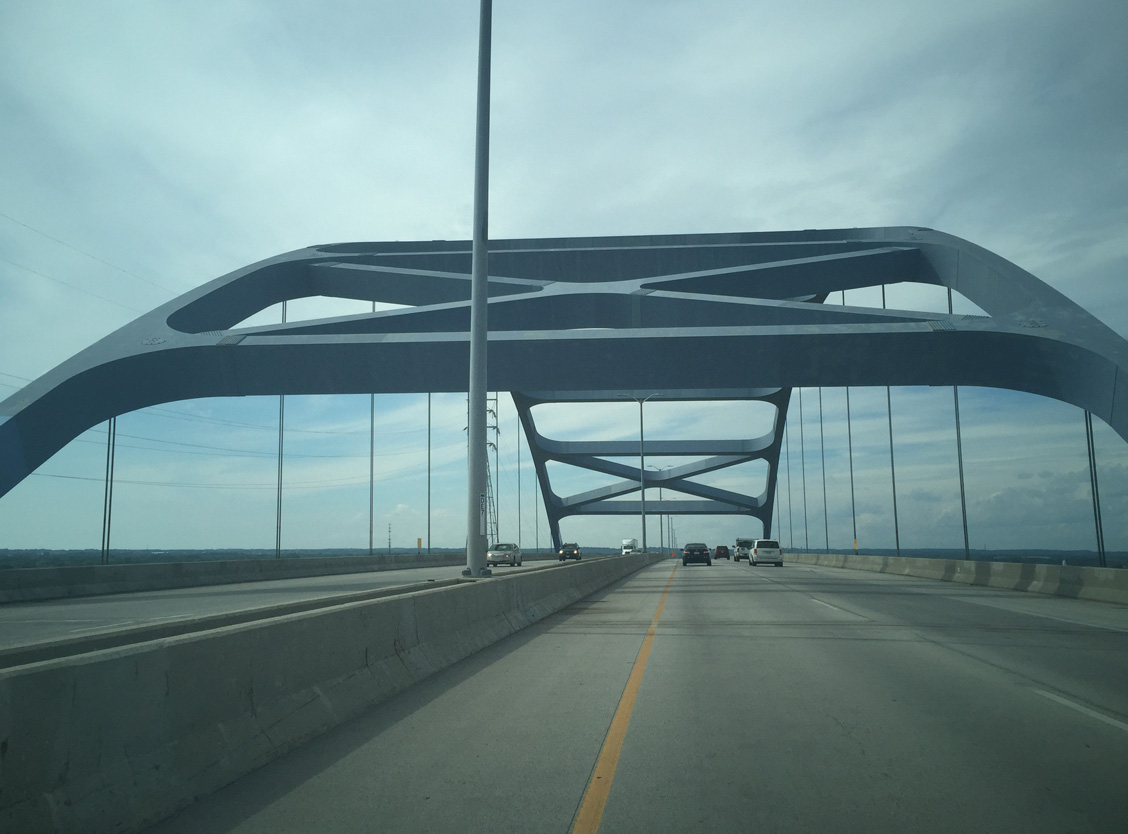
The urban style freeway of I-43 advances north through Glendale along an expressway originally built for U.S. 141. Continuing through the northern suburb villages of Fox Point, River Hills and Bayside, Interstate 43 leaves the Milwaukee area for Saukville and the split with Wis 57. There the freeway turns east by Port Washington to run along the west shore of Lake Michigan to Sheboygan and Manitowoc.

View of Leo Frigo Bridge from mouth of Fox River Photo by Peter Johnson (06/17/15).
The rural freeway leads away from the lake through northern Manitowoc County to enter Brown County and the Green Bay metropolitan area. Once at Bellevue, I-43 curves northeast than west as part a belt route with Wis 172 and I-41 encircling Green Bay. The final stretch traverses industrial and wetland areas along the southern periphery of Green Bay itself, including the high level Leo Frigo Bridge across the Fox River.
 Parallel U.S. Routes
Interstate 43 replaced U.S. 141 between Milwaukee and Green Bay. The route also doubles as U.S. 41 along the south leg of I-41/894 in Milwaukee.
History
Interstate 43 was not an original 1956 Interstate Highway; it was commissioned in the 1970s along U.S. 141 as part of the Milwaukee-Green Bay Interstate Highway.1 Government planning maps of the Interstate Highway System from that era initially showed Interstate 43 as part of an extended Interstate 57, with presumably a long overlap along Interstate 94 from Chicago to Milwaukee (note that this overlap was never shown on any planning maps, so it would have been implied). Potential funding for the freeway in 1972 referenced the future Interstate as an extension of I-57 as well.2
The initial 82 mile long route for I-57 was approved by the Federal Highway Administration in May 1973 from Saukville, northeast along U.S. 141, to Wis 42 at Sheboygan and then northward to U.S. 151 outside Manitowoc. A northwesterly trajectory took I-57 from U.S. 151 to the planned Bellevue interchange south of Green Bay. This route did not extend south of Saukville due to the controversial Cedarburg Bog area. Instead provisions were made to tie the new I-57 in with the preexisting U.S. 141 freeway south of Saukville. The proposed new I-57 took it through Mequon and along the Wisconsin 57 corridor into Milwaukee otherwise.3
The Milwaukee-Green Bay Interstate was soon designated as a distinct route (numbered Interstate 43) and the southern terminus was located at the current junction between Interstates 94 and 794 (Marquette Interchange) in Downtown Milwaukee. The existing U.S. 141 freeway in north Milwaukee became part of I-43; the Interstate was then extended north toward Green Bay. Construction of this portion of the route was completed in 1981.1
Further south, what was originally designated as Wis 15 (via the Rock Freeway, which connected Beloit with Milwaukee) began construction in 1969 and was completed in 1976. Approximately ten years later on November 24, 1987, the highway was added to Interstate 43. With this action, I-43 gained 72 miles to the southwest along Wis 15 (Rock Freeway) to Interstate 90 near the state line.1 STH-15 was decommissioned by this action. With the extension of Interstate 39 into Wisconsin on October 16, 1992, I-43 connected to I-39. Signs for Interstate 39 were mostly erected around 1996.
For more information, visit Chris Bessert’s Wisconsin Highways: Interstate 43 page. This page also includes a discussion of the proposed location of the “Milwaukee to Green Bay Interstate Highway,” including consideration for what later became Interstate 41 as a candidate for I-43 in the early planning stages.
Route Information
North End – Howard, WI
South End – Beloit, WI
Branch Routes – 0
Mileage – 191.55*
Cities – Beloit, Delavan, Milwaukee, Sheboygan, Manitowoc, Green Bay
- Junctions –


Source: December 31, 2021 Interstate Route Log and Finders List
* – 5 miles on I-41

The Leo Frigo Bridge spans the Fox River near its mouth on Green Bay. A portion of the arch bridge sagged on September 25, 2013, leading to a three month plus emergency closure for repairs. WisDOT indicated that soil conditions corroded steel pilings, causing one to buckle and a pier to sink. Measures were taken during the $15 million repair project to prevent corrosion for a 75 year period.5

The ramps from I-41 south to I-43 south and I-43 south to I-41 south closed on October 23, 2015. The last phase of the I-41 Project reopened those connections with new ramps in August 2016.

The first portion of U.S. 141 upgraded to the North-South Freeway in Milwaukee ran north from Wis 190 (Capitol Drive) to County Trunk Highway PP (Good Hope Road). This stretch was completed in 1963.6

Interstate 43 was posted in 1975 along the U.S. 141 freeway from Interstate 94 in Milwaukee to Wis 23 at Sheboygan. U.S. 141 was truncated northward to Grafton by 1977.6
Major Projects
Construction at Interstate 41 modernized and expands the freeway through the Green Bay area as part of the overall US 41 Project through Brown County. Work at the north end of Interstate 43 included an upgrade of the substandard cloverleaf interchange into a high-speed directional T interchange. The southbound beginning of I-43 from I-41 shifted from a tight right side ramp to a new directional ramp departing from the left. Work also separated movements at the adjacent diamond interchange with U.S. 141 and County HS (Velp Avenue). Construction commenced in September 2013, with the interchange at I-41 and U.S. 141 opened to traffic on August 26, 2016.
A major revamp of the south end for Interstate 43, where I-39, I-90 and I-94 come together with Wis 81, was part of the long term I-39/90 Expansion Project. Work replaced the cloverleaf interchange there with a directional T interchange joining I-43 with I-39/90/94 and a diverging diamond (DDI) for Beloit via Wis 81. Three projects upgraded I-43:7
- 1003-10-79 – I-43 Interchange Off Alignment – Summer 2018 to Fall 2019.
- 1003-10-80 – I-43 Interchange and Mainline Reconstruction – Summer 2019 to Fall 2021.
- 1003-11-71 – I-39/90 and I-43 Mainline Reconstruction – Summer 2018 to Fall 2019.
 Photo Guides
North End 
 – Howard, Wisconsin
![]() North at
North at ![]()
![]()
![]()
The Leo Frigo Memorial (Tower Drive) Bridge4 accommodates larger ships on the Fox River with a navigational clearance of approximately 120 feet. The tied arch bridge affords views of Downtown Green Bay, Lake Michigan / Green Bay and Lambeau Field. Photo by Peter Johnson (08/30/16).

One mile ahead of I- 41/U.S. 141 (Exits 192A/B) along Interstate 43 north. This guide sign was amended in 2015 to show an I-41 shield in place of a U.S. 41 marker. Photo by Peter Johnson (02/02/18).

The last confirming marker for Interstate 43 north stands beyond the entrance ramp from Atkinson Avenue. Photo by Peter Johnson (02/02/18).

The I-43 mainline defaults onto the U.S. 41/141 freeway (Exit 192A) north to Abrams. U.S. 141 travels to Iron Mountain, Michigan, while U.S. 41 follows the shoreline of Green Bay to Marinette and Menominee, Michigan. Photo by Peter Johnson (02/02/18).

The freeway expands to four northbound lanes ahead of the ramp split for Interstate 41 and U.S. 41-141. Photo by Peter Johnson (02/02/18).

End signage for Interstate 43 was installed during September 2015. Photo by Peter Johnson (02/02/18).

Interstate 41 runs south from Ashwaubenon to Appleton. Connections with the Wis 29/32 expressway in Green Bay lead motorists northwest to Shawano. References for Wis 29 at Exit 192B were added during 2016 work to revamp the interchange. Photo by Peter Johnson (02/02/18).

The highest point of the directional T interchange is the flyover connecting with I-41 southbound. The upgraded exchange replaced a folded diamond interchange. Photo by Peter Johnson (02/02/18).
![]()
![]()
![]() South at
South at ![]()

Interstate 41 begins along the U.S. 41-141 freeway south from Lineville Road (CTH-M). The systems interchange with Interstate 43 follows in one mile. Photo by Peter Johnson (10/28/16).

I-41 expands to five southbound lanes auxiliary lanes open for Interstate 43 south. A left exit for I-43 was used because of the wetlands and tight space between the freeway and adjacent Velp Avenue. Milwaukee is the control city because I-43 is a shorter route to Wisconsin’s largest city than I-41 at this point. Photo by Peter Johnson (06/14/18).

U.S. 141 separates from I-41/U.S. 41 to the immediate south of Interstate 43 to join Velp Avenue east to Downtown Green Bay. I-43 runs just north of the city center across the Leo Frio Memorial Bridge. Photo by Peter Johnson (06/14/18).

The high-speed ramp to Interstate 43 south does not have any advisory speed so traffic can safely exit at 70 miles per hour. Interstate 43 forms the north and east legs of the Green Bay Beltway. U.S. 141 departs I-41 at the succeeding ramp to the right and joins Velp Avenue east toward Downtown Green Bay. Photo by Peter Johnson (06/14/18).
![]()
![]()
![]() North at
North at ![]()

Interstate 41 turns northeasterly from Green Bay into the village of Howard on the approach to U.S. 141 and CTH-HS (Velp Avenue) and I-43 south. Completed in December 2016, the systems interchange at Exit 170 utilizes a distributor roadway northbound for both Velp Avenue and Interstate 43 south. Photo by Peter Johnson (06/14/18).

Two lanes separate from the Interstate 41 northbound mainline for Exit 170A to U.S. 141 south and CTH-HS in Howard and Interstate 43 south around Green Bay. Photo by Peter Johnson (06/14/18).

A dumbbell interchange (Exit 170A) joins U.S. 141 north with I-41 north ahead of the directional T interchange (Exit 170B) with Interstate 43 south. Photo by Peter Johnson (01/30/18).

A reassurance marker for Interstate 43 stands along the flyover ramp (Exit 170B) carrying traffic from I-41 north. This ramp opened on August 27, 2015. Photo by Peter Johnson (11/03/15).
![]() South
South

The first reassurance shield for Interstate 43 south, posted just after the August 28, 2015 opened ramp from I-41 north to I-43 south. Photo by Peter Johnson (01/30/18).
North End Throwback
![]() North at
North at ![]()
![]()

One mile ahead of then U.S. 41/141 (Exits 192A/B) on I-43 north near Ken Euers Nature Area. Photo by Chris Lokken and Sage Sulenta (04/14/07).

Sign bridge located by the Military Avenue overpass on I-43 north. One lane was allocated for each direction of U.S. 41-141. U.S. 141 south was omitted from overhead for Exit 192B, due to U.S. 141 south exiting almost immediately after Interstate 43’s northern terminus. Photo by Chris Lokken and Sage Sulenta (04/14/07).

A pair of end shields for Interstate 43 were posted just beyond the Military Avenue overpass. Photo by Chris Lokken and Sage Sulenta (04/14/07).
This scene is now where the southbound flyover to Interstate 41/U.S. 41-141 departs. Photo by Jeff Royston (10/00).

Traffic for U.S. 41 and U.S. 141 north to Marinette and Iron Mountain, Michigan departed at Exit 192A. 08/12/09

Continuing on the sharp ramp to U.S. 41 and U.S. 141 south was this reassurance shield assembly (similar to how IowaDOT signs Interstate to Interstate connections). A new flyover replaced the movement on August 26, 2016. Photo by Chris Lokken and Sage Sulenta (04/14/07).

The tight loop ramp from Interstate 43 north to U.S. 41-141 south closed permanently in October 2015 as part of a project to rebuild the southbound lanes of Interstate 41. Photo by Chris Lokken and Sage Sulenta (04/14/07).
![]()
![]() South at
South at ![]()

One mile north of Interstate 43 south along U.S. 41-141 southbound. Interstate 43 serves the immediate waterfront area of Green Bay before encircling the east side, while I-41/U.S. 41 stays on the west side of the city. 05/30/11

Traffic departed U.S. 41/141 for the southbound beginning of Interstate 43 at Exit 171. The previous exchange between the two freeways was similar to a folded diamond interchange, with low speed ramps.
I-41/U.S. 41 connects Green Bay with the Fox Valley Cities of Appleton and Oshkosh while I-43 heads southeast to Sheboygan and Manitowoc. 05/30/11
![]()
![]() North at
North at ![]()

Traveling north on U.S. 41 across Velp Avenue, a half mile ahead of the previous interchange (Exit 171) connecting with Interstate 43 south. I-43 serves Downtown Green Bay before reaching Wis 54 and Wis 57, which provide a direct link to Door County. Otherwise, Interstate 43 turns to the south towards Sheboygan and Milwaukee. 05/30/11

This sign bridge was located at the split of traffic between U.S. 41/141 north and Interstate 43 south. U.S. 41 and U.S. 141 extended north along a freeway from Howard to Abrams before separating to Marinette and Iron Mountain, Michigan respectively. This loop ramp was replaced by a new directional ramp during road work between 2013-16. 05/30/11
South End – Beloit, Wisconsin
![]() South at
South at ![]()
![]()
![]()

Beyond the dumbbell interchange (Exit 2), traffic along Interstate 43 south partitions into ramps for I-39/90 to Janesville and Rockford, Illinois. Photo by Peter Johnson (12/17/21)

Previous guide signs for Exit 1B used Madison in place of Janesville for I-39/90 north. Rockford, Illinois was added for Exit 1A. Photo by Peter Johnson (12/17/21)

Left Exit 1A constitutes a high flyover joining I-39/90 south ahead of Cranton Road at Beloit. Photo by Peter Johnson (12/17/21)
![]() North
North ![]() West at
West at ![]()
![]()

Exits 185 A/B separate from I-39/90 north for I-43 north and Wis 81 (Milwaukee Road) west 1.9 miles from the Illinois state line. Photo by Peter Johnson (12/17/21)

A fourth lane opens along I-39/90 north ahead of the Colley Road underpass and Exit 185 for Interstate 43 north and Wis 81 west. Photo by Peter Johnson (12/17/21)

Cranston Road spans I-39/90 north southeast from an area of industrial businesses south of Wis 81 (Milwaukee Road) just ahead of the DDI at Exit 185 A. Photo by Peter Johnson (12/17/21)

Traffic departs from I-39/90 north for Interstate 43 north to Delavan, Elkhorn and Milwaukee. Photo by Peter Johnson (12/17/21)

Exit 185 A follows for Wis 81 (Milwaukee Road) west into Beloit. Photo by Peter Johnson (12/17/21)

Flyovers linking I-43 with I-39/90 span Wis 81 (Milwaukee Road) eastbound ahead of Millington Road. Photo by Peter Johnson (12/17/21)
![]() South
South ![]() East at
East at ![]()
![]()

I-39/90 continue south from STH-S (Shopiere Road) to Exits 185 A/B for Interstate 43 north and Wis 81 (Milwaukee Road) west. Photo by Peter Johnson (12/17/21)

A single lane ramp separates from I-39/90 south for Interstate 43 northeast to Milwaukee and Wis 81 west into Beloit. Photo by Peter Johnson (12/17/21)

Exit 185 A ties into Wis 81 (Milwaukee Road) west leading into area of big box retail and traveler services. Photo by Peter Johnson (12/17/21)
South End Throwback
![]() South at
South at ![]()
![]()
![]()

Crossing over Schroeder Road, the first guide for I-39/90 (Exits 1B/A) appears along I-43 south. All signage for the cloverleaf interchange omitted the 1993 extension of I-39 northward into Wisconsin from Rockford, Illinois. 05/30/11

Departing from the diamond interchange with Hart Road, Interstate 43 progresses one mile west to I-39/90. I-39/90 lead south three miles to cross the Illinois state line and north ten miles to Janesville. 05/06/10
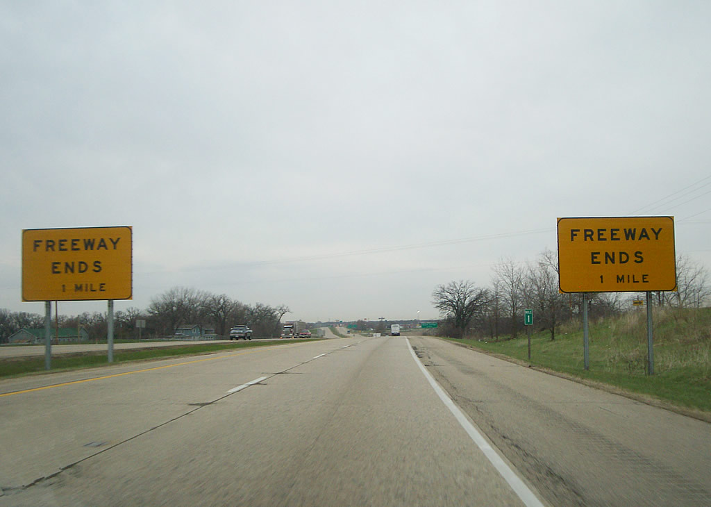
A pair of freeway ends signs preceded the exchange with I-39/90. Similar signage was posted at the original southern terminus of Interstate 69 at Indianapolis. Photo by Chris Lokken and Sage Sulenta (04/14/07).

An end shield precedes the ramp departures for I-39/90 and the I-43 transition into Wis 81, a commercial arterial extending west into Beloit. 05/06/10

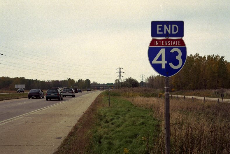
A previous pair of I-43 end shields were also posted at the cloverleaf interchange (Exits 1B/A) with I-39/90 and Wis 81 (Milwaukee Road) west. Photo by Brian Dowd (12/02).

Exit 1B leaves Interstate 43 south for I-39 north / I-90 west to Madison. Construction through 2023 upgrades the corridor to six overall lanes. 05/06/10

Interstate 43 south reaches the loop ramp (Exit 1A) for I-39 south / I-90 east to Rockford, Chicago, Bloomington and Normal. Wis 81 commences a nearly 124-mile route to Wis 133 at Cassville here. 05/06/10
![]() South at
South at ![]()
![]()
![]()


Interstate 43 south at I-39/90 and Wis 81 west during construction of the I-39/90 and I-43/WIS 81 Interchange project. Photos by Peter Johnson (04/10/20).
Stage 2A Phase 1 of the I-39/90 and I-43/WIS 81 Interchange project removed the loop ramps between the two freeways and temporarily converted the exchange into a diamond interchange.
A temporary loop ramp was later added to connect I-43 south and Wis 81 east with I-39/90 southbound during Stage 2B Phase 2 in Fall 2020. Photos by Peter Johnson (04/10/20).
![]() East at
East at ![]()
![]()
![]()

Interstate 39 was eventually added to this assembly after 2007, 14 years after the extension north from Rockford, Illinois to Wausau was made official by AASHTO. Photo by Chris Lokken and Sage Sulenta (04/14/07).

Wis 81 end shield assembly posted ahead of the arterial transition into Interstate 43. A signalized intersection lies ahead with Ford Drive north and Freeman Parkway south, local roads serving adjacent businesses and subdivisions. 05/06/10

Supplemental signs were added to reflect the Interstate 39 extension north from Rockford, Illinois to Wausau, Wisconsin. I-39 combines with I-90 east to the south side of Rockford, where it shifts westward for the eventual pairing with U.S. 51 to Lasalle, Peru and Normal. 05/06/10

Heading south from Beloit, I-39/90 transition into the tolled Jane Addams Memorial (Northwest) Tollway. The two routes combine with U.S. 51 in six miles and split in 20 miles ahead of U.S. 20. I-90 remains tolled leading southeast to Chicago. 05/06/10
![]() North at
North at ![]()
![]()

I-39/90 lead north 45 miles to the capital city of Madison, where I-94 ties in for a three way overlap to Portage. 05/06/10

Millington Road forms a south side frontage road to Interstate 43 as motorists pass by the first northbound reassurance marker. The freeway doubles as an Alternate route for I-39 to Exit 6 with Wis 140. 05/06/10


Wis 81 east transitioned into Interstate 43 northbound through the temporary diamond interchange with I-39/90 north to Janesville and Madison and I-39/90 south to Rockford, Illinois. Photos by Peter Johnson (04/10/20) during the I-39/90 and I-43/WIS 81 Interchange project.
Flyovers were constructed joining I-39/90 with Interstate 43 above a diverging diamond interchange (DDI) built with Wis 81 below. Wis 81 was extended east over Gateway Boulevard to the dumbbell interchange (Exit 2) joining Hart Road (CTH-X) with I-43. Completion of the final interchange layout took place in Fall 2021.
![]() North
North ![]() West at
West at ![]()
![]()

Just beyond the Illinois state line, I-39 north / I-90 west travel to within two miles of Interstate 43 and Wis 81. A rest area precedes the cloverleaf interchange. 05/06/10

Cranston Road spans I-39/90 one mile ahead of Exit 185B for Interstate 43 north. The freeway remains rural as it encircles the eastern outskirts of Beloit. 05/06/10

The northbound beginning of Interstate 43 departs I-39 north / I-90 west via Exit 185B. I-43 serves the cities of Delavan, Elkhorn, and Waukesha on its northeasterly course toward Milwaukee. The freeway reaches I-41/894 in 60 miles. 05/06/10
![]() South
South ![]() East at
East at ![]()
![]()

Forthcoming Exit 185 with Interstate 43 north and Wis 81 south comprises the second of two interchanges serving the city of Beloit on I-39 south / I-90 east. The cloverleaf interchange with I-43 north lies one mile south of the Hart Road overpass here. 05/06/10

Exit 185A departs I-39 south / I-90 west for Wis 81 (Milwaukee Road) west. The Trunk Highway extends west from the ending I-43 toward Downtown Beloit to the straddle southern reaches of Wisconsin westward to Cassville along the Mississippi River. 05/06/10

Exit 185B loops away from I-39 south / I-90 east for Interstate 43 north. I-43 constitutes a rural freeway to Mukwonago, where it transitions to a commuter route leading into Milwaukee, 64 miles to the northeast. 05/06/10
Sources:
- Wisconsin Highways: Highways 40-49, Chris Bessert.
- “I-57 Fund Extension Appears Probable.” The Milwaukee Journal, October 7, 1972.
- “Route Approved for I-57.” The Milwaukee Journal, May 18, 1973.
- State of Wisconsin Statutes: Chapter 84, State Trunk Highways (Federal Aid) – Section 84.1033 states as follows: “Leo Frigo Memorial Bridge. No later than 6 months after May 9, 2002, the department shall designate and mark the bridge on I 43 across the Fox River in the city of Green Bay as the “Leo Frigo Memorial Bridge” in recognition and appreciation of Leo Frigo, a civic and philanthropic leader in the Green Bay area whose legacy includes one of the largest food pantry programs in the nation for feeding the hungry.”
- “Final investigative report from Leo Frigo Bridge sagging released.” Fox 11 News, May 18, 2015.
- Wisconsin Highways: Highways 140-149, Chris Bessert.
- I-39/90 Expansion Project, Project Overview.
https://projects.511wi.gov/i-39-90/full-project-overview/Wisconsin Department of Transportation.
Page updated May 23, 2022.