Interstate 215 Nevada


Traffic along George Crockett Road eastbound separates for Interstate 215 (Bruce Woodbury Beltway) immediately following Las Vegas Boulevard. 07/06/18
Overview
Connecting I-15 south of the Las Vegas Strip with I-11 south in Henderson, Interstate 215 makes up the southeast quadrant of the 51 mile long Bruce Woodbury Beltway encircling Las Vegas and North Las Vegas. Extending 11.1 miles, the I-215 portion of the beltway provides direct access to Harry Reid International Airport (LAS) while also serving as a commuter route between Henderson and Paradise in the south reaches of the Las Vegas area.
The Bruce Woodbury Beltway begins at the Henderson Bowl Interchange, a systems exchange with I-11/U.S. 93-95 and State Route 564 in the city of Henderson. Following the former alignment of Lake Mead Parkway, I-215 heads west to Green Valley Ranch before turning north to Paradise. Near the LAS Airport, the beltway curves west again ahead of the Fish Bowl interchange with Interstate 15 near the south end of the Las Vegas Strip.
Though I-215 ends at the exchange with I-15, the Bruce Woodbury Beltway continues west and north around Las Vegas as Clark County Route 215. The county-maintained freeway reconnects with I-15 north of Nellis Air Force Base in the city of North Las Vegas.
 History
The American Association of State Highway and Transportation Officials (AASHTO) formally approved 18.9 miles of the I-215 designation April 17, 1993, between Tropicana Avenue (SR 593) near Spring Valley and I-515/U.S. 93-95 in Henderson, though signs were only erected along the 11.1 mile section between I-15 and I-515. Completion of the initial stretch of I-215 in 1996 consisted of a short spur between I-15 and Harry Reid International Airport (LAS) via the connector and tunnel along State Route 171. Additional segments were built between 1996 and 1999, with the final mile between Gibson Road and I-515 completed by 2005.
Route Information
- East End – Henderson, NV
- West End – Paradise, NV
Mileage – 11.173
- Cities – Las Vegas, Henderson
- Junctions –


Sources: 2025 State Maintained Highways of Nevada, Descriptions and Maps (NDOT)
I-215 Annual Average Daily Traffic (AADT)
Source: 2024 AADT Traffic Records Information Access (TRINA) – Nevada Department of Transportation (NDOT)
 Photo Guides
East End  – Henderson, Nevada
![]() East at
East at ![]()
![]()
![]()
![]()
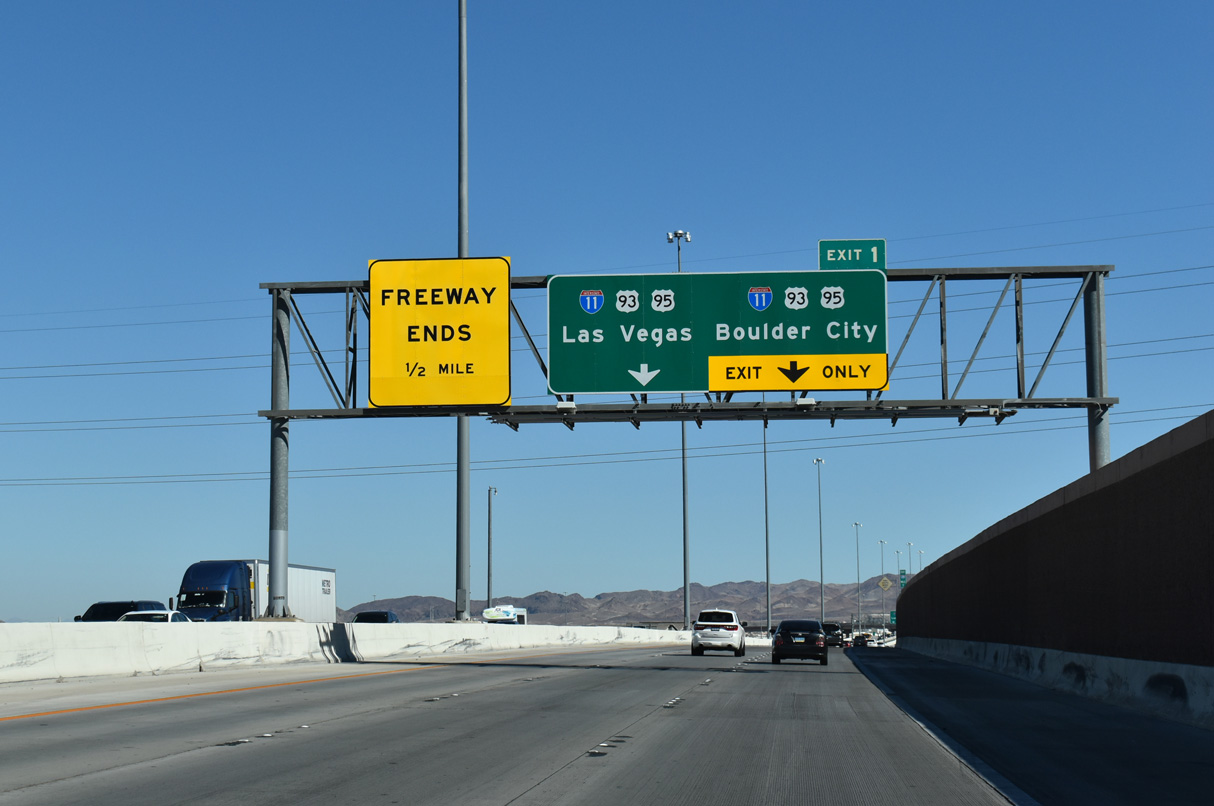
Spanning Gibson Road (Exit 2), I-215 (Bruce Woodbury Beltway) advances a half mile to the Henderson Bowl Interchange with I-11, U.S. 93/95 and SR 564. 10/20/25
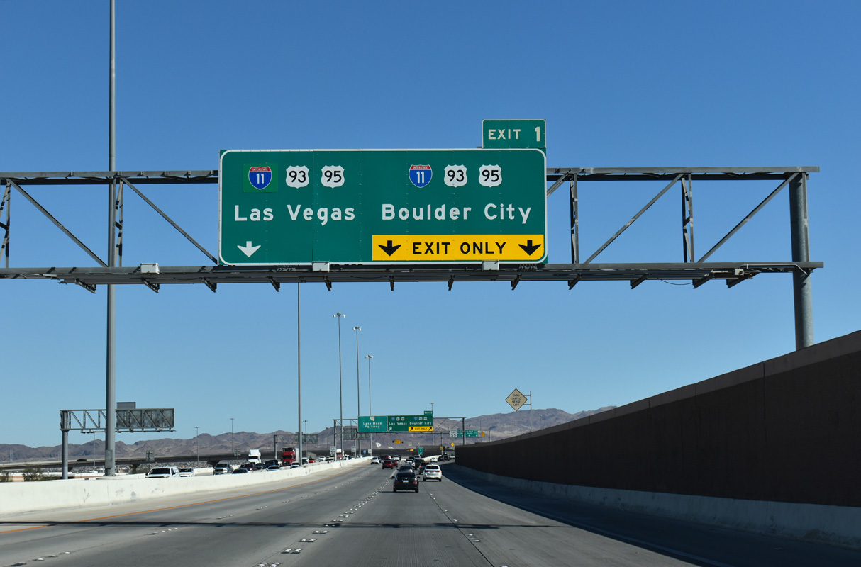
Traffic at the east end of Interstate 215 partitions with two lanes joining I-11/U.S. 93-95 northwest to Las Vegas and southeast to Boulder City. 10/20/25
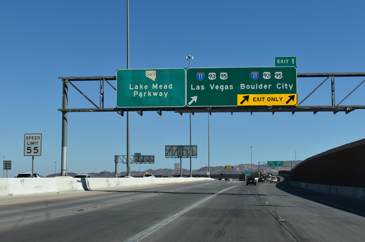
SR 564 extends northeast from the end of I-215 along Lake Mead Parkway through Henderson to Lake Las Vegas and Lake Mead National Recreation Area. 10/20/25
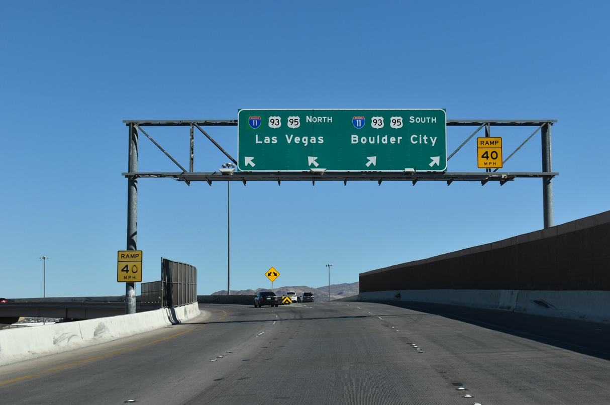
Ramps separate for I-11/U.S. 93-95 north to the city of Las Vegas and I-11/U.S. 93-95 south 17.4 miles to Boulder City. 10/20/25
![]() North at
North at ![]()
![]()
![]()

Advancing north toward I-215 (Bruce Woodbury Beltway) and SR 564 (Lake Mead Parkway), the Las Vegas Strip skyline comes into view along Interstate 11. 03/31/22

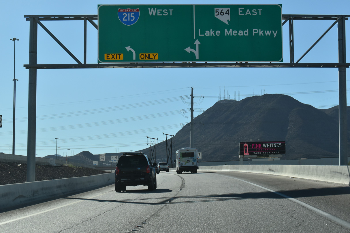
8.2 miles in length, SR 564 follows Lake Mead Parkway east to the center of Henderson before turning northeasterly to the entrance of Lake Mead National Recreation Area. The easternmost portion of I-215 overlays a former segment of Lake Mead Parkway between I-11/U.S. 93-95 and SR 146 at Exit 6. 03/31/22

A two lane ramp funnels traffic from I-11 and U.S. 93/95 north to both I-215 west and SR 564 east. Lake Mead Parkway (SR 546) extends 1.75 miles east from I-215 to SR 582 (Boulder Highway) in Henderson. 03/31/22

I-215 travels through western reaches of Henderson toward both Harry Reid International Airport (LAS) and the south end of the Las Vegas Strip. 03/31/22

I-215 follows Bruce Woodbury Beltway between I-11 and I-15 at the Fish Bowl interchange, while Clark County Route 215 lines the remainder of the 51 mile long loop. 03/31/22
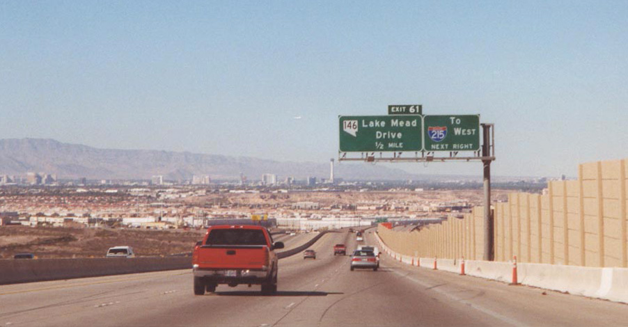
Interstate 515 north at SR 146 (formerly Lake Mead Drive) prior to the completion of I-215 in 2005. SR 146 was subsequently truncated west to Exit 6 while the state route east of I-515 was renumbered to SR 564 by 2003. 11/11/00
![]()
![]()
![]() South at
South at ![]()
![]()

Interstate 11 converges with the east end of I-215 and SR 564 (Lake Mead Parkway) south of Auto Show Drive in Henderson. 10/24/25

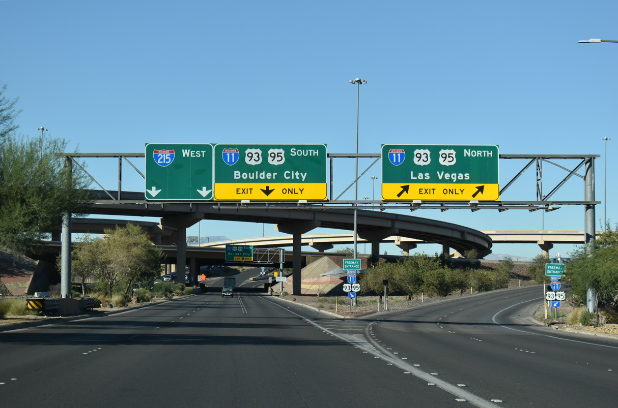
Exit 23 separates from I-11/U.S. 93-95 south with two lanes for I-215 west to Paradise and Enterprise and SR 564 (Lake Mead Parkway). 10/24/25
Traffic from I-11 south separates at the Henderson Bowl for SR 564 (Lake Mead Parkway) east to Lake Mead National Recreation Area and I-215 (Bruce Woodbury Beltway) west to Enterprise and Summerlin. 10/24/25
![]() West at
West at ![]()
![]()
![]()
![]()
SR 564 (Lake Mead Parkway) west ends where I-215 begins at the exchange with I-11/U.S. 93-95. I-11 (Oran K. Gragson Freeway) extends 14.5 miles northwest alongside U.S. 93/95 to Downtown Las Vegas. 10/24/25
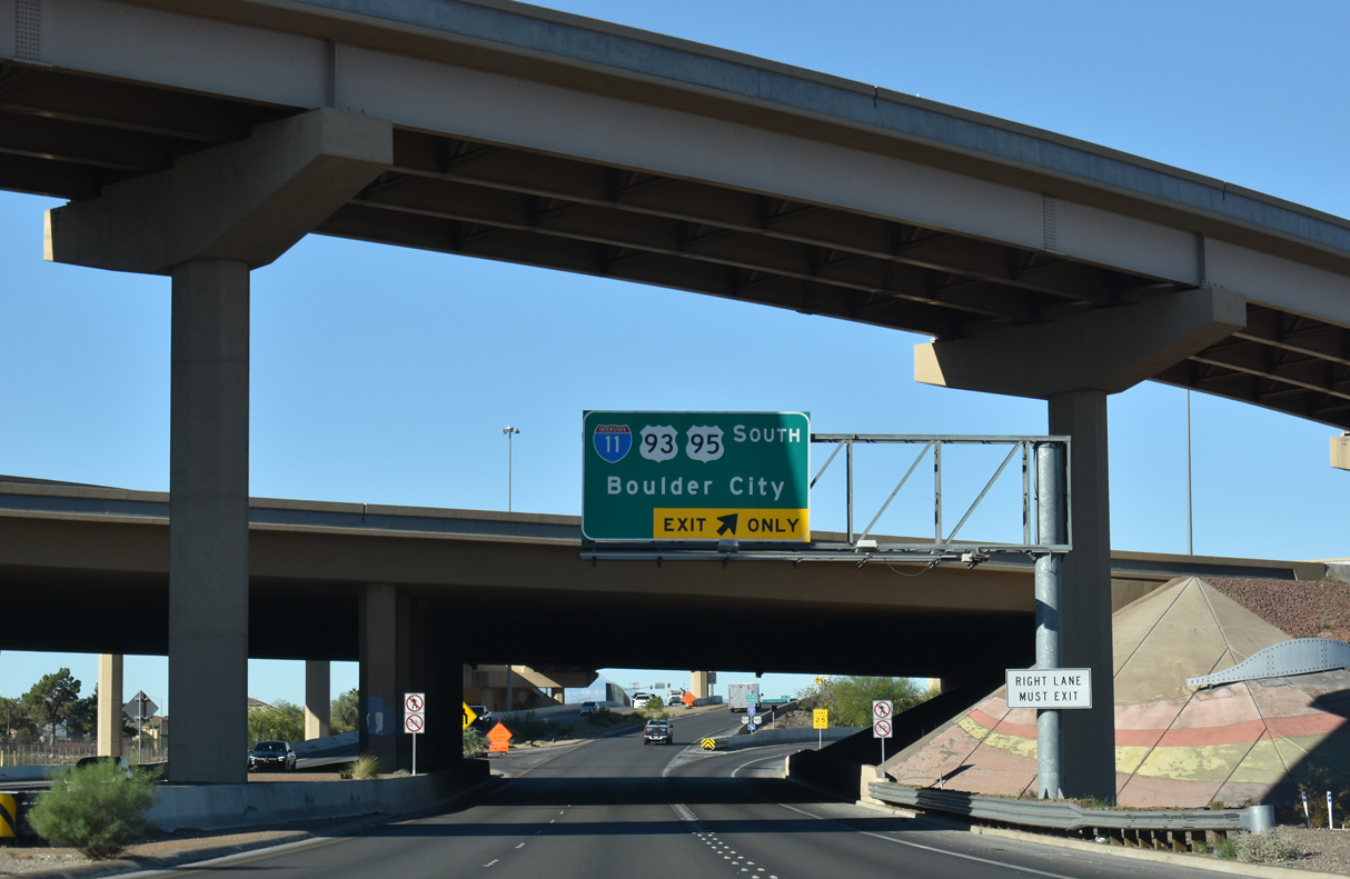
A loop ramp links SR 564/I-215 west with I-11/U.S. 93-95 south to Boulder City. Replaced with I-11 in 2018, I-515 previously extended southeast beyond Exit 56 for Nevada State Drive and ahead of Railroad Pass. 10/24/25
 East End – Throwback
![]() East at
East at ![]()
![]()
![]()
![]()

Spanning Gibson Road at Exit 2, I-215 (Bruce Woodbury Beltway) advanced a half mile to the Henderson Bowl Interchange with I-515, U.S. 93/95 and SR 564. 03/09/19

Replaced by I-11, I-515 overlapped with U.S. 93/95 northwest 14.5 miles to I-15 by Downtown Las Vegas. I-11 travels southeast to Boulder City and the Hoover Dam area. 03/01/19

SR 564 extends northeast from the Henderson Bowl Interchange along Lake Mead Parkway. 03/01/19

Traffic separated from the east end of I-215 along the flyover for Interstate 515 to Las Vegas and south Henderson. 07/22/17

Prior to the completion of I-215 east to I-515, Bruce Woodbury Beltway east concluded at at-grade intersection with Gibson Road in Henderson. Once I-215 fully opened to the Oran K. Gragson Freeway, SR 146 (formerly Lake Mead Drive) was truncated west to I-215 at Pecos Road and St. Rose Parkway. Photo by Jeff Royston (12/00).
West End – Paradise, Nevada
![]() West at
West at ![]()
![]()

Interstate 215 west travels under S Las Vegas Boulevard ahead of Exit 12A for I-15 north and a c/d roadway to Russell Road. I-15 runs along the west side of the Las Vegas Strip toward the Downtown Las Vegas. 03/07/19

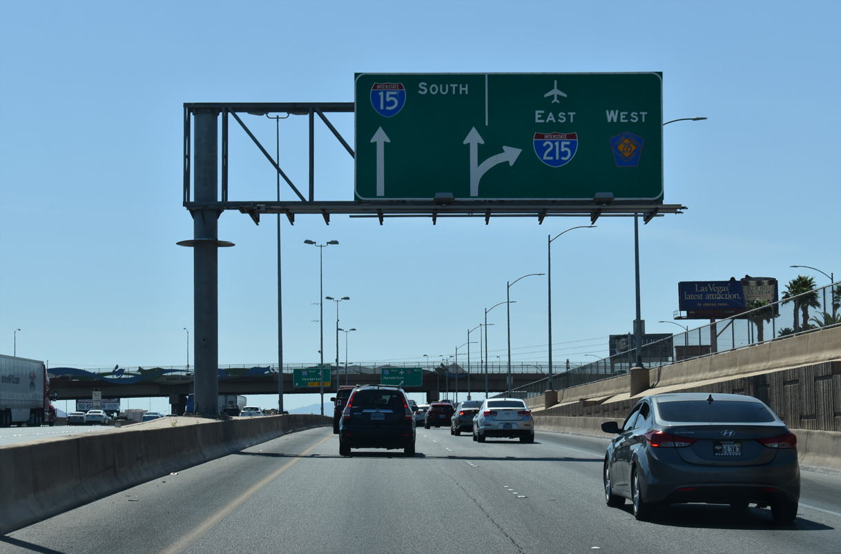
A loop ramp (Exit 12B) departs next within the Fish Bowl interchange for Interstate 15 south to Barstow and the Los Angeles area. 03/07/19

Exit 12B leaves Bruce Woodbury Beltway west for I-15 south to California as I-215 transitions into Clark County Route 215. CC 215 (Bruce Woodbury Beltway) continues west to Spring Valley and north to Summerlin. 07/21/17

Prior sign assembly located at the end of I-215 west at the exchange with I-15 in south Las Vegas. The freeway portion extended a short distance west to Decatur Boulevard before diverging to frontage roads. 11/11/00
![]() East at
East at ![]()
![]()

Clark County Route 15 transitions to I- 215 eastbound at the Fish Bowl Interchange (Exit 12) with Interstate 15 03/04/19

Two lanes depart from CC 215 east for both I-15 south to California and Las Vegas Boulevard. The beltway mainline continues to the northbound exit for I-15 and I-215 to Harry Reid International Airport (LAS). 07/21/14

Exit 12A partitions for I-15 south to southwest Henderson, Jean and Primm and the adjacent diamond interchange with S Las Vegas Boulevard. 03/04/19
![]() South at
South at ![]()
![]()

A Union Pacific rail line spans I-15 on the half mile approach to Interstate 215. I-215 follows Bruce Woodbury Beltway from I-15 east to I-11/I-515 in Henderson. 07/22/17
A collector distributor roadway extends south from the exchange with SR 593 (Tropicana Avenue) to Russell Road and the Fish Bowl Interchange with I-215/CC 215. 04/01/22
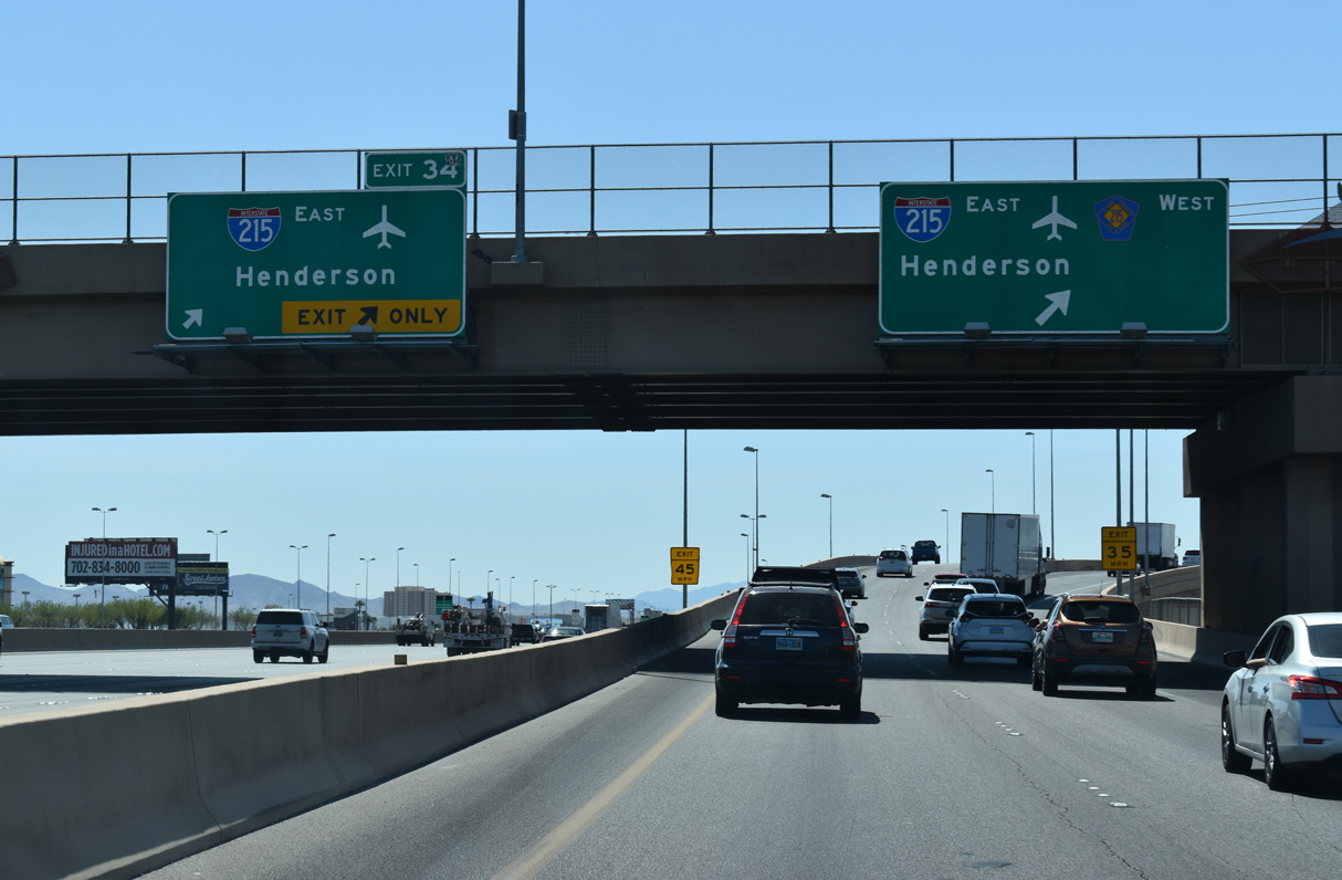
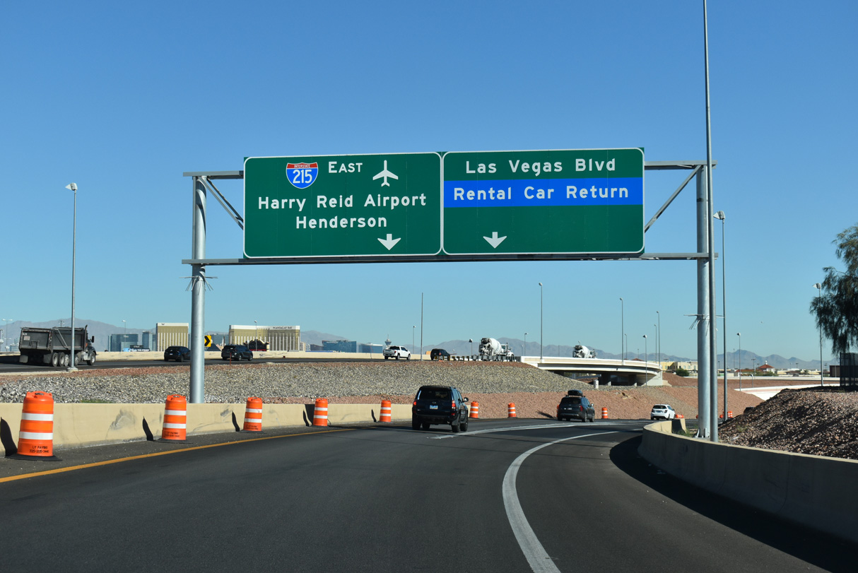
Passing under Sunset Road, ramps from both the I-15 southbound mainline and the adjacent c/d roadway depart for I-215 to Harry Reid International Airport (LAS) and Henderson. The forthcoming flyover also links with S Las Vegas Boulevard and the Las Vegas Car Rental Center. 04/01/22
![]() North at
North at ![]()
![]()

A collector distributor roadway (Exit 33) joins I-15 north with SR 160 (Blue Diamond Road), I-215 east and Clark County Route 215 west. 10/24/25

Exit 33 leaves I-15 north with two lanes for SR 160, I-215 and CC 215. Improvements made at the exchange with SR 160 by 2012 included consolidating exiting traffic into this single egress point. SR 160 travels west to Enterprise and north to Pahrump. Blue Diamond Road leads the route east to parallel Las Vegas Boulevard. 10/24/25

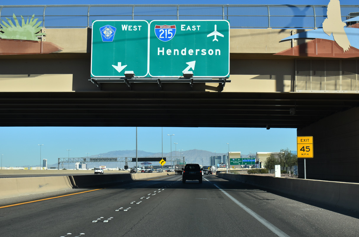
SR 160 (Blue Diamond Road) follows an 80.3 mile long course west to Mountain Springs in Clark County and north to U.S. 95 midway between Indian Springs and Amargosa Valley in Nye County. Two lanes advance north to the Fish Bowl Interchange. 10/24/25

The c/d roadway extends north from SR 160 (Blue Diamond Road) to the half turbine interchange with I-215 east and CC 215 west. 10/24/25
Connecting I-15 with Henderson and North Las Vegas, I-215 and CC 215 make up the 51-mile long Bruce Woodbury Beltway. 10/24/25
I-215 runs southeast from Harry Reid International Airport (LAS) 11.1 miles to Interstate 11 and U.S. 93/95 in the city of Henderson. 10/24/25
Sources:
- Mr. Mojave. “Las Vegas Beltway Complete…sorta.” Online posting, misc.transport.road, November 27, 2003.
Page updated November 17, 2025.