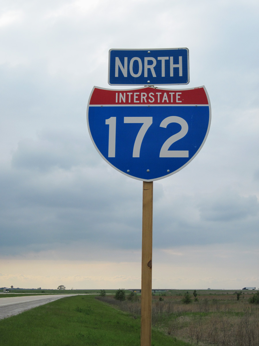
Interstate 172 Illinois
Overview
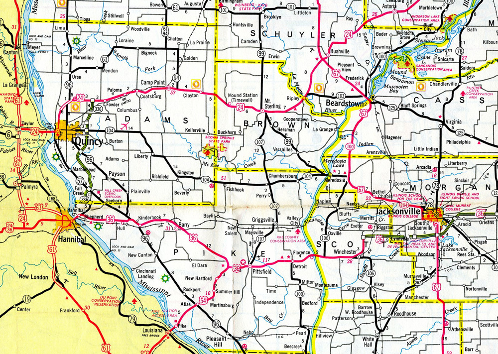
Interstate 172 connects I-72/U.S. 36 with the Adams County seat of Quincy and the expressway along IL 336 north to Macomb. The rural freeway passes east of Quincy along bluffs rising above the Mississippi River while the southern extent traverses the river flood plain in Pike County.
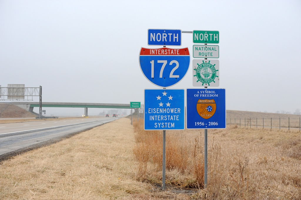
I-172 is also part of IL 110, the Chicago-Kansas City Expressway. Referred to as the CKC for short, the multi state route overlaps with other Interstates and U.S. highways as both an alternate route to I-55 and I-70 and an economic generator for cities located on the route.
IL 336 takes over from the ending Interstate 172 as an at-grade expressway north toward Carthage and east to Macomb. The expressway was cosigned as part of the CKC (IL 110) in 2010. Long range plans call for the IL 336 alignment to extend east beyond Macomb to Bardolph and Cuba; northeast around Canton; and east parallel to IL 116 to Interstate 474 at Bellevue. While incorporating some grade separations and interchanges, the overall route is not planned as an Interstate standard facility. More information is available at the IL 336 Peoria to Macomb Study web site.
 History
Illinois originally submitted Interstate 172 as the new designation for the Central Illinois Expressway to the American Association of State Highway and Transportation Officials (AASHTO). The limited access highway was signed as U.S. 36 and completed in 1991 from I-55 at Springfield to IL 336 near Hull. AASHTO approved the numbering on June 9, 1991, with it contingent upon Federal Highway Administration (FHWA) approval. No signs were erected however, and by 1995 a new numbering plan emerged.
As approved by AASHTO on April 22, 1995, the Central Illinois Expressway was renumbered instead as a westward extension of Interstate 72. The I-172 designation was then applied to the 17 mile long freeway spur for IL 336 north from the proposed I-72 to Quincy and U.S. 24.
Route Information
North End – Quincy, IL
- South End – Fall Creek, IL
Mileage – 19.69
Cities – Quincy
- Junctions –

Source: December 31, 2021 Interstate Route Log and Finders List
The original freeway for IL 336 extended north from a two lane alignment (old IL 79) connecting with U.S. 36 at Shepherd. A portion of the old alignment remains along 130th Street and the frontage road along north side of I-72.
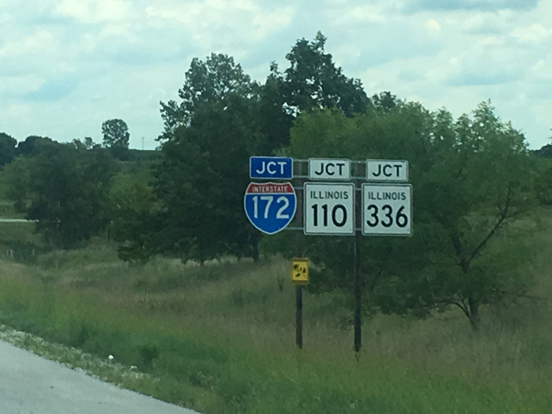
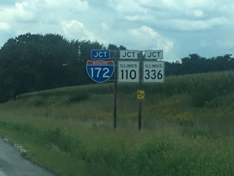
An older sign array for I-172 and the Great River Road that was posted ahead of the Adams County line on the freeway northbound. Photo by Jeff Royston (02/05/08).

Interstate 172 initially traverses flat agricultural areas south to Ewbanks. The shield assembly here was replaced when the Chicago-Kansas City Expressway was established in 2010. Photo by Jeff Royston (02/05/08).
North End 
 – near Quincy, Illinois
![]()
![]() North at
North at ![]()
![]()
I-172/IL 110 (CKC) turn northwest ahead of the rural diamond interchange (Exit 19) with U.S. 24. 05/07/10
U.S. 24 represents a cross state route from Quincy east to Peoria and Sheldon. 05/07/10
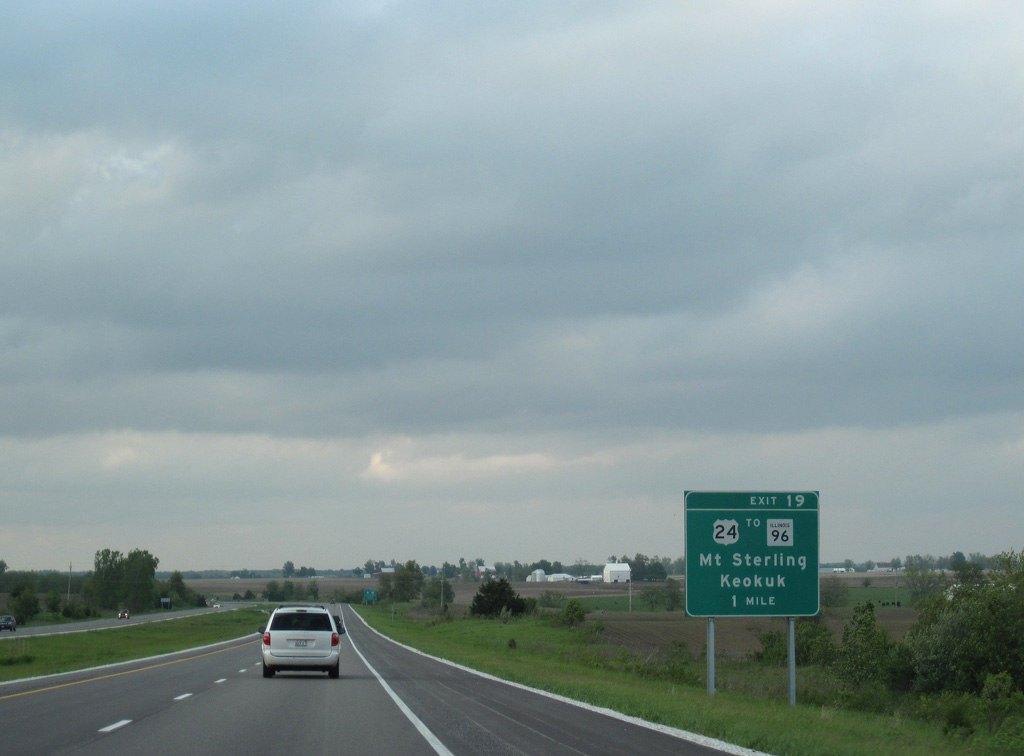
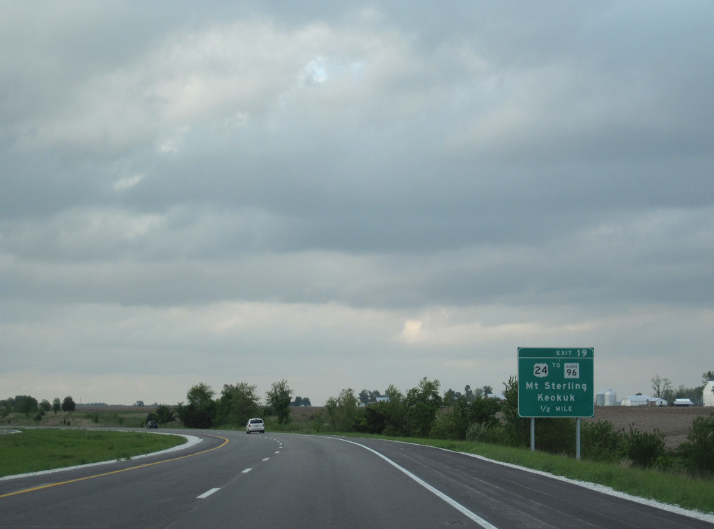
An end shield for I-172 precedes Exit 19 to U.S. 24 near the community of Fowler. U.S. 24 connects the freeway with IL 96 north to Keokuk, Iowa to the west and the Brown County seat of Mt. Sterling 30 miles to the east. Photo by Jeff Royston (02/05/08).
![]()
![]() North at
North at ![]()
![]()
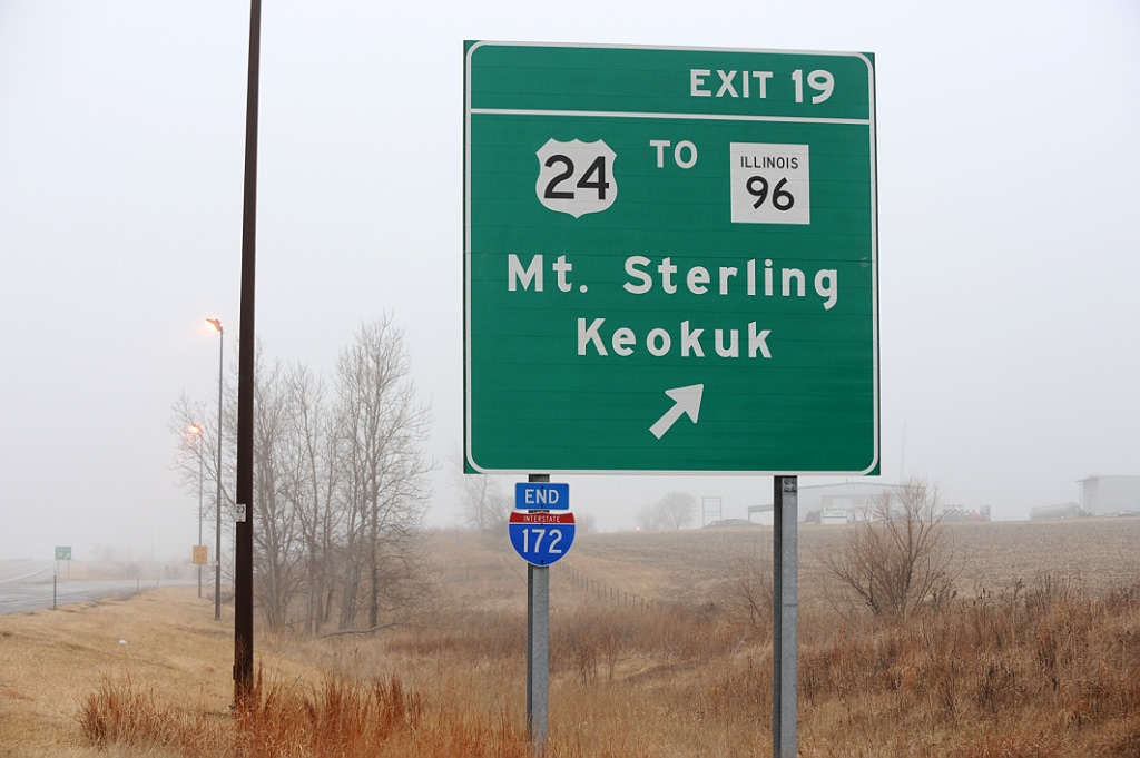
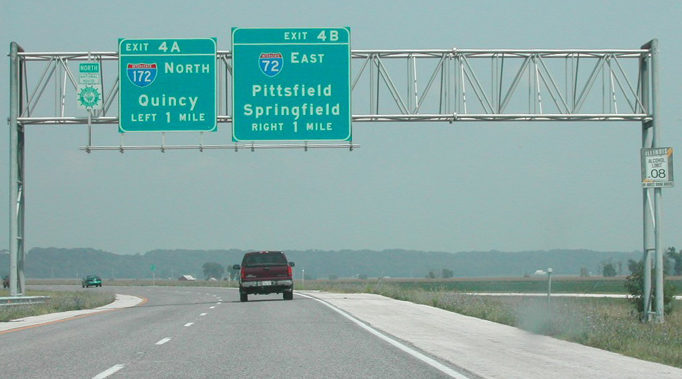
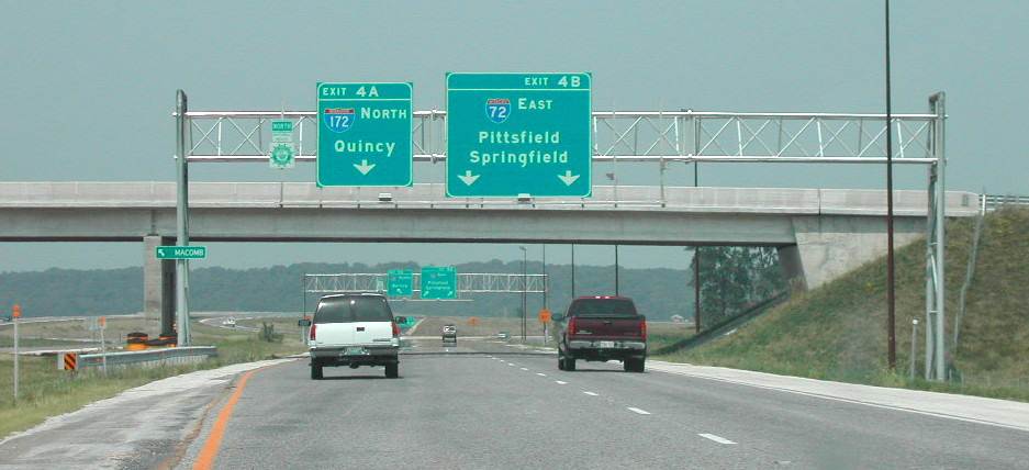
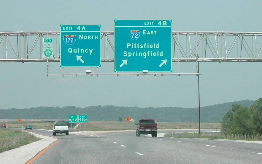
IL 336 proceeds south from the intersection with County Road 1800 N near Bloomfield to become Interstate 172 at the diamond interchange (Exit 19) with U.S. 24. 05/07/10
The first confirming marker for Interstate 172 south. I-172/IL 110 (CKC) turn southwesterly from the exchange with U.S. 24 to the eastern outskirts of Quincy by Hickory Grove. Photo by Joseph Barnes (08/14/16).
![]() East at
East at ![]()
![]()
![]()
U.S. 24 travels north from Downtown Quincy to overlap with IL 96 for 0.63 miles before turning due east to Interstate 172, IL 110 (CKC) and IL 336. Photo by Joseph Barnes (08/14/16).
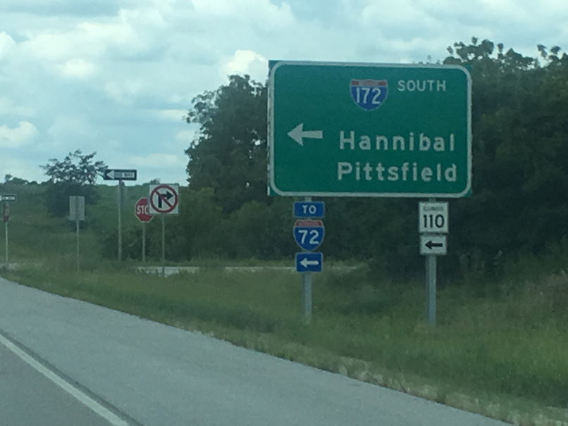
I-172 heads south to Interstate 72 between the Mark Twain Bridge and Hull. IL 110 (CKC) accompanies the freeway from the end of IL 336 to I-72 west into Missouri. Photo by Joseph Barnes (08/14/16).
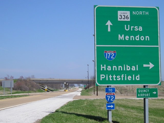
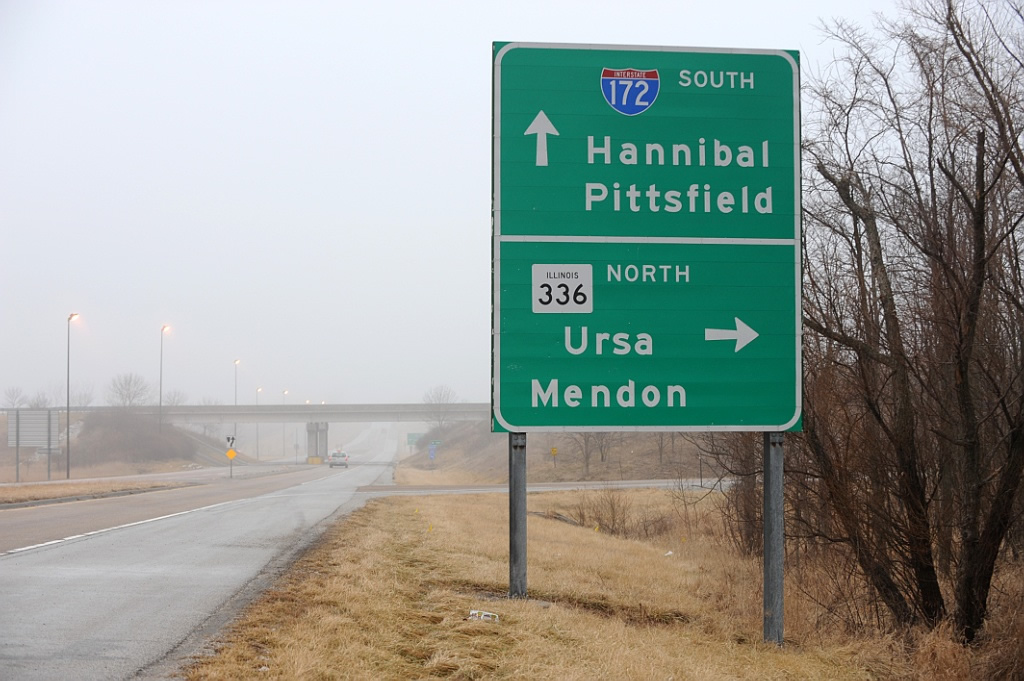
The control cities for IL336 north changed from Ursa and Mendon to Carthage and Macomb as the expressway was lengthened northward to U.S. 136 and U.S. 67. Photo by Jeff Morrison (04/20/08).
![]() West at
West at ![]()
![]()
![]()
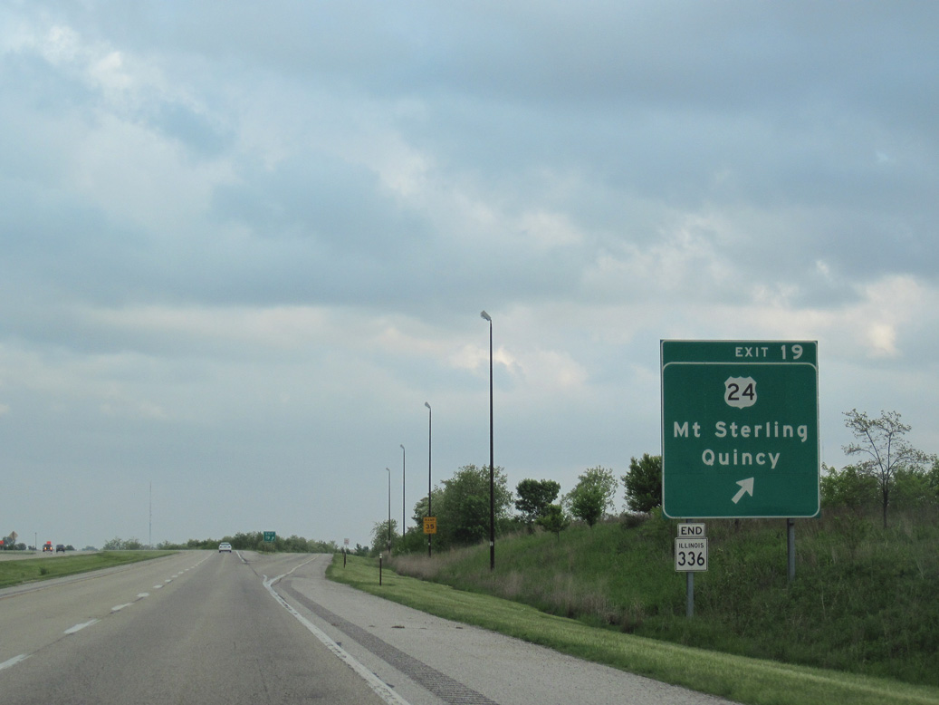
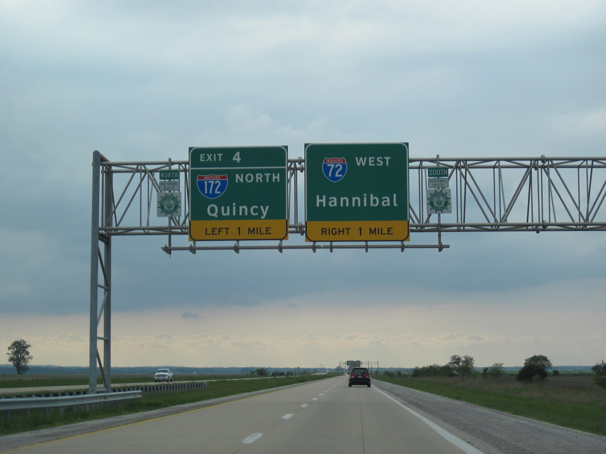
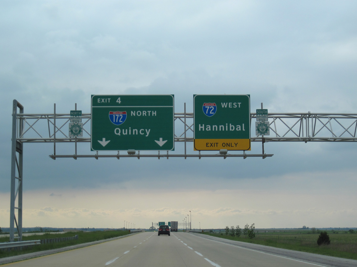
U.S. 24 travels 2.4 miles west from Fowler to meet Interstate 172 south, IL 336 north and the Chicago-Kansas City (CKC) Expressway. Photo by Joseph Barnes (08/14/16).
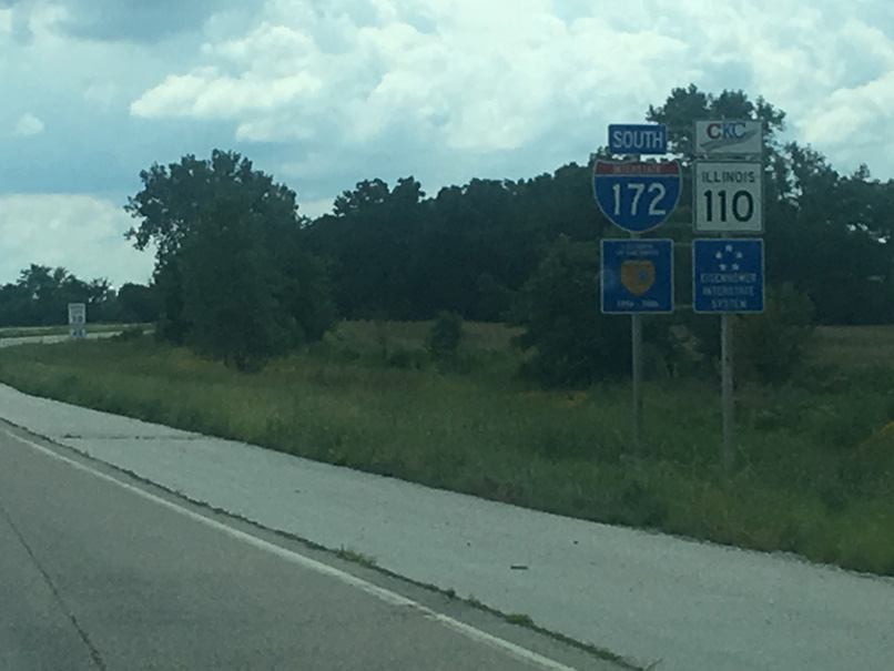
IL 110 (CKC) combines with IL 336 along an expressway north to U.S. 136 at Carthage and U.S. 67 at Macomb. Photo by Joseph Barnes (08/14/16).
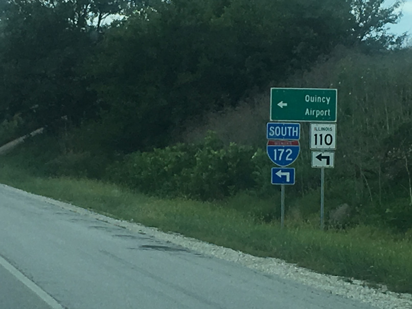
I-172/IL 110 bypass Quincy to the east through two interchanges. The second links with IL 104 east to Quincy Regional Airport (UIN). Photo by Joseph Barnes (08/14/16).
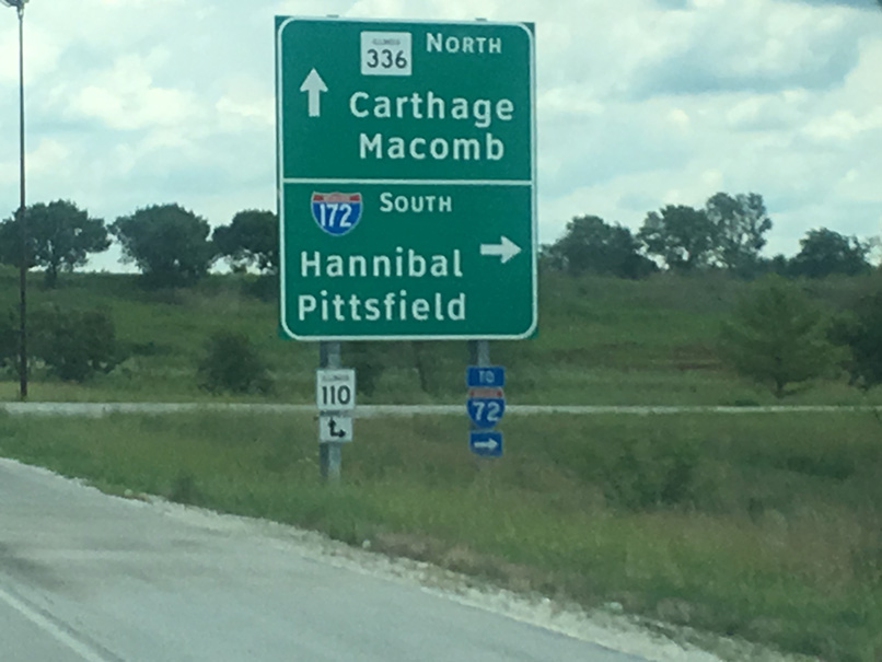
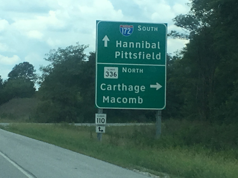
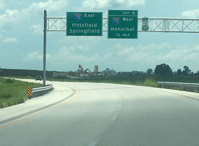
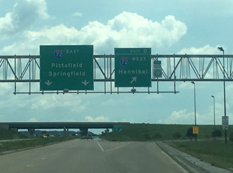
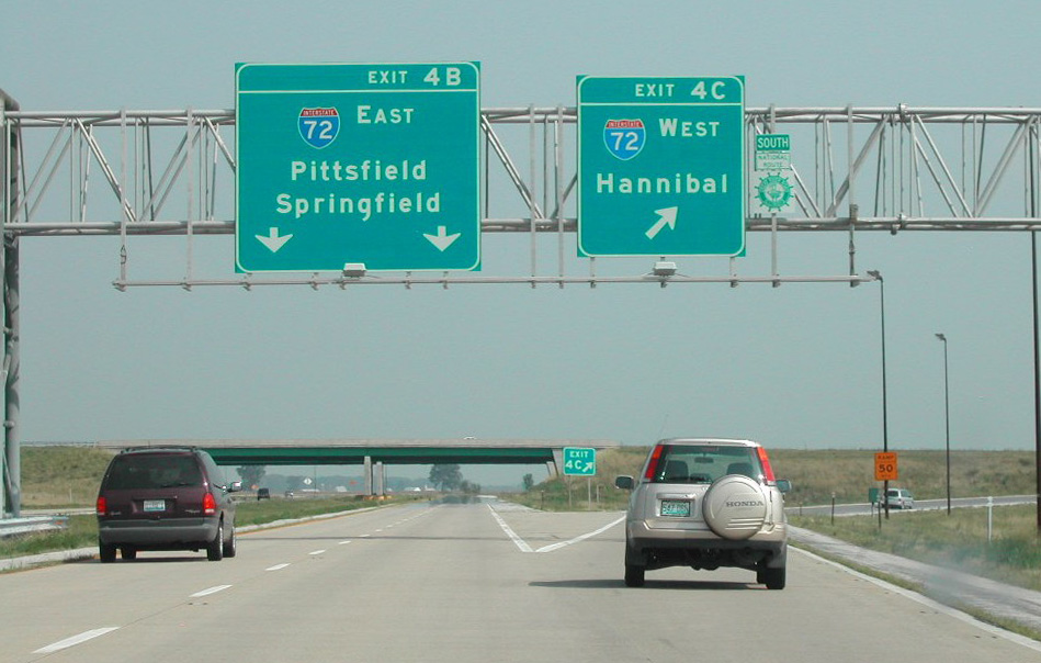
The southbound control cities for Interstate 172 are Hannibal, Missouri for I-72 west and Pittsfield, seat of Pike County and former end point of U.S. 54, via I-72 east. Photo by Joseph Barnes (08/14/16).
The guide sign for IL 336 north from U.S. 24 west was replaced to show Carthage and Macomb, following extension of the expressway north to U.S. 136. Photo by Jeff Royston (02/05/08).
South End – Fall Creek, Illinois
![]() South at
South at ![]()
![]()
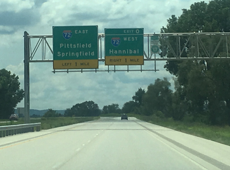
I-172/IL 110 (CKC) arc around the settlement of Fall Creek to meet Interstate 72 at a trumpet interchange (Exit 0) in one mile. Photo by Joseph Barnes (08/14/16).
I-72/U.S. 36 travel southwest five miles from the end of I-172 to Hannibal and six miles southeast to Hull. IL 110 combines with I-72 west to become Missouri Route 110 across the Mark Twain Bridge. Photo by Joseph Barnes (08/14/16).
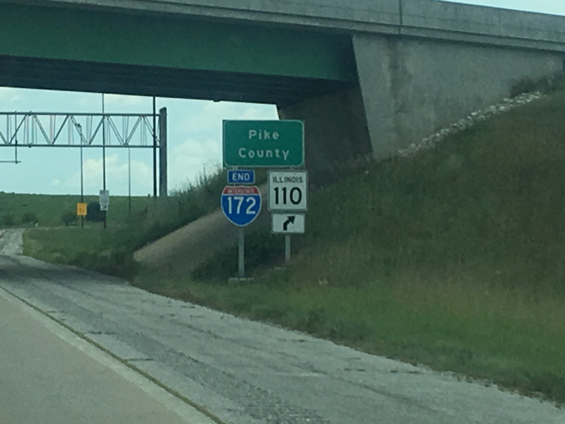
An end shield for Interstate 172 stands at the old IL 79 overpass beside the Pike County line. Photo by Joseph Barnes (08/14/16).
I-72/U.S. 36 (Central Illinois Expressway) run 65 miles east to Jacksonville and 94 miles to Springfield. Photo by Joseph Barnes (08/14/16).
![]()
![]() East at
East at ![]()
I-72/U.S. 36 angle northeast from the Mark Twain Bridge across agricultural areas to connect with Interstate 172 north to Quincy. Named the Purple Heart Memorial Highway, the freeway enters the Abraham Lincoln National Heritage Area. 04/13/13
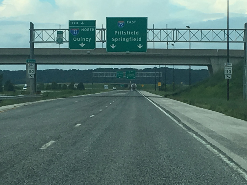
IL 110 (CKC) departs from I-72 east for I-172 north to IL 336. The Great River Road system also extends north along Interstate 172 to IL 57. Photo by Joseph Barnes (08/12/16).

Interstate 172 travels north 15 miles to Quincy while providing part of a route to Macomb via IL 336 and U.S. 136, 82 miles to the northeast. I-72/U.S. 36 continue 31 miles east to Pittsfield and 96 miles to Springfield. Photo by Joseph Barnes (08/12/16).
![]()
![]() West at
West at ![]()
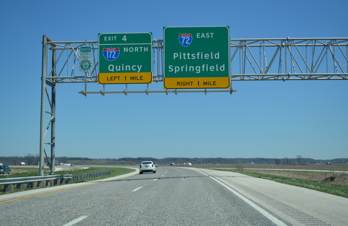
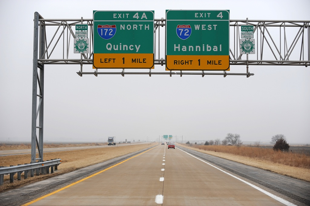
I-72/U.S. 36 head northwest from the village of Hull to Left Exit 4 to Interstate 172 north. 05/07/10
The freeway mainline defaults onto I-172/IL 110 (CKC) north to Quincy while I-72/U.S. 36 turn southwesterly three miles to IL 106 (old U.S. 36) and four miles to Hannibal, Missouri. 05/07/10
Westbound I-72/U.S. 36 reach the split with I-172 north, 21 miles east of Monroe City, Missouri. The Mississippi Great River Road system leads both north to Quincy via I-172/IL 110 (CKC) and west on I-72 to the Mark Twain Bridge. 05/07/10
 South End Throwback
![]() South at
South at ![]()
![]()

Former exit numbers for Interstate 172 referenced the mileage from I-72 at the Missouri state. This numbering scheme is uncommon, but not unique in the Interstate system. Other examples include the east end of I-630 in Little Rock, Arkansas and formerly at the west end of I-195 outside Trenton, New Jersey. Photo by Brian Dowd (08/03/02).
Sign changes made by 2007 assigned the westbound ramp as Exit 0 while the mainline continuation to I-72 east was unnumbered. U.S. 36 remains unposted on all signs at the exchange. Photo by Brian Dowd (08/03/02).
![]()
![]() East at
East at ![]()
Exit numbers were previously assigned to both I-172 north and the Interstate 72 eastbound mainline from when IL 336 traveled south to East Hannibal. Photo by Brian Dowd (08/03/02).
The trumpet interchange at I-72 and I-172 previously represented a rare instance in the Interstate system where every movement was assigned an exit number. Photo by Brian Dowd (08/03/02).
A left exit ramps remains from when IL 336 was the main route by nearby Fall Creek. Panels for I-72 east were replaced by 2008 to omit Exit 4B. Photo by Brian Dowd (08/03/02).
![]()
![]() West at
West at ![]()
Until September 2000, this exchange marked both the western end of I-72 and the southern end of I-172. With the completion of the new Mark Twain Bridge over the Mississippi River, Interstate 72 was extended into Missouri. Photo by Jeff Royston (02/05/08).
Page updated July 19, 2021.