Interstate 310 Louisiana
Overview
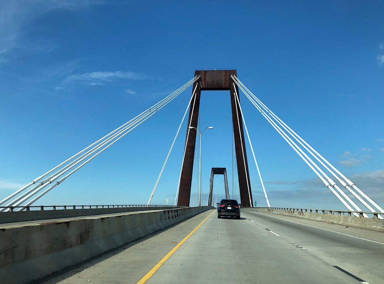
The Hale Boggs Memorial Bridge opened in 1983 as a local link between LA 18 at Luling and LA 48 at Destrehan.3 Photo by Peter Johnson (02/22/20).
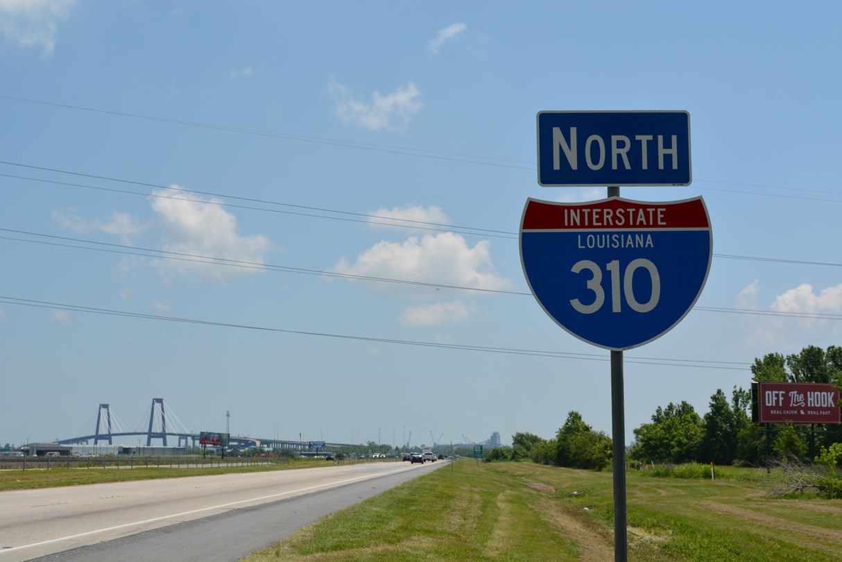
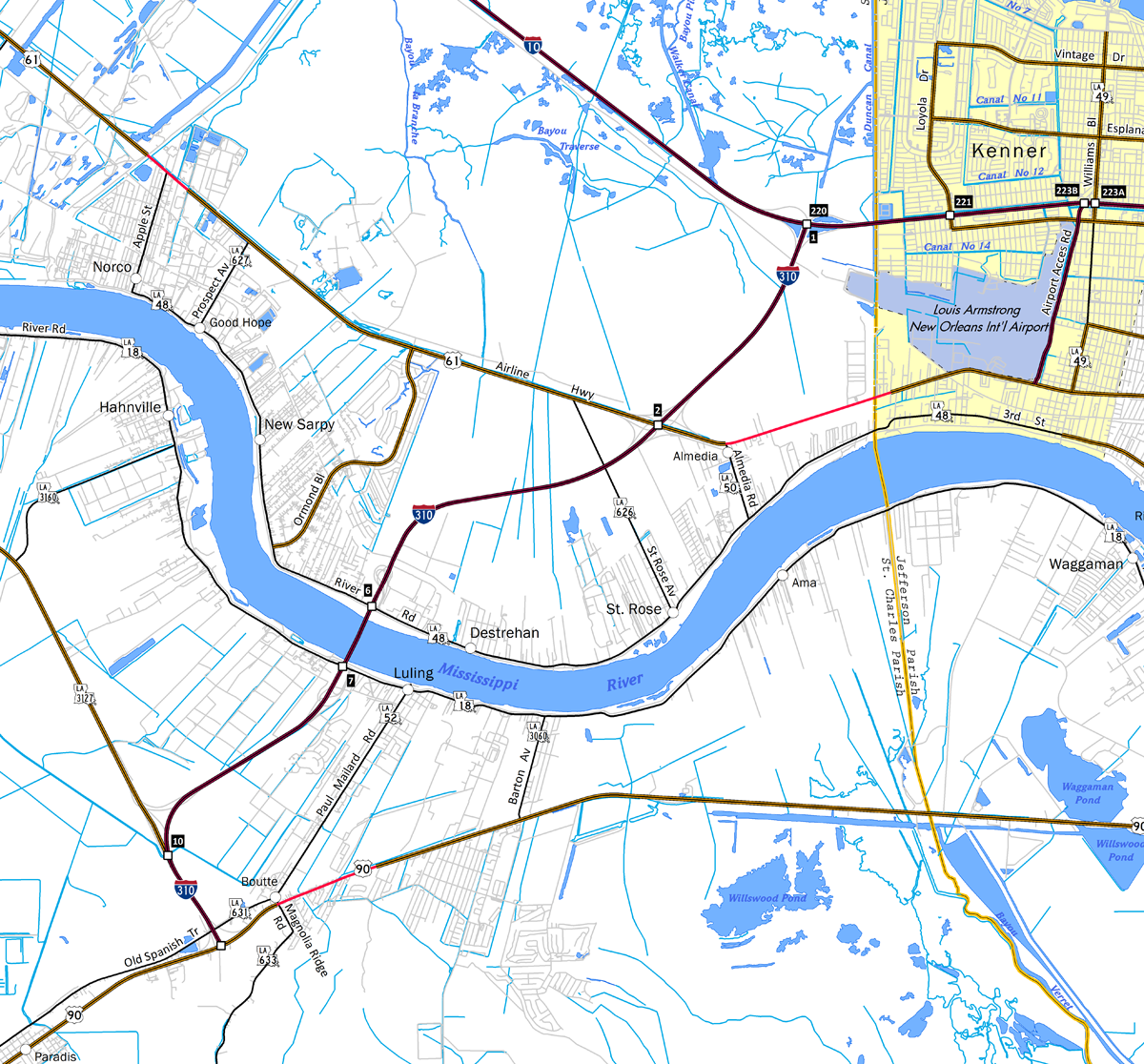
Interstate 310 is a mostly elevated freeway linking U.S. 90 at the unincorporated community of Boutte with I-10 and the New Orleans metropolitan area at Kenner. I-310 spans the Mississippi River between the St. Charles Parish communities of Luling and Destrehan across the Hale Boggs Memorial Bridge.
Route Information
North End – Kenner, LA
South End – Boutte, LA
Mileage – 11.25
Cities – Kenner, New Orleans
- Junctions –

Source: December 31, 2021 Interstate Route Log and Finders List
I-310 Annual Average Daily Traffic (AADT)
Source: 2019 – LADOTD Traffic Monitoring
 History
Vieux Carre Expressway
A study in 1969 outlined an outer belt freeway system in New Orleans between the Earhart and View Carre Expressways. It included adding a new uptown Mississippi River crossing via Earhart Boulevard at Napoleon Avenue. Interstate 310 was considered as a possible designation for both expressways.
The Earhart Expressway was proposed to run east from Louisiana 49 (Williams Boulevard) near New Orleans International Airport (MSY) to the Pontchartrain Expressway along Earhart Boulevard. The Vieux Carre or Riverfront Expressway would have extended east through Downtown New Orleans to an elevated highway passing through the French Quarter along the Mississippi Riverfront.
Origins of the Vieux Carre Expressway dated back to November 1946 when New York transportation pioneer Robert Moses unveiled his “Arterial Plan for New Orleans”. This freeway would begin at Interstate 10, follow Elysian Fields Avenue (Louisiana Highway 3021), then head southwest between the Mississippi River and Jackson Square to the Pontchartrain Expressway (U.S. 90 Business) at Downtown.1
The Vieux Carre Expressway was the most controversial aspect of the Moses arterial plan. However, criticism of the idea did not emerge until October 1964 when $25 million in funds were allocated for construction of the 3.5 mile long freeway. Prior to this time, work was already underway along a 690 foot long, 98 foot wide, six lane tunnel. Subterranean work began between Poydras and Canal Streets in the foundations of Rivergate, which opened in 1967. A heated battle ensued from there between proponents of the Riverfront Expressway and community leaders. Opposition finally won out in July 1969.2,3
Following the cancellation of the Riverfront Expressway proposal, the Earhart Expressway was rescinded westward to the Jefferson Parish line. The limited access highway within Jefferson Parish was eventually constructed. However it was only partially constructed, as an interchange between the expressway and Causeway Boulevard was omitted and the western extension to Williams Boulevard was never built. LA 3139 overlays the Earhart Expressway / Boulevard east from LA 3154 (Dickory Drive) to Monroe Street in New Orleans.
St. Charles Parish
Along with Interstate 510, I-310 in St. Charles Parish was included in a plan for a greater outer belt freeway around the New Orleans metropolitan area. Numbered Interstate 410, this highway was deferred and subsequently canceled. However it reemerged in the Louisiana Statewide Transportation Plan Update issued in 2003 under an I-510 project that would expand the Chalmette Bridge (LSTP-029). Connecting the freeway spurs along I-310 and I-510 was considered by the Louisiana Department of Transportation and Development (LADOTD) as a possible solution to perennially clogged Interstate 10 between the airport and Downtown.
Costing $297.1 million, work on the freeway between Boutte and I-10 by the Jefferson Parish line broke ground in 1976. The American Association of State Highway and Transportation Officials (AASHTO) approved this route as Interstate 310 on July 6, 1977.
Also known as the Luling-Destrehan Bridge, the $124.2 million Hale Boggs bridge across the Mississippi River opened in 1983. Succeeding construction completed in 1988 added four miles of freeway between Luling and U.S. 90 at Boutte. The subsequent project extended the freeway northeast nearly four miles to U.S. 61 (Airline Highway) at a cost of $64.6 million. This section opened to traffic following a ribbon cutting ceremony on July 24, 1991.4
The final 2.25 mile long stretch, between Airline Highway and Interstate 10, was completed on May 7, 1993.5 Temporary guide signs were posted along I-310 until the road fully opened to traffic between U.S. 90 and Interstate 10. A $1.5 million project between February and October 1993 replaced the small ground level signs with aluminum truss overhead sign bridge assemblies.6
Interstate 310 and Louisiana Highway 3127 separate at a three-wye interchange to the northwest of Boutte. Photo by Peter Johnson (02/22/20).
 Photo Guides
North End  – Kenner, Louisiana
![]() North at
North at ![]()
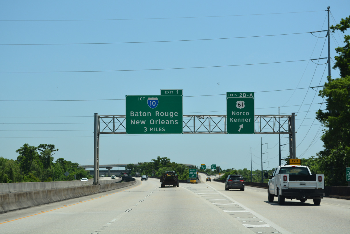
A multi level systems interchange joins Interstate 310 with U.S. 61 (Airline Highway) at Exit 2. This exchange is almost completely elevated due to the Labranche Wetlands. 05/11/22
Interstate 310 continues 2.25 miles north from U.S. 61 to conclude at Exits 1/1 A for I-10. 05/11/22
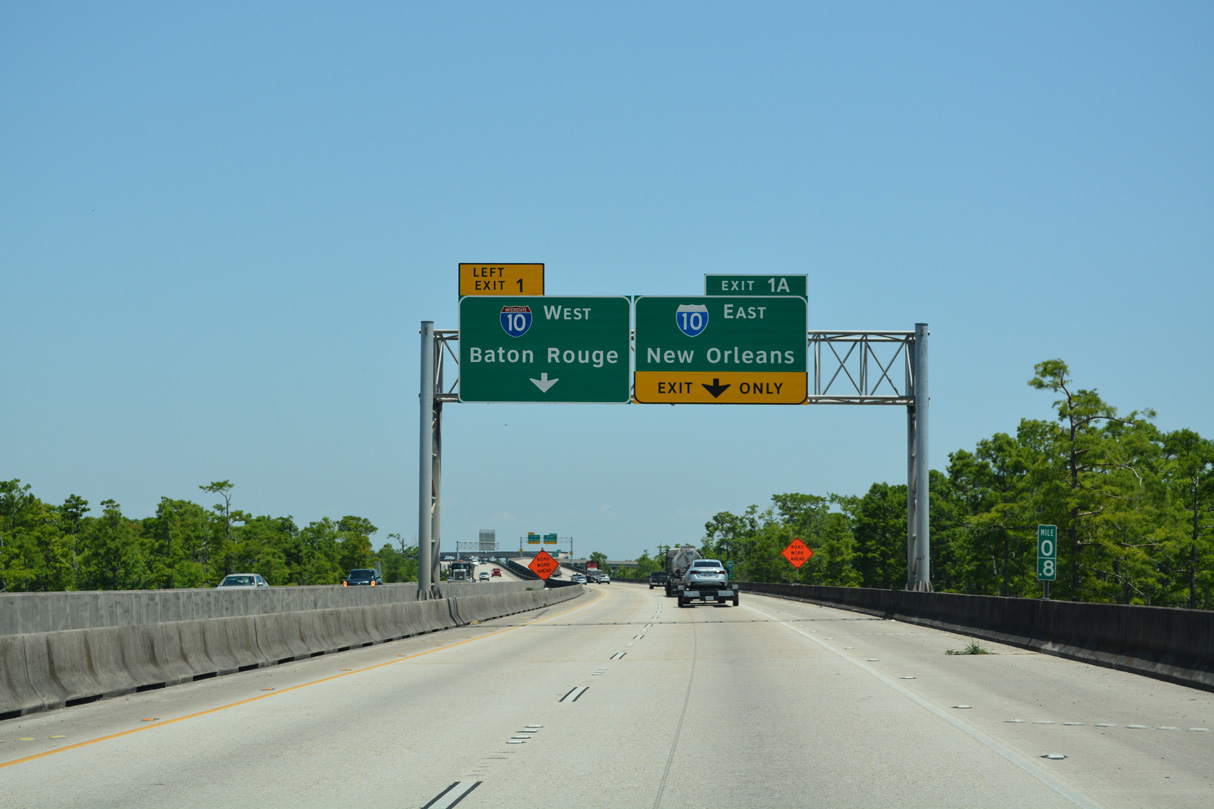
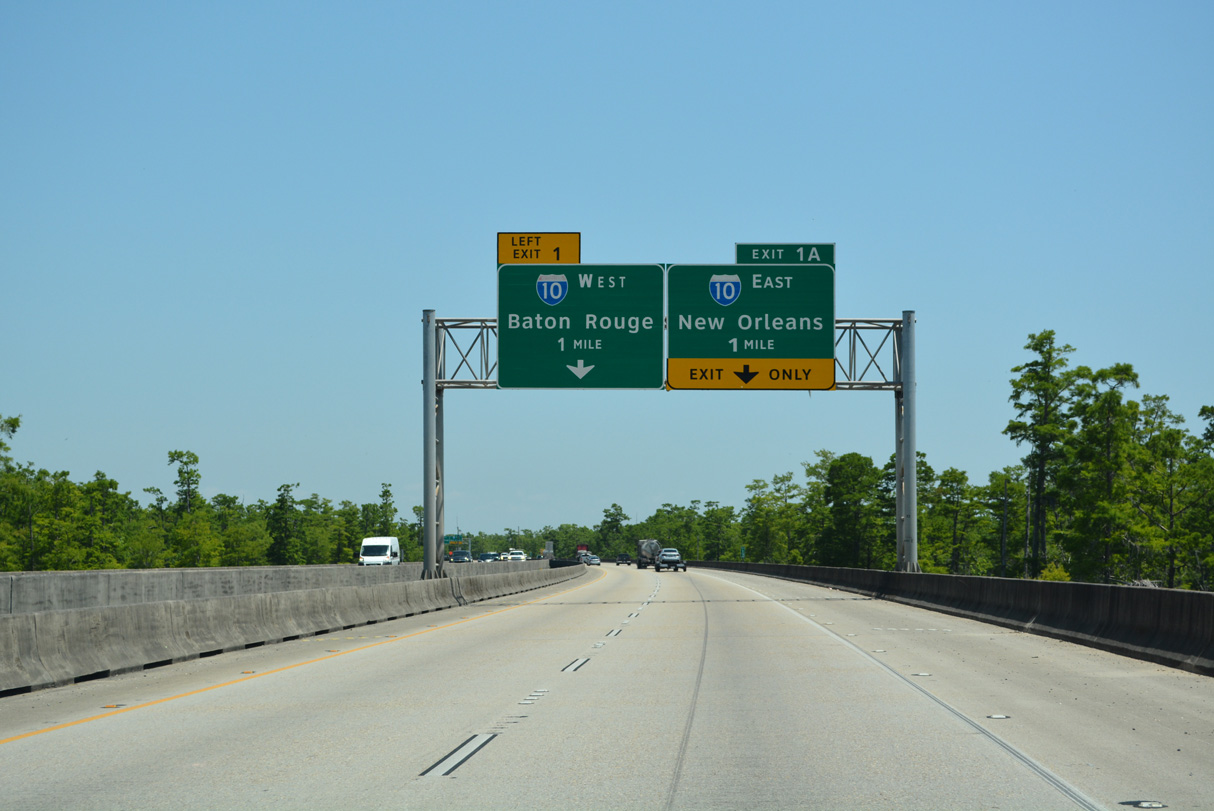
The city limits of New Orleans lie ten miles to the east along forthcoming I-10. The capital city of Baton Rouge is 57 miles to the northwest. 05/11/22
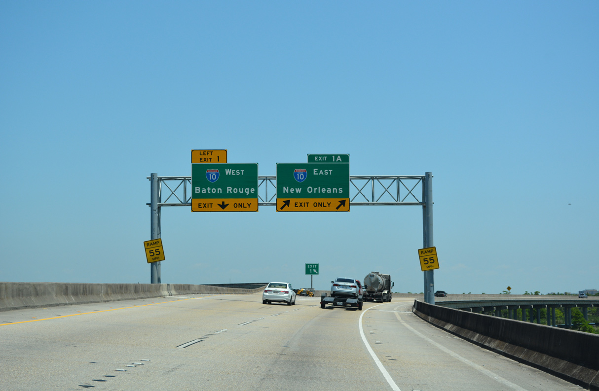
Traffic partitions at Left Exit 1 for Interstate 10 west ten miles to I-55 at LaPlace and Exit 1 A for I-10 east through Kenner and Metairie. This sign truss was installed by February 29, 2020.<sup>7</sup> 05/11/22
![]() West at
West at ![]()
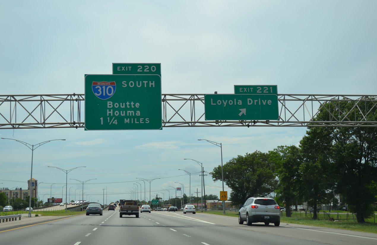
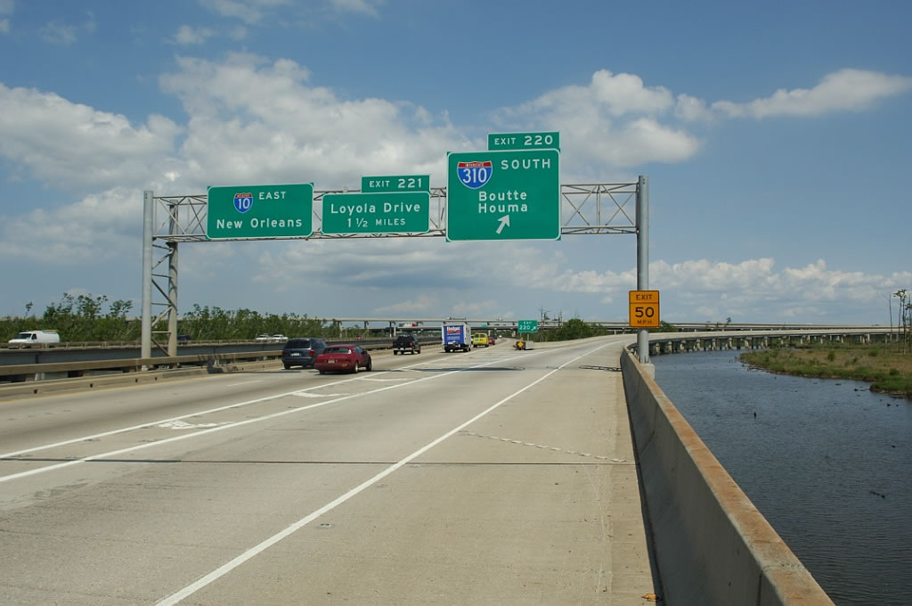
Exit 221 leaves I-10 west for Loyola Drive in the city of Kenner. The freeway continues 1.25 miles to Interstate 310 in St. Charles Parish. 05/09/15
Interstate 310 angles southwest from Exit 220 to connect I-10 with U.S. 90 for points southwest including Houma, Morgan City, and Raceland. The freeway spans the Mississippi River between Destrehan and Luling while also serving St. Charles Parish and communities such as Saint Rose and Boutte. 05/09/15
![]() East at
East at ![]()
Leading east from I-55 at LaPlace to Interstate 310, I-10 runs ten miles along an uninterrupted viaduct across the southwestern fringes of the Lake Pontchartrain, including the Bonnet Carre Spillway. 10/22/03
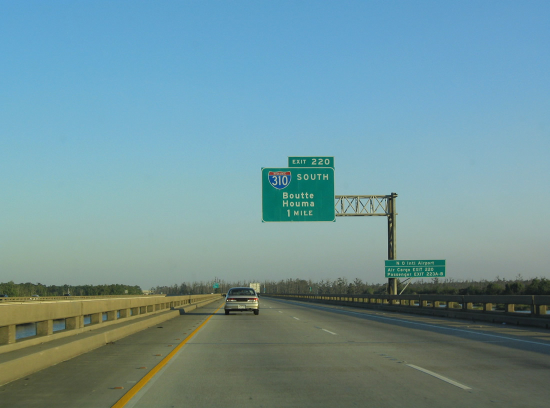
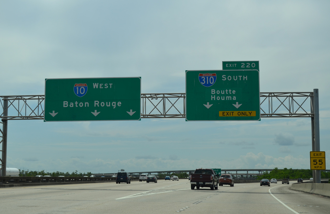
Greenouts on Exit 220 overheads added Boutte to the original I-310 control city of Houma. Interstate 310 also provides an alternate route to Louis Armstrong New Orleans International Airport (MSY) via U.S. 61 (Airline Highway). 10/22/03
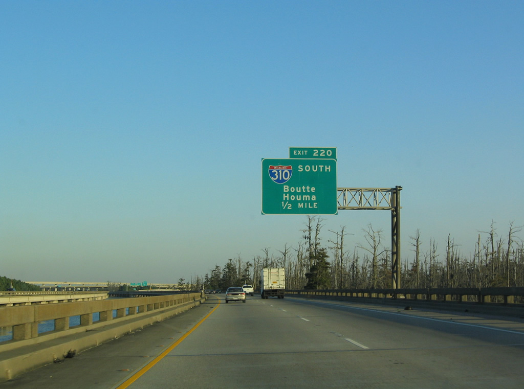
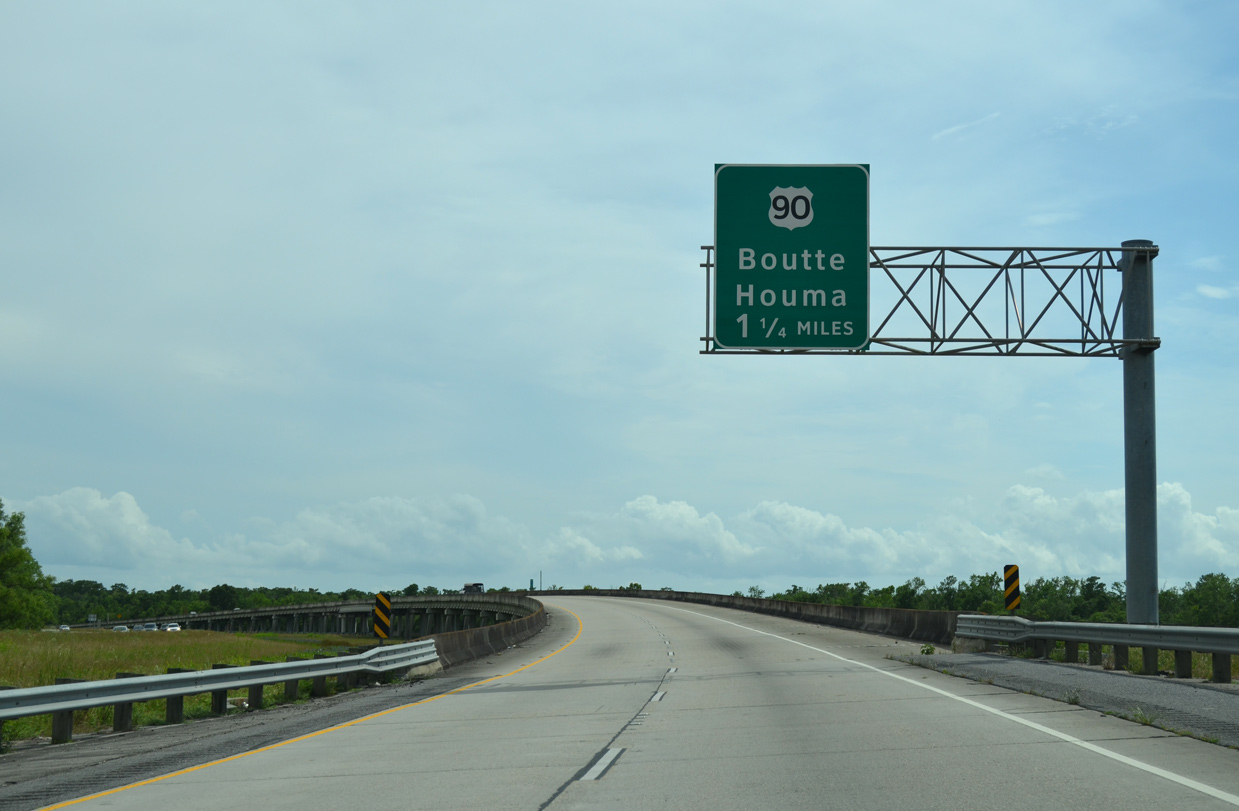
Flyovers at the directional T interchange (Exit 220) come into view on the half mile approach for Interstate 310 south. 10/22/03
The longest continuous viaduct extends southward from I-10 east along I-310 south. Interstate 10 returns to grade level through the city of Kenner. Photo by Jeff Royston (05/24/06).
 North End Throwback


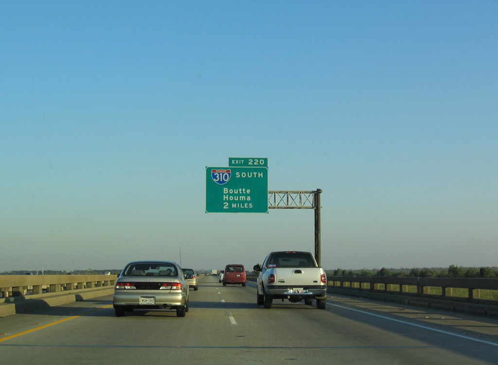
Previous guide signs along Interstate 310 leading north to I-10 in St. Charles Parish. 05/09/15
South End  – Boutte, Louisiana
![]()
![]() South at
South at ![]()
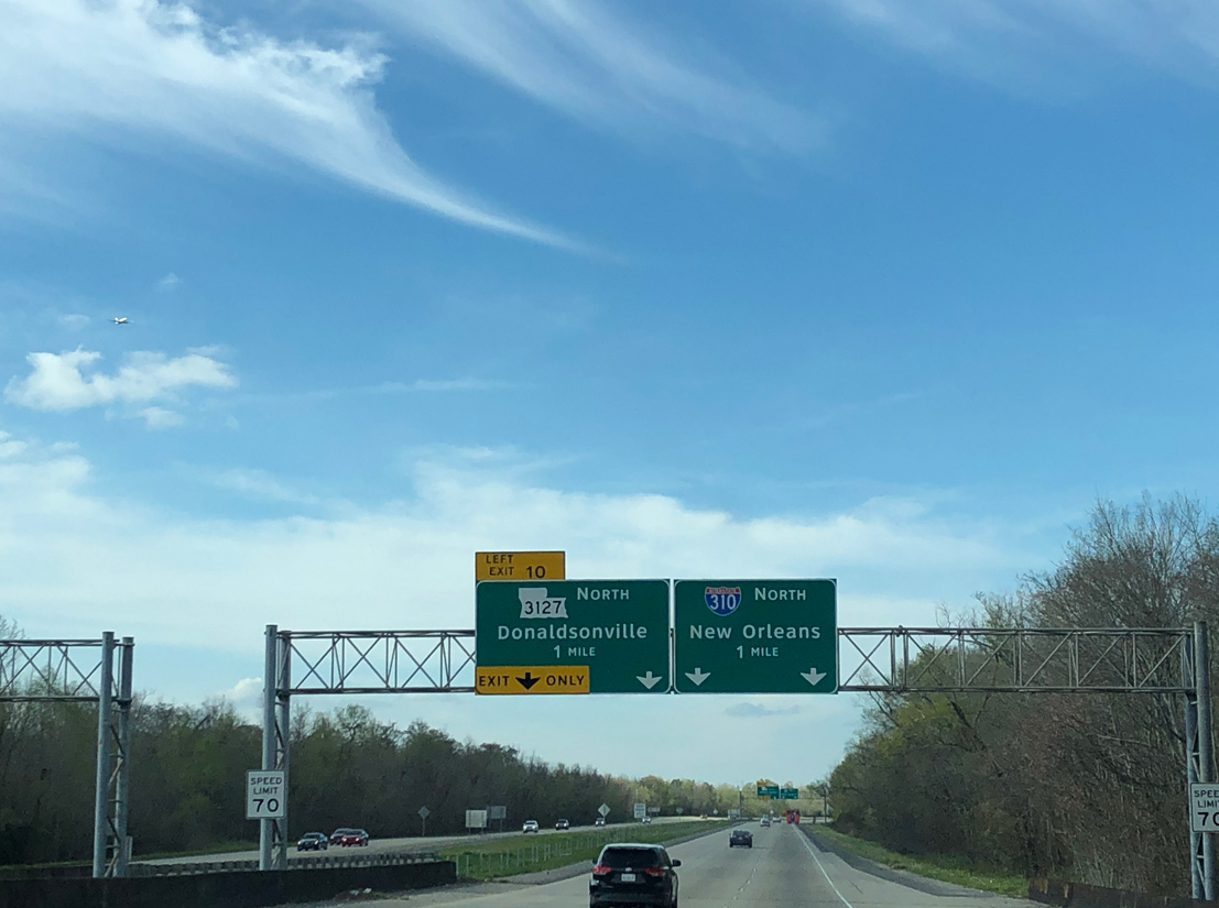
LA 3127 (River Parishes Highway) joins Interstate 310 at a three-wye interchange (Exit 10) just north of the freeway end at Boutte. 05/09/15
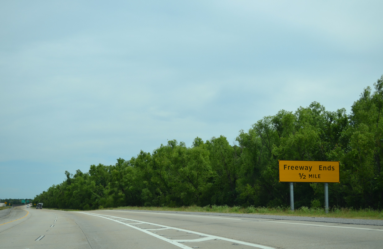
A pair of freeway ends signs stand at the LA 3127 entrance ramp. 05/09/15
The I-310 mainline shifts onto the off-ramp for U.S. 90 at stub ends built into the freeway for the planned extension beyond Boutte. 05/09/15
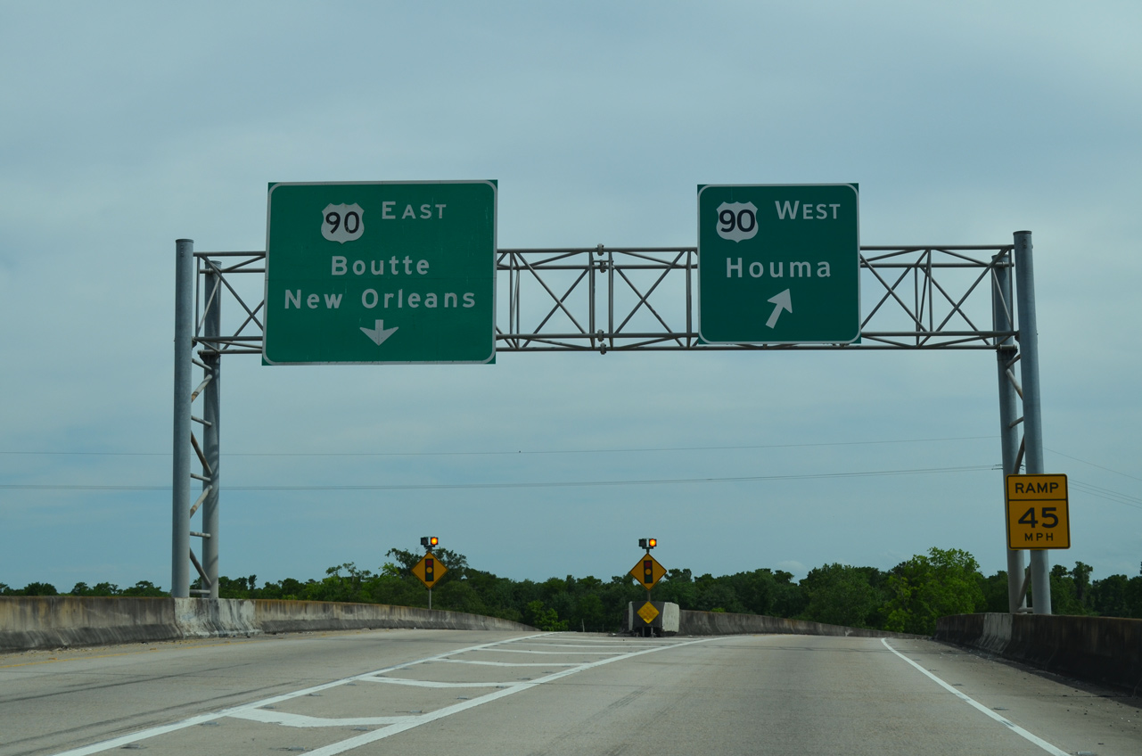
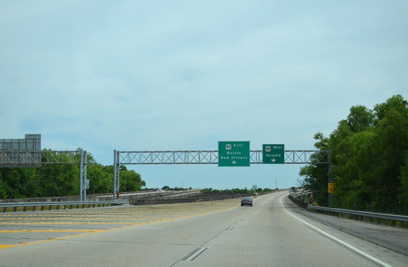
U.S. 90 travels southwest from I-310 to Raceland, Houma, Thibodaux and Morgan City. The highway upgrades to a freeway (Future I-49) in 14 miles. 05/09/15
![]() East at
East at ![]()
![]()
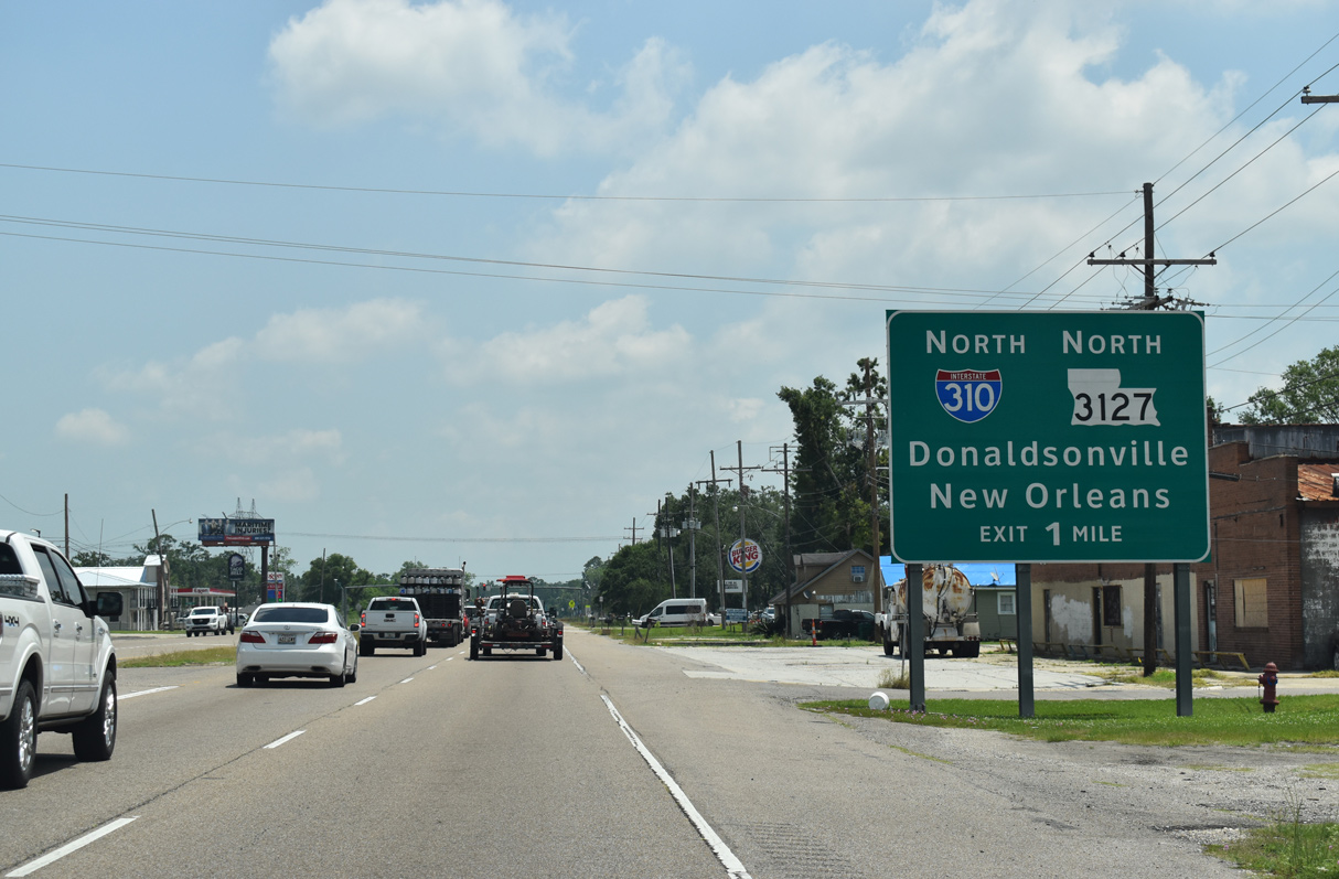
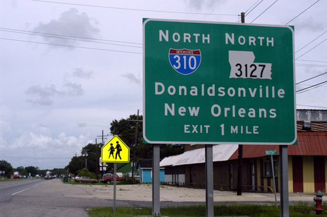
One mile from the south end of Interstate 310 and LA 3127 on U.S. 90 eastbound. 05/11/22
The previous first advance sign for I-310/LA 3127 north on U.S. 90 east. Photo by Jeff Royston (12/12/02).
Advancing through the half diamond interchange with Interstate 310, U.S. 90 next meets the northbound entrance ramp for Destrehan, Kenner and New Orleans. 05/11/22
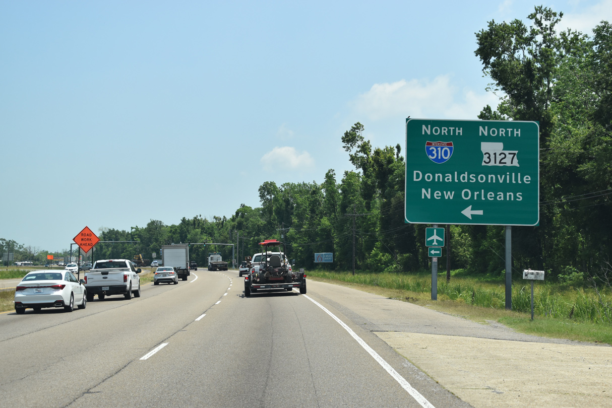
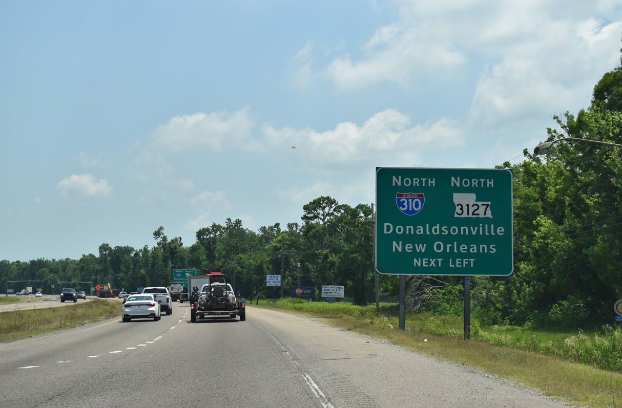
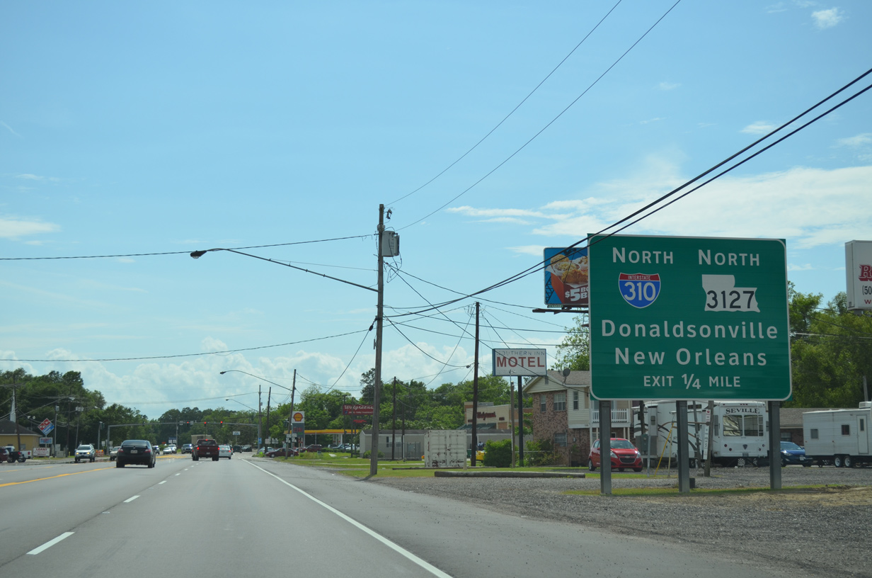
Interstate 310 angles northeast five miles from U.S. 90 to the Hale Boggs Bridge across the Mississippi River. U.S. 90 spans the Mississippi over the Huey P. Long Bridge in 16 miles. 05/11/22
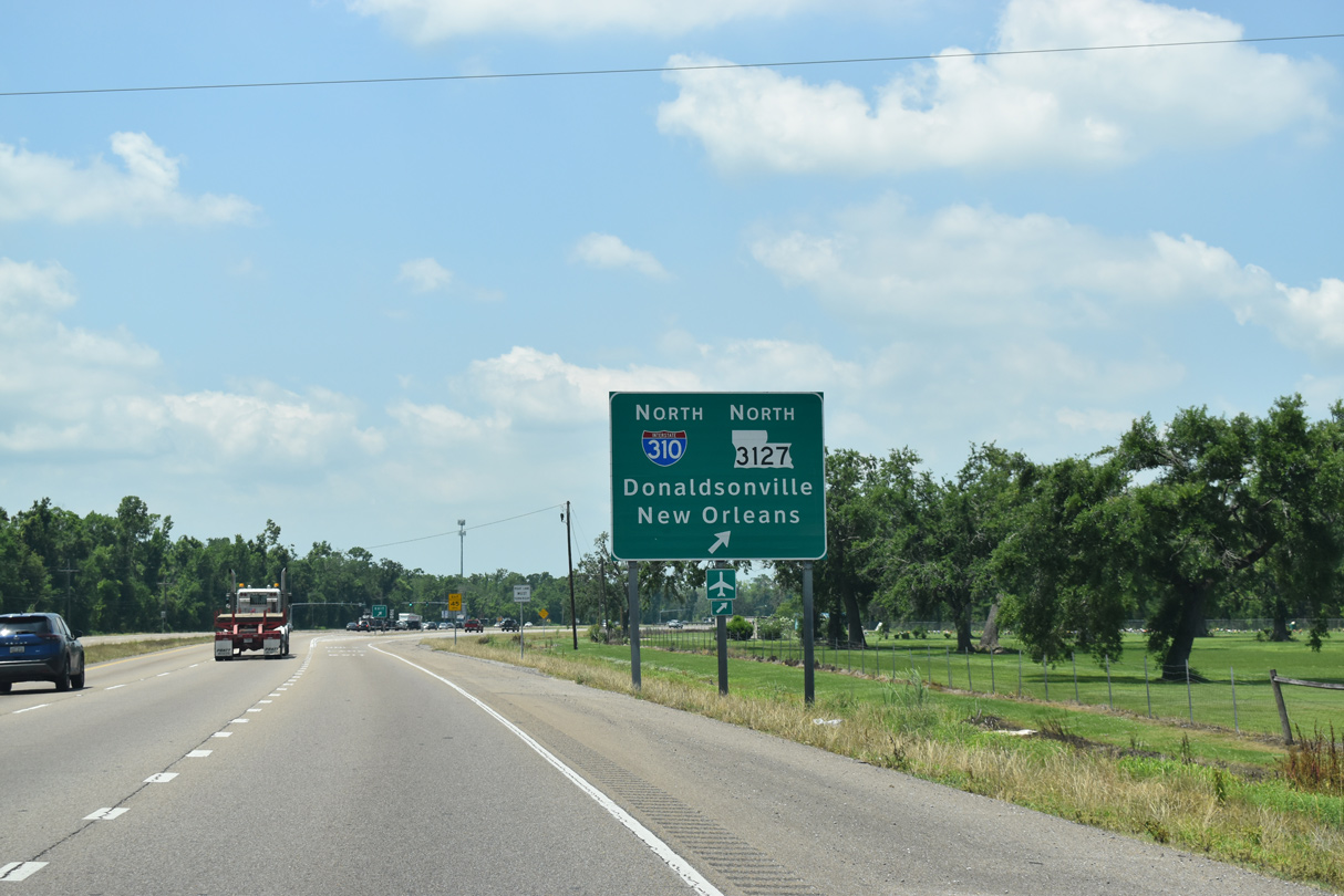
LA 3127 branches northwest from I-310 nearby and travels 44 miles to the Ascension Parish seat of Donaldsonville. Photo by Peter Johnson (02/22/20).
![]() West at
West at ![]()
![]()
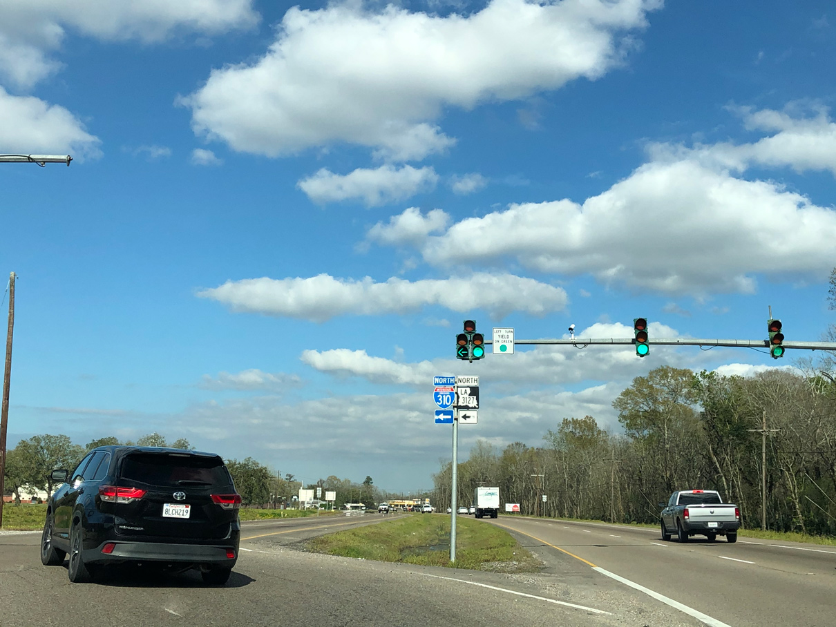
U.S. 90 advances west to I-310/LA 3127 north from the intersection with LA 52 north and LA 633 south in Boutte. 05/09/15
Westbound U.S. 90 reaches the half diamond interchange with I-310/LA 3127 north to New Orleans International Airport (MSY) and Donaldsonville. 05/11/22
Sources:
- “Moses’ New Orleans.” Fred Robertson,
http://www.robertsongovernor.org/moses.htm. this web site examined the impact of that report and the freeway plans on New Orleans. - Tom Lewis, Divided Highways New York: Viking, 1997.
- ViewKeeper.Org: The Near Demise of the French Quarter.
http://www.viewkeeper.org/artmap_i310.htmlincluded maps, diagrams, and photos showing the proposed route of the Vieux Carre Expressway from the 1950s and chronicled in the book, The Second Battle of New Orleans, most of which took place in the 1960s. - “Scissors Snip Opens I-310 Pathway for St. Charles.” The Times-Picayune (New Orleans, LA), July 24, 1991.
- “Last Link of I-310 Completed.” The Times-Picayune (New Orleans, LA), May 8, 1993.
- “Sign Project for Interstate is Under Way.” The Times-Picayune (New Orleans, LA), October 28, 1993.
- “I-310, St. Charles Parish, S.P. No. H.013599.” Louisiana Department of Transportation & Development (LADOTD) Announcements, February 21, 2020.
Page updated July 2, 2022.