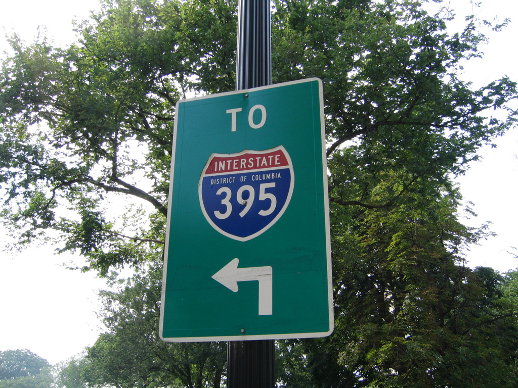
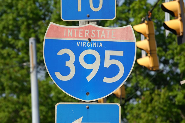
Interstate 395 Virginia / District of Columbia
Overview
Interstate 395 joins Fairfax County and the cities of Alexandria and Arlington in Northern Virginia with the District of Columbia. I-395 extends northeast from the Springfield Interchange with the Capital Beltway (I-95/495) along the Henry G. Shirley Memorial Highway. Crossing the Potomac River into Washington, I-395 continues along the Southwest Freeway to I-695 (Southeast Freeway).
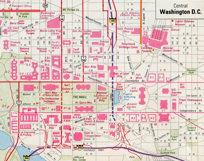
The northern portion of Interstate 395 follows the Center Leg Freeway and Mall Tunnel below the National Mall by the Capitol Reflecting Pool, just west of the U.S. Capitol building. The Center Leg Freeway emerges from the 3rd Street Tunnel at U.S. 50 (New York Avenue).
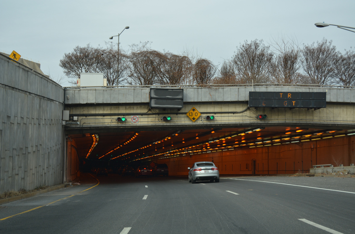
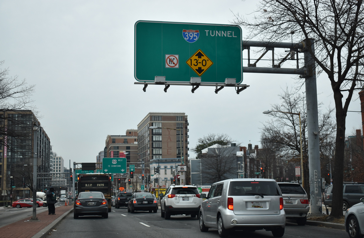
Interstate 395 enters the Third Street Tunnel at C Street SW, north from the exchange with I-695 (Southeast Freeway) near Capitol Hill. 12/16/16
Changes approved by the American Association of State Highway and Transportation Officials (AASHTO) in November 2020 reroute Interstate 395 east over I-695 along the Southeast Freeway to I-295/D.C. 295 (Anacostia Freeway) and renumber the Center Leg Freeway as Interstate 195. The application cited motorist confusion at the exchange joining the Southwest, Southeast and Center Leg Freeways, where two thirds of traffic runs east to west, while the Interstate numbering changes from 395 to 695. A safety study concluded that over 100 accidents occur each year associated with weaving traffic directly attributed to the “exit condition confusion”.
Opened to traffic on November 17, 2019, Express lanes run between the north and southbound roadways along Interstate 395 through Northern Virginia. Previously high occupancy vehicle (HOV) lanes, construction underway from 2017 to Summer 2020 expanded the two lane reversible roadway to three lanes and converted their operation into a toll facility.
Included within the 95 Express Lanes Comprehensive Agreement with Transurban, work on the I-395 Express Lanes Extension rebuilt eight miles of roadway. The high occupancy toll (HO/T) lanes require drivers to have an E-ZPass or other eligible toll transponder. Eligible HOV traffic can use the lanes free of charge with an E-ZPass Flex transponder with the HOV mode set.
Third Street Tunnel
Construction started in July 2015 added a deck above the Center Leg Freeway supporting the Capitol Crossings development at Massachusetts Avenue. Costing $200 million, the lid joins an area bound by Massachusetts Avenue and 3rd, 2nd and E Streets.1 The four phase, $1.3 billion Third Street Tunnel project ran through 2019.
New development above i-395 in #Washington #DC #roads pic.twitter.com/fs3CpVp8xw
— AARoads (@AARoads) December 16, 2016
Route Information
Mileage
Virginia – 9.91
Cities – Alexandria, Arlington
- Junctions –


District of Columbia – 3.88
Cities – Washington
- Junctions –
Source: December 31, 2021 Interstate Route Log and Finders List
I-395 Annual Average Daily Traffic (AADT)
Source: 2016 AADT VDOT Traffic Volume
2018 AADT Traffic Volume Maps – District Department of Transportation
Similar to Interstate 180 in California, while approved by AASHTO, neither it nor I-195 were ever signed in the field.
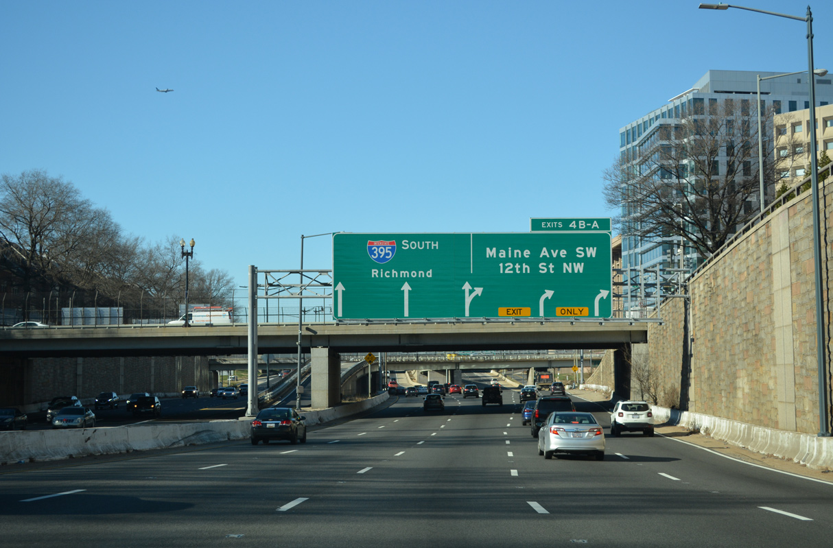
Interstate 395 (Southwest Freeway) drops below grade west ahead of 7th Street SW and Exit 4 B for 12th Street NW to Downtown, Washington. 12/27/22
High Priority Corridor
The entire length of Interstate 395 through metropolitan Washington, D.C. is part of High Priority Corridor 33: Capital Gateway Corridor.
 History
Designated Virginia State Route 350, the Henry G. Shirley Memorial Highway initially opened at Arlington in 1944. The freeway ran between U.S. 1 at Woodbridge and the 14th Street Bridge into D.C. by 1952. Upgrades to Interstate standards followed between the mid-1960s and 1975, when I-95 was signed in place of SR 350.2
With cancellation of the Center Leg Freeway north to unconstructed sections of both I-66 and I-295 (East Leg Freeway), Interstate 95 was rerouted onto the Capital Beltway in 1977
The Federal Highway Administration (FHWA) approved a request to withdraw two segments of the Interstate Highway System and transit project substitutions in Washington, DC on October 3, 1975. This included all of I-70S within the District of Columbia and I-95 from I-295 in Washington northeast to I-495 (Capital Beltway) in Prince George’s County, Maryland. State transportation agencies for Maryland and Virginia came into agree with officials from D.C. to reroute I-95 along the Capital Beltway. Additional renumbering involved redesignating the Shirley Highway in Northern Virginia and the Southwest Freeway northward to the junction with I-295 in Washington as Interstate 395. The American Association of State Highway and Transportation Officials (AASHTO) approved all of these actions on November 15, 1975, though the designation for I-395 was listed as pending.
The FHWA suggested Interstate 895 as the designation in a letter to AASHTO on November 11, 1975:
We agree with the proposal by the District of Columbia and Virginia to assign a three-digit number to the presently numbered segment of I-95 from an intersection with I-495 in Virginia to an intersection with I-295 in the District of Columbia. But, since the route is not a spur, the request to number the route as I-395 is not compatible with existing route numbering policies. Perhaps another number such as I-895 should be considered.
AASHTO followed up with the Virginia Department of Transportation (VDOT) and the District of Columbia Department of Transportation (DDOT) on December 2, 1975 to review and advise if I-895 was acceptable in place of I-395. DDOT responded by January 13, 1976, indicating that they previously considered I-895 as an alternative, but elected to request I-395 for several reasons:
The route is a spur route; the present terminus is with the city’s arterial street system.
Public sentiment and policy does not offer assurance that the route will be extended to connect with I-295 nor does it assure that I-295, as now designated, will be constructed to intersect with proposed I-395.
The I-395 numbering will tell the motorist to expect a route end; an even digit prefix suggest bypass routing and return to a main line via freeway.
Since it is our best guess that extension of this facility will not terminate in a connection with another I-95 segment, it is our judgment that the route numbering change to I-395 will more likely result in one re-signing of the routes involved thereby eliminating the costs and confusion of an additional route number change.
Per discussion with AASHTO, reservations from Virginia Governor Norbert T. Tiemann for the renumbering of I-95 to I-395 were withdrawn and an application for the change was placed for the Route Numbering Committee Meeting on July 12, 1976. With concurrence from the FHWA, the I-395 numbering was subsequently approved on November 13, 1976.
A District of Columbia proposal in 1984 outlined numbering changes for both the Center Leg and Southeast Freeways. Realignment for Interstate 395 would replace both unsigned routes of I-695 and I-295 along the Southeast Freeway east to Capitol Street. Interstate 195 would be established along the Center Leg Freeway north from the Southwest Freeway to U.S. 50 (New York Avenue). The renumbering request to AASHTO was approved by the Route Numbering Committee on May 23, 1984. However the changes were not implemented on area roads.
The Interstate 195 proposal took place during work to complete the Center Leg Freeway north of Massachusetts Avenue. Several General Drafting maps and the Rand McNally 1985 Northern American Road Atlas showed the I-195/395 change.
Completion of the northern segment of the Center Leg Freeway was delayed from 1978 to 1984 due to a lack of funding. Work resumed at that time, and the northbound lanes opened to traffic in December 1986, followed by the southbound lanes in February 1987.3
The Virginia Department of Transportation (VDOT) Springfield Interchange project rebuilt the substandard cloverleaf interchange joining I-95, I-395 (Shirley Highway) and the Capital Beltway (I-95/495) into a multi level systems interchange. Work was completed in July 2007 after eight years of construction. HOV connections were added later.
Prior to their conversion to tolled Express lanes, the HOV-3 lanes along Interstate 395 required vehicles to have three occupants during morning (6:00 a.m. – 9:00 a.m.) and afternoon (3:30 p.m. – 6:00 p.m.) commuting hours. Motorcycles, alternative fuel vehicles and emergency vehicles were exempt from the HOV restrictions.4,5 The lanes were open to all motorists during non peak hours.
North End  New York Ave – Washington, D.C.
![]() North at
North at ![]()
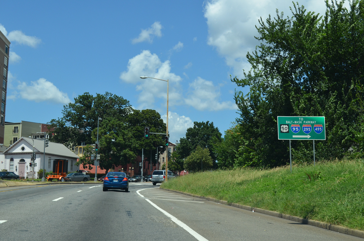
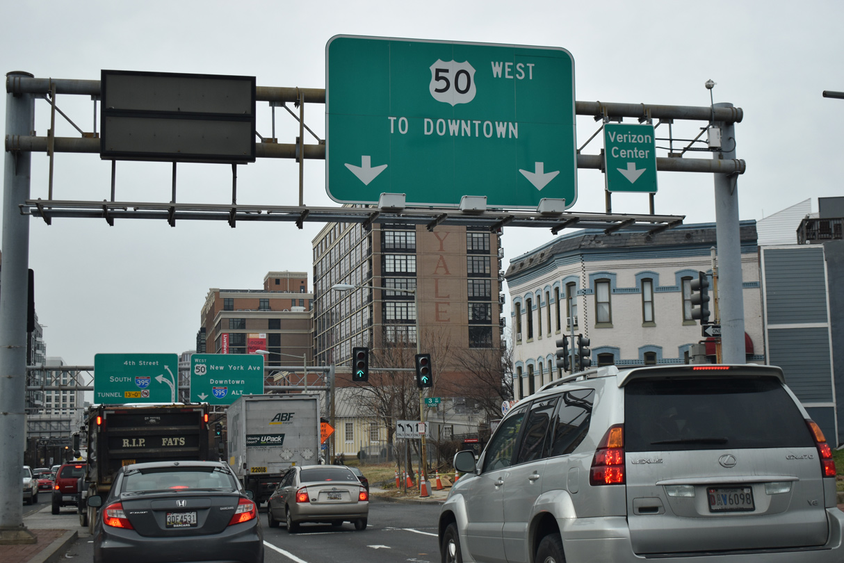
Ramps from the Southeast and Southwest Freeways converge ahead of the Mall Tunnel along Interstate 395 north. The Center Leg Freeway proceeds north 1.5 miles to U.S. 50 (New York Avenue). 12/16/16
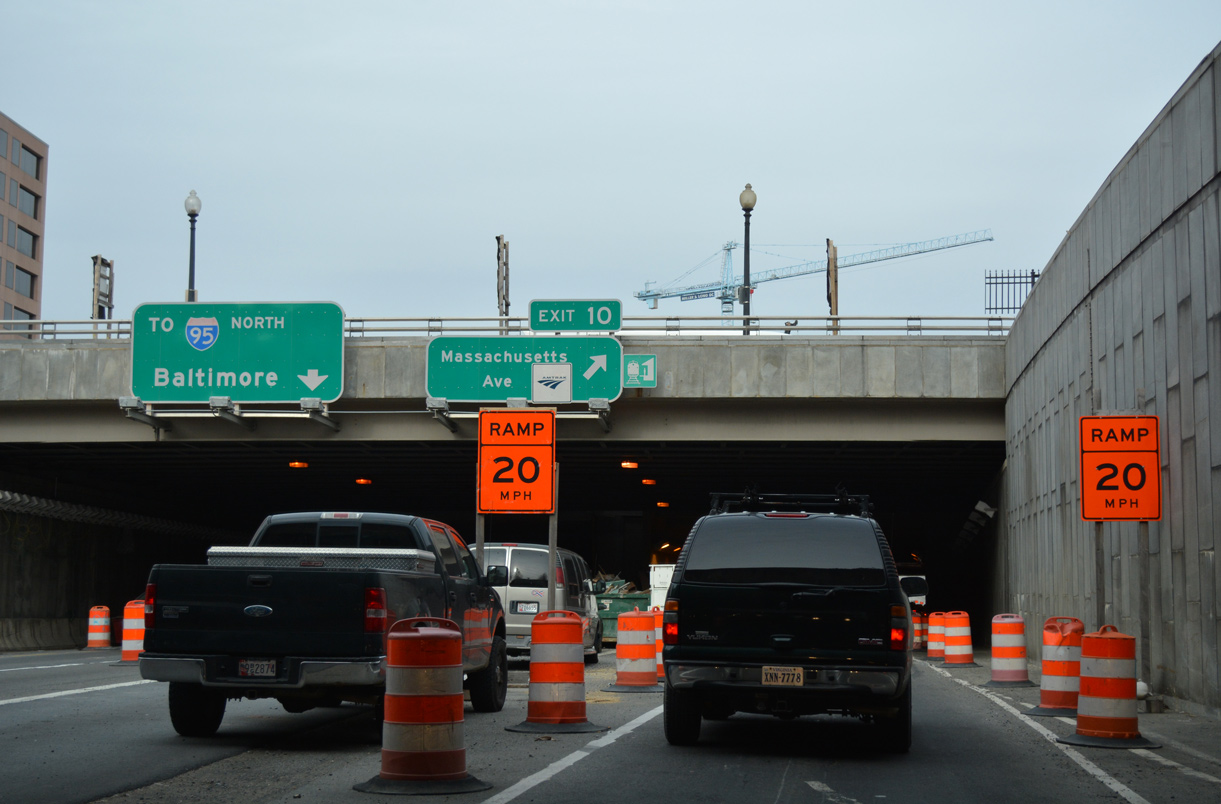
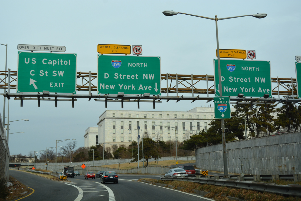
Exit 10 to Massachusetts Avenue is the last off-ramp from Interstate 395 north. The ensuing stretch passes through the 3rd Street Tunnel. 12/16/16
Traffic defaults onto U.S. 50 (New York Avenue NW) eastbound at the north end of the Center Leg Freeway. U.S. 50 transitions to a freeway in 2.50 miles and leaves the District of Columbia to New Carrollton and Annapolis, Maryland. 08/04/13
![]() New York Avenue – East at
New York Avenue – East at ![]()
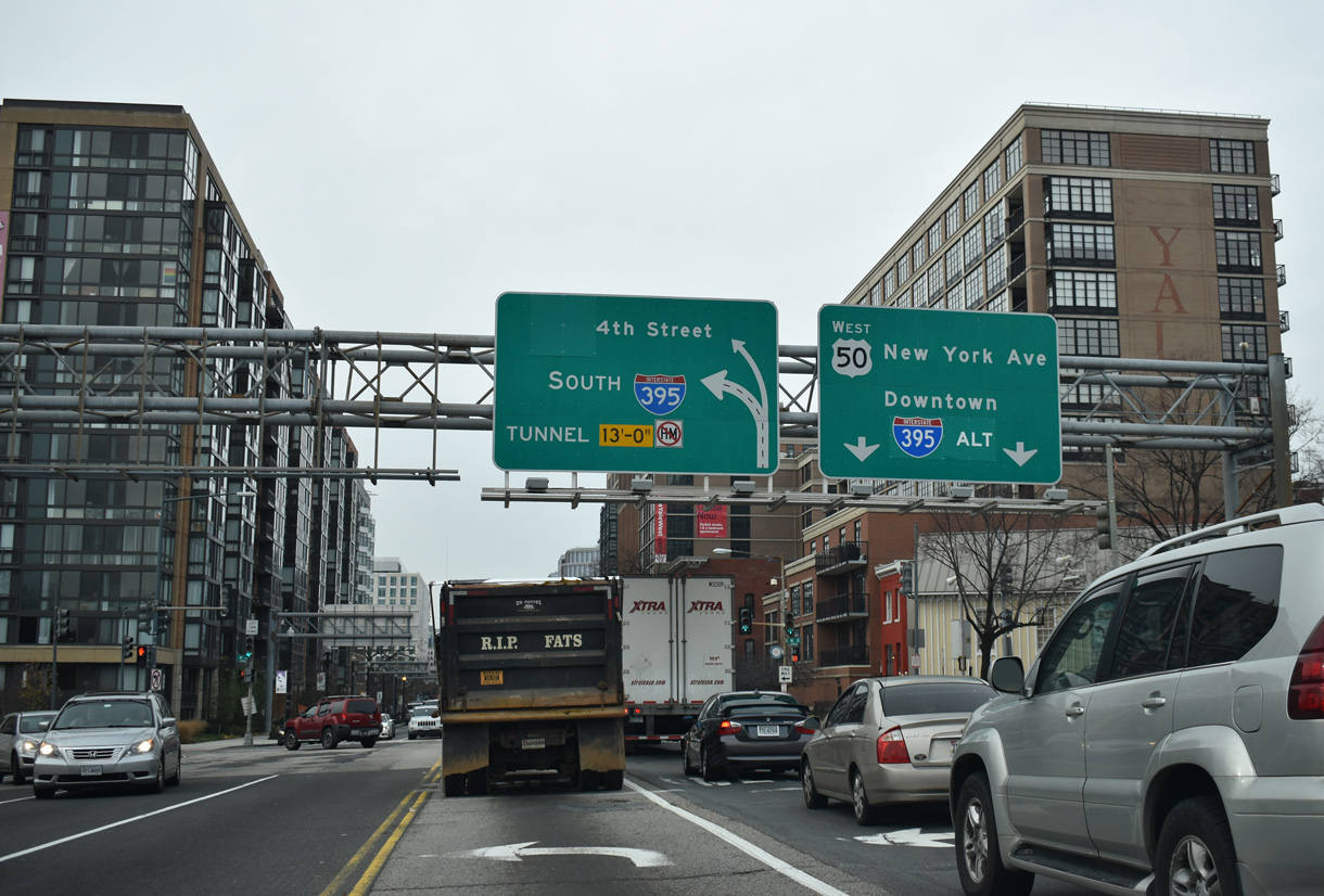
U.S. 50 (New York Avenue NW) passes between the Meridian at Mount Vernon Triangle development and Yale Stream Landry Condominiums on the block preceding 4th Street NW and I-395 (Center Leg Freeway) south.
The U.S. 50 reassurance marker here was replaced with a speed limit 25 MPH sign in 2017. 12/16/16
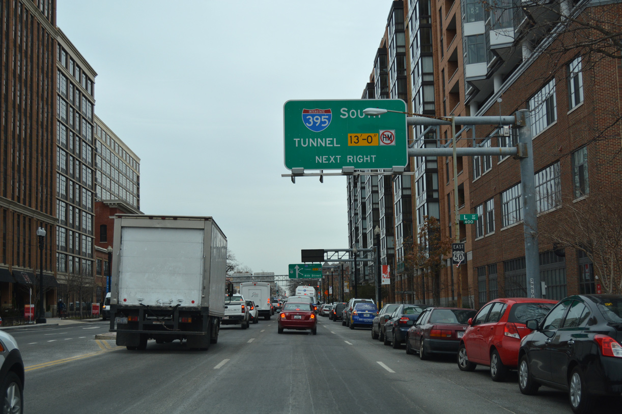
Interstate 395 branches southeast from the crowded intersection joining U.S. 50 (New York Avenue NW) with 4th Street NW. The Center Leg Freeway lowers into the 3rd Street Tunnel at adjacent K Street NW. Photo by Peter Johnson (06/06/21).
![]() New York Avenue – West at
New York Avenue – West at ![]()
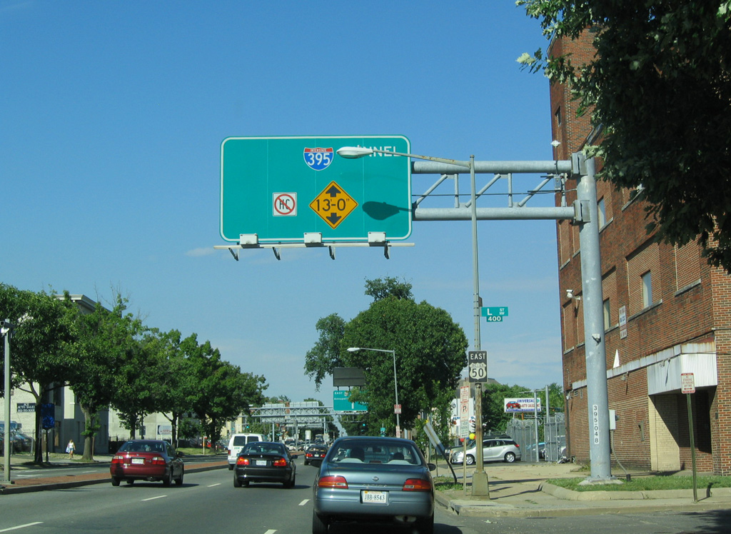
U.S. 50 (New York Avenue NW) angles southwest to New Jersey Avenue NW and 4th Street NW, where the Center Leg Freeway begins. I-395 enters the 3rd Street Tunnel to the immediate south below K Street. 01/04/19
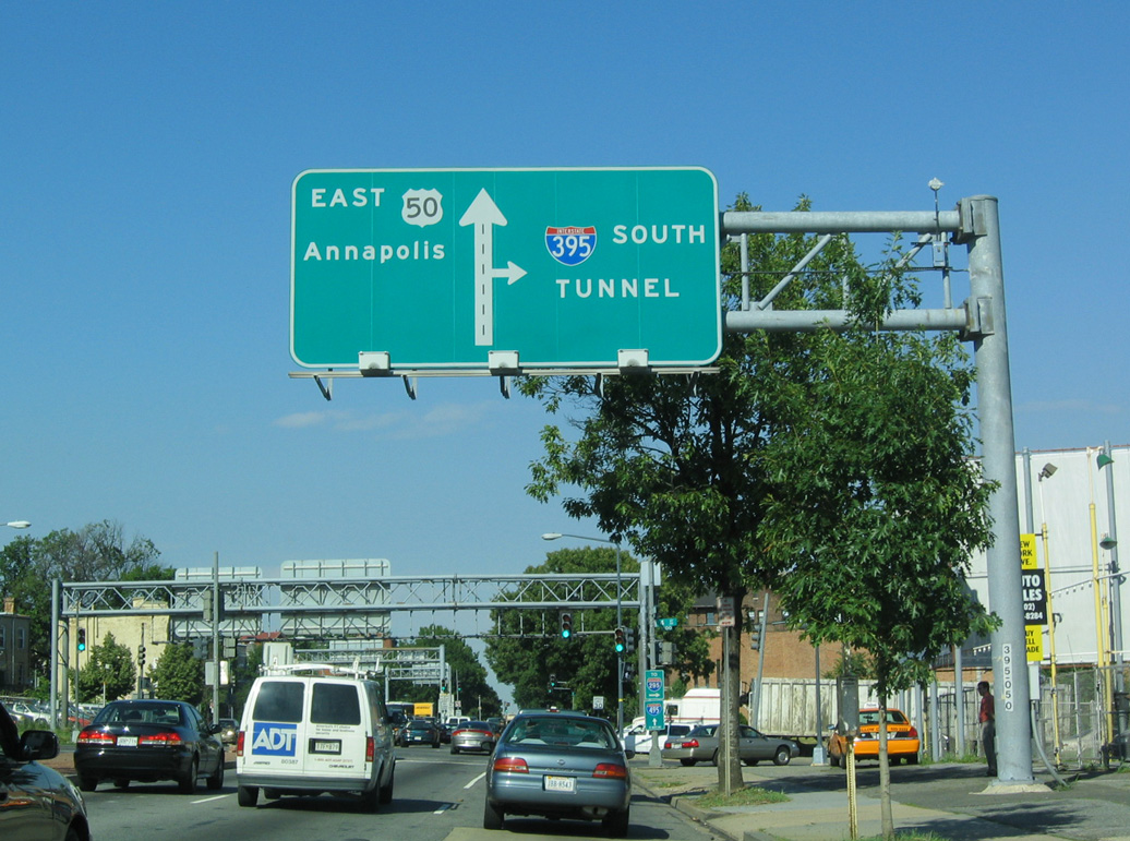
U.S. 50 (New York Avenue) continues westward from I-395 (Center Leg Freeway) to 6th Street NW, where it combines with U.S. 1 south into Downtown Washington. U.S. 1/50 are not posted along 6th Street, instead shields reference I-395 Alternate. 01/04/19
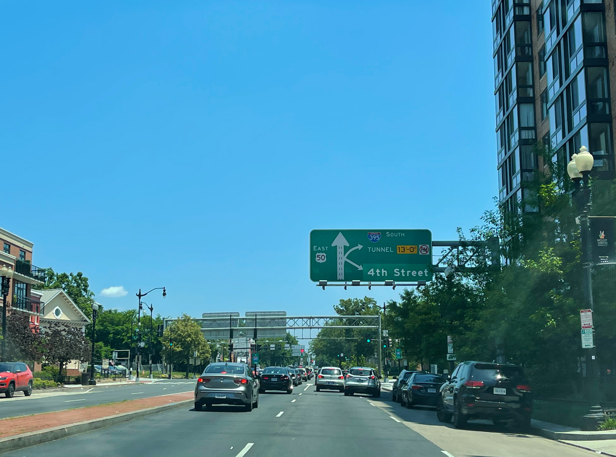
Traffic turning south from westbound U.S. 50 (New York Avenue NW) separates for I-395 south and parallel 4th Street SW. 01/04/19
 North End Throwback
Approaching the five way intersection with I-395 (Center Leg Freeway) south and 4th Street NW on U.S. 50 (New York Avenue) eastbound prior to redevelopment. 06/01/04
U.S. 50 extends east from the I-395 north end toward Annapolis. Southward, the Center Leg Freeway takes I-395 under the National Mall to emerge at the Southeast Freeway (I-695) east of L’Enfant Square. 06/01/04
South End – Springfield, Virginia
![]() South at
South at ![]()
![]()

I-395 advances a half mile south from SR 648 (Edsall Road) to the Springfield Interchange (Exit 1). 01/04/19
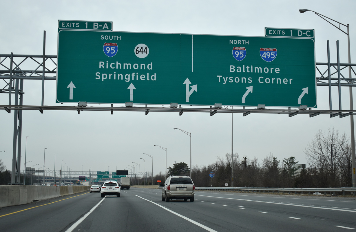
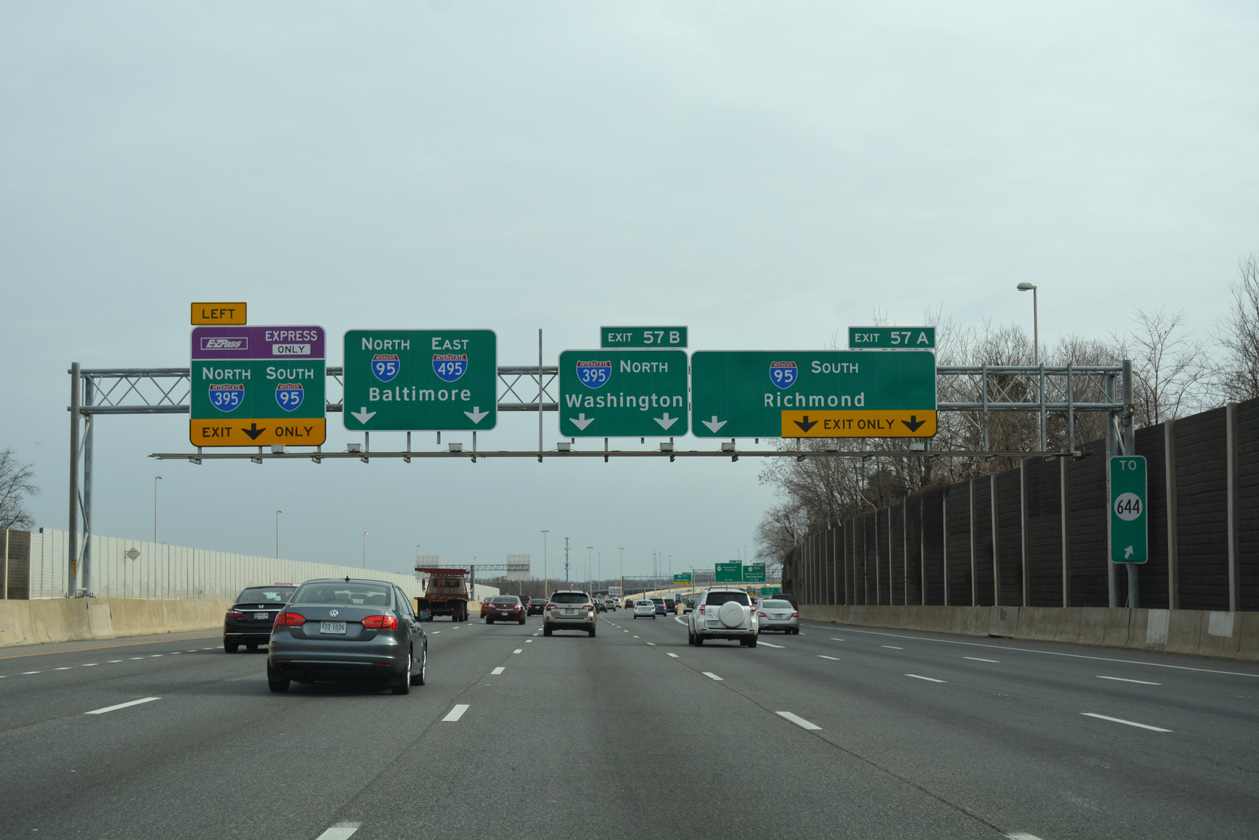
Southbound I-395 expands to five lanes. Three depart at forthcoming Exit 1D/C for the Capital Beltway. 01/04/19
I-495 north leads to Tysons Corner and Montgomery County, Maryland. I-95/495 combine east across southern Alexandria to the Woodrow Wilson Bridge. 01/04/19
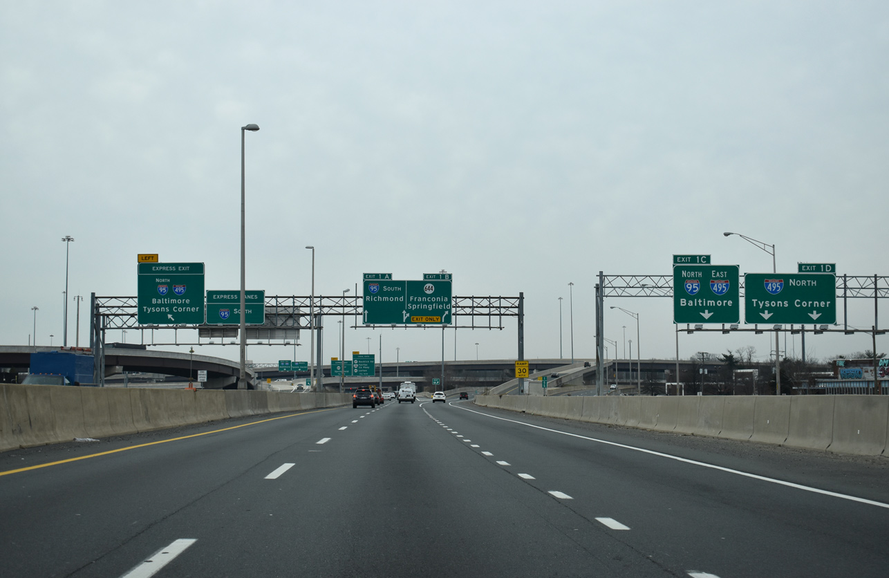
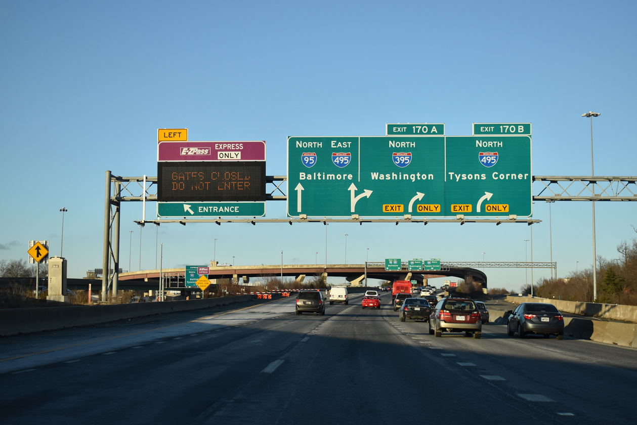
Flyover ramps separate from the I-395 Express Lanes for the Capital Beltway. 01/04/19
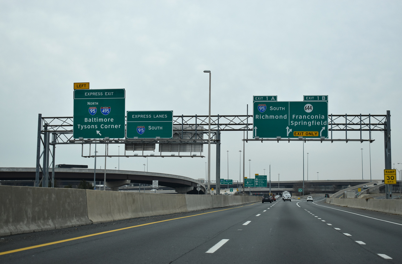
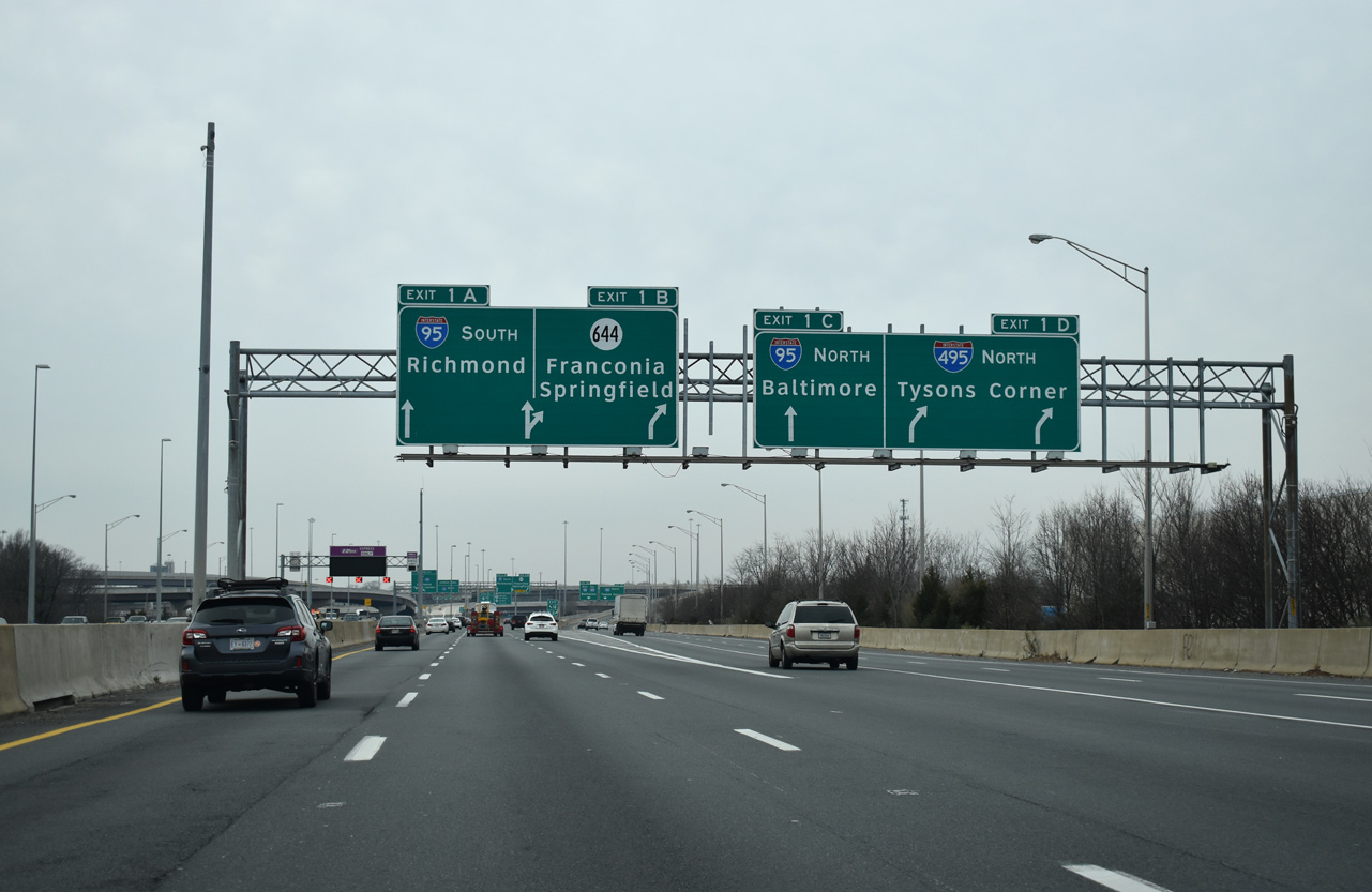
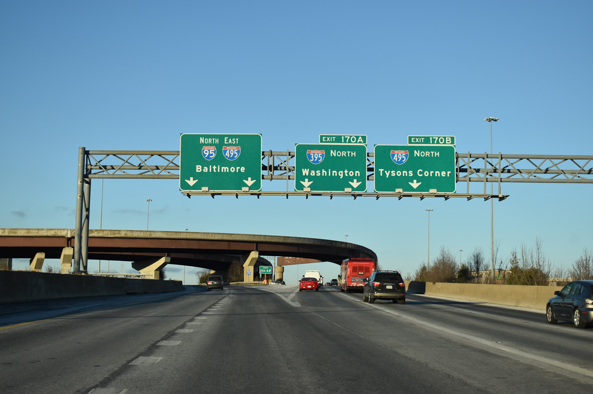
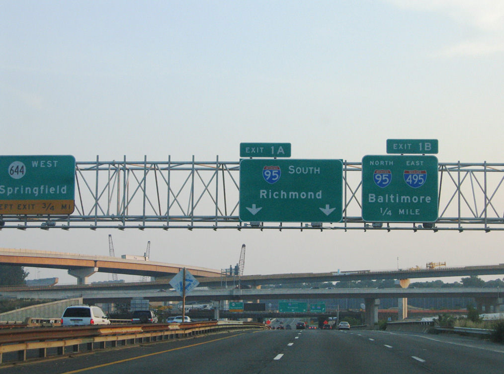
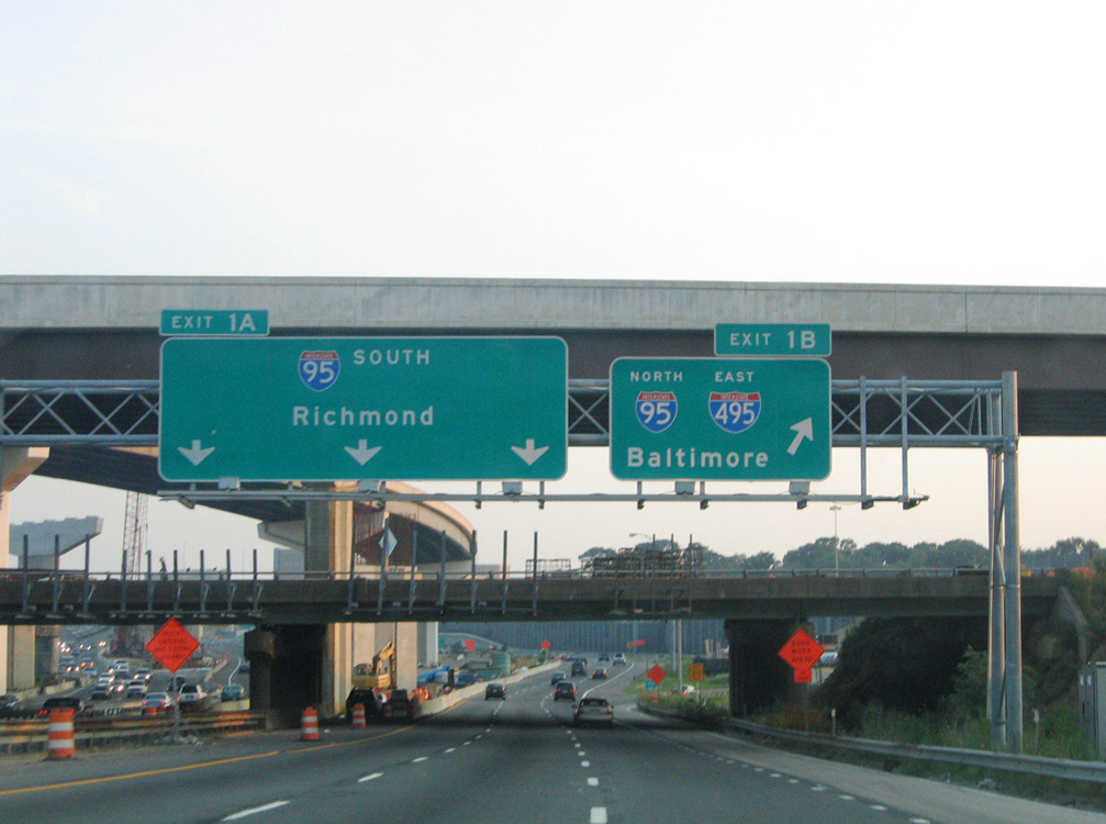
Interstate 395 separates into roadways for I-95 to Fredericksburg (Exit 1A) and to SR 644 along Old Keene Mill Road west and Franconia Road east at Springfield (Exit 1B). 01/04/19
![]() North at
North at ![]()
![]()
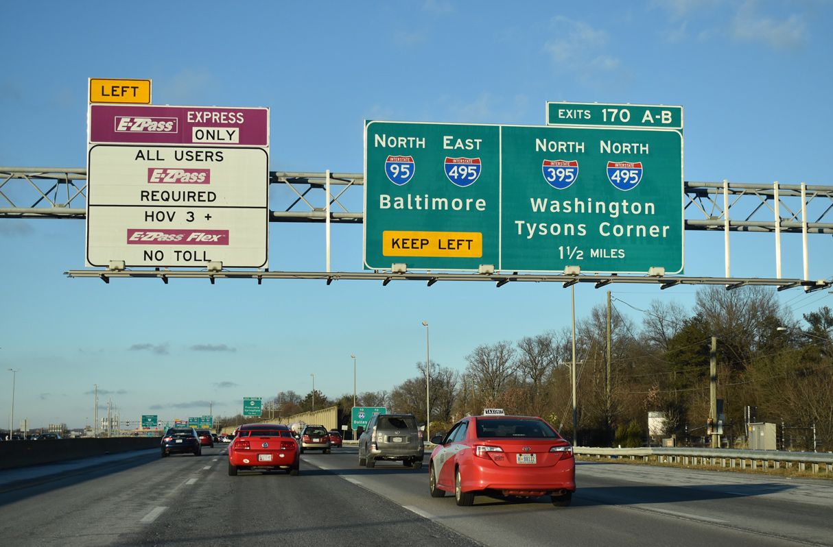
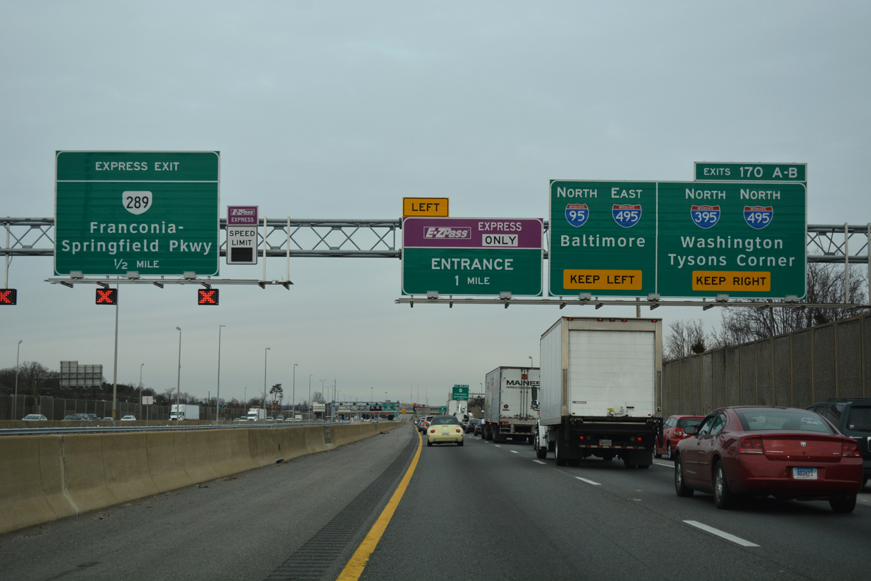
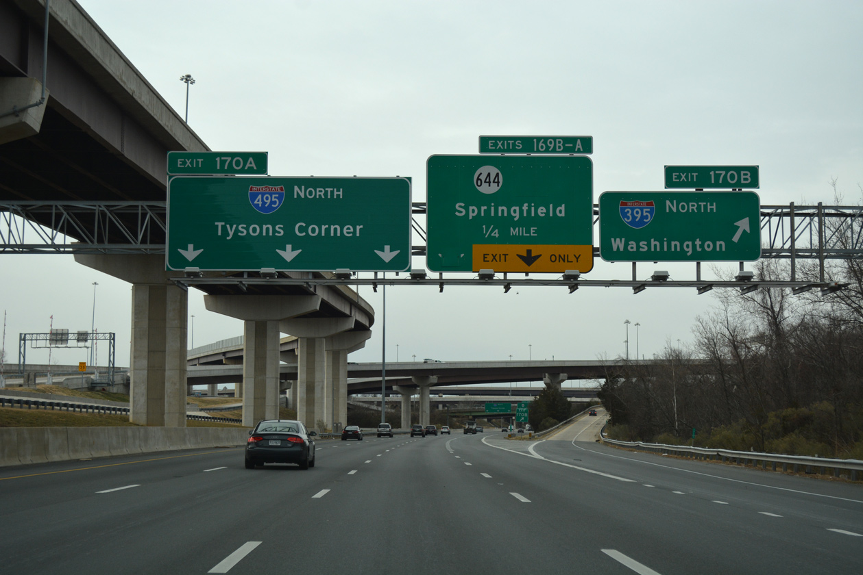
Traffic separates for the Capital Beltway well ahead of the Springfield Interchange (Exit 170) from within the exchange at SR 644 (Old Keene / Franconia Roads). An ingress point also departs for the I-395 Express toll lanes north to Arlington. 12/17/20, 12/16/16
The northbound mainline of I-95 continues onto a two-lane flyover for Interstate 495 east to the Woodrow Wilson Bridge and Oxon Hill, Maryland. I-395 extends the Henry G. Shirley Memorial Highway north with three lanes to Exit 170B (I-495 north) and Washington, DC. Photos taken 12/17/20.
![]()
![]() West at
West at ![]()
Interstate 95 departs the Capital Beltway along a two-lane flyover as I-495 continues west to Exit 170B for I-395 north into Arlington and Washington. 12/16/16
![]() East at
East at ![]()
![]()
Traffic bound for Interstate 95 south and SR 644 (Franconia Road) partitions from the Capital Beltway mainline well in advance of the Springfield Interchange with I-395. 12/16/16
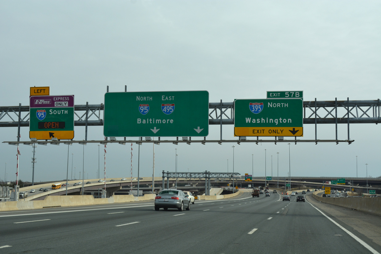
Exit 57B to I-395 north departs from I-495 south beyond the separation of Exit 57A for I-95 south to Richmond. 12/16/16
South End Throwback
![]() South at
South at ![]()
![]()
Interstate 395 south at Exit 1B/A during construction to upgrade the Springfield Interchange into a systems exchange. 08/01/05
Exit 1B formerly comprised a loop ramp from I-395 south to I-95 north / I-495 east to Prince George’s County, Maryland. 08/01/05
![]() North at
North at ![]()
![]()


Interstate 95 north approaching the Springfield Interchange during the seven year reconstruction of the freeway at SR 644 and the Capital Beltway. 06/22/05, 06/02/03
Sources:
- “Major work for Capitol Crossing project is set to begin on I-395.” The Washington Post (DC), June 23, 2015.
- Henry G. Shirley Memorial Highway, Roads to the Future (Scott Kozel).
- Center Leg Freeway (I-395), DCRoads.net.
- Scheulen, Jeff, “AARoads feedback: HOV on I-395 / I-95 in Northern Virginia,” Personal Email, February 15, 2007.
- Virginia Department of Transportation (VDOT) Travel Center: High Occupancy Vehicle (HOV) Systems. page accessed August 25, 2007.
Page updated April 7, 2023.