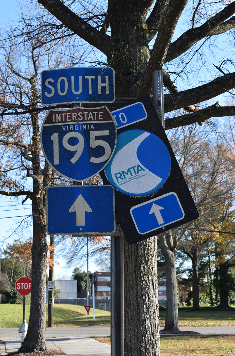
Interstate 195 Virginia
Overview
Interstate 195 is an urban freeway spur branching southwest from I-64/95 (Richmond-Petersburg Turnpike) to Carytown in the city of Richmond. The Beltline Expressway accompanies a CSX Railroad corridor between the Malvern Gardens community and the Museum District. The south end splits into branches for the tolled Powhite Parkway (SR 76) west to Midlothian and the tolled Downtown Expressway (SR 195) back to Interstate 95.
 History
Plans for the Richmond Expressway System were announced in October 1966. As originally envisioned, the $90 to 95 million system would consist of four segments:1
- Beltline Expressway – a four to six lane route running northeast from near Willow Oaks on the south banks of the James River to Bryan Park on the North Side of the city.
- Downtown Expressway – a six lane roadway angling southeast from the Beltline Expressway along Idlewood Avenue to the Richmond-Petersburg Turnpike near Main Street Station.
- Powhite Parkway – an expressway linking Chippenham Parkway in Chesterfield County to the Beltline Expressway at Willow Oaks. This route would follow the Powhite creekbed and Southern Railway line.
- Riverside Parkway – paralleling the south bank of the James River, between the Powhite Parkway and Huguenot Bridge. Provisions were considered for an extension of this leg west into Henrico County, including a bridge across the James to the west of the Huguenot Bridge.
Tolls collected on the expressway system were proposed mostly at 15 cents, with selected locations levying either 10 or 25 cents. Speed limits were to be set at 50 miles per hour.1
Route Information
North End – Richmond, VA
South End – Richmond, VA
Mileage – 3.24
Cities – Richmond
- Junctions –

Source: December 31, 2021 Interstate Route Log and Finders List
I-195 Annual Average Daily Traffic (AADT)
Source: 2016 VDOT Traffic Volume
The Beltline Expressway opened in 1975.2 The route of I-195 was approved by the American Association of State Highway and Transportation Officials (AASHTO) on June 9, 1986. The application sent to AASHTO by the Virginia Department of Transportation (VDOT) provided the following reasoning:
The requested designation is for Interstate Route 195 which provides, in conjunction with the Downtown Expressway, ingress and egress to the central business district of Richmond. This designation conforms with current FAI designation and signing in this area and forms part of the Interstate System in Virginia.
 Photo Guides
North End  – Richmond, Virginia
![]() North at
North at ![]()
![]()
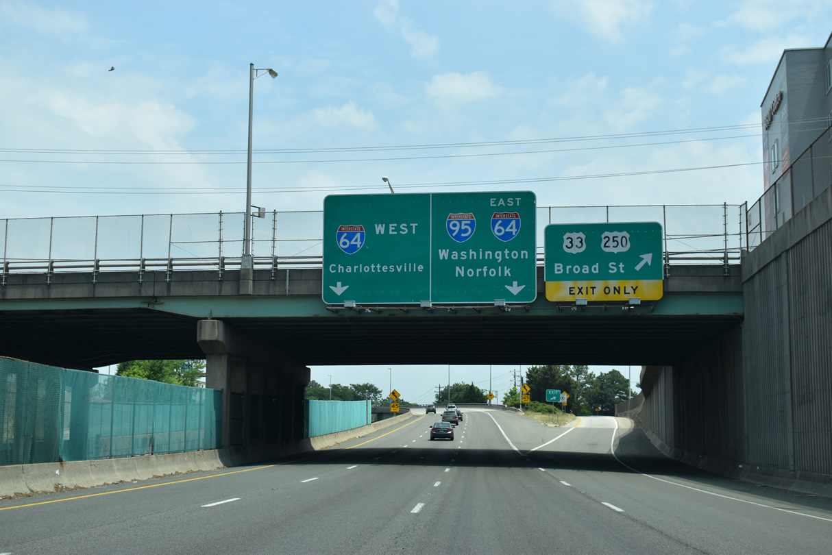
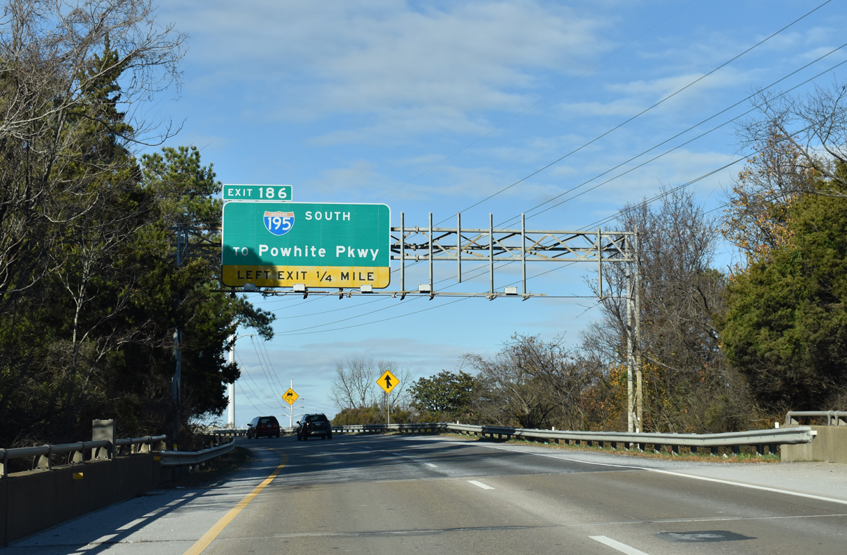
Interstate 195 (Beltline Expressway) meets U.S. 33/250 (Broad Street) 1.25 miles from the three-wye interchange with I-64 and I-95. 05/28/21

The Beltline Expressway navigates through a series of S-curves above industrial areas and a CSX Railroad yard along the Henrico County line. 05/28/21
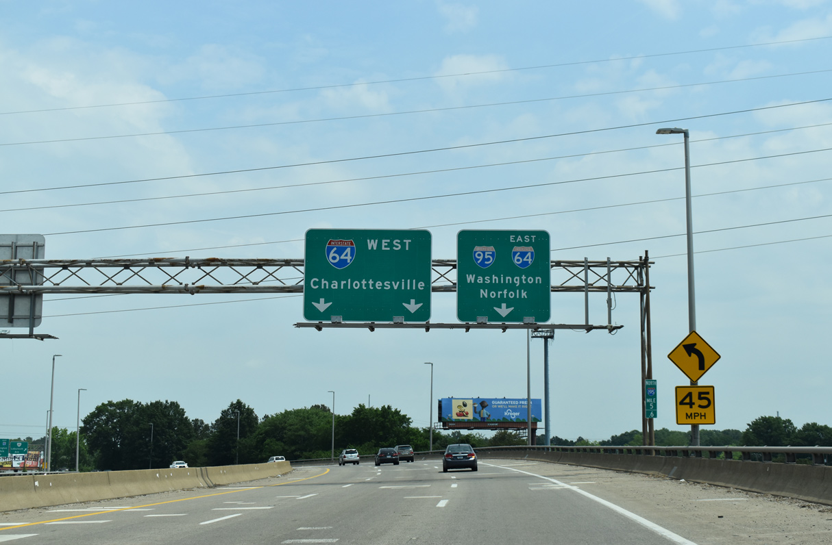
Two lanes separate for Interstate 64 west to Waynesboro and Staunton in 0.4 miles. 05/28/21
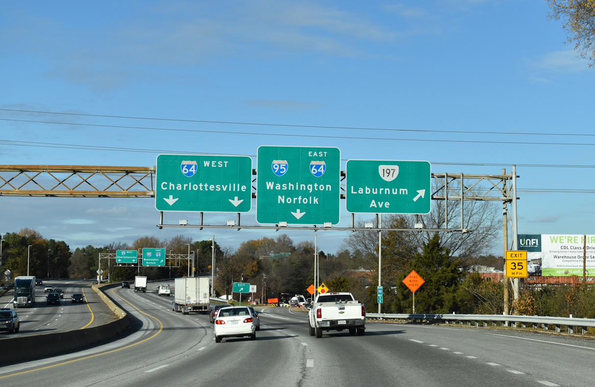
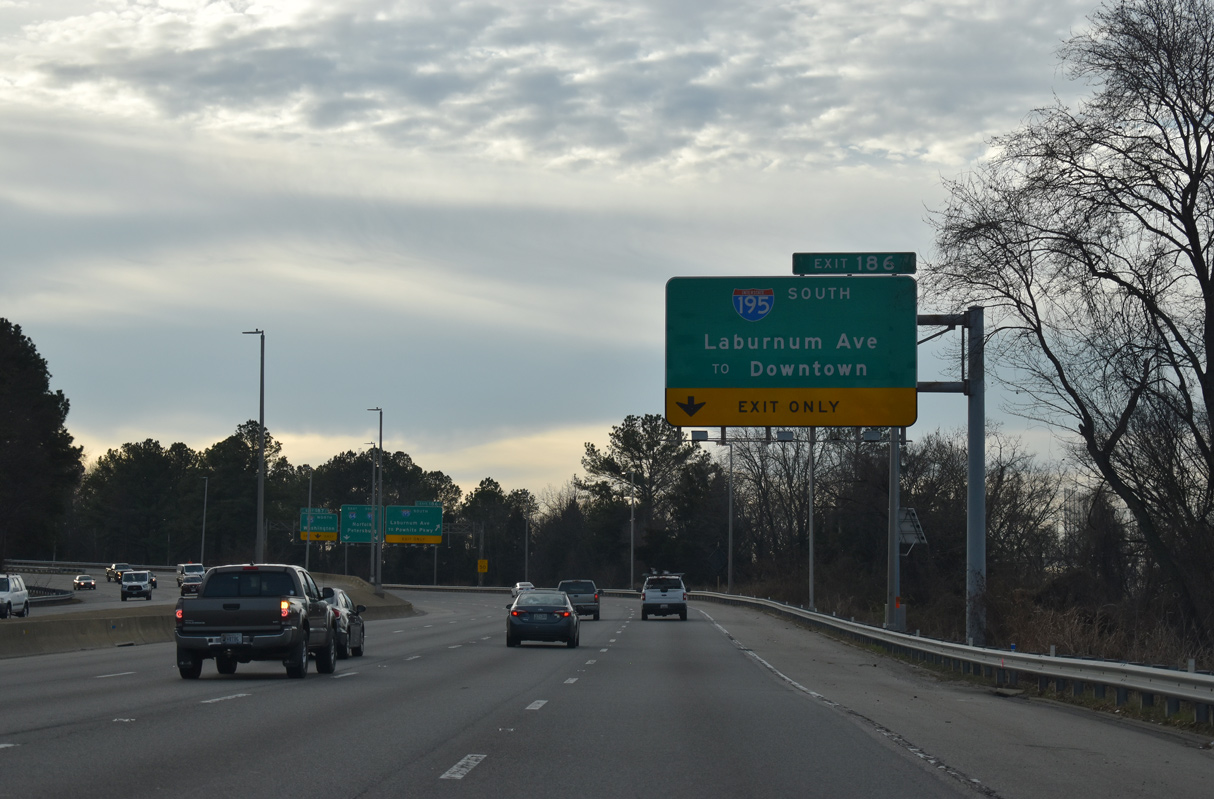
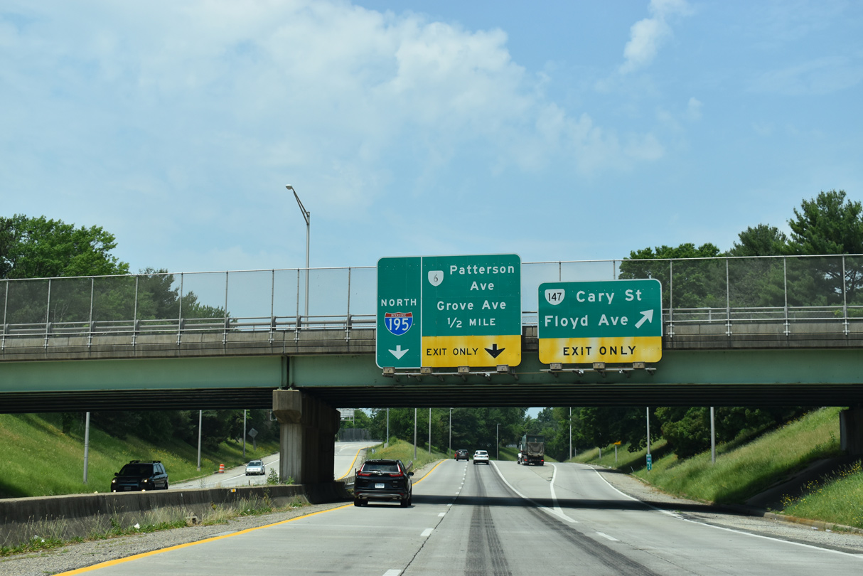
A half diamond interchange joins Interstate 195 with SR 197 (Laburnum Avenue) east ahead of the ramp split for I-64 west to Charlottesville and I-64/95 east. 12/27/20
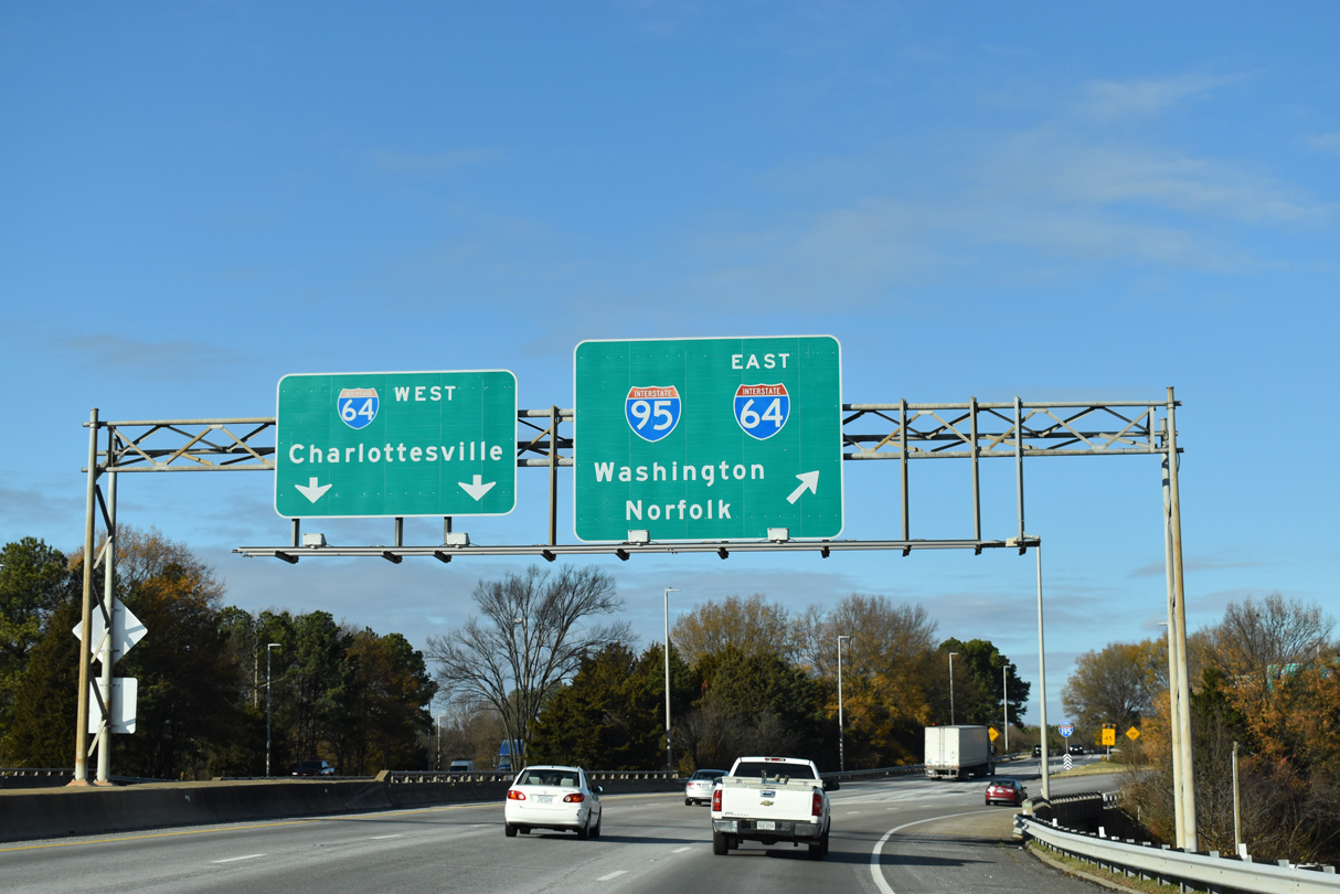
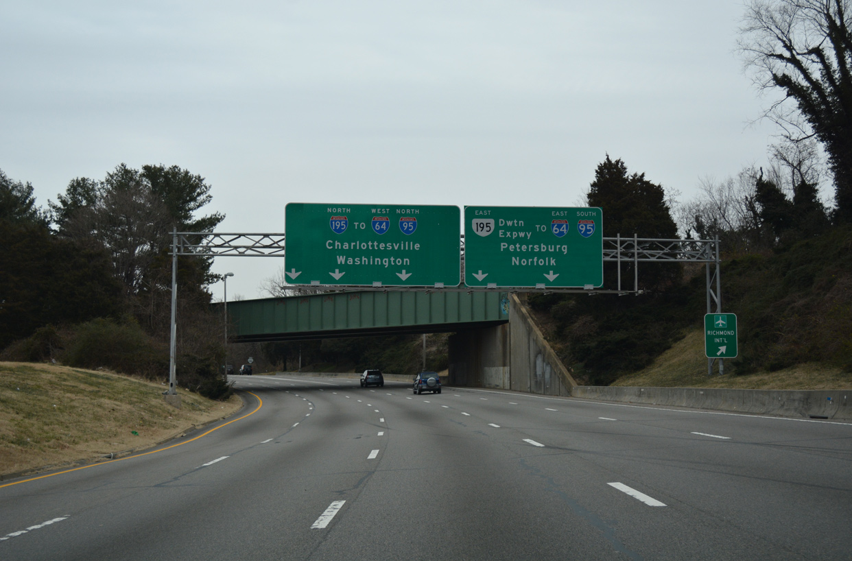
Passing over Laburnum Avenue, Interstate 195 separates with the ramps for I-95 north to Washington, DC and I-64/95 east toward Hampton Roads. 12/17/20
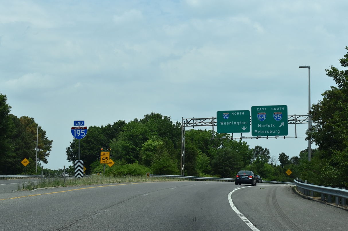
An end shield for Interstate 195 stands at the gore point for I-64 west and I-95/64 east. 05/28/21
![]() East at
East at ![]()
![]()
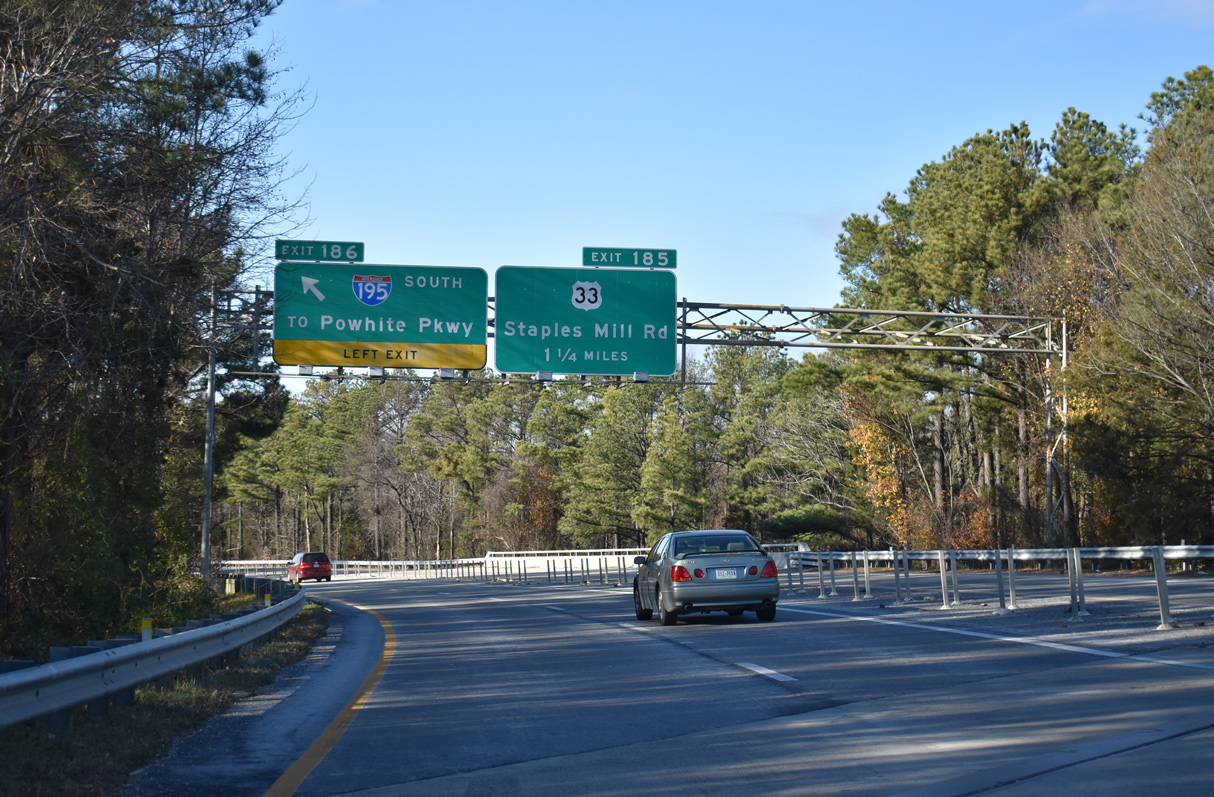
Interstate 64 crosses paths with U.S. 33 (Staples Mill Road) at Dumbarton, 1.75 miles northwest of the exchange (Exit 186) with I-195, SR 197 (Laburnum Avenue) and I-95. 12/30/20
Winding southeast between a CSX Railroad yard and Joseph Bryan Park, Interstate 64 advances to within a half mile of I-195 (Beltline Expressway) and I-95. 12/30/20
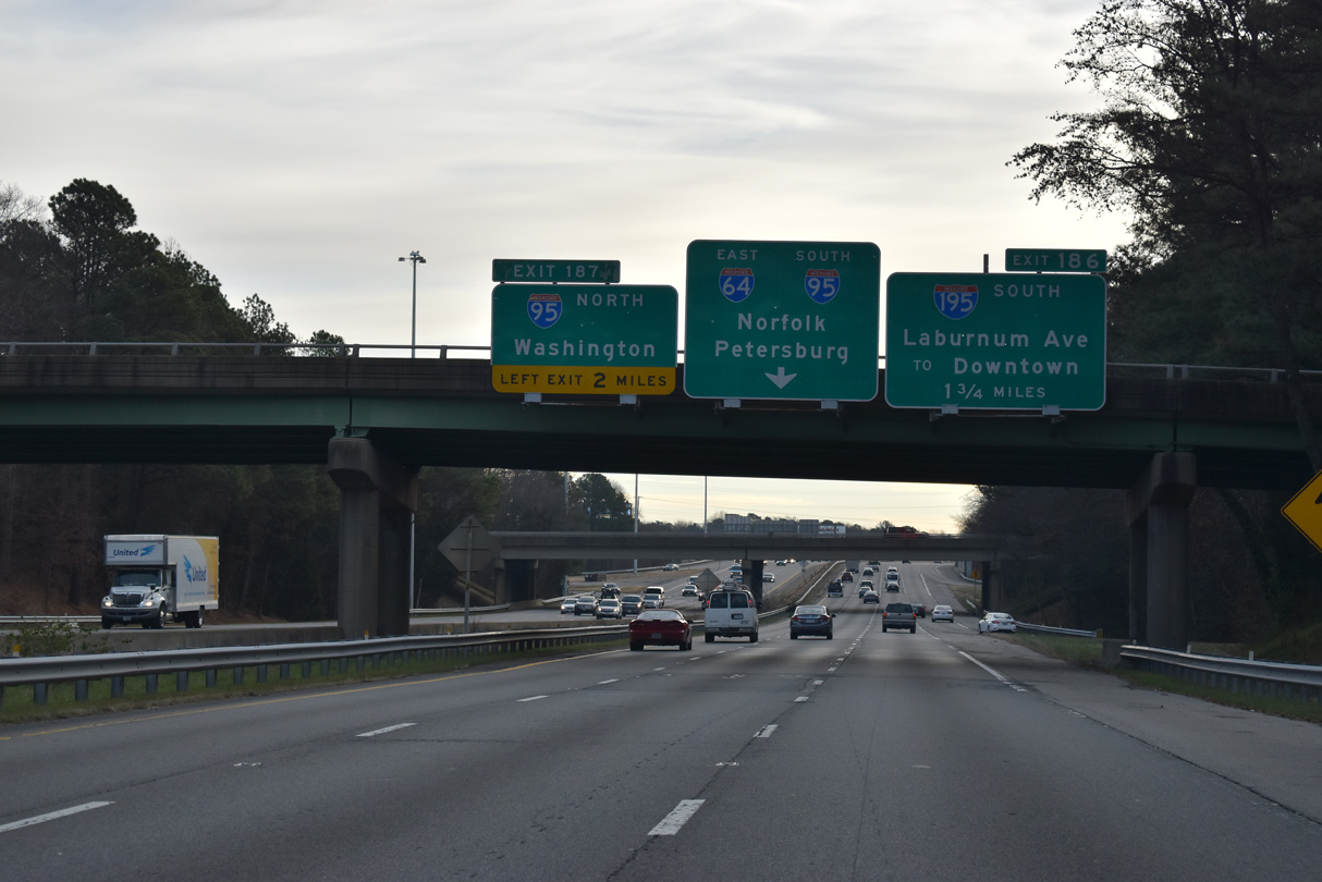
Interstate 64 enters the city of Richmond at the overlapping directional T interchanges with I-195 south and the Richmond-Petersburg Turnpike (I-95). 12/30/20
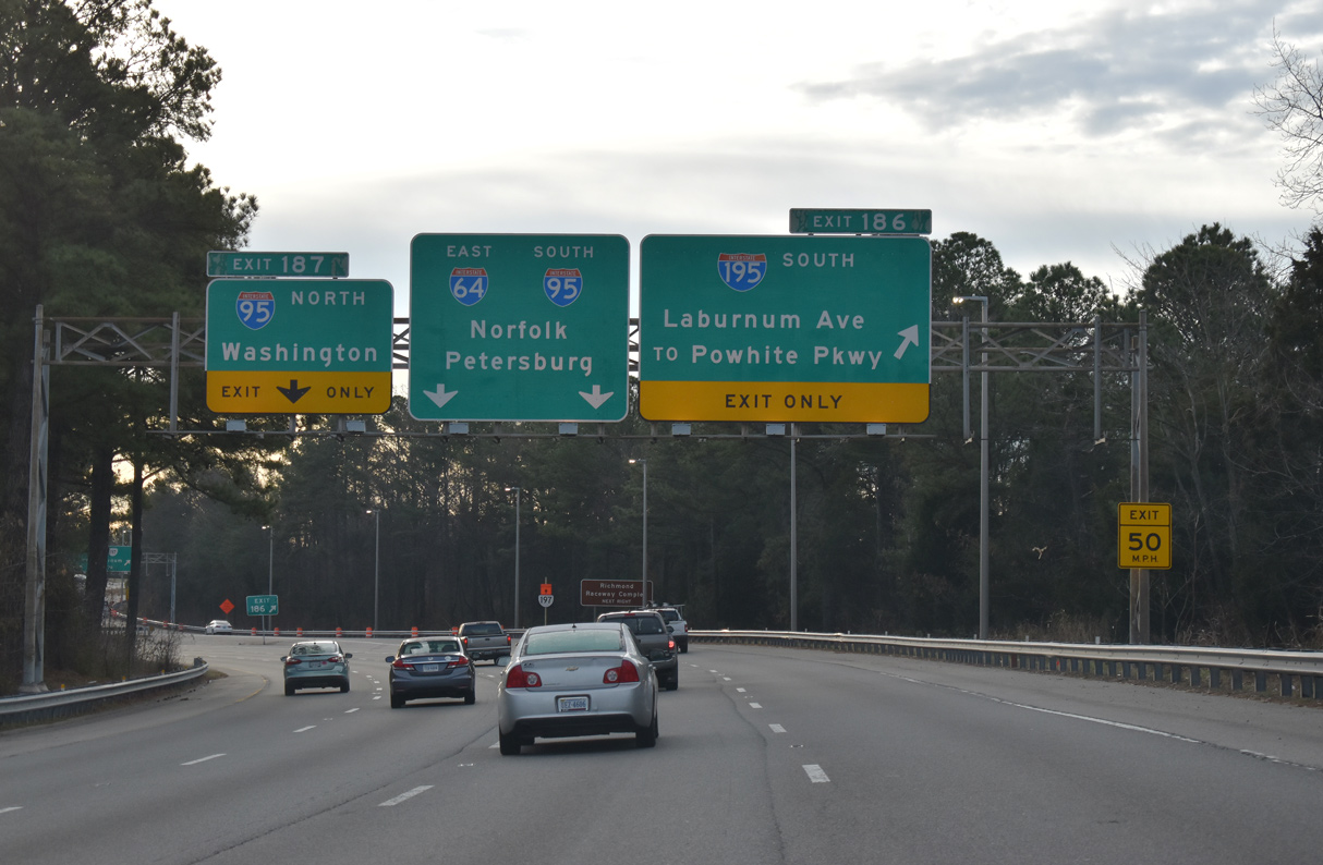
Exit 186 departs from I-64 east to both Interstate 195 south and adjacent SR 197 (Laburnum Avenue) east to the Ginter Park neighborhood in Richmond. 12/30/20
![]() South at
South at ![]()
![]()
Interstate 95 converges with U.S. 301 (Chamberlayne Road) near Chamberlayne, two miles north of I-64/195. 05/28/21
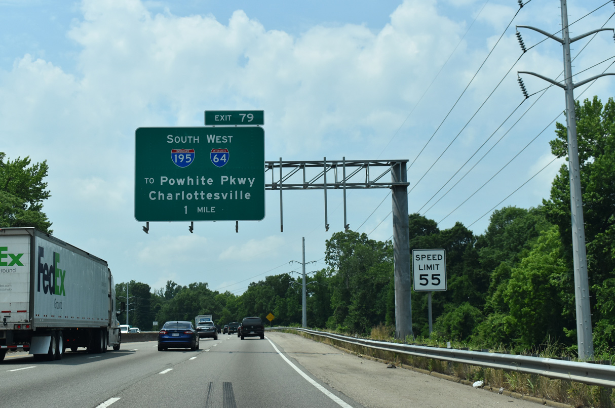
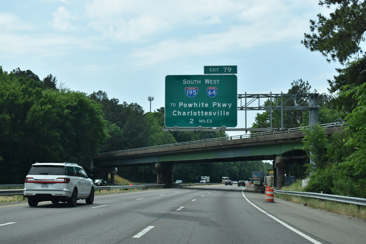
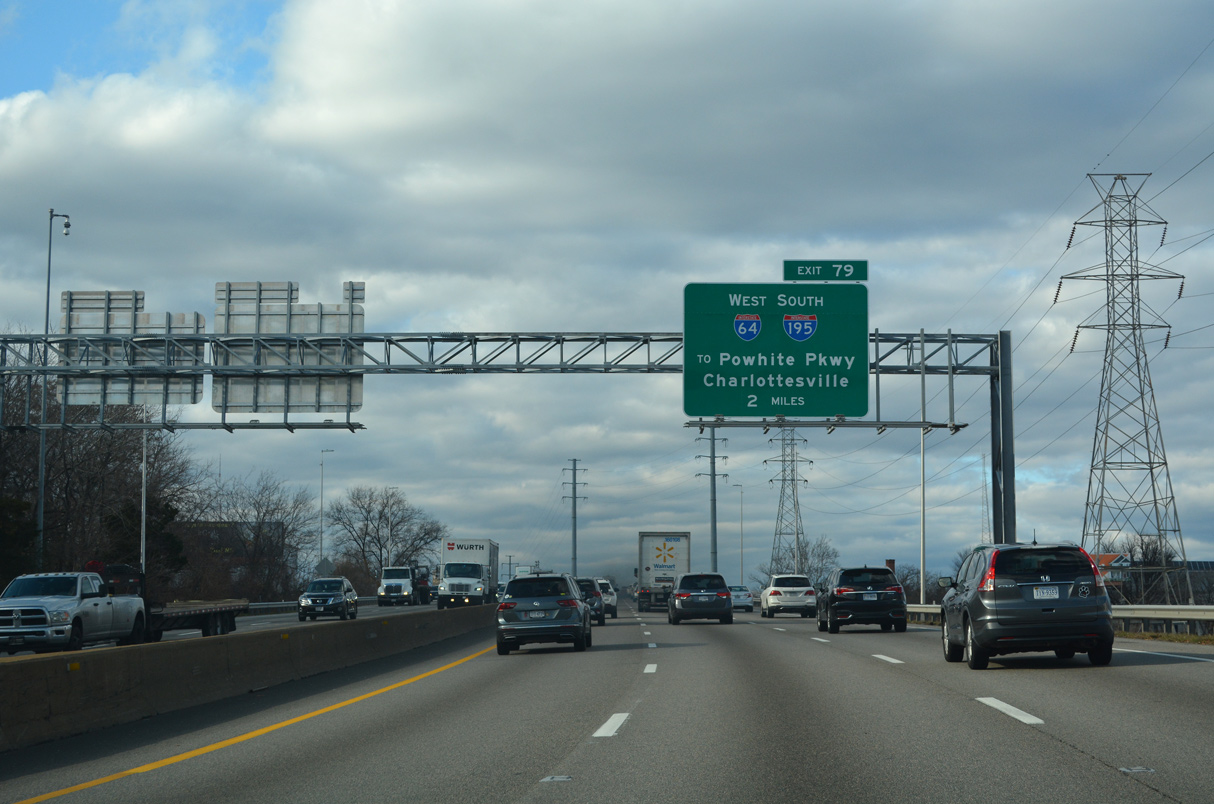
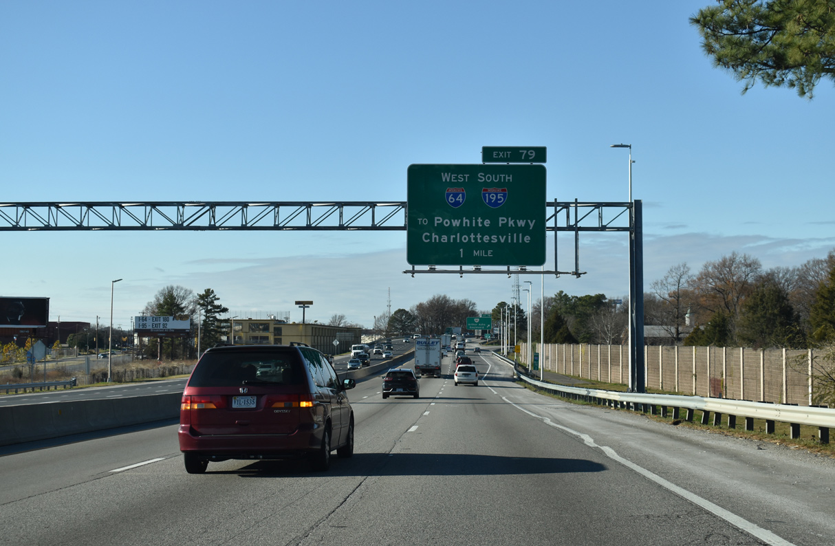
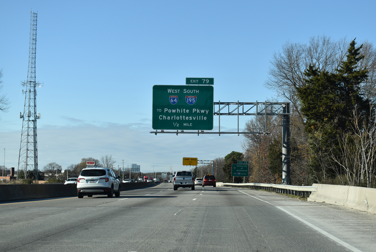
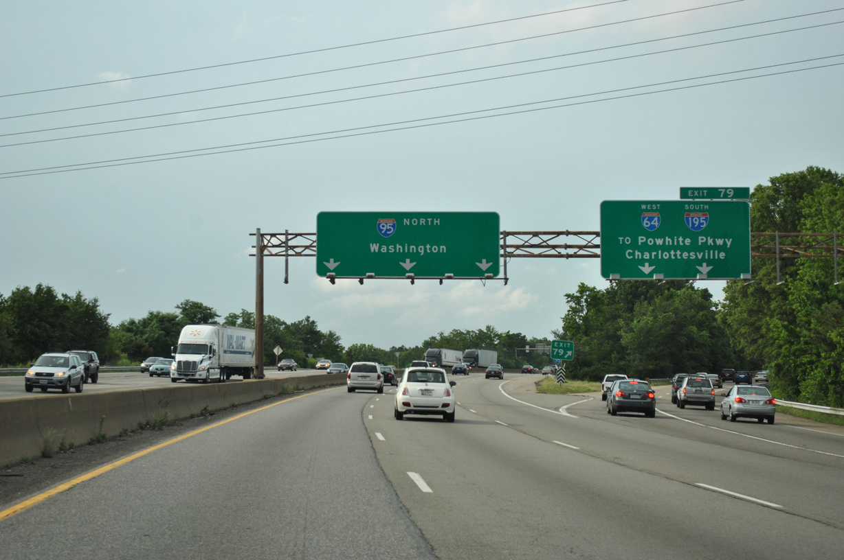
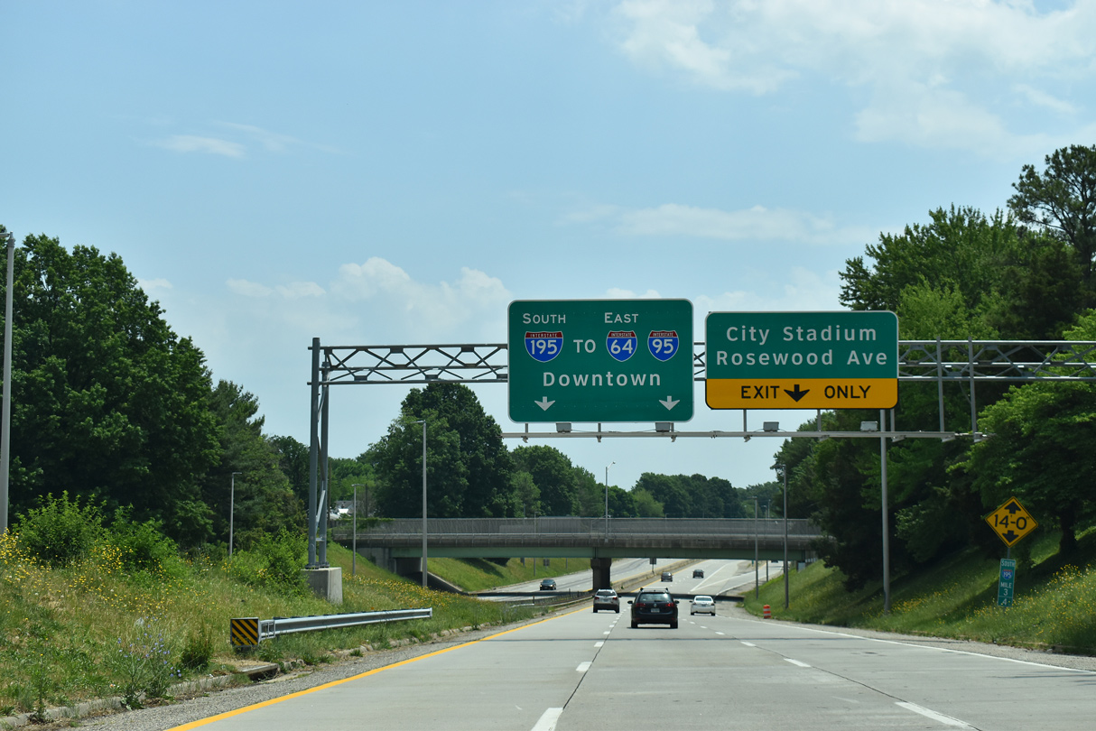
Advancing one mile south to Exit 79 for I-195 (Beltline Expressway) south and I-64 west, Interstate 95 enters the city of Richmond by Joseph Bryan Park. 05/28/21
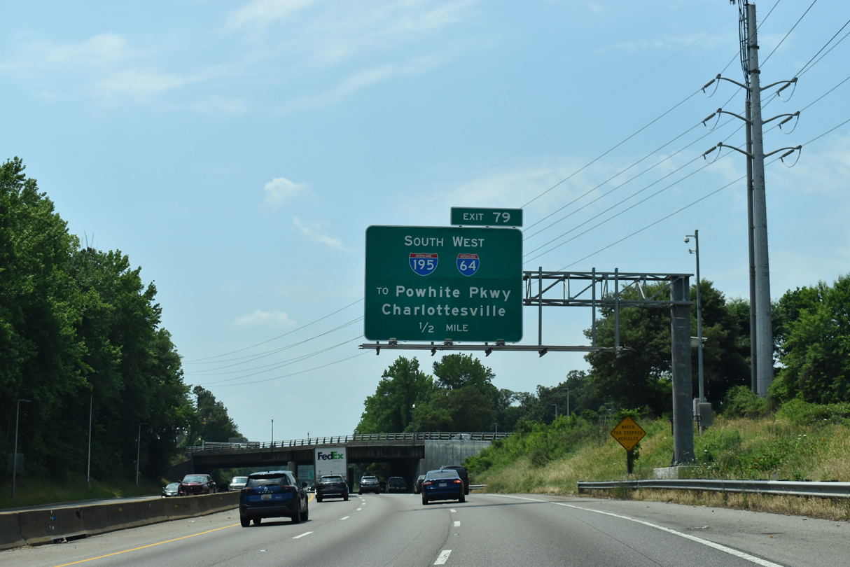
The Beltline Expressway links I-64 and I-95 with Powhite Parkway (SR 76) south to Midlothian and the Downtown Expressway (SR 195) east to the Richmond central business district. 05/28/21
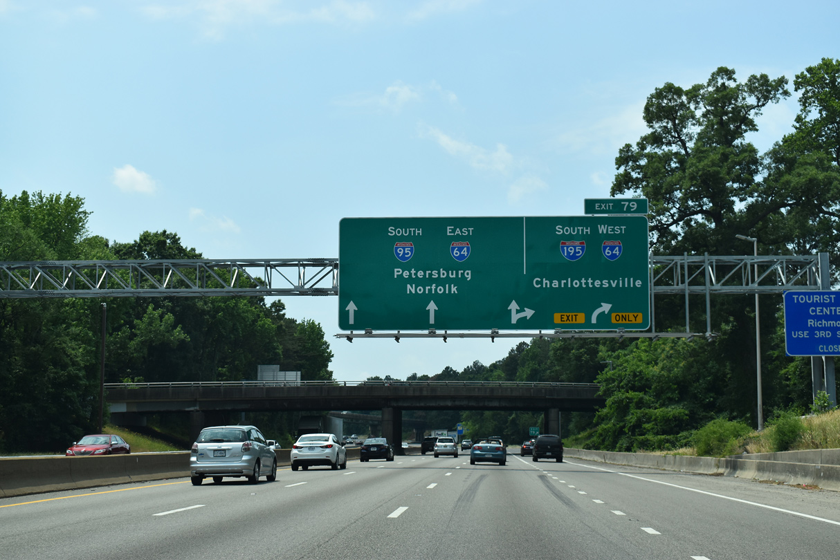
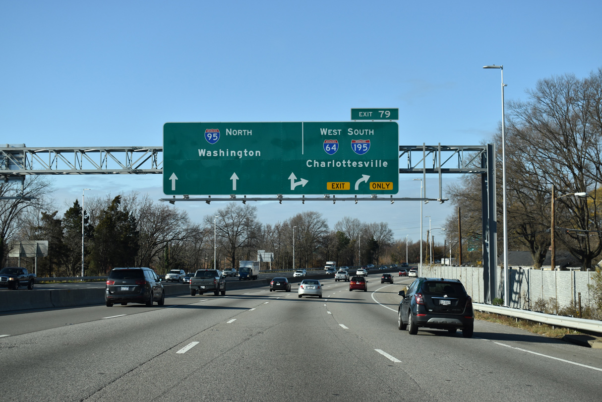
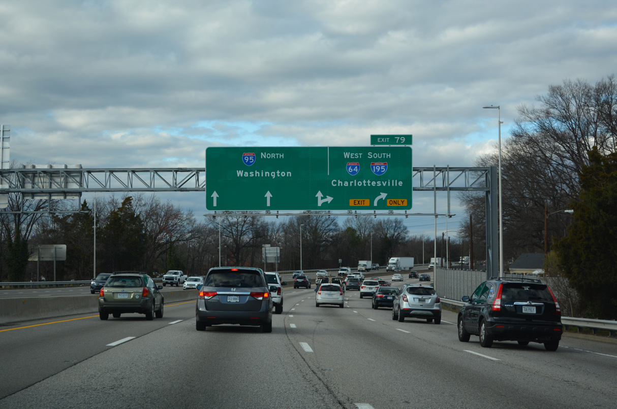
Bellevue Avenue spans Interstate 95 south at Exit 79 for I-64 west and I-195 south. I-64 east combines with I-95 south for 3.1 miles along the northernmost stretch of the Richmond-Petersburg Turnpike. 05/28/21
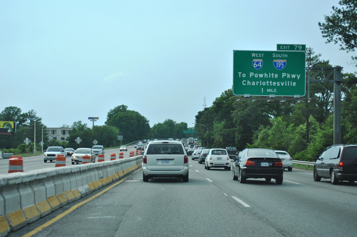
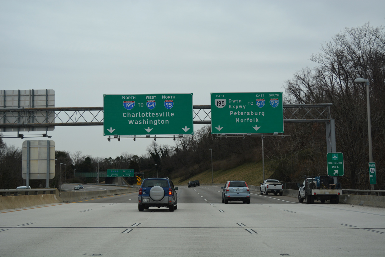
Entering the three-wye interchange with I-64 and I-195, Exit 79 splits into ramps for both Charlottesville and the Beltline Expressway to Downtown Richmond via SR 195 and Chesterfield County via SR 76 (Powhite Parkway). 05/28/21
![]() West
West ![]() North at
North at ![]()
I-64/95 partition at Interstate 195, two miles beyond the former Richmond-Petersburg Turnpike toll plaza location. 12/16/22
Curving west by the Sherwood Park neighborhood, I-64/95 advance one mile to Exit 79 for I-195 beyond the exchange with Hermitage Road and SR 161 (Arthur Ashe Boulevard). 12/16/22
Curving northward along the Rosedale community, a half mile from the separation with I-64 west and I-195 south. The city of Charlottesville lies 64 miles beyond Exit 79. 12/16/22
Three lanes continue north along Interstate 95 toward Ashland, Fredericksburg and Northern Virginia. 12/16/22
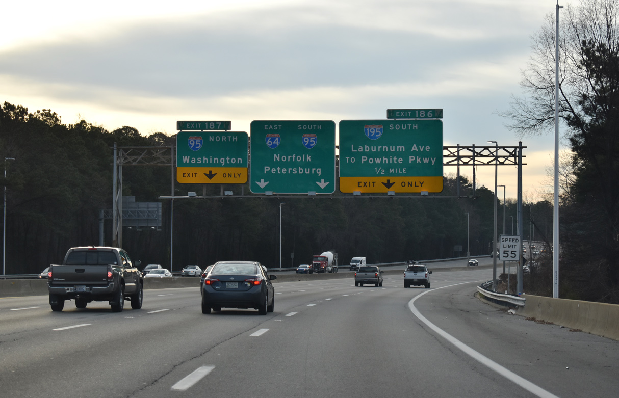
I-64 west links with Interstate 195 (Beltline Expressway) south at the ensuing ramp beyond Exit 79. 12/16/22
Left Exit 186 drops from Interstate 64 west to the Beltline Expressway south back into Richmond to Powhite Parkway (SR 76) south and SR 195 east. 12/17/20
 North End Throwback
![]() North at
North at ![]()
![]()
Interstate 64 splits from I-95 (Richmond-Petersburg Turnpike) northbound in 0.75 miles at Exit 79. 06/01/12

I-195 ties into the upcoming exchange from the southwest. 06/01/12
I-64 west to I-195 separates from I-95 north above SR 197 (Laburnum Avenue). 06/01/12
![]() South at
South at ![]()
![]()


Guide signs for Exit 79 to Interstate 195 and I-64 west on I-95 south in Richmond were replaced in 2020. 01/04/19, 12/31/16
South End  – Richmond, Virginia
![]() South at
South at ![]()
![]()
Interstate 195 (Beltline Expressway) drops below grade from Scott’s Addition and U.S. 33/250 (Broad Street) as a CSX Railroad separates the north and southbound roadways. The route concludes in 1.75 miles. 12/30/20
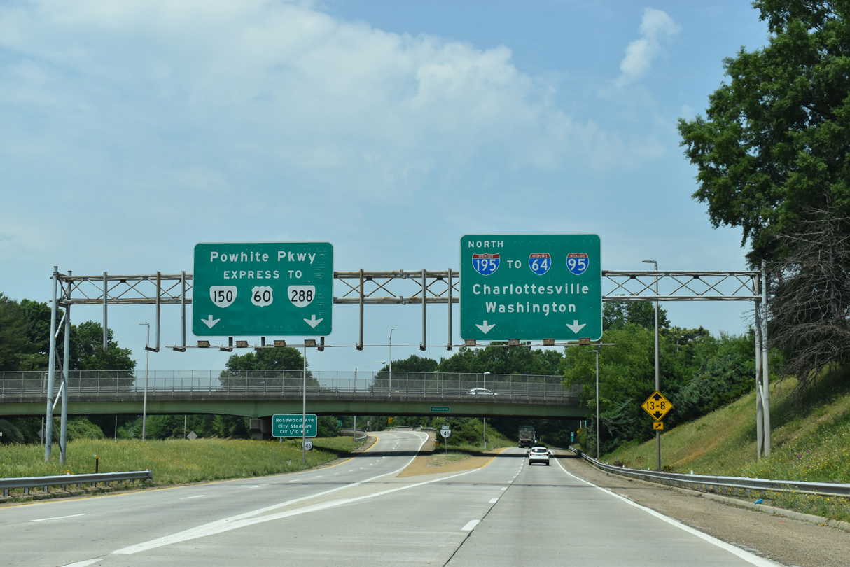
SR 76 (Powhite Parkway) stems southwest from the Beltline Expressway to the Chesterfield County suburbs. The toll road connects with SR 150 (Chippenhem Parkway) at Bon Air and U.S. 60 east of Midlothian. 12/30/20
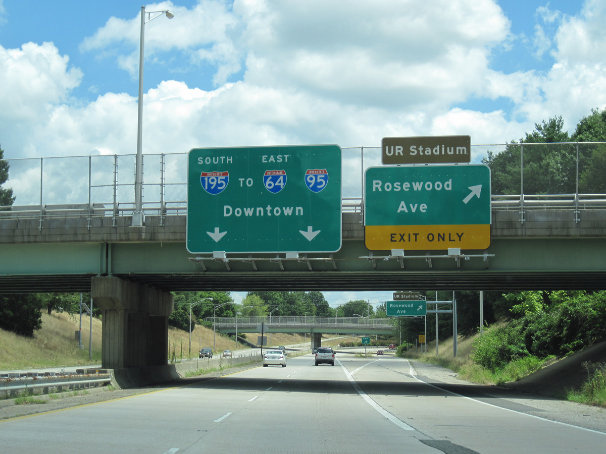
Interstate 195 extends southeast from SR 76 (Powhite Parkway) between the Carytown and Stadium neighborhoods to the tolled Downtown Expressway (SR 195). 12/30/20
Interstate 195 transitions to State Route 195 at the McCloy Street overpass and loop ramp for Rosewood Avenue and City Stadium. 05/28/21
A sign bridge replaced these overheads at McCloy Street. Mile markers for I-195/SR 195 decrease along the Downtown Expressway east to I-95. 07/09/10
![]() West at
West at ![]()
![]()

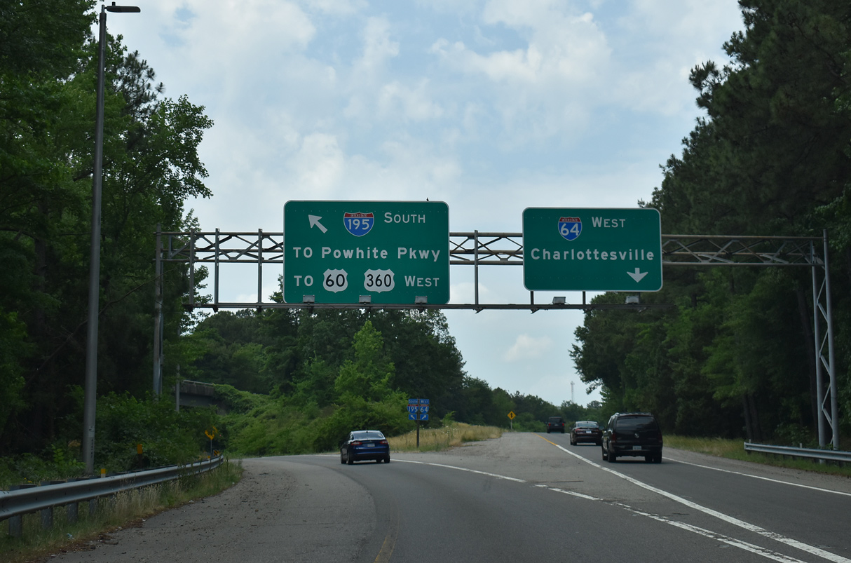
SR 195 (Downtown Expressway) partitions at a wye interchange for SR 146 south to the Powhite Parkway (SR 76) and Interstate 195 north onto the Beltline Expressway. 05/28/21
SR 146 angles southwest by City Stadium to SR 76 just ahead of the James River. I-195 encircles Carytown north to the Museum District. 05/28/21
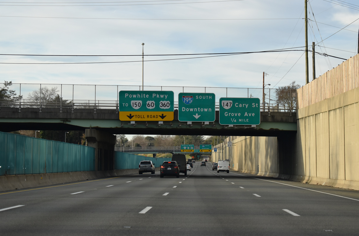
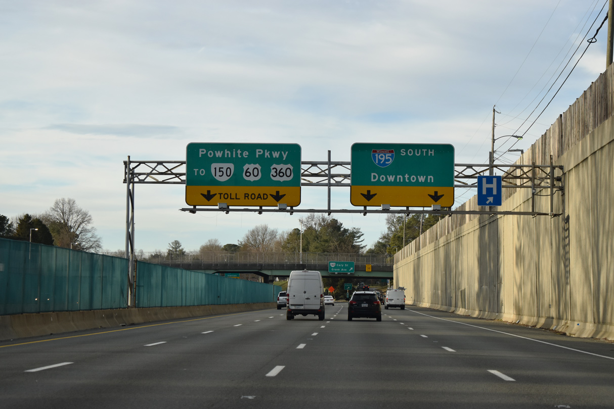
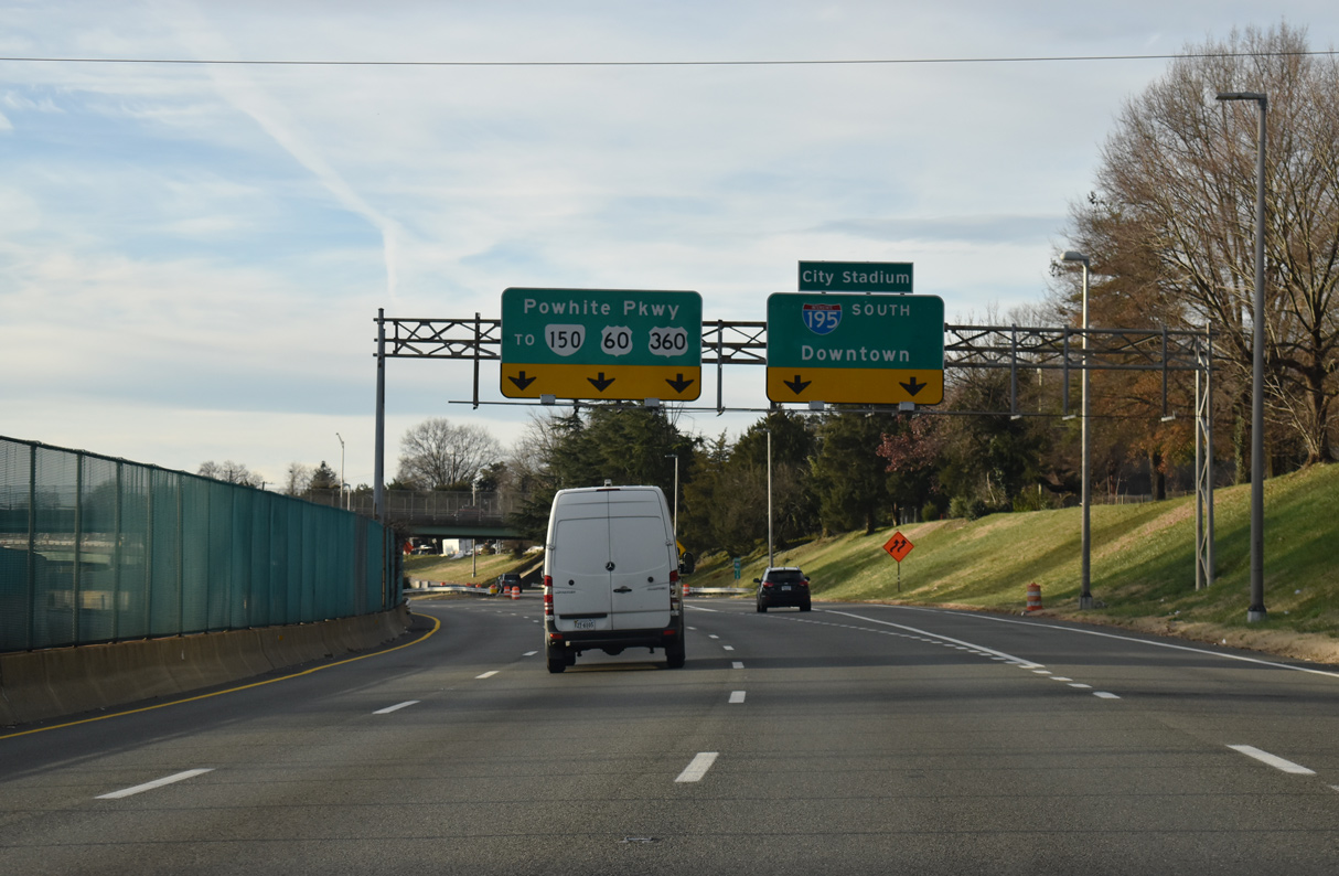
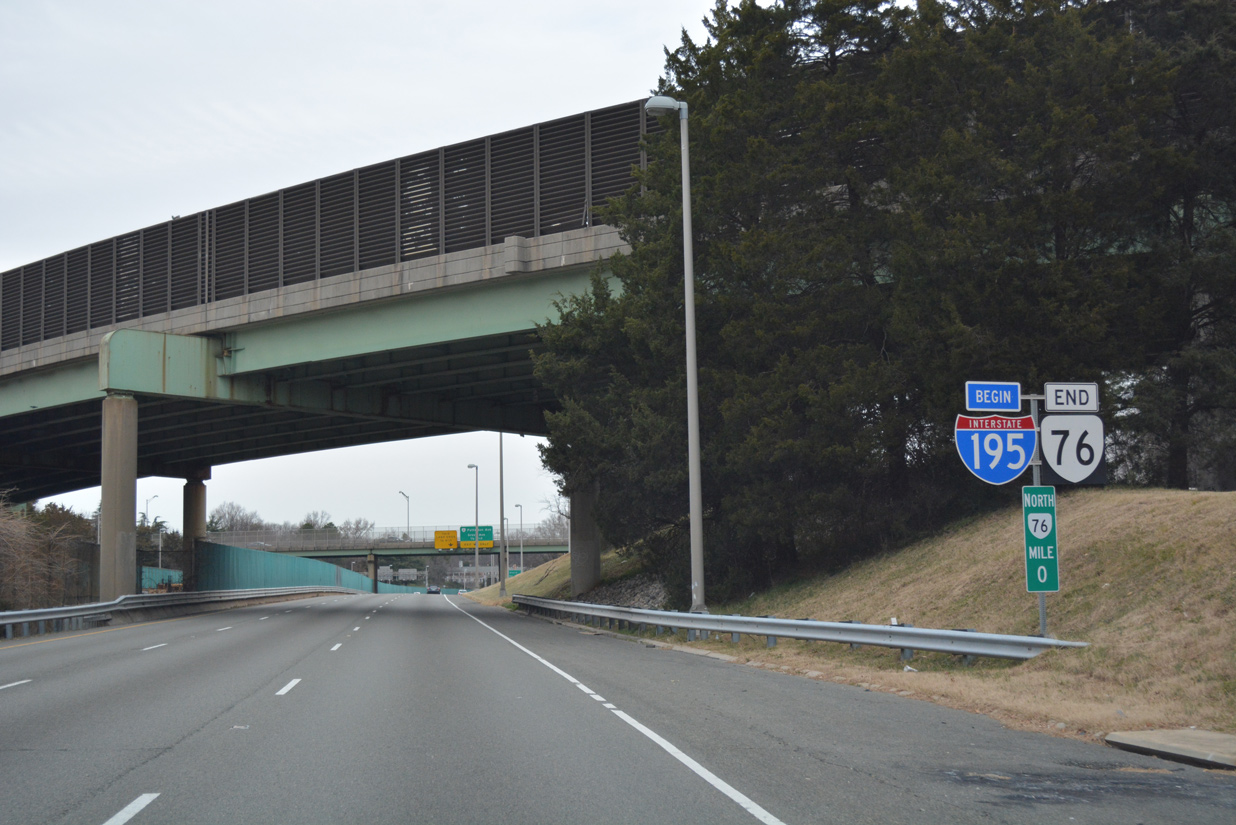
Interstate 195 converges with the north end of SR 76 (Powhite Parkway) by SR 147 (Cary Street). 05/28/21
![]() North at
North at ![]()
![]()
Crossing the James River, Powhite Parkway (SR 76) approaches the split with SR 146 to SR 195 (Downtown Expressway) east. I-195 commences north at the merge with SR 195 west. 12/16/16
Traffic partitions for SR 146 east to toll SR 195 through Downtown Richmond and SR 76 north to I-195 north. Regional traffic headed to Norfolk via I-64 east or Petersburg via I-95 south is directed onto the Downtown Expressway. 12/16/16
SR 76 transitions onto Interstate 195 (Beltline Expressway) northbound at a wye interchange by Carytown. 12/16/16
Sources:
- “Expressway Plans Unveiled 20 Years Ago.” Richmond Times-Dispatch (VA), October 30, 1986.
- I-195 Beltline Expressway. RoadstotheFuture (Scott Kozel).
Page updated April 7, 2023.