Interstate H201

Overview
Interstate H-201 supersedes Route 78 along the Moanalua Freeway between the Halawa Interchange at Aiea and Kalihi by Fort Shafter Military Reservation. IH-201 follows all of the Moanalua Freeway with the exception of the western 0.7 miles between Kamehameha Highway (Route 99) and the Halawa Interchange.
The urban freeway constitutes a commuter route between Downtown Honolulu and points west along Interstate H1. The freeway also serves Aliamanu Military Reservation, Tripler Army Medical Center and Fort Shafter in addition to the Salt Lake area. Connections at the west end also provide direct access to Aloha Stadium.
 History
The easternmost portion of the Moanalua Freeway was completed in 1959-60 and signed as Hawaii Route 72. This stretch, between Puuloa Road / Exit 3 and Middle Street, was renumbered to Route 78 when Interstate H1 was designated. The remainder of Moanalua Road was upgraded to freeway standards during the 1980s.
Subsequent action by the Hawaii Department of Transportation on April 6, 1988 requested the Federal Highway Administration (FHWA) for the addition of a 4.1 mile segment of SR 78 along the Moanalua Freeway to the Interstate system under the provision of 23 U.S.C. 139(a). The requested addition was to be numbered as H-1A. FHWA concurred with the request on November 1, 1989, citing that the entire route met Interstate standards with the exception of the Middle Street Interchange where SR 78 meets I-H1. The route number H-1A was assigned subject to approval from the American Association of State Highway and Transportation Officials (AASHTO) Route Numbering Committee.
The Hawaii Department of Transportation submitted an application to AASHTO on May 18, 1990 for the establishment of Interstate H-1A for the 4.1 mile long portion of the Moanalua Freeway. Action on the request was withheld at the meeting on June 4, 1990 and explained in a letter sent to the Hawaii Department of Transportation from AASHTO on June 14, 1990:
After the Committee discussed the application with Chief Engineer Tetsuo Harano, they decided to withhold action on the application so that further review could be made by Hawaii and the Federal Highway Administration on the proposed Interstate Route.
FHWA followed up with AASHTO related to the Interstate route numbering of the Moanalua Freeway on June 18, 1990:
We understand the AASHTO Route Numbering Committee that met on June 2 withheld approval of the State of Hawaii’s request to assign the Interstate route number H-IA to the Moanalua Freeway. The FHWA approved the addition of the Moanalua Freeway to the Interstate System on November 1, 1989, under 23 U.S.C. 139(a), Additions to the Interstate System. Our principle concern at the time was the qualification of the facility as a logical addition to the Interstate System, not the specific numbering of the route per se.
We recognize that the AASHTO route numbering policy does not subscribe to new divided route numbering such as Interstate 35E and 35W and we support that policy. The addition of the Moanalua Freeway to the Interstate System constitutes a loop from H-l; therefore, a three-digit number may be suitable.
We will ask the State to reconsider the route numbering. We appreciate the opportunity to comment to AASHTO on proposed
Interstate route numbering.
FHWA then suggested to the Hawaii Department of Transportation:
Therefore, other options to the H-IA numbering may be a three-digit number. For example, H-201, because the approved Interstate segment constitutes a loop from Interstate H-1. We would not object to a three-digit number; however, it would, of course, be subject to approval by the AASHTO Route Numbering Committee.
Hawaii submitted a new application to AASHTO for the establishment of Interstate H-101 along the Moanalua Freeway on October 16, 1990. The Route Numbering Committee approved the request on December 7, 1990, but instead as Interstate H-201. Correspondence from AASHTO to the state of Hawaii on December 14, 1990 explained the change:
The Interstate Route was approved as H-201 instead of H-101 as submitted because this route constitutes a loop, and the Committee felt that a three-digit number beginning with an even digit was more suitable. The Federal Highway Administration has concurred with this request.
Route Information
West End – Aiea, HI
East End – Honolulu, HI
Mileage – 4.10
Cities – Honolulu
- Junctions –

Source: December 31, 2021 Interstate Route Log and Finders List
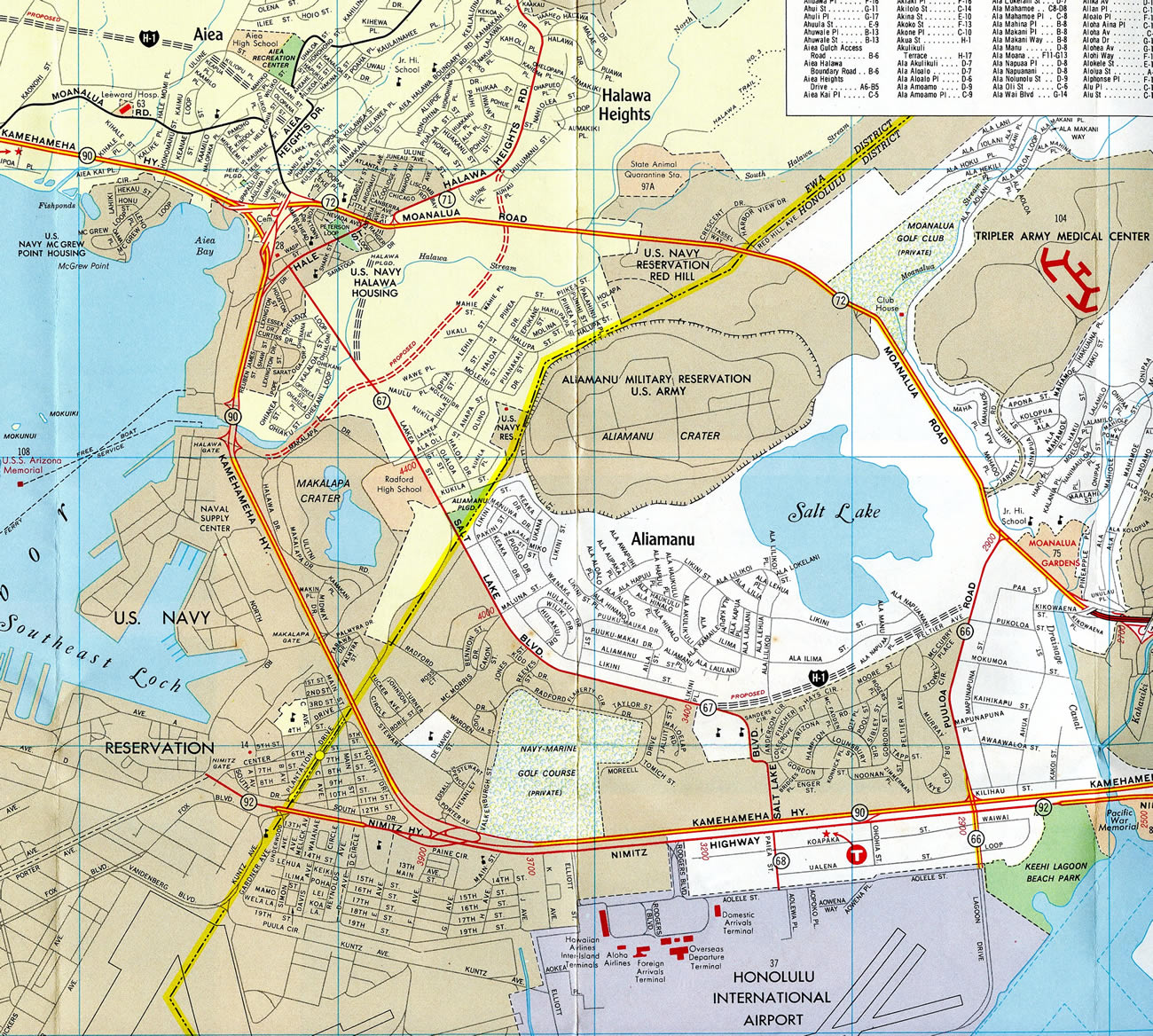
The Halawa Interchange between I-H1, I-H3 and I-H201 was built partially in place of the U.S. Navy Halawa Housing area. Freeway construction also severed the route of Route 71 (Halawa Heights Road), with Kahuapaani Street replacing it as the through route south to Salt Lake Boulevard.
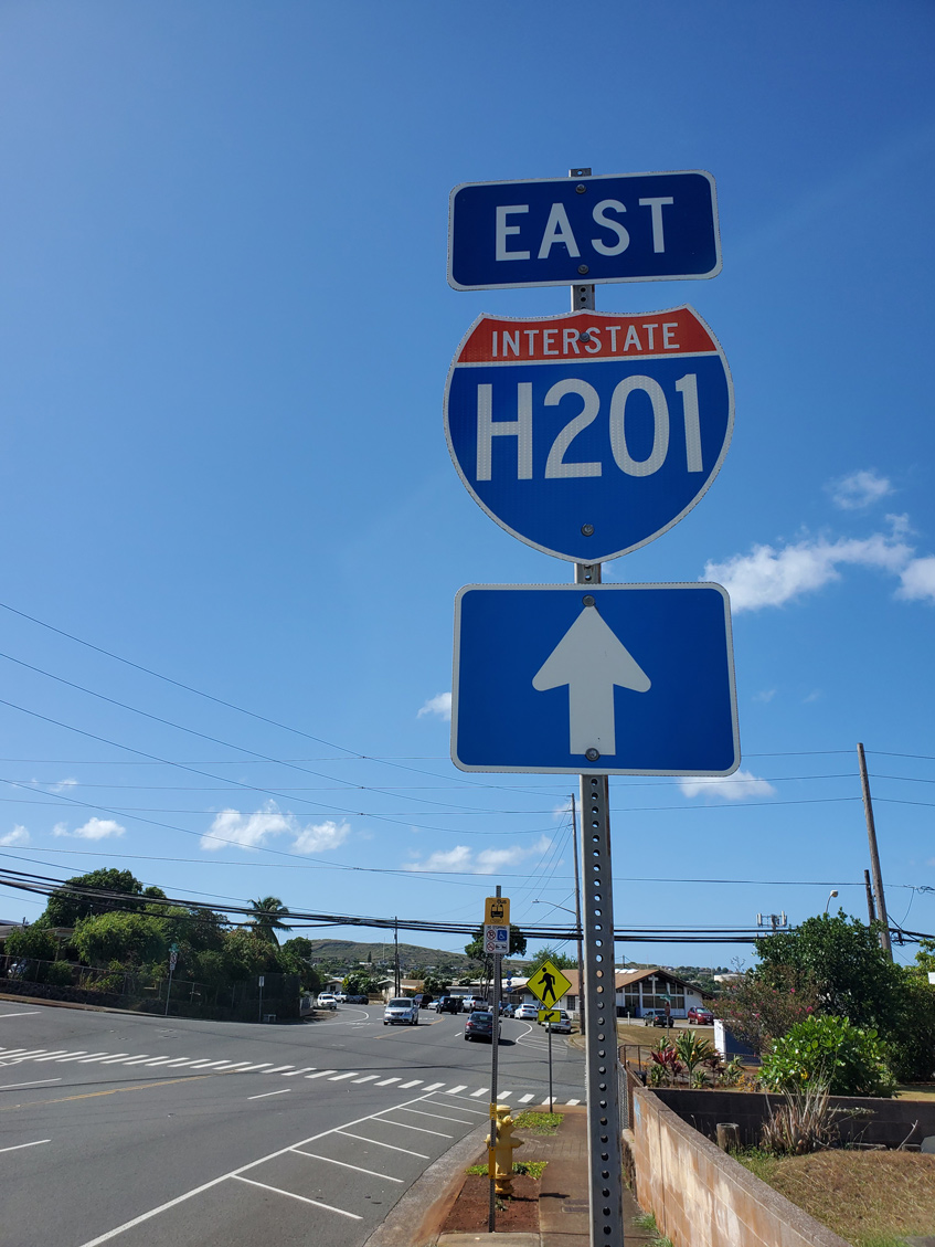
During a “superpave” project along Interstate H-201 (Route 78) in July 2004, night time closures resulted in the placement of new I-H201 signs in both directions of the Moanalua Freeway.1 Photo by Brian Galapin.
West End –  – Aiea, Hawaii
![]() West at
West at ![]()
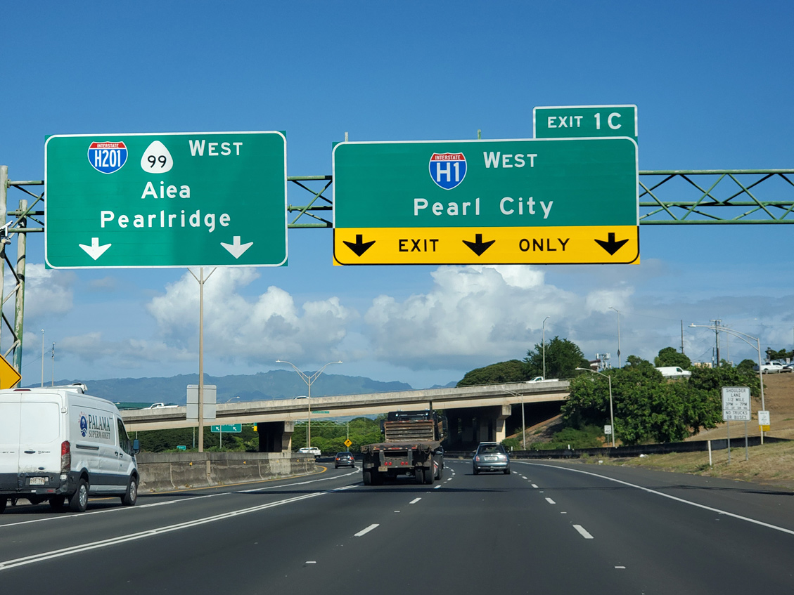
I-H201 (Moanalua Freeway) advances west from Exit 1 E to Ulne Street, Aloha Stadium and Halawa Heights to Exit 1 C for I-H1 to Pearl City, Waipahu and Kapolei. 08/15/19
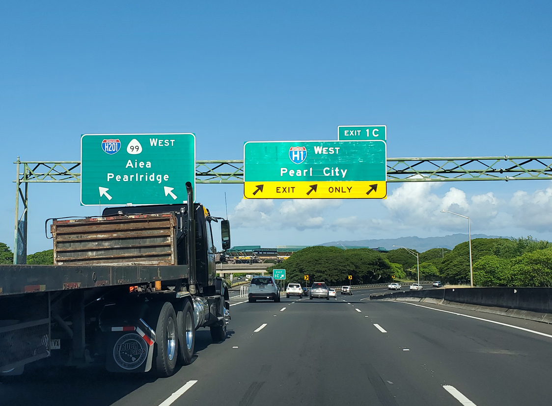
Interstate H-201 transitions to Route 78, 0.38 miles beyond Exit 1 C for I-H1 west. Route 78 extends the Moanalua Freeway another 0.74 miles to Route 99 (Kamehameha Highway) ahead of Pearl City. 08/15/19
East End – Honolulu, Hawaii
![]() East at
East at ![]()
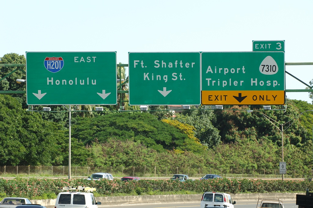
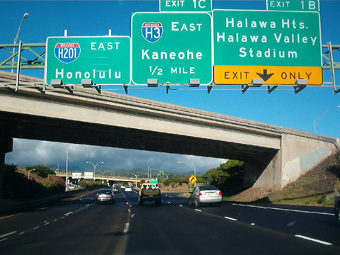
Interstate H-201 (Moanalua Freeway) concludes at I-H1 eastbound beyond the ensuing ramps for Route 7310 (Jarrett White Road) and Funston Road to Fort Shafter. Photo by Jeff Royston (02/01/06).
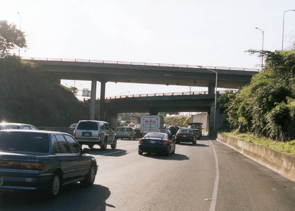
Interstate H-201 defaults onto I-H1 eastbound toward Downtown Honolulu at the exchange with Middle Street. Photo by Oscar Voss (11/01).
![]() West at
West at ![]()
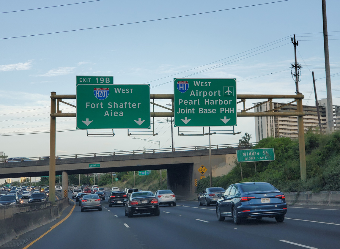
I-H1 (Lunalilo Freeway) advances west from SR 61 (Kalihi Street) to Left Exit 19 B for I-H201 (Moanalua Freeway) at Fort Shafter. 08/15/19
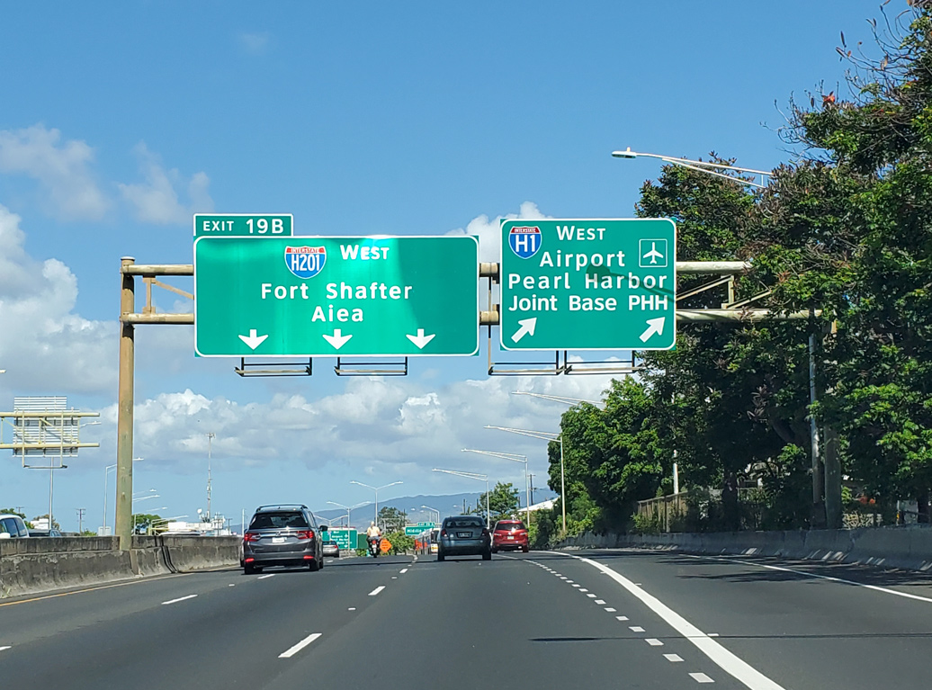
Three lanes continue onto I-H201 (Moanalua Freeway) west toward Aeia at Left Exit 19 B. I-H1 turns southwest along the Queen Liliuokalani to Honolulu International Airport (HNL). 08/18/19
![]() East at
East at ![]()
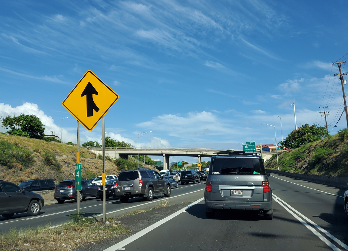
I-H1 converges with the east end of I-H201 (Moanalua Road) at a wye interchange adjacent to Middle Street. Mile marker 4.83 for SR 78 appears at the gore point preceding the Ola Lane overpass. 08/15/19
Sources:
- Voss, Oscar. “Interstate H-201 update.” Online posting, misc.transport.road, September 17, 2003.
- “Moanalua is actually part of interstate.” Honolulu Star-Bulletin (HI), July 27, 2004.
Page updated January 25, 2024.