Interstate 794 Wisconsin
Overview
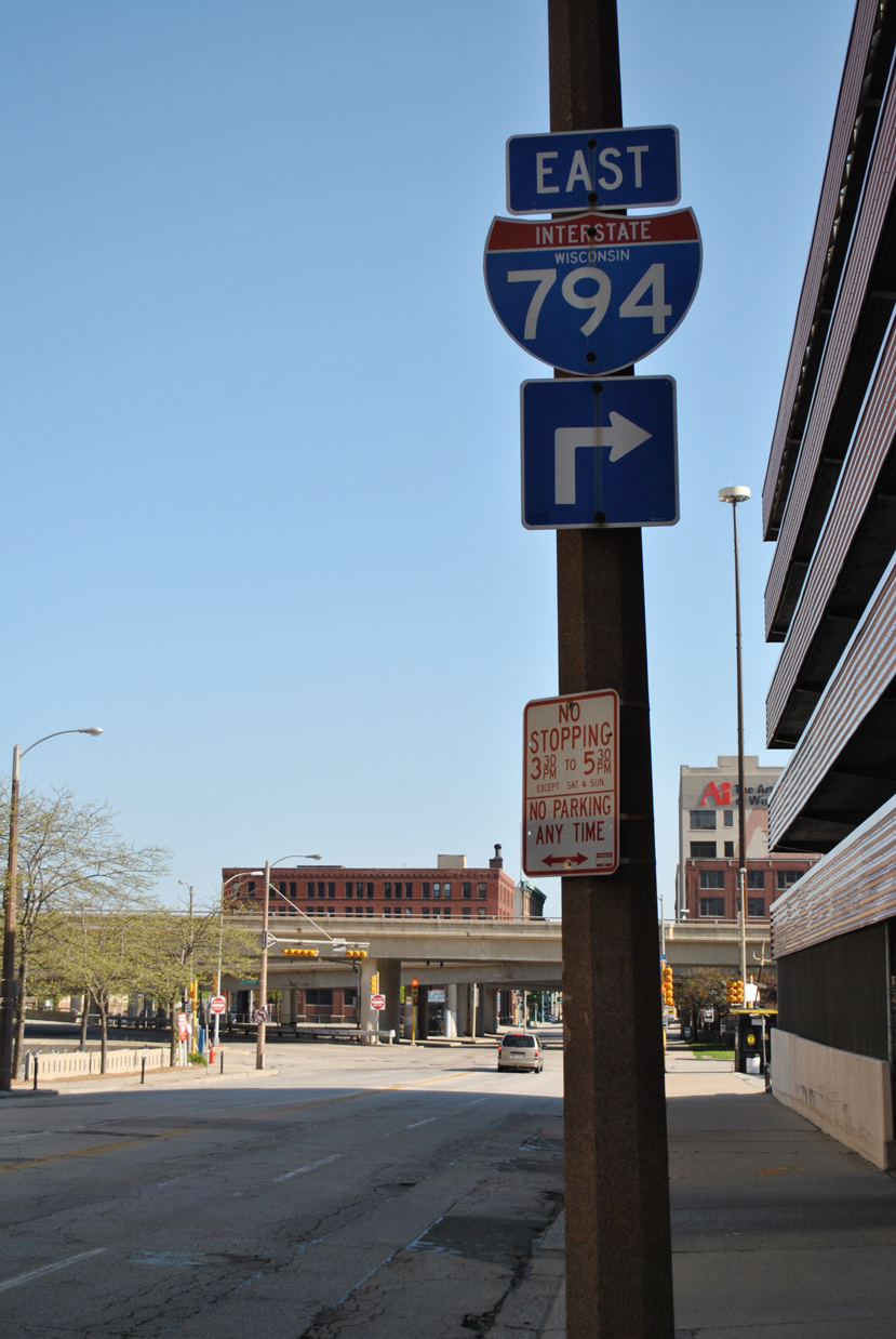
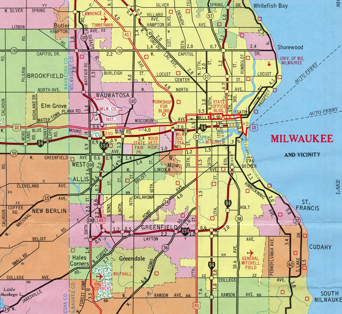
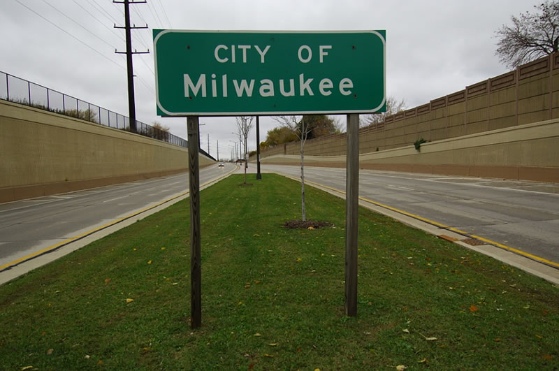
Interstate 794 is a short freeway spur connecting the Marquette Interchange at I-94 and I-43 in Downtown Milwaukee with the Milwaukee Bayfront and Jones Island on Lake Michigan. I-794 extends the East West Freeway from I-94 to the Lake Freeway, which runs south along Milwaukee Bay to the Daniel Hoan Bridge. A tied arch span, the Hoan Bridge crosses the Milwaukee River Inlet and carries I-794 south onto Jones Island and the Port of Milwaukee.
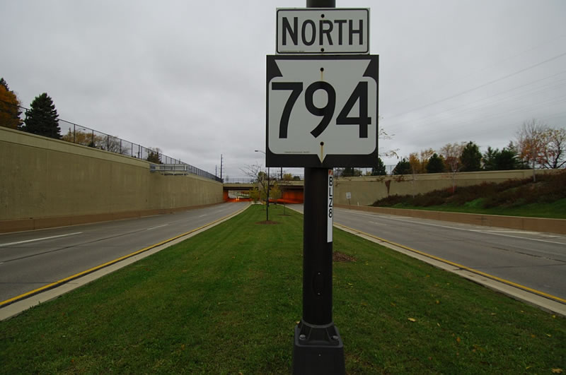
South of the Carferry Drive interchange (Exit 3), the Lake Freeway transitions into Wis 794 (Lake Parkway). Lake Parkway extends the state trunk highway southward as a controlled access route through St. Francis to Pennsylvania Avenue in Cudahy. The parkway section travels below grade south of the tunnels at St. Francis Avenue, while the Interstate portion is entirely elevated.
Major Projects
The Hoan Bridge Project9 commenced in October 2013. It involved the reconstruction of Interstate 794 from the Milwaukee River at Downtown south to Jones Island. The first stage, from late 2013 to late 2014, affected all of east and southbound with the removal and replacement of bridges, concrete overlay and surface repair and redecking of the Hoan Bridge. Northbound work (stages 2A and 2B) ran from the end of 2014 to December 2015.
Completed with a ribbon cutting ceremony held on June 13, 2017, the Milwaukee Lakefront Gateway Project reconfigured the Lake Interchange where I-794 turns from the East West Freeway onto the Lake Freeway. Two new ramps, from I-794 east and to I-794 west, replaced ones built for the unconstructed north Lake Freeway extension. The new ramps were built to the south, opening a two and a half acre site for development beside the proposed 44 story Couture tower.8
Lake Parkway Extension
A six mile extension of Lake Parkway (Wis 794) was approved by the Southeastern Wisconsin Regional Planning Commission on December 5, 2012. However funding was still needed for the $207 million project extending STH-794 south from Edgerton Avenue to STH-100, mostly adjacent to the Union Pacific Railroad.7
 History
Interstate 794 opened initially as a spur from the Marquette Interchange to Plankinton Avenue (Exit 1 D) in 1968. A short extension followed in 1969 to Jackson Street (Exit 1 E).1 The Lake Interchange, where I-794 turns southward, was constructed with elements for the unbuilt Lake Freeway north to the Park Freeway.
Origins of the Lake Freeway and Parkway date back to 1929 when Lincoln Memorial Drive opened north from Downtown. Residents in Bay View, Cudahy and South Milwaukee sought a similar road to Lincoln Memorial Drive to better connect them with the city center. This led to discussion by city and county officials of a southern extension of the route in the mid-1920s. Plans however were initially sidelined due to the Great Depression, but mid 1930s momentum from Bay View business groups netted official support, with the city commencing funding on a southward extension of the drive in 1936.2
By 1941 a bridge or tunnel was envisioned at the Milwaukee River, with the parkway extending south to the city line. The advent of World War II curtailed progress on the project to 1945, when escalating costs resulted in city officials shelving the project. Increasing traffic congestion and the establishment of the Interstate system led to the 1963 Milwaukee County expressway system plan, which included a harbor bridge between Downtown and Bay view. By 1967 the Lake Freeway south to Layton Avenue was included.2
Work on the Lake Freeway kicked off in 1970, with construction of the Danial Hoan Bridge since the right of way was already public land. The tied arch bridge was completed in 1974 but was disconnected to other roads. This was due to opposition resulting from lawsuits, petitions and demonstrations from area residents involving the remainder of the Lake Freeway. The bridge was finally connected to area roads in 1977.2
An extension of the roadway southward from Carferry Road remained planned, but options varied with a 1986 study comprising a 3.3 mile long, four lane arterial along the North Western Railroad tracks. Another proposal involved tearing down 600 feet of the Hoan Bridge and extending the roadway at-grade across an intersection with Carferry Road.3
Route Information
North End – Milwaukee, WI
South End – Milwaukee, WI
- Mileage – 3.75 (4.12)1
Cities – Milwaukee
- Junctions –

Source: December 31, 2021 Interstate Route Log and Finders List
Official Wisconsin Department of Transportation records indicate 4.12 miles.1
The East West Freeway defaulted traffic to 6th Street until 1969, when the Marquette Interchange was completed.
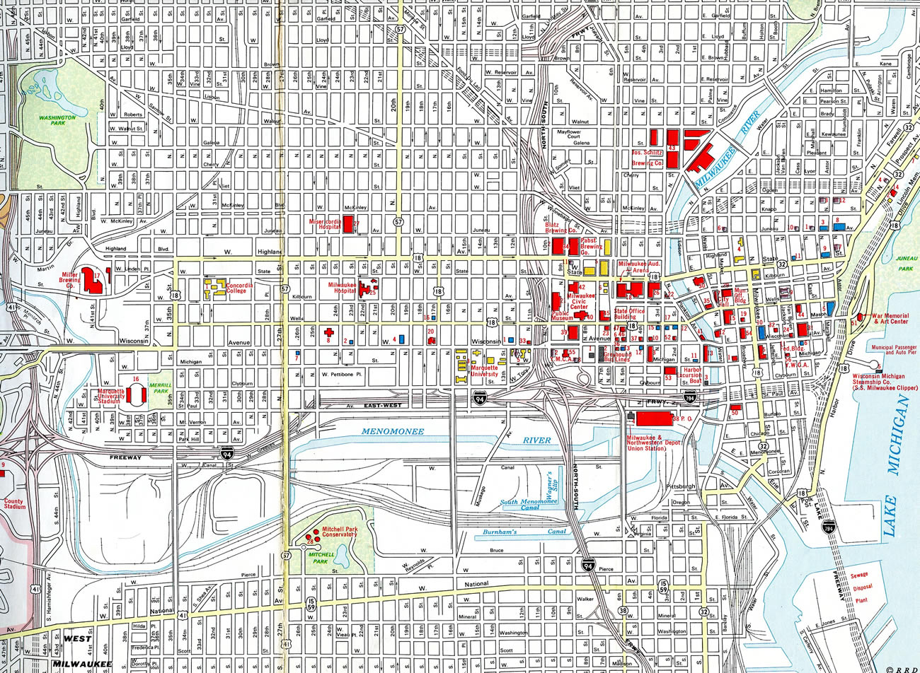
The Lake Freeway, along with the Park Freeway west from Juneau Park, was proposed to form an urban loop encircling Downtown Milwaukee. Only a short stretch of the Park Freeway was built, a spur leading east from the North South Freeway to Jefferson Street, while the Lake Freeway was unconstructed north of I-794.
I-794 / Wis 794
Annual Average Daily Traffic (AADT)
Source: 2018-19 AADT WisDOT TCMap (Traffic County Map)


Crossing over the Milwaukee River inlet, the Daniel Webster Hoan Memorial Bridge measures 10,032 feet in length. The Hoan Bridge made the news on December 13, 2000, when a section of the bridge approach buckled four feet. Fortunately no one was injured. The bridge was relatively new in terms of anticipated bridge life span (having been completed in 1972). During the emergency closure of the span, the affected segment was replaced. The bridge fully reopened on November 1, 2001. Chris Bessert’s Hoan Bridge web page provides more information and details on this near tragedy. Photos by Peter Johnson (03/22/20 and 05/12/20).
Work finally started in 1991 on a four lane controlled access parkway extending I-794 south to Layton Avenue as STH-794. The $130 million, 3.2 mile long roadway was designed with a 40 mile per hour speed limit, 10 to 15 foot high noise barriers and landscaping to create a gateway from South Side to Downtown Milwaukee.4,5
Lake Parkway (Wis 794) opened to traffic on October 1, 1999. The four lane arterial was the first major road built in Milwaukee since 1978, when STH 119 to the airport opened.2 The parkway is a limited access roadway with just one at-grade intersection at E Oklahoma Avenue, and a tunnel below the rebuilt Union Pacific Railroad tracks at St. Francis Avenue.4
The removal of the Park Freeway spur north of Downtown as spearheaded by Mayor John Norquist in 1999 included a similar proposal to tear down Interstate 794. While the Park Freeway plan garnered public support as it only handled local traffic, the I-794 plan did not due to regional transportation needs. Backers of the proposal to replace I-794 with an at-grade boulevard cited reconnecting the Historic Third Ward area with Downtown.6
A later proposal by Mayor Norquist in 2003 suggested extending I-794 west to the Zoo Interchange as part of a plan to reroute I-94 away from the Marquette Interchange prior to its reconstruction. Read more about that on the I-894 guide.
 Photo Guides
West End  – Milwaukee, Wisconsin
![]() West at
West at ![]()
![]()
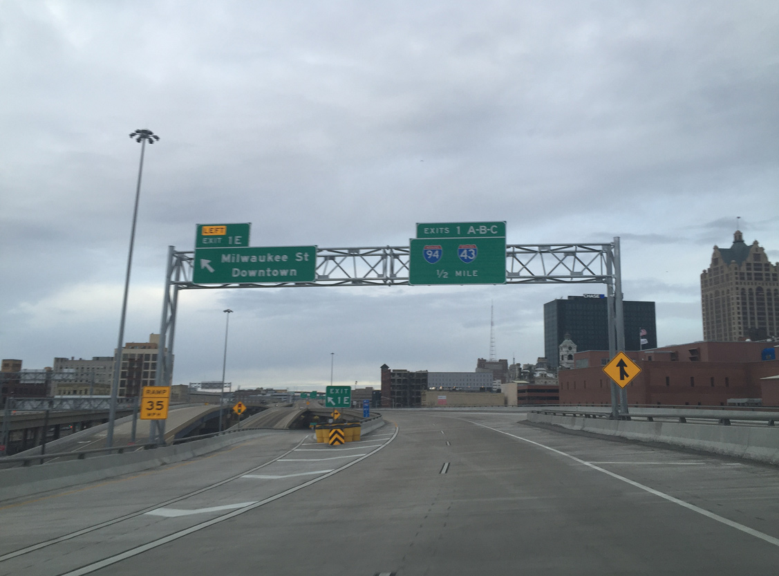
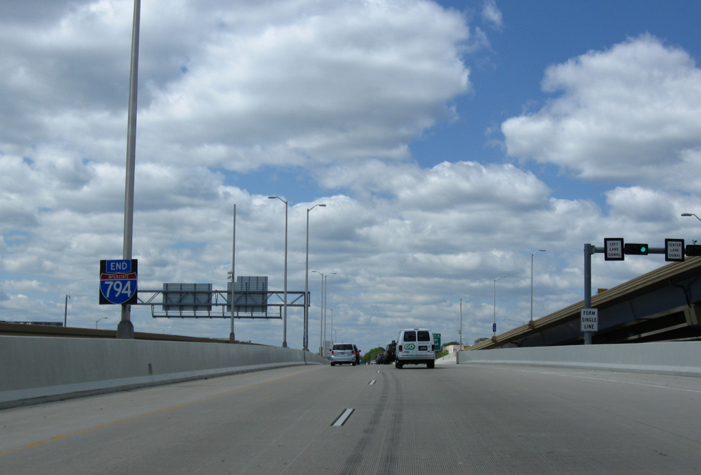
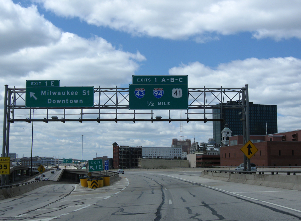
Interstate 794 turns west at the Lake Interchange to Left Exit 1E for Milwaukee Street. A half mile remains ahead of the Marquette Interchange ramps to I-43 and I-94. Photo by Peter Johnson (02/07/16).
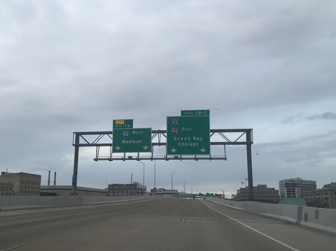
Progressing westward, Interstate 794 spans the Milwaukee River on the quarter mile approach to the Marquette Interchange (Exits 1A/B/C). Photo by Peter Johnson (02/07/16).
Interstate 94 overtakes the East West Freeway en route to Elm Grove, Brookfield and Madison. Photo by Peter Johnson (02/07/16).
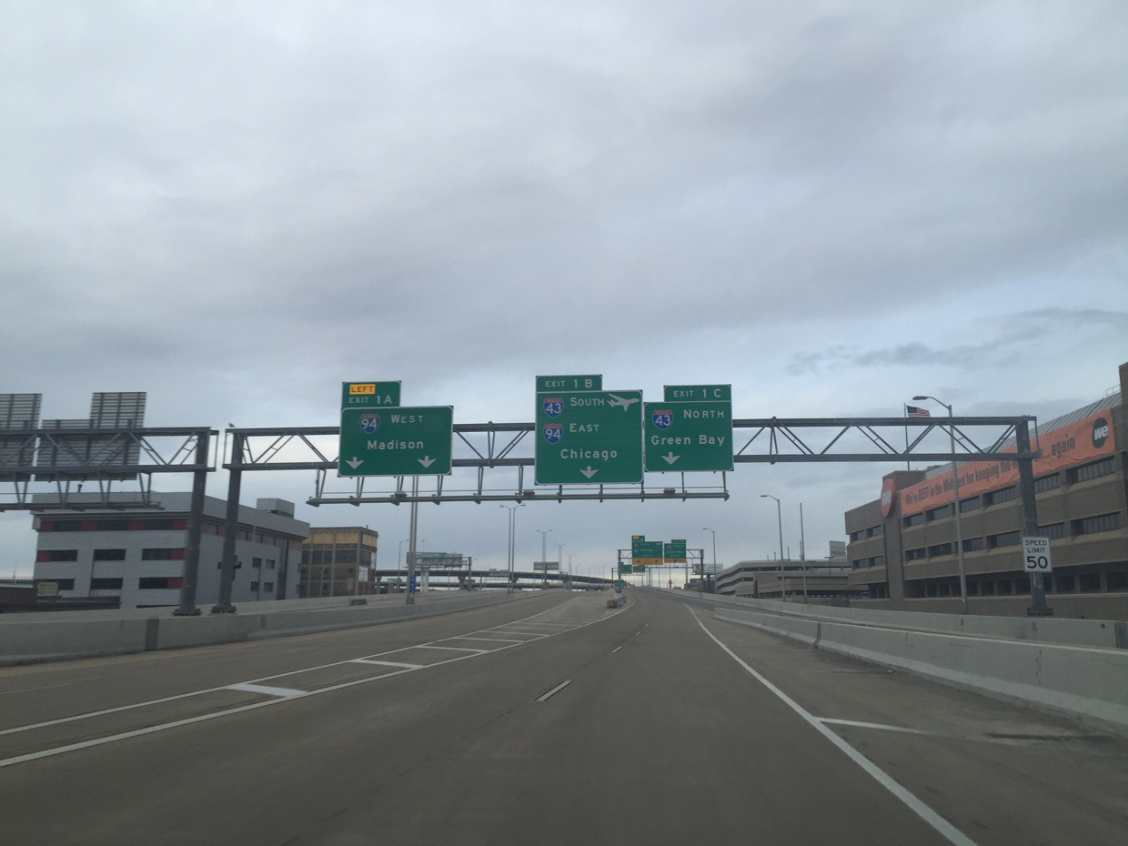
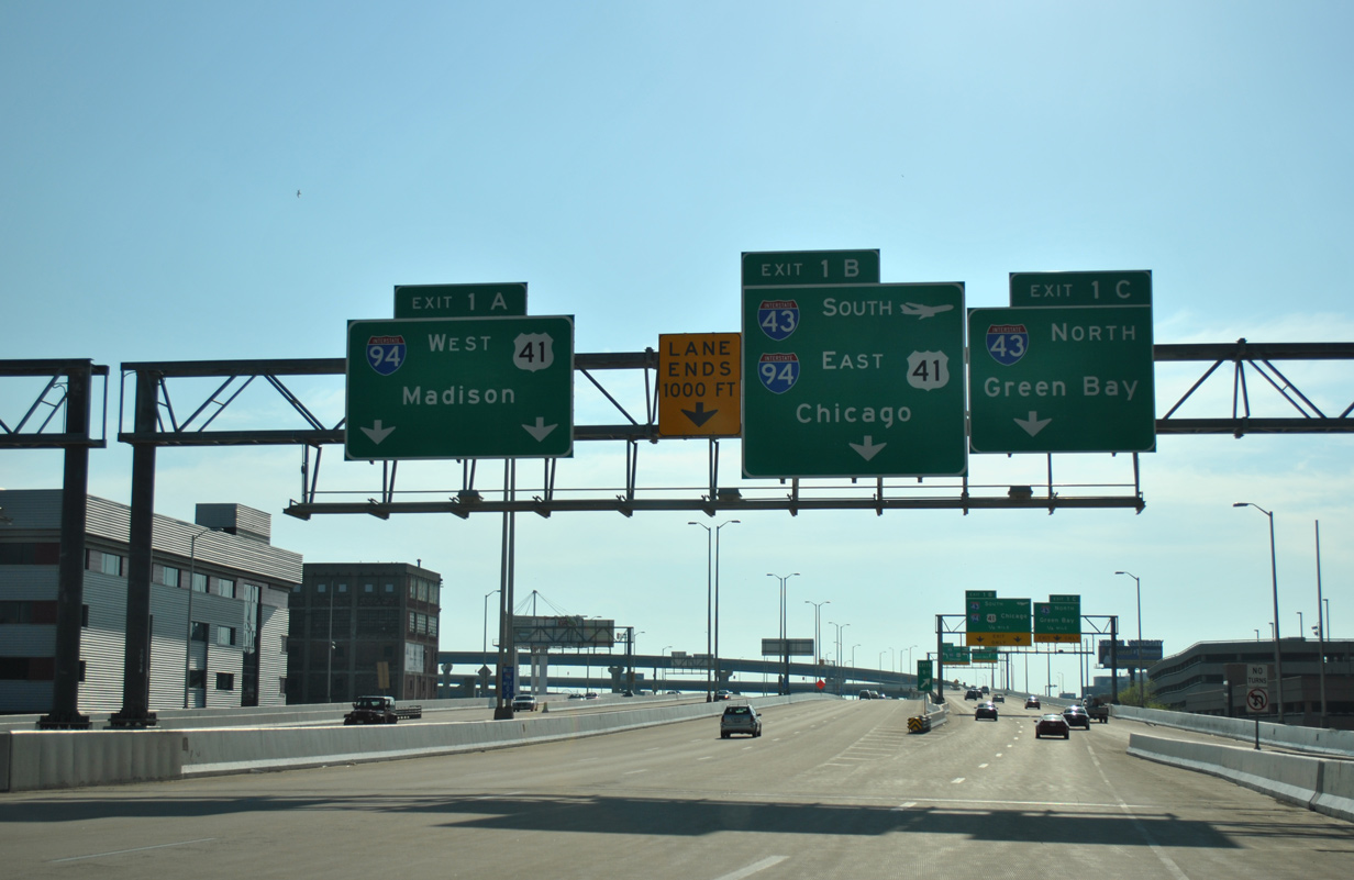
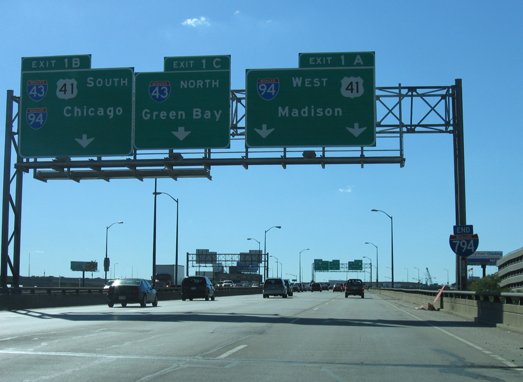
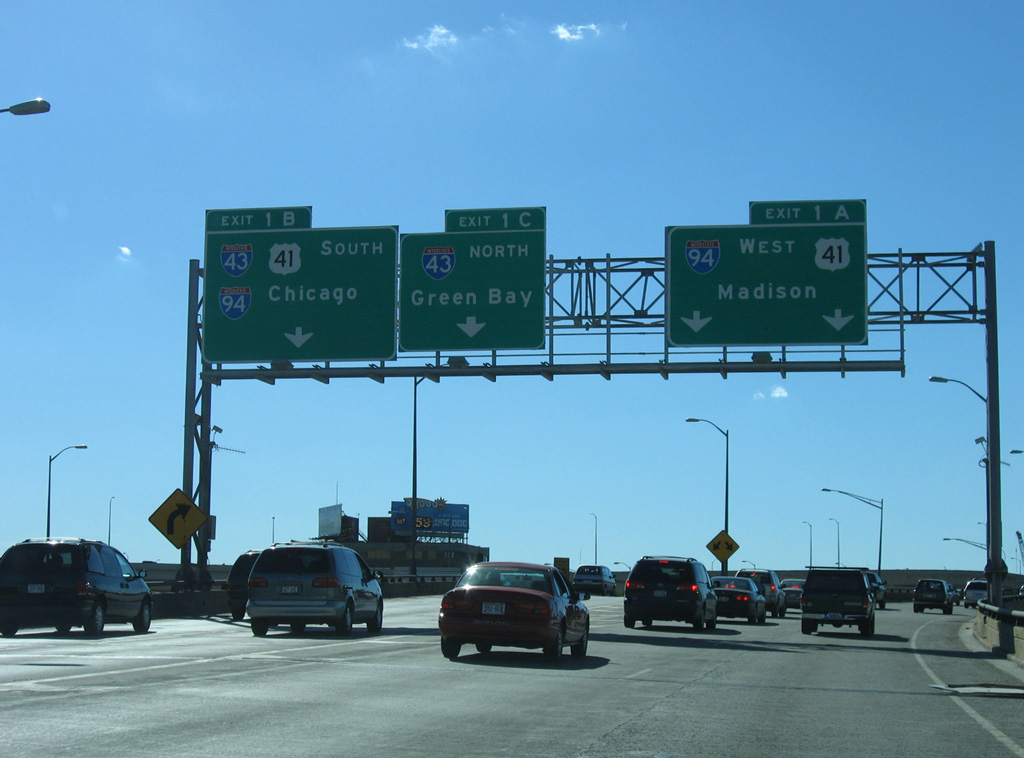
An entrance ramp ties into the flyovers for Exits 1B/C from 2nd and Clybourn Streets. U.S. 41 previously overlapped with I-94 west to the Stadium Interchange and south to the Airport Interchange. The concurrency was removed when Interstate 41 was signed in place of U.S. 41 along I-894 in 2015. 05/30/11
Flyovers shuttle motorists from I-794 west to the North South Freeway. I-43/94 travel south from I-794 to the Airport Interchange, where I-43 turns west along side I-41/894 to Greenfield. 05/30/11
An end shield for I-794 precedes the entrance ramp from 11th and Tory Hill Streets ahead of the flyover carrying I-94 west from the North South Freeway. 05/09/10
![]() North
North ![]() West at
West at ![]()
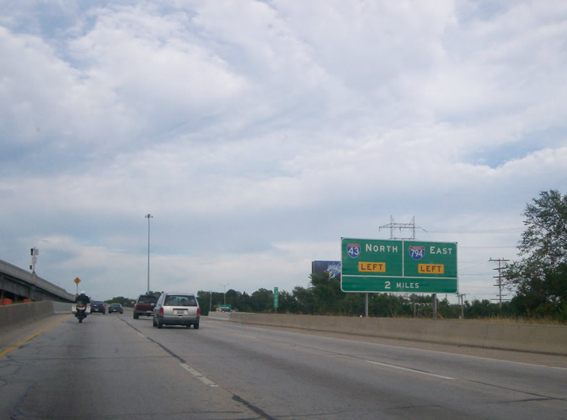
A lengthy collector distributor roadway system accompanies I-43/94 between the Lincoln and Greenfield Avenue overpasses. The c/d roadway connects the North South Freeway with Becher Street and Lapham Boulevard while the mainline advances north two miles to the Marquette Interchange with Interstate 794. 06/13/15
Interstate 43 continues north from the left two lanes through the Marquette Interchange toward Whitefish Bay, Fox Point and Green Bay. 06/13/15
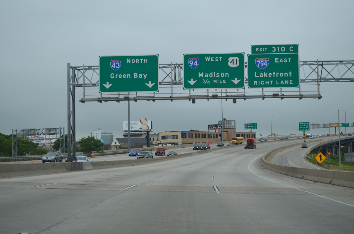
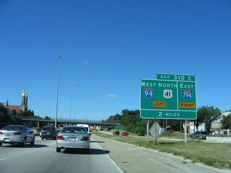
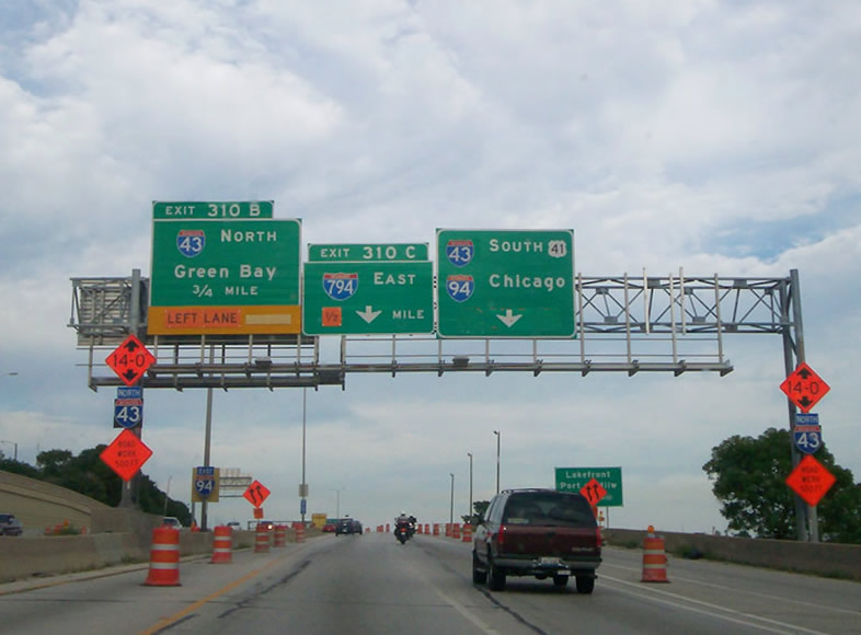
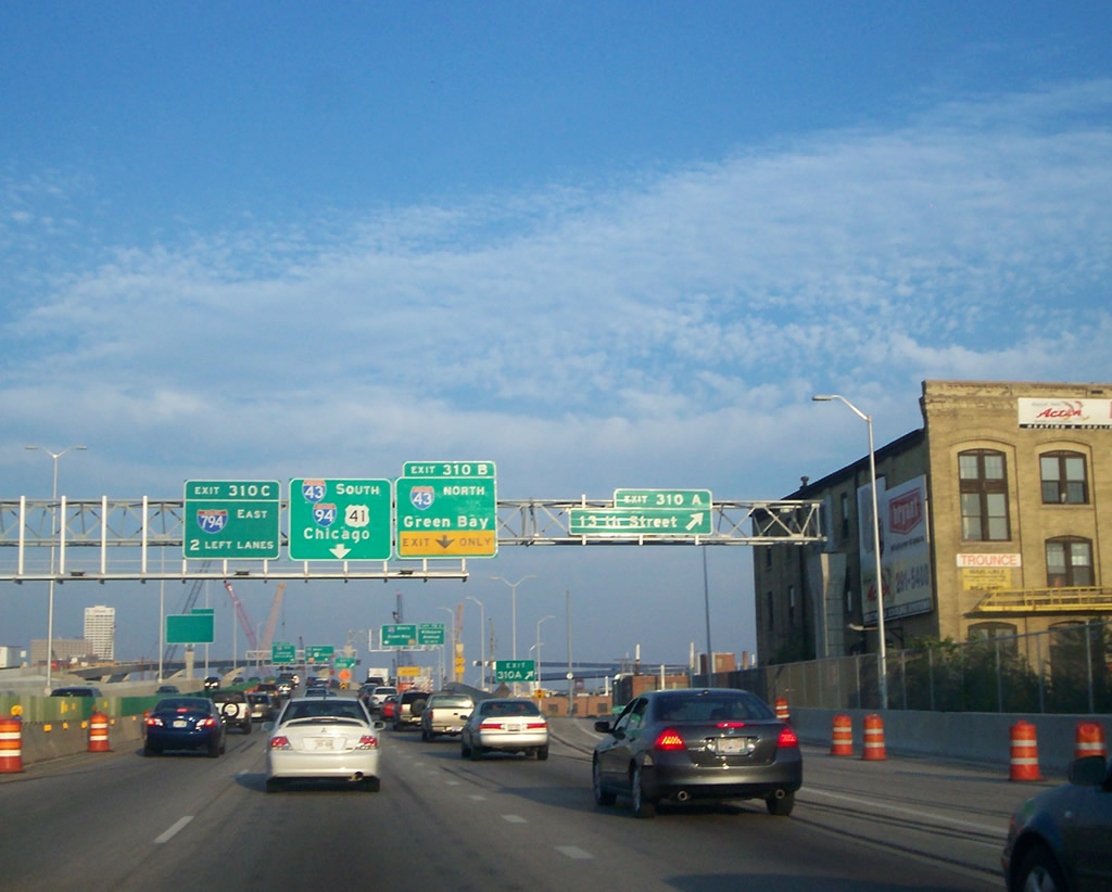
A high bridge takes I-43 north / I-94 west over the Menomonee River and adjacent industrial areas to Exit 310C for Interstate 794 east. 06/13/15
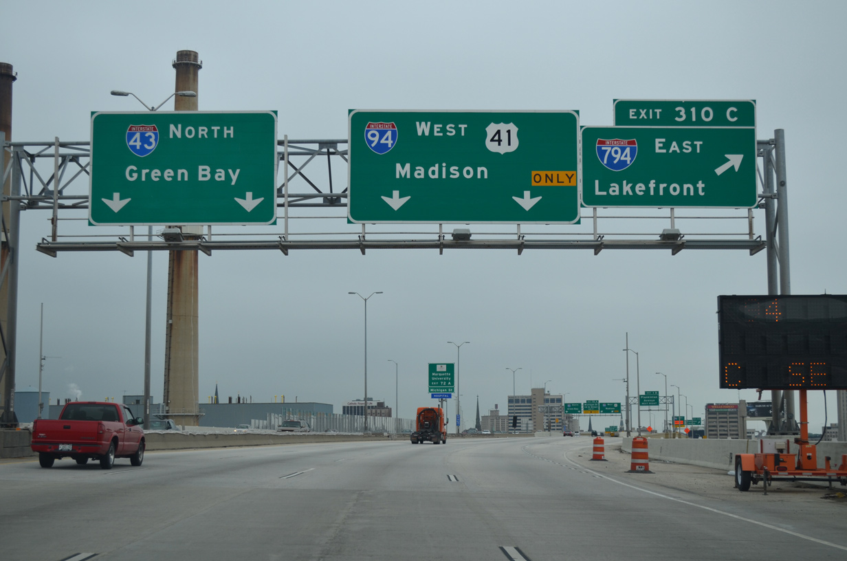
Interstate 794 spurs east from the Marquette Interchange to the Milwaukee Lakefront as I-94 turns west toward Miller Park and the western suburbs. 06/13/15
![]() South at
South at ![]()
![]()
Interstate 43 (North South Freeway) drops below grade from the diamond interchange (Exit 73) with STH-145 to Downtown and the Marquette Interchange with I-94/794. 05/30/11

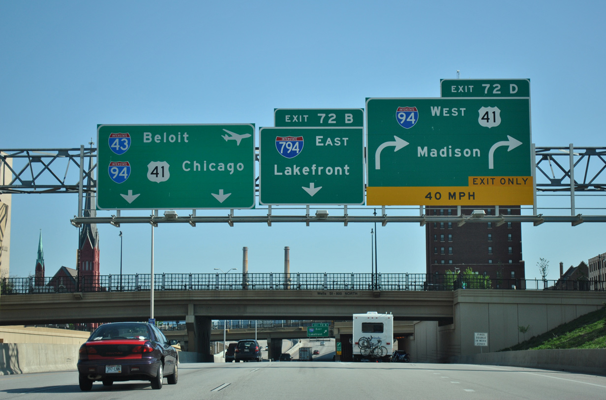
Removal of the Park Freeway interchange shifted the roadways of Interstate 43 inward to the Highland Avenue overpass. Three lanes continue to the merge with I-94 east toward General Mitchell International Airport (MKE), Chicago and Beloit. 05/30/11
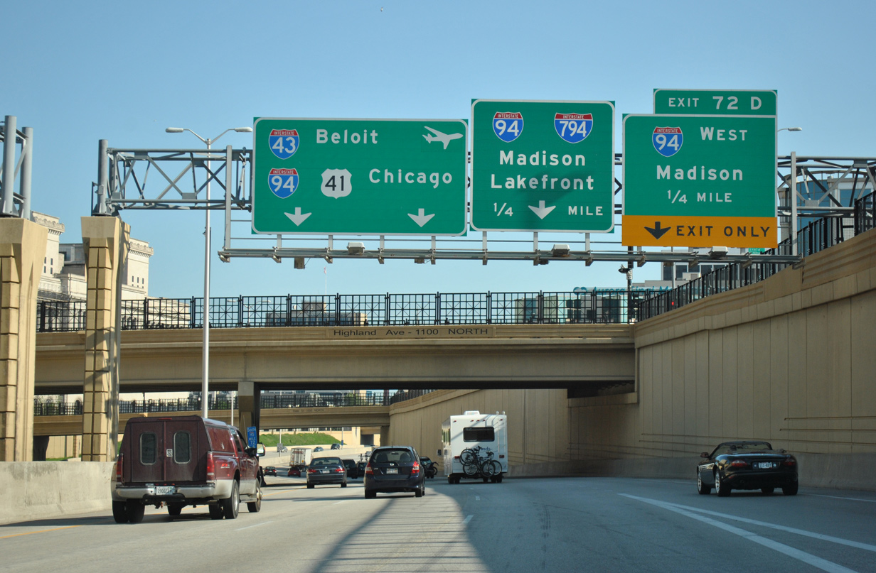
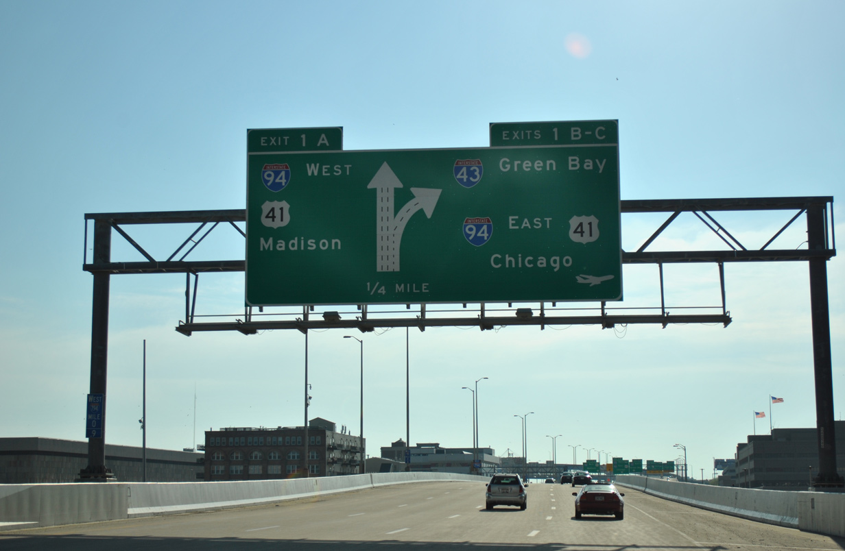
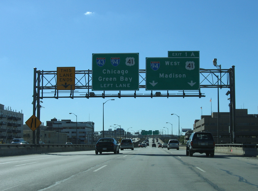
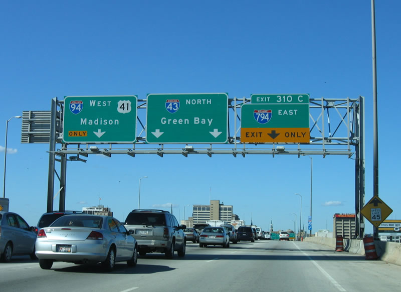
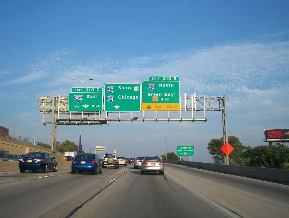
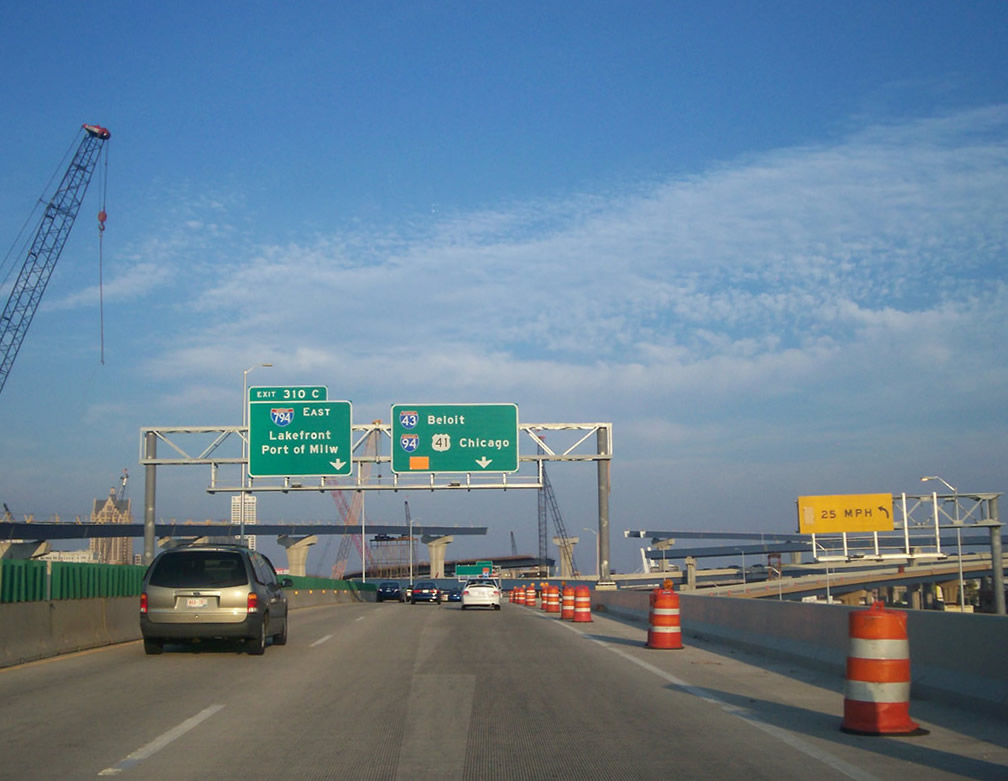
An auxiliary lane joins I-43 south from STH-145 (Fond du Lac Avenue) to Exit 72D for I-94 west. I-94 travels the East West Freeway across Milwaukee to Elm Grove and Brookfield. I-794 extends the freeway east to the Lake Freeway south. 05/30/11
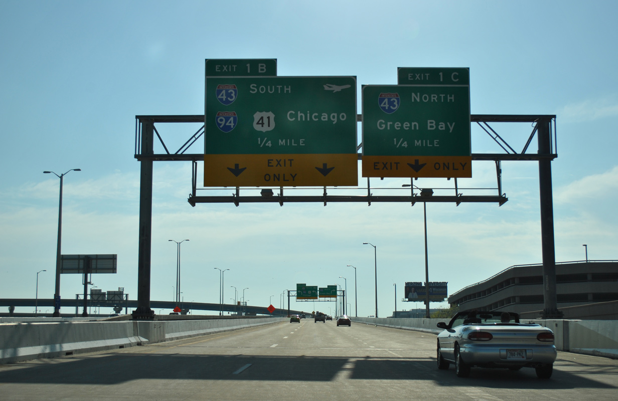
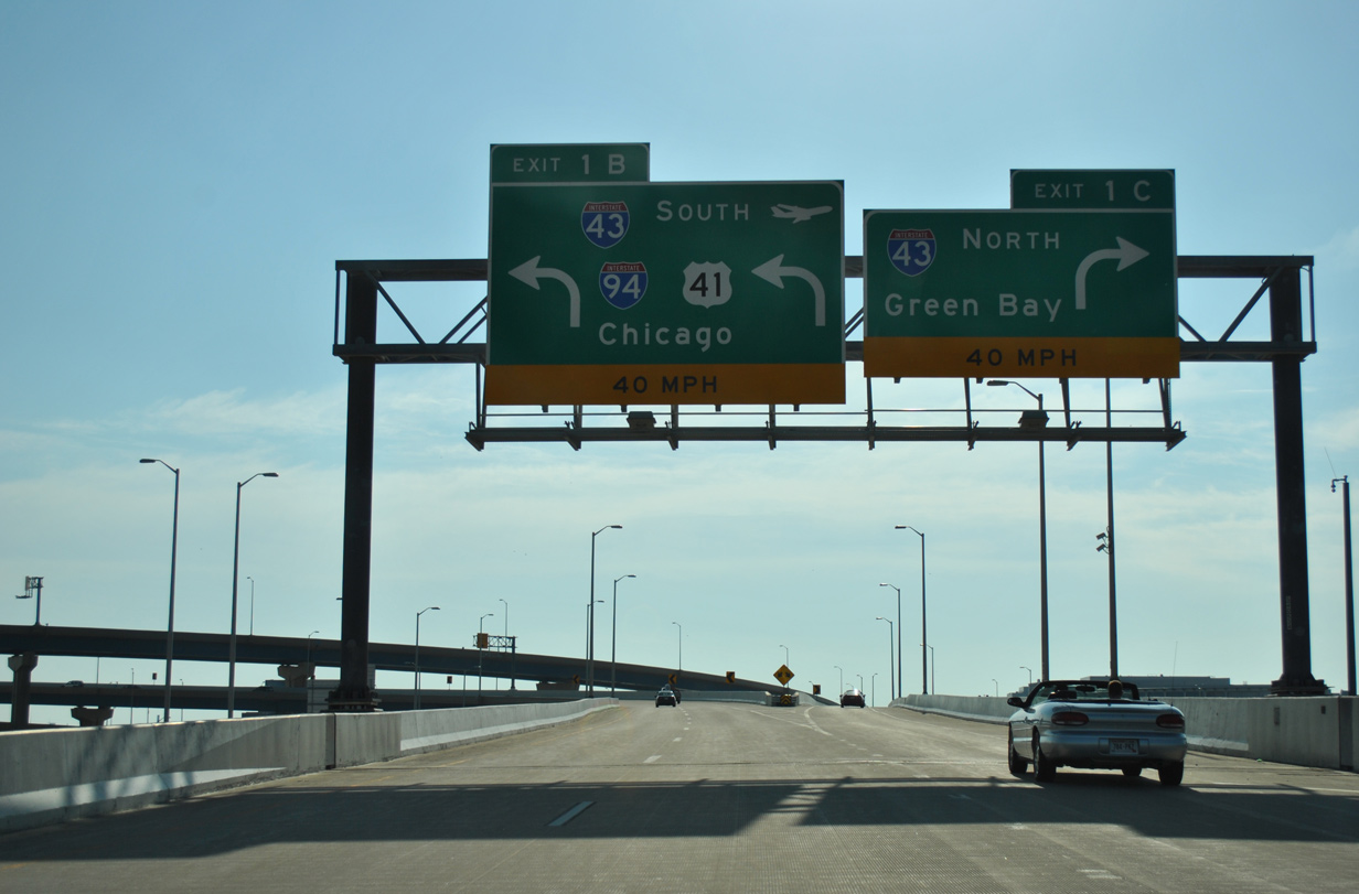
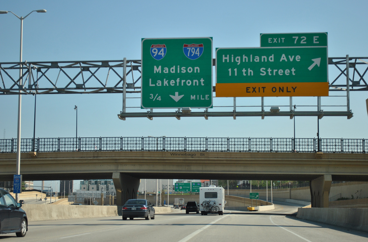
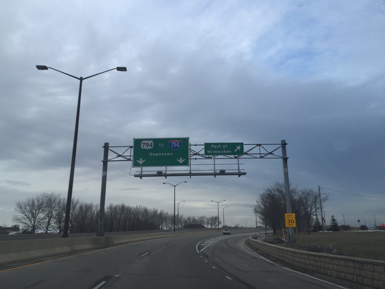
A two lane ramp shuttles motorists through a tunnel from I-43 south onto I-94 west at Exit 72D. A single lane flyover (Exit 72B) follows for Interstate 794 east across the south side of Downtown to Lakeshore State Park. 05/30/11
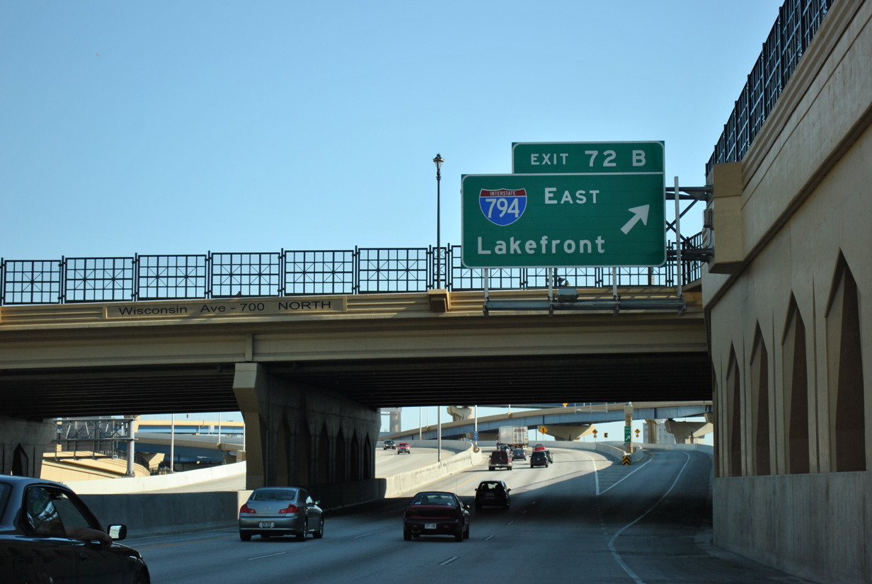
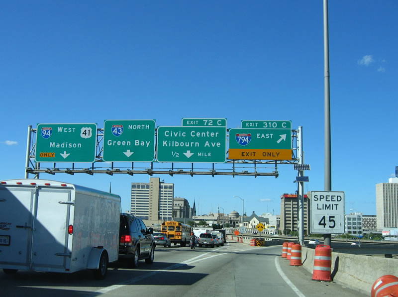
Drivers taking Exit 72B see two ramps for the Milwaukee central business district before I-794 turns south onto the Hoan Bridge to the Port of Milwaukee. 05/30/11
 West End Throwback
![]() West at
West at ![]()
![]()
These signs were replaced as part of the Hoan Bridge Project in 2015. Merging from the right was the two-lane ramp from Lincoln Memorial Drive by the eastern terminus of U.S. 18. The Milwaukee Lakefront Gateway Project replaced this ramp with a new ramp tieing in from an extension of Lincoln Memorial Drive to the south. 05/09/10
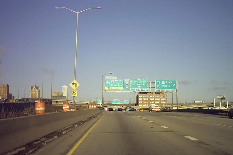
This diagrammatic sign was added as part of the Marquette Interchange project completed in December 2008. It was replaced during reconstruction of the I-794 viaduct between Milwaukee Street (STH-32) and the Milwaukee River in 2014. 05/30/11
Prior to the upgrade of the Marquette Interchange, Left Exit 1B connected I-794 west with I-43 south / I-94 east toward the airport. 09/02/05
Two of these signs were replaced in 2015 to reflect the relocation of U.S. 41 away from the Marquette Interchange. U.S. 41 is now Interstate 41 running along the Airport and Zoo Freeways (Interstate 894). 05/30/11
Travelers headed to Interstate 43 (North South Freeway) north departed from Interstate 794 west via Left Exit 1C. Most movements at the original Marquette Interchange used left exit ramps. 09/02/05
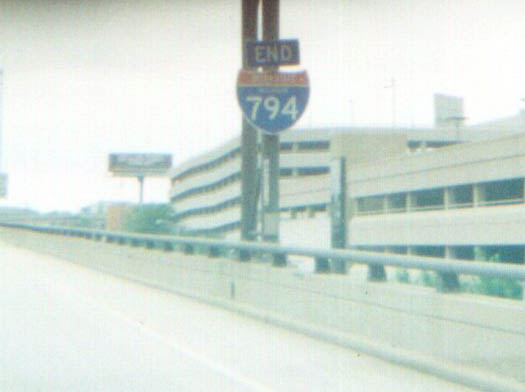
Removed by 2005, a state-named end shield was posted along Interstate 794 west ahead of the East West Freeway transition to I-94. Photo by Marc Welby (07/03/00).
A three lane flyover replaced the left exit ramps for I-43 and I-94. Construction to upgrade the Marquette Interchange took place between 2005 and 2008. 09/02/05
![]() North
North ![]() West at
West at ![]()
The previous sign posted two miles south of the Interstate 794 referenced the left exit ramp for the continuation of I-94 west / U.S. 41 north. This movement now utilizes the highest flyover of the Marquette Interchange. 09/02/05

Typical traffic congestion as I-43 north and I-94 west prepared to split at the old Marquette Interchange. Two lanes now serve the westbound continuation of I-94. 09/02/05
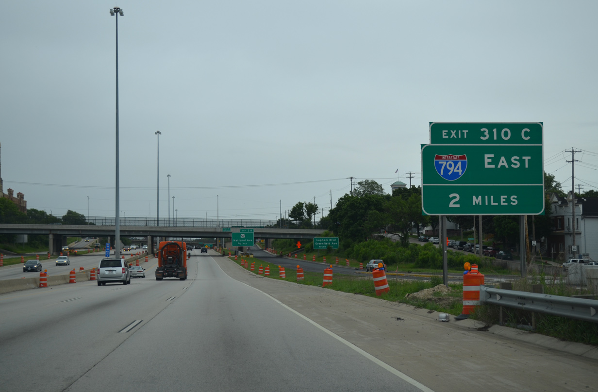
A lane drop occurred at the ramp departure (Exit 310C) for Interstate 794 east. Much of the traffic congestion on this day was related to traffic continuing north on Interstate 43. 09/02/05
The adjacent off-ramp (Exit 72C) from I-43 north was removed due to the addition of the flyover from I-794 west. A new ramp, signed as Exit 72A, departs from within the Marquette Interchange to Michigan Street. 09/02/05
![]() East at
East at ![]()
![]()
Posted within the Stadium Interchange with Wis 175 (former U.S. 41 and Wis 341), this sign formerly referenced the left exit ramps for both I-43 north and I-794 east. The 2007 replacement included exit tabs and Green Bay / Lakefront for the respective routes. Photo by Chris Lokken and Mike Saldivar (08/13/06).
An elevated stretch of Interstate 94 parallels an industrial area along St. Paul Avenue and the Menomonee River preceding the Marquette Interchange. Photo by Chris Lokken and Mike Saldivar (08/13/06).
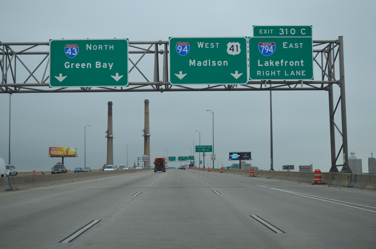
Signs for Exits 310B (I-43 north) and 310C, the continuation of the East West Freeway to I-794, were reused during a later stage of the Marquette Interchange project. Photo by Chris Lokken (09/21/07).
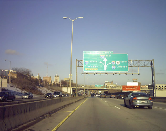
This diagrammatic sign was removed at the onset of the Marquette Interchange project. I-794 continues the eastward push toward the Milwaukee Lakefront before turning southward to Lake Parkway (Wis 794). Photo by Craig Holl (circa 2000).
The second in a series of diagrammatic signs posted ahead of the I-94/U.S. 41 merge with Interstate 43. Photo by Craig Holl (circa 2000).
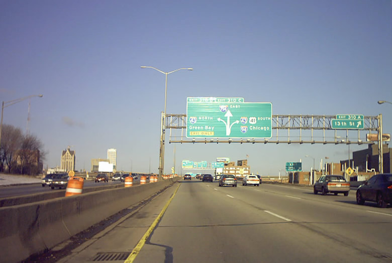
The off-ramp to 13th Street was extended westward to depart I-94 east ahead of the 16th Street overpass. Exit 310B for I-43 north to Green Bay immediately follows the overpass now. Photo by Chris Lokken (09/21/07).
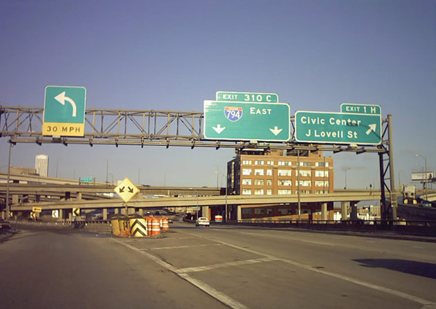
Exit 1H quickly followed to James Lovell Street beyond Left Exit 310B for I-43 north and the 110-mile drive to Green Bay. Photo by Craig Holl (circa 2000).
The industrial building located within the Marquette Interchange was demolished to make way for modernization of the exchange. Photo by Craig Holl (circa 2000).
High flyovers took shape as part of the $810-million Marquette Interchange project in this scene at the new off-ramp taking Interstate 94 east onto the North South Freeway. Photo by Chris Lokken (09/21/07).
South End / Lake Parkway – Milwaukee, Wisconsin
![]() South at
South at ![]()
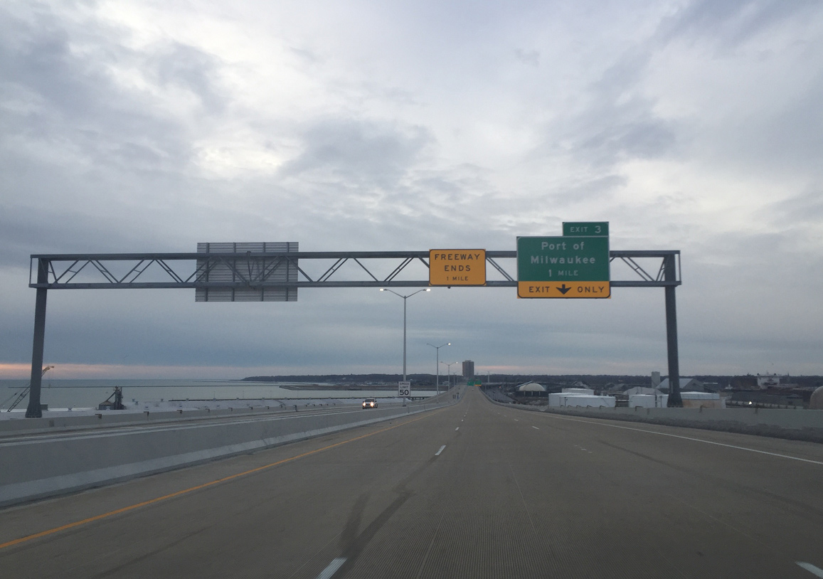
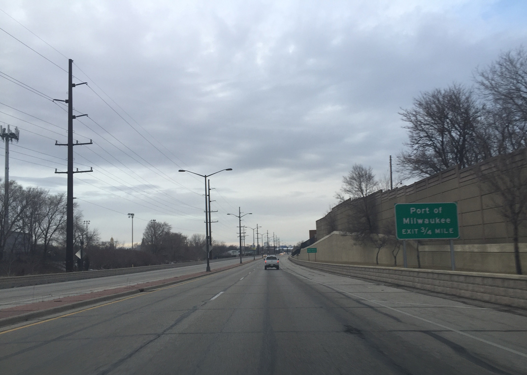
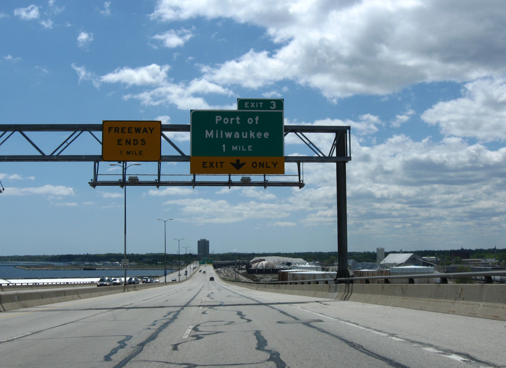
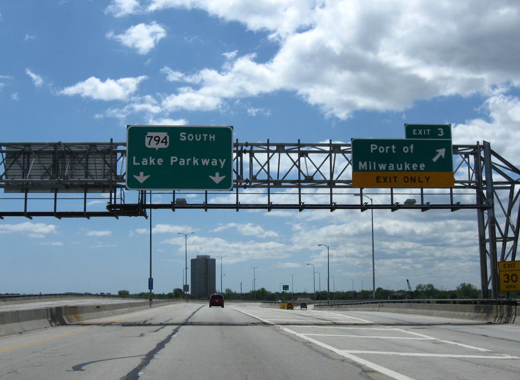
Lowering from the Hoan Bridge, I-794 approaches the folded diamond interchange (Exit 3) with Carferry Drive. The forthcoming exit serves both the Port of Milwaukee and the Lake Express high speed ferry across Lake Michigan to Muskegon, Michigan. Photo by Peter Johnson (02/07/16).
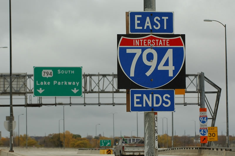
Interstate 794 lines the east side of Jones Island to Exit 3 and the transition to STH-794 (Lake Parkway). Photo by Peter Johnson (02/07/16).
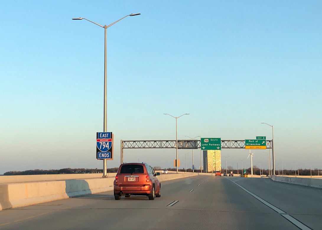
A new end sign assembly for I-794 was posted at the completion of the Hoan Bridge Project in 2015. Photo by Peter Johnson (05/12/20).
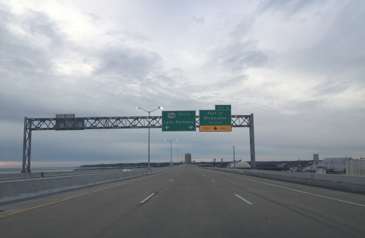
Exit 3 departs I-794 south for Carferry Road and Lincoln Avenue to the Bay View community. Extending the route south as the four-lane Lake Parkway to the city of St. Francis, Wis 794 takes over. Photo by Peter Johnson (02/07/16).
![]() North at
North at ![]()
Lake Parkway (STH-794) leaves the city of St. Francis and enters the city of Milwaukee north of General Mitchell International Airport (MKE). Photo by Jeff Royston (11/06/05).
The first northbound Wis 794 reassurance shield within the city of Milwaukee. Lake Parkway was constructed within a narrow right of way, generally below grade. Photo by Jeff Royston (11/06/05).
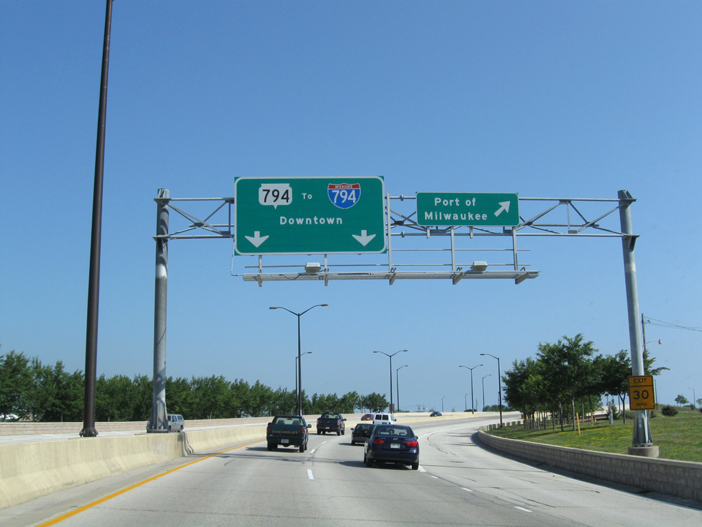
Wis 794 north intersects a connector to Oklahoma Avenue at grade before continuing toward the Port of Milwaukee interchange and beginning of I-794. Photo by Peter Johnson (02/07/16).

An end shield assembly follows for STH-794 north as the freeway ascends onto the tied arch Hoan Bridge over Jones Island. Photo by Peter Johnson (02/07/16).
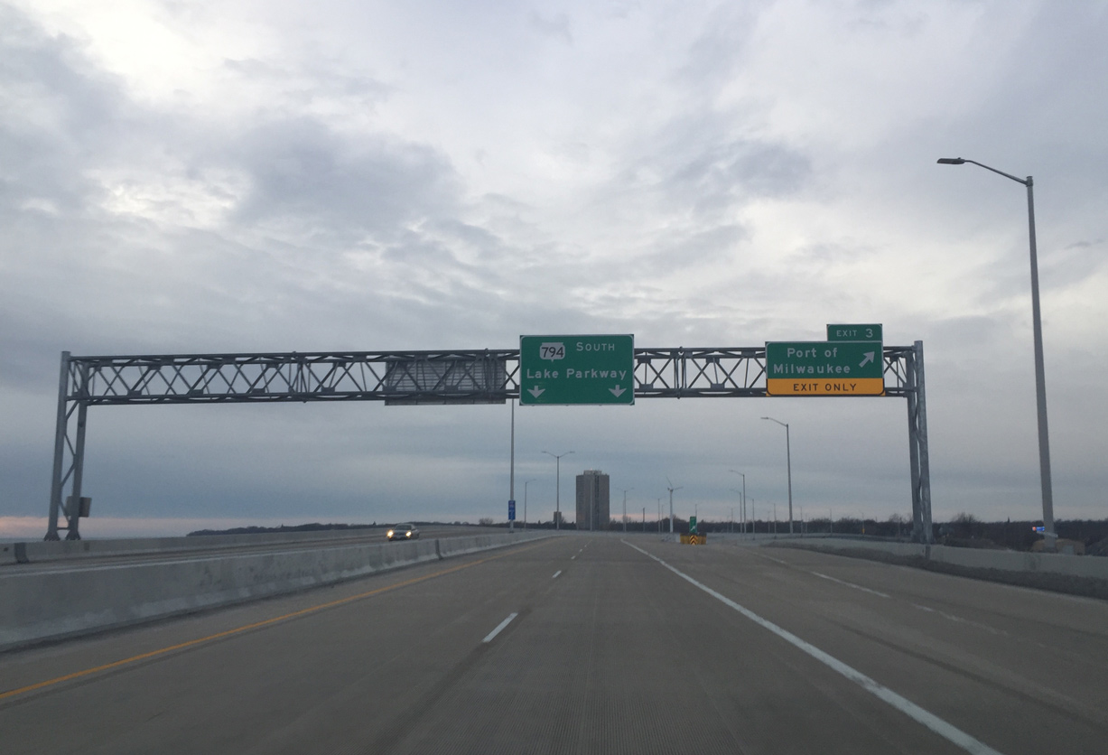
Wis 794 (Lake Parkway) swings northeast away from the parallel Union Pacific Railroad to reach the loop ramp (Exit 3) for Carferry Road. Interstate 794 takes over from here northward to Downtown Milwaukee. Photo by Peter Johnson (02/07/16).
South End Throwback
![]() South at
South at ![]()
Traveling along the original deck of the Daniel Hoan Bridge south over the Port of Milwaukee. 05/09/10

These signs were carbon copied onto a new sign bridge during the Hoan Bridge Project. 05/09/10
This end shield was posted above the barrier median of Interstate 794 ahead of Exit 3. It was replaced with a cutout shield by 2009. Photo by Jeff Royston (11/06/05).
The sign bridge at the off-ramp (Exit 3) for Carferry Drive was replaced during the Hoan Bridge Project. 05/09/10
![]() North at
North at ![]()
The overheads at the Carferry Drive off-ramp on STH-794 (Lake Parkway) north were replaced as part of the Hoan Bridge Project. 08/12/09
Sources:
- Wisconsin Highways: Highways 400-894 (Chris Bessert).
- “Parkway ‘fulfills’ Bay View dream.” Milwaukee Journal Sentinel, October 3, 1999.
- “Good news, bad news on new parkway.” Milwaukee Journal Sentinel, October 5, 1999.
- “Lake Parkway south-side link fulfills a long-held dream.” Milwaukee Journal Sentinel, June 21, 1999.
- “Lake Parkway to open to traffic today.” Milwaukee Journal Sentinel, October 1, 1999.
- “Deal creates different fates for freeways – Norquist, others wanted Park East spur and I-794 to fall, but latter stretch stays.” Milwaukee Journal Sentinel, May 3, 1999.
- “Regional planners approve Lake Parkway extension” Milwaukee Business Journal, December 6, 2012.
- “‘Gorgeous new addition:’ WisDOT celebrates opening of the Lakefront Gateway Project.” Fox6 (Milwaukee, WI), June 13, 2017.
https://projects.511wi.gov/hoan-bridge-project/overview/
Page updated May 16, 2020.