Interstate 696 Michigan
Overview
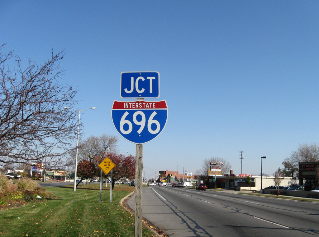
Interstate 696 (Walter P. Reuther Freeway) forms a northerly bypass of Detroit between I-96 at Novi and I-94 at St. Clair Shores. The freeway is mostly urban, traveling below grade from Southfield to Roseville and along a trenched freeway parallel to Eleven Mile Road between Evergreen Road (Exit 11) and Southfield Road (Exit 12). A cut and cover tunnel takes the route below parkland south of Lincoln Drive, where another trenched section leads I-696 to two additional cut and cover tunnels east of Greenfield Road (Exit 13).
A symmetrical stack interchange joins Interstate 696 with I-75 at the city of Ferndale. The freeway parallels 10 Mile Road both leading to and away from that exchange, before it shifts northward back to 11 Mile Road ahead of the four level interchange with Mound Road. I-696 carries eight lanes from M-5 to M-10, six lanes from M-10 (Lodge Freeway) to Greenfield Road (Exit 13), eight lanes again from Exit 13 to M-3 (Gratiot Road) and six lanes to I-94 at St. Clair Shores.
 History
The Michigan State Highway Department recommended Interstate Route Numbering in 1958 outlined that through routes in urban areas should follow the circumferential route. The consensus was that utilizing the circumferential route would relieve unnecessary traffic through the urban area, and that the circumferential routes would be ready for operation for a considerable length of time prior to the completion of the urban connecting routes. Within the Detroit area, what would become I-696 was assigned Interstate Route 98.
The American Association of State Highway Officials (AASHO) addressed the Michigan recommendations on August 29, 1958:
For the Detroit area we note that you have used 2-digit numbers that have not been assigned by the Route Numbering Committee and which are not available for metropolitan areas.
AASHO instead recommended that Route 98 be changed to 696. The state concurred with the recommendation on September 12, 1958 and AASHO gave final approval on Decemember 18, 1958.
Interstate 696 opened initially between I-96 and U.S. 24 in late 1963. Business Spur I-696 was designated the year before and decommissioned by 1970. The next portion of freeway opened was the stretch between I-75 and I-94 in 1979.1 Completion of the 28.2 mile long route took another ten years with an opening on December 14, 1989. Opening ceremonies were held by Michigan Governor Blanchard for the 9.1 mile section from U.S. 24 (Telegraph Road) east to Interstate 75.2
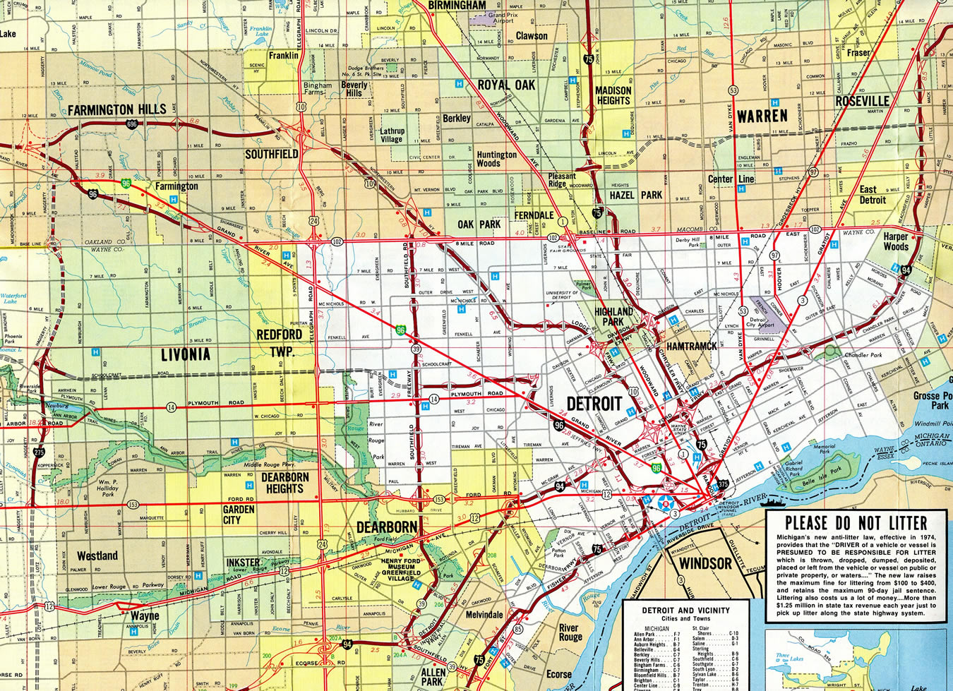
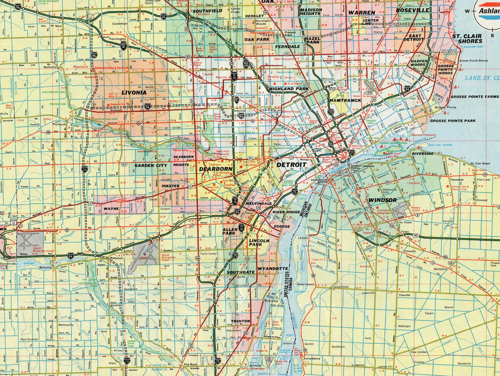
Detroit – 1976/77 Michigan Official Highway Map
Interstate 696 next opened between I-75 at Madison Heights and I-94 at Roseville in 1979. Until 1989, I-696 at Southfield defaulted onto the Governor John Lodge Freeway (U.S. 10).
Route Information
East End – St. Clair Shores, MI
West End – Novi, MI
Mileage – 29.30
Cities – Farmington Hills, Southfield, Oak Park, Royal Oak, Madison Heights, Warren, Roseville
- Junctions –


Source: December 31, 2021 Interstate Route Log and Finders List
I-696 Annual Average Daily Traffic (AADT)
Source: 2017 AADT – MDOT Traffic Volumes Map
Business Spur I-696 traveled the length of the John C. Lodge Expressway from Smithfield southeast to Downtown Detroit until 1970, when it was replaced by a realignment of U.S. 10.
East End  – St. Clair Shores, Michigan
![]() East at
East at ![]()
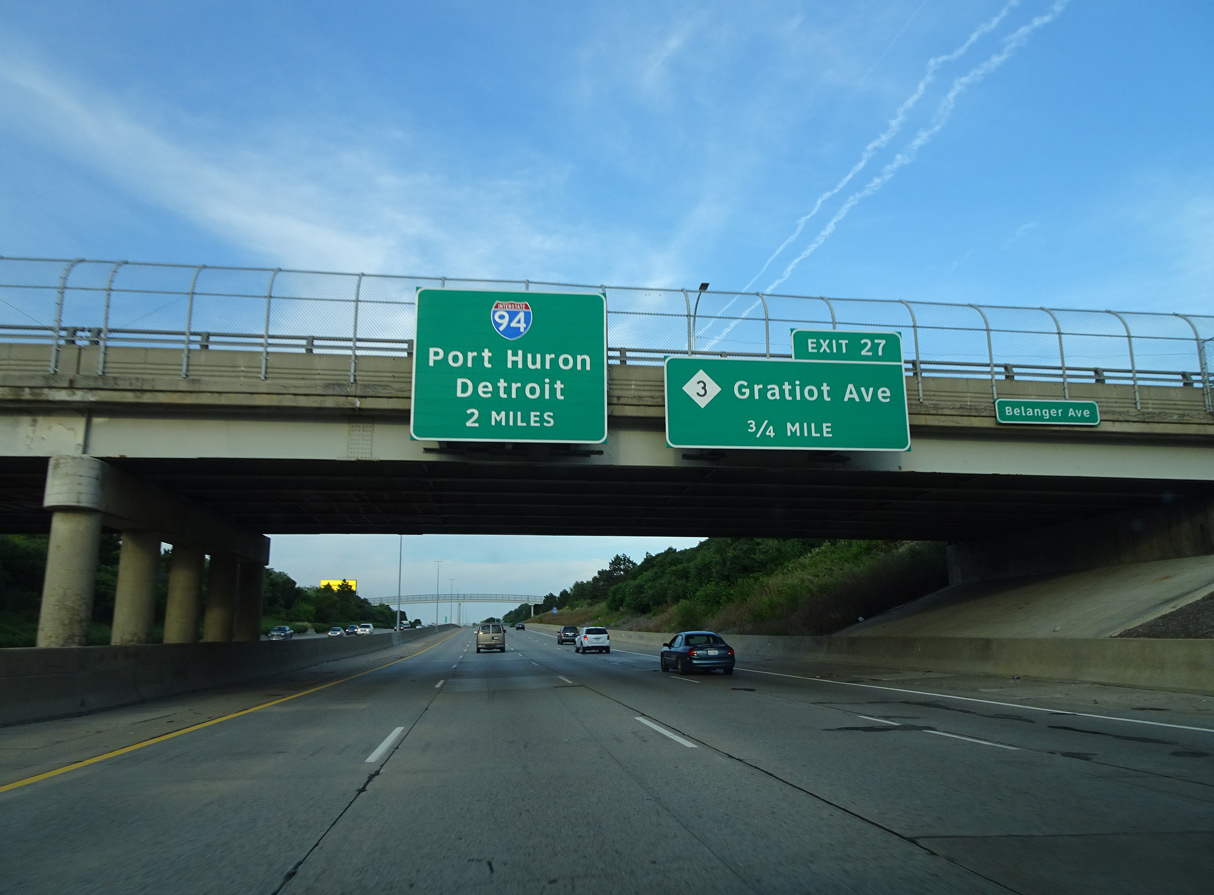
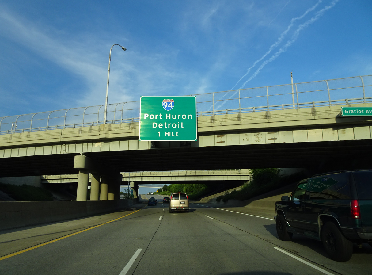
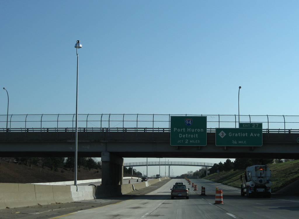
Interstate 696 east, two miles out from the unnumbered directional T interchange with I-94 at the Belanger Street overpass. Photo by Eric Stuve (07/09/17).
Gratiot Road, the former alignment of U.S. 25, spans I-696 over the final mile leading to St. Clair Shores. Photo by Eric Stuve (07/09/17).
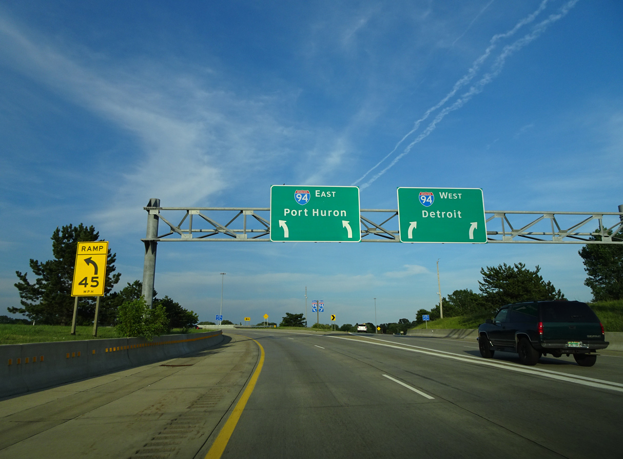
Exit 28 joins the adjacent frontage road (11 Mile Road) as it stems east from I-696 and I-94 to the St. Clair Shores government complex at Jefferson Avenue. Photo by Eric Stuve (07/09/17).
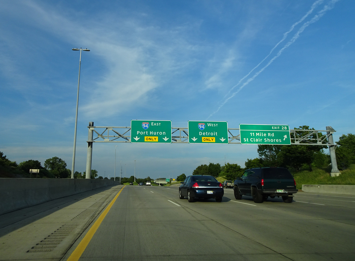
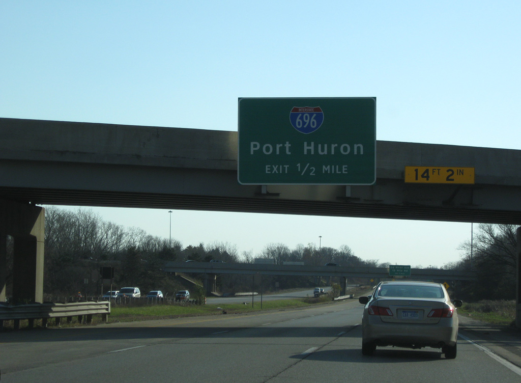
Two lane ramps join Interstate 94 westbound leading back south to Harper Woods and Detroit and eastbound traveling north to Mount Clemmons, Port Huron and Sarnia, Ontario. Photo by Eric Stuve (07/09/17).
![]() East at
East at ![]()
The initial guide sign for Exit 229 to I-696 west appeared along I-94 east within the diamond interchange at Nine Mile Road (Exit 228).
All I-696 signs along I-94 remaining with Highway Gothic font were replaced with Clearview by 2013. 11/05/11
I-94 straddles the Roseville and St. Clair Shores city line northward from Ten Mile Road to Twelve Mile Road. Interstate 696 (Walter P. Reuther Freeway) west runs across Roseville to Warren. 11/05/11
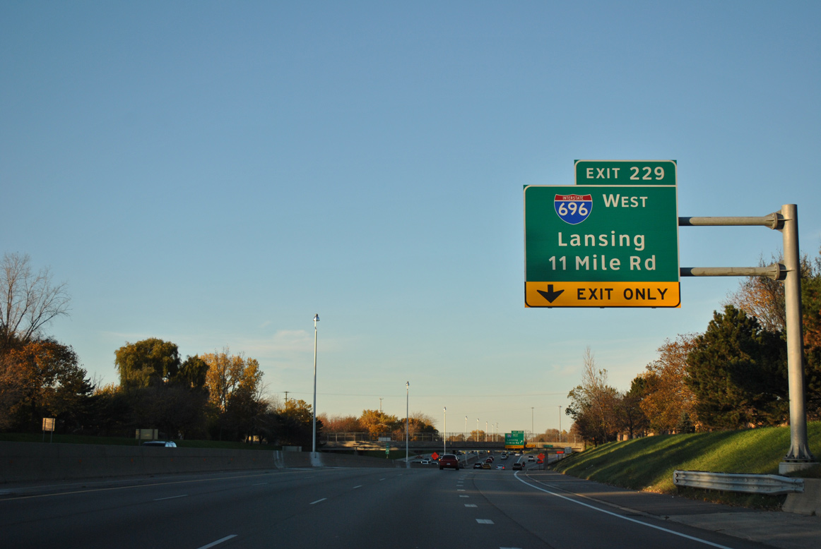
The entrance ramp from Ten Mile Road adds a fourth eastbound lane along I-94 to the directional T interchange (Exit 229) with Interstate 696 west. 11/05/11
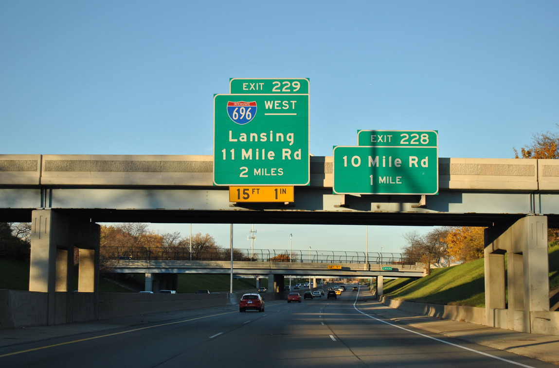
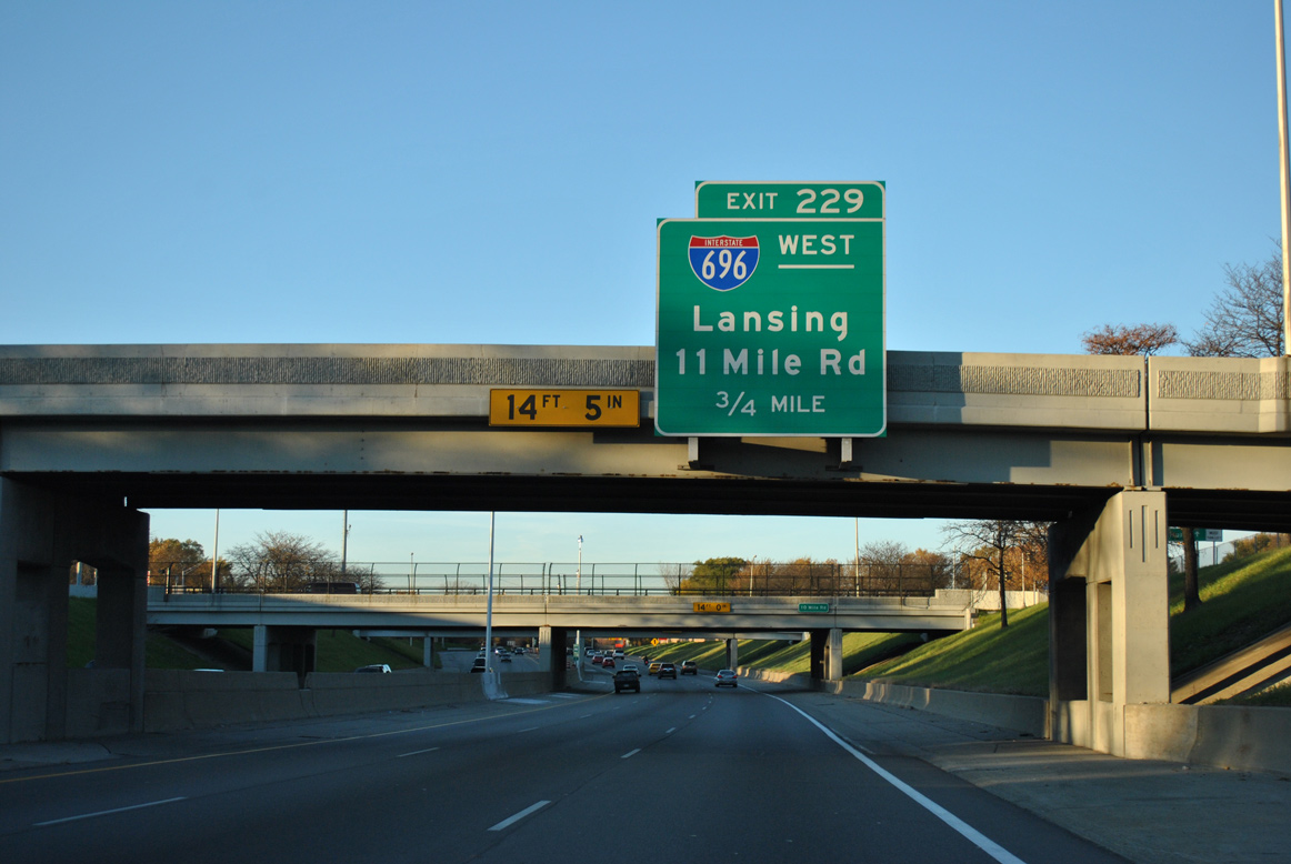
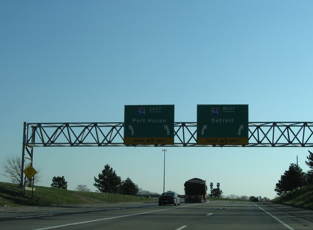
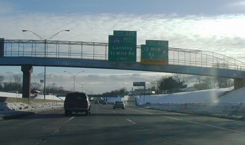
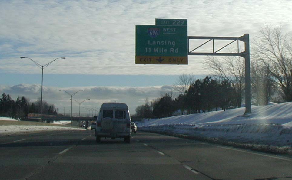
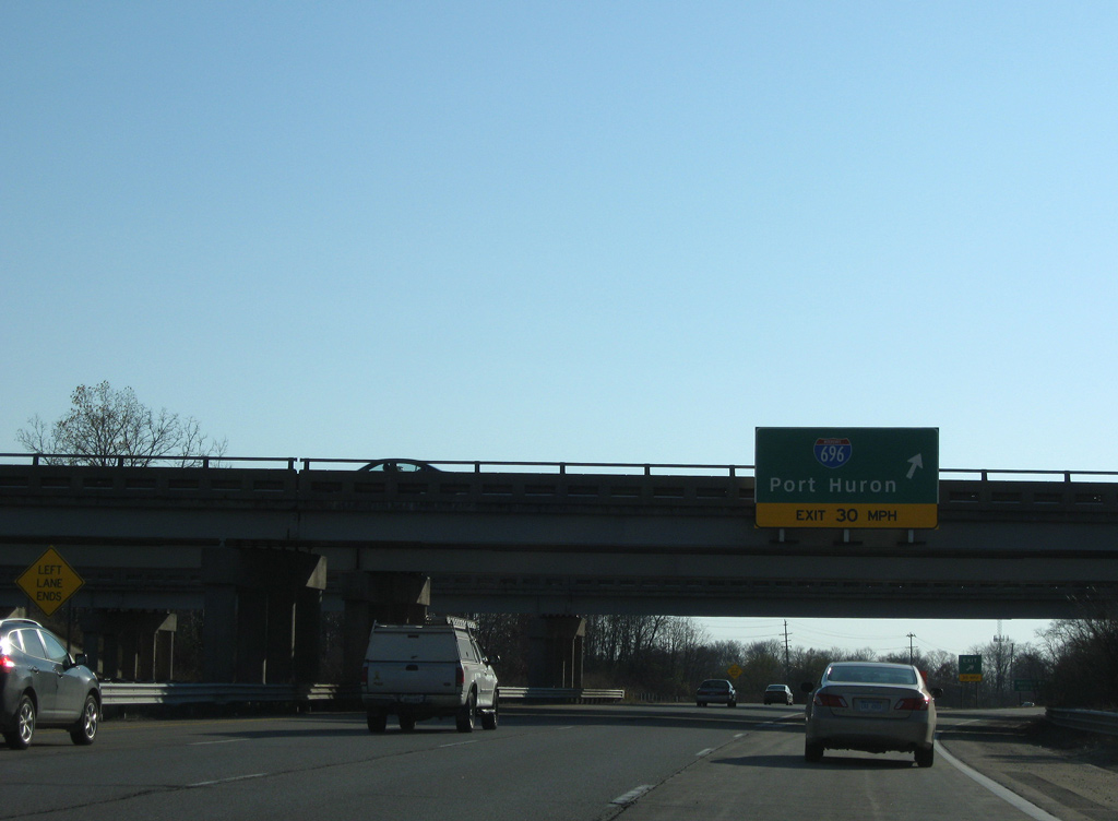
Exit 229 departs I-94 (Edsel Ford Freeway) east with two lanes for Interstate 696 across the northern Detroit suburbs to Lansing. 11/05/11
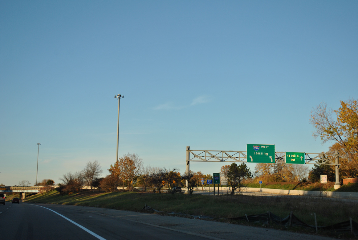
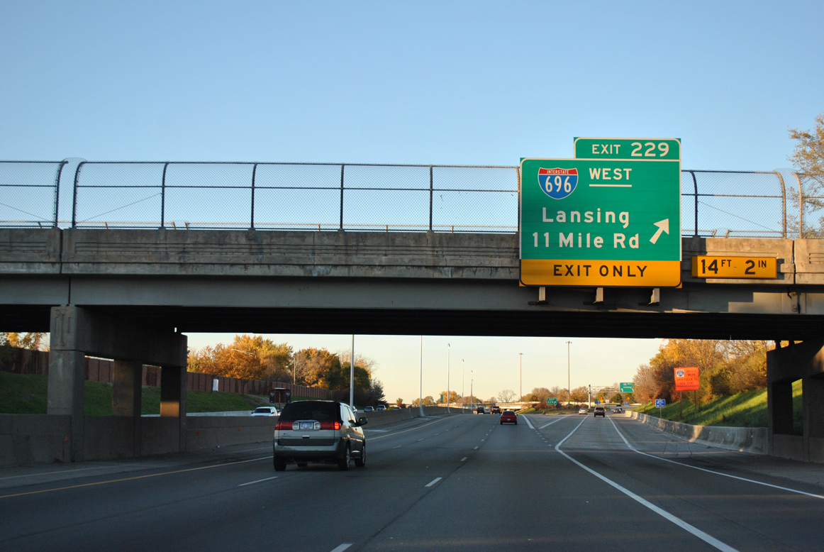
Exit 229 curves onto Interstate 696 west to Warren, Smithfield and I-96 at Novi. A parclo interchange lies within the exchange at I-94, joining both freeways with Eleven Mile Road as it spurs east from the frontage road system of I-696. 11/05/11
 East End Throwback
![]() East at
East at ![]()
All signs for I-94 on I-696 east were replaced with Clearview font based panels by 2011. 11/07/09
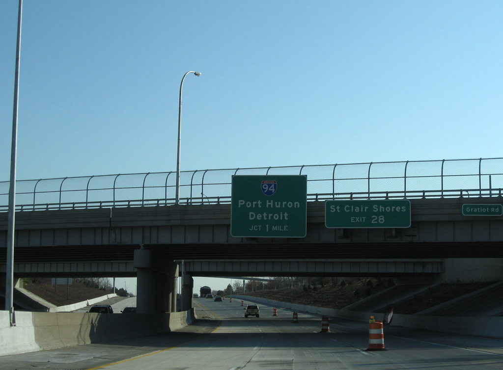
I-696 advances one mile east from M-3 (Gratiot Road) through the city of Roseville to I-94. 11/07/09
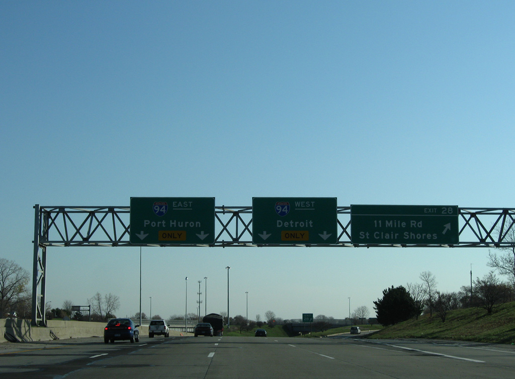
Eastbound Interstate 696 expands to four lanes leading into the exchange with I-94. 11/07/09
I-94 straddles the St. Clair Shores city line at the east end of I-696. 11/07/09
![]() West at
West at ![]()
Westbound I-94, one mile north of I-696 (W.P. Reuther Freeway) at Exit 230 with 12 Mile Road. I-696 serves as a bypass of Detroit by passing through Warren, Oak Park and Farmington Hills. At no point does the freeway enter Wayne County or the City of Detroit. These guides sign were replaced by 2013. Photo by John Harmon (01/01/01).
An auxiliary lane accompanies I-94 (Edsel Ford Freeway) west from 12 Mile Road to Exit 229 for I-696 west. I-696 provides a direct route to I-96 toward Lansing, Grand Rapids and Muskegon.
This guide sign was replaced by 2012. Photo by John Harmon (01/01/01).
West End – Novi, Michigan
![]() West at
West at ![]()
![]()
![]()
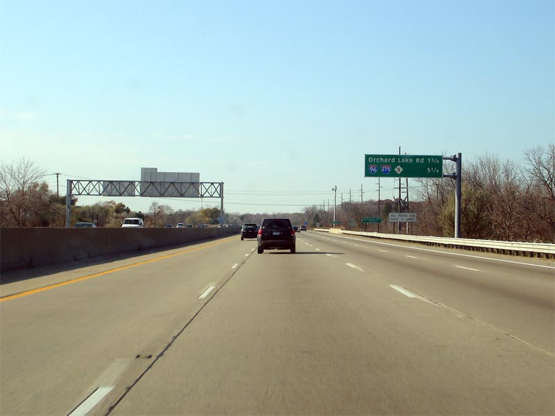
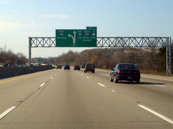
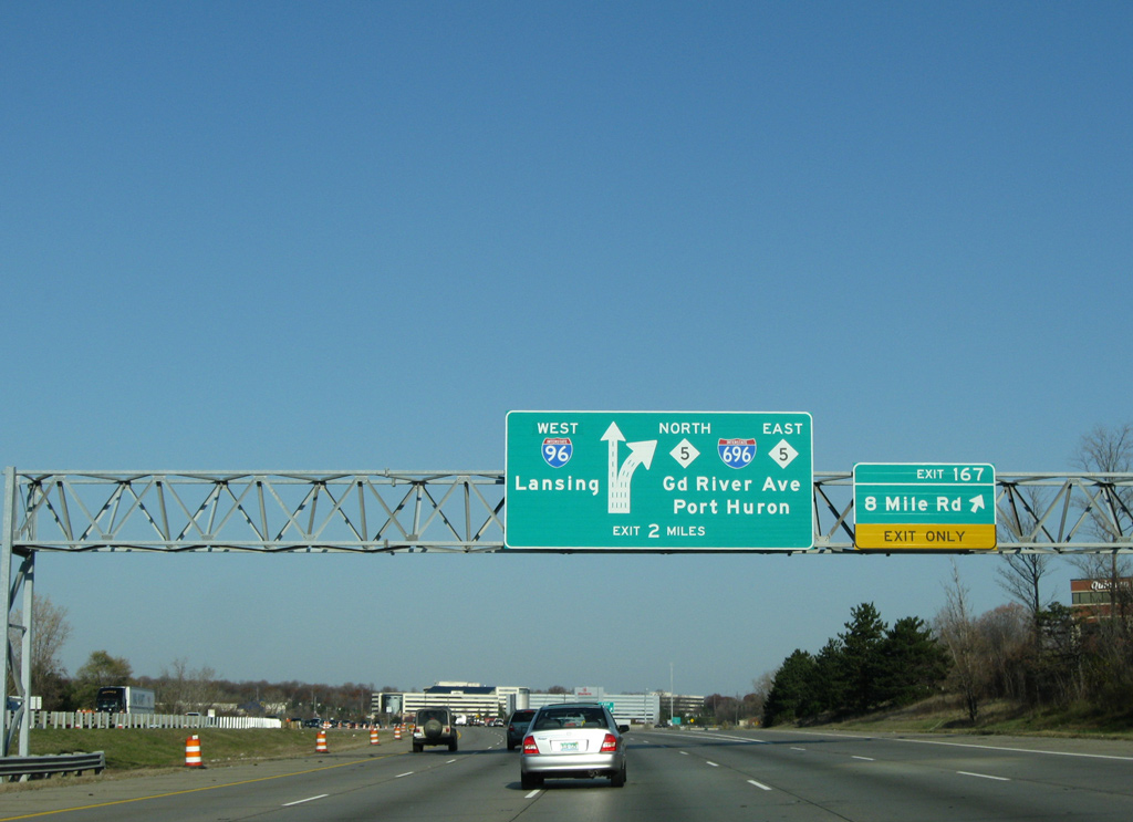
Interstate 696 travels west with one mainline interchange between U.S. 24 (Telegraph Road) and the junction with I-96/275 and M-5. This interchange sequence sign precedes the transition to I-96 west by 5.25 miles. Photo by Scott Steeves (11/05/06).
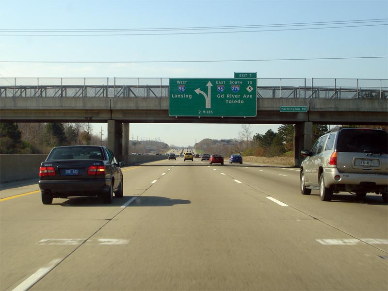
Exit 1 departs Interstate 696 (W.P. Reuther Freeway) west in two miles with two lanes for M-5 north to Novi, I-96 east / I-275 south to Livonia and M-5 east to Farmington. Photo by Scott Steeves (11/05/06).
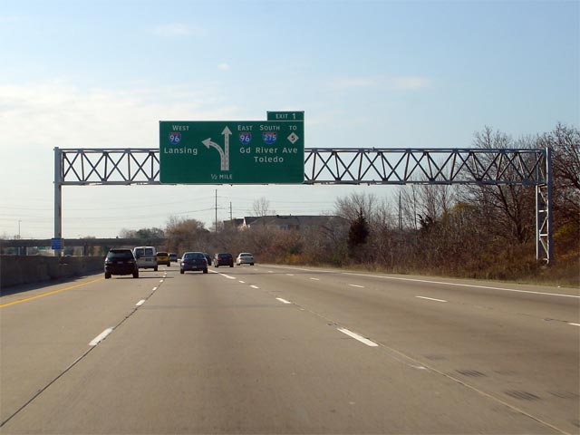
Curving southward, I-696 west separates with Exit 1 in one mile. The mainline reduces to two lanes beyond the Halsted Road overpass as it defaults onto Interstate 96 west to Novi and Lansing. Photo by Scott Steeves (11/05/06).
M-5 spurs north from I-96, I-275 and I-696 by the city of Walled Lake to Pontiac Trail. The state trunk highway east joins Grand River Avenue from Farmington to the city of Detroit. Photo by Scott Steeves (11/05/06).
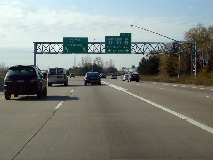
Traffic partitions for Interstate 96 west to Lansing and I-96/275 south to Livonia and Toledo. I-696 merges onto I-96 west in 1.75 miles. Photo by Scott Steeves (11/05/06).
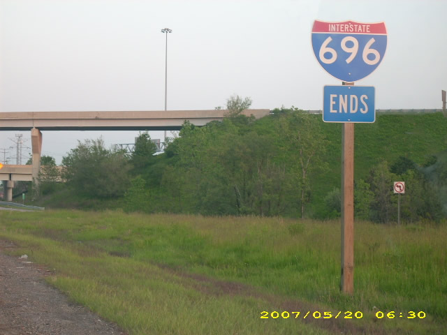
An end shield formally marks the conclusion of Interstate 696 west at the gore point with I-96 west. Ramps passing above link M-5 (Haggerty Connector) with I-96. Photo by Frank Gillon, Jr. (05/20/07).
![]() West at
West at ![]()
![]()
![]()
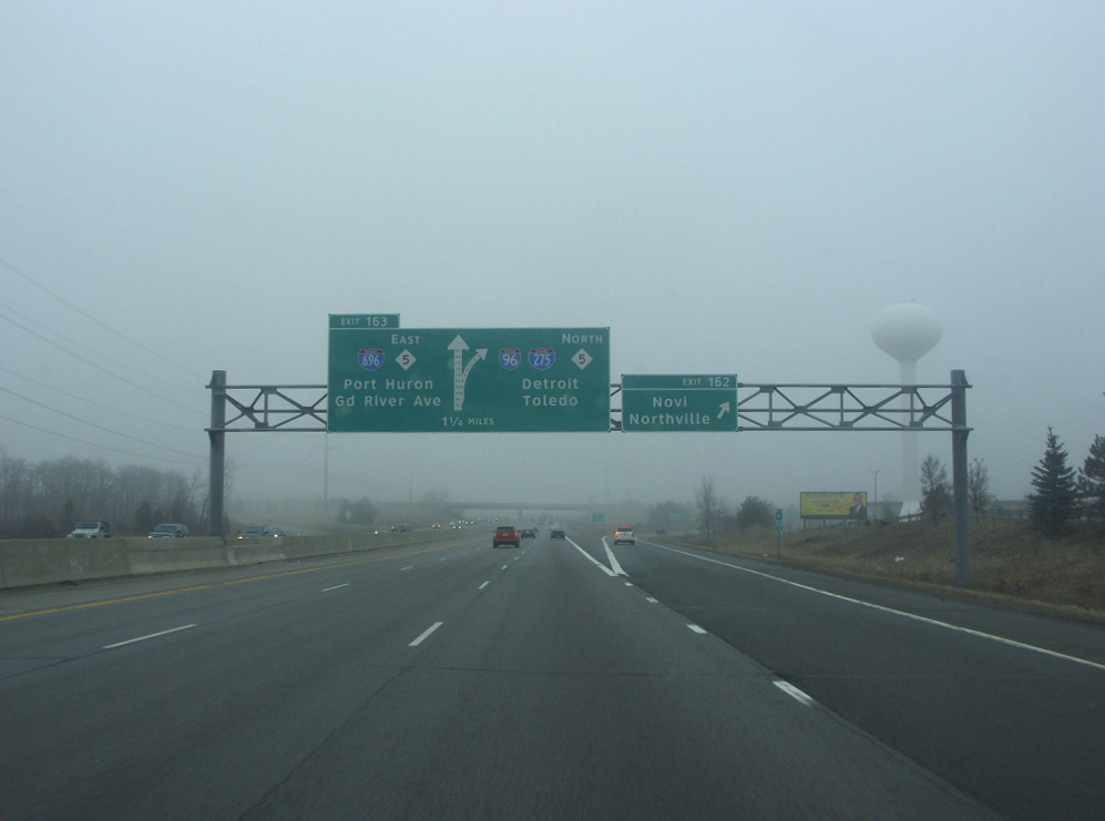
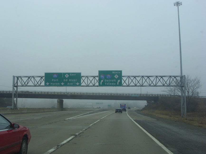
Three lanes continue east from Interstate 96 onto I-696 (Walter P. Reuther Freeway) at Exit 163. Prior to 1976, I-96 ran east over what is now the M-5 freeway spur leading southeast to Grand River Road. The route was realigned then to overlap with I-275 southbound when it opened between Novi and the Jeffries Freeway at M-14. Photo by Doug Kerr (03/07/09).
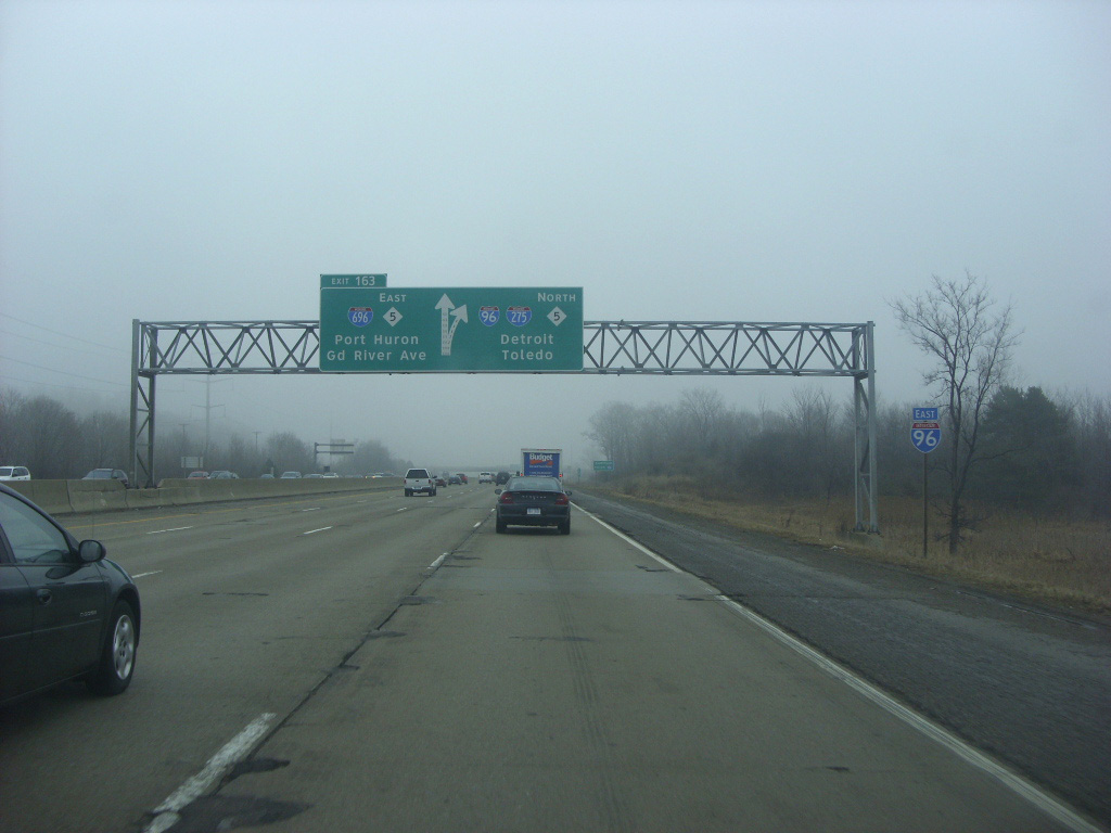
Nearing the split of I-696 east from I-96 east. Interstate 696 opened initially from M-5 (old I-96) east to the Lodge Freeway (M-10) in 1963. The Lodge Freeway historically carried Business Spur I-696 southeast from Southfield into Detroit until 1970. Photo by Doug Kerr (03/07/09).
Interstate 96 east joins the southbound beginning of I-275 from Farmington Hills to Livonia. I-96 turns east there along the Jeffries Freeway to Detroit while I-275 continues south to Romulus and I-75 near Monroe. Photo by Doug Kerr (03/07/09).
![]() West
West ![]() North at
North at ![]()
![]()
The first in a series of diagrammatic signs on I-96/275 north for the I-696 (Walter P. Reuther Freeway) and M-5 was posted at Exit 167 to Eight Mile Road. Separate panels for the I-96 and the exit for I-696/M-5 (Grand River Avenue) were installed here by 2011. 11/07/09
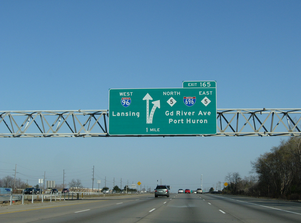
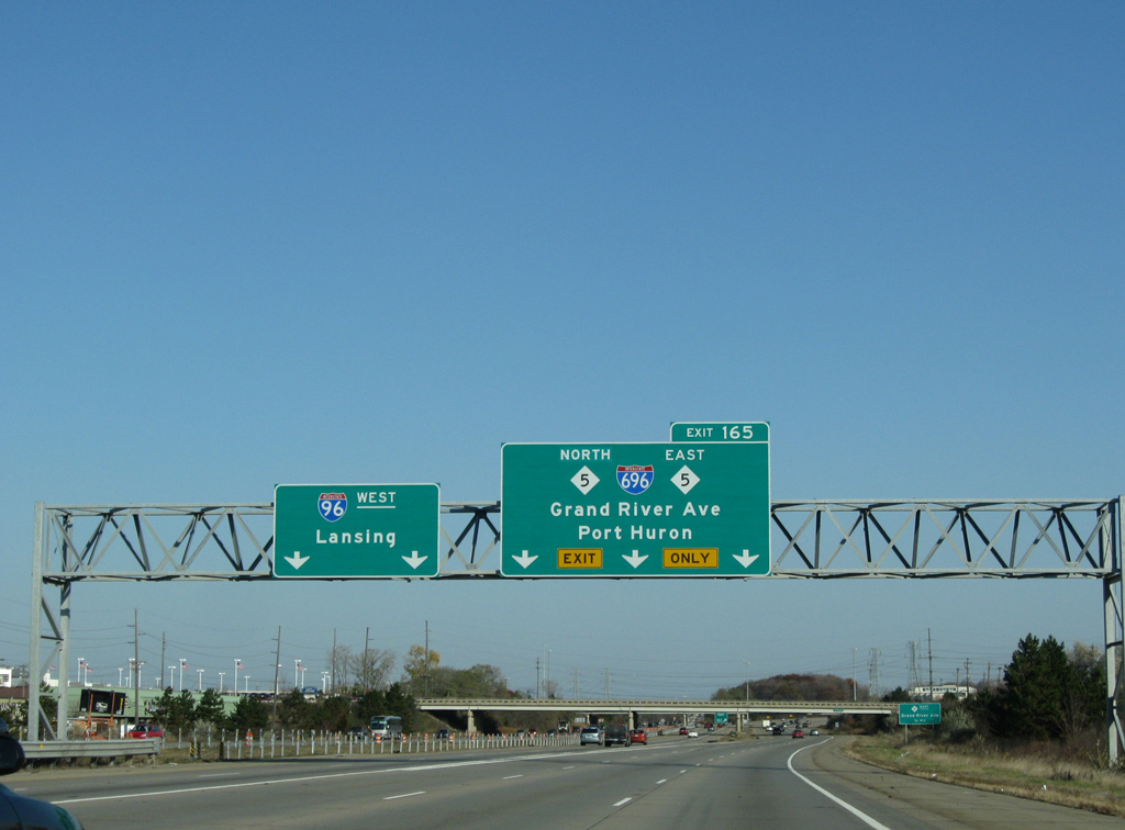
Nearing the Nine Mile Road underpass, I-96/275 partition in one mile into separate roadways. The c/d roadway for I-696 east and M-5 was formerly Exit 165 and is now unnumbered. 11/07/09
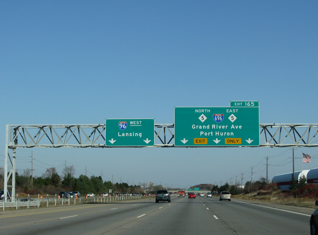
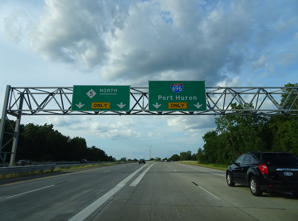
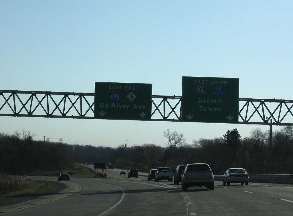
Separate panels were installed on this sign bridge by 2011, showing a single lane for M-5 north and two lanes for I-696 east to Port Huron (via I-94 east) and M-5 south to Grand River Avenue. 11/07/09
Interstate 275 north ends as I-96 west separates with a long collector distributor roadway joining the freeway with M-5 east to Farmington and Grand River Avenue, I-696 east to Southfield and Warren and M-5 north to Novi and Walled Lake. 11/07/09
The c/d roadway splits with the exit for M-5 east to Grand River Avenue while two lanes progress northward to Interstate 696 east. Grand River Avenue through Farmington was signed as Business Loop I-96 until 1976. 11/07/09
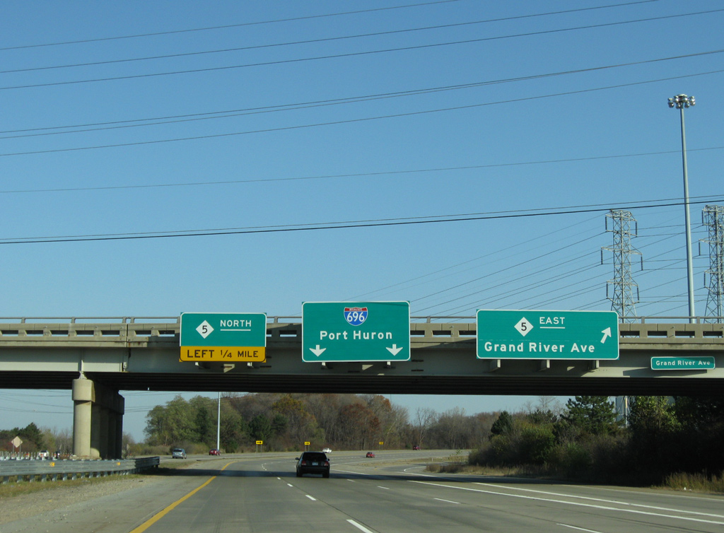
Exit 165 splits again before passing over the M-5 mainline for Interstate 696 east toward Port Huron (via I-94 east) and M-5 north to Pontiac Trail in Commerce Township. Photo by Eric Stuve (07/09/17).
![]() South at
South at ![]()
![]()
![]()

M-5 south transitions to M-5 east as the state trunk highway passes over Interstate 696. A slip ramp joins the freeway with I-96 east / I-275 south. 11/07/09
Two lanes part ways with M-5 south for the beginning of Interstate 275. I-275 extends south from I-96 at M-14 near Plymouth to I-75 north of Monroe. 11/07/09
M-5 south combines with an entrance ramp from I-696 east to pass under Haggerty Highway and a ramp from I-696 west to I-275 south. 11/07/09
Two lanes carry M-5 southeast to Farmington Hills and Farmington while motorists bound for I-696 east loop onto the I-275 northbound exit ramp for the Walter P. Reuther Freeway east. 11/07/09
Sources:
- Michigan Highways: Highways 250 through 696 (Chris Bessert).
- “Detroit freeway’s final link opened.” Toledo Blade (OH), December 15, 1989.
Page updated July 26, 2021.