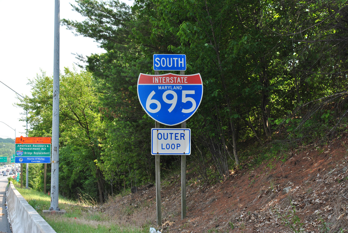
Interstate 695 Maryland
Overview
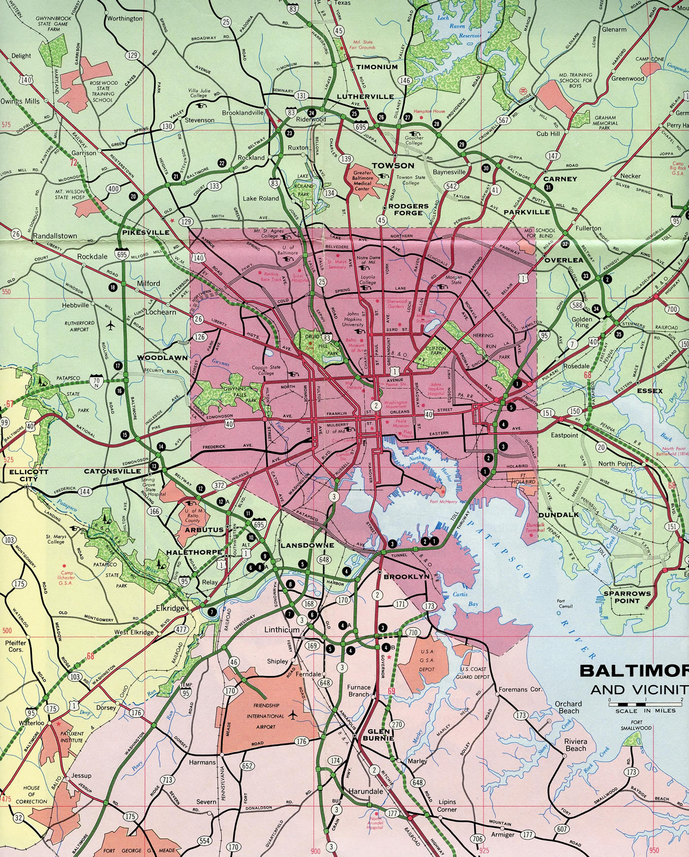
A heavily traveled freeway, Interstate 695 encircles Baltimore as both a busy commuter route and a truck bypass. Milepost 0 is located at the double leaf bascule on the Curtis Creek Bridges at Hawkins Point in Baltimore city. The Baltimore Beltway uses a sequential exit numbering system due to the close proximity of interchanges.
The entire 51.51 mile1 long Baltimore Beltway is signed as Interstate 695. The Maryland Department of Transportation (MDT) 2016 Highway Location Reference (HLR) logs attribute 29.17 miles to IS 695 in Baltimore County, including the 1.52 mile overlap with IS 83, and 2.92 miles in Anne Arundel County. This figure represents the beltway from Interstate 97 near mile marker 3 clockwise to I-95 at Rossville (Exit 33).
MD 695 extends the beltway 11.366 miles south from I-95 to the Baltimore city line past mile marker 48. MD 695 resumes along the Beltway another 2.48 miles west from the city line, from a point 0.16 miles ahead of MD 710, to Exit 4 with I-97 south. 3.34 miles of I-695 fall within the city of Baltimore, including the 1.6 mile long Francis Scott Key Bridge. The toll bridge across the Patapsco River is maintained by the Maryland Transportation Authority (MDTA).
#BREAKING: Complete collapse of Francis Scott Key Bridge in Baltimore, MD, after cargo ship seemingly crashes into support column.
Full before & after CCTV incoming. pic.twitter.com/lMQG460Yhn
— Moshe Schwartz (@YWNReporter) March 26, 2024
The entire truss portion of the Francis Scott Key Bridge collapsed into the Patapsco River on March 26, 2024 when the cargo ship Dali collided with one of the main pier supports of the span. The accident occurred around 1:20 AM EDT, approximately 20 minutes after the ship departed from the Port of Baltimore. Video of the incident shows a visible loss of power on the ship twice before impact. Several motorists were traveling across the bridge at the time.5
 History
Began as a county project, the Baltimore beltway originated in planning as early as 1949. Taken over by the state in 1953 and added to the Interstate system by 1956, the beltway was three quarters complete by 1962. Portions of the Windlass and Patapsco Freeway projects were incorporated into the southeastern quadrant by 1974.2
Route Information
East End – Rosedale, MD
West End – Arbutus, MD
Mileage – 30.57 (51.5061)
Cities – Baltimore
- Junctions –


Source: December 31, 2021 Interstate Route Log and Finders List
I-695 Annual Average Daily Traffic (AADT)
The Baltimore Beltway was completed north from MD 2 in Anne Arundel County to U.S. 40 (Pulaski Highway) east of Baltimore in 1962. The next portion to open was the Southeast Freeway between Pulaski Highway and MD 150 (Eastern Boulevard) in 1972.2 This section was later dropped as part of the Beltway mainline, with I-695 shifting westward along portions of the Winlass and Patapsco Freeways.

The Baltimore Beltway was vastly complete in 1976 with the exception of the Francis Scott Key Bridge and its approaches, which opened a year later. Signs for the beltway displaying MD 695 were later replaced with tri-color Interstate markers for continuity purposes.

Button copy overhead for I-95 on Interstate 695 northbound at the parclo interchange with MD 7 (Exit 34). September 1993
The official route of Interstate 695 ran along the northern portion of the Baltimore Beltway. As approved by the American Association of State Highway and Transportation Officials (AASHTO) on November 15, 1975, the Interstate portion was lengthened from a point south of Baltimore to the Anne Arundel Expressway (MD 10). The Francis Scott Key Bridge was the final segment built along the overall beltway. Discussion for a second Patapsco River crossing in Baltimore started in the early 1960s as a solution to traffic congestion along the Baltimore Harbor Tunnel (Interstate 895). A tunnel was proposed, and bids for construction were accepted on July 30, 1970. However due to substantial costs, officials shifted plans from a tunnel to a four lane bridge.3
Construction on the Francis Scott Key Bridge commenced in 1972. Costing $60.3 million, the 10.9 mile project included the steel arch-shaped continuous through truss bridge over the Patapsco River, the 0.64 mile long dual span drawbridge over Curtis Creek, and the 0.74 mile long spans over Bear Creek, east of Coffin Point. Topping out at 185 feet, the Francis Scott Key Bridge opened to traffic on March 23, 1977.3
The Francis Scott Key Bridge approaches were constructed with two overall lanes. The western section was expanded a short time after the span opened. The eastern segment through the Sparrows Point industrial area was not expanded to four lanes until November 1999.2
Expansion plans underway in the early 2000s estimated $800 million in funds needed for widening two sections of the Baltimore Beltway. Options considered including adding Express Toll or High Occupancy Toll (HO/T) lanes with variable rates based upon traffic congestion and time of day. Sections outlined for widening from six to eight lanes included the Beltway north from I-95 at Halethorpe to MD 122 (Security Boulevard) at Woodlawn and I-695 east from I-83 near Towson to I-95 near Overlea.4 HO/T lanes were not implemented along the Beltway at that time.
Construction in the mid 2000s widened the northern portion of the beltway between I-795 (Northwest Expressway) and Interstate 83 to eight lanes and added sound barriers. Other expansion projects along the Beltway in 2004 included reconstructing the Liberty Road interchange (Exit 18) and adding a southbound lane between Frederick Road (Exit 13) and Interstate 95 (Exit 11). MD 43 (White Marsh Boulevard), which provides an alternate route from I-695 east to I-95 north at White Marsh, was extended to Eastern Avenue (MD 150) by 2006.4
 Photo Guides
East End  – Rosedale, Maryland
![]() North at
North at ![]()
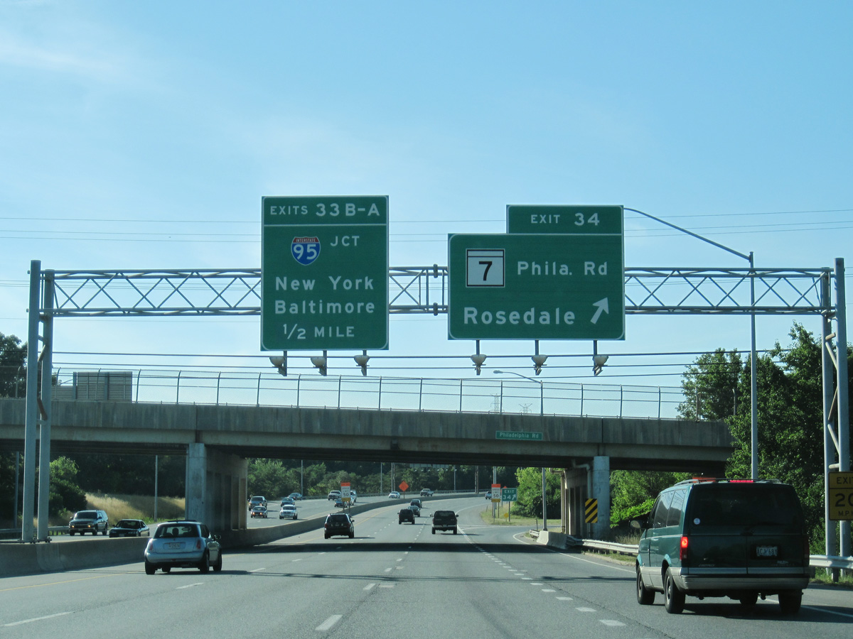
Interstate 695 advances a half mile north from MD 7 (Philadelphia Road) to the systems interchange (Exit 43) with I-95 by Rossville. 07/02/10
![]() South at
South at ![]()
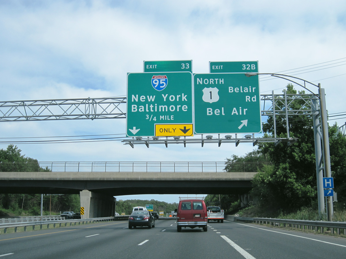
A cloverleaf interchange (Exit 32) joins Interstate 695 with U.S. 1 (Bel Air Road) at Overlea, 0.75 miles north of the exchange with I-95. 06/30/10
Construction from 2008 to 2014 rebuilt the substandard junction at I-95/695 into a systems interchange. Work coincided with the addition of tolled Express Lanes along I-95 between I-895 and MD 43 (White Marsh Boulevard). 06/30/10
![]() North at
North at ![]()
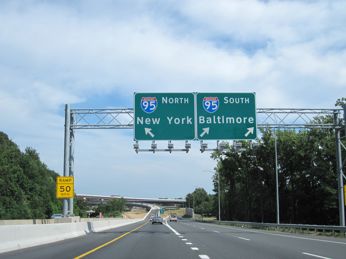
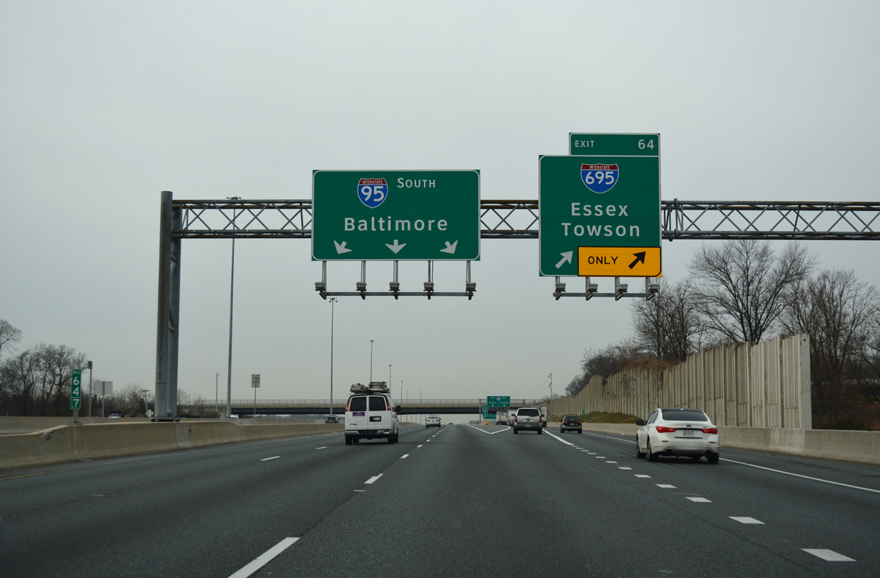
Interstate 95 and the I-95 Express Lanes extend north from the merge with I-895 (Harbor Tunnel Thruway) and through the community of Rosedale to meet the Baltimore Beltway at Exit 64. 01/04/19
Three lanes depart from the Interstate 95 general travel lanes northbound for the Beltway inner loop to Essex and Dundalk and the outer loop to Overlea and Towson. 01/04/19
![]() South at
South at ![]()
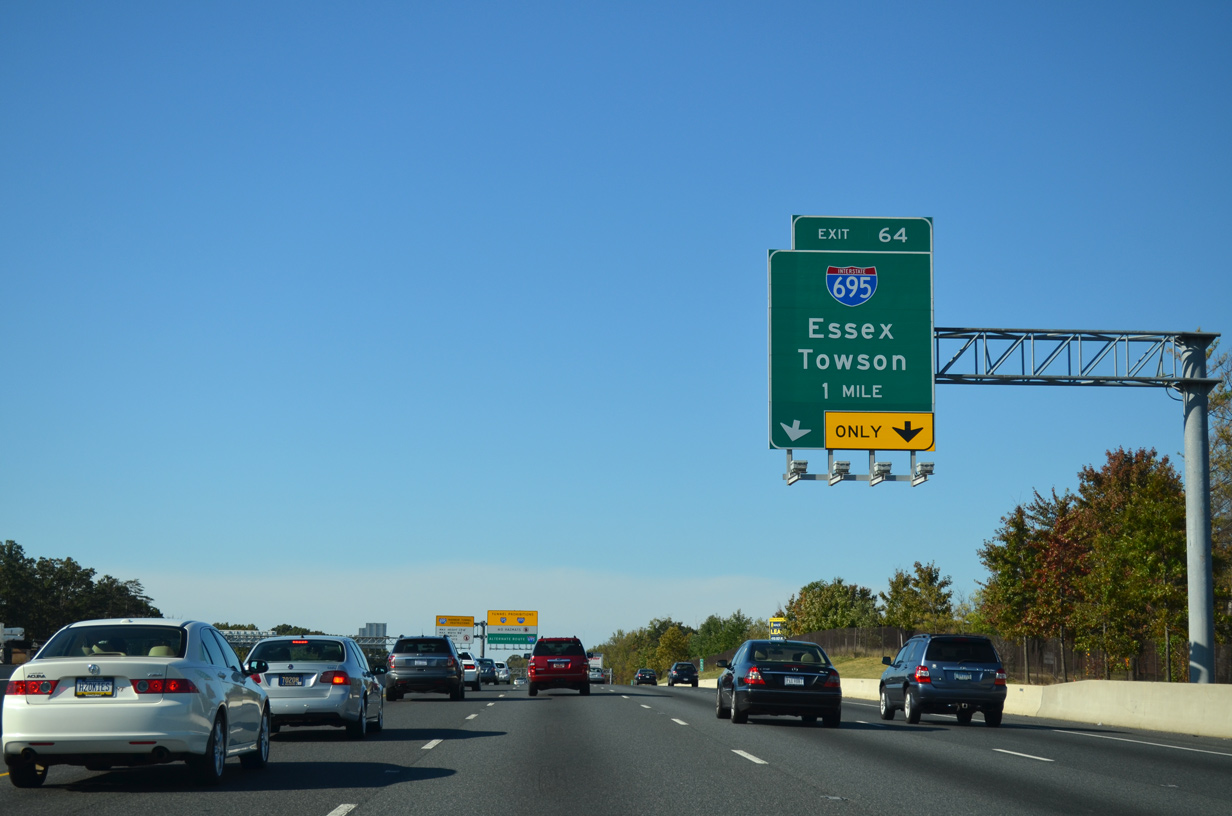
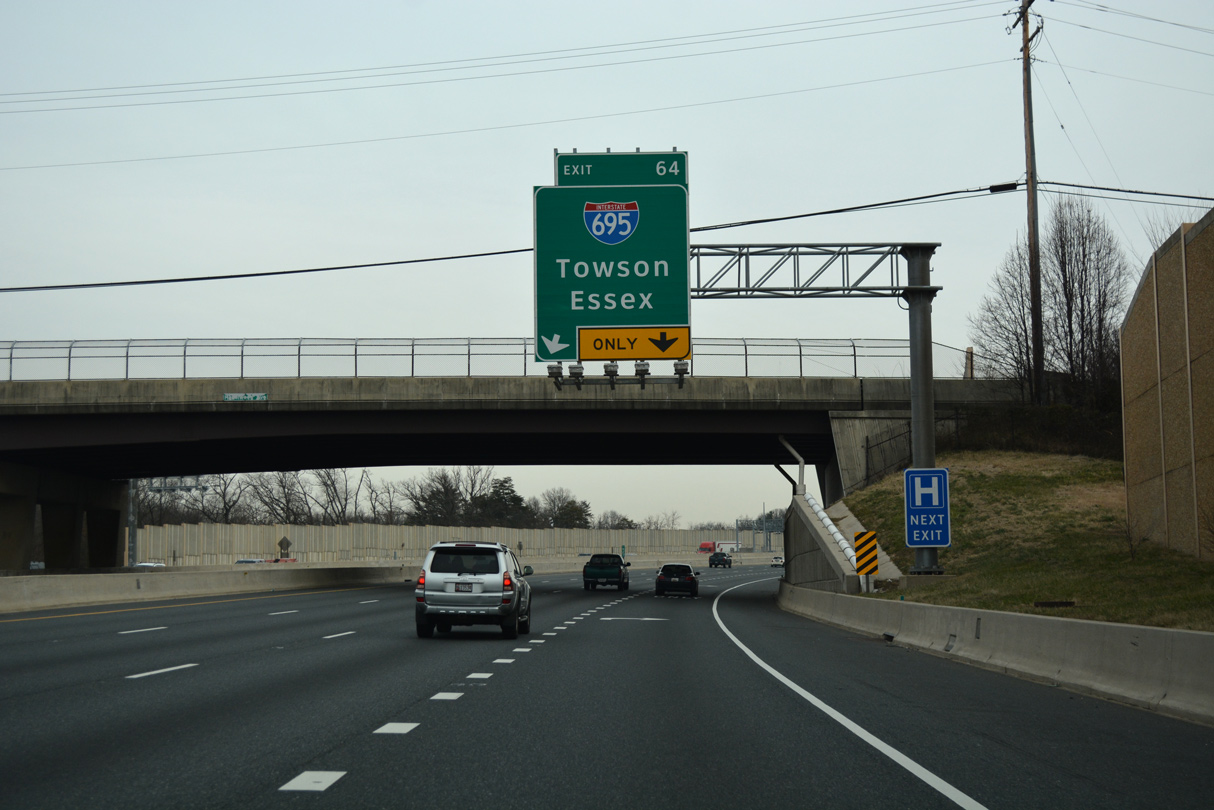
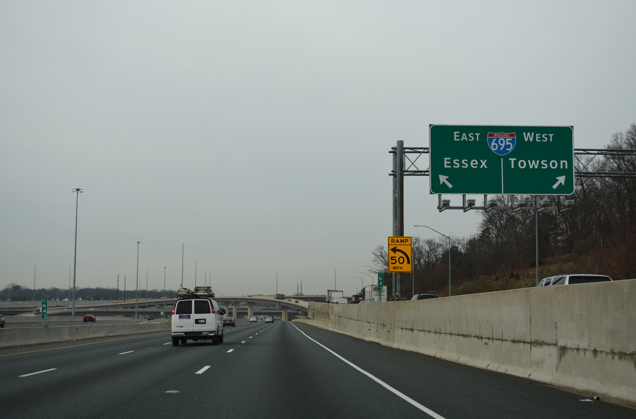
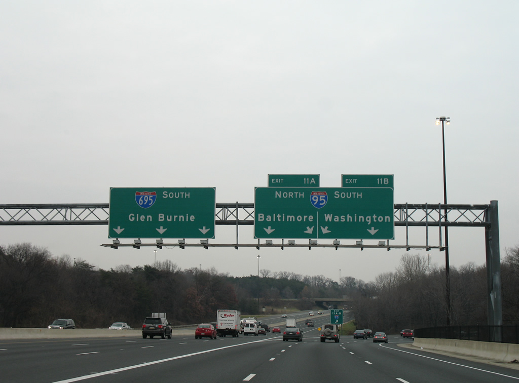
Exit 64 joins I-95 with I-695 south to Essex, Dundalk and the Francis Scott Key Bridge west to Glen Burnie. 10/12/14
Exit 64 leaves Interstate 95 southbound ahead of the Rossville Boulevard overpass for the Baltimore Beltway. 01/04/19
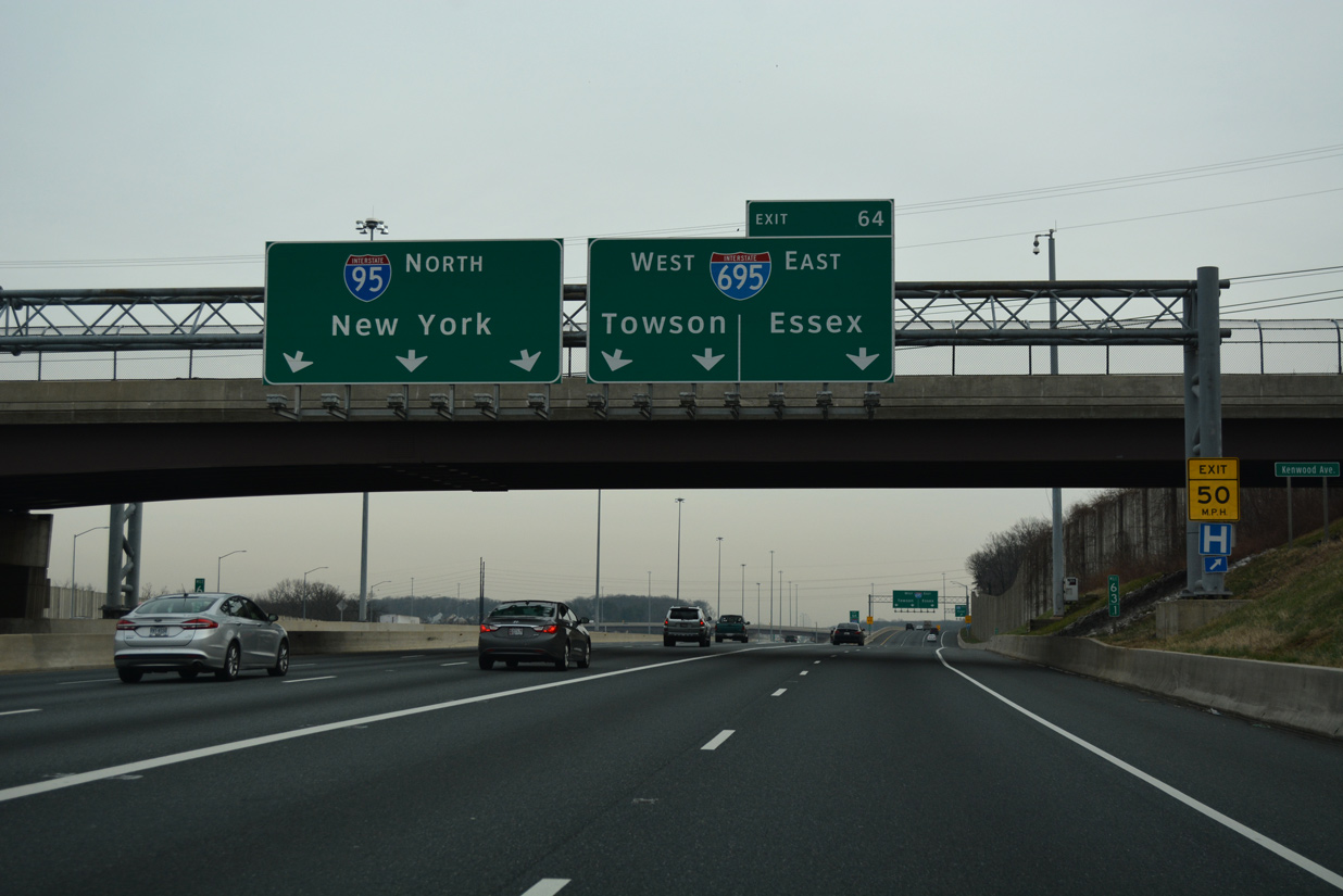
Interstate 695 encircles the north side of Baltimore from I-95 to Parkville, Towson and Pikesville. 01/04/19
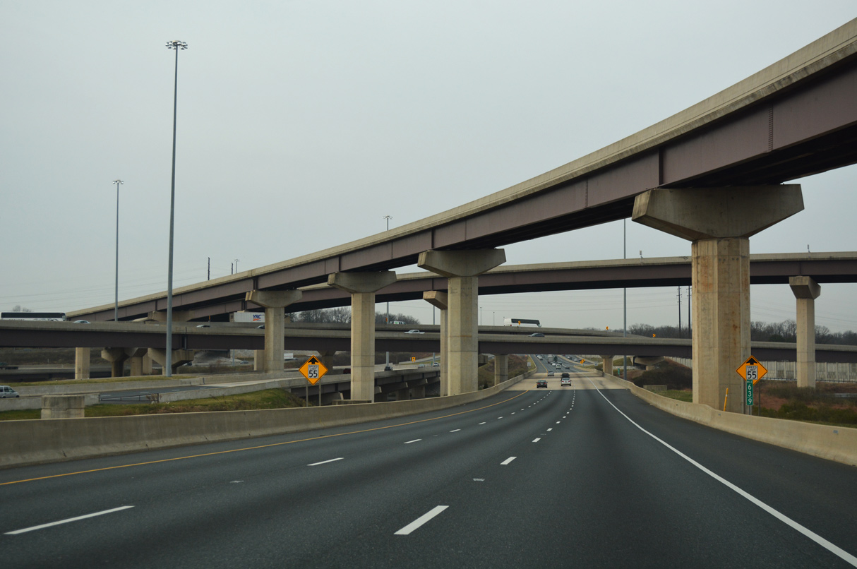
High flyovers span both I-95 and the Baltimore Beltway at the multi level exchange between the two freeways. 01/04/19
West End – Arbutus, Maryland
![]() North at
North at ![]()
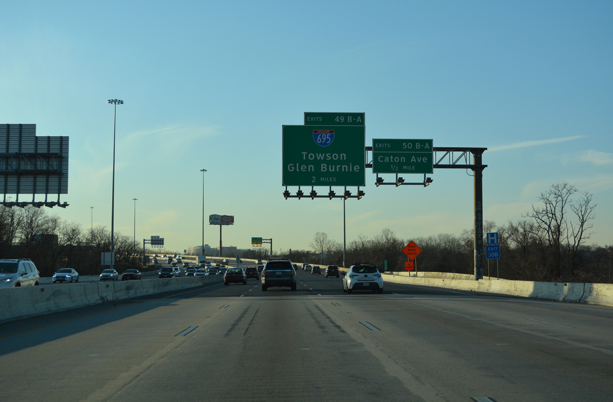
A fourth lane opens northbound along I-695 from the Washington Boulevard (U.S. 1 Alternate) entrance ramp to Exit 11 A for Interstate 95 north. Exit 11 B follows as a loop ramp for I-95 south. 12/21/22
![]() South at
South at ![]()
Interstate 695 southbound spans Southwestern Boulevard (U.S. 1), AMTRAK and Benson Avenue with six lanes. Three separate at Exit 11 for I-95 north into Baltimore and southwest to Laurel and Washington, DC. 12/28/07
![]() North at
North at ![]()

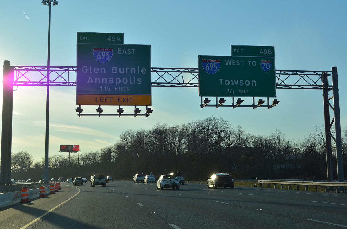
Interstate 95 enters the directional cloverleaf interchange (Exit 49) with the Baltimore Beltway beyond the Sulphur Springs Road underpass at Arbutus. Left Exit 49B links with the I-695 north to Pikesville and Towson. 06/20/12
![]() South at
South at ![]()
Leading away from the Inner Harbor of Baltimore, I-95 passes north of the Morrell Park neighborhood, two miles ahead of Interstate 695. 12/21/22

Located 1.25 miles ahead of I-695 in Baltimore, ramp stubs at Desoto Road were built along I-95 for the planned east end of Interstate 70. 12/21/22
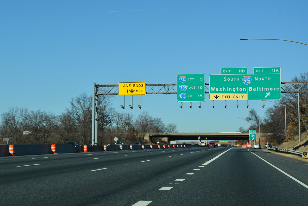
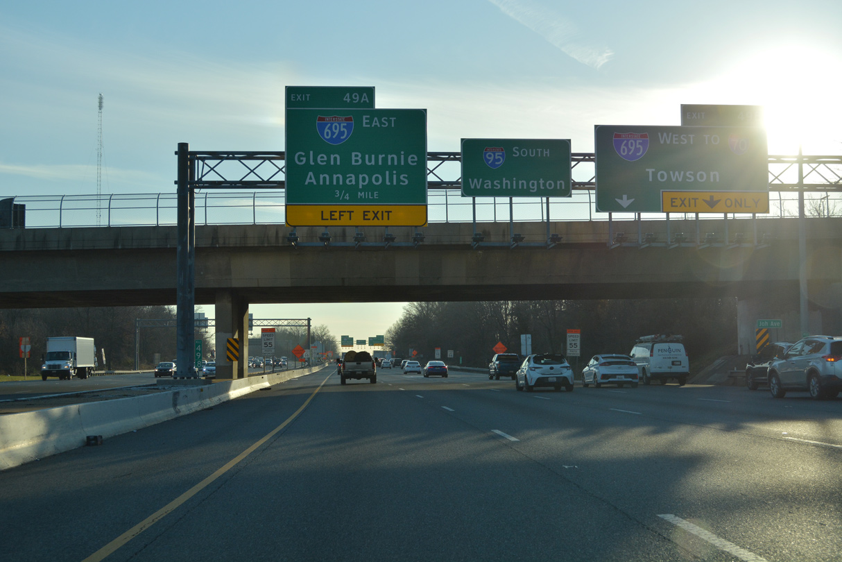
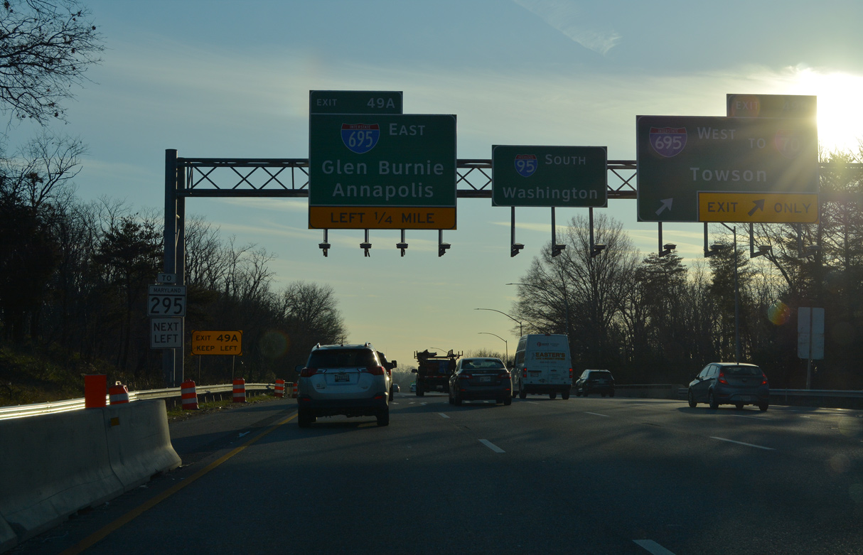
Left Exit 49 A links Interstate 95 south with I-695 east to Halethorpe, Landsdowne and I-97 south for Glen Burnie and Annapolis in Anne Arundel County. 12/21/22
I-95 leaves the city of Baltimore at the Joh Avenue overpass preceding the exchange with Interstate 695. 12/21/22
Exit 49 B leaves I-95 south for I-695 (Baltimore Beltway) west to I-70 for Frederick. 12/21/22
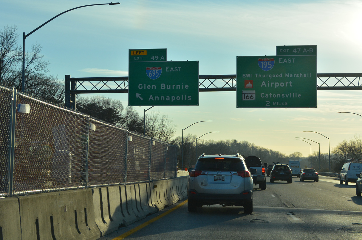
Left Exit 49 A departs I-95 south for I-695 east two miles ahead of Interstate 195 to BWI Thurgood Marshall International Airport. 12/21/22
Sources:
- Maryland Interstate and Beltway Mileage Report, Maryland Department of Transportation (MDOT), December 31, 2020.
- MDRoads: I-695.
- Francis Scott Key Bridge (I-695) mdta.maryland.gov.
- “Tolls may help fund Beltway expansion.” Baltimore Sun (MD), November 14, 2003.
- “Key Bridge collapses into Patapsco River in Baltimore after vessel hits support column; state of emergency declared ” The Baltimore Sun (MD), March 26, 2024.
Page updated March 26, 2024.