Interstate 695 District of Columbia

Overview
Located wholly within the District of Columbia, Interstate 695 connects I-395 at the Center Leg and Southwest Freeways with the Anacostia Freeway (I-295 / D.C. 295) across the 11th Street Bridge. Following the Southeast Freeway, I-695 links central Washington with the Navy Yard district, Southeast Washington and Joint Base Anacostia-Bolling.
Signs installed by November 2011 during the 11th Street Bridge project revealed the signed status of Interstate 695. The Interstate was previously an unsigned route.
Interstate 695 will be replaced by an realignment of I-395 eastward from the Center Leg Freeway onto the Southeast Freeway. Approved by the American Association of State Highway and Transportation Officials (AASHTO) in November 2020, the change cited a high frequency of accidents due to motorist confusion at the exchange joining the Southwest, Southeast and Center Leg Freeways, where the primary lanes of I-395 north become I-695 east. I-395 along the Center Leg Freeway will be renumbered as Interstate 195.
Virginia Avenue Tunnel
A $250 million project reconstructed the 3,800 foot long CSX Railroad tunnel between Virginia Avenue SE adjacent to Interstate 695 between 2nd and 11th Streets. Two single track tunnels accommodating double-stacked freight cars were built simultaneously. The new facility removed a bottleneck along the freight corridor and supports train speeds to 40 miles per hour. Following completion of the tunnels, Virginia Avenue was rebuilt with added bike paths, wider sidewalks and improved lighting.1 The first 4,100 foot long cut and cover tunnel began operations in December 2016. Phase two of the project finished in January 2019.2
Route Information
East End – Washington, DC
West End – Washington, DC
Mileage – 2.00
Cities – Washington
- Junctions –

Source: December 31, 2018 Interstate Route Log and Finders List
I-695 Annual Average Daily Traffic (AADT)
| Location | Vehicles per day |
|---|---|
| I-395 to 11th Street Br | 155,700 |
| 11th Street Br | 77,100 |
Source: Traffic Volume Map 2018 – District Department of Transportation
Interstate 695 spans the Anacostia River northwest from I-295/D.C. Route 295 (Anacostia Freeway) to the Southeast Freeway at the Navy Yard district in Washington. 12/16/16
 History
Interstates 295 and 695 were approved in 1958 as original Interstate highways in Washington, D.C. I-695 was approved along both the Southwest Freeway, from I-66 to I-95 west of the National Mall, and the Southeast Freeway from the Center Leg Freeway (I-95) to Interstate 295. I-295 was assigned to the Anacostia Freeway and the 11th Street Bridge north to I-695 along the Southeast Freeway.
Other Interstate highways proposed within Washington, DC included:
- Interstate 66 (Potomac River Freeway and North Leg Freeway) was planned for an extension from U.S. 29 (Whitehurst Freeway) east to I-95, with connections to the U.S. 50 freeway en route to Annapolis.
- Interstate 95 was originally planned to run through the district, via I-395 (Southwest Freeway / Center Leg Freeway) to U.S. 50, then north along a new alignment to the existing northern I-95 interchange with the Capital Beltway.
- Center Leg Freeway – Interstate 395 between I-695 (Southeast Freeway) and U.S. 50 – groundbreaking in 1966 and open to traffic on November 5, 1973.3
- Continuation of the Center Leg Freeway north to meet I-66 (North Leg Freeway) and the Capital Beltway was never constructed. Some of the former freeway right of way coincided with a power transmission corridor.
- Interstate 266 – an urban loop connecting I-66 across the Three Sisters Bridge over the Potomac River. I-266 was proposed in 1964 and was dead by 1977 due to community opposition.
- Interstate 270 / Interstate 70S was planned for an extension from the Capital Beltway (I-495) southeast into Downtown Washington roughly parallel to MD 355 (Old U.S. 240). Corridors considered for the unconstructed route included a continuation of the Potomac River Freeway north from I-66 and the Northwest Freeway.4
- Interstate 295 (East Leg Freeway) – from I-695 (Southeast Freeway) north to Barney Circle and unbuilt I-95
Due to the elimination of various freeway proposals throughout Washington, D.C., Interstate 295 was eventually shortened to end at I-695 (Southeast Freeway) on the north side of the Anacostia River. The anti-freeway revolt in the 1960s and 1970s also resulted in the cancellation of I-95 north from the Center Leg Freeway to Langley Park, Maryland and I-695 along the Southwest Freeway to I-66 (Potomac River Freeway).
A portion of the East Leg Freeway (I-295) was resurrected in a 1982 plan for the Barney Circle Freeway. The Barney Circle Freeway, which formed an arc east from the Southeast Freeway to D.C. 295 along the Kenilworth Avenue Freeway, was listed in the Federal Highway Administration Interstate Route Log and Finder’s List as part of I-295. Removed from consideration in 1996, planning documents previously referenced the freeway as Interstate 695.
Planners developed a new plan in 20075 to reconstruct the Southeast Freeway (formerly I-295) with replacement bridges over the Anacostia River and provide full movements at the interchange with the Anacostia Freeway (I-295 / D.C. 295).
The alignments for I-295 and I-695 were clarified in the District of Columbia Department of Transportation (DDOT) application submitted for the American Association of State Highway and Transportation Officials (AASHTO) meeting of May 15, 2009:6
The purpose of this request is to redesignate the 0.61 mile portion of I-295 crossing the Anacostia River to I-695 to maintain system continuity. I-695 (Southeast Freeway) begins where I-395 turns north into the 3rd Street tunnel in Southwest Washington, and continues for 1.39 miles to the interchange with I-295 at 11th Street in Southeast Washington. In 1984, the District received approval from AASHTO to redesignate I-695 to I-395, and to redesignate the portion of I-395 through the 3rd Street tunnel as I-195. However, this approval was contingent on extending I-695 across the Anacostia River and connecting to DC 295 north of Pennsylvania Avenue. Since this connection was never completed, I-695 was never redesignated. This original application will be abandoned with approval of the current request. With the pending de-designation of a portion of I-295, I-695 will no longer connect to an interstate highway at its eastern terminus. Because of this, the District is requesting to extend I-695 across the Anacostia River on the de-designated I-295 alignment to a new terminus at the end of I-295. This change will serve to rationalize the freeway system in the District and provide for interstate connections at both ends of I-695.
AASHTO approved the request to realign I-295 and I-695, contingent upon Federal Highway Administration (FHWA) concurrence. Costing $390 million, the 11th Street Bridge Project started in December 2009. All ramps between I-295, I-695 and D.C. 295 were open to traffic by August 2013, with work continuing on local connections through 2015.7
 Photo Guides
East End 
 Anacostia Freeway – Washington, D.C.
![]() East at
East at ![]()
![]()
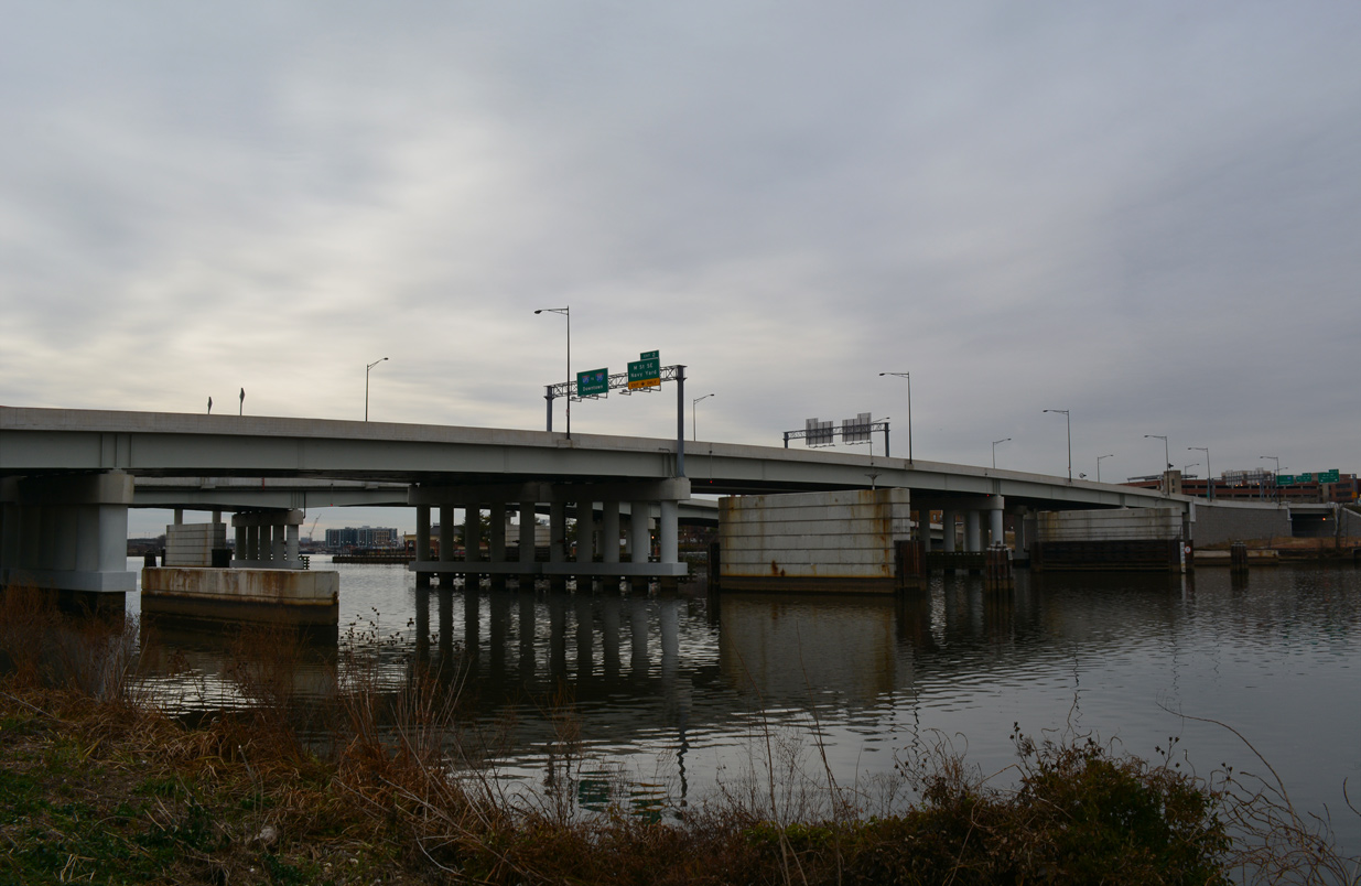
Traveling south across the 11th Street Bridge, Interstate 695 splits into two lane ramps for D.C. 295 north to U.S. 50 and I-295 south to Oxon Hill, Maryland. 12/16/16
Historically the 11th Street Bridge defaulted onto I-295 south with no access to the Anacostia Freeway north. 10/12/14
An end sign for Interstate 695 precedes the merge with the flyover from D.C. 295 south onto I-295 south. 10/12/14
![]() North at
North at ![]()
![]()
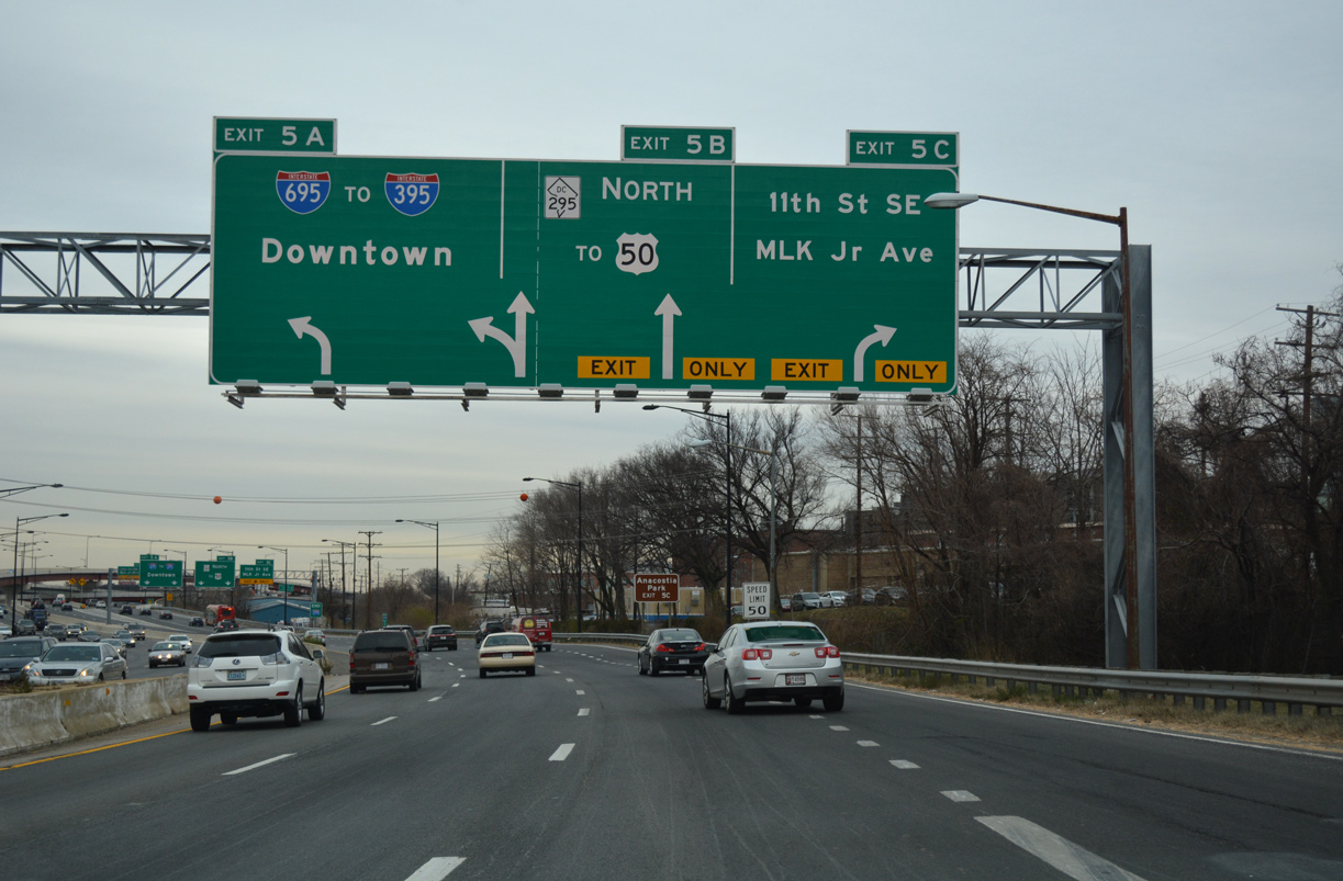
Left Exit 5A departs from I-295 north for I-695 west across the 11th Street Bridge. Exit 5 C leaves simultaneously from the outside lane for Martin Luther King, Jr. Avenue south and 11th Street SE north. 12/16/16
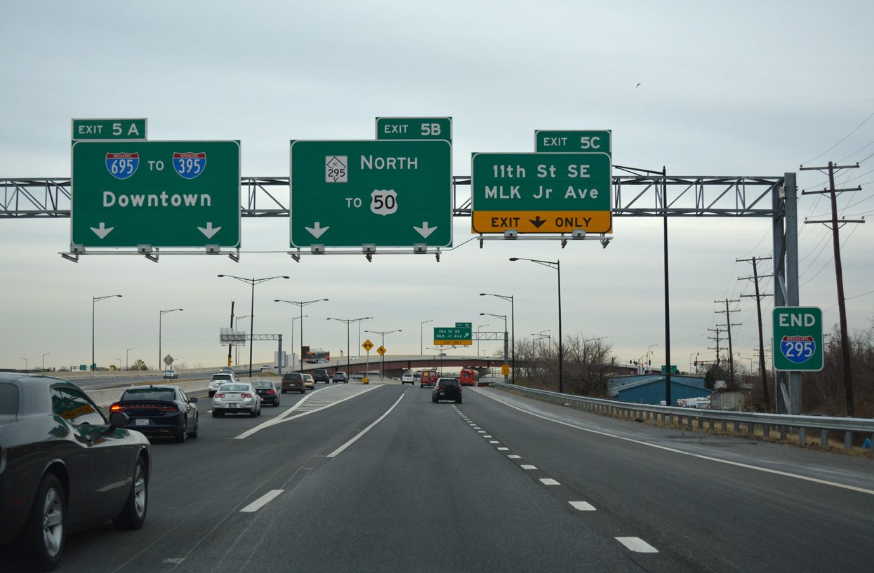
I-295 north transitions to D.C. 295 north as the Anacostia Freeway continues to E Capitol Street. Prior to 2009-13 construction, the ramp for the 11th Street Bridge (then unsigned I-295 north) exited from the right side here. 12/16/16
![]() South at
South at ![]()
![]()
Providing access to the 11th Street Bridge north from D.C. 295 south, the interchange at I-295/695 was completed in 2012. D.C. 295 transitions into I-295 south along the remainder of the Anacostia Freeway. 10/12/14
West End Center Leg Frwy – Washington, D.C.
![]() West at
West at ![]()
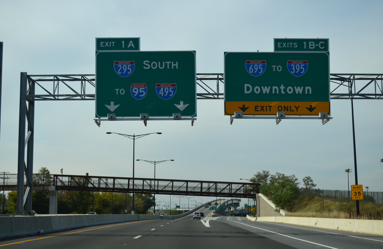
Interstate 695 concludes at a three-wye interchange with I-395 (Center Leg / Southwest Freeways) west beyond Capitol Hill. 12/27/22
Exit 1 C constitutes a bypass ramp circumventing the entrance ramp onto I-695 west from 3rd Street SE at Capitol Hill. 12/27/22
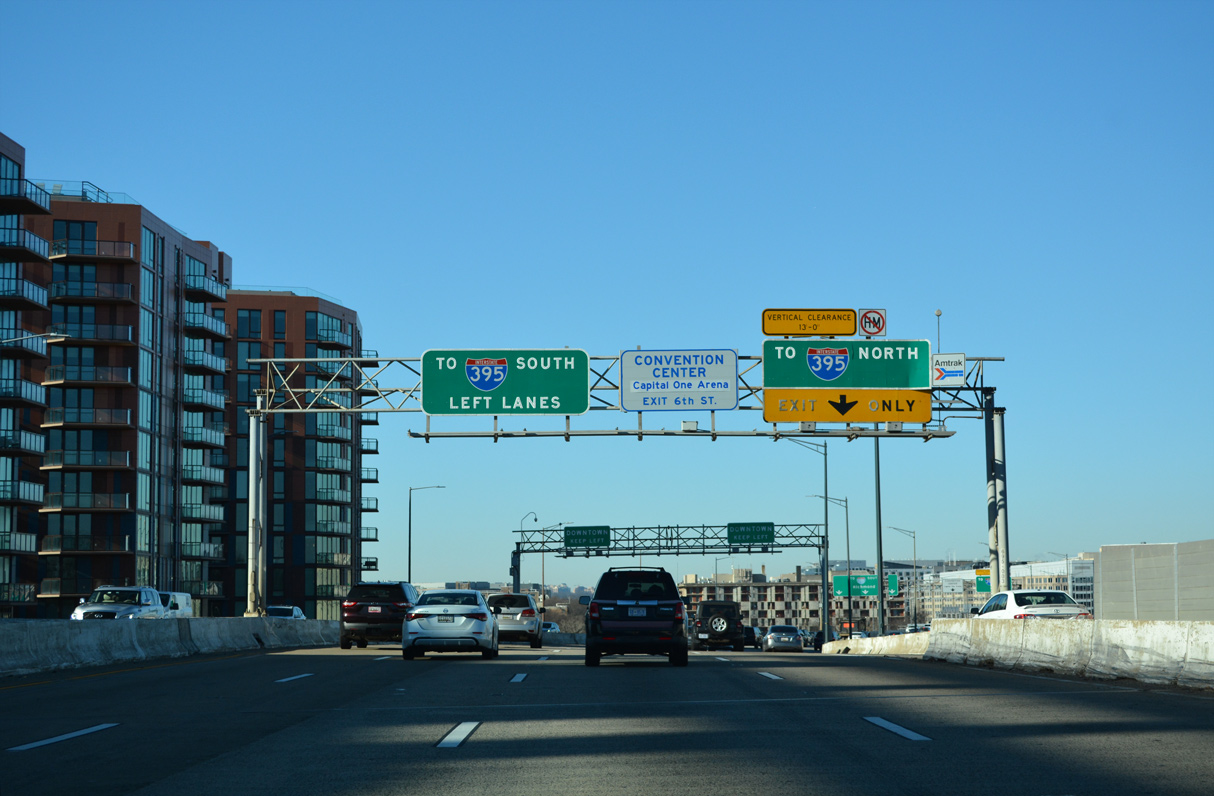
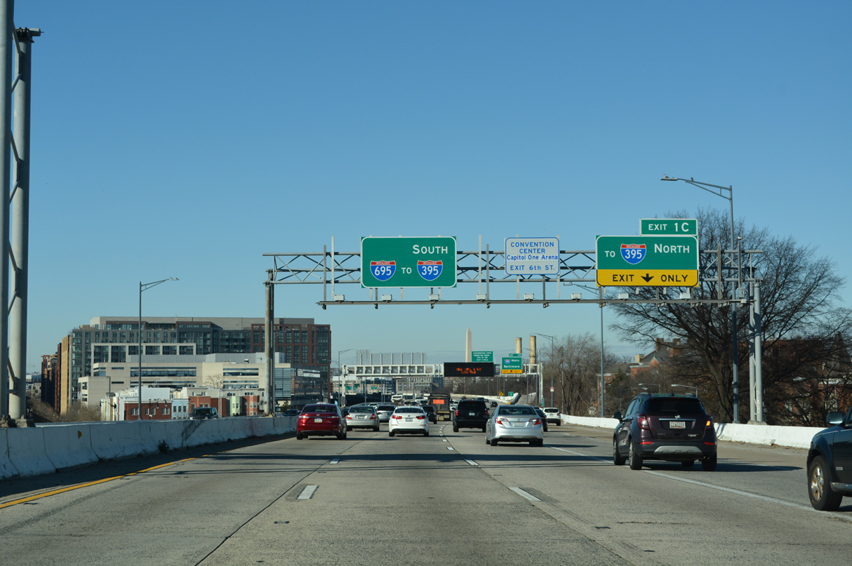
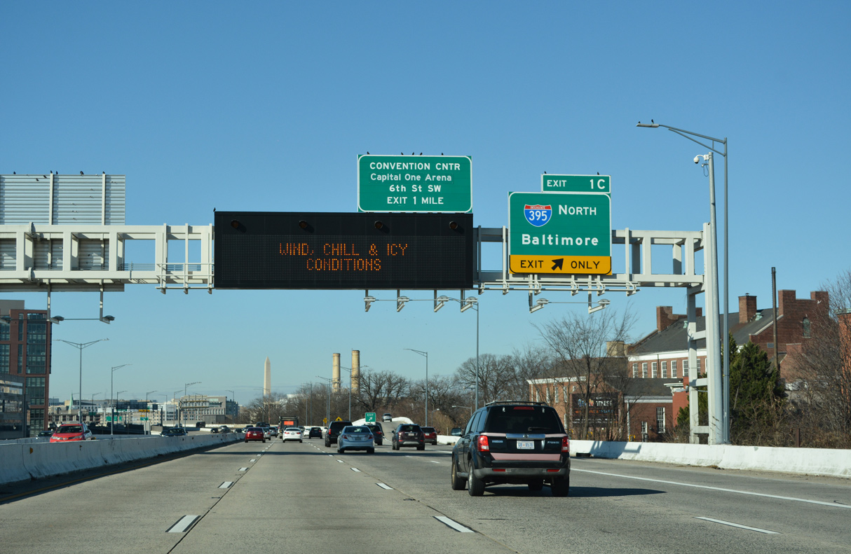
Interstate 695 (Southeast Freeway) defaults onto I-395 (Southwest Freeway) south toward Arlington, Virginia while a single lane ramp drops from the four lane viaduct onto I-395 north through the Mall Tunnel. 12/27/22
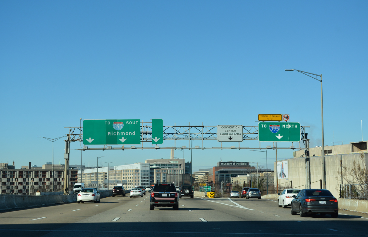
The sign for 6th Street S.W. was removed for the continuation of I-695 west onto I-395 south. I-395 travels north under the U.S. Capitol complex en route to U.S. 50 (New York Avenue) at the Mt Vernon Triangle neighborhood. 12/27/22
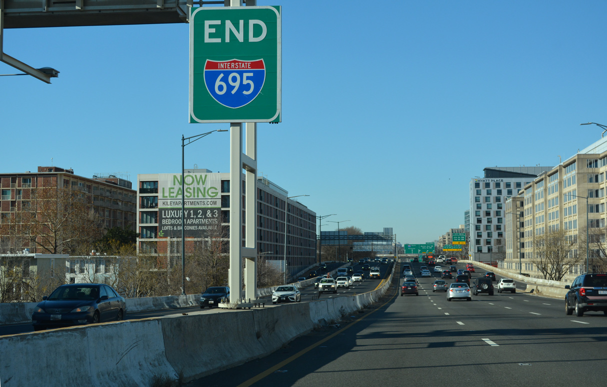
I-395 south passes south of the National Mall en route to the George Mason Bridge into Virginia. The end sign for I-695 was added by August 2014. 12/27/22
![]() North at
North at ![]()
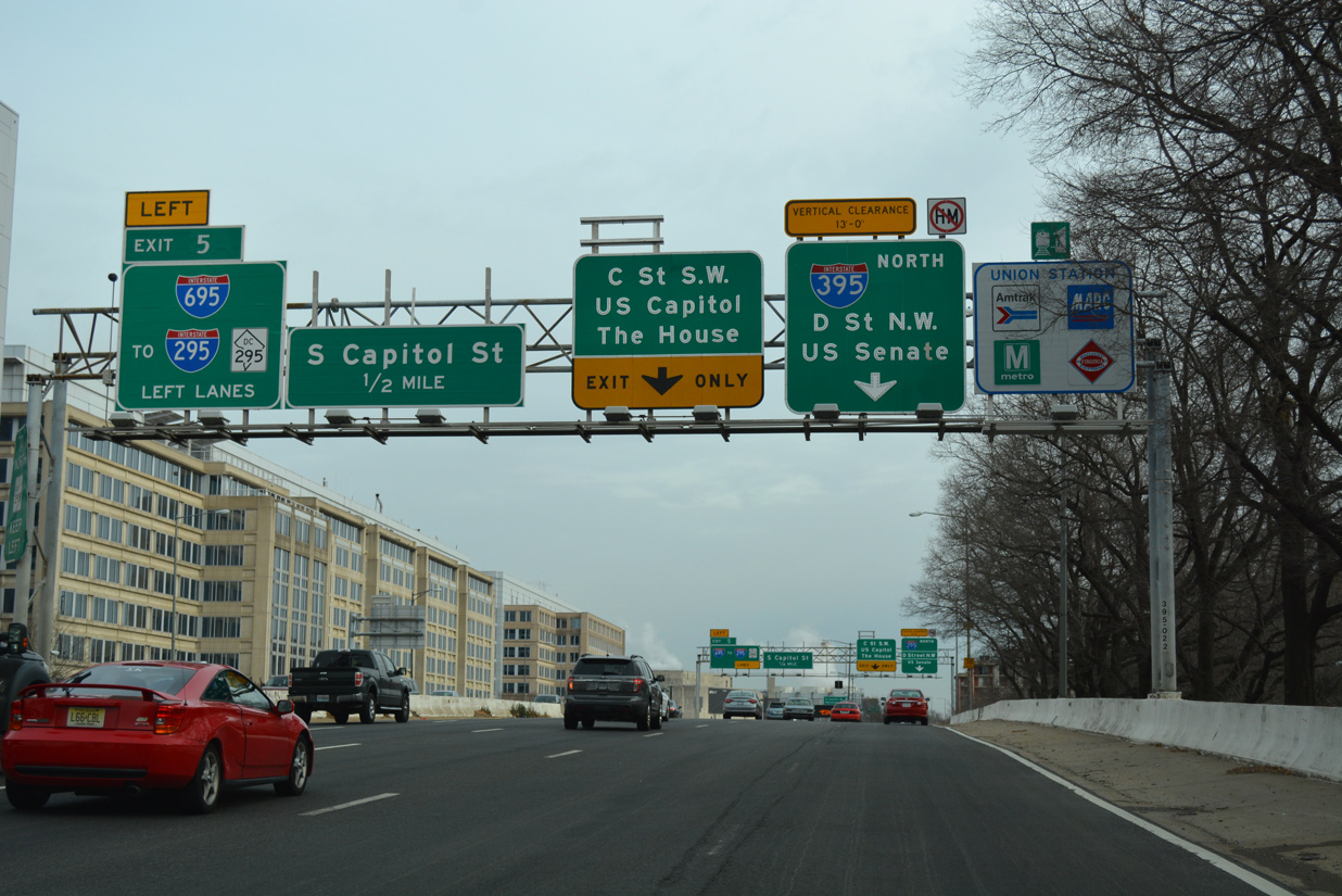
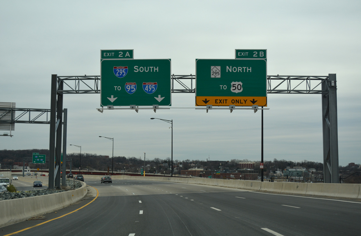
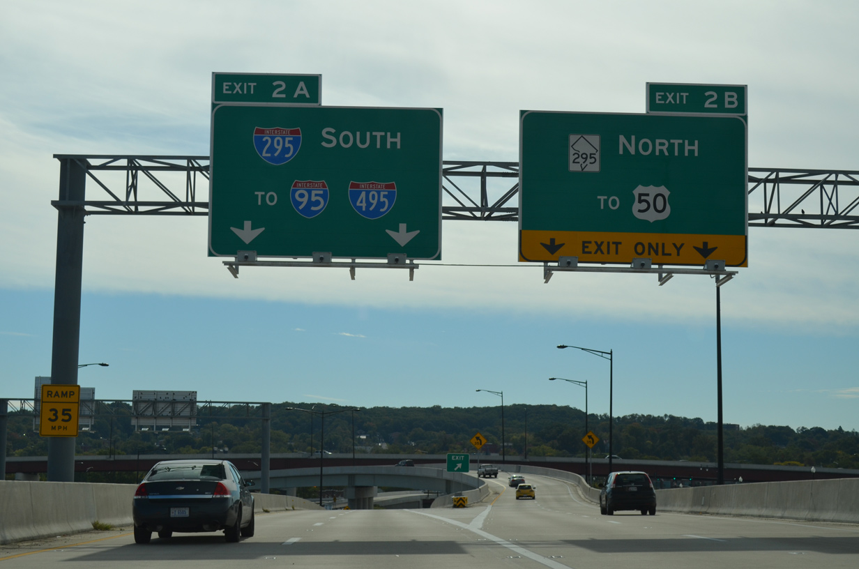
Interstate 395 (Southwest Freeway) travels below grade from L’Enfant Plaza to a viaduct spanning 4th Street SW leading to Exit 5 with I-695 (Southeast Freeway) east. 12/16/16
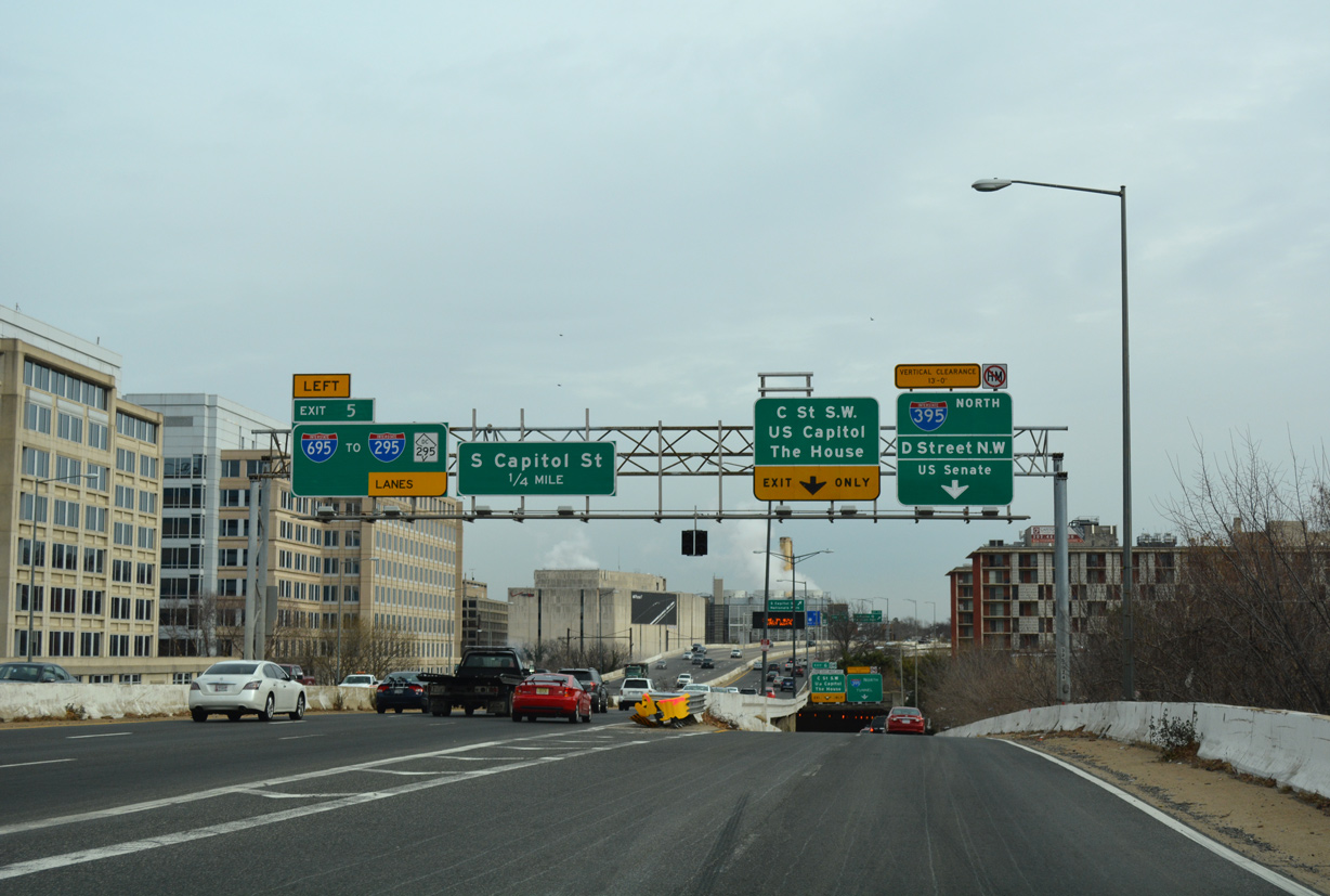
Interstate 395 curves northward onto the Center Leg Freeway as I-695 east takes over the freeway mainline toward Washington Navy Yard and the 11th Street Bridge across the Anacostia River. 12/16/16
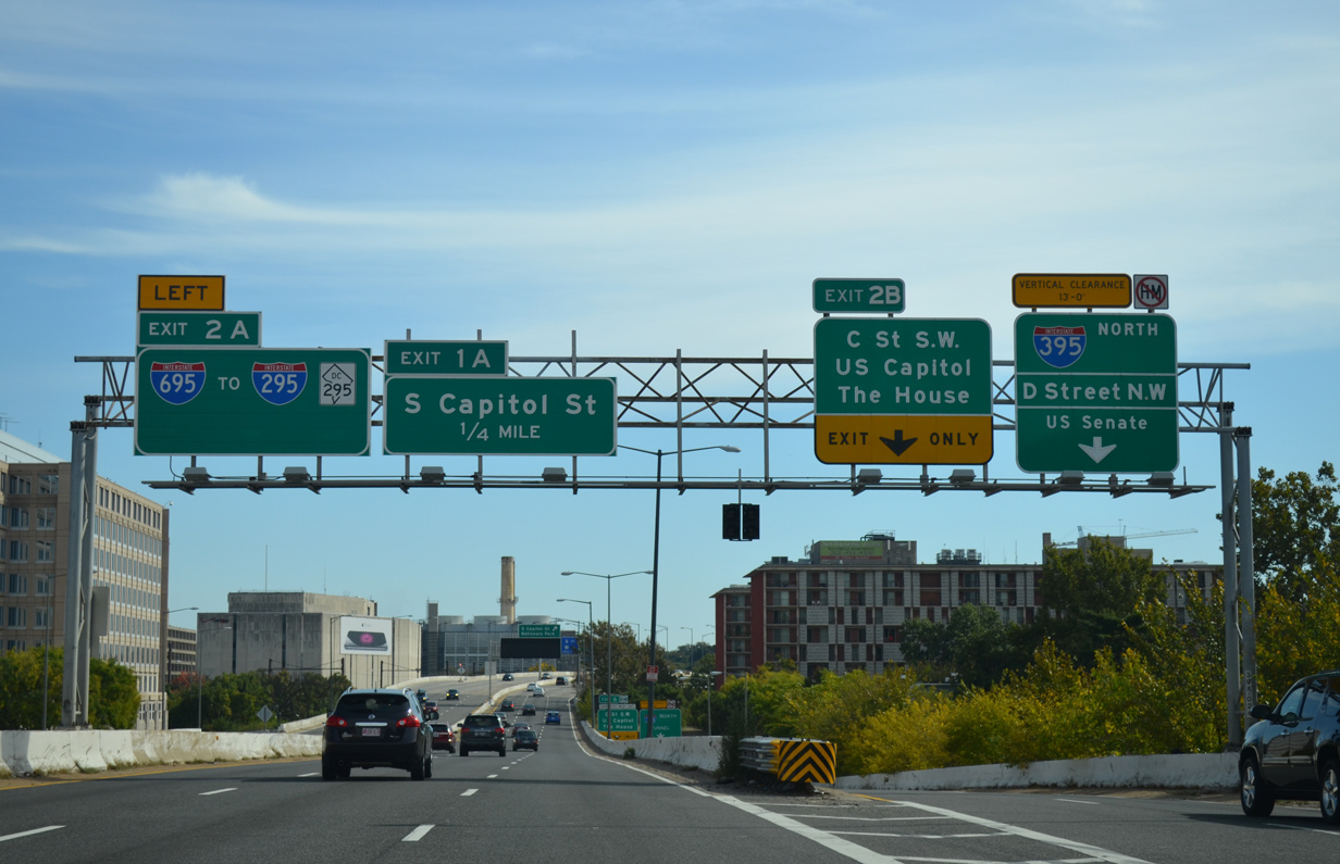
Exits along Interstate 395 in the District of Columbia were renumbered. Left Exit 2A for I-695 became Exit 5 and Exit 2B for C Street changed from to Exit 6. 10/12/14
![]() South at
South at ![]()
Interstate 395 commences south from U.S. 50 (New York Avenue NW) at 4th Street NW and the Mount Vernon Triangle community. The Center Leg Freeway runs south through the Third Street Tunnel at K Street NW toward Interstate 695 (Southeast Freeway). Photo by Peter Johnson (06/06/21).
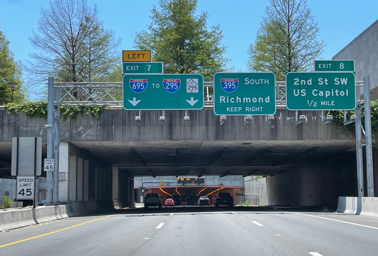
Interstate 395 enters the Mall Tunnel beyond D Street and ahead of Left Exit 7 for I-695 (Southeast Freeway) east. Photo by Peter Johnson (06/06/21).
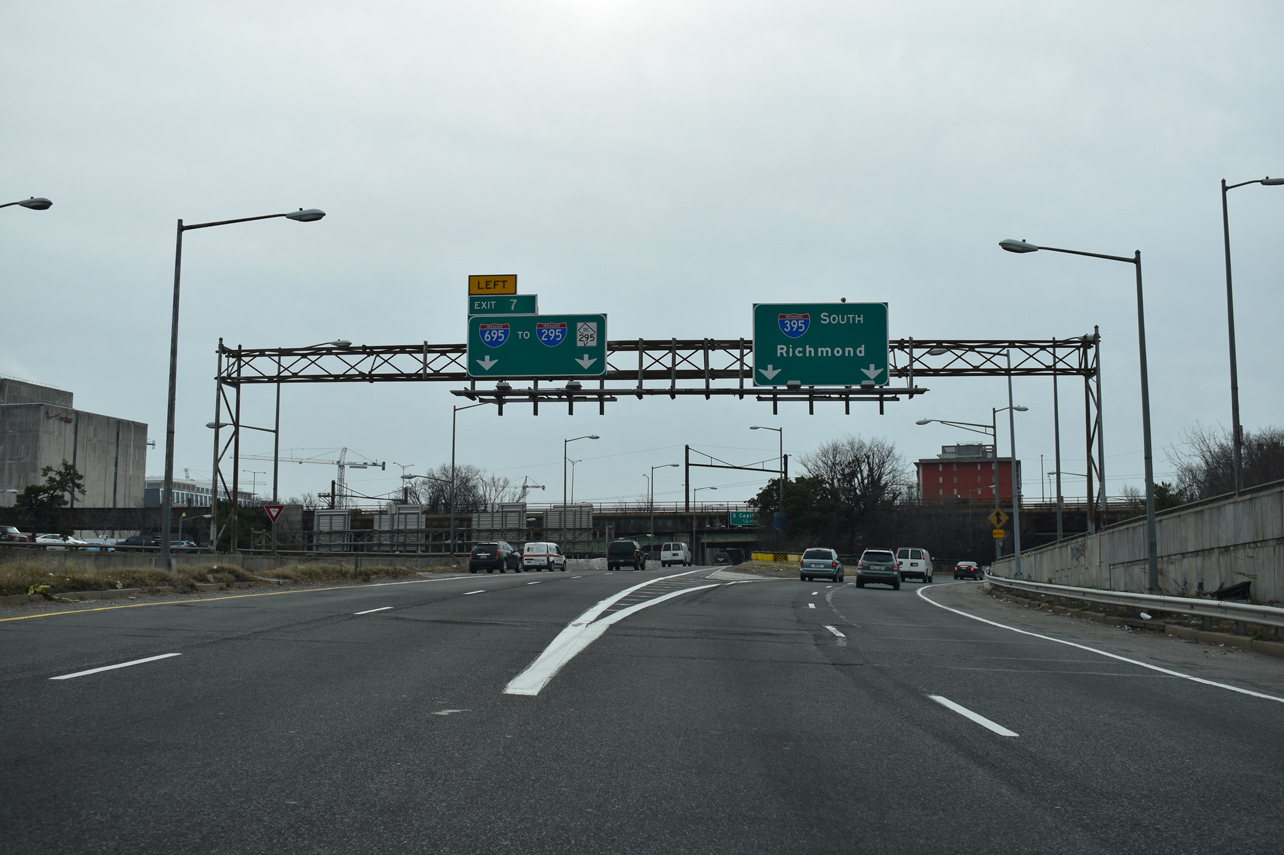
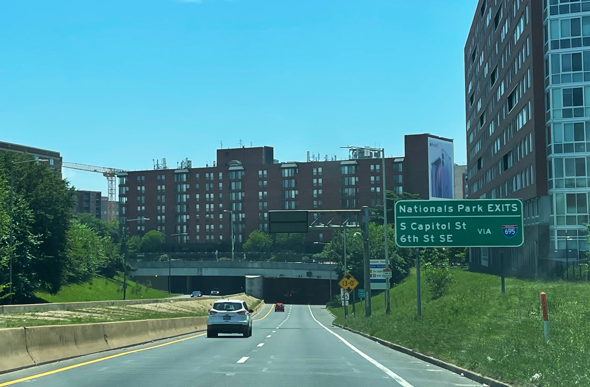
I-395 emerges from the Mall Tunnel at the three-wye interchange with the Southwest and Southeast Freeways. Exit 7 leads to both I-695 east for the Anacostia Freeway (D.C. 295 north / I-295 south) and S Capitol Street to the Navy Yard district and Nationals Park. 01/04/19
Sources:
- “Virginia Avenue Tunnel project advances in D.C. amid neighborhood disruption.” The Washington Post (DC), January 28, 2017.
- “Clark/Parsons Reaches Substantial on Virginia Avenue Tunnel Reconstruction Project.” Clark Construction Group, news release. January 14, 2019.
- Center Leg Freeway (Interstate 395) at DC Roads.Net (Steve Anderson)
- Whitehurst Freeway (U.S. 29) at DC Roads.Net (Steve Anderson)
- Southeast Freeway (Interstate 695) at DC Roads.Net (Steve Anderson)
- Letter to FHWA from AASHTO on Application Regarding Interstate Route: Elimination of I-295 in Southeast Washington, DC and extend I-695 to maintain system continuity between I-395 and I-295/DC-295.
https://www.transportation.org/sites/route/docs/AASHTO-FHWA%20DC%20I-295%20and%20I-695.pdf - 11th Street Bridge Project.
http://ddot.dc.gov/page/11th-steet-bridge-projectDistrict Department of Transportation (DDOT), web site.
Page updated April 7, 2023.