Interstate 680 Nebraska / Iowa
Overview
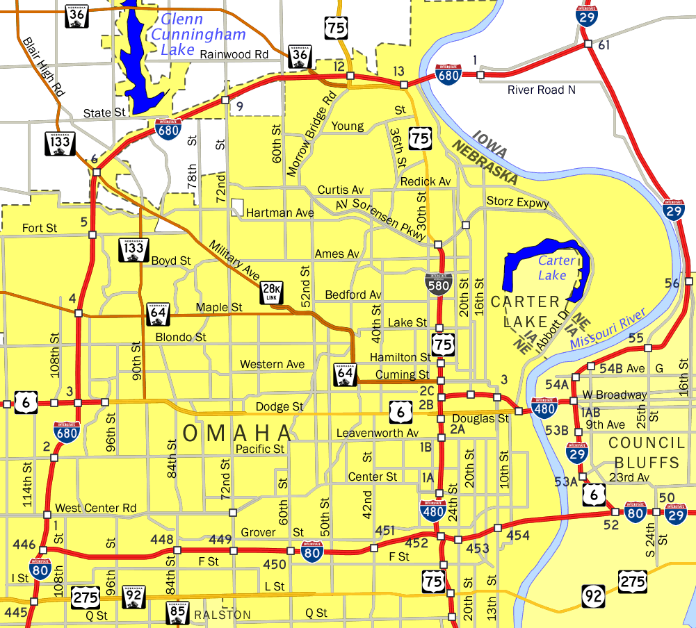
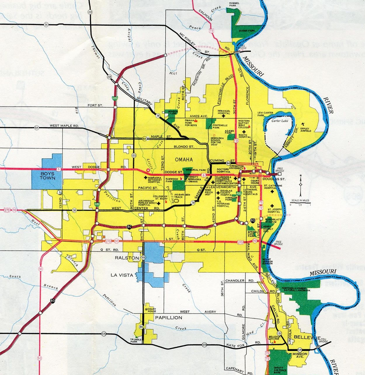
Interstate 680 forms a belt route encircling Omaha from the Prairie Lane neighborhood to the Missouri River at Wyman Heights. The route within Nebraska is mostly suburban, with development lining the freeway frontage from I-80 north to 72nd Street (Exit 9). Suburban expansion in Omaha westward along Highway 64 (Maple Road), the West Dodge Expressway (U.S. 6) and Center Road (former N-38) adds commuter traffic to Interstate 680. I-680 changes cardinal directions from north-south banners between I-80 and 72nd Street to east/west banners for the remainder of the route into Iowa.
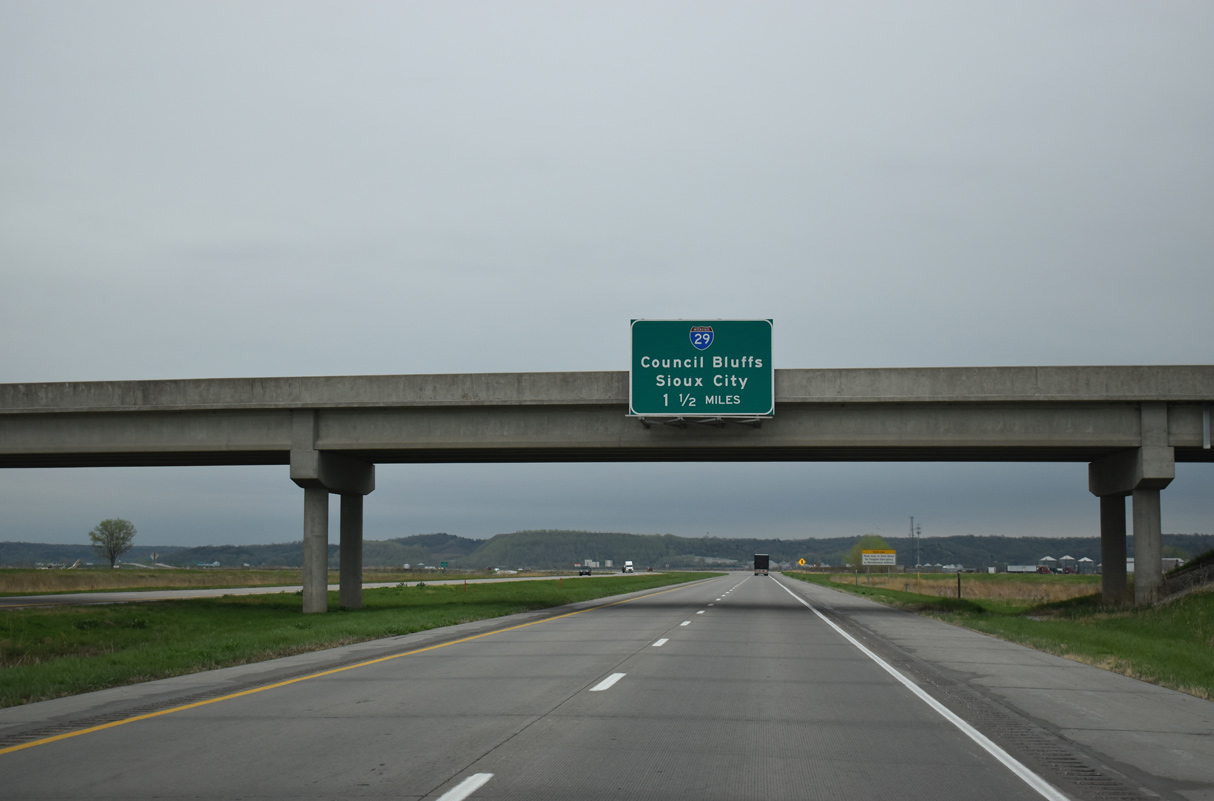
Crossing the Mormon Bridge over the Missouri River, I-680 traverses a flood plain east to the cloverleaf interchange with I-29 and County Road G37 outside the city of Crescent. I-680 ends at the rural exchange, but previously combined with Interstate 29 north paralleling the Missouri and Boyer Rivers to Loveland. I-680 branched eastward from I-29 across the Loess Hills, where a vista point is located along the scenic and lightly traveled freeway leading to Interstate 80 near Neola.
The American Association of State Highway and Transportation Officials (AASHTO) approved a request from the state of Iowa on October 5, 2019 to renumber I-680 between I-29 at Loveland and I-80 near Minden as Interstate 880. This action included the removal of I-680 from the 9.91 mile long overlap with Interstate 29. Referencing closures of I-29/680 during Missouri River flooding in 2019, the application read:
This new Interstate route is being established to help avoid routing confusion during flooding events that have occurred recently in this area.
 History
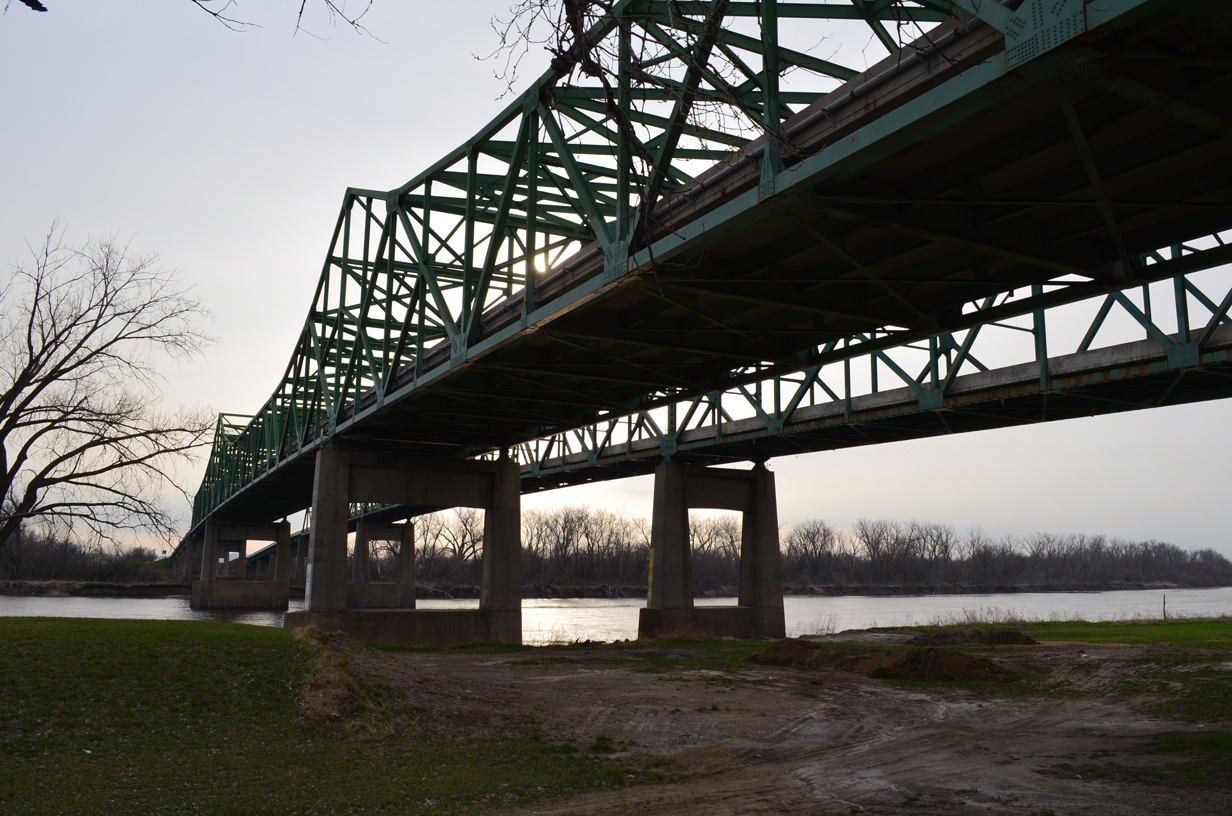
The Mormon Bridge carrying Interstate 680 traffic across the Missouri River. 03/30/16
The Mormon Pioneer Memorial Bridge, a pair of cantilever bridges across the Missouri River at Florence Bend and north Omaha, carries Interstate 680 from Nebraska to Iowa. The original span opened to traffic on December 14, 1952,1 as it connected N-36 with Iowa 988. The 1,603 foot long bridge carried two-way traffic across a 26 foot wide deck.2 The westbound bridge opened to traffic as a toll free route in 1975. Tolls remained in place along the eastbound span at a rate of 75 cents per passenger car until April 21, 1979. A ceremony was held that day to deed the bridge to the states of Iowa and Nebraska from the Douglas County Nebraska Bridge Commission.3
Originally, what became I-680 was planned in two parts: Interstate 280, the loop from I-80 west of Omaha to I-29 north of Council Bluffs, and Interstate 80N, the independent section of I-680 east of I-29 in Iowa. I-680 was initially proposed for the entire route, but the American Association of State Highway Officials (AASHO) changed it to I-80N on November 10, 1958.4 The I-280 designation was dropped by 1965 once it was realized that Iowa would have had two separate Interstates numbered 280: one here and the other at the Quad Cities (Moline/Bettendorf).
The concurrent section with I-29 was completed as Interstate 29 opened from 16th Street (Exit 56) north at Council Bluffs to U.S. 30 (Exit 75).5 A short stretch of I-680 opened from the temporary end of I-80 north to U.S. 6 (W Dodge Road) within Omaha in 1961.6 Interstate 80N opened from I-29 near Loveland to I-80 in conjunction with I-80 east to U.S. 59 on December 13, 1966.5
As approved by AASHTO on November 10, 1973, Interstate 680 was extended north along I-29 and then east along former I-80N. This lengthened I-680 another 26 miles. The remainder of the route was completed on August 14, 1974 after a dedication ceremony preceded the opening of I-680 from Mormon Bridge Road (Exit 12) east to the Mormon Bridge.7
A ten year, $325 million project to improve Interstate 80 across Omaha included a redesign of the three-wye interchange with I-680 in Omaha. The upgrade included adding collector distributor roadways to serve local traffic on both freeways for West Center Road (Exit 1) to the north and U.S. 275 (Exit 445) to the southwest. The project started in Spring 1994 as work neared completion on the interchange redesign between I-80, I-480 and U.S. 75 (Kennedy Freeway) to the east.8,9 Work at the exchange ran through December 199710,11 while construction to expand I-680 to six lanes from Pacific Street (Exit 2) to U.S. 6 (Exit 3) followed between 1998 and December 13, 1999, when the Pacific Street entrance ramp to I-680 north opened.12
The cloverleaf interchange (Exit 3) joining Interstate 680 with West Dodge Road (U.S. 6) was rebuilt during a five year, $24 million project starting in July 2000. Exit 3 was redesigned to incorporate new directional ramps replacing loop ramps from I-680 north to U.S. 6 west and from U.S. 6 east to I-680 north. This work eventually ran in tandem with the ancillary project to build the West Dodge elevated expressway. The new ramp from I-680 to West Dodge Road opened to traffic on December 10, 2003.13 All work was completed at the West Dodge interchange by July 1, 2005.14
Two year widening of Interstate 680 was completed in November 2005 between West Maple Road (N-64) and Fort Street (Exit 5). Work expanded the freeway to six overall lanes.15
Route Information
Nebraska – 13.32
Cities – Omaha
- Junctions –

Iowa – 3.1*
Cities – none
- Junctions –
Source: December 31, 2021 Interstate Route Log and Finders List
* – estimate from Google Maps. The Interstate Route Log and Finders List omits I-680 in Iowa.
I-680 Annual Average Daily Traffic (AADT)
Source: 2018 AADT Interactive Statewide Traffic Flow Map (NDOT)
2016 AADT – Traffic Flow Map of Pottawattamie County, Iowa (IowaDOT)

The Rand McNally North American Road Atlas showed Interstate 280 on the Omaha inset until the 1967 edition.

The Neola Diagonal, I-80 northeast from I-29 to I-680, was the alignment advocated by Council Bluffs and Omaha officials during the early Interstate system development. Iowa officials pushed for the route west to Loveland and I-29 to benefit Sioux City.
I-680 was open north to Highway 64 (Maple Street) by 1969 and under construction from there north to the new alignment of Highway 133 (Blair High Road).
The $100 million West Dodge Expressway project, which added express lanes for U.S. 6 above W Dodge Road from 120th Street to I-680, started in Fall 2003. The westbound viaduct for U.S. 6 opened in July 2006, well ahead of the August 2007 scheduled completion. The eastbound elevated deck was ready for traffic in October 2006. All major work on the project was completed by mid July 2007.16
The 2007-2011 State Transportation Improvement Program for District Two called for expansion of 1.2 miles of I-680 from Fort Street north to Irvington Road to six overall lanes. This project joined a planned replacement of the Pacific Street bridge. The expansion project never went forward, but the $5.3 million project to replace the Pacific Street overpass across I-680 ran from May 2008 to August 22, 2008.17
Record flood levels along the Missouri River in 2011 submerged and irreparably damaged a 3.1 mile stretch of I-680 from the Missouri River to Interstate 29. An emergency repair project ensued in September 2011, with two contractors chosen with a winning bid of $19.2 million.18 The contractors beat the December 23rd deadline to have at least one lane of traffic in each direction open with the help of good weather and 14 hour workdays. The freeway reopened on November 2, 2011.19
Flooding from the Missouri River resulted in closures along I-680 and I-29 three separate times in 2019.
East End 
 – Crescent, Iowa
![]() East at
East at ![]()
![]()
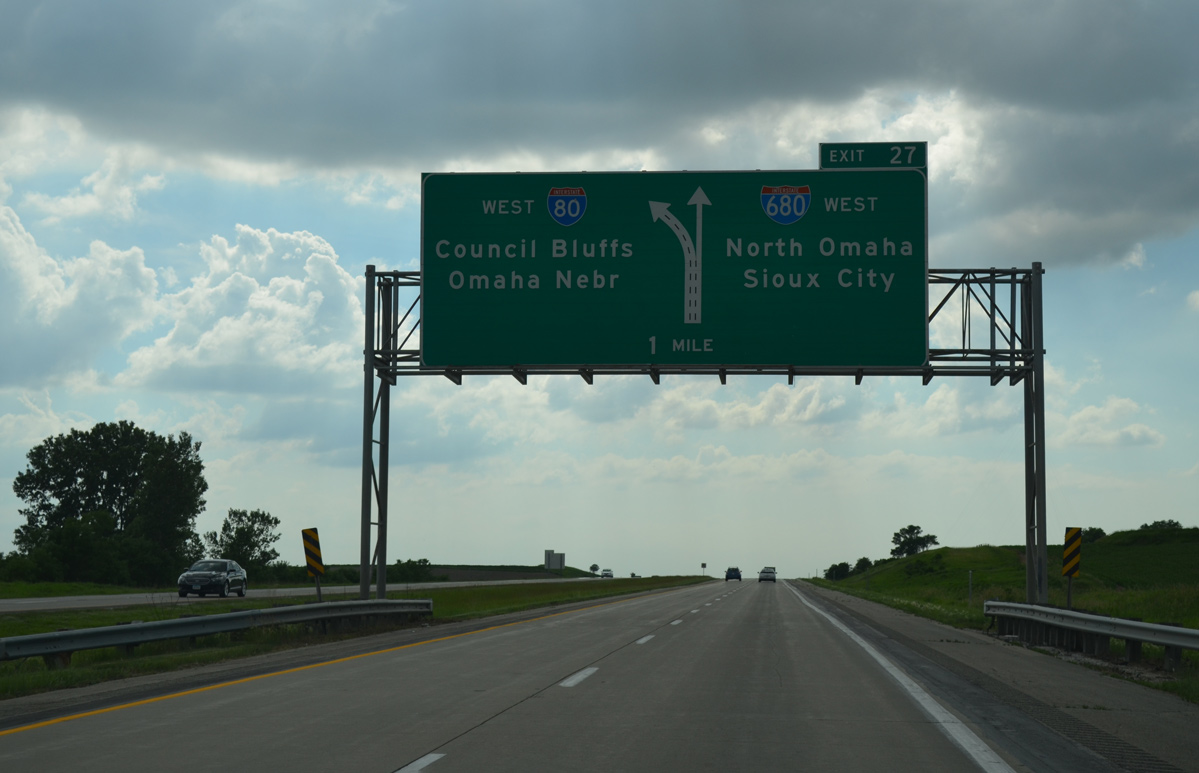
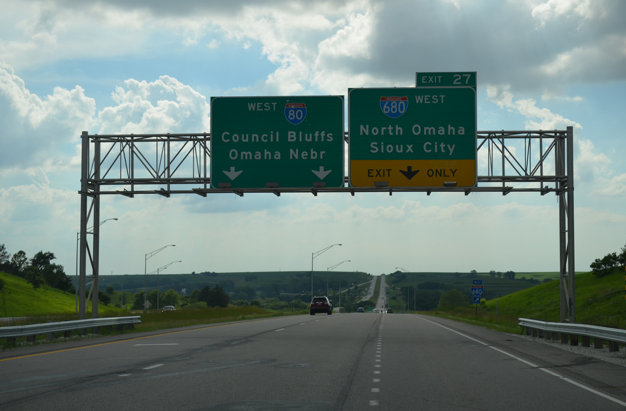
A diamond interchange connects I-680 with 130th Street at Exit 1, 1.5 miles west of Interstate 29. 05/08/22
I-680 shifts northeast from 130th Street to the cloverleaf interchange with Interstate 29. 05/08/22
I-29 leads south into Council Bluffs, where it combines with I-80. 05/08/22
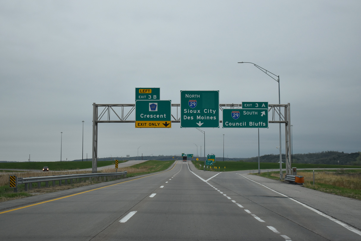
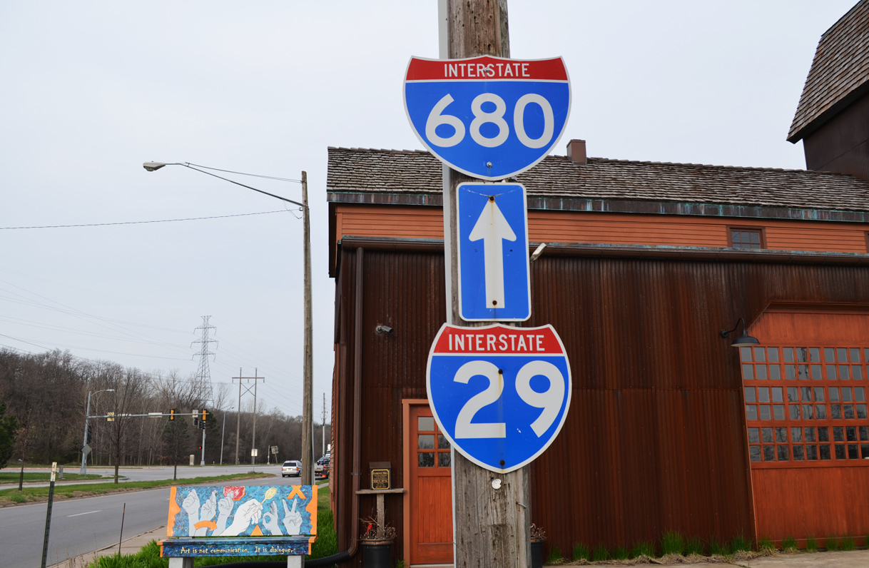
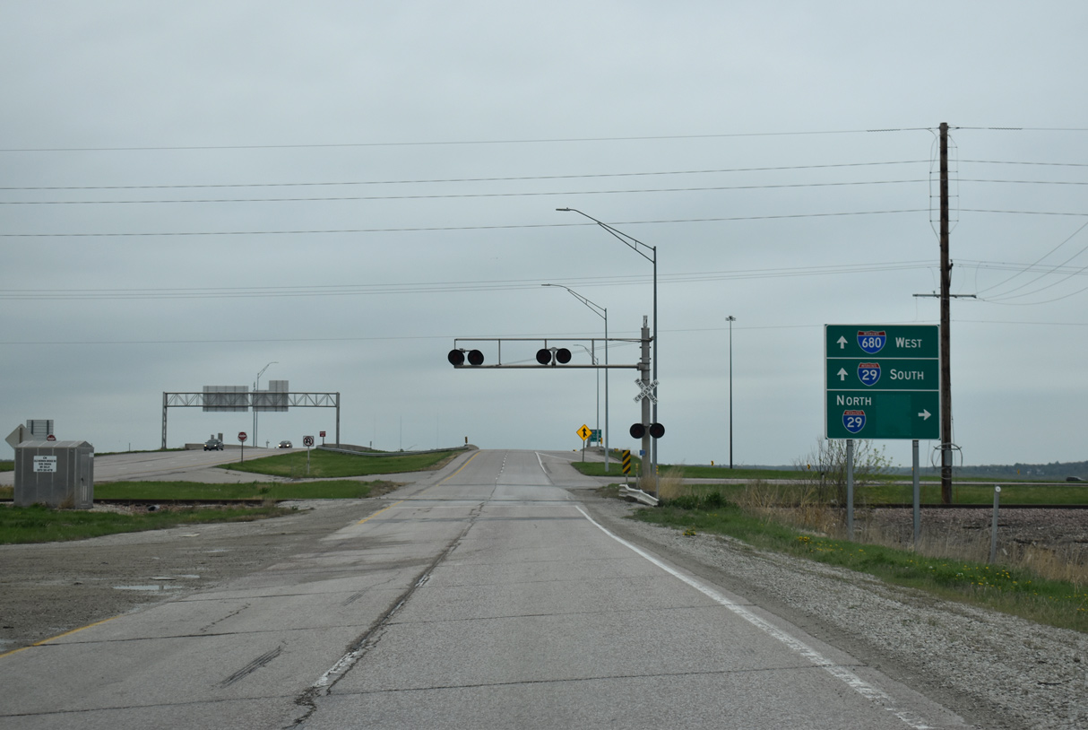
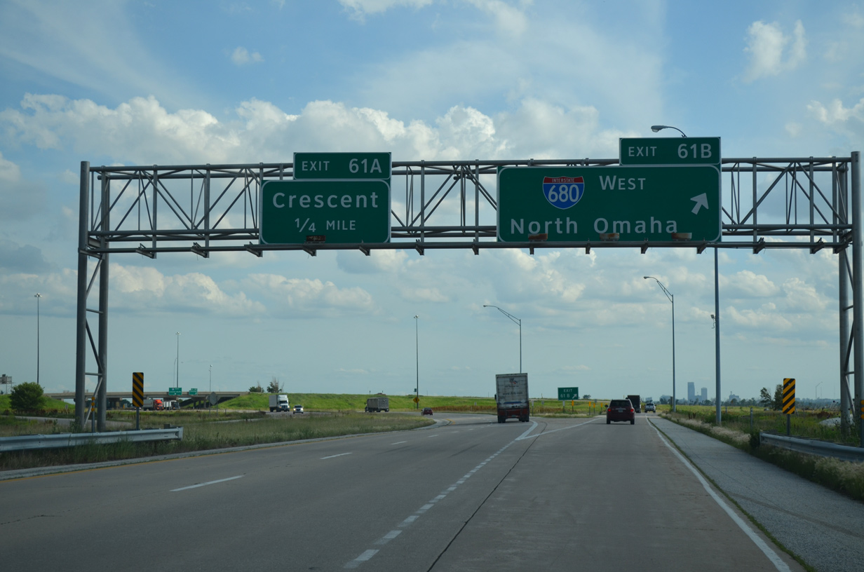
Exit 3 A leaves I-680 east for Interstate 29 south to St. Joseph and Kansas City, Missouri. CR G37 extends east ahead along Old Mormon Bridge Road into the city of Crescent. 05/08/22
I-680 was greened out on existing signs when Interstate 880 was established in 2019. 05/08/22
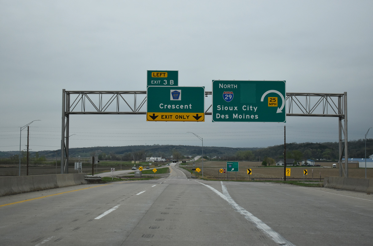
I-29 continues north from I-680 to I-880 east toward Des Moines at Loveland and Sioux City. The freeway mainline transitions into CR G37 via Left Exit 3 B. 05/08/22
![]() West at
West at ![]()
![]()
CR G37 (Old Mormaon Bridge Road) expands into a four lane highway just ahead of an at-grade crossing with the CN Railroad and transition to Interstate 680. 05/08/22
The entrance ramp for I-29 north departs from CR G37 just beyond the CN Railroad crossing for Sioux City and Sioux Falls, South Dakota. 05/08/22
Interstate 680 commences toward the Mormon Bridge and Omaha, Nebraska as the loop ramp for I-29 south into Council Bluffs leaves CR G37 westbound. 05/08/22
![]() South at
South at ![]()
![]()
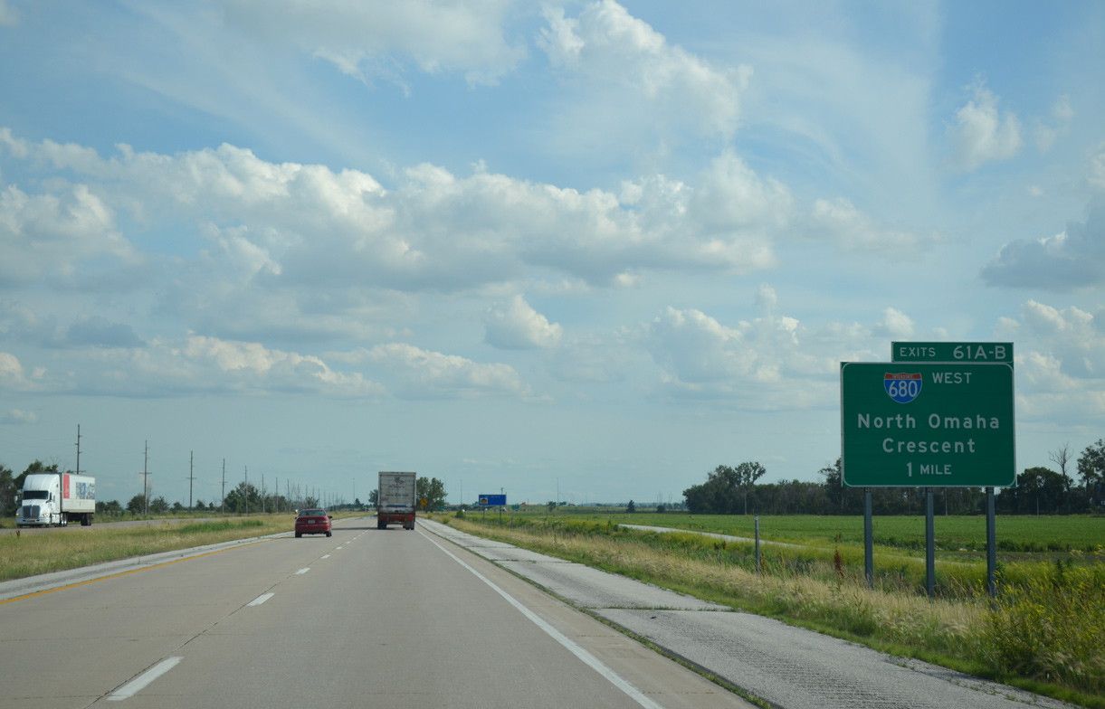
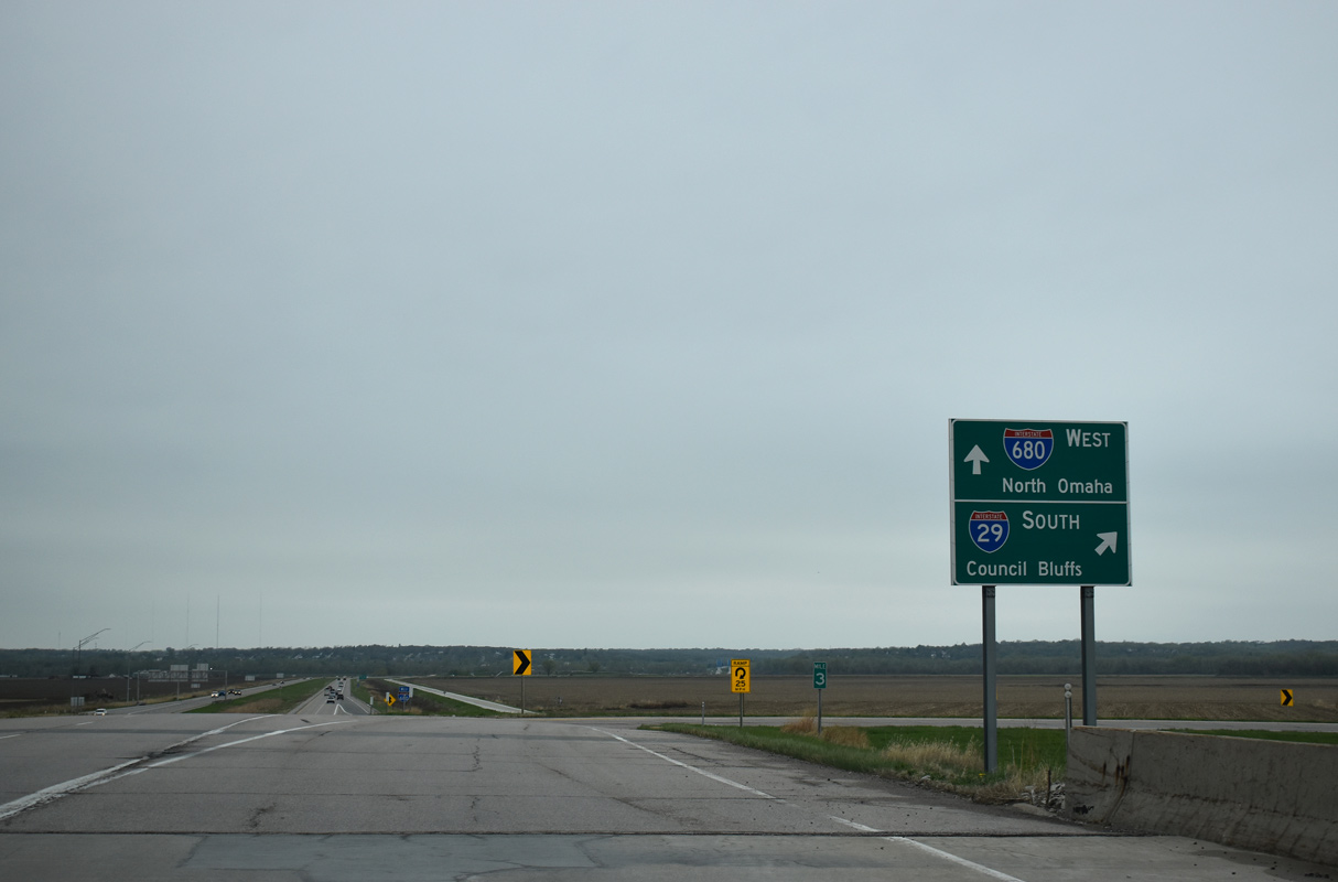
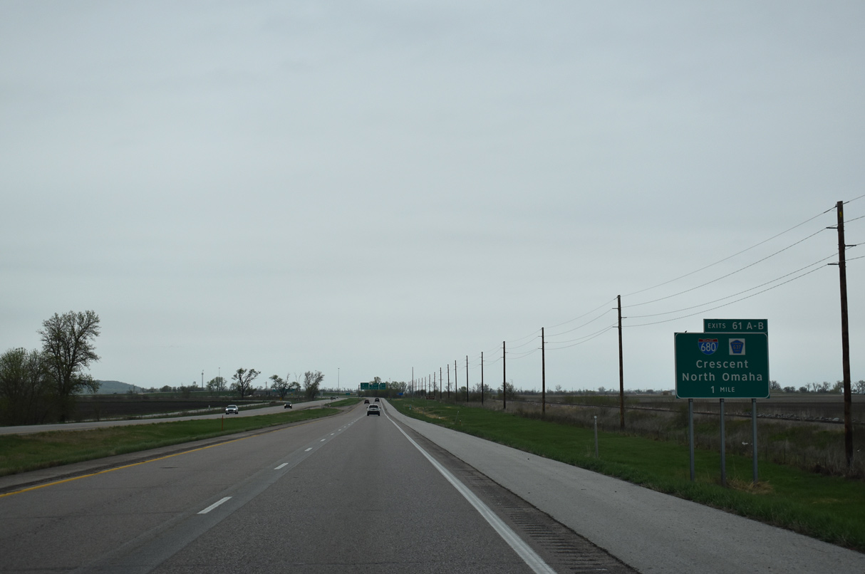
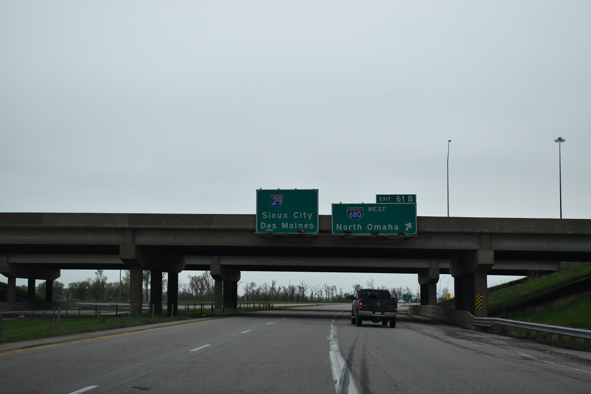
One mile north of the cloverleaf interchange (Exits 61B/A) with Interstate 680 west and CR G37 (Old Mormon Bridge Road). 06/17/15
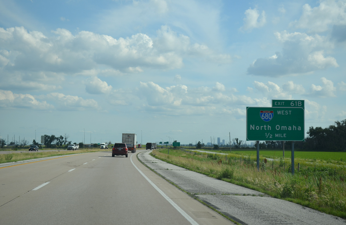
The Omaha skyline comes into view a half mile ahead of Exit 61B for Interstate 680 west to the Mormon Bridge. 06/17/15
I-680 arcs southwest from Crescent, Iowa around the north side of Omaha while Interstate 29 continues south to Council Bluffs. 06/17/15
![]() North at
North at ![]()
![]()
I-29 advances north from alongside the Missouri River to the cloverleaf interchange (Exit 61) with I-680 west and CR G37 east. 05/08/22
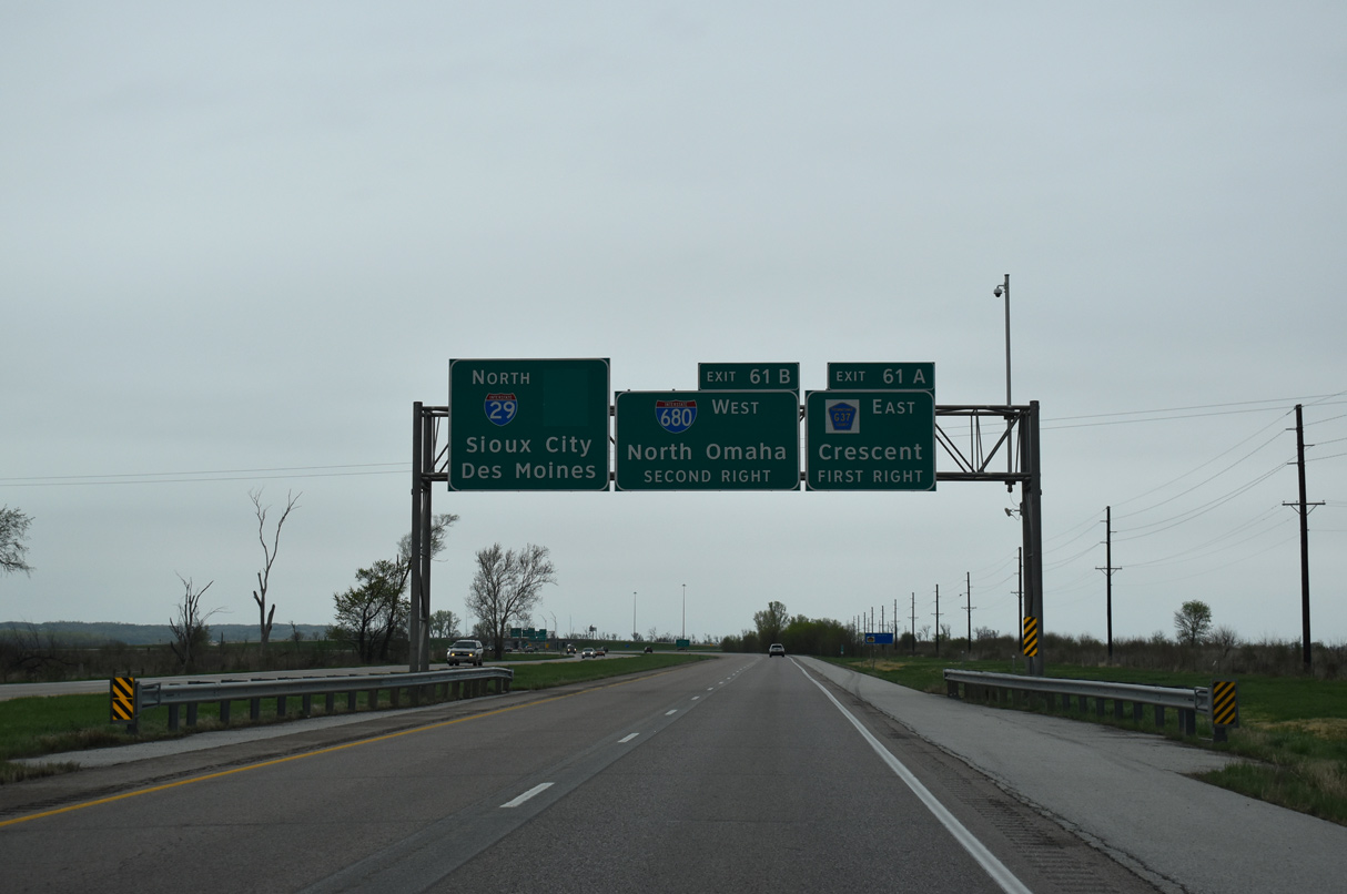
CR G37 (Old Mormon Bridge Road) extends east from Interstate 680 into the city of Crescent. 05/08/22
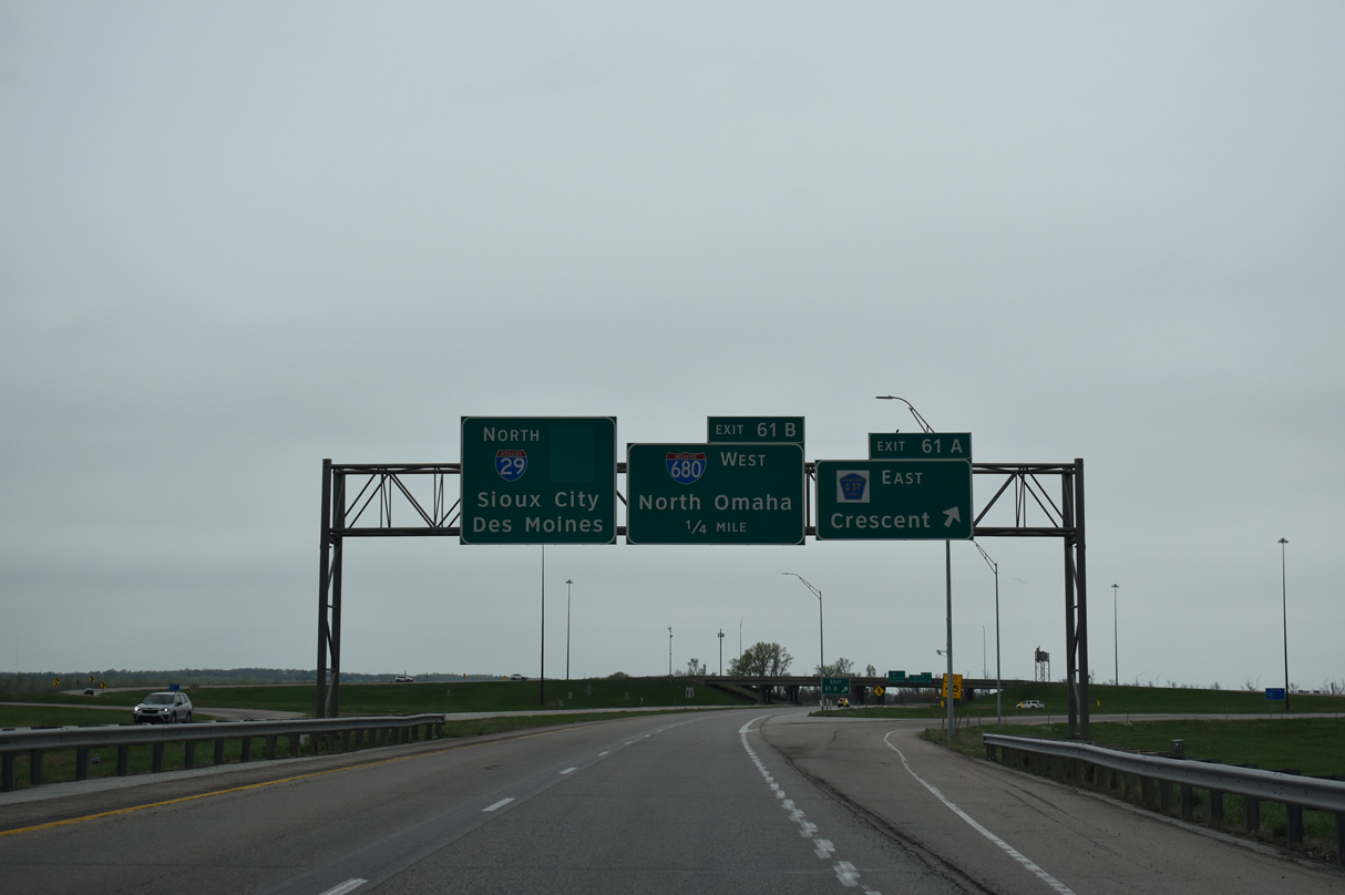
I-29 north entering the cloverleaf interchange with CR G37 east and I-680 west at Exit 61. 05/08/22
Interstate 680 arcs west across the north side of Omaha, Nebraska from I-29 and the Mormon Bridge spanning the Missouri River. 05/08/22
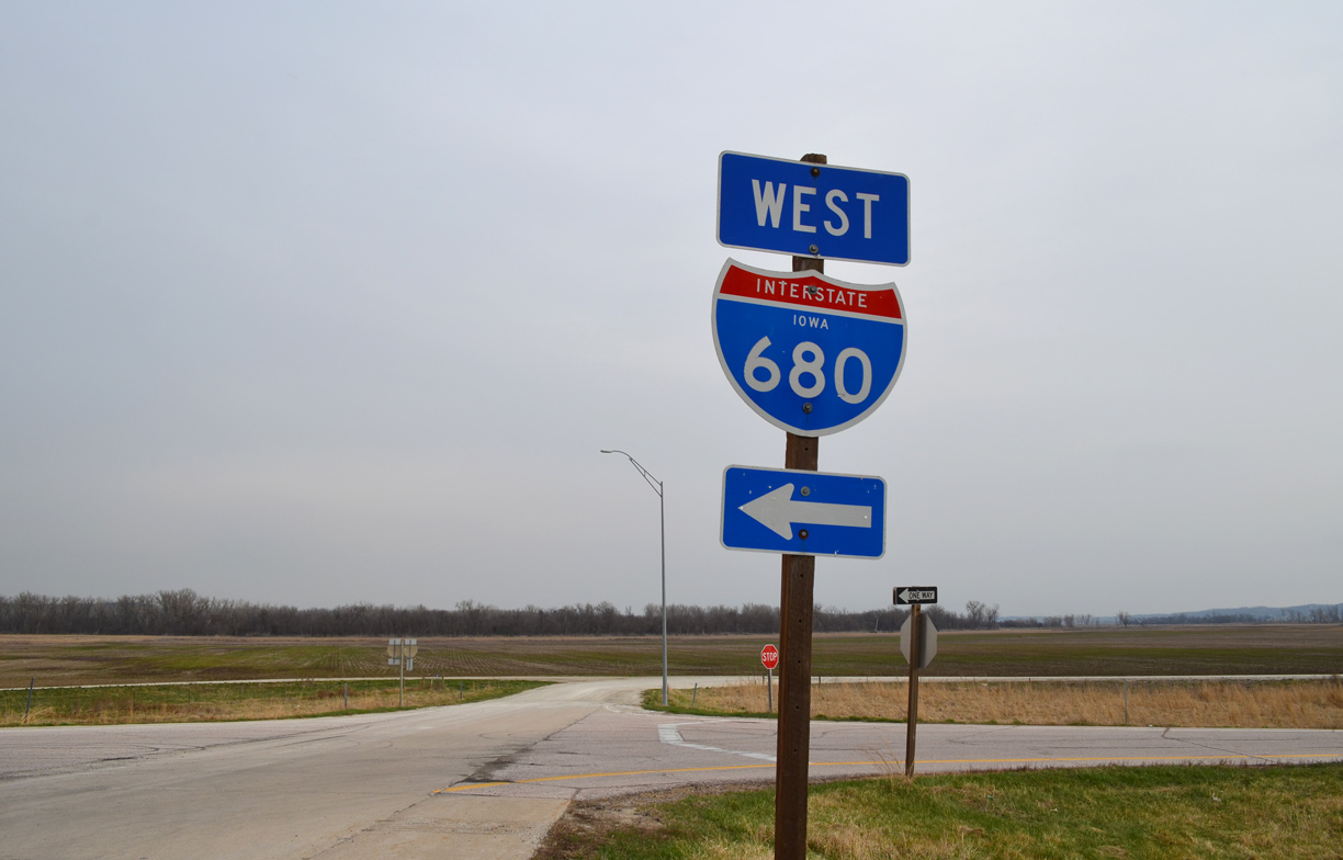
Former East End – Minden, Iowa
![]() East at
East at ![]()
This sign for Interstate 80 was replaced with a Clearview font based assembly by 2014. Photo by Jeff Royston (12/04/05).
A wide view of the directional T interchange between I-80 and I-680. The exchange is set in a rural valley fed by Mosquito Creek. Photo by Jeff Royston (12/04/05).
![]() West at
West at ![]()
The first sign for Interstate 680 preceded the diamond interchange (Exit 29) joining I-80 with County Route L66 to Minden. 03/28/16
Westbound Interstate 80 rises on a bluff midway between CR L66 (335th Street) and the westbound split with I-680. 06/17/15
Interstate 680 comprised a rural route to north Omaha while I-80 turned southwest from Neola into Council Bluffs. 06/17/15
![]() East at
East at ![]()

Entering the directional T interchange with Interstate 680 on I-80 east. Sign changes made by 2011 greened out North Omaha and replaced the exit tab for I-680 west. The erroneous exit tab on the pull through panel remained.
Clearview sign panels installed by 2014 restored North Omaha while adding a LEFT exit tab for I-680. The erroneous tab to the right was also finally dropped. Photo by Dale Sanderson (2001).
![]() /
/ ![]() at
at ![]()

Approaching the easternmost mainline interchange of Interstate 680 along County Road G8L (Railroad Highway) north. Signs here previously referenced I-80 for the eastbound on-ramp. All stand alone shields were replaced by 2014 with small guide signs. I-680 is referenced solely with the change. Photo by Jeff Morrison (06/09/03).

The replacement signage for the south end of Iowa 191 at the diamond interchange with I-680. The shield for I-80 east was replaced with a small guide sign placed further south by 2014. County Road G8L follows old IA 191 south from here. Photo by Jeff Morrison and Jason Hancock (06/12/05).

Between Jan. 1, 1969 and July 1, 2003, Iowa 191 paralleled Interstate 80’s diagonal southwest from Neola to Council Bluffs. It was truncated to I-680 at Exit 28. This sign assembly previously directed motorists onto the westbound on-ramp to north Omaha and the former continuation of IA 191 south. It was replaced with an end shield by July 2005. Photo by Jeff Morrison (06/09/03).
South End – Omaha, Nebraska
![]() South at
South at ![]()
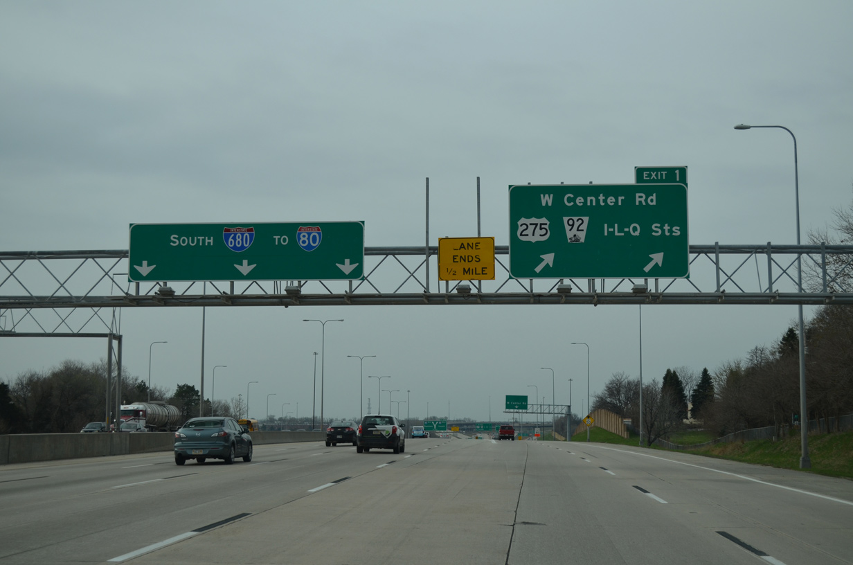
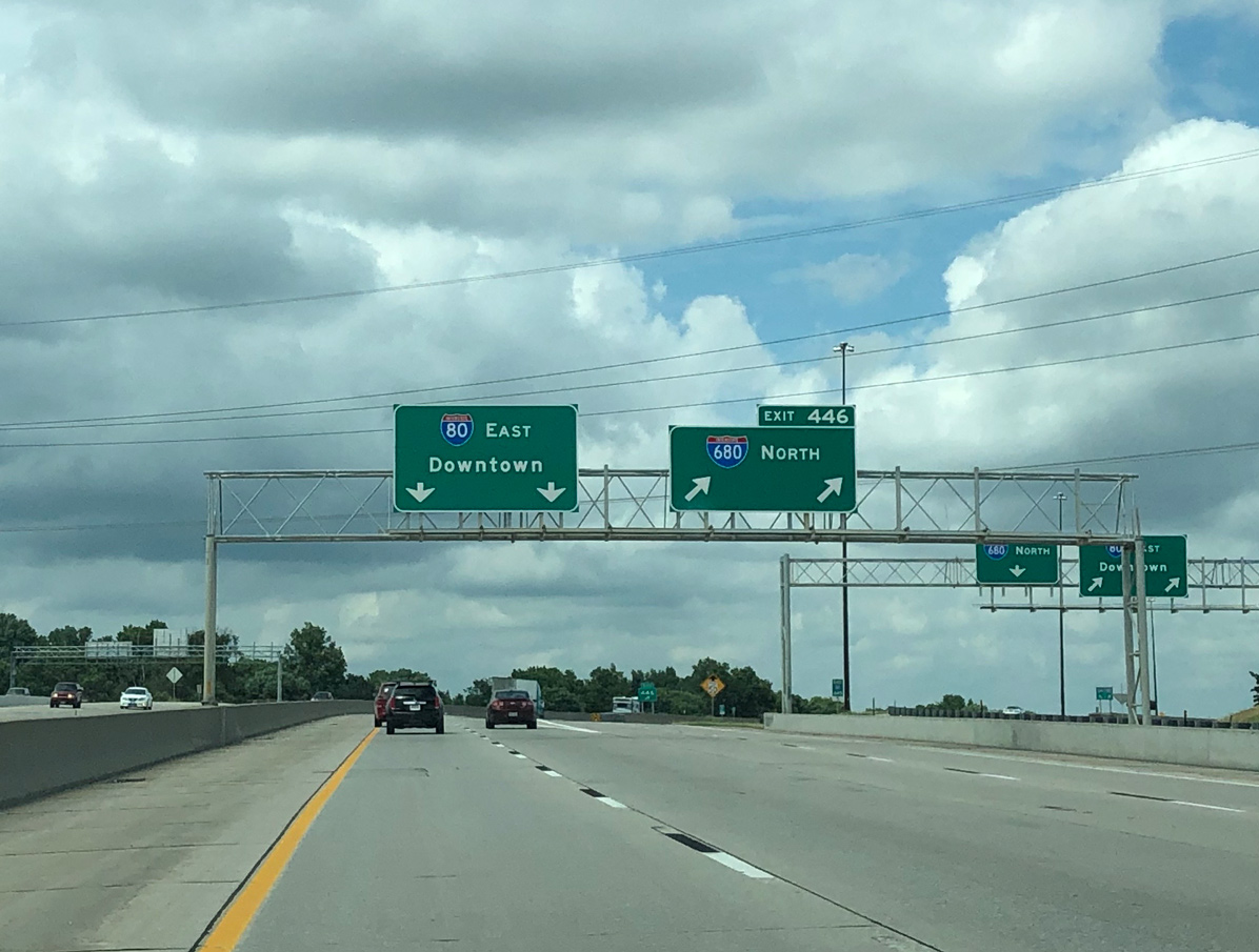
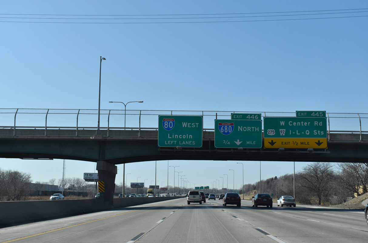
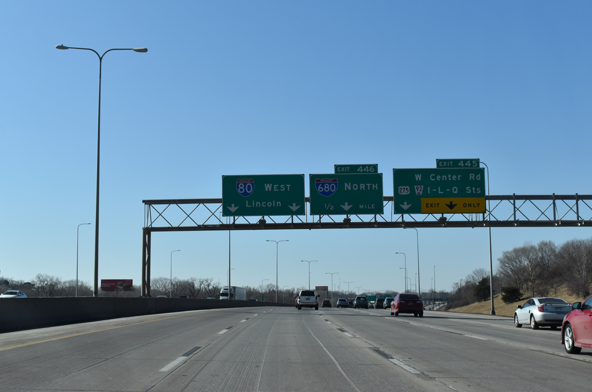
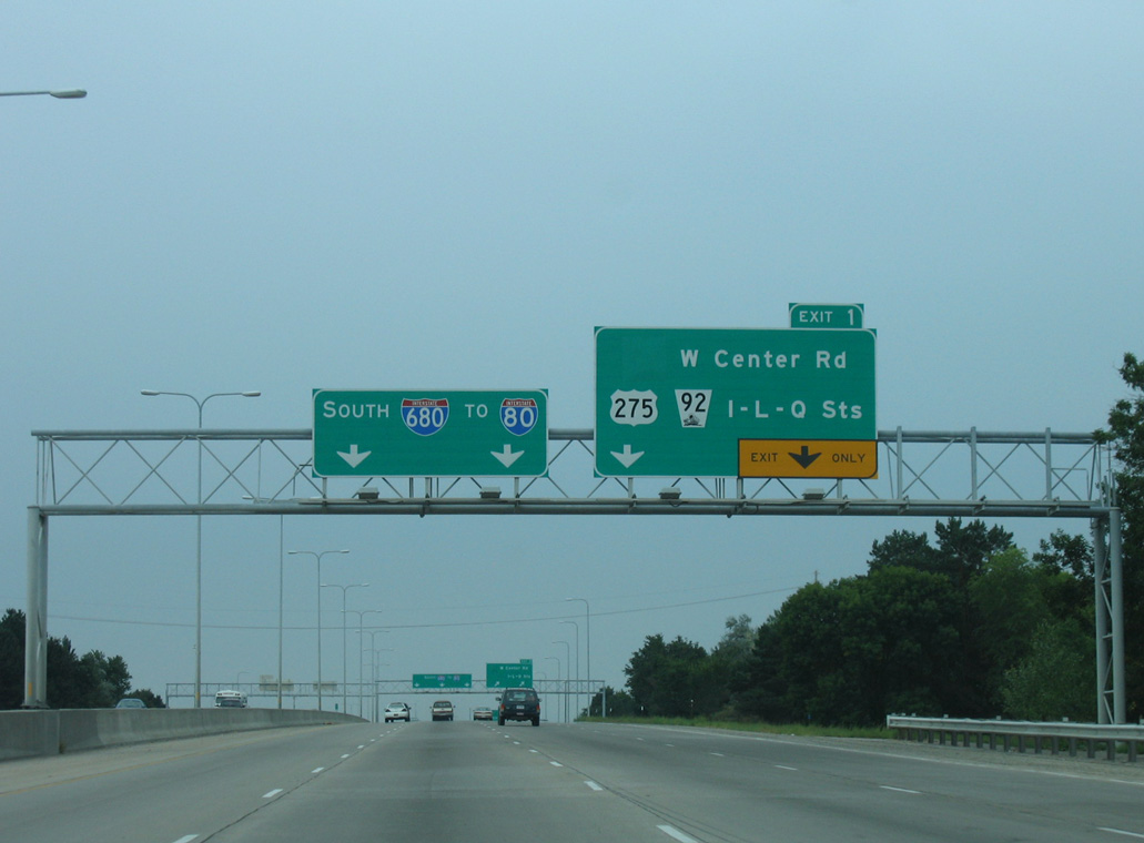
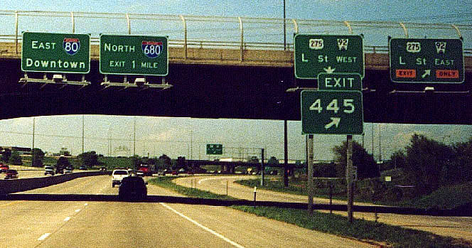
A two lane collector distributor roadway branches away from the southbound mainline at Exit 1 for W Center Road (former N-38). The c/d roadway continues south to provide access to the local lanes of I-80 west for I Street, U.S. 275/N-92 (L Street) and Q Street. The ramp from I-680 south to I-80 west bypasses all local exits to Giles Road (Exit 442). 03/30/16
The c/d roadways bring Interstate 680 up to 11 overall lanes as the freeway passes through the parclo interchange (Exit 1) with West Center Road (former N-38). The freeway mainline splits in one half mile for Interstate 80. 03/29/16
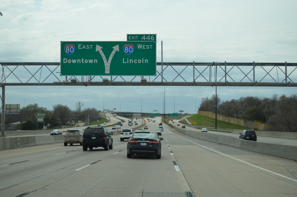
The two left lanes connect to Interstate 80 east, while the two right lanes connect to I-80 west (signed as Exit 446 based upon the I-80 mileage). The connection from southbound Interstate 680 to eastbound I-80 is part of a commuting pattern to Downtown Omaha. 03/29/16
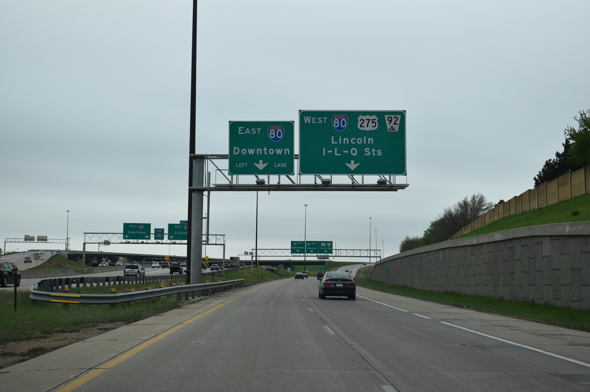
The Exit 1 c/d roadway partitions into a two lane ramp for I-80 west to U.S. 275/N-92 for Westwood Heights and Old Millard East and a single lane connection to I-80 east toward the Westgate Area and Downtown. 05/08/22
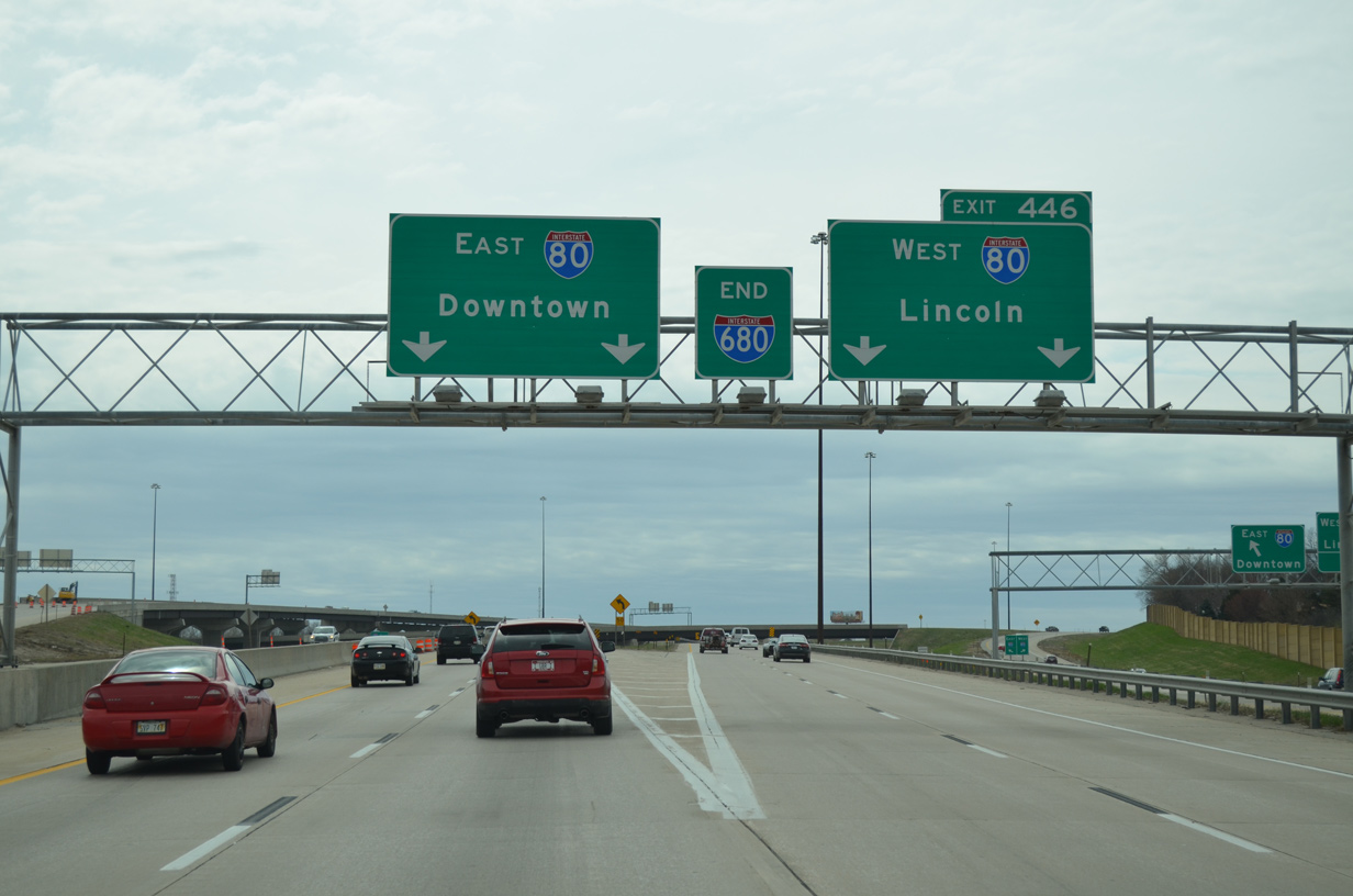
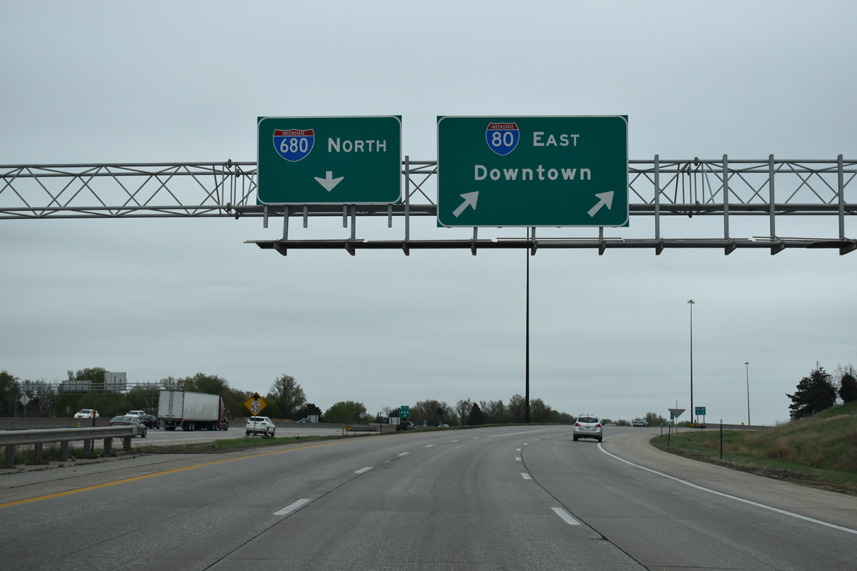
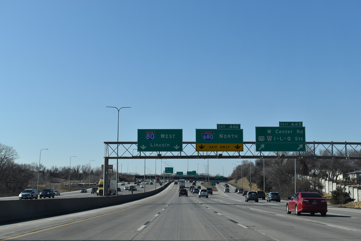
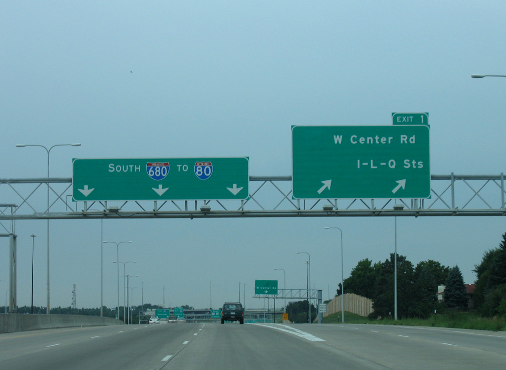
Typical of Nebraska and Iowa signing practices, an end panel appears as Interstate 680 enters the three wye interchange with I-80. The transition to westbound Interstate 80 is part of the bypass route around Council Bluffs and central Omaha. 03/29/16
The c/d roadway partitions for Interstates 80 east and west. Construction underway in 2015 and 2016 resulted in ramp closures as NDOT rebuilt some of the ramps between the two freeways. 05/08/22
![]() East at
East at ![]()
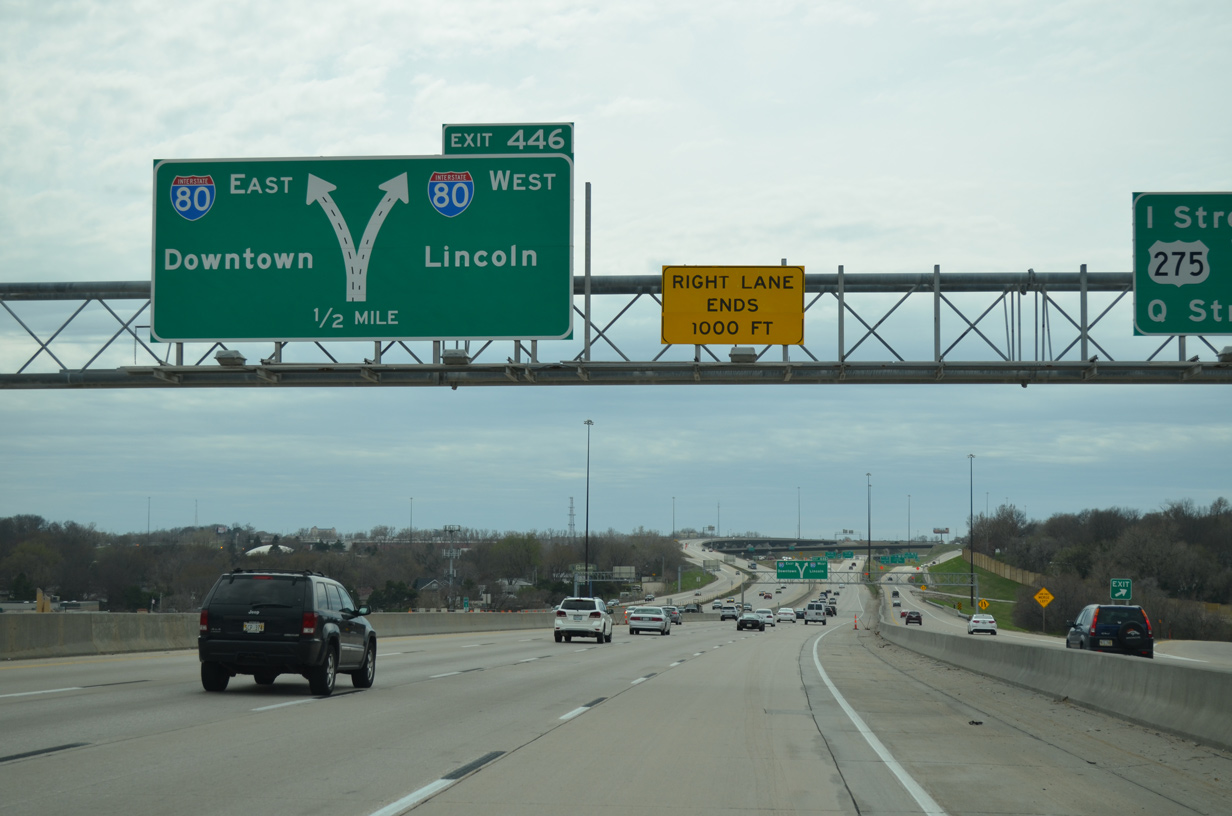
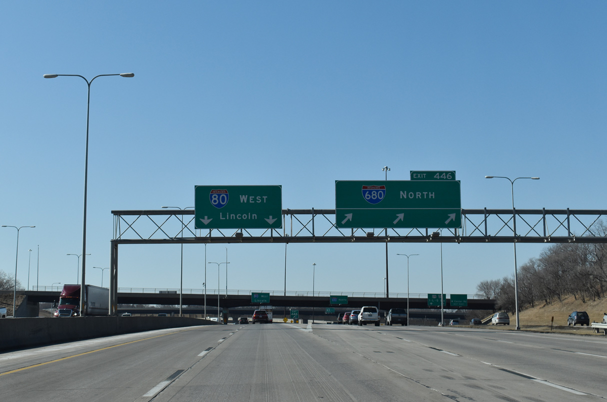
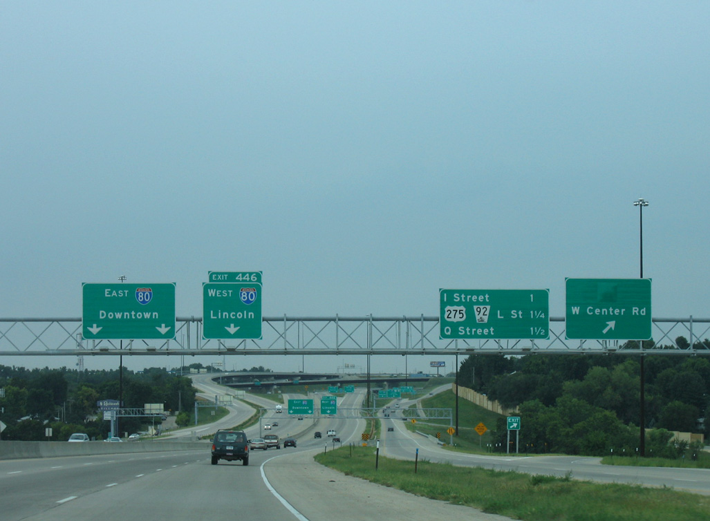
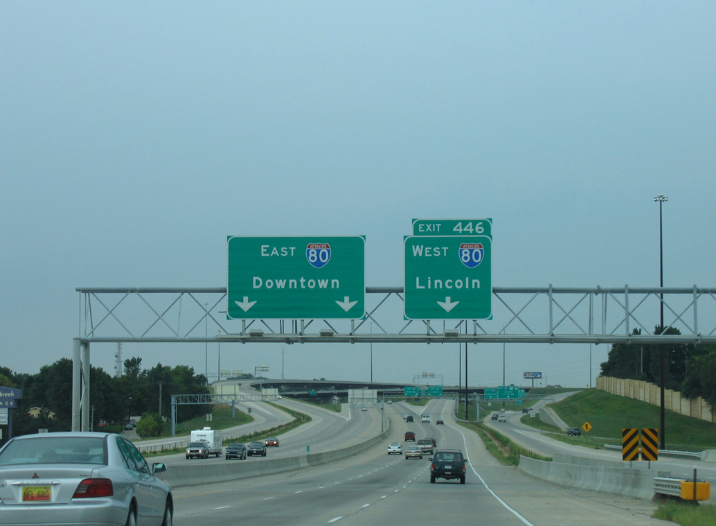
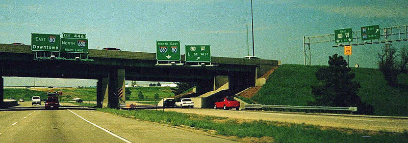
Crossing the Douglas County line and West Papillion Creek, I-80 turns northward to Exit 446 with Interstate 680. Photo by Peter Johnson (06/21/20).
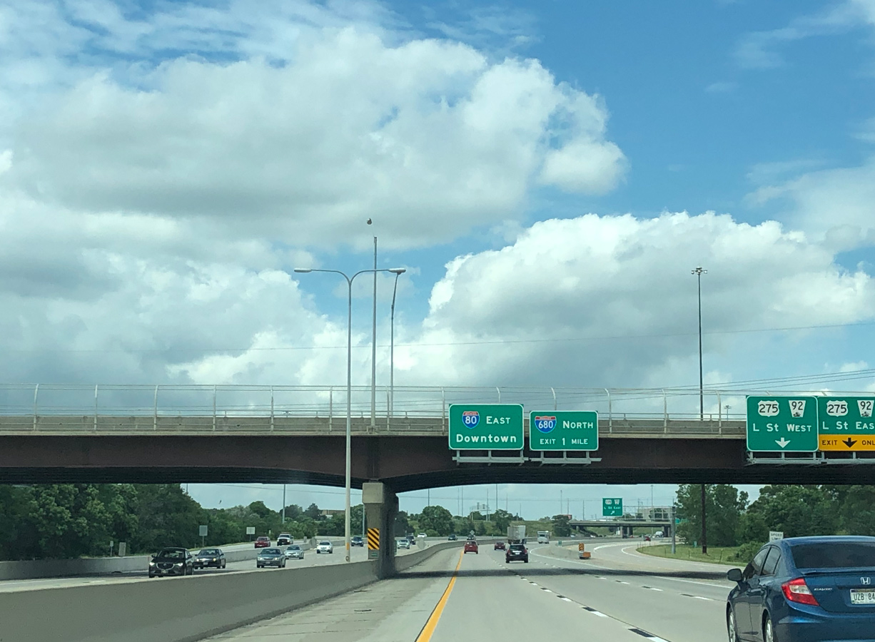
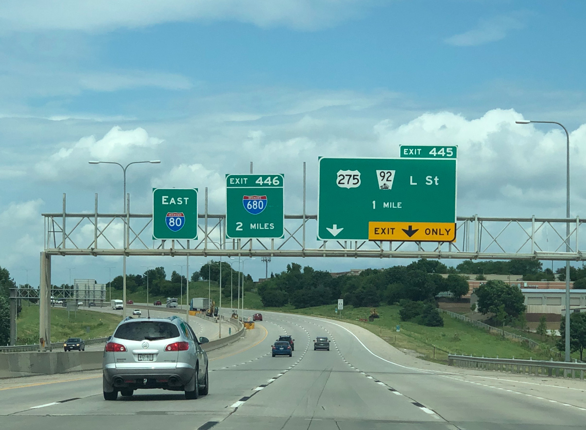
A two-lane collector distributor roadway (Exit 445) splits from the I-80 eastbound mainline at the Q Street overpass. The roadway serves the adjacent cloverleaf interchange with U.S. 275/N-92 (L Street) while the mainline continues one mile to Exit 446 with the I-680 north. Photo by Peter Johnson (06/21/20).
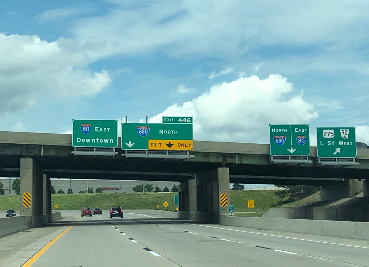
Advancing north from U.S. 275/N-92 (L Street), I-80 enters the three wye interchange (Exit 446) with Interstate 680. The adjacent c/d roadway remains separate from the I-80 mainline until after the exchange with I-680. Photo by Peter Johnson (06/21/20).
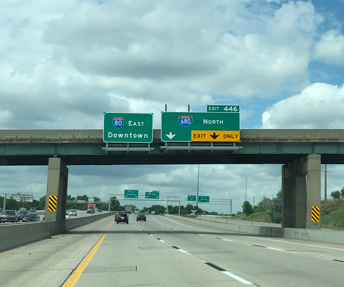
Passing under I Street, both the Interstate 80 mainline and c/d roadway for Exit 445 advance to their respective ramps for I-680. Interstate 680 encircles Omaha to Florence. Photo by Peter Johnson (06/21/20).
Interstate 80 resumes an eastward course from Exit 446 to the Westgate Area, Robin Hill and Hanscom Park toward Downtown Omaha. Photo by Peter Johnson (06/21/20).
A slip ramp joins the Exit 445 c/d roadway with the flyover taking motorists from I-80 east to Interstate 680 north. 05/08/22
![]() West at
West at ![]()
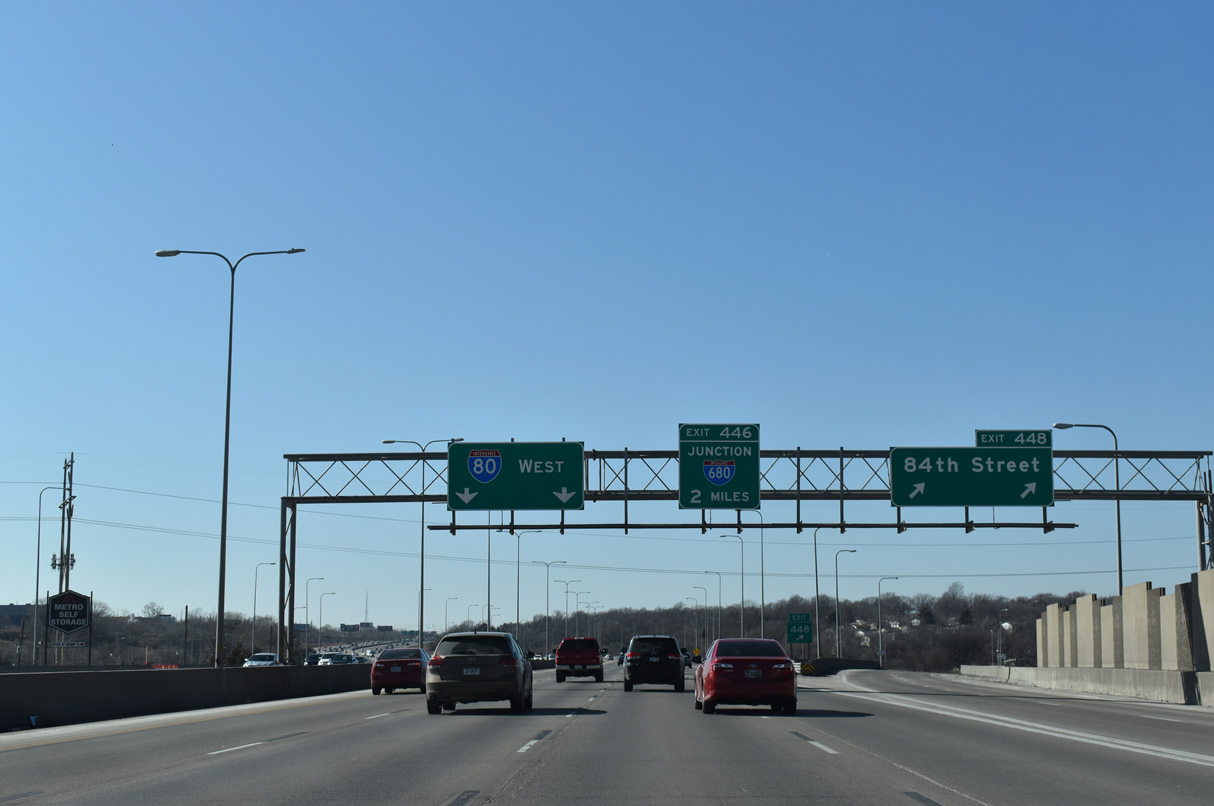
Interstate 80 west leaves the Westgate Area on the two miles leading to Exit 446 for I-680 north. 02/22/20
I-80 westbound advances with five lanes toward the three wye interchange (Exit 446) with I-680 north. A collector distributor roadway (Exit 445) departs prior to the mainline I-680 off-ramp (Exit 446) for the subsequent three exits of I-80 west to I Street, U.S. 275/N-92 (L Street) and Q Street). 02/22/20
South 96th Street spans I-80 west a half mile ahead of the separation with the c/d roadway for Exit 445. Exit 445 also connects with the local lanes of I-680 north to the adjacent West Center Road (former N-38) interchange (Exit 1). 02/22/20
Interstate 680 travels north to serve as the western and northern bypass of Omaha. However, it is also a conduit for the growing western suburbs in conjunction with the booming corridor along U.S. 6 and the West Dodge Expressway. 02/22/20
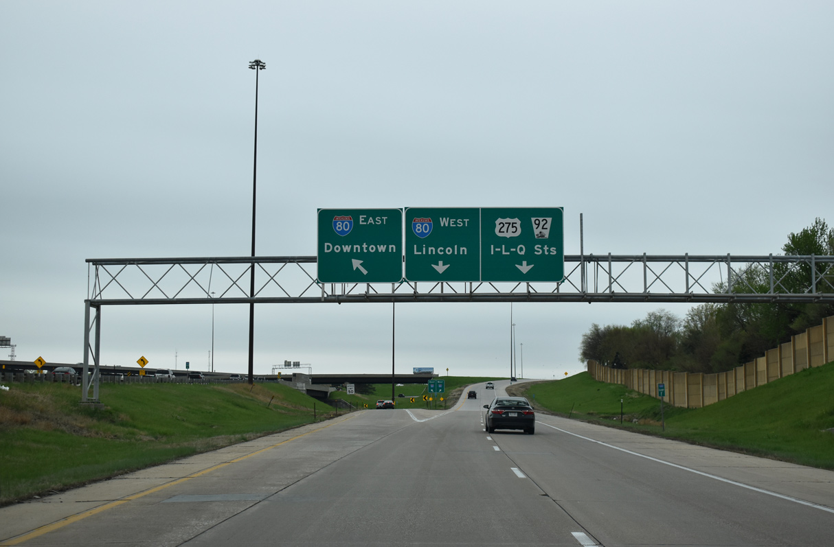
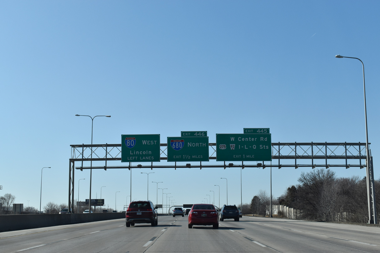
Two lanes partition from I-80 west for the c/d roadways running north to West Center Road and southwest to I-L-Q Streets. The additional roadways along both I-80 and I-680 were added during construction from Spring 1994 to December 1997 to better separate local and through traffic movements. 02/22/20
Three lanes follow onto the Interstate 680 mainline (Exit 446), which bypasses West Center Road (old N-38) to Pacific Street and the West Dodge Expressway (U.S. 6) leading to Elkhorn and Fremont. 02/22/20
 South End Throwback
![]() South at
South at ![]()
Replaced guide signs for I-680 south at Exit 1. The shield for N-38 was greened out, as it was decommissioned on January 1, 2003. 09/05/05
The c/d roadway for Exit 1 continues to parallel I-680 before merging onto the westbound I-80 c/d roadway that connects to U.S. 275/N-92 and the alphabet streets. 09/05/05
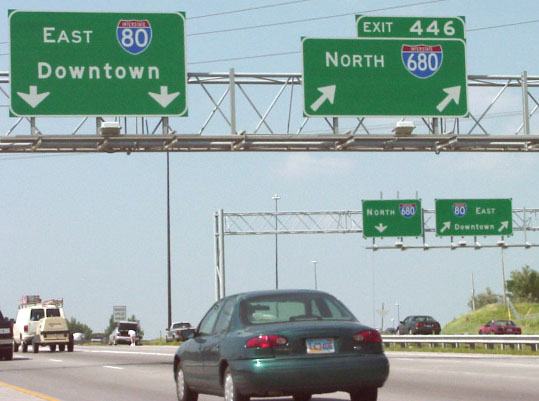
Separate panels for Interstate 80 east and Exit 446 for I-80 west were replaced with a diagrammatic sign by 2007. 09/05/05
11 lanes of traffic run between Exit 1 with West Center Road and Interstate 80 (Exit 446). Signs here were also replaced with a single diagrammatic sign by 2007. 09/05/05
![]() East at
East at ![]()
Interstate 80 east at the Exit 445 c/d roadway for U.S. 275/N-92 (L Street). I-80 was only four lanes wide at this time. Photo by Nick Wiltgen (05/01).
Widening of Interstate 80 to six lanes included sign changes at the L Street overpass. A lane drop now occurs at Exit 446. Photo by Nick Wiltgen (05/01).
Replaced guide signs and removed light fixtures as the split of I-80 east and I-680 north. No control city is used for Interstate 680 in Omaha. Photo by Dale Sanderson (2001).
Sources:
- “Mormon Bridge Opens.” Eugine Register-Guard (Eugene, OR), December 14, 1952.
- Mormon Pioneer Memorial Bridge, Johnweeks.com.
- “President Kimball speaks at rites ending tolls on Mormon Bridge.” The Deseret News (Salt Lake City, UT), April 28, 1979.
- Stephen Summers’s Interstate system route numbering page.
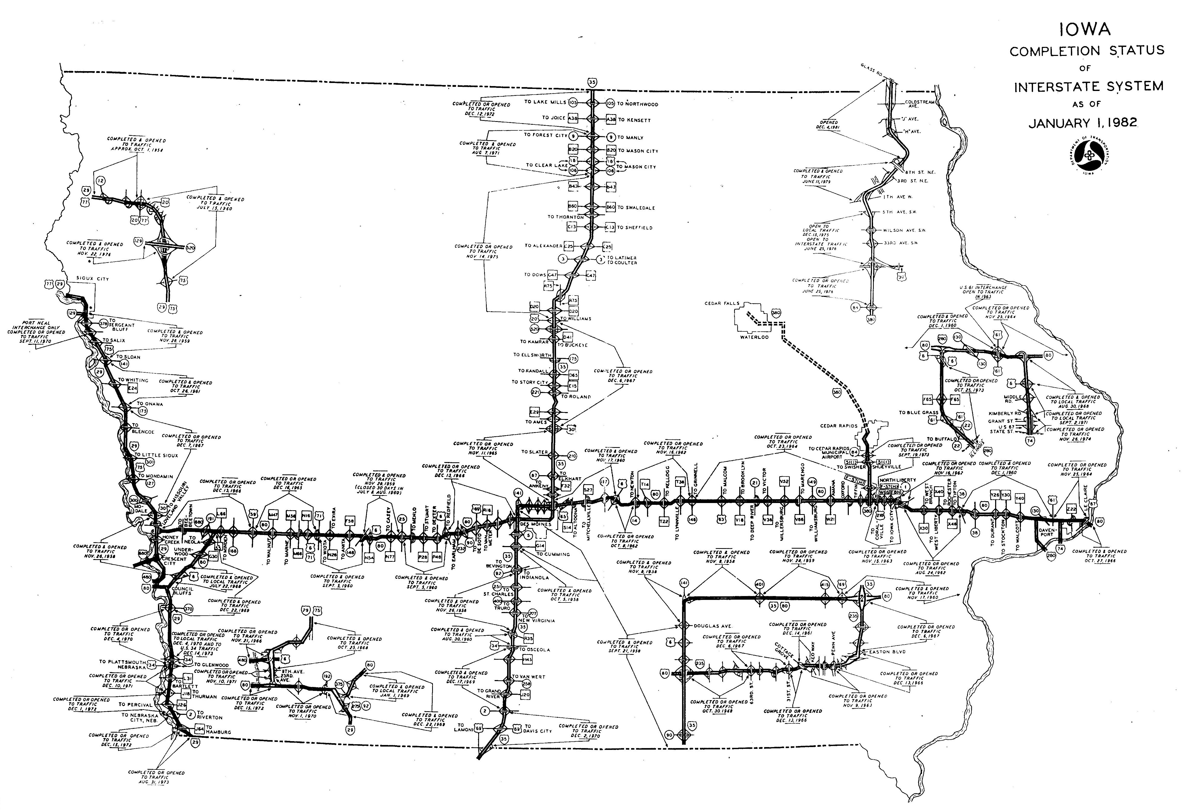
- “Iowa Completion Status of Interstate System as of January 1, 1982.” Iowa Department of Transportation.
- Nebraska Highways: Interstate 680 (Chris Geelhart).
http://www.northernplainshighways.org/nebraska/ne300up.html#I-680 - “‘Mormon Trail Interstate’ Opens in Nebraska.” The Deseret News (Salt Lake City, UT), August 31, 1974.
- “Major Highway Interchange Nears Completion Interstate Engineer Hopes for No Repeat Of Wet ’93 Summer.” Omaha World-Herald (NE), January 2, 1994.
- “Kennedy – Interstate 80 – 480 Interchange Work.” Omaha World-Herald (NE), June 29, 1994.
- “Rebuilding of I-80: End Is in Sight Final Work Going to Bid Soon Interstate Construction.” Omaha World-Herald (NE), July 14, 1997.
- “New Lanes May Unclog Rush Hour.” Omaha World-Herald (NE), November 22, 1997.
- “Interstate Rebuilding Is 99% Complete.” Omaha World-Herald (NE), December 14, 1999.
- “Interstate 680 Iowa/Nebraska Additions and Edits.” personal email from John 2889 at MSN dot com, 12/10/03.
- “A smoother ride at I-680-West Dodge.” Omaha World-Herald (NE), June 11, 2005.
- “I-680 widening nears the finish line.” Omaha World-Herald (NE), October 11, 2005.
- “Project unties the traffic knot – Expressway’s major work done earlier than expected – Smooth flow for construction.” Omaha World-Herald (NE), July 20, 2007.
- “Bridge’s reopening will please businesses – The Pacific Street bridge over I-680, closed since May for road work, may reopen as early as Saturday.” Omaha World-Herald (NE), August 22, 2008.
- “Happy holidays for I-680 rebuilders? – Two contractors chosen for the job have until Dec. 23 to open the road, with big bonuses for getting done earlier.” Omaha World-Herald (NE), September 27, 2011.
- “Early reopening of I-680 ends flood-forced detours.” Omaha World-Herald (NE), November 3, 2011.
Page updated November 4, 2020.