Interstate 680 Ohio
Overview
Interstate 680 branches north from I-76 at Beaver Township in Mahoning County, joining the Ohio Turnpike with the city of Youngstown. The freeway loop runs north between Boardman and the city of Struthers. Entering Youngstown at the Lansingville neighborhood, I-680 makes a sweeping curve west to South Avenue and then turns north to the inner belt freeway system encircling Downtown.
U.S. 62, U.S. 422 and Ohio State Route 193 represent the eastern half of the inner loop, joining I-680 with Youngstown State University and northern neighborhoods of the city. Turning westward to I-80, Interstate 680 meets SR 711, a 1.39 mile long freeway connector linking with both SR 11 north to Ashtabula and I-80 east to Sharon, Pennsylvania. I-680 west defaults onto I-80 west at the separation with SR 11 south by Mineral Ridge.
Exit numbers along Interstate 680 increase from north to south.
 History
The proposed Interstate Route System issued by Ohio in March 1958 inventoried the freeway loop through Youngstown as I-78. I-80 east into Pennsylvania was I-84 and the Ohio Turnpike was I-80. I-78/80 overlapped west to Streetsboro, where I-78 turned northwest along what is now I-480.
Revisions proposed by the Ohio Department of Highways reserved I-280 for the “Akron Bypass”, which had yet to be approved, and assigned Interstate 480 to the connecting loop in Youngstown. However, a request made from the state to the American Association of State Highway Officials (AASHO) on August 8, 1958 resulted in the change to Interstate 680. The original layout for I-77 took the route west from the Cleveland area alongside I-80/90 to Toledo and then north to an overlap with I-75 into Michigan. Ohio suggested that I-77 instead terminate at the junction of I-90 in Cleveland, eliminating what would have been a 118 mile long concurrency with I-80/90. The connecting loop in Toledo would then become Interstate 280, and I-480 assigned to Akron. AASHO entirely agreed with the Ohio proposal in a letter dated August 29, 1958, and on November 10, 1958, the urban Interstate numerology for the Youngtown area was approved.
Route Information
North End – Austintown, OH
South End – Beaver Twp, OH
Mileage – 16.43
Cities – Youngstown
- Junctions –

Source: December 31, 2021 Interstate Route Log and Finders List
The proposed route of Interstate 680 appeared on the 1962 County Engineer Map for Mahoning County, Ohio as the Relocation of S.R. 7. The project alignment extended south of the Ohio Turnpike near Five Points to SR 7 (Market Street Extension) midway between SR 165 and Pine Lake Road. This extension was never built.
Bids were opened for the construction of I-680 between Williamson Avenue and Hayes Avenue on the Youngstown Expressway system on September 27, 1960. The state estimated for building this section of I-680 was $1.483,800 and the low bid was $1.298,913.1 A 2.8 mile long section of I-680 south from Midlothian Boulevard (SR 625) in Youngstown to U.S. 224 west of Poland was programmed for an April 18, 1972 bid opening. Construction costs for this segment were estimated at $8.8 million.2 The section included bridges taking I-680 over Mathews Road and overpasses for U.S. 224 and Thalia Avenue above the freeway. Work was originally scheduled for completion on November 30, 1973.3
Prior to 1972, the Ohio Turnpike from Jackson Township, Ohio to Monroeville, Pennsylvania was designated as Interstate 80S. No changes were proposed for I-680 following the renumbering of I-80S to Interstate 76.
The final segment of Interstate 680 opened to traffic on December 15, 1975. Costing $16.2 million, the 10.3 mile long link extended from SR 625 to a partial interchange with South Avenue in Youngstown.4
A folded diamond interchange (Exit 16) with SR 164 (South Avenue) was constructed near the south end of Interstate 680. Construction on the $11.6 million project commenced in April 2018 and the exchange opened to traffic following a ribbon cutting ceremony on November 27, 2019. Work continued nearby on a park and ride site to mid 2020. SR 164 was also widened south to a roundabout built at SR 626 (Woodworth Road) and expanded across the Ohio Turnpike.5
 Photo Guides
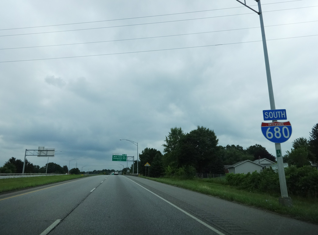
North End  – Mineral Ridge, Ohio
![]() North at
North at ![]()
![]()
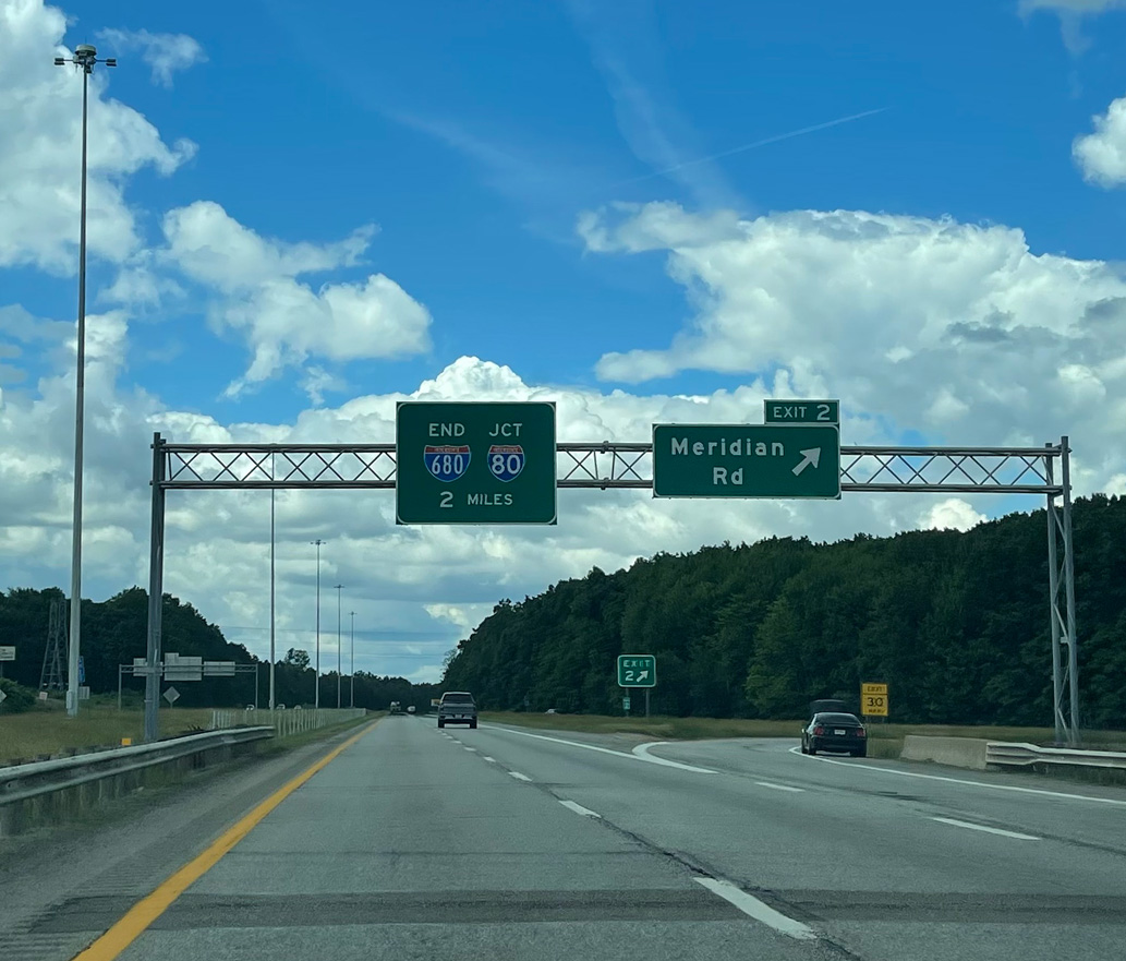
Interstate 680 crosses into Austintown Township at Exit 2 for Meridian Road, two miles from I-80/SR 11. Photo by Peter Johnson (06/14/21).
Interstate 680 advances west through a rural area to the four-wye interchange with I-80 west and SR 11 (Lake Erie to Ohio River Highway). Photo by Peter Johnson (06/14/21).
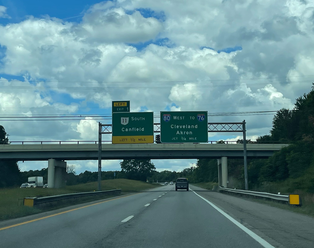
Left Exit 1 connects I-680 north with SR 11 south to Canfield and Columbiana. Photo by Peter Johnson (06/14/21).
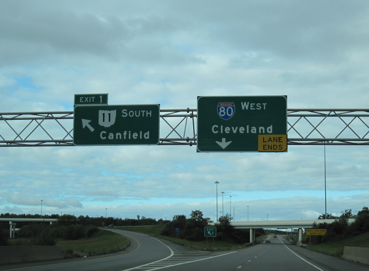
I-680 north defaults onto Interstate 80 west beyond Left Exit 1. Cleveland lies 67 miles to the northwest. 10/01/10
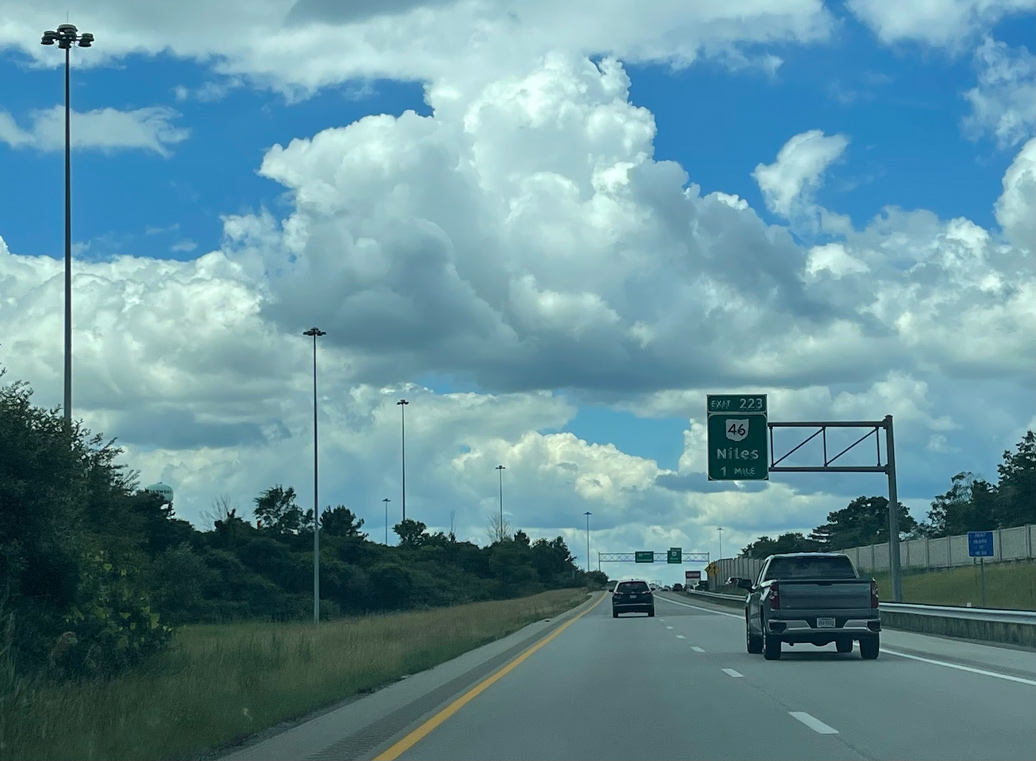
Traffic from I-680 northbound merges onto the left side of I-80 west ahead of the parclo interchange (Exit 223) with SR 46 (Canfield Niles Road). Photo by Peter Johnson (06/14/21).
![]() East at
East at ![]()
![]()
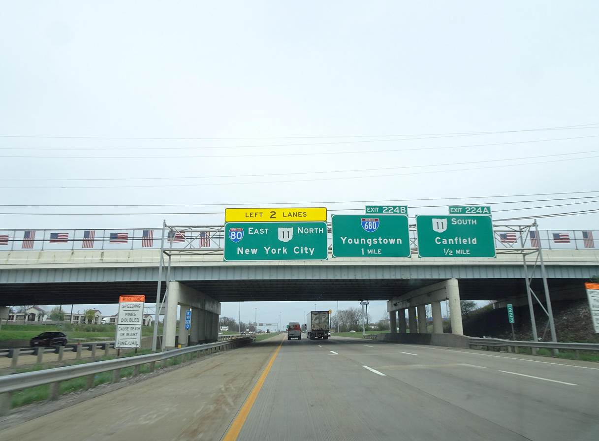
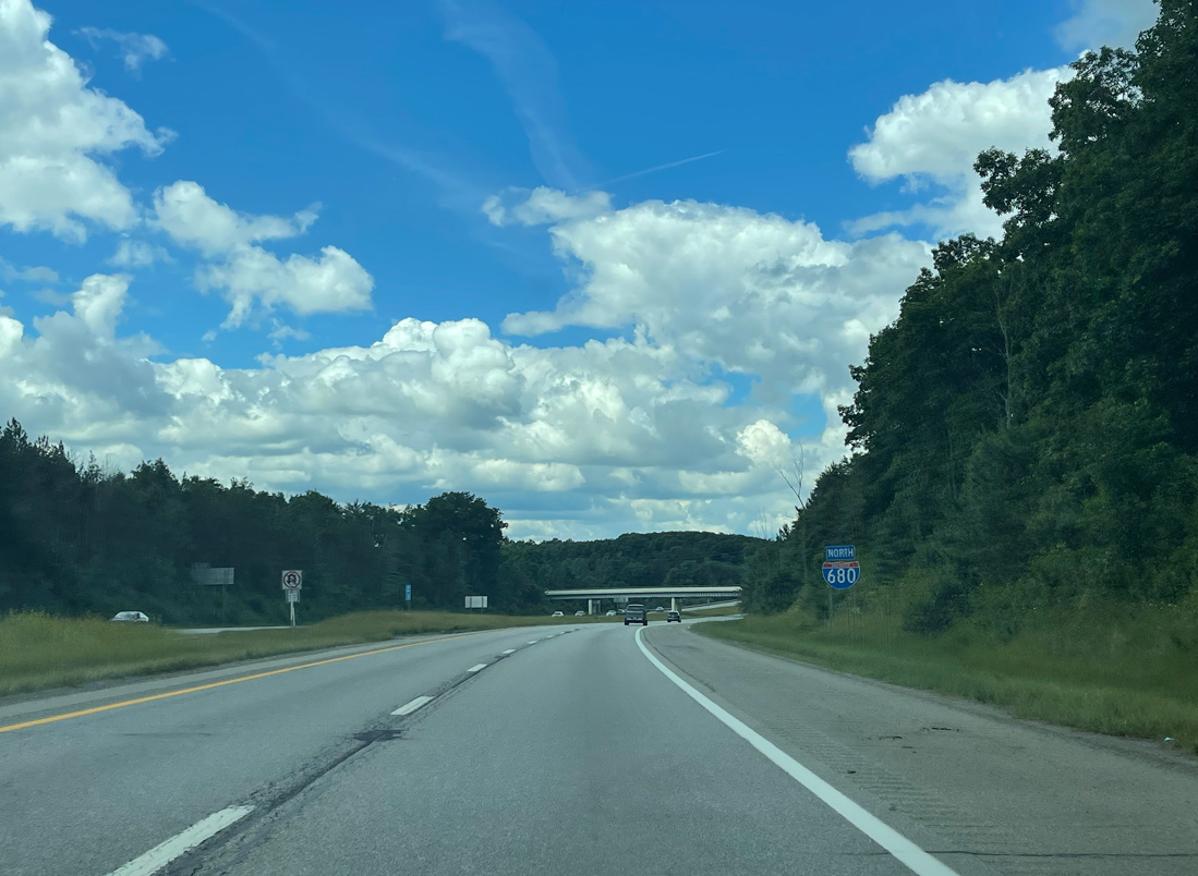
I-80 converges with SR 11 (Lake Erie to Ohio River Highway) and Interstate 680 a half mile east of the exchange (Exit 223) with SR 46 (N Canfield Niles Road) in Austintown Township. Photo by Eric Stuve (05/05/18).
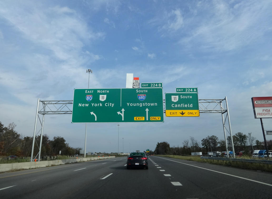
Completed in 1971, SR 11 is a freeway traveling south from Exit 224A to Canfield, Columbiana and East Liverpool. Photo by Eric Stuve (10/29/16).
SR 11 combines with I-80 northeast 4.1 miles from the multi level interchange with Interstate 680 to Girard and Churchill. Photo by Eric Stuve (05/05/18).
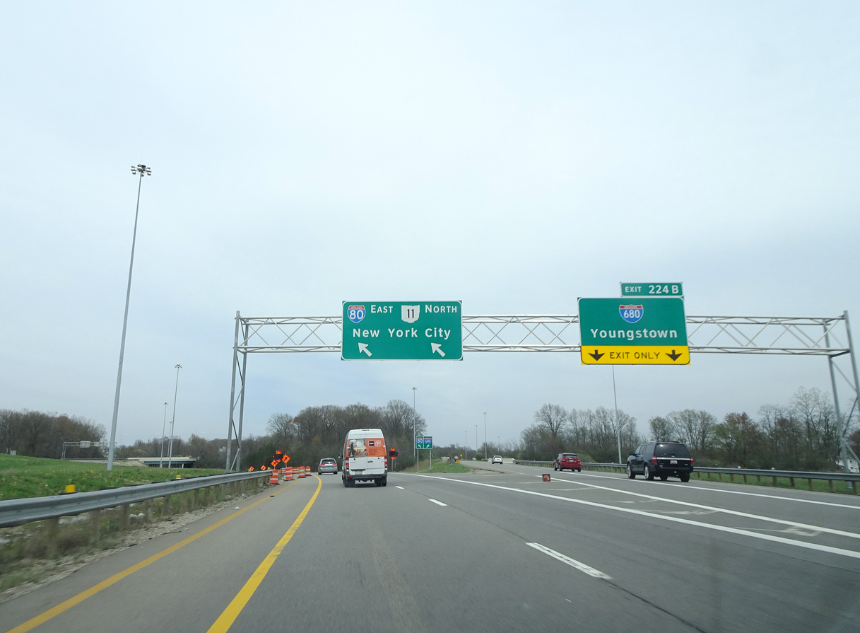
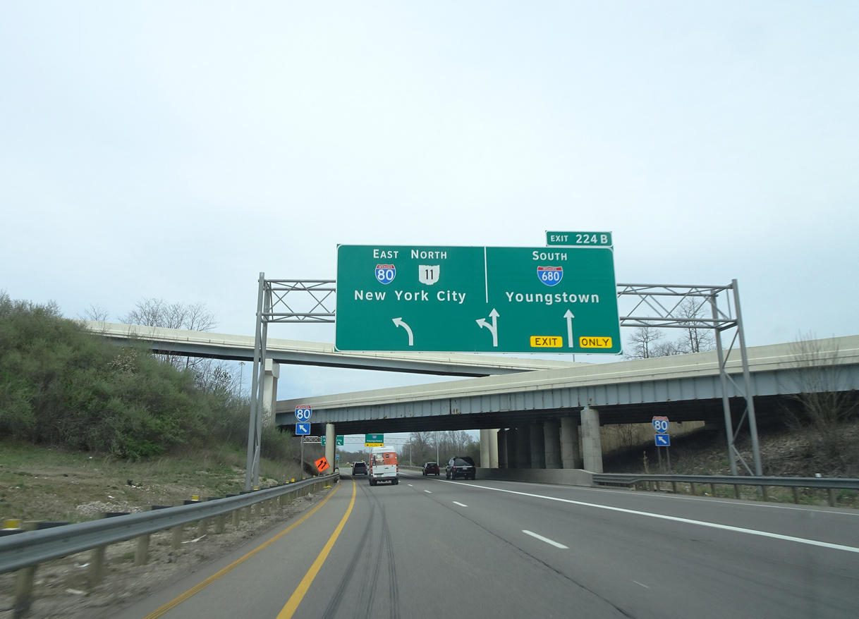
Interstate 680 leads six miles east from Exit 224B to Downtown Youngstown. Photo by Eric Stuve (05/05/18).
![]() North at
North at ![]()
![]()
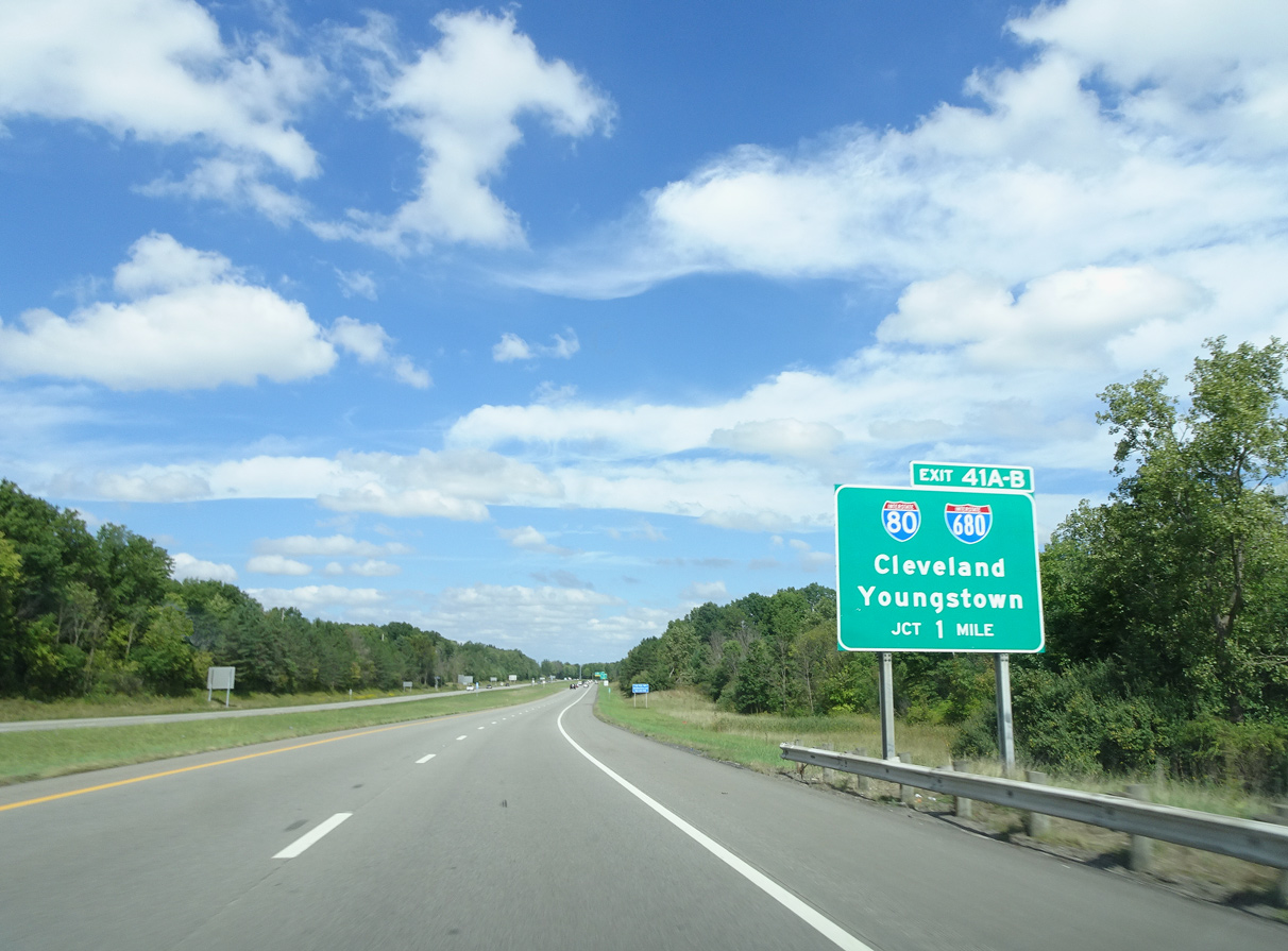
SR 11 heads north from Mahoning Avenue (CR 18) to I-80 and I-680 south at Exit 41. Photo by Eric Stuve (09/16/18).
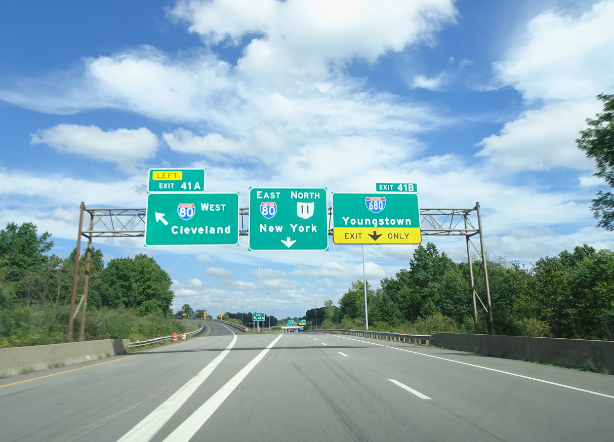
Left Exit 41A departs SR 11 north for I-80 west to the Ohio Turnpike (I-76) and Cleveland. Photo by Eric Stuve (09/16/18).
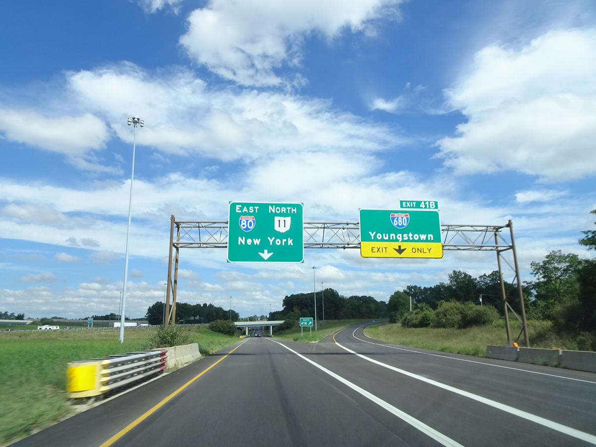
Single lane ramps separate for Interstate 680 south and SR 11 north onto I-80 east. SR 11 (Lake Erie to Ohio River Highway) continues north from the Youngstown area to Ashtabula. The last section of this freeway was completed in 1972. Photo by Eric Stuve (09/16/18).
South End – North Lima, Ohio
![]() South at
South at ![]()
![]()
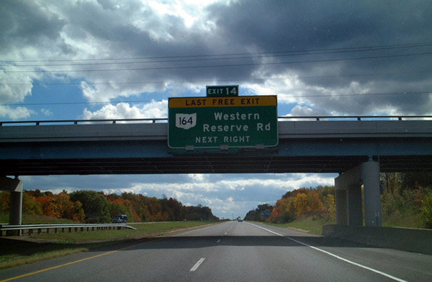
Interstate 680 continues from the village of Poland to SR 164 (Western Reserve Road) where Beaver, Boardman and Springfield Townships come together. Prior to 2019, this was the last exit southbound. 10/07/01
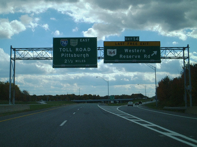
Interstate 680 previously defaulted onto I-76 (Ohio Turnpike) east toward Pittsburgh, Pennsylvania beyond the modified diamond interchange at Exit 14. 10/07/01
Intestate 680 concludes one mile south of the E. Calla Road (CR 30) underpass near Morgantown. Photo by Dan Garnell (07/12/03).
![]()
![]() West at
West at ![]()

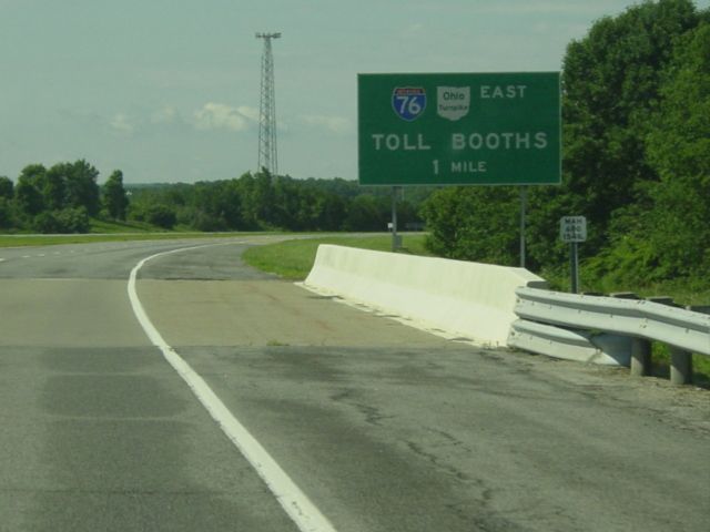
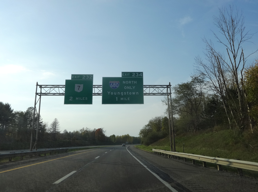
Interstate 76 (Ohio Turnpike) travels west from the Mahoning Valley Service Plaza in Springfield Township to meet the south end of I-680 at Exit 234. Photo by Eric Stuve (10/29/16).
Curving northward ahead of Yellow Creek, I-76 (Ohio Turnpike) advances one mile to the wye interchange (Exit 224) with Interstate 680 north. Photo by Eric Stuve (10/29/16).
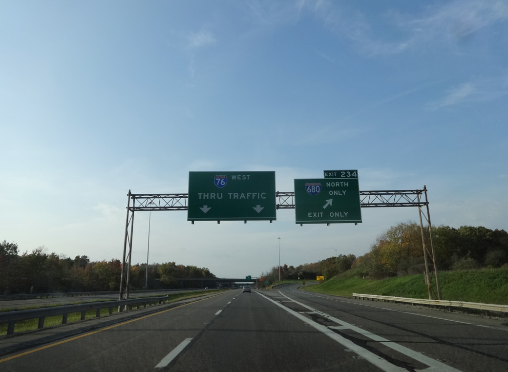
Entering Beaver Township, the Ohio Turnpike westbound reaches Exit 234 for I-680 north to Poland, Struthers and Youngstown. Photo by Eric Stuve (10/29/16).
Sources:
- “Bids Opened on Two Area Highway Jobs.” The Salem News (OH), September 28, 1960.
- “State to Push Bypass Extensions.” The Salem News (OH), January 14, 1972.
- “Mahoning Rt. 14 Paving is Planned.” The Salem News (OH), March 28, 1972.
- “I-680 Segment to Open.” The Salem News (OH), December 13, 1975.
- “Beaver Twp. interchange opens to I-680.” The Vindicator (Warren, OH), November 28, 2019.
Page updated July 14, 2021.