Interstate 590 New York

Overview
Interstate 590 forms part of the Rochester Outer Loop in Monroe County, New York. The commuter route arcs northeast through the town of Brighton from I-390 (Genesee Expressway) to the Can of Worms Interchange with I-490 along the Rochester city line. New York State Route 590 extends north from the exchange joining I-490/590 along a freeway to NY 104 and Sea Breeze Drive in the town of Irondequoit.
 History
The west leg of the Rochester Outer Loop at Gates and the east leg through Brighton were originally designated as New York Route 47. Interstate 390 was proposed northward from Henrietta and Brighton along the Genesee Expressway to I-490 and the Inner Loop at Downtown. Interstate 590 was approved by the American Association of State Highway and Transportation Officials (AASHTO) on November 10, 1973 from I-490 by Gates Center to I-490 in southeast Rochester.
The Genesee Expressway was canceled north of the Outer Loop due to both high costs and community opposition. This resulted in the replacing I-590 with a northern extension of I-390 over the western half of the Outer Loop. The switch was approved at the AASHTO meeting on June 25, 1979, but subject to Federal Highway Administration (FHWA) concurrence. The redesignation also included extensions of both I-390 north to Lake Ontario State Parkway and I-590 north to NY 104. However both expressways north of I-490 were never signed as Interstates and instead posted as NY 390 and NY 590 respectively.
The Rochester Outer Loop (former NY 47) was open south from the Can of Worms Interchange with I-490 to Winton Road in the town of Brighton by 1968. The Sea Breeze Expressway, including a portion of former U.S. 104, was also complete north to Ridge Road.
Route Information
North End – Rochester, NY
South End – Brighton, NY
Mileage – 5.31
- Cities – Rochester
- Junctions –

Source: December 31, 2021 Interstate Route Log and Finders List
I-590 Annual Average Daily Traffic (AADT)
Source: 2015 NYSDOT Traffic Data Viewer
The old Can of Worms interchange consisted of adjacent directional T interchanges along Interstate 490 with left exits joining I-590 and NY 590. The junction was redesigned to eliminate the overlap between I-590/NY 590 with I-490 by 1991.
 Photo Guides
North End 
 – Rochester, New York
![]() North at
North at ![]()
![]()
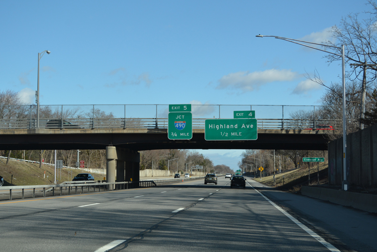
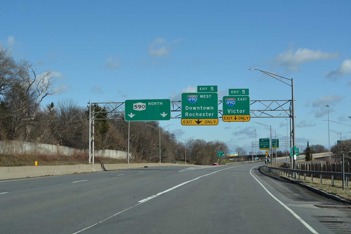
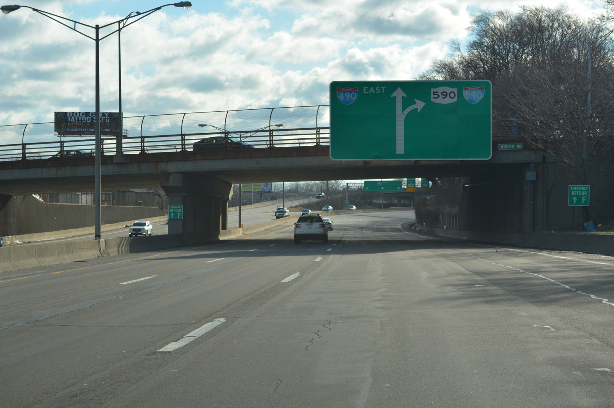
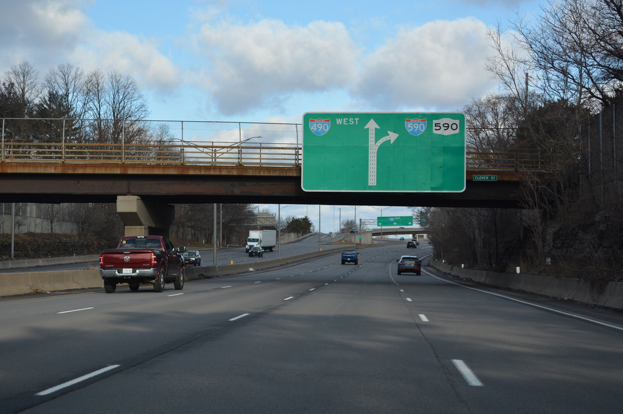
A split diamond interchange (Exit 4) joins I-590 with Elmwood Avenue and Highland Avenue in Brighton ahead of the exchange with Interstate 490 at Exit 5. 03/26/23
I-590 concludes north of the Highland Avenue overpass with two lanes continuing the Rochester Outer loop north onto NY 590 and two lanes separating for I-490 (Eastern Expressway). 03/26/23
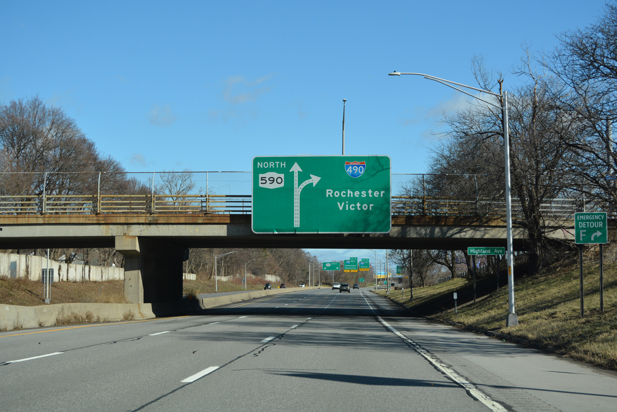
Major road construction at the Can of Worms Interchange in the early 1990s eliminated the dog leg alongside I-490 between I-590 and NY 590 north to the Seabreeze Expressway. 03/26/23
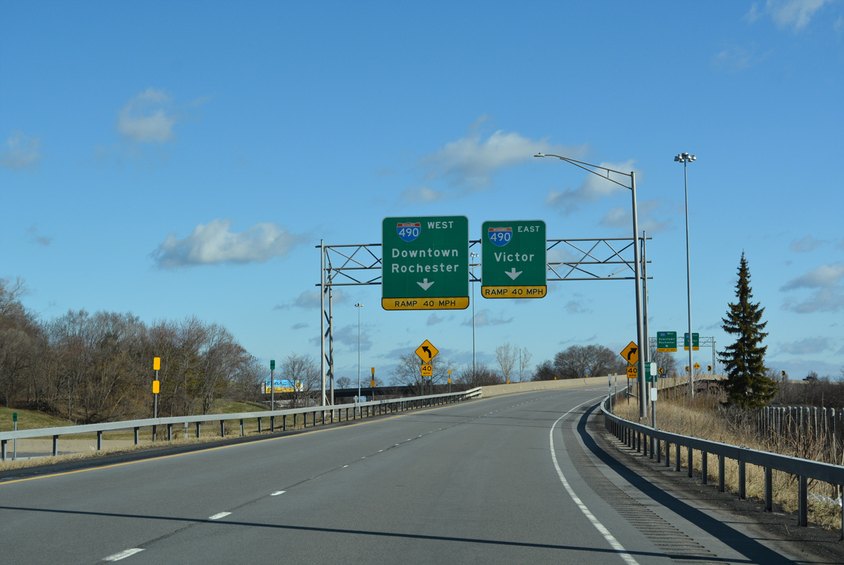
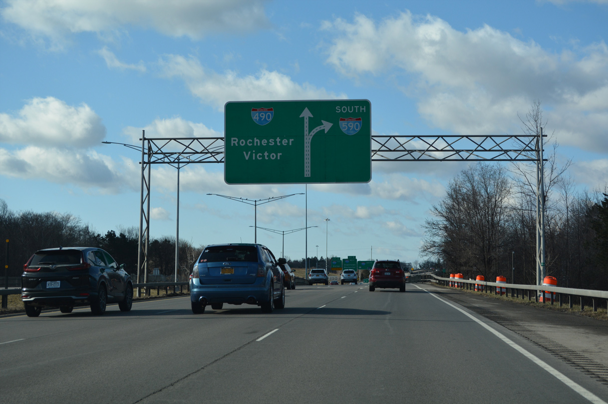
Flyovers link the north end of I-590 with Interstate 490 west between Cobbs Hill and Park Avenue in east Rochester to Downtown and I-490 southeast to Pittsford, Perinton and Victor. 03/26/23
Interstate 490 travels 11.5 miles southeast to the New York Thruway (I-90) at Victor and three miles west to the Rochester central business district. 03/26/23
![]() South at
South at ![]()
![]()
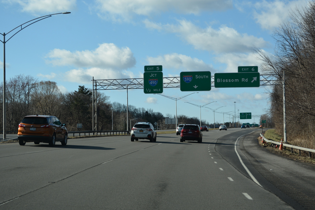
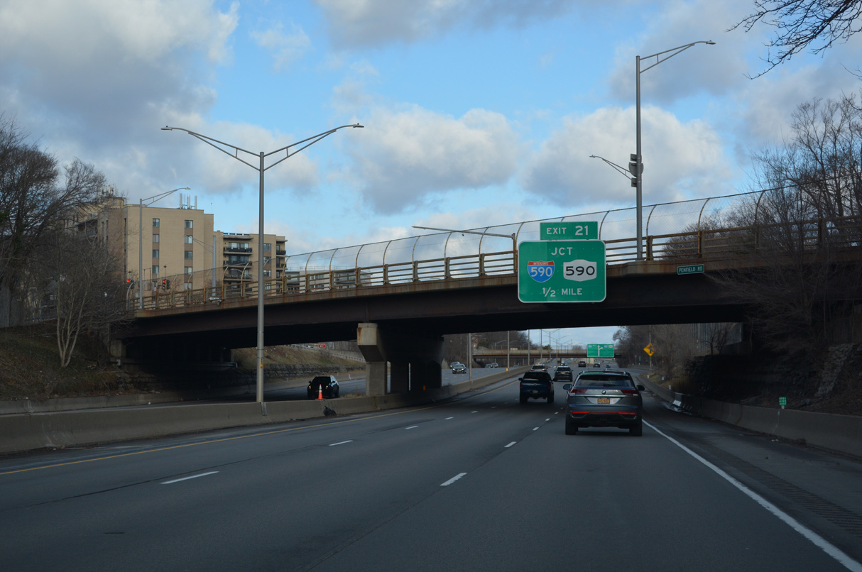
Exit 6 leaves NY 590 (Rochester Outer Loop) for Blossom Road to Browncroft in Rochester and Ellison Park in Brighton a half mile north of the Can of Worms Interchange (Exit 5) with Interstate 490. 03/26/23
Two lanes continue southwest from NY 590 onto I-590 through the exchange with I-490 (Eastern Expressway). 03/26/23
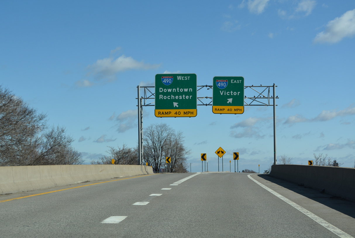
The lone left exit ramps at the Can of Worms Interchange connect NY 590 south with Interstate 490. 03/26/23
High flyovers separate from Exit 5 for I-490 west to Downtown Rochester and east to the New York Thruway at Victor. 03/26/23
![]() East at
East at ![]()
![]()
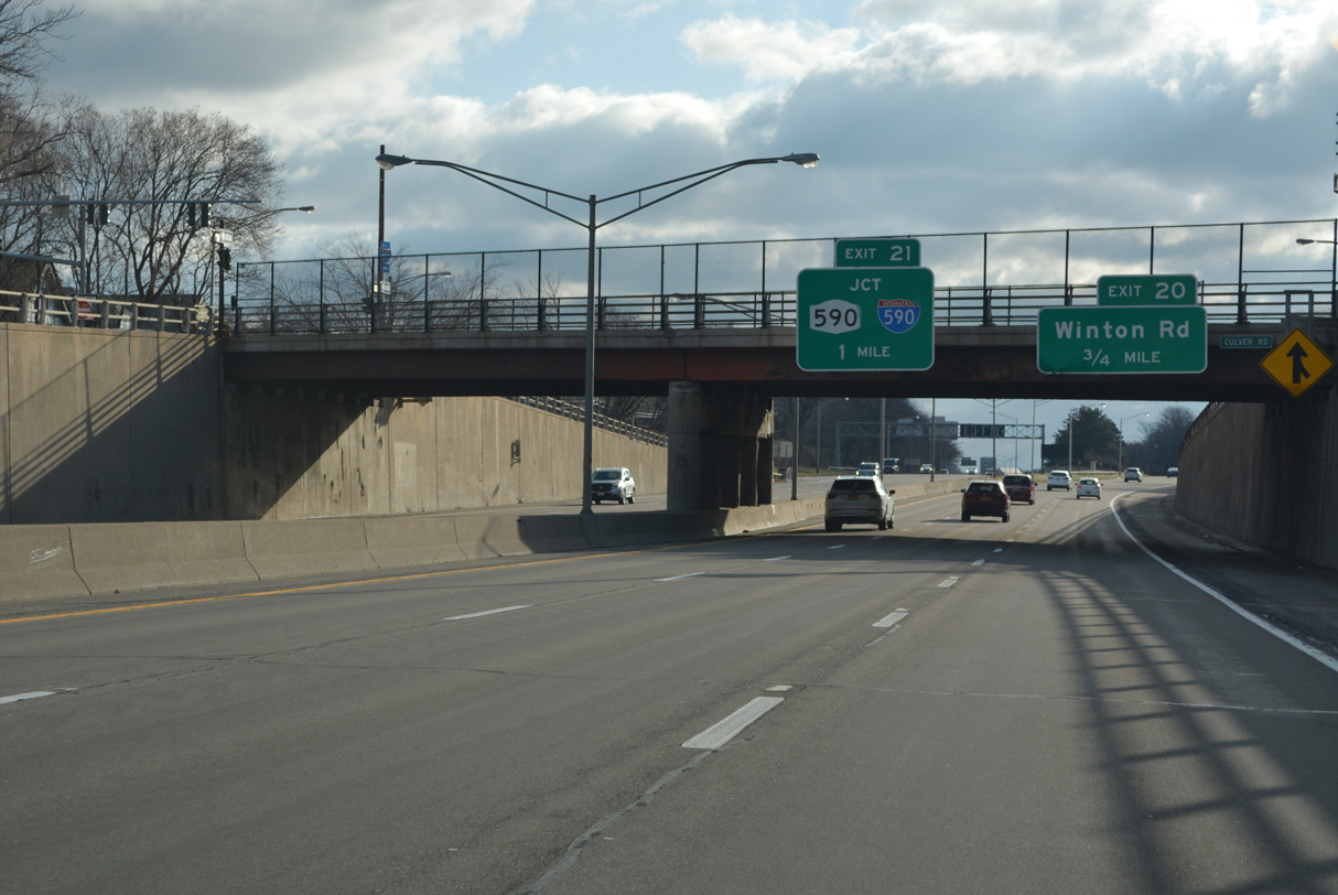
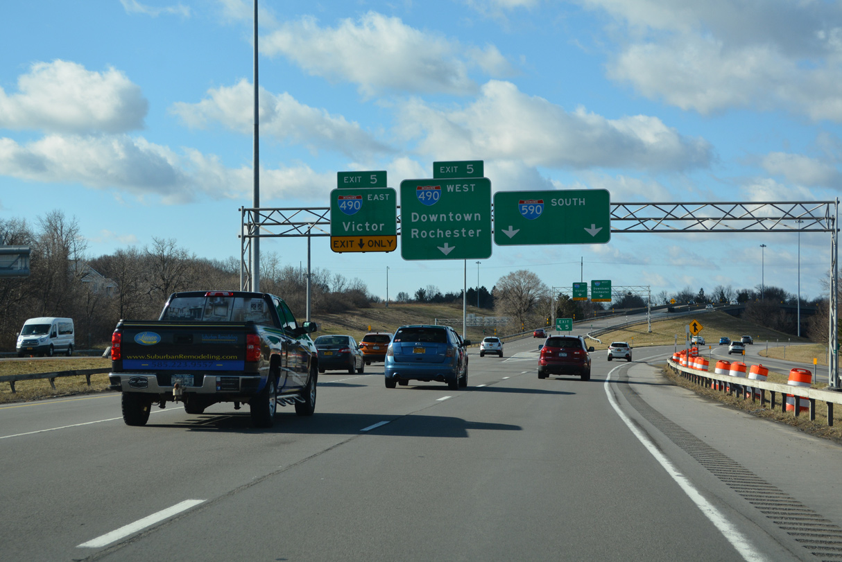
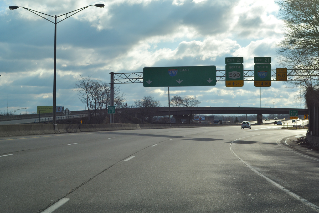
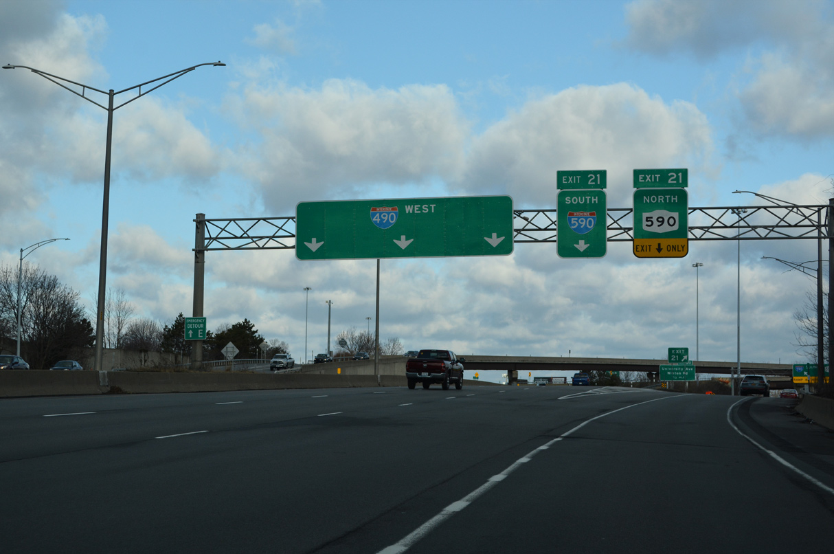
Traveling below grade, I-490 (Eastern Expressway) passes under Culver Road at the Upper Monroe and Cobbs Hill neighborhoods in South East Rochester one mile from the Can of Worms Interchange (Exit 21) with I-590/NY 590. 03/26/23
Exit 21 carries all traffic in unison for the Rochester Outer Loop south across the town of Brighton and north to Browncroft in east Rochester and the town of Irondequoit. 03/26/23
Interstate 490 continues east from the Can of Worms Interchange to Pittsford and East Rochester. I-590 (Rochester Outer Loop) arcs southwest to I-390 north of Henrietta and east of Greater Rochester International Airport (ROC). 03/26/23
NY 590 extends 5.1 miles north to Sea Breeze Drive at Titus Avenue at East Irondequoit. This sign bridge was removed by 2022. 05/10/05
![]() West at
West at ![]()
![]()
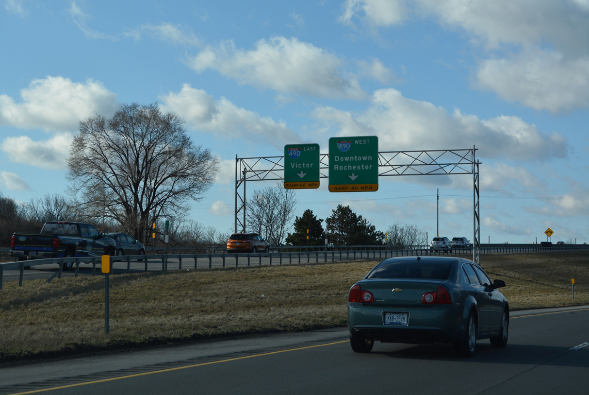
Entering the town of Brighton ahead of NY 441 (Linden Avenue), I-490 travels below grade northwest to the Can of Worms Interchange with NY 590 north and I-590 (Rochester Outer Loop) south. 03/26/23
Two lanes depart at Exit 21 for I-590 south through Brighton and NY 590 north to Irondequoit. 03/26/23
Crossing the Rochester city line, I-590/NY 590 (Rochester Outer Loop) angle northeast through overlapping directional T interchanges with Interstate 490. 03/26/23
Exit 21 partitions for a flyover to I-590 south to I-390 near the Strong neighborhood in south Rochester. A grade level ramp passes below a CSX Railroad line before joining NY 590 north to the Browncroft neighborhood in east Rochester and NY 104 at East Irondequoit. 03/26/23
South End – Brighton, New York
![]() South at
South at ![]()
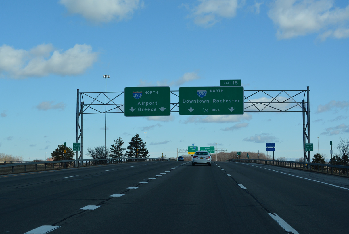
Interstate 590 (Rochester Outer Loop) south concludes one mile west from the diverging diamond interchange (Exit 1) with Winton Road. 03/26/23
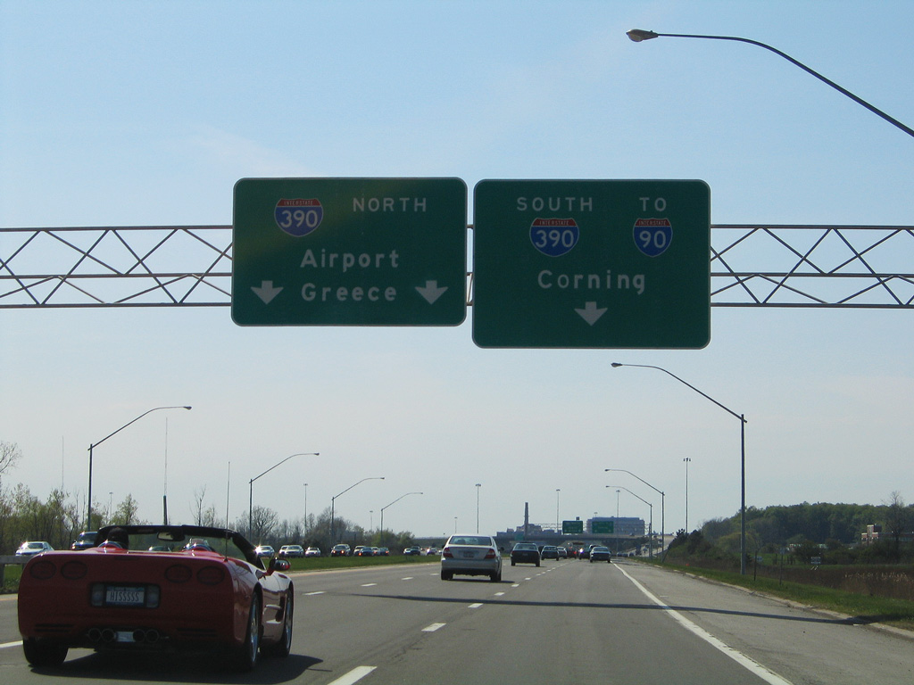
The Rochester Outer Loop continues northwest from I-590 as part of I-390 to Greater Rochester International Airport (ROC) and I-490 at Gates. NY 390 extends the freeway loop north to Lake Ontario State Parkway in the town of Greece. 03/26/23
A two lane flyover separates from I-590 for Interstate 390 (Genesee Expressway) south to the New York State Thruway (I-90) at Henrietta, Geneseo and I-86 (Southern Tier Expressway) in the town of Avoca. 03/26/23
The Rochester Outer Loop continues west along I-390 to the exchange with NY 15A (Henrietta Road) just outside the Rochester city limits. 03/26/23
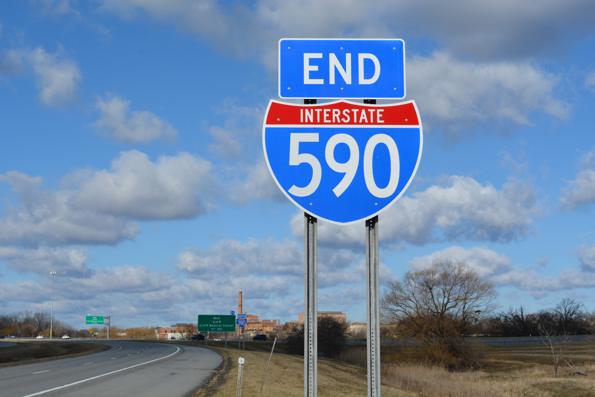
An end shield for Interstate 590 stands within the directional T interchange at I-390. 03/26/23
![]() South at
South at ![]()
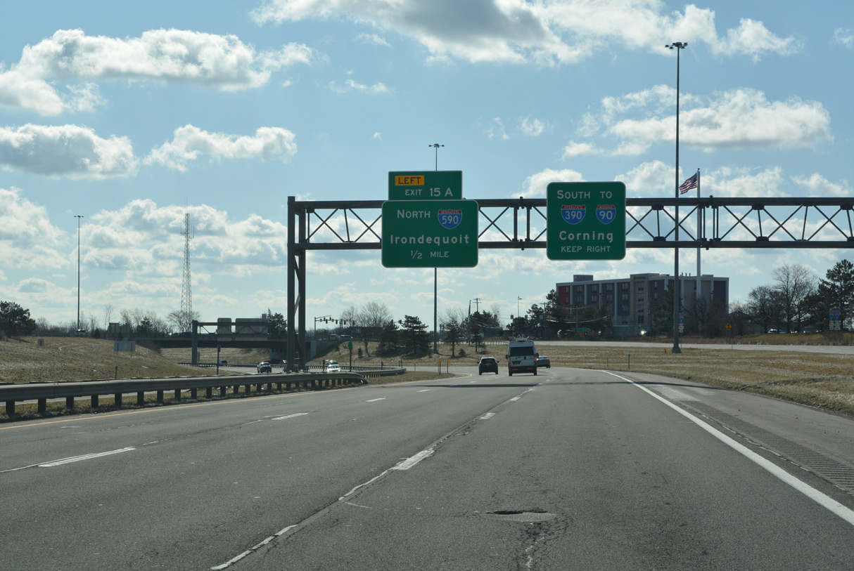
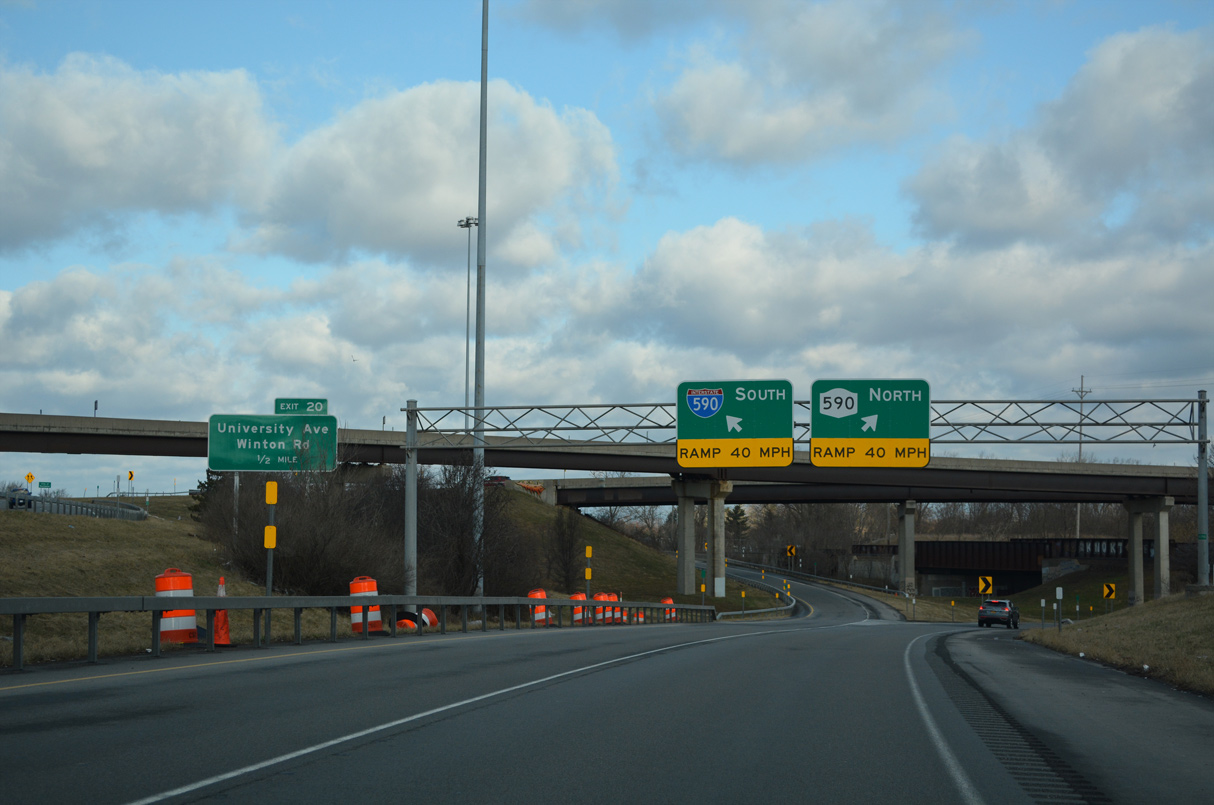
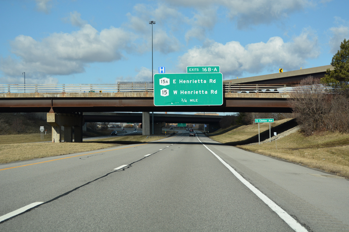
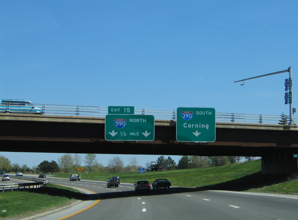
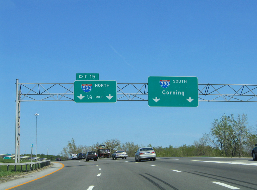
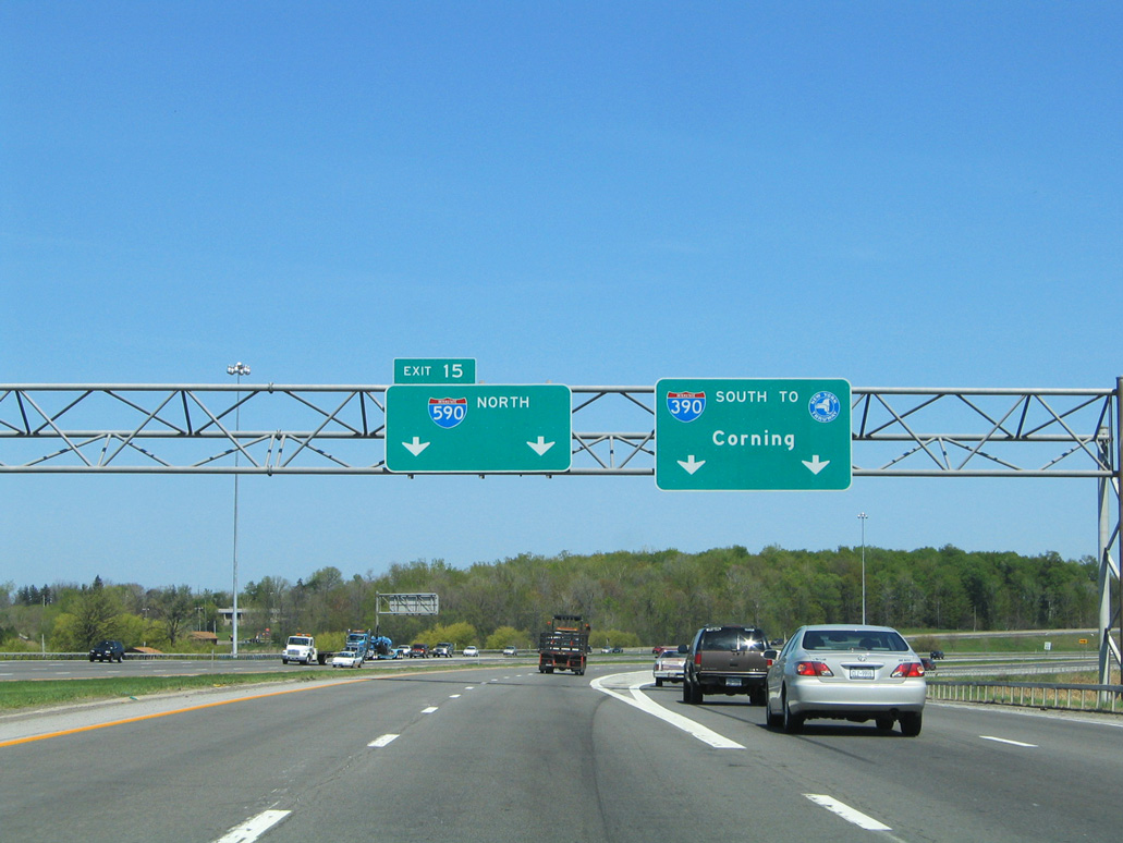
Interstate 390 navigates east through an S-curve from the parclo interchange (Exit 16 B) with NY 15A (Henrietta Road) to Left Exit 15A for I-590 (Rochester Outer Loop) north. 03/26/23
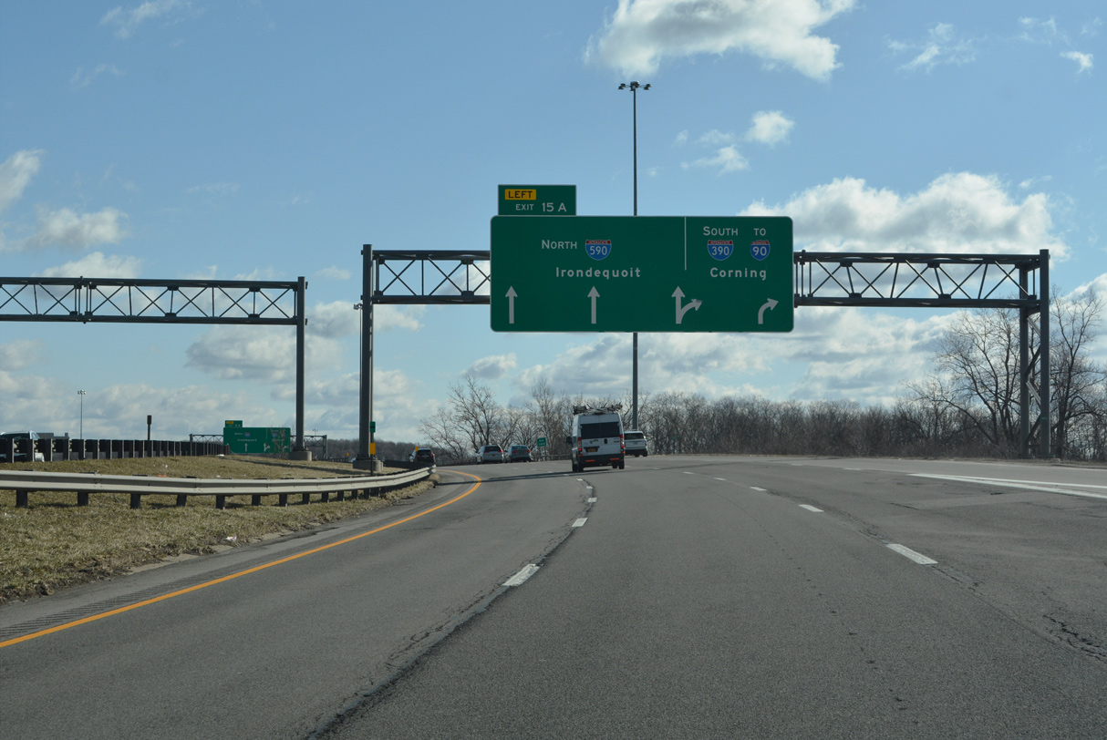
Crossing Erie Canal, I-390 enters the exchange (Exit 15 A) with Interstate 590 adjacent to Brighton Town Park. 03/26/23
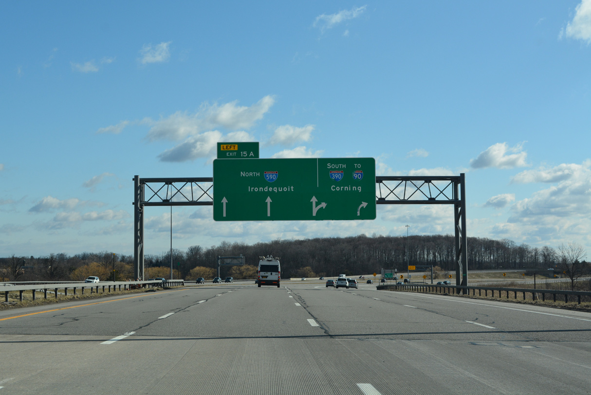
I-390 turns south through Henrietta and Rush en route to I-86 in the Southern Tier of New York. Interstate 590 loops northeast through Brighton toward Pittsford and I-490 at southeast Rochester. 03/26/23
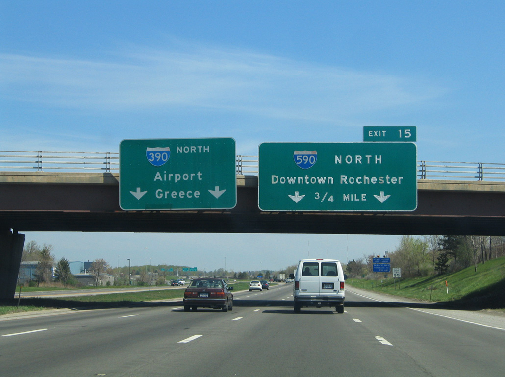
![]() North at
North at ![]()
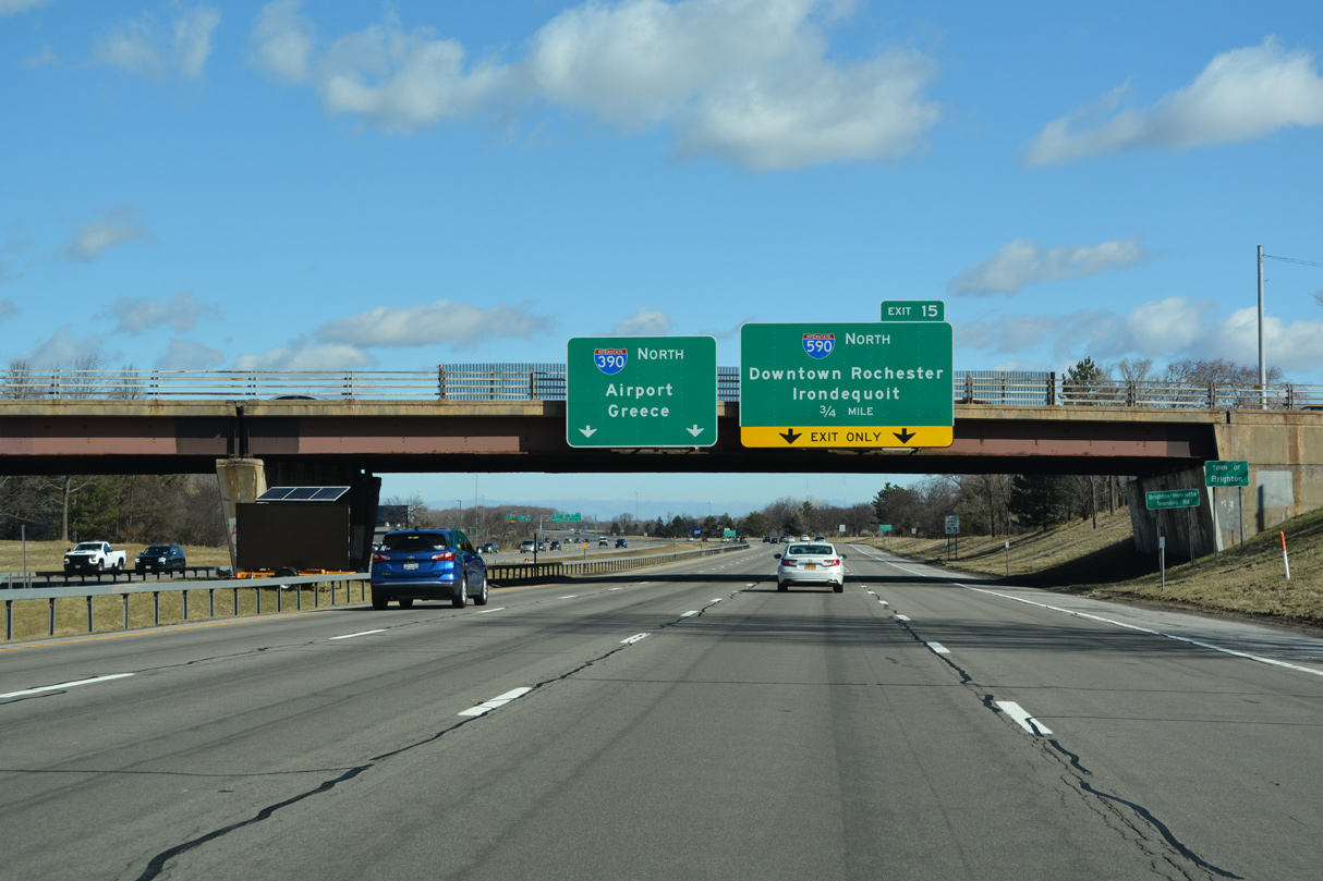
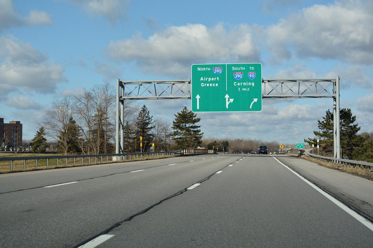
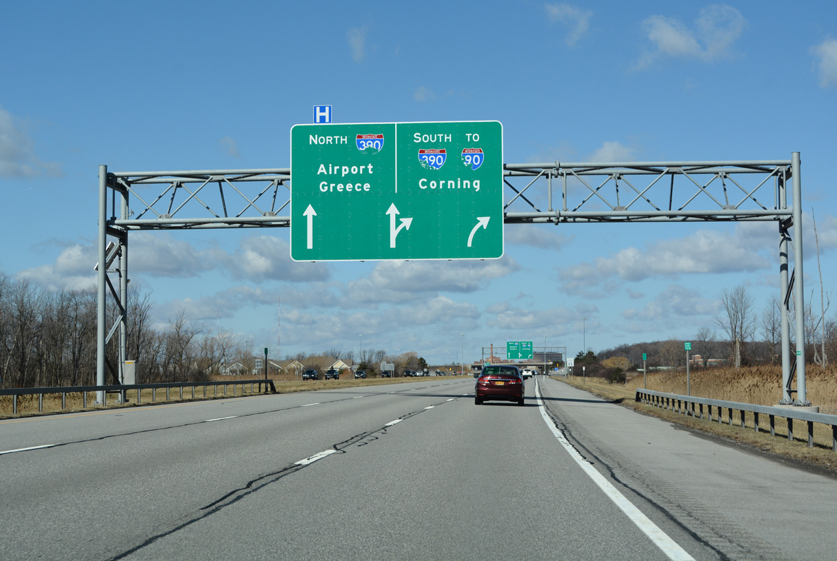
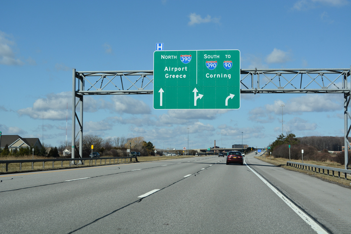
I-390 north enters the town of Brighton 0.75 miles ahead of the directional T interchange (Exit 15) with Interstate 590 and the Rochester Outer Loop. 03/26/23
Traffic along I-390 north partitions at Exit 15 beyond Erie Canal with two lanes joining Interstate 590 north through Brighton and two lanes shifting onto the Rochester Outer Loop to Greater Rochester International Airport (ROC). 03/26/23

I-590 north ties into I-490 at the Can of Worms Interchange, three miles east of Downtown Rochester. I-390 continues northwest to I-490 at the town of Gates. 03/26/23
South End Throwback
![]() South at
South at ![]()
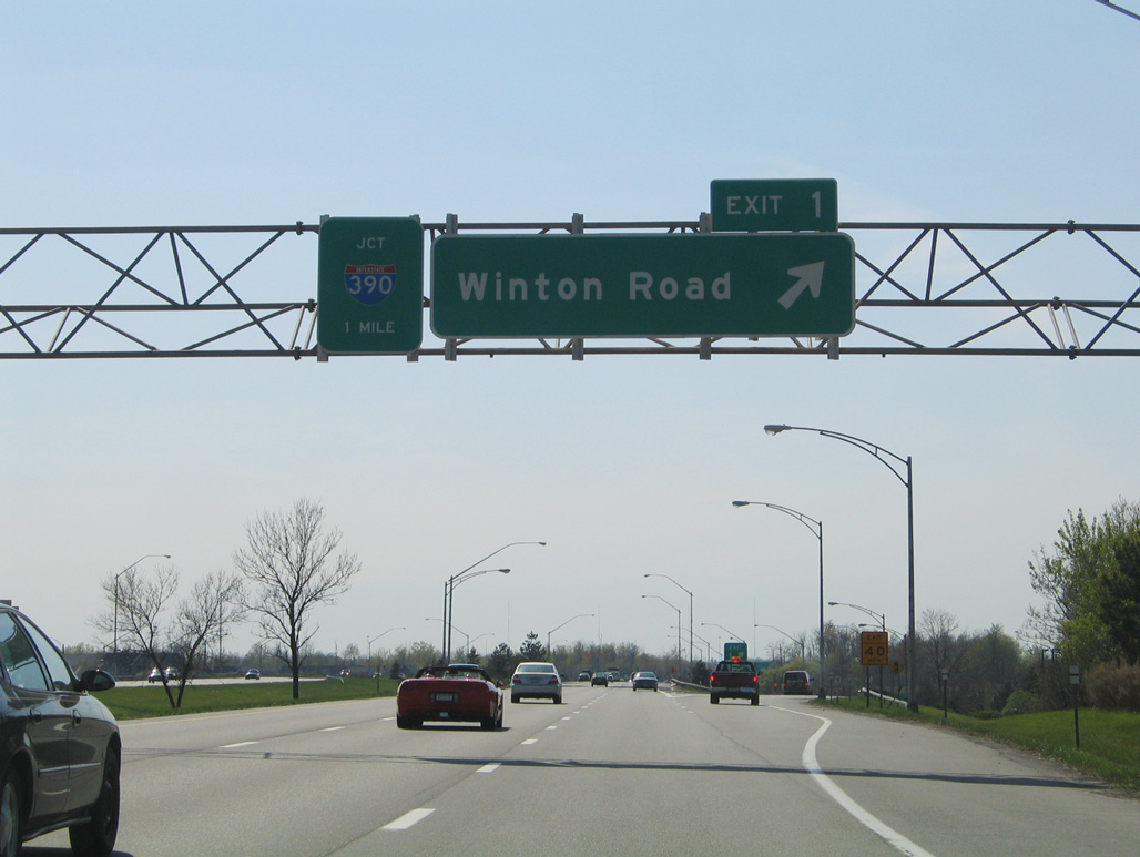
The first sign for I-390 on I-590 south previously appeared at what was a diamond interchange (Exit 1) with Winton Road. 05/10/05
Former overheads for I-390 on Interstate 590 west of Winton Road in Brighton. 05/10/05
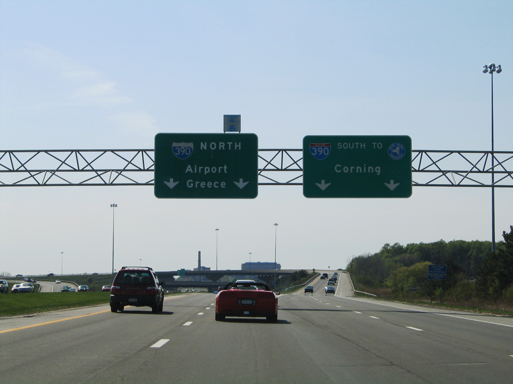
An APL overhead replaced these overheads at the directional T interchange joining the south end of I-590 with I-390. 05/10/05
![]() North at
North at ![]()
Replaced button copy overheads for Exit 15 on I-390 north at the Brighton-Henrietta Town Line Road overpass. 05/09/05
![]() South at
South at ![]()
The initial guide signs for Interstate 590 and Exit 15 were posted at the NY 15A (Henrietta Road) overpass. These were removed during road work in 2016. 05/10/05
Interstate 590 was originally just Exit 15. Exit 15 B is for Brighton-Henrietta Town Line Road to the south. 05/10/05
Guide signs for Interstate 390 use Corning, located beyond the end of I-390 along I-86/NY 17 east. 05/10/05
Page updated April 6, 2023.