Interstate 585 South Carolina
Overview
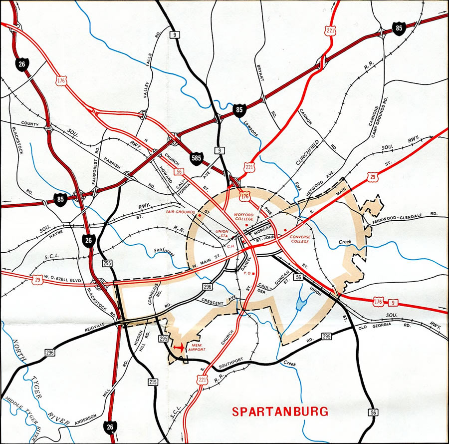
Interstate 585 is a short spur overlapping with U.S. 176 (N Pine Street) southeast from I-85 into Spartanburg. A diamond interchange joins the north end of I-585 with I-85/U.S. 176 at signalized intersections near Lone Oak. U.S. 176 was upgraded to Interstate standards southeast from the adjacent intersection with Upper Valley Falls Road / Fairforest Road to the University of South Carolina Upstate (USCS) campus by 2006. The original freeway for I-585 stretches 2.25 miles southeast from Business Loop I-85 into the city of Spartanburg by Pinewood Shopping Center.
Despite I-585 shields posted along U.S. 176 north to I-85, South Carolina Department of Transportation (GIS) data inventories only the section of U.S. 176 (N Pine Street) south from Business Loop I-85 as part of Interstate 585. Exit numbers for Interstate 585 utilize the mileposts of U.S. 176 starting from the North Carolina state line.
U.S. 176/S.C. 9 extend southeast along N Pine Street 0.57 miles to Garner Road. This section of arterial was formerly a part of Business Spur I-585. The last shield for the spur was removed after 2004, though a reassurance marker for I-585 north remains posted as of 2021.
Jim D’Amato, senior transportation planner with Spartanburg County, indicated that transportation planners were working on ramp upgrades and improvements to bring U.S. 176 to Interstate standards in order to tie into Interstate 85. He indicated that “Interstates have to link” in an article published by the Herald-Journal on February 2, 2005.4 Completed in 2006, work however left three at-grade intersections, including two at the diamond interchange with I-85.
There remain no plans to upgrade the exchange between I-85 and U.S. 176 to a freeway to freeway interchange. The US 176 Corridor Improvements underway between Winter 2017 and Winter 2018 instead made center median improvements and coordinated traffic signals from Springfield Road east to Fairforest Road. The $1.7 million project was approved on December 3, 2009.8
Route Information
North End – Southern Shops, SC
South End – Spartanburg, SC
Mileage – 2.25
Cities – Spartanburg
- Junctions –

Source: December 31, 2021 Interstate Route Log and Finders List
Portions of the original alignment of Interstate 85 through Upstate South Carolina were constructed in the 1940s as a bypass for U.S. 29. The substandard and narrow design through Spartanburg led to the relocated I-85, which was built between 1988 and 1995.
 History
Interstate 585 opened as a freeway for U.S. 176 in 1957.1,5 It was built in conjunction with projects to upgrade the U.S. 29 bypass of Spartanburg to Interstate 85.
Efforts to relocate Interstate 85 away from Spartanburg onto a new alignment in 1983 led to a Spartanburg Area Transportation Study (SPATS) committee vote in 1984 pertaining to area highways. The SPATS recommendation to the South Carolina Highway Department included an access improvement plan for both Interstate 585 and Asheville Highway (S.C. 56). A study presented to Spartanburg City Council in May 1984 recommended designating both I-585 and S.C. 56 as primary routes to and from the Spartanburg central business district while renumbering the old I-85 as Interstate 285 once the new alignment for I-85 opened to the north.
Improvements proposed for I-585 and S.C. 56 included new way finding signs for Uptown Spartanburg, extending street lighting, replacing Hearon Circle with a diamond interchange and building a half cloverleaf interchange between Pine Street (Business Spur I-585 / U.S. 176) and McCravy Drive. The SPATS committee however differed from a city council study, suggesting the highway department consider an alternative to the McCravy Drive interchange.10 Upgrades at Hearon Circle and for Pine Street at McCravy Drive were never implemented.
The new alignment for Interstate 85 opened to traffic in August 1995. SCDOT received approval from the American Association of State Highway and Transportation Officials (AASHTO) for both the relocation of I-85 and the recognition of Business Loop I-85 on April 22, 1995. This left I-585 as a spur from the cloverleaf interchange with the business route by the Milliken Arboretum.
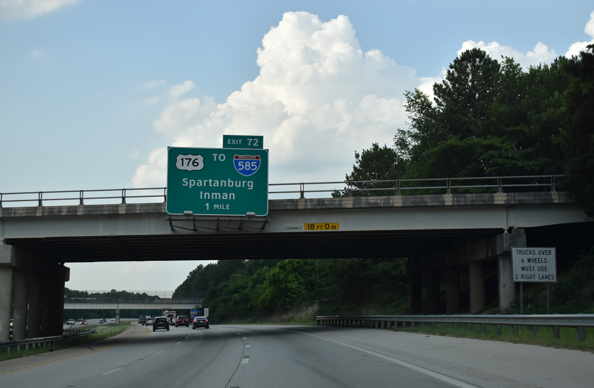
U.S. 176 was upgraded to Interstate standards from Business Loop I-85 northwest to Interstate 85 as part of a two phase project starting in 2003. The first phase involved interchange construction at both Campus Boulevard to USCS and Valley Falls Road. Phase two focused on upgrading the remainder of U.S. 176 to I-85.2 Costing $62 million, road work was formally completed following a ribbon cutting ceremony held on October 25, 2006.3
Further south in Spartanburg, a $3.5 million project added a new off-ramp from Interstate 585 east to S.C. 9 (Church Street), replacing an adjacent ramp to U.S. 221 (Whitney Road). The work modified the entrance ramp bringing S.C. 9 south onto I-585 into a distributor roadway connecting the new S.C. 9 exit with U.S. 221. This replaced a weaving traffic pattern on the I-585 mainline leftover from the 1950s design of the freeway. Construction on the ten month long project started in May 2005.4
The California Avenue overpass at Exit 24 was damaged by a tractor trailer hauling machinery in January 2014. The incident dislocated the span by nearly five feet, leading to its closure and subsequent demolition.5 A $12 million project followed to replace both the damaged span and to raise the height on the nearby bridge carrying S.C. 9 over I-585 by two feet.6 The California Avenue bridge reopened in March 2015. Associated repaving along I-585 and work on the S.C. 9 overpass were completed in mid June 2015.7
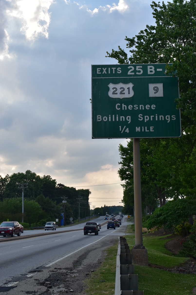
S.C. 9 combines with I-585/U.S. 176 (N Pine Street) south from Boiling Springs Road ahead of the diamond interchange (Exit 25B) with U.S. 221 (Whitney Road) and the Spartanburg city line. 05/25/21
 Photo Guides
North End 
 – Southern Shops, South Carolina
![]() North
North ![]() West at
West at ![]()
I-585/U.S. 176 shift west from the diamond interchange with Valley Falls Road at Lone Oak one mile ahead of Interstate 85. Photo by Carter Buchanan (08/20/16).
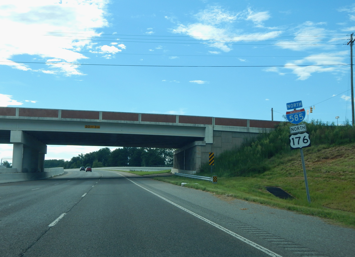
A reassurance shield acknowledges N Pine Street as Interstate 585 north at the Valley Falls Road (Road 79) overpass. Photo by Carter Buchanan (08/20/16).
The final confirming marker for Interstate 585 north stands beyond the entrance ramp from Valley Falls Road. Photo by Carter Buchanan (01/16/16).
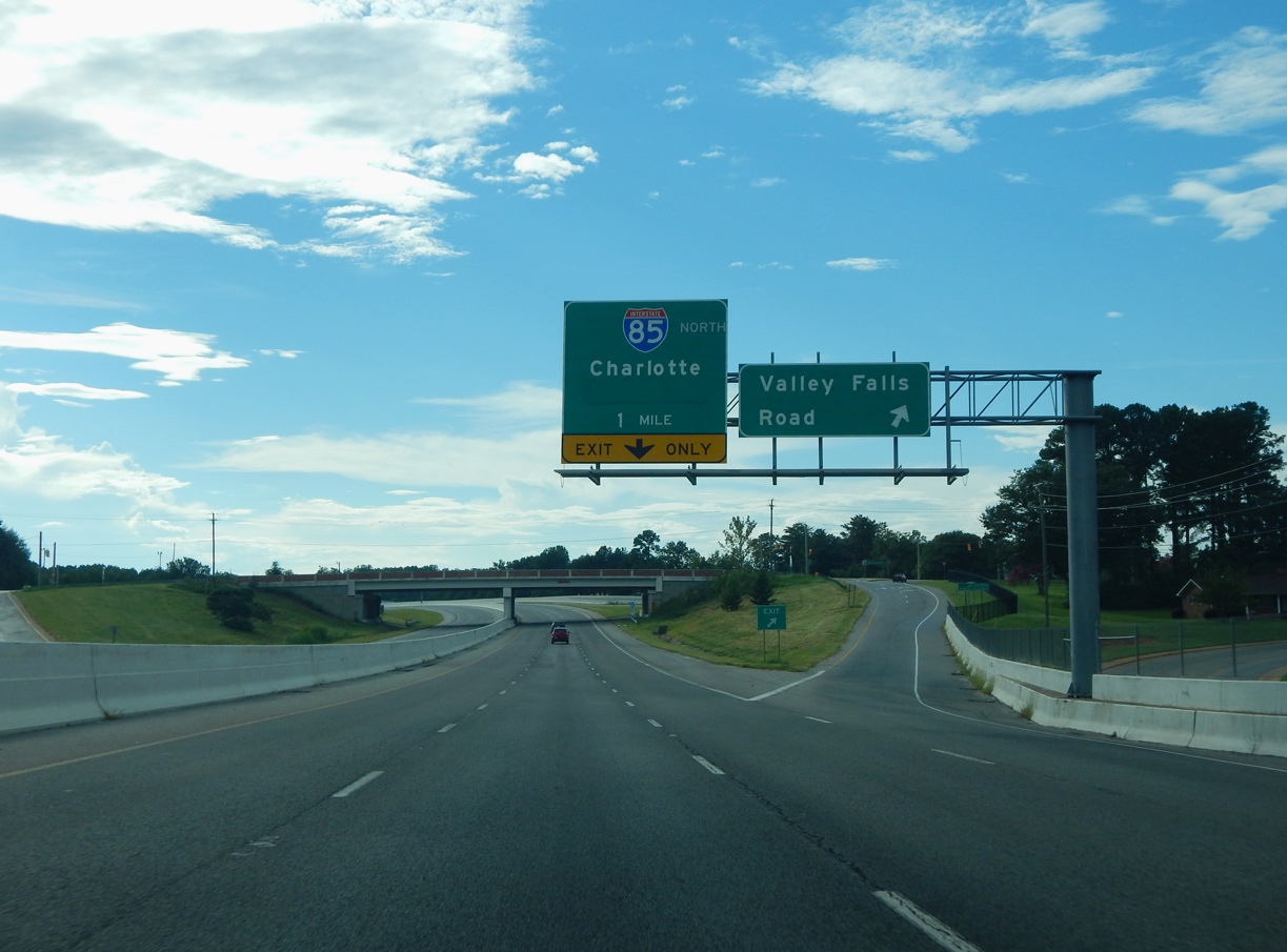
A signalized intersection with Fairforest Road south and Upper Valley Falls Road north precedes the diamond interchange joining I-585/U.S. 176 (N Pine Street) with I-85. Photo by Carter Buchanan (01/16/16).
The right lane defaults onto the entrance ramp for I-85 north to Gastonia and Charlotte, North Carolina. U.S. 176 (N Pine Street) proceeds north to overtake S.C. 56 along Asheville Highway to Dodd Hill and the city of Inman. Photo by Carter Buchanan (01/16/16).
![]() East at
East at ![]()
![]()
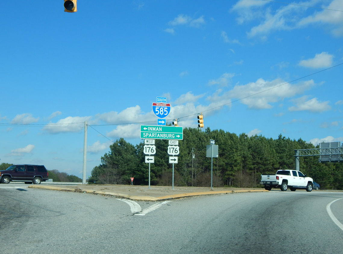
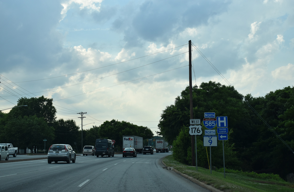
U.S. 176 branches east from Asheville Highway (S.C. 56) 0.46 miles to the diamond interchange (Exit 72) with Interstate 85 by Southern Shops. Photo by Carter Buchanan (08/21/16).
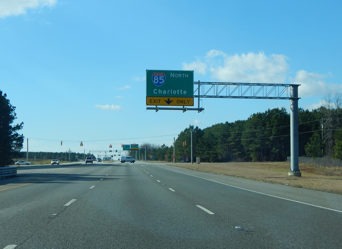
Interstate 85 leads southwest from U.S. 176 (N Pine Street) toward Duncan, Greer and Greenville. Photo by Carter Buchanan (08/21/16).
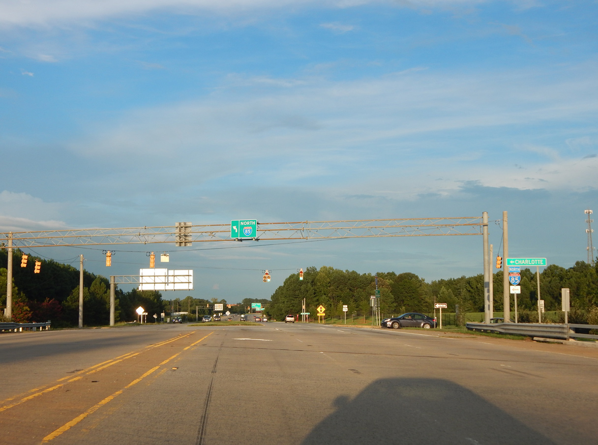
Crossing over I-85, U.S. 176 (Pine Street) reaches the northbound entrance ramp to Gaffney, Kings Mountain and Charlotte, North Carolina. Traffic lights were added here by 2011. Photo by Carter Buchanan (08/21/16).
![]() North at
North at ![]()
![]()
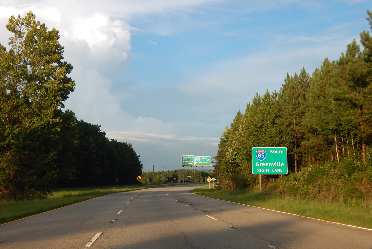
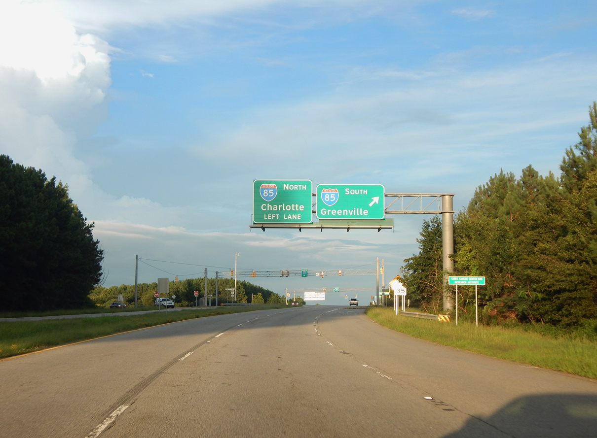
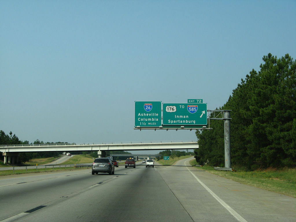
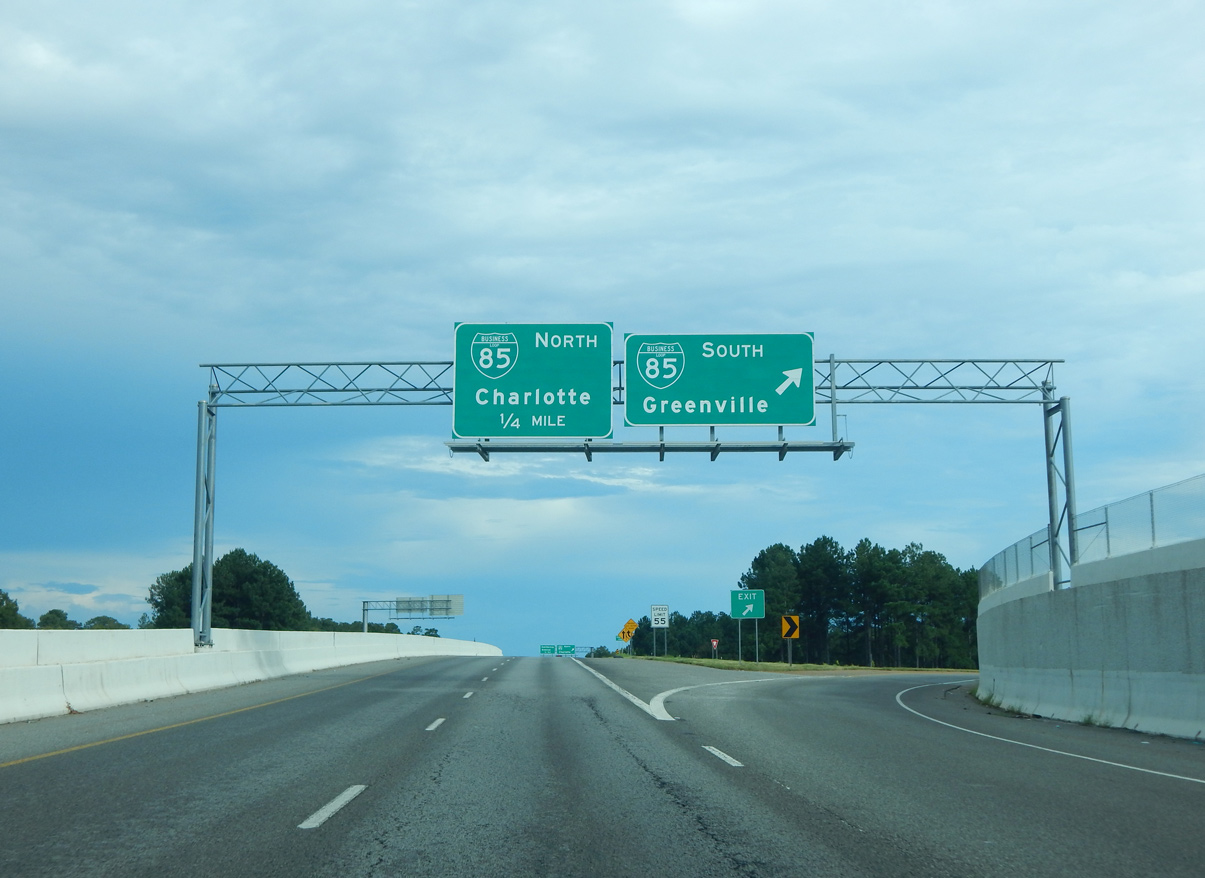
Leaving the cloverstack interchange with Interstate 26, I-85 navigates through an S-curve under New Cut Road (Road 65) and a Norfolk Southern Railroad ahead of the diamond interchange (Exit 72) with U.S. 176 (N Pine Street) and I-585 south. 05/25/21
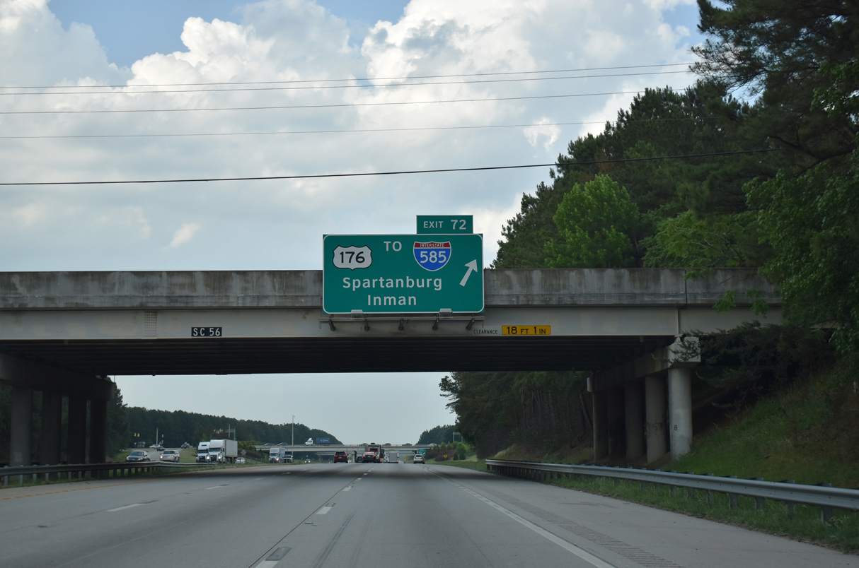
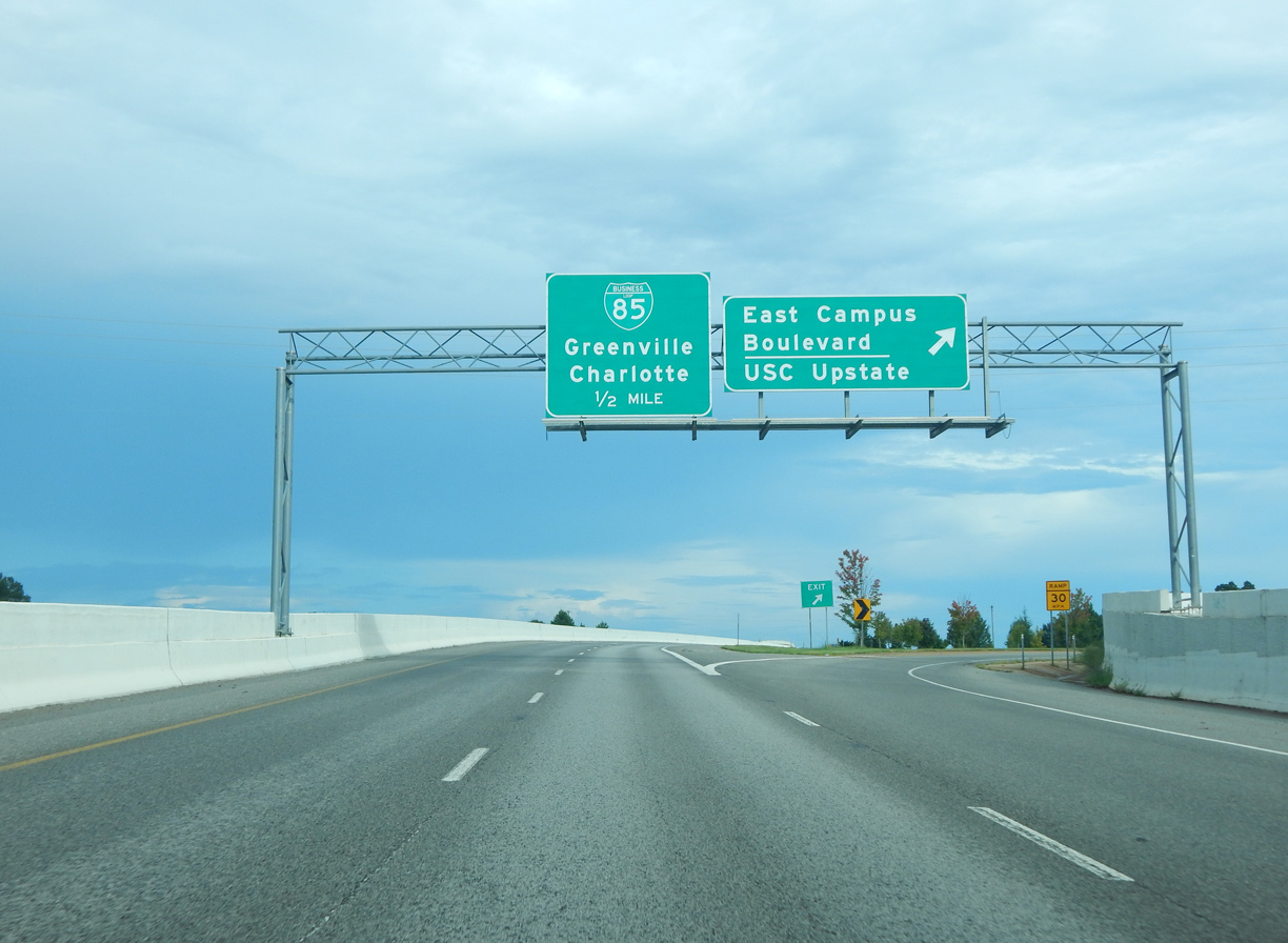
Exit 72 departs I-85 north beyond the S.C. 56 (Asheville Highway) overpass for U.S. 176 (N Pine Street) west to Inman and I-585/U.S. 176 east to USC Upstate and Spartanburg. 05/25/21
The initial stretch of I-585 travels at-grade, with signalized intersections both at the ramps to I-85 and at Fairforest Road / Upper Valley Falls Road nearby. Photo by Carter Buchanan (01/16/16).
![]() South at
South at ![]()
![]()
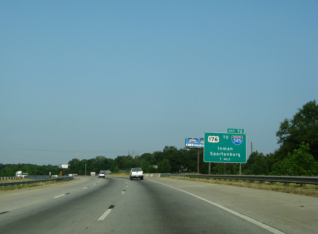
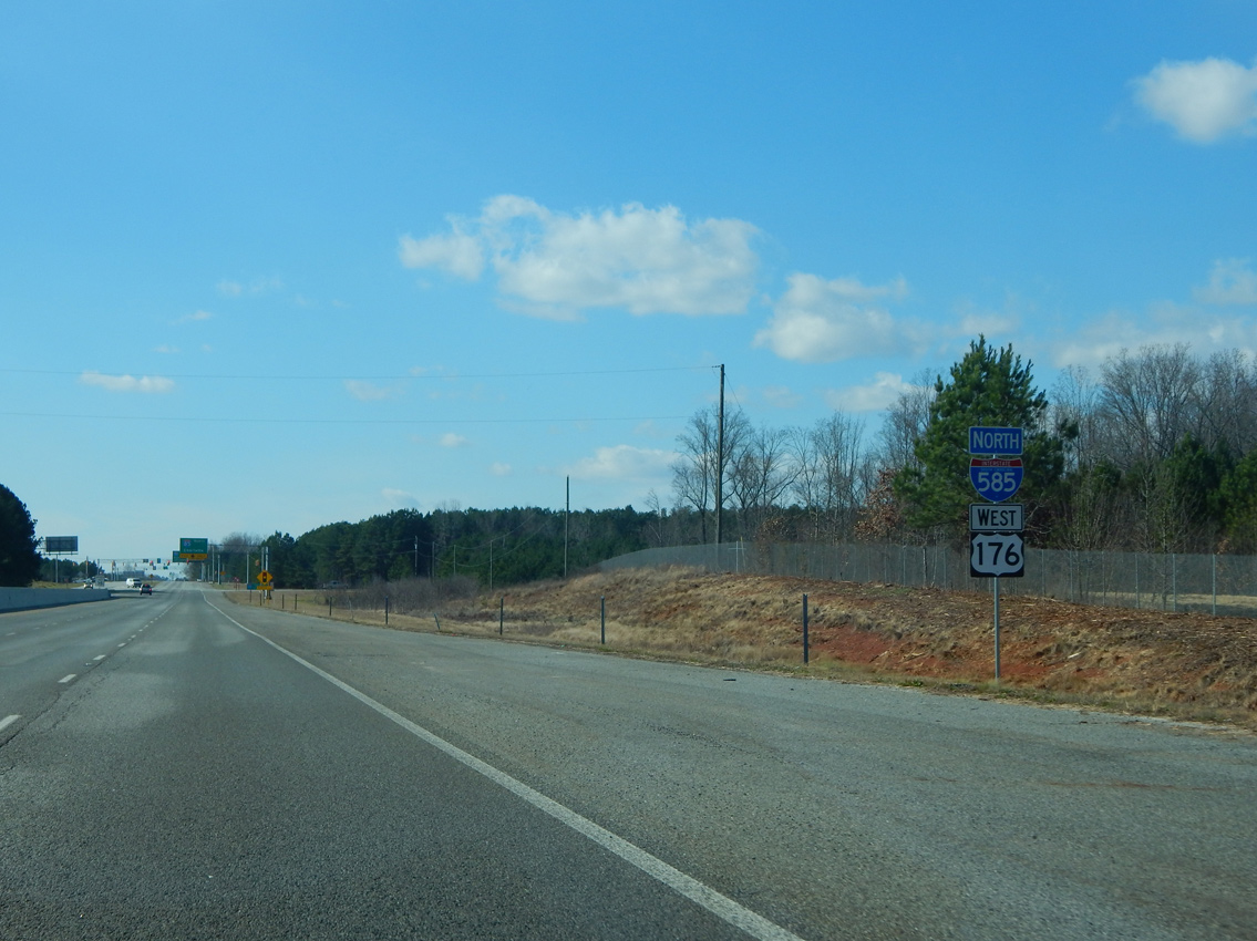
I-85 spans Valley Falls Road (Road 79) one mile northeast of Exit 72 for U.S. 176 (N Pine Street) and I-585 south. U.S. 176 runs northwest from Spartanburg to Inman, Campobello and Landrum. Signs for Exit 72 were replaced by 2012. 06/01/07
Upper Valley Falls Road (Road 366) crosses over I-85 southbound at Exit 72. U.S. 176 (N Pine Street) heads 1.59 miles southeast to the cloverleaf interchange joining I-585 with Business Loop I-85. 06/01/07
North End – Lone Oak, South Carolina
![]() North
North ![]() West at
West at ![]()
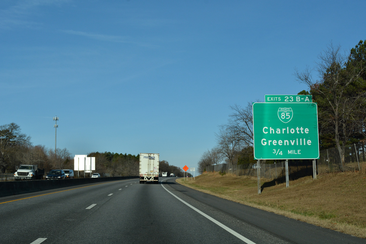
I-585/U.S. 176 (N Pine Street) run alongside Milliken Arboretum and Chinquapin Creek to a three quarter cloverleaf interchange (Exits 23B/A) with Business Loop I-85. 12/15/16
Milliken Road parallels the east side of I-585/U.S. 176 to Exit 23B with Business Loop I-85 north. Slip ramps connect the adjacent frontage road with both I-585 west and Business 85 north. 12/15/16
Replacement signs posted at Business Loop I-85 on I-585 west by 2006 omitted the exit numbers. Business 85 converges with Interstate 85 north in 4.07 miles, 29.2 miles south of the North Carolina state line. 12/15/16
A loop ramp connects I-585/U.S. 176 west with Business Loop I-85 (Veterans Parkway) southbound ahead of Hearon Circle at Lone Oak. Photo by Carter Buchanan (08/20/16).
![]() South
South ![]() East at
East at ![]()
U.S. 176 (N Pine Street) previously ran between two frontage roads south from a folded diamond interchange with Valley Falls Road to Business Loop I-85. This stretch was upgraded to limited access standards with as many as seven lanes. Photo by Carter Buchanan (08/20/16).
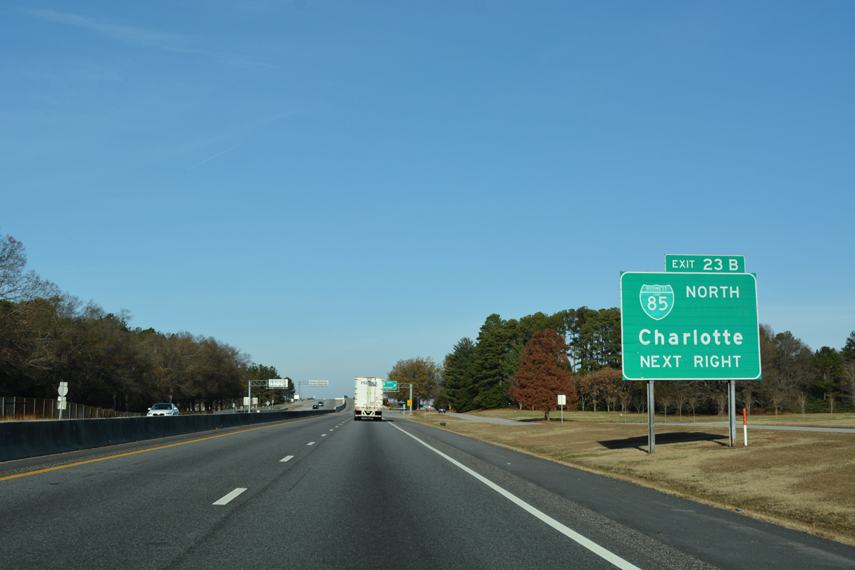
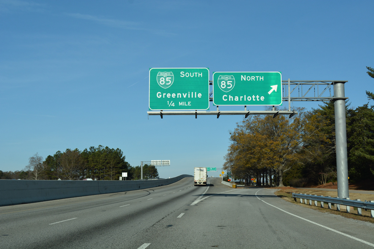
Formerly Exit 23A, the ramp for Business Loop I-85 south toward Greenville departs from I-585/U.S. 176 (N Pine Street) east. Photo by Carter Buchanan (08/20/16).
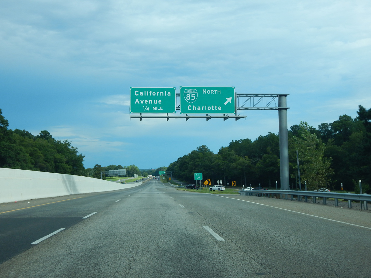
A loop ramp joins Business Loop I-85 north toward Gaffney and Kings Mountain, North Carolina. I-585/U.S. 176 (N Pine Street) continue southeast to California Avenue (Road 124). Photo by Carter Buchanan (08/20/16).
![]() North at
North at ![]()
![]()

S.C. 56 (Asheville Highway) provides the connection with U.S. 176 (N Pine Street) west from Business Loop I-85 north. 12/15/16
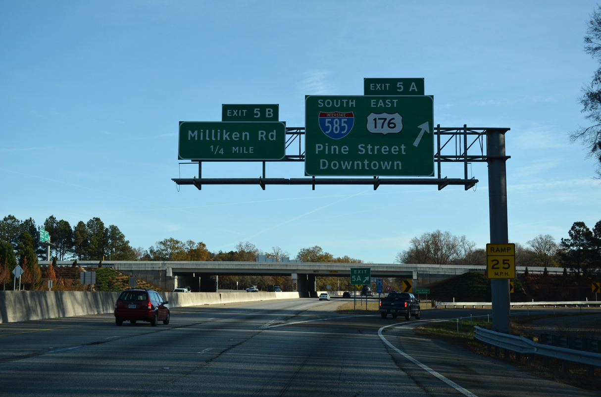
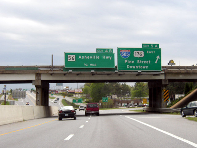
Business 85 north at the three quarter cloverleaf interchange (Exit 5 A) with I-585/U.S. 176 (N Pine Street) south into Spartanburg. This exchange was overhauled by 2006 to improve ramp geometry and bring U.S. 176 to Interstate standards. 12/15/16
![]() South at
South at ![]()
![]()

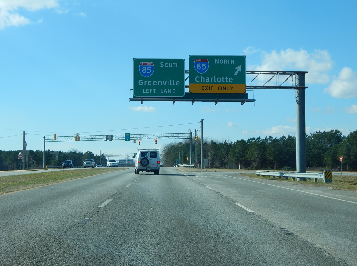
Southbound Business Loop I-85 at Exit 5B for U.S. 176 west. Prior to 2003 road work, U.S. 176 was an at-grade arterial with a lone interchange at Valley Falls Road. Photo by Chris Patriarca (04/06/03).
Exit 5A loops away from Business Loop I-85 south onto I-585/U.S. 176 (N Pine Street) southbound. Photo by Chris Patriarca (04/06/03).
South End  – Spartanburg, South Carolina
![]() South
South ![]() East
East
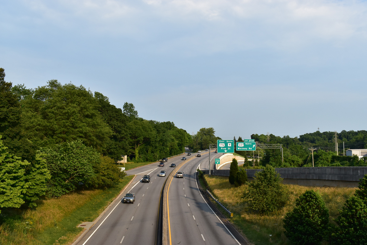
I-585 concludes south of the exchange (Exit 25) with S.C. 9 (Boiling Springs Road) north, Church Street (U.S. 176 Connector) south and adjacent U.S. 221 (Whitney Road). U.S. 221 runs north toward Cherokee Springs while overtaking Church Street south to Downtown Spartanburg. Photo by Carter Buchanan (08/20/21).
Road work completed by 2006 consolidated Exit 25 into a single off-ramp from I-585/U.S. 176 east. Previously a succeeding ramp departed for U.S. 221 (Whitney Road) beyond the entrance ramp bringing S.C. 9 onto N Pine Street from Boiling Springs Road south. 05/25/21
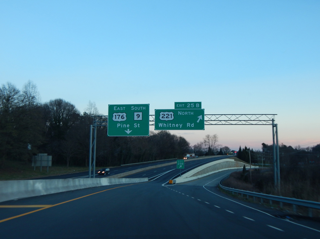
S.C. 9 south combines with I-585/U.S. 176 east along N Pine Street as Exit 25B lowers to meet U.S. 221 (Whitney Road). Photo by Carter Buchanan (01/16/16).
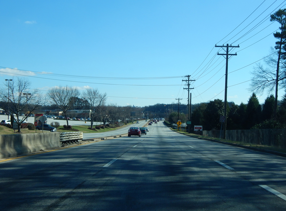
Interstate 585 ends as U.S. 176/S.C. 9 transition into a six lane commercial boulevard south toward Downtown Spartanburg. Signs for Business Spur I-585 were posted along the ensuing stretch until 2004. Photo by Carter Buchanan (01/16/16).
![]() West
West ![]()
![]() North at
North at ![]()
![]()
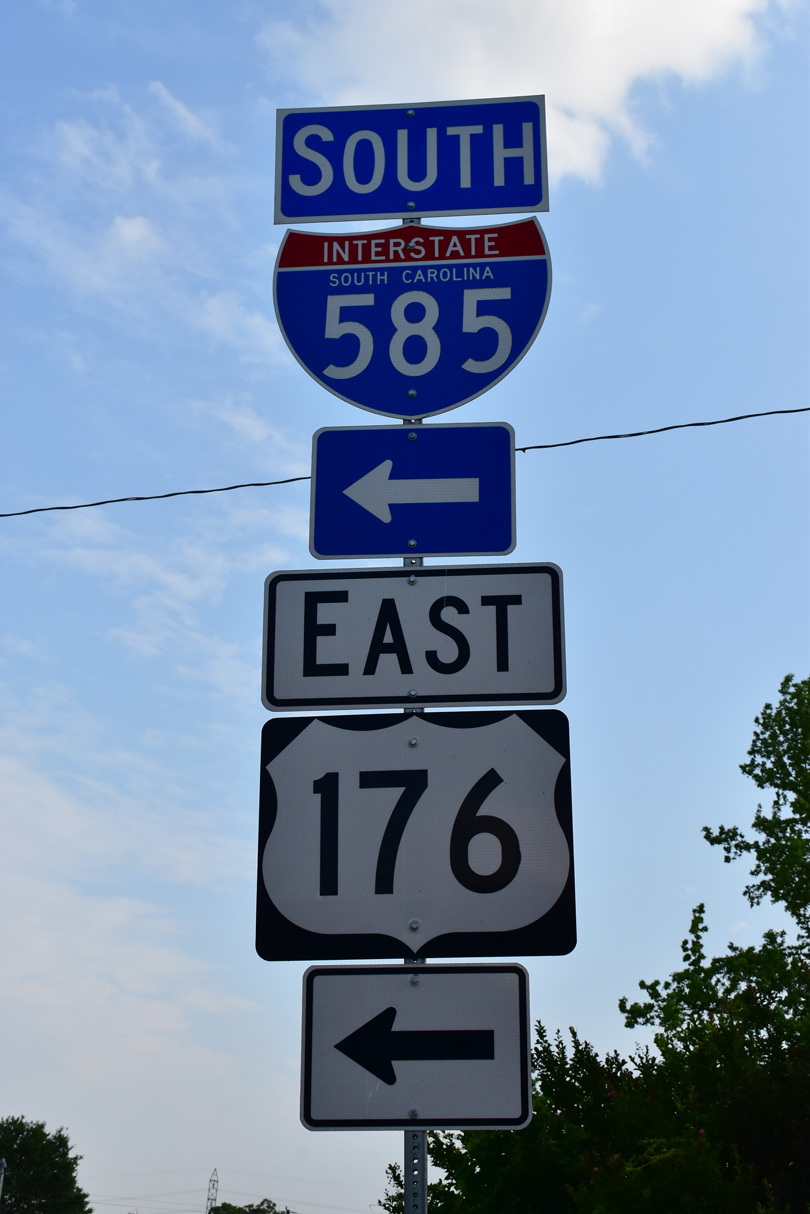
A remnant from when Business Spur I-585 was posted along N Pine Street, this set of shields marking I-585 stands along U.S. 176/S.C. 9 north of Garner Road in Spartanburg. 05/25/21
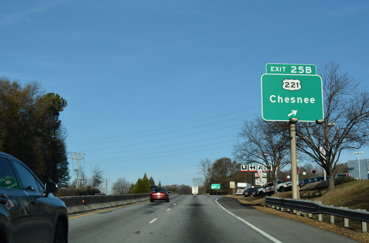
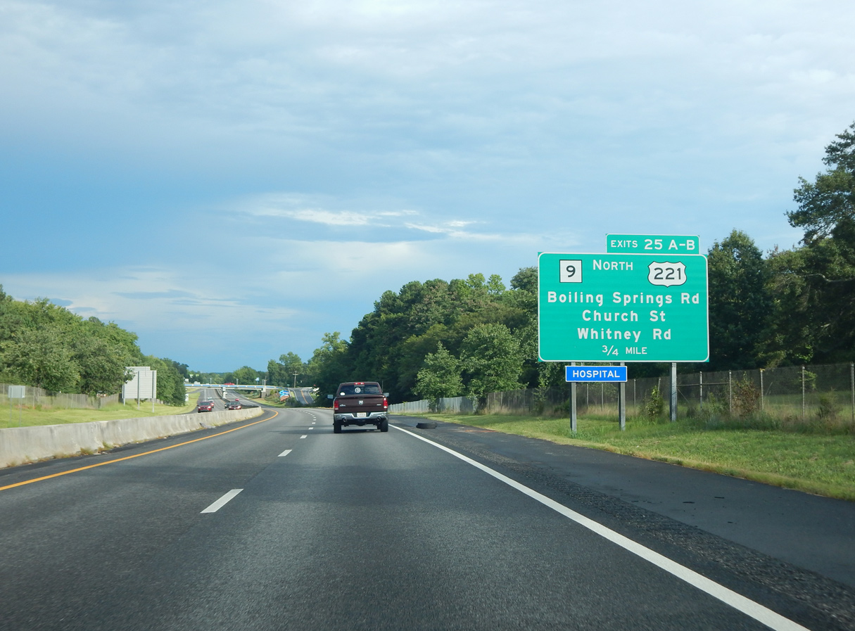
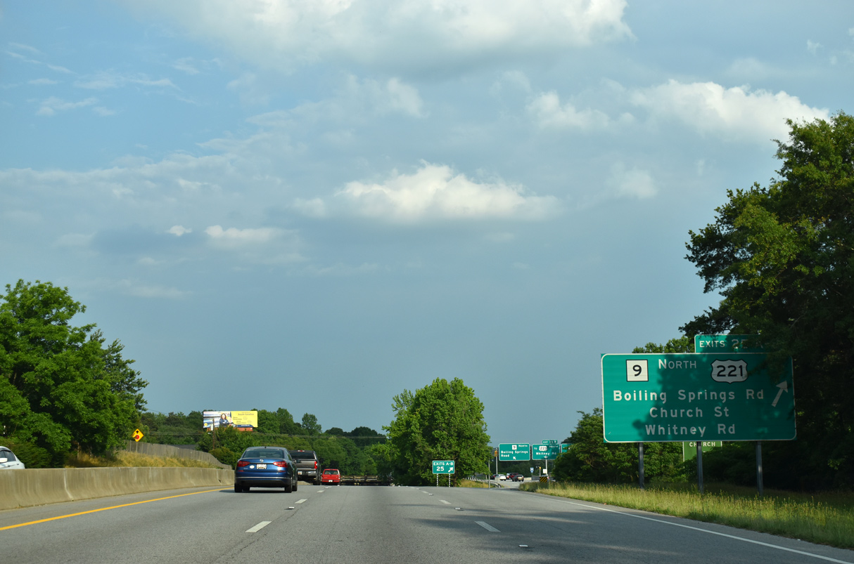
U.S. 221 leads 14 miles north from Exit 25B to the city of Chesnee. I-585/U.S. 176 (N Pine Street) advance northwest to Lone Oak and Southern Shops. 12/15/16
The initial guide sign for Interstate 585 west precedes entrances to Pinewood Shopping Center and an adjacent car dealership. A split diamond interchange follows with U.S. 221 (Whitney Road) and S.C. 9 north onto Boiling Springs Road. 05/25/21
Sources:
- Interstate 585 (Kurumi).
- “Agency mapping new route to USCS.” Herald-Journal (Spartanburg, SC), February 12, 2001.
- “Millions aid Spartanburg traffic flow.” Herald-Journal (Spartanburg, SC), December 6, 2007.
- “Highway project near USC Upstate open to drivers.” Herald-Journal (Spartanburg, SC), October 14, 2006.
- “Project will smooth rough intersection.” Herald-Journal (Spartanburg, SC), February 2, 2005.
- “Pine Street lane closures announced to demolish California Avenue Bridge.” Herald-Journal (Spartanburg, SC), June 26, 2014.
- “Work continues on Interstate 585 bridge.” Herald-Journal (Spartanburg, SC), February 2, 2015.
- “Highway 9 bridge reopens to traffic after being closed for repairs.” Herald-Journal (Spartanburg, SC), June 19, 2015.
- Project Information – US 176 Corridor Improvements, Project Identification Number: 0039714RD01. SCDOT web site.
- “Asheville Highway, I-585 Access Improvements Recommended.” Herald-Journal (Spartanburg, SC), June 16, 1984.
Page updated July 1, 2022.