Interstate 580 Nevada
Overview
Interstate 580 overlays U.S. 395 in western Nevada between Fairview Drive in Carson City and I-80 in Reno. Completion of the freeway through Washoe Valley connected the Nevada capital city to the Interstate system. I-580 serves both through traffic and commuters, varying between urban stretches through Reno and Carson City, and hugging the eastern slopes of Steamboat Hills to the Galena Creek concrete arch bridge overlooking Pleasant Valley.
Got arch bridge? This massive bridge carries I-580 & US 395 over a valley between Exits 50 & 60. #roads #bridges #nevada #washoe pic.twitter.com/5EQkl4p54A
— AARoads (@AARoads) July 17, 2017
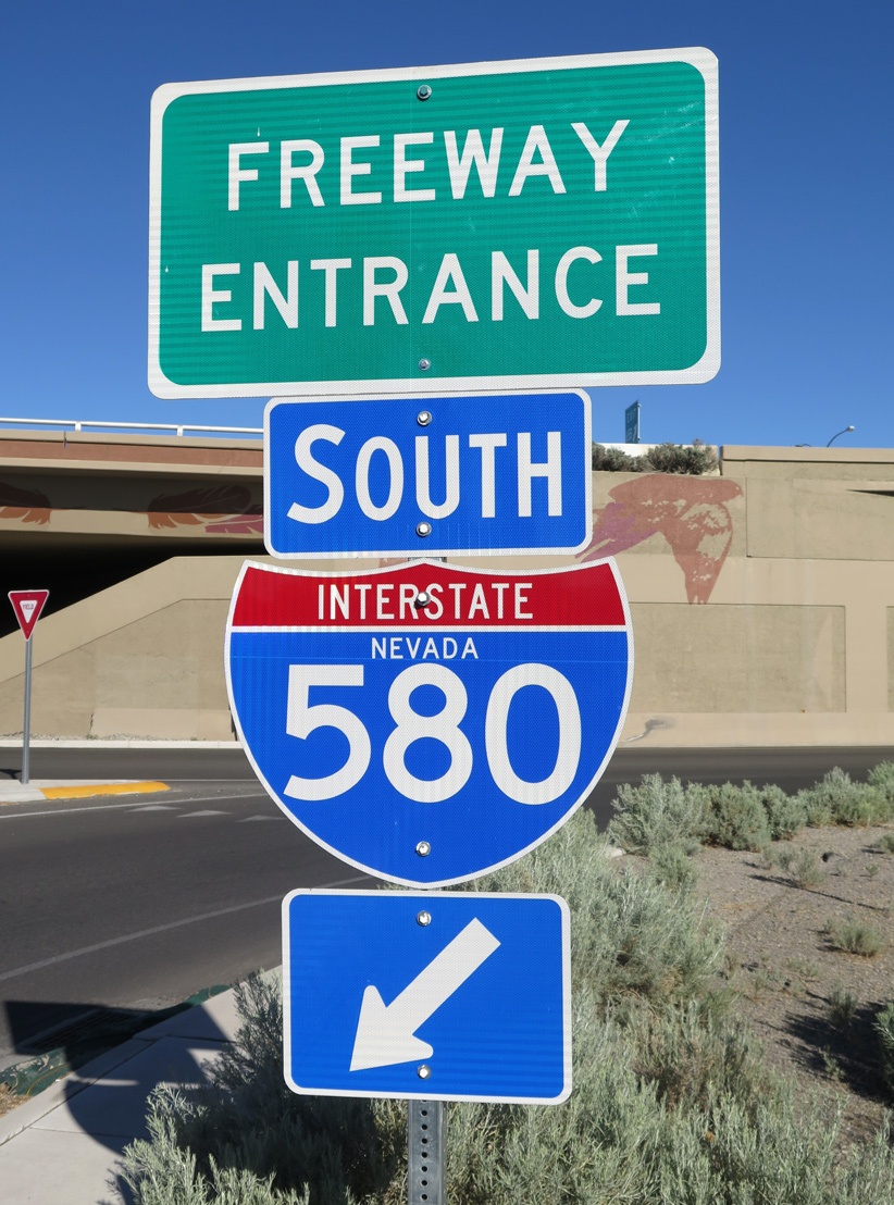
Opened at 10 AM on August 2, 2017,8 the 3.146 mile long link from Fairview Drive (Exit 38) south to U.S. 50 and U.S. 395 at S Carson Street completed the 35 mile route. Exit numbers along I-580 use U.S. 395 mileposts, increasing from the California state line at Topaz Lake.
High Priority Corridor
Interstate 580 in Nevada is part of High Priority Corridor 68: Washoe County Corridor and U.S. 95 Las Vegas to Reno Corridor.
 History
Planning for the North-South Freeway in Reno started in 1957. Studies underway by 1963 resulted in a recommended freeway alignment in 1968. Community opposition however, and lawsuits filed in 1972 and 1973, required an Environmental Impact Study (EIS) be conducted. Meanwhile work on the freeway north from Reno was underway, with U.S. 395 completed from Exit 35 (formerly Exit 67) (2nd Street / Glendale Avenue) to Exit 72 (North Virginia Street) at Panther Valley. This section opened to traffic in 1973.3
The Final EIS for the North-South Freeway was completed in January 1977. Construction followed on the limited access highway between 2nd Street / Glendale Avenue and S. Virginia Street (Exit 31). This section opened to traffic in 1980.3
4.2 miles of the North-South Freeway (U.S. 395) between I-80 and S. Virginia Street (U.S. 395 Business) was conditionally approved by the Federal Highway Administration (FHWA) on August 18, 1978 as Interstate 380. That numbering was short lived as by August 31, 1978, the designation was revised to I-580 in order to be consistent with the numbering of the I-515 spur in Las Vegas.9
A short stretch of Interstate 580 was opened to traffic from I-80 south to Villanova Drive in 1980. U.S. 395 temporary shifted to Kietzke Lane (SR 667) to continue south to Virginia Street. The unsigned route was sometimes shown as “Spur I-580” on 1980s road maps.
A Supplemental EIS for the U.S. 395 freeway leading south from S. Virginia Street (U.S. 395 Business) to Winters Ranch (near Washoe City) was conducted from 1979 to 1983. Construction got underway afterwards, with the initial North-South Freeway extension completed between Exits 29 and 31 (formerly Exits 61 and 63) in 1983. The remainder of the freeway south to SR 431 / Mt. Rose Highway was finished in 1998.3
It was during a brief period in the early to mid 1980s that I-580 appeared to be signed along the North-South Freeway. As noted by contributor Jeff Royston, some shields may have been posted. Dave Billeci further added that in 1983 he observed signs for both U.S. 395 and I-580 in Reno south of the interchange with Interstate 80, as well as on overhead signs along I-80 east at the exchange. He noted that these were removed a few years later.1
An extension of the Interstate 580 designation southward to Carson City was formally proposed and accepted by late 1984. Reasons included for the extension included the need to link the Nevada state capital city to the Interstate system as well as for an improved commuter route.10 The FHWA approval also allowed for I-580 to be established along additional segments as they were constructed and opened.2 The 2002 FHWA Route Log and Finders List officially recognized Interstate 580 as extending between Neil Road (formerly Del Monte Lane) north to Interstate 80 at Exit 15 via U.S. 395.
Work on the I-580 Freeway Extension Project was underway in 2003, following to the west of U.S. 395 from Steamboat south to Pleasant Valley and Washoe City.3 Simultaneously to the south, construction on the Carson City Freeway portion of I-580 upgraded a four-lane segment of U.S. 395 to Interstate standards at Lakeview and the Washoe County / Carson City line. Costing over $200 million, ground breaking for Phase 1 of the Carson City Freeway took place in 2000.4
Route Information
North End – Reno, NV
South End – Carson City, NV
Mileage – 35.02 (35.05*)
Cities – Carson City, Reno
- Junctions –

Source: 2022 State Maintained Highways of Nevada, Descriptions and Maps (NDOT)
* – December 31, 2021 Interstate Route Log and Finders List
I-580 Annual Average Daily Traffic (AADT)
Source: 2019 AADT Traffic Records Information Access (TRINA) – Nevada Department of Transportation (NDOT)

A milepost incorrectly identified U.S. 395 at Panther Valley as part of Interstate 580. Prior to 2012, the NDOT mileposts were the only indication that U.S. 395 through Reno was also I-580. As is standard in Nevada, these white mileposts indicate the type of route (IR means Interstate), route number (580), mileage (distance north from the county line), and county (WA means Washoe County). The design is the same that Caltrans uses. Photo by Mike Ballard (06/98).

Construction for Interstate 580 at Snyder Avenue in south Carson City. Phase 2B-2 construction of the Carson City Freeway included the grade separated crossing at Snyder Avenue. This work was completed from early 2013 to Summer 2013.6 06/21/14
Despite being unsigned, Interstate 580 appeared on the Rand McNally North American Road atlas throughout the 1980s editions.
The $555 million I-580 Freeway Extension Project ran through 2012, with the 8.5 mile section, and the 1,700 foot long and 300 foot high Galena Creek cathedral arch bridge, the largest structure of its kind, fully opened to traffic on August 27.5 The Carson City Freeway project opened initially from Lakeview south to U.S. 50 (William Street) on February 16, 2006. The 1.8 mile link south from the SPUI with William Street to Fairview Drive was finished in September 2009.6
With the completion of the Galena Creek/Pleasant Valley Bypass in August 2012, the route from U.S. 50 (Williams Street) in Carson City north to Reno was designated as Interstate 580, with signs installed throughout the route by October 2012. The lone exception was the segment of the Carson City Freeway spurring south to Fairview Drive. NDOT listed that portion officially as a part of IR580, but signed it solely as U.S. 50. With completion of Phase 2B-2 south from Fairview Drive to South Carson Street, I-580 was fully signed south of Williams Street.
The freeway around Carson City was officially dedicated as the Carson City Deputy Sheriff Carl Howell Memorial Freeway in December 2015.4 A six feet tall metal sculpture of an eagle at the south end of the freeway honors the name of Eagle Valley, where Carson City sits. A similar sculpture is located at the north end of the freeway at Arrowhead Drive.7
A community free fun walk, run and ride celebrated the opening of the last leg of the Carson City Freeway on July 22, 2017. The $42.24 million7 section opened to motorists on August 2.
A wide right of way is reserved for the planned single point interchange joining the south end of I-580 with U.S. 395/395 Business (S Carson Street) and U.S. 50 west to Lake Tahoe. 07/17/17
Exit numbers along Interstate 580 were changed by late 2019 to reflect its official mileage between Carson City and Reno. Previous exit numbers referenced U.S. 395 mileage.
Future work will upgrade the signalized south end of I-580 at the partition with U.S. 50 west to Lake Tahoe and U.S. 395 south to Minden to a single point urban interchange (SPUI). Estimated to cost $20 million or more7, this work is scheduled for the mid-2020’s as funding becomes available.4,6
 Photo Guides
North End 
 – Reno, Nevada
![]()
![]() North at
North at ![]()
Spanning 2nd Street with seven northbound lanes, I-580/U.S. 395 advance a half mile to Interstate 80 (Exits 36B/A). 07/17/17
A lane drop occurs as I-580/U.S. 395 cross over the Truckee River and Kietzke Lane (SR 667). Traffic partitions nearby with two lanes departing for I-80 east through Sparks. A subsequent two-lane ramp (Exit 36B) follows for I-80 west to Verdi. 07/17/17
East from I-580 through Sparks, Interstate 80 constitutes a six-lane freeway to Rock Boulevard, with auxiliary lanes accompanying the route to the east Truckee Meadows industrial area. 07/17/17
Exit 36B loops onto I-80 west toward Sacramento, California as part of the turbine style interchange joining the two freeways. I-580 ends as U.S. 395 continues north to Panther Valley, Bordertown and Susanville, California. 06/28/14
![]() South at
South at ![]()
![]()
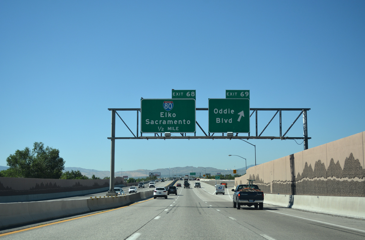
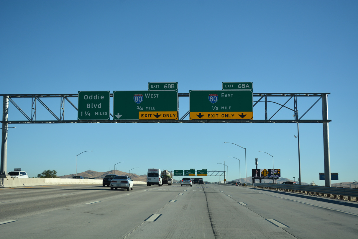
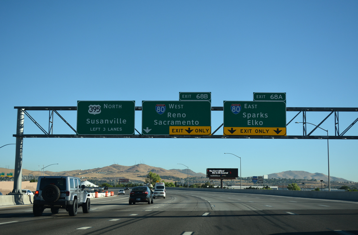
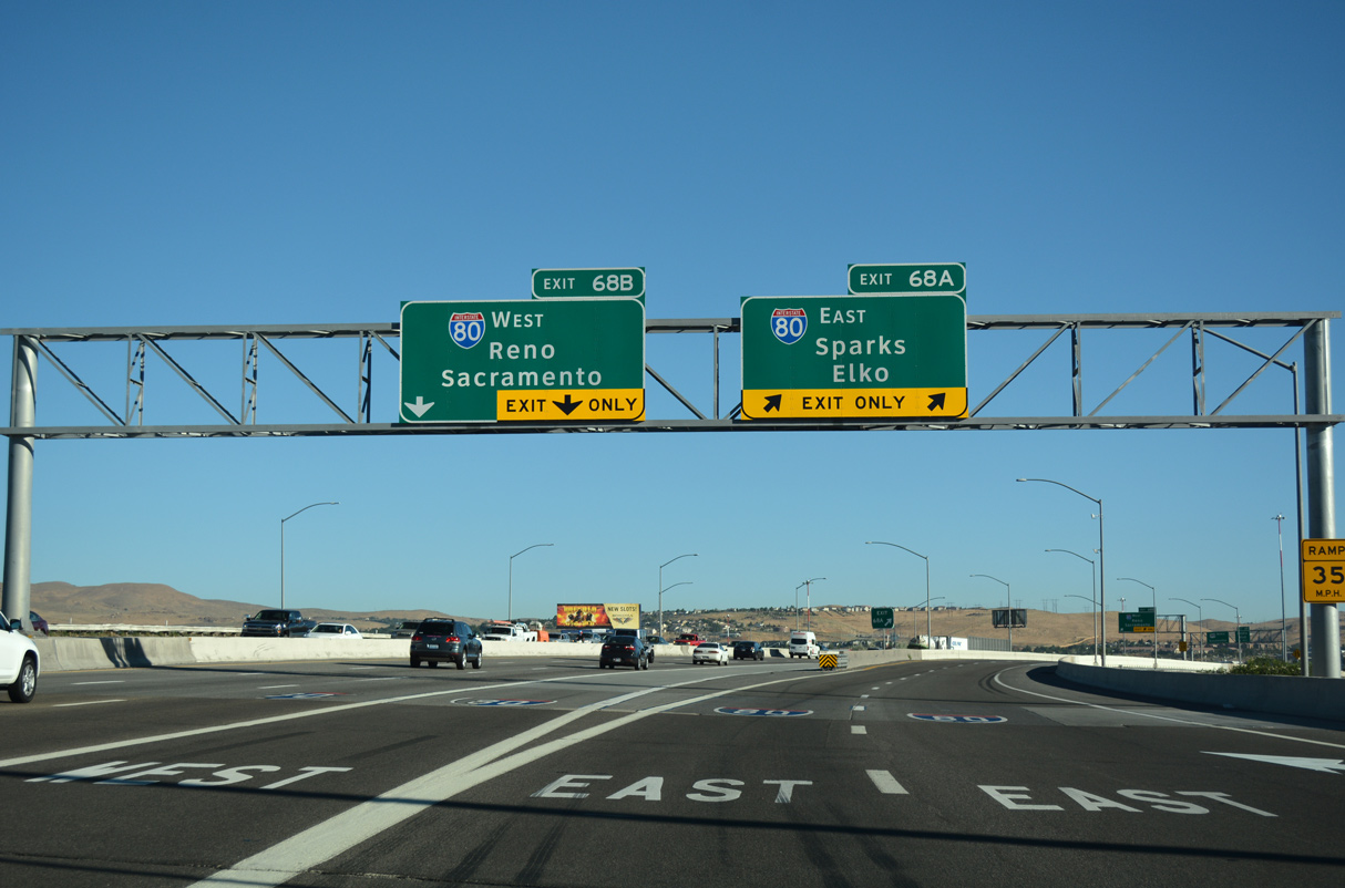
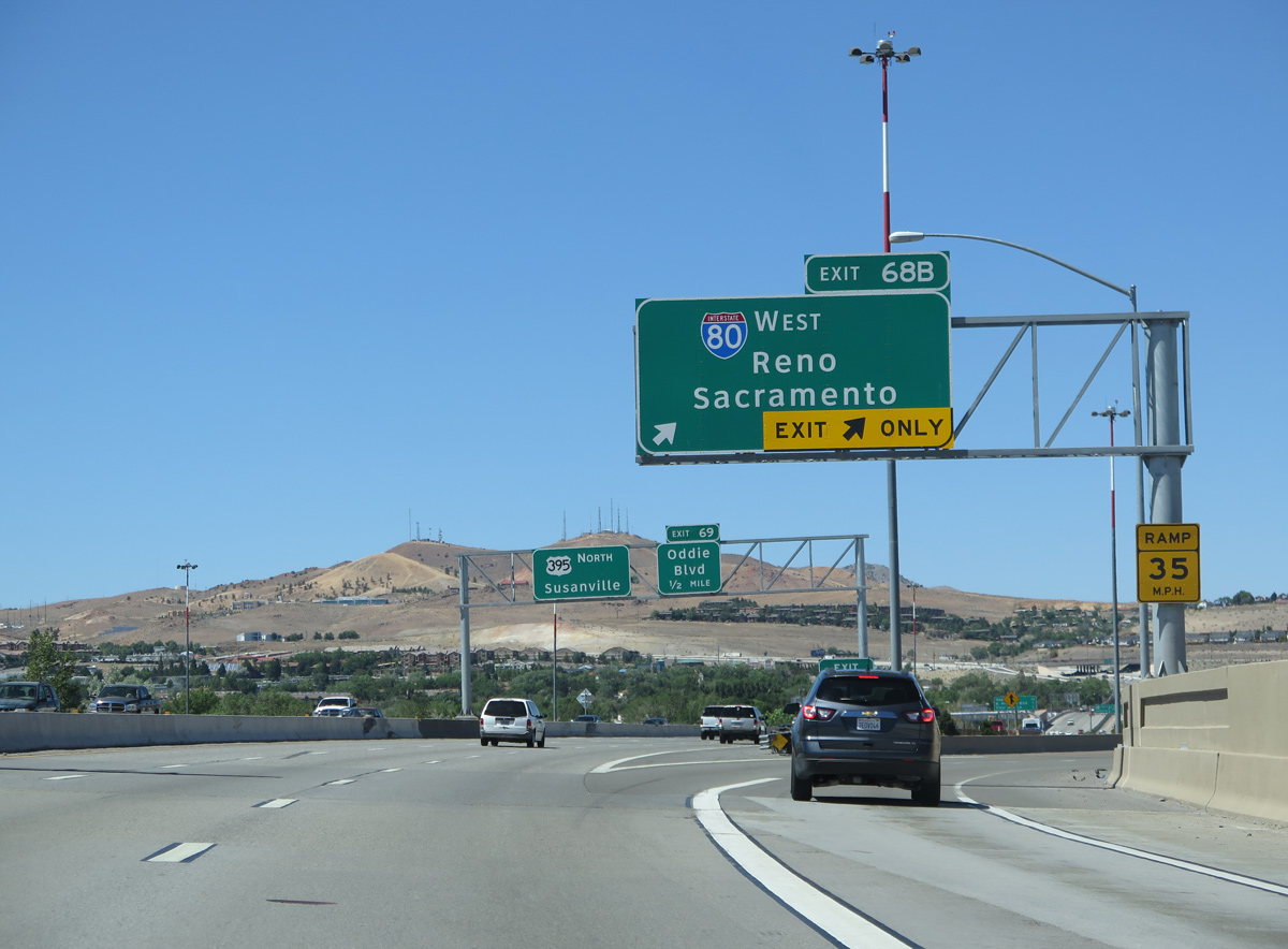
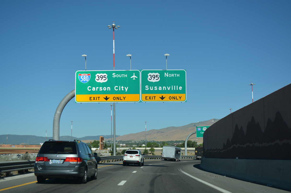
U.S. 395 leads south one half mile from the parclo interchange (Exit 69) with Oddie Boulevard to the systems interchange with I-80 and the southbound beginning of Interstate 580. 07/17/17
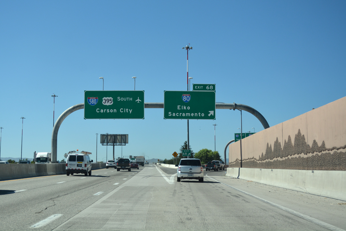
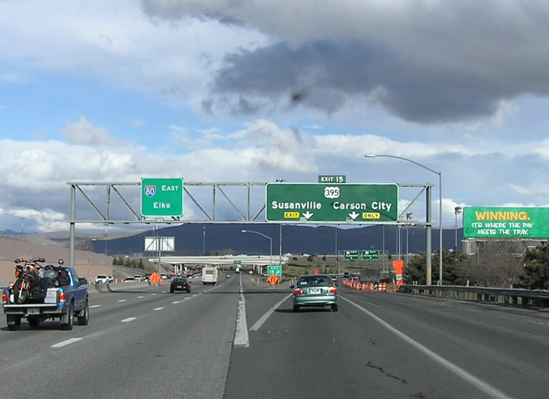
All traffic for I-80 west to Truckee and Sacramento, California and east to Fernley and Elko departs in unison from U.S. 395 (Martin Luther King, Jr. Memorial Highway). I-580/U.S. 395 shift southeast from Exit 68 to pass east of Downtown Reno and west of Reno / Tahoe International Airport (RNO). 07/17/17
![]() East at
East at ![]()
![]()
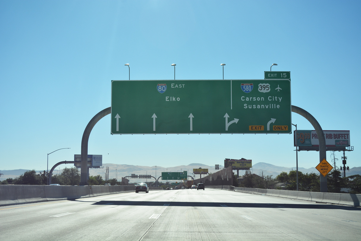
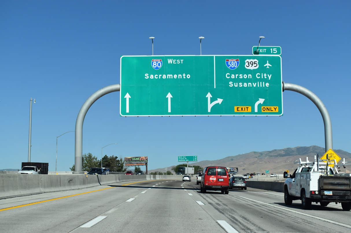
Auxiliary lanes in each direction of Interstate 80 expand the freeway to eight overall lanes between Wells Avenue (Exit 14) and I-580/U.S. 395 (Exit 15). 07/17/17
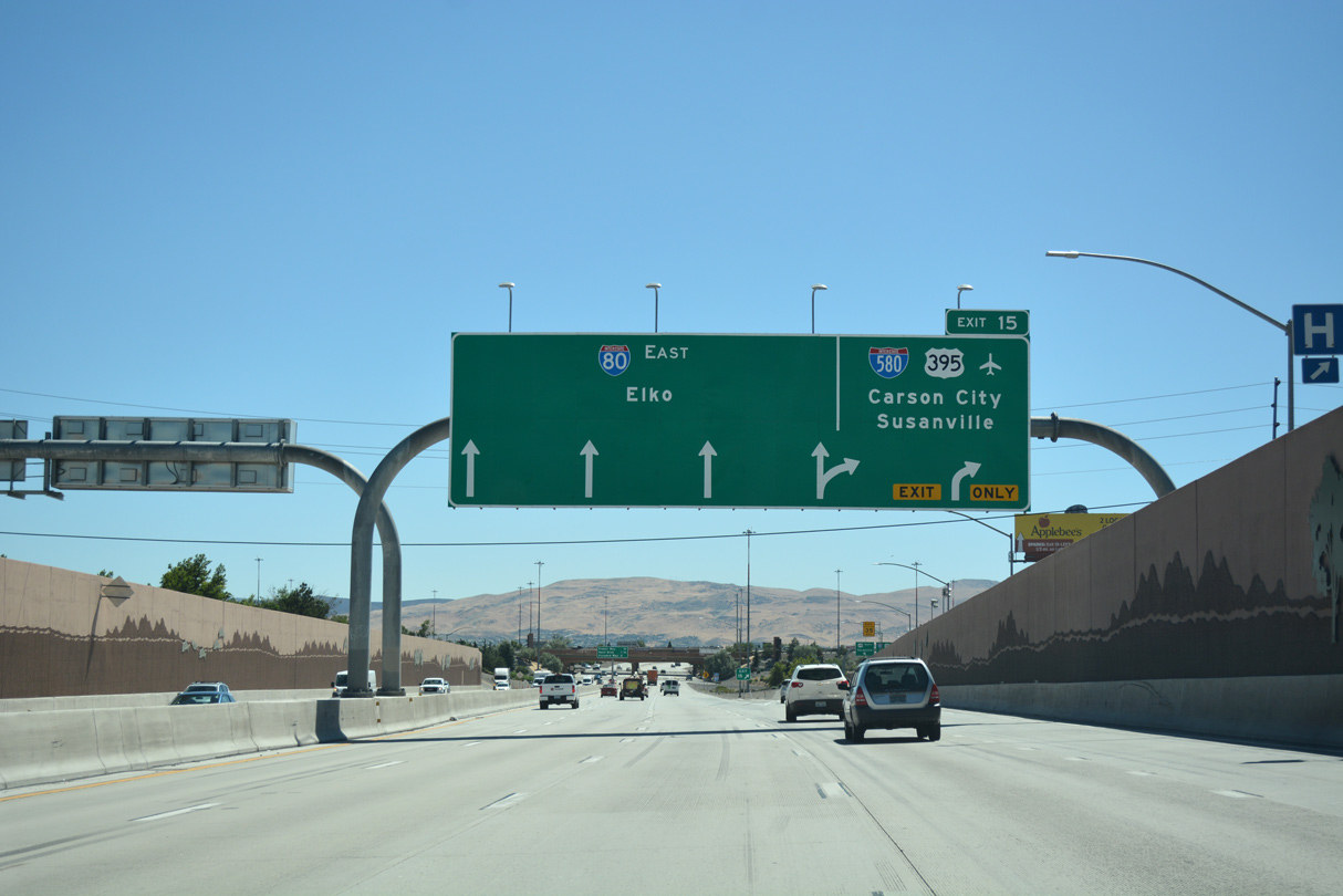
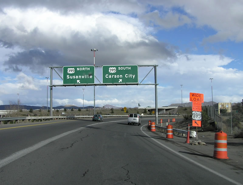
Traffic partitions with two lanes joining I-580/U.S. 395 south to Washoe Valley and Carson City and U.S. 395 extending north to Stead and Cold Spring in north Reno. 07/17/17
Interstate 580 accompanies U.S. 395 south through Reno, paralleling Virginia Street (U.S. 395 Business / U.S. 395 Alternate) from near Downtown to Pleasant Valley. U.S. 395 continues along a freeway 23 miles north to California State Route 70 at Halellujah Junction. 07/17/17
![]() West at
West at ![]()
![]()
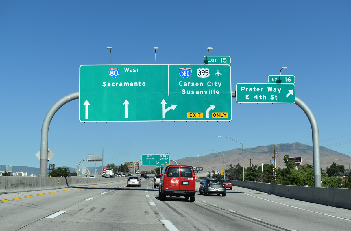
I-80 shifts northward across the Reno / Sparks city line over 4th Street / Prater Way (Business Loop I-80) just ahead of the half turbine interchange (Exit 15) with Interstate 580 south and U.S. 395 (Martin Luther King, Jr. Memorial Highway). 07/11/18
Exit 15 separates from the I-80 westbound mainline as a distributor roadway, taking commuters from both the freeway and Prater Way below to Interstate 580 and U.S. 395. 07/11/18
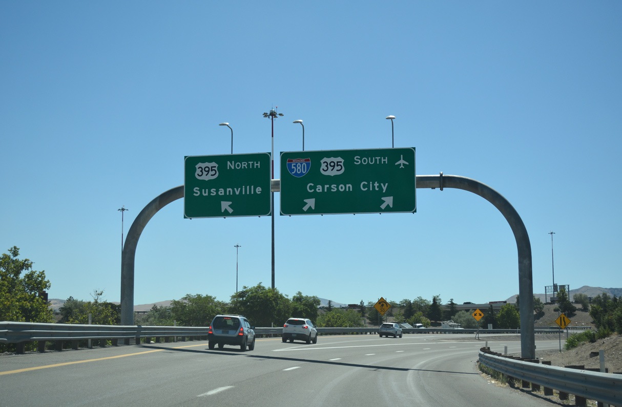
With traffic joining the ramp to I-580 and U.S. 395 from Prater Way, a pair of overheads direct motorists south to Reno / Tahoe International Airport (RNO) and the capital city and north to Susanville, seat of Lassen County, California. 07/17/17
 North End Throwback
Interstate 80 east at Exit 67 for U.S. 395 and unsigned I-580 south. Reconstruction of I-80 added a fourth eastbound lane and sound walls. Photo by Chris Elbert (03/19/05).
Non-reflective signs previously partitioned traffic at Exit 15 for U.S. 395. The southbound ramp to I-580 splits here with two lanes initially now, but tapers to one before merging onto U.S. 395 ahead of the Truckee River. Photo by Chris Elbert (03/19/05).
South End  / South Carson Street – Carson City, Nevada
![]()
![]() South
South ![]() West at
West at ![]()
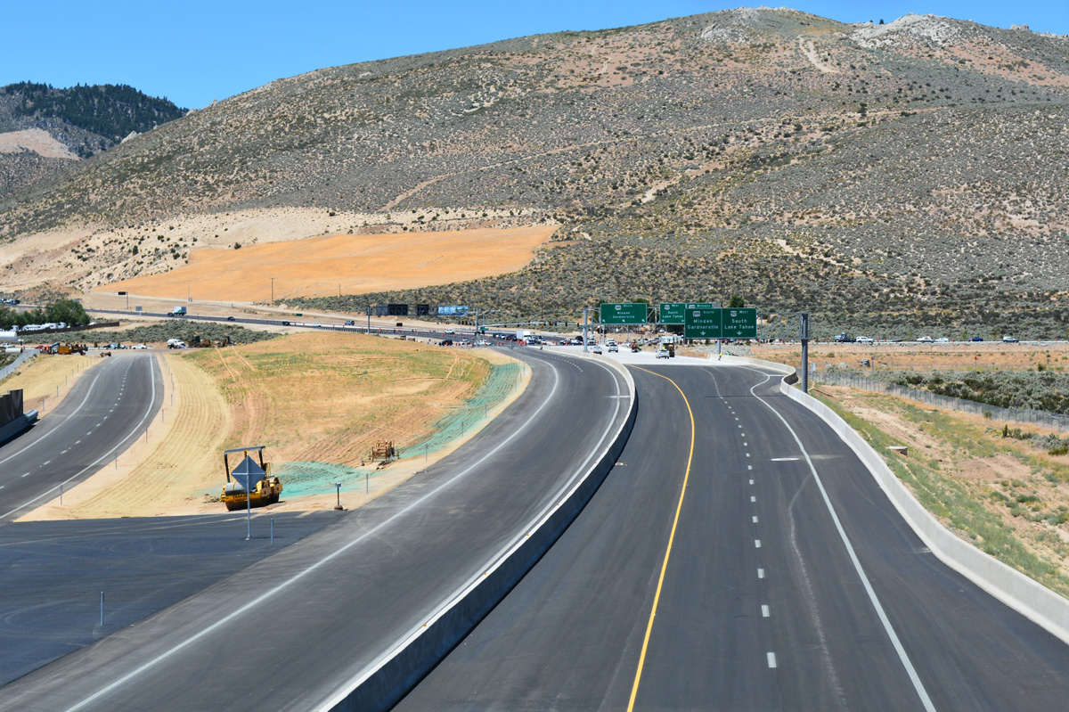
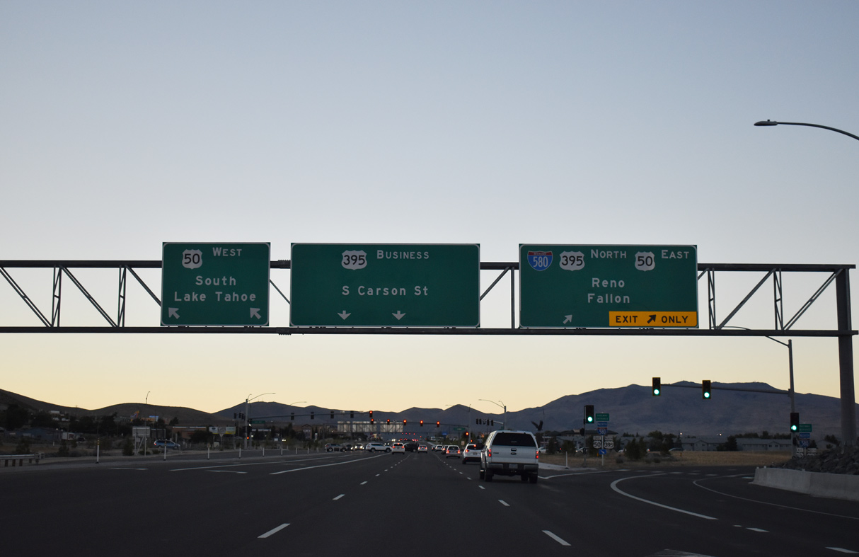
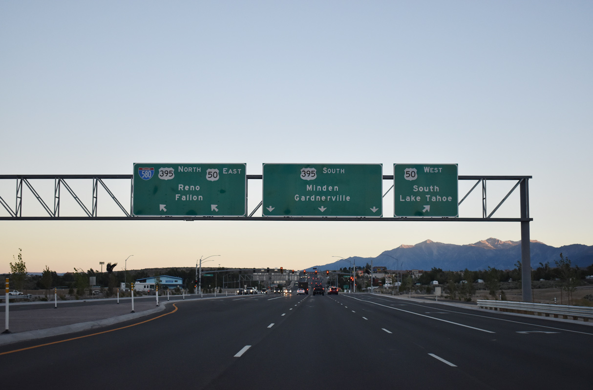
An interchange sequence sign references the south end of the Carson City Freeway, where U.S. 50 west and U.S. 395 south split for Lake Tahoe and Minden respectively. This sign stands just north of the Clearview Drive overpass. 07/11/18
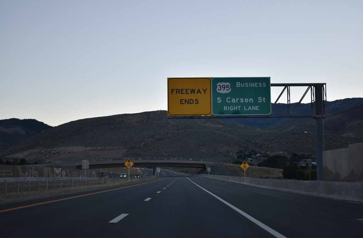
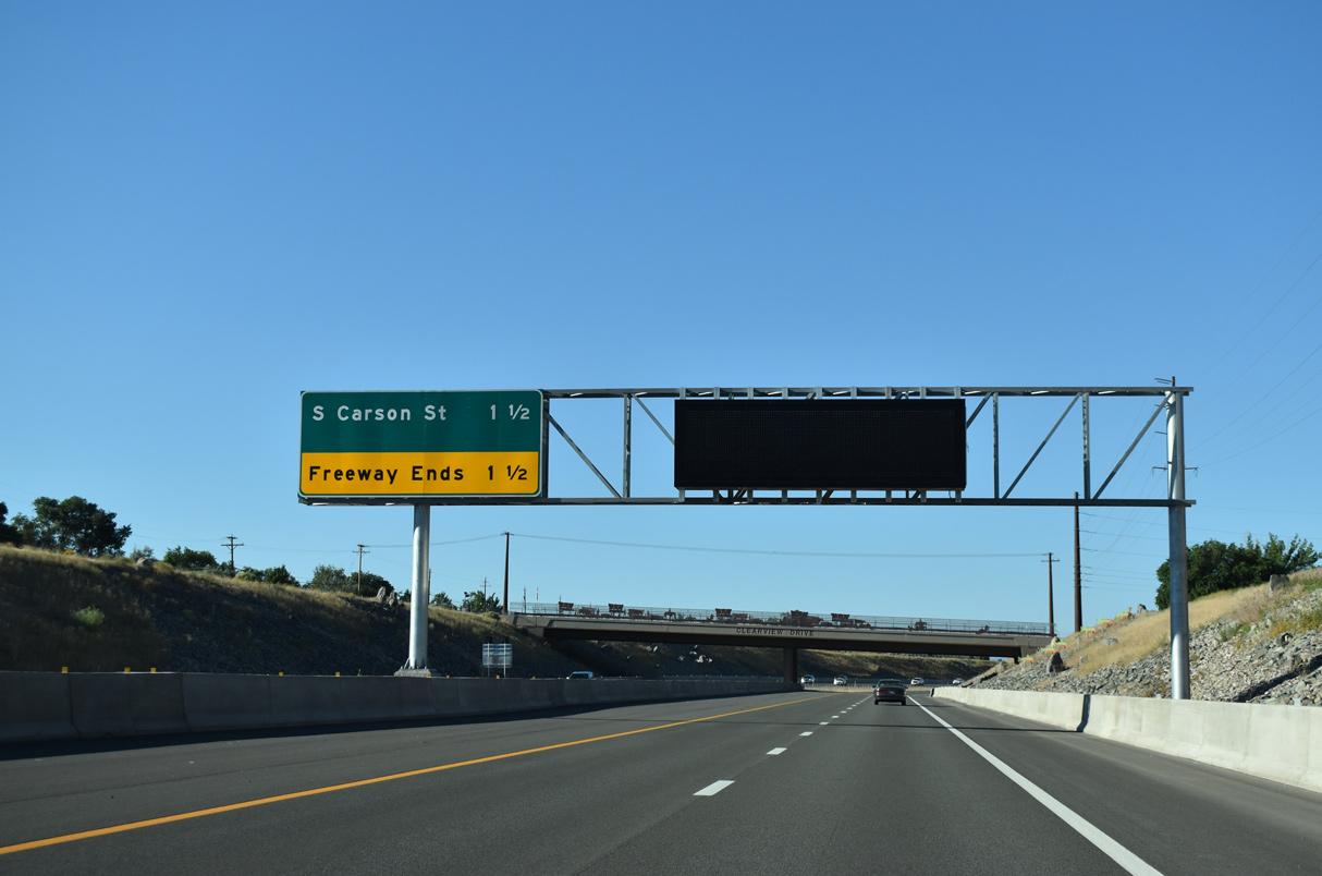
I-580/U.S. 50-395 curves west below SR 526 (Snyder Avenue) to U.S. 395 Business (S Carson Street). A SPUI will replace the at-grade intersection with S Carson Street in the future. 07/10/18
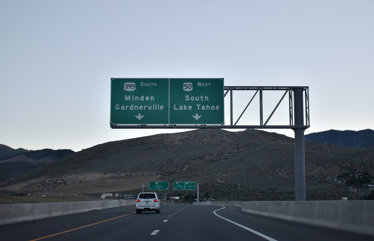
U.S. 50 advances west from I-580 and U.S. 395 across the Carson Range to Spooner Junction (SR 28) and Lake Tahoe. 07/10/18
U.S. 395 overtakes S Carson Street from U.S. 395 Business along an arterial route to Douglas County and Carson Valley. 07/10/18
![]() East at
East at ![]()
![]()
![]()
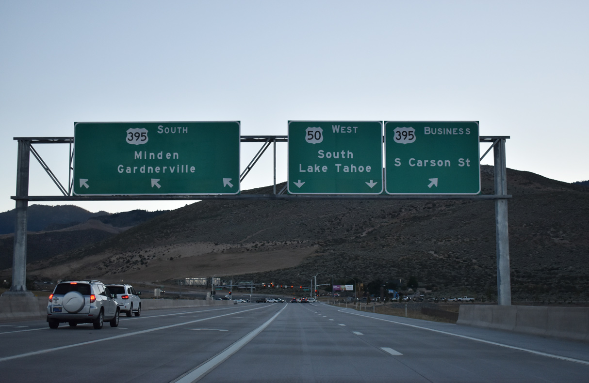
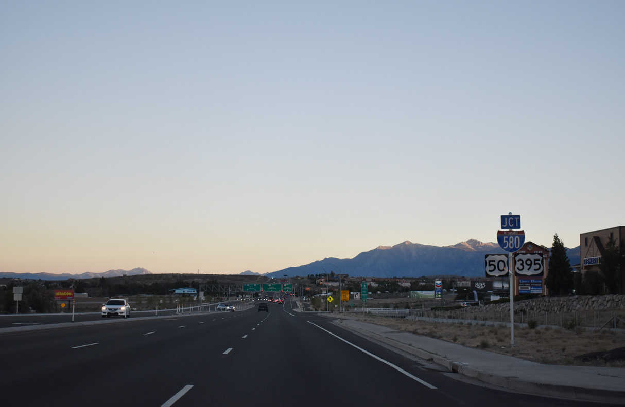
Connecting with Interstate 580 (Carson City Freeway) directly at U.S. 395 (S Carson Street), U.S. 50 lowers from the Carson Range along an expressway extending east from Spooner Junction. 07/10/18
U.S. 395 enters Carson City and Eagle Valley from Gardnerville and Minden in the south Carson Valley. U.S. 395 Business follows the pre-freeway route (Carson Street) of U.S. 395 north to the State Capitol and Downtown Carson City. 07/10/18
![]() North at
North at ![]()
![]()
![]()
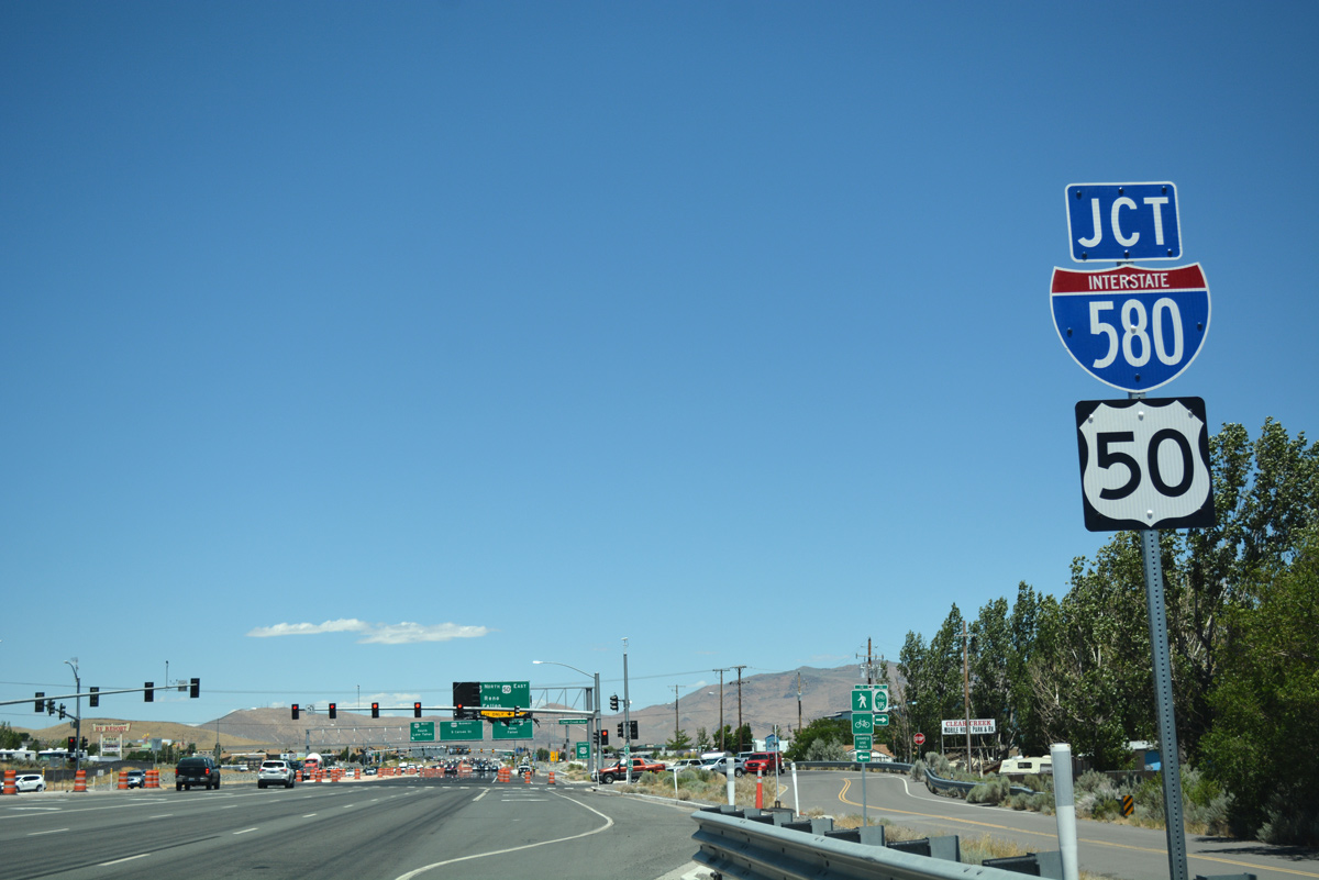
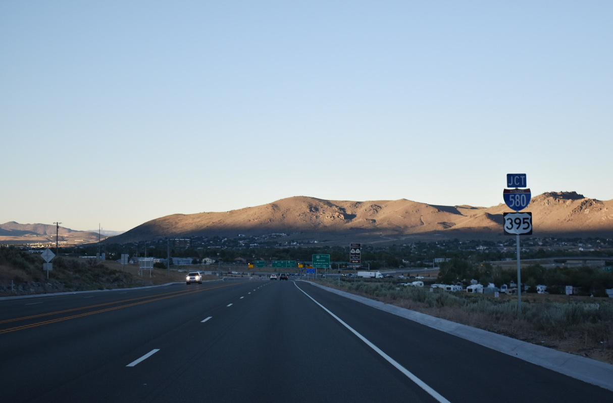
U.S. 395 enters the Carson City limits north from Topsy Lane and just ahead of Clear Creek Road, U.S. 50 west and Interstate 580 north. 07/17/17
An east side frontage road serves a mobile home park and storage facility while big box retail lines the west side of U.S. 395 to the at-grade intersection with U.S. 50 west to Lake Tahoe and I-580 (Carson City Freeway) north to Reno. 07/10/18
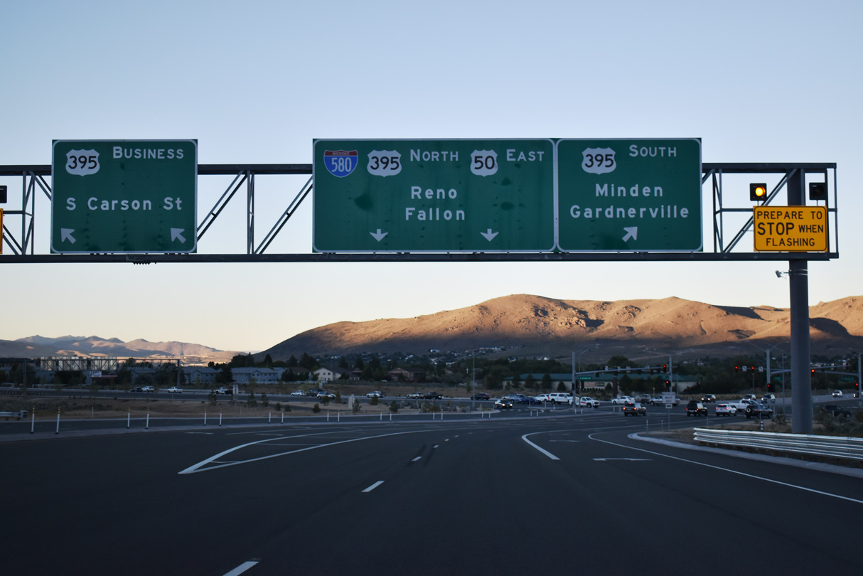
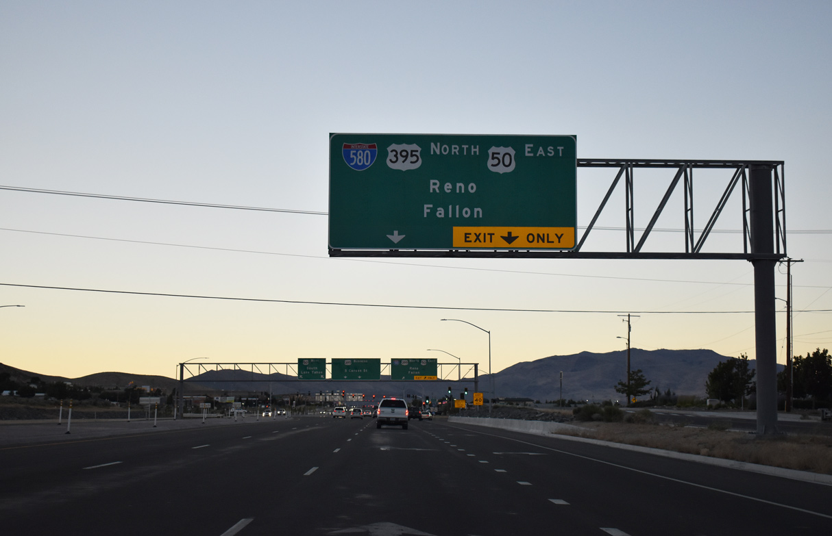
U.S. 50 east / U.S. 395 north overlap with I-580 to bypass Carson City as Carson Street becomes U.S. 395 Business north to Downtown. AASHTO approved a Nevada application to designate U.S. 50 Business along S Carson Street and William Street on May 15, 2009. However NDOT never signed the bannered route. 07/10/18
![]() South at
South at ![]()
![]()
![]()
S Carson Street comprises a six-lane commercial arterial from Fairview Drive (former Temporary U.S. 50) to Interstate 580, U.S. 50 and U.S. 395. 07/10/18
A dual left turn lane joins the south end of U.S. 395 Business (S Carson Street) with the northbound beginning of I-580. U.S. 50 east / U.S. 395 north overlap with the Carson City Freeway to bypass Downtown. 07/10/18
Sources:
- Billeci, Dave. Personal Email, “A I-580 NEVADA FACTOID” from March 23, 2006.
- Spring 2012 Applications for AASHTO Special Committee on Route Numbering.
- Project History and Overview,
http://www.freewayextension.comI-580 Extension Project web site. - “Community invited to fun run/walk event to celebrate Carson City freeway opening.” Northern Nevada Business Weekly, July 6, 2017.
- “Work nears completion on Reno-Carson freeway.” Associated Press State Wire: Nevada (NV), May 29, 2012.
- Nevada Department of Transportation : I-580 / U.S. 395,
https://www.nevadadot.com/projects-programs/road-projects/carson-city-freewayNDOT project web site. - “Carson City Bypass to open first week in August.” Nevada Appeal (Carson City, NV), June 17, 2017.
- “New freeway to save drivers time in Carson City.” KOLO 8 (Carson City, NV), August 2, 2017.
- AASHTO application for Establishment of I-580, dated August 30, 1978, retrieved from AASHTO Route Numbering Archive.
- AASHTO application for Extension of I-580, dated November 2, 1984, retrieved from AASHTO Route Numbering Archive.
Page updated November 11, 2020.