Interstate 580 Nebraska


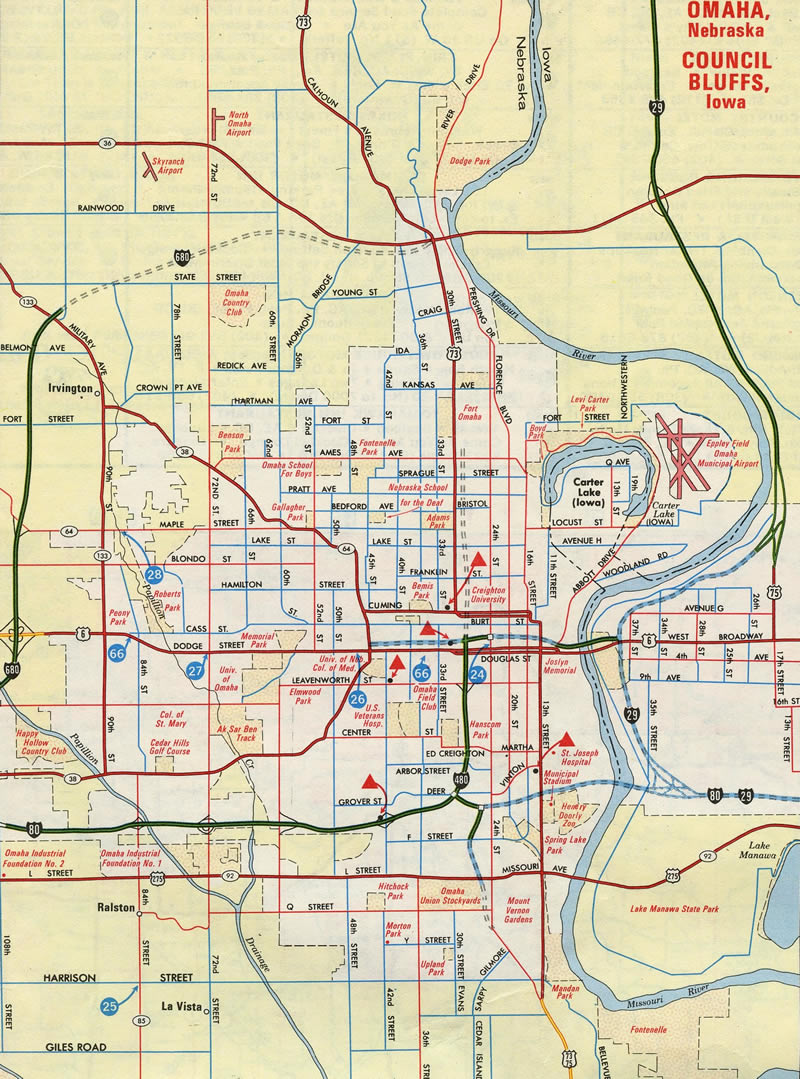
Omaha Inset – 1980 Official Nebraska Highway Map
Interstate 580 was designated along the North Freeway from I-480 north to Lake Street but dropped before the freeway was completed.
Overview
Interstate 580 in Nebraska was designated along the North Freeway, which carries U.S. 75 north from I-480 outside Downtown Omaha to the Miller Park-Minne Lusa community. The North Freeway links I-480 with Eppley Airfield (OMA) and the North Omaha area.
 History
I-580 was established by the American Association of State Highway and Transportation Officials (AASHTO) on July 13, 1976. Maps showed Interstate 580 signed on the North Freeway in the late 1970s and to 1983. Funding issues delayed completion of the route in 1980, and I-580 was removed from the Interstate Highway System because of the relatively high cost of upgrading portions of the North Freeway to Interstate standards.1
Origins of the North Freeway date back to 1954 when a $2.5 million north to south expressway was proposed to boost economic development and speed cattle to the Stockyards.2 1960s plans called for the route to extend north to Interstate 680 in the Florence area.3
Route Information
North End – Omaha, NE
South End – Omaha, NE
Mileage – 3.0
Cities – Omaha
- Junctions –

Source: Application for the Establishment of I-580 submitted to AASHTO on May 14, 1976.
The canceled West Freeway appears as well from Interstate 480 west to Saddle Creek Road. Ramps constructed at the I-480/North Freeway interchange for the incomplete West Freeway were dismantled during a often delayed project from 2005 to 2010.
Prolonged funding issues prompted the State Legislature to change the law to allow use of money for roads that were once a part of the Interstate system to help cover the costs of utility relocations needed for completion of the North Freeway in 1984.4 Additionally the North Freeway received a $6.2 million grant from the Federal Highway Administration (FHWA) in December 1984 to put toward the $60 million estimated completion costs.5 With funding in place, the North Freeway was extended from Lake Street 1.5 miles north to A.V. Sorenson Parkway and 30th Street on November 15, 1988.6 The extension cost $57.5 million and was coupled with the Storz Expressway.7 The Storz Expressway opened on July 26, 1989 as a three mile long controlled access route from the North Freeway to Abbott Drive near Eppley Field. The $19.4 million roadway was funded by federal and city funds.7
U.S. 73 was routed northward along the North Freeway to Lake Street until December 6, 1984, when Nebraska and Iowa highway officials moved forward on a renumbering plan to truncate U.S. 73 southward to Winnebago, Nebraska. The former route was replaced by a shift in U.S. 75 westward from the Interstate 29 corridor leading north from Council Bluffs. This also eliminated a lengthy overlap between U.S. 73/75 from Winnebago to Dawson. The change was done in an effort to reduce motorist confusion and to slightly cut costs associated with maintaining at least 100 dual signs between Omaha and Dawson.8
North End –  / Storz Expressway – Omaha, Nebraska
![]() North Freeway – North
North Freeway – North
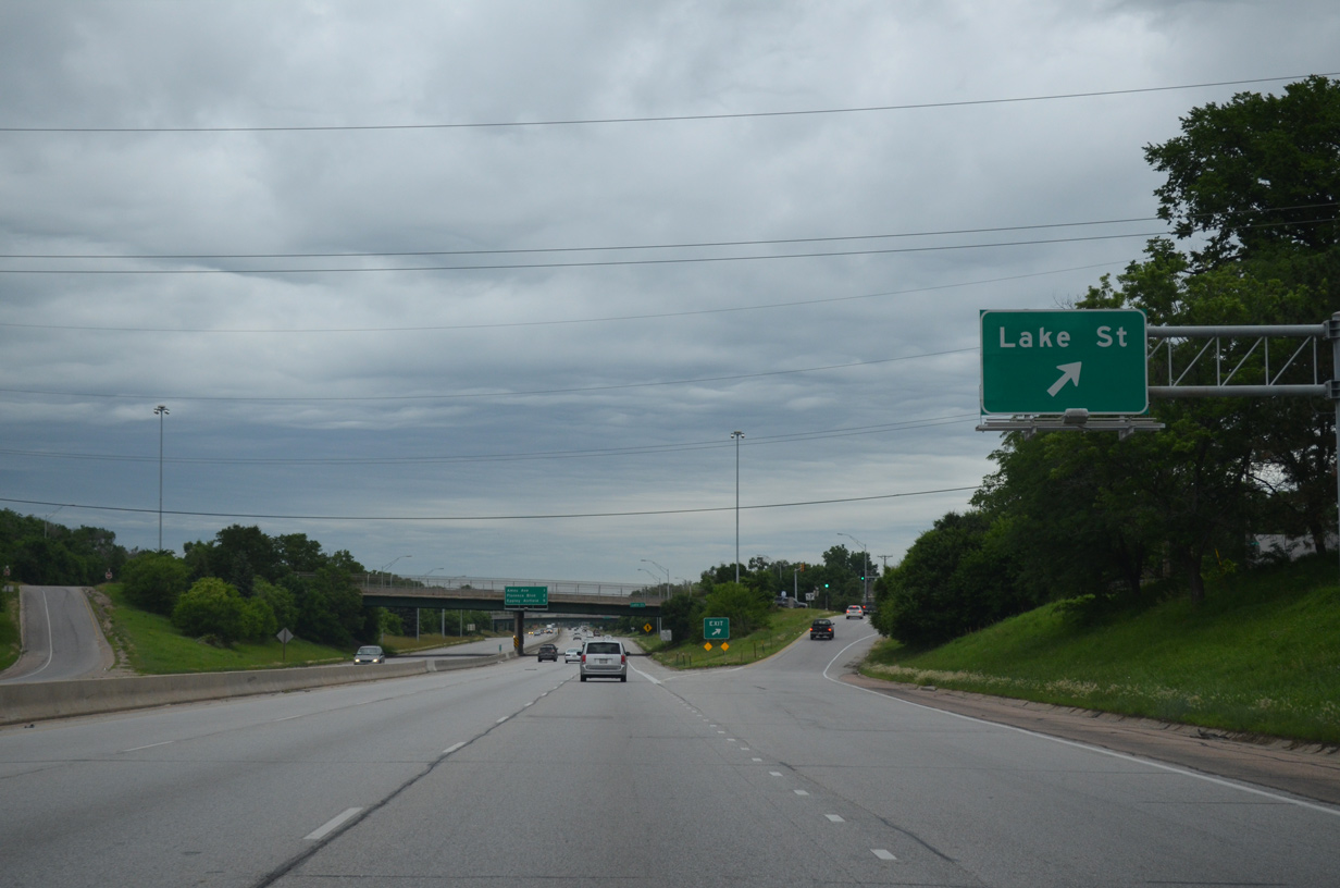
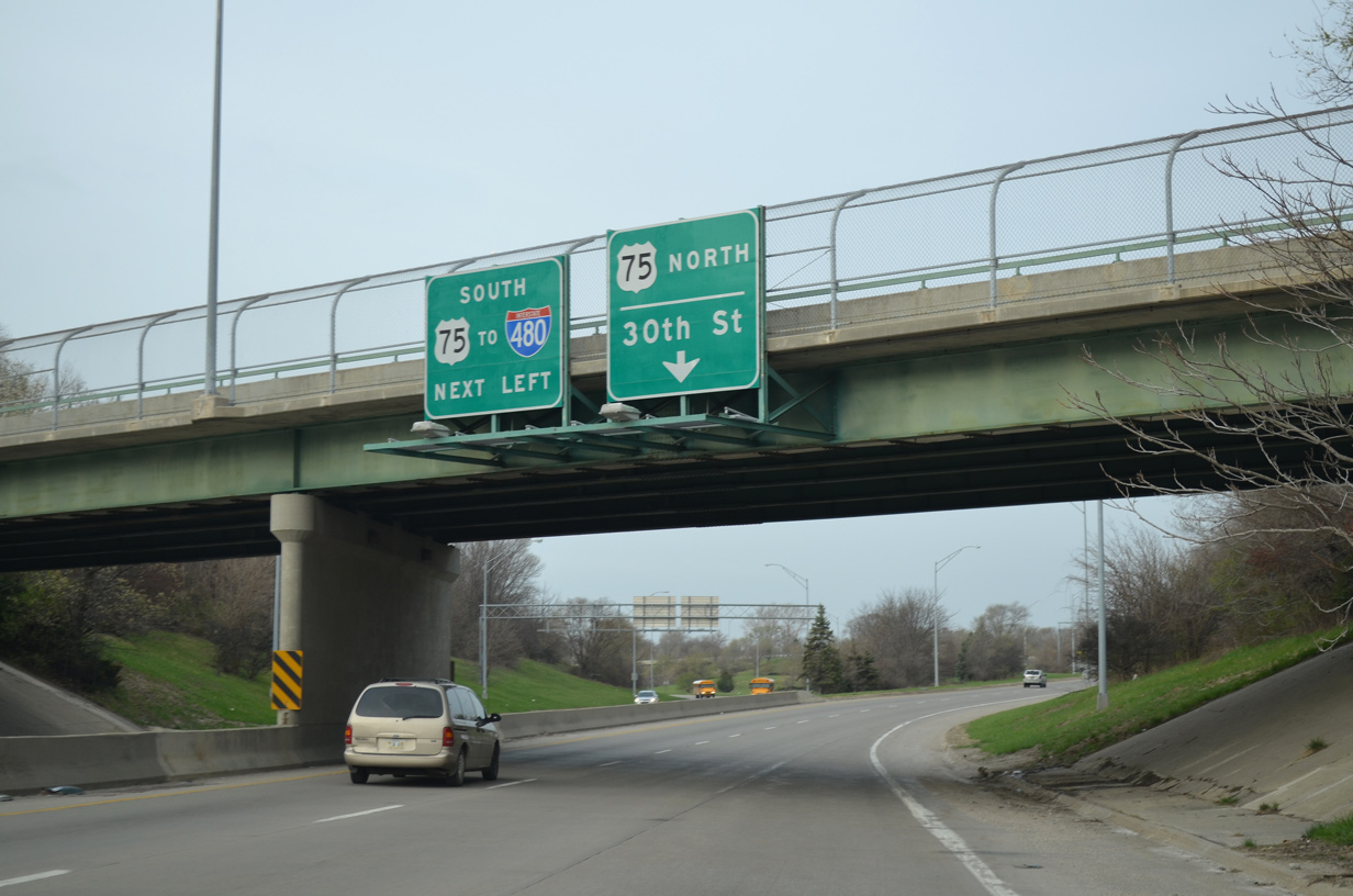
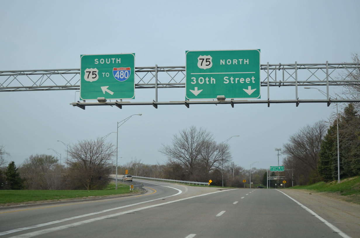
The Lake Street off-ramp was northernmost extent of Interstate 580, as the route was decommissioned before construction began along the North Freeway to 30th Street in 1984. 06/18/15
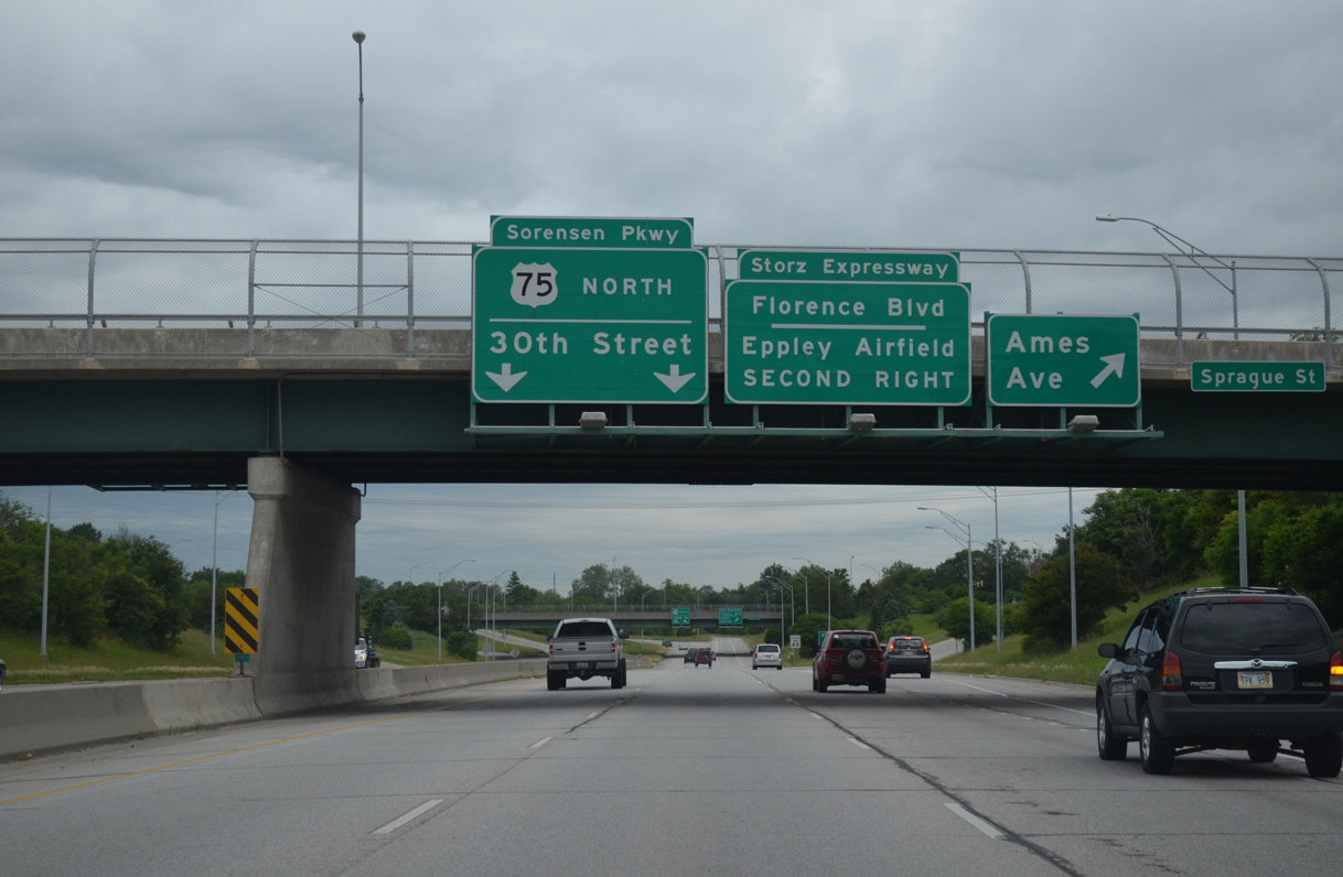
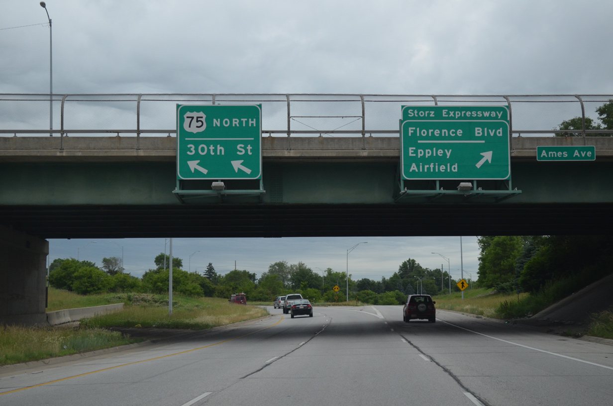
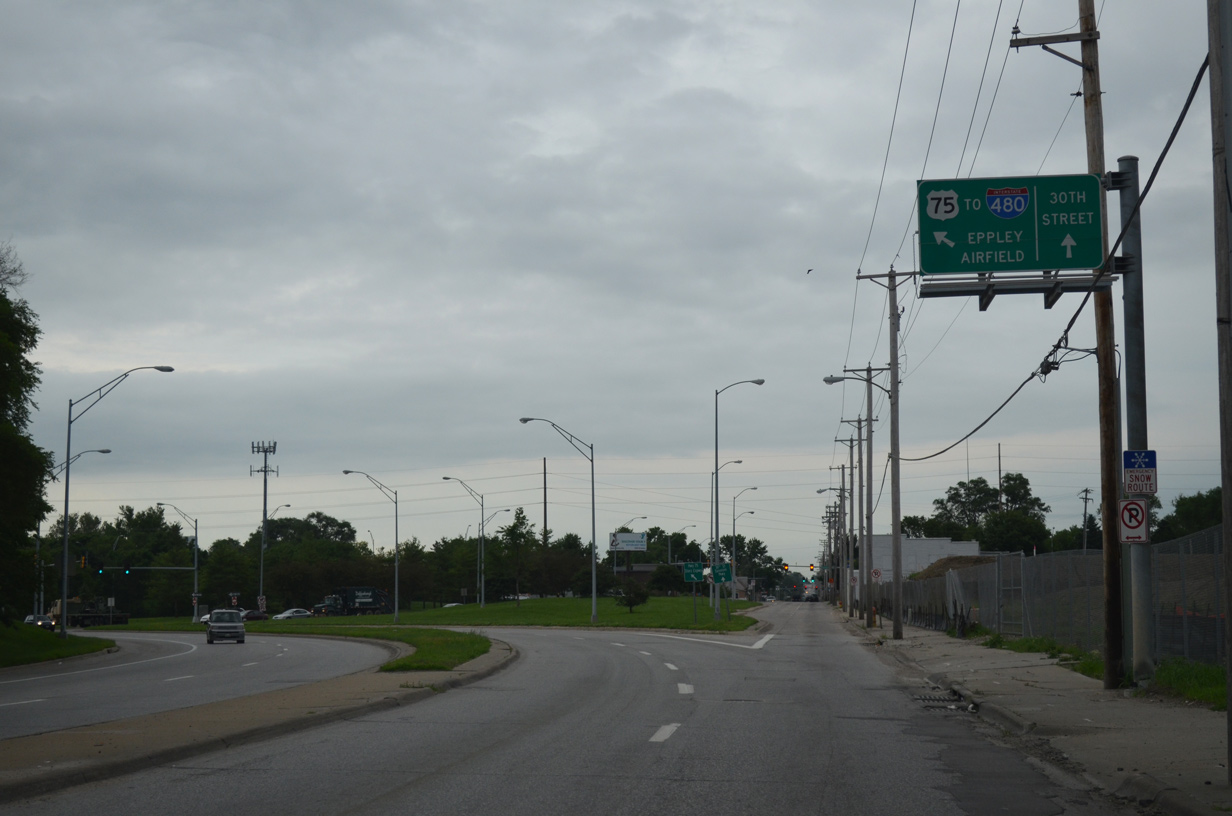
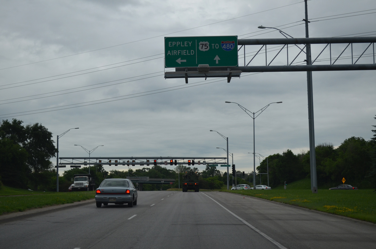
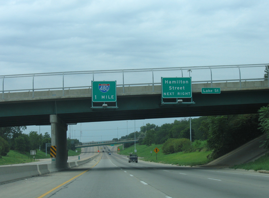
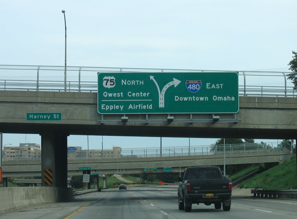
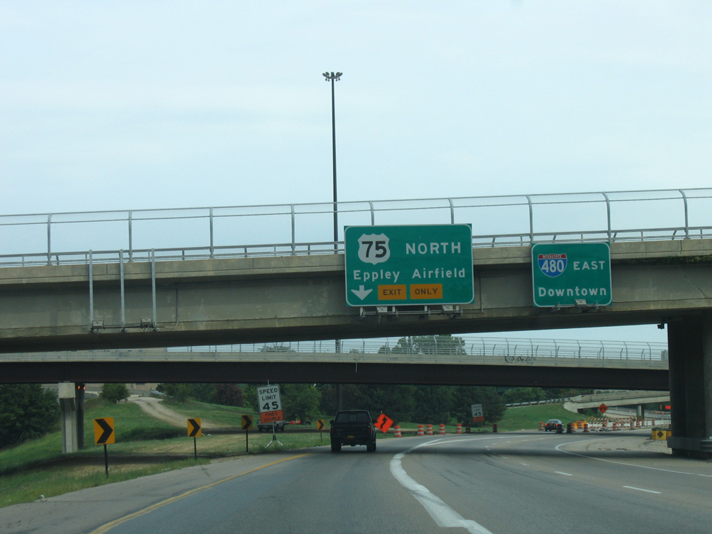
U.S. 75 (North Freeway) splits with the Storz Expressway east to Eppley Field (OMA) beyond the Ames Avenue overpass. 06/18/15
The Arthur C. Storz Expressway arcs east around the Levi Carter community to Abbott Drive and the passenger terminal of Eppley Airfield (OMA). Originally a three-wye interchange was planned to join the North Freeway and Storz Expressway. 06/18/15
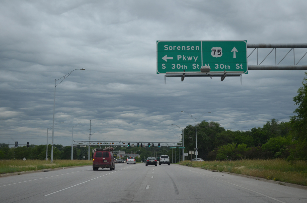
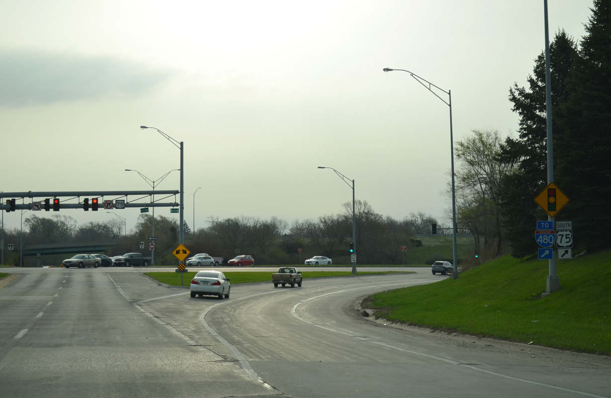
U.S. 75 (North Freeway) shifts westward and intersects Sorenson Parkway at-grade before transitioning onto 30th Street north to the Minne-Lusa and Florence communities. Sorenson Parkway meanders west to Northwest Omaha and N-133 (Blair High Road). 06/18/15
![]() South at North Freeway
South at North Freeway
U.S. 75 south separates from 30th Street at the beginning of the North Freeway. 30th Street continues south parallel to the freeway as the historic alignment of U.S. 73. 06/18/15
Angling southeast, U.S. 75 (North Freeway) intersects Sorenson Expressway west and Storz Expressway east. 06/18/15
Storz Expressway West at ![]() North Freeway
North Freeway
Storz Expressway travels west as a limited access route from 16th Street to the wye interchange with U.S. 75 (North Freeway). 09/04/05
A left exit ramp joins the Storz Expressway with U.S. 75 (North Freeway) south to Interstate 480 and Downtown Omaha. 03/30/16
The North Freeway leads U.S. 75 south from the Storz Expressway to Bellevue and I-480 at Downtown Omaha. Sorensen Parkway extends west from Storz Expressway to N-133 (N 90th Street); U.S. 75 follows 30th Street north to Florence and I-680 west of the Mormon Bridge. 03/30/16
Sorensen Parkway – East at ![]() / Storz Expressway
/ Storz Expressway
Sorensen Parkway east at Arthur C. Storz Expressway and the entrance ramp for U.S. 75 (North Freeway) south. 03/30/16
South End  – Omaha, Nebraska
![]() North Freeway – South at
North Freeway – South at ![]()
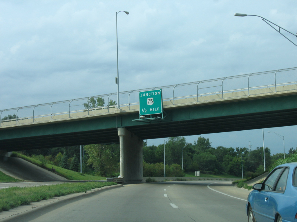
U.S. 75 (North Freeway) passes through the diamond interchange with Lake Street one mile ahead of Interstate 480. The signed extent of Interstate 580 began at Lake Street. 09/05/05
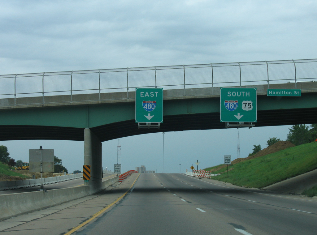
Traffic splits just beyond the Hamilton Street overpass for the continuation of U.S. 75 onto I-480 south and the left exit for I-480 east. 09/05/05
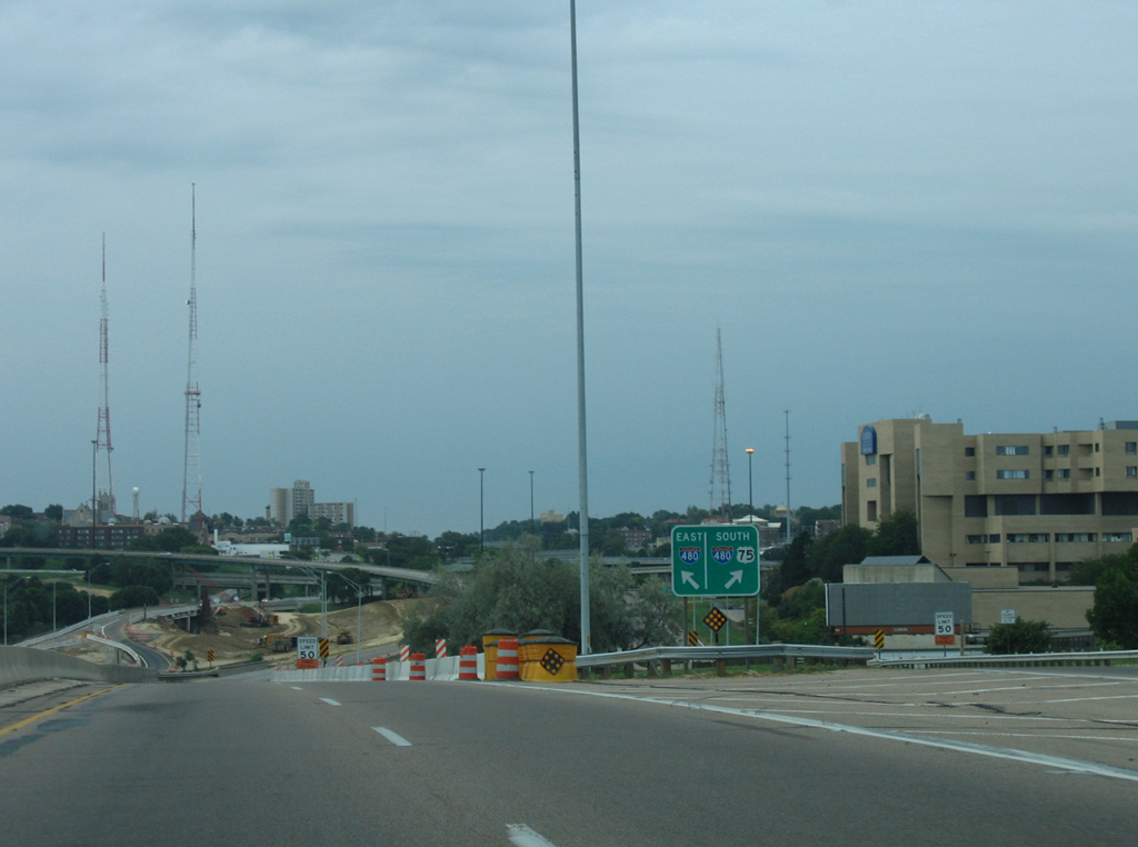
Approaching the Cuming Street underpass, motorists separated into ramps for I-480 as construction on the five-year project to rebuild the directional interchange with U.S. 75 and the unconstructed West Freeway was underway. 09/05/05

The entrance ramp from Cuming Street connects with both directions of I-480 as a flyover turned eastward ahead of 24th Street. The left side ramp to Council Bluffs was rebuilt during 2005-10 construction. 09/05/05
![]() West at
West at ![]() North Freeway
North Freeway
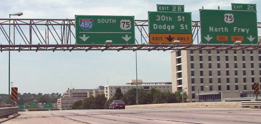
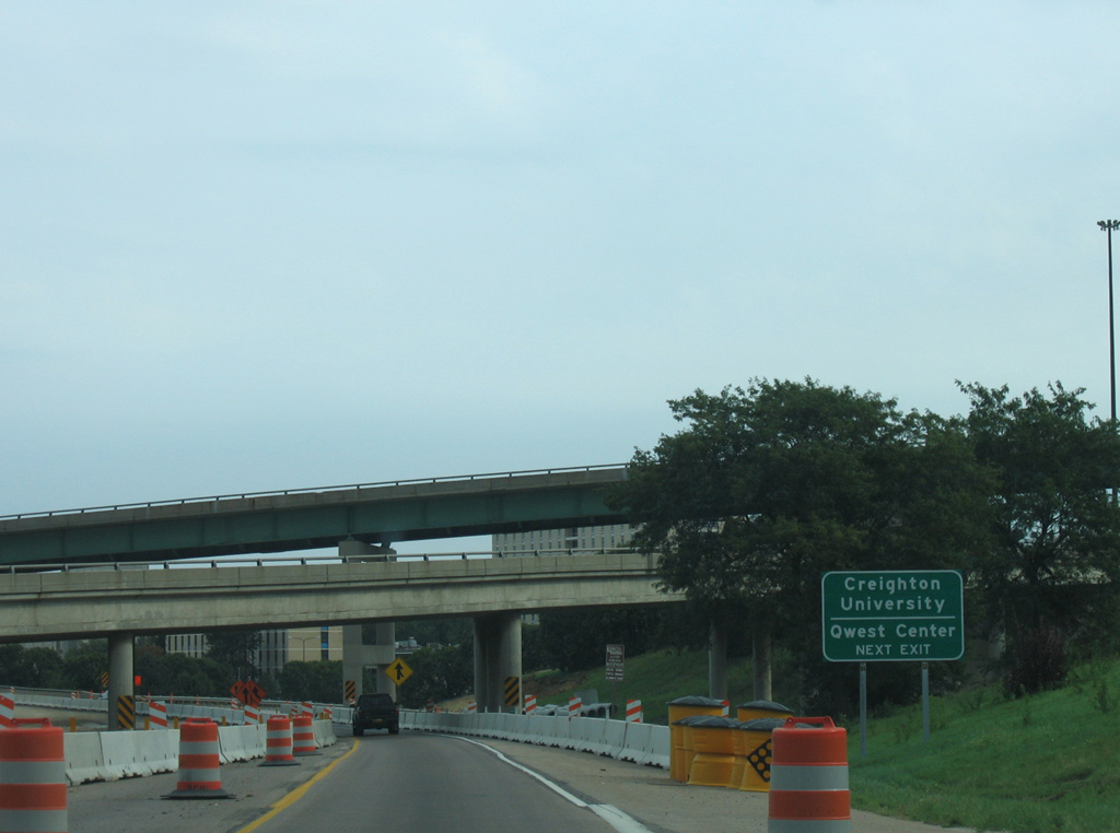
Passing by Creighton University, Interstate 480 turns southwest at the former end of I-580. Exit 2C departs next for the North Freeway to Eppley Field (OMA). Photo by Dale Sanderson (2001).
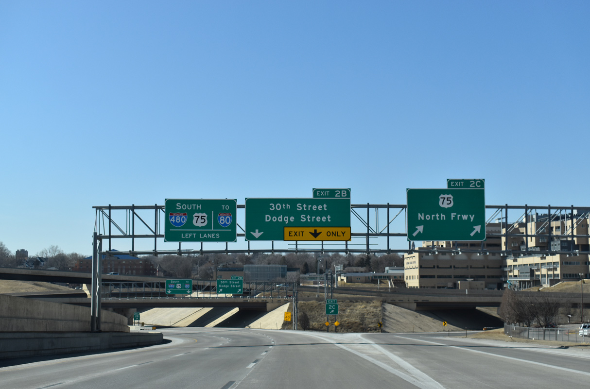
Interstate 480 west at U.S. 75 (North Freeway) and the former northbound beginning of I-580. Exit 2B followed for 30th Street and U.S. 6 (Dodge Street) via 31st and Davenport Streets. 02/22/20
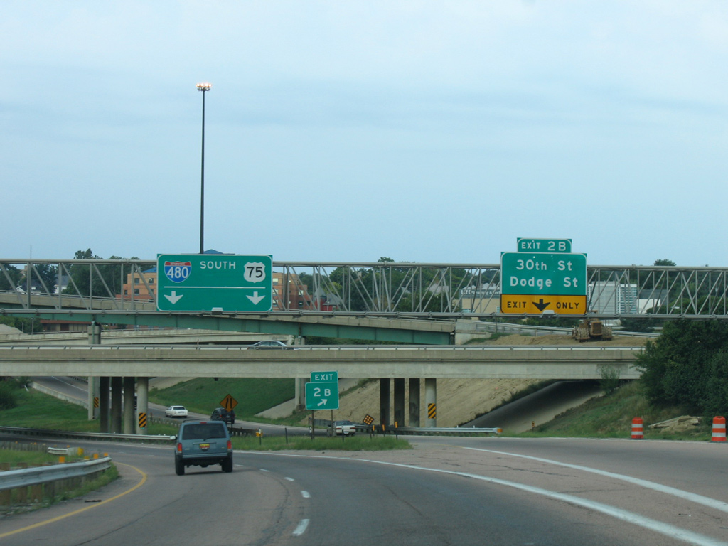
The 30th Street off-ramp (Exit 2B) was a remnant from the canceled West Freeway. The West Freeway would have paralleled U.S. 6 (Dodge Street) to Interstate 680 at the Dodge Street Expressway. The local connection to Gifford Park here was rebuilt to intersect 30th Street at-grade. 09/05/05
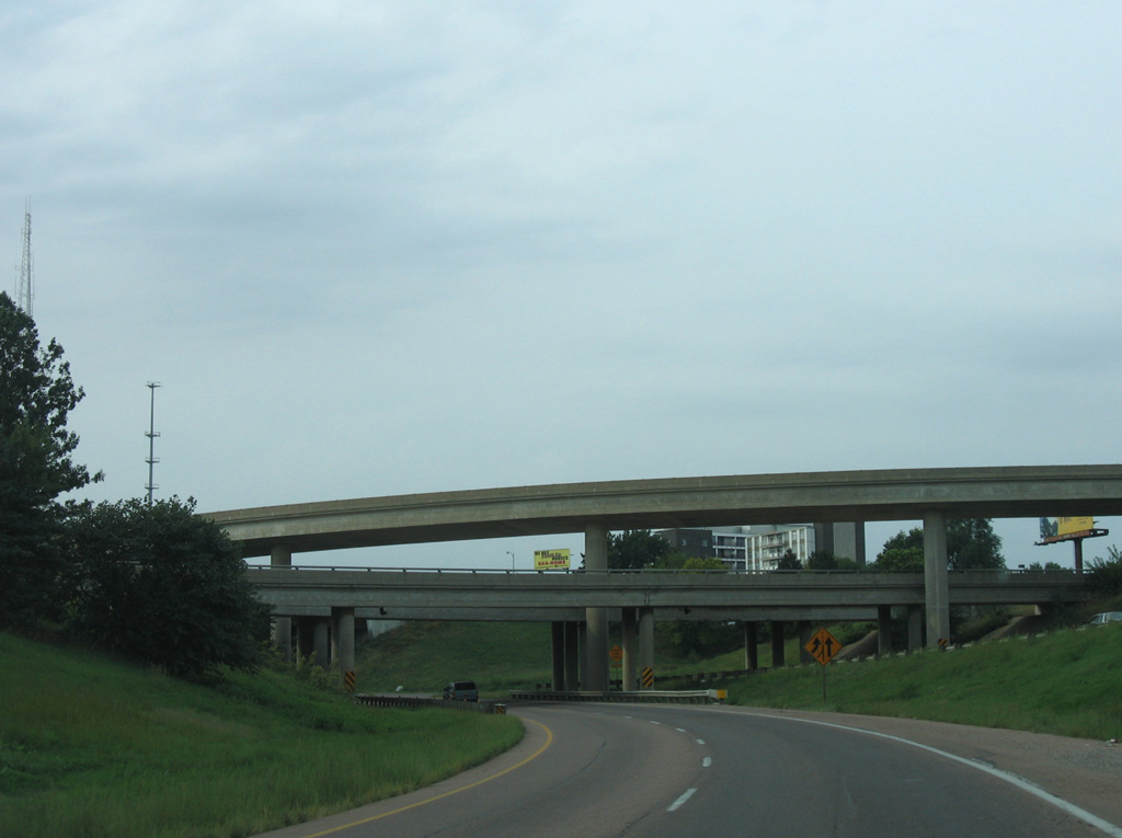
Since demolished, all of the bridges pictured here were remnants from the unconstructed West Freeway. They included the eastbound ramps to I-480 and the North Freeway and the off-ramp from I-480 north to 30th Street. 09/05/05
![]()
![]() North at North Freeway
North at North Freeway
I-480/U.S. 75 emerge from a below grade section of freeway and separate at the U.S. 6 (Douglas and Dodge Street) overpasses. The traffic pattern at the original interchange with the North Freeway defaulted the I-480 mainline onto U.S. 75 north. I-480 was eventually realigned through the middle of the rebuilt exchange with four overall lanes. 09/05/05
A left exit previously connected I-480/U.S. 75 north with 31st Street at the Gifford Park neighborhood to the west. Permanently closed in 1984, this ramp was built in 1971 for the West Freeway. 09/05/05
The West Freeway off-ramp passed above the southbound lanes of U.S. 75 and 30th Street. It combined with a ramp from I-480 west before tieing into 31st and Davenport Streets. 09/05/05
Additional flyovers carried traffic from U.S. 75 south and 30th Street east to I-480 east. The 30th Street ramp was demolished during 2005-10 reconstruction. 09/05/05
Sources:
- Neil Alexander Bratney
- “32 – Year Project Divided Community Is Freeway Progress? Some Still Unsure.” Omaha World-Herald (NE), September 17, 1986.
- “Traffic Rolls to 30th and Fort Streets Freeway Is Seen as Boon for North Omaha.” Omaha World-Herald (NE), November 16, 1988.
- “Utilities to Spend $3 Million In ’84 on Path for Freeway.” Omaha World-Herald (NE), December 10, 1983.
- “North Freeway Gets $6.2 Million Grant.” Omaha World-Herald (NE), December 12, 1984.
- “North Freeway Is Now Open Past Lake St.” Omaha World-Herald (NE), November 15, 1988.
- “Two Down, One to Go In Northern Freeways.” Omaha World-Herald (NE), July 25, 1989.
- “End of U.S. 73 Signs To End the Confusion.” Omaha World-Herald (NE), December 7, 1984.
Page updated November 4, 2020.