Interstate 535 Minnesota / Wisconsin
Overview
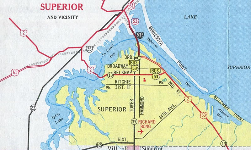
Interstate 535 is a short freeway linking I-35 and U.S. 53 in Duluth, Minnesota, with 3rd Street and Hammond Avenue in Superior, Wisconsin. The route spans Howards Bay and the St. Louis River between Connors and Rice’s Points along the John A. Blatnik Bridge, a continuous steel through truss arch bridge.
The Minnesota Department of Transportation (MnDOT) is in charge of maintenance for the Blatnik Bridge on I-535/U.S. 53 while the Wisconsin Department of Transportation (WisDOT) is responsible for maintenance of the Bong Bridge (U.S. 2) to the south. Costs are split between the two states.
Interchanges along Interstate 535 are unnumbered. The west end ties into I-35 and the expressway leading U.S. 53 northwest at the locally named “Can of Worms” interchange. The junction involves two directional T interchanges, with a signalized turn from I-35 north onto U.S. 53 north across the U.S. 53 southbound lanes leading to I-535.

Looking southeast from Enger Park at the “Can of Worms” interchange and I-535/U.S. 53 leading south along Rice’s Point to the Blatnik Bridge. Photo by Monte Castleman (07/02).
I-35, I-535, Hwy 53 Twin Ports Interchange
Costing around $442 million, the Twin Ports Interchange program replaces 33 bridges, updates the interchange joining I-35, I-535 and U.S. 53 in Duluth and revises the ramps along Interstate 535 at Garfield Avenue. Both interchanges serve the Clure Public Terminal, but weight restrictions previously in place forced overweight vehicles to and from the port onto local streets. Design work was 60% complete as of November 2019. However as plans advanced, an estimated $100 million shortfall for the project arose, due to increased costs with addressing contaminated soil and water, geotechnical challenges, and maintaining two lanes of traffic along Lower Michigan Street southbound during construction. As a result the Minnesota Department of Transportation (MnDOT) deferred work on the project phases involving Garfield Avenue and U.S. 53.7
Initial construction at the Twin Ports Interchange got underway in 2021. Work through Fall 2022 reduces I-35 to a single lane configuration per direction between 27th Avenue W and Garfield Avenue. Construction replaces the 27th Avenue W Bridge and several ramps at the exchange with I-35/535 and U.S. 53 closed.
I-35 southbound shifted onto Lower Michigan Street from Fall 2021 to Fall 2022 while I-35 northbound uses the southbound lanes between Garfield Avenue and 22nd Avenue W. I-35 traffic then shifts onto the rebuilt northbound roadway with two-way traffic in late Fall 2022 and ramps to I-535 reopen as a portion of U.S. 53 closes.
All roadways and ramps through the Twin Ports Interchange will be in their final configuration by Fall 2023. Finishing work along I-35 continues to Summer 2024.
Also known as the Can of Worms interchange in part due to the third-highest crash rate in Minnesota, the exchange between I-35/535 was built in the 1960s utilizing elevated roadways and ramps due to poor foundation soils. Deterioration of the bridges resulted in the overweight truck detours currently in place. Further south at Garfield Avenue, weight restrictions also apply to the interchange built there in 1969.
The MnDOT FASTLANE Grant application for the Twin Ports Interchange 2020 program estimated $244 million for the preferred alternative, with a time savings of 14 years. A previous alternative called for maintaining the existing facilities and replacing elements piecemeal over an 18 year period using traditional funding sources.6 Redesign of the Can of Worms interchange includes relocating the Interstate 35 mainline so that each roadway runs next to one another in place of the current wide median. This will allow for the relocation of left exits to right exits and eliminate merge conflict points. Additionally a value engineering study analyzed whether the I-35 mainline could be rebuilt entirely on embankment versus on elevated viaduct. The signalized movement from I-35 north to U.S. 53 north however remains.
Work at the I-535/Garfield Interchange replaces all of the bridges at the junction. No geometric changes are required outside of expanding bridges to standard widths.6
Route Information
Mileage
Wisconsin – 1.21
Minnesota – 1.57
Cities – Duluth
- Junctions –

Source: December 31, 2021 Interstate Route Log and Finders List
U.S. 53 traveled Garfield Avenue north to Piedmont Avenue west to the current alignment along Trinity Road prior to the completion of the freeway ascending west by the Goat Hill neighborhood.
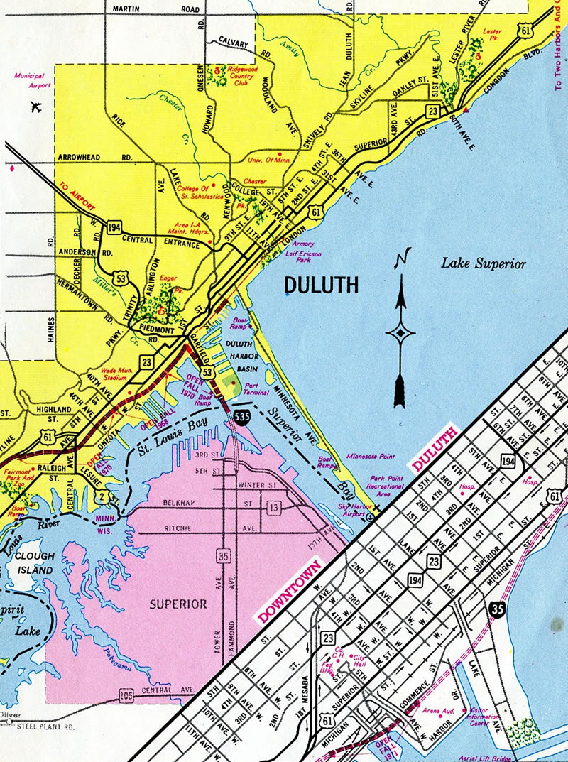
Interstate 35 opened in conjunction with I-535 leading west from the Can of Worms in December 1971.2 The freeway opened east to Mesaba Avenue soon thereafter. Overall completion of I-35 however, was delayed until 1992.
 History
The John A. Blatnik Bridge was constructed between November 1958 and December 2, 1961 at a cost of $15 million. The 7,980 foot long span varies in width between 58 and 70 feet. It is the second longest bridge in Minnesota to the nearby Bong Bridge (8,320 feet). The span provides a 120 foot clearance above the St. Louis River.1
I-535/U.S. 53 defaulted onto Garfield Avenue at the north end of the Blatnik Bridge until December 1971, when the connection to Interstate 35 and the Can of Worms Interchange opened to traffic.2
Several projects have taken place along the Blatnik Bridge to extend its lifespan. The approaches were widened in conjunction with the installation of a new deck and roadway lighting in 1993 and 1994. The span was repainted between 1996 and 1998.1
The bridge was monitored closely following the 2007 collapse of the I-35W bridge in Minneapolis.1 Corrosion of support elements led to weight restrictions on the span and Interstate 535 in general in early 2008.3
A $12.95 million rehabilitation project commenced in May 2012 to repair and strengthen gusset plates on the bridge main span, replace the bridge deck expansion joints, sandblast and repaint areas subjected to road salt, and replace the concrete rail with a thinner light weight rail to improve the load carrying capacity. Wrapping up work was the installation of a new LED based lighting system, which was activated for the first time on October 25, 2013.4
Work on the Bong Bridge started in 1979. It includes an 80 foot high steel tied arch at a height of 120 feet above the St. Louis River. The $70 million span replaced the 1927 Arrowhead drawbridge when it opened on October 25, 1984. A two year project on the span resulted in one way traffic on the Bong Bridge for each year, while a detour route for U.S. 2 was implemented alongside I-535/U.S. 53 across the Blatnik Bridge. Work completed on October 31, 2015 involved replacing, repairing and repainting structural components of the steel arch, overlaying the deck, replacing expansion joints and lighting fixtures and repairing the sidewalk.5
North End  – Duluth, Minnesota
![]()
![]() North at
North at ![]()
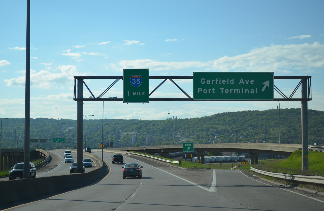
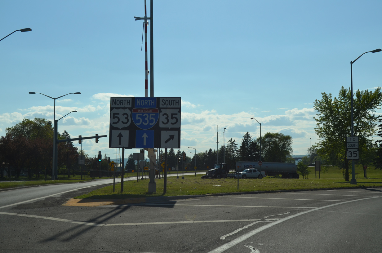
Two wye interchanges join I-535/U.S. 53 with Garfield Avenue (historic U.S. 53) by the Port Terminal. The freeway continues one mile to I-35. 06/14/15
I-535/U.S. 53 bend west along the shore of St. Louis Bay to the Can of Worms interchange with Interstate 35. I-35 extends four miles north to end at MN 61 (London Road). 06/14/15
A large BNSF Railroad yard appears along the east side as I-535/U.S. 53 prepare to separate into single lane ramps for Downtown, Lincoln Park and Spirit Valley in Duluth. 06/14/15
Flyover ramps shuttle motorists over BNSF Railroad lines to both I-35 north toward the North Shore and the continuation of U.S. 53 north to Duluth Heights. 06/14/15
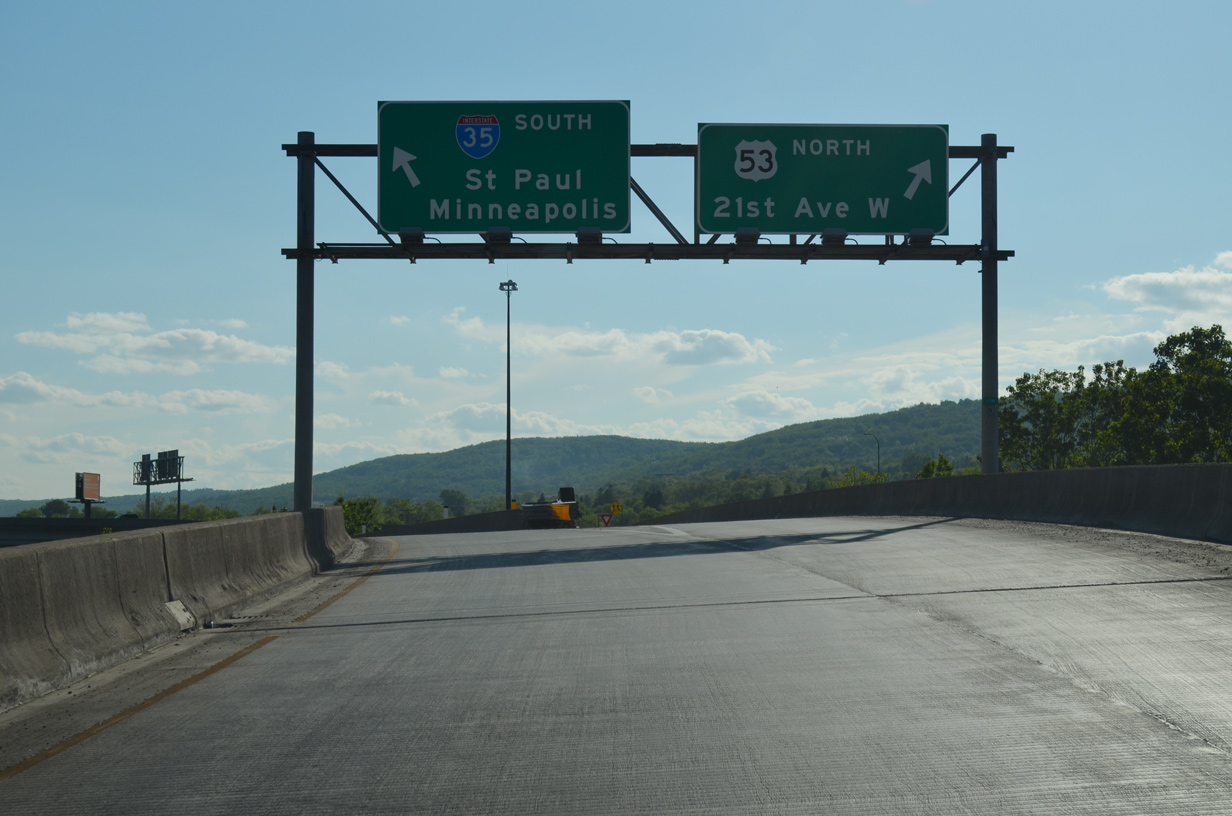
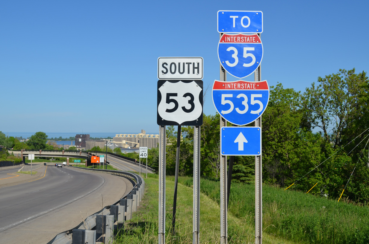
A left exit follows onto Interstate 35 south to Minneapolis and St. Paul while U.S. 53 curves west and north to 21st Avenue W and Piedmont Avenue. 06/14/15
![]() North at
North at ![]()
![]()
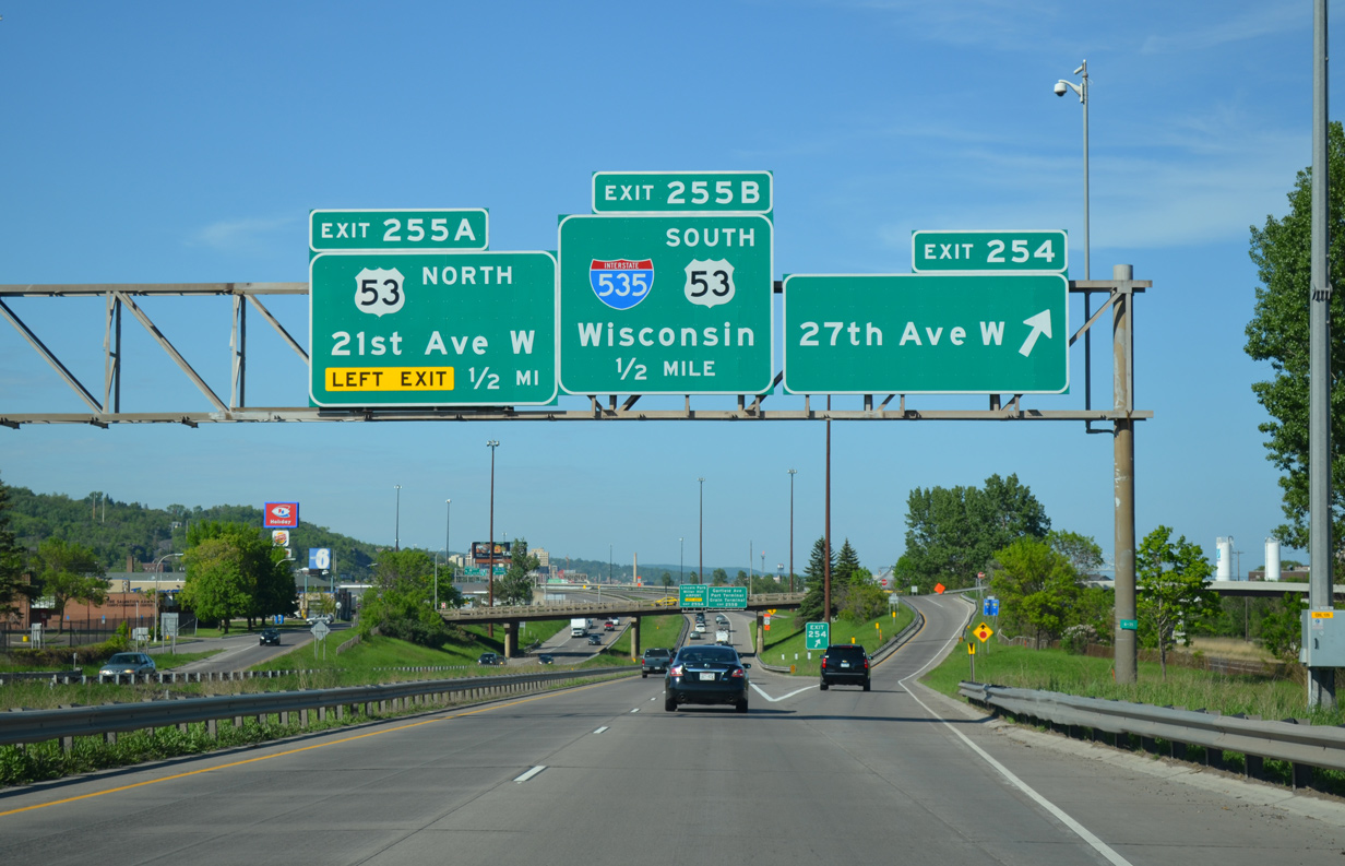
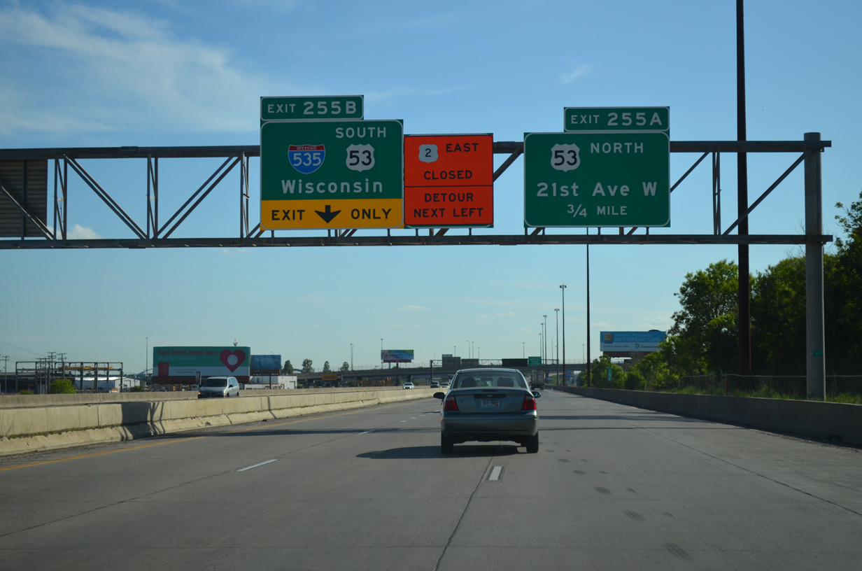
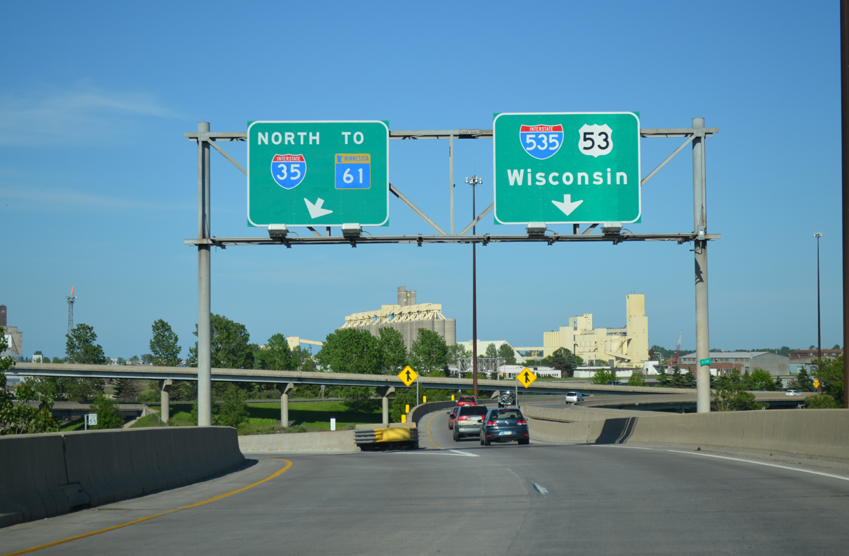
The first guide sign for Interstate 535 south (Exit 255B) appears as I-35 enters the diamond interchange (Exit 254) with 27th Avenue W. 06/14/15

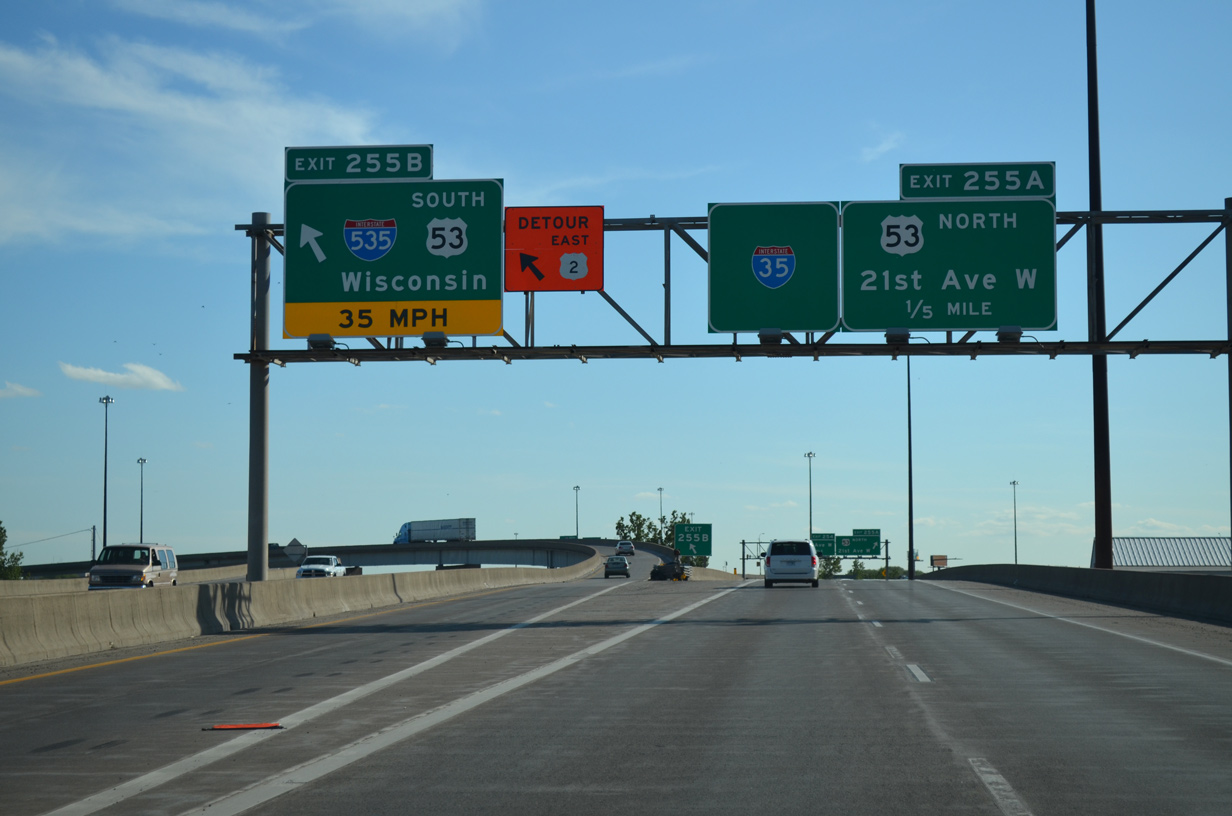
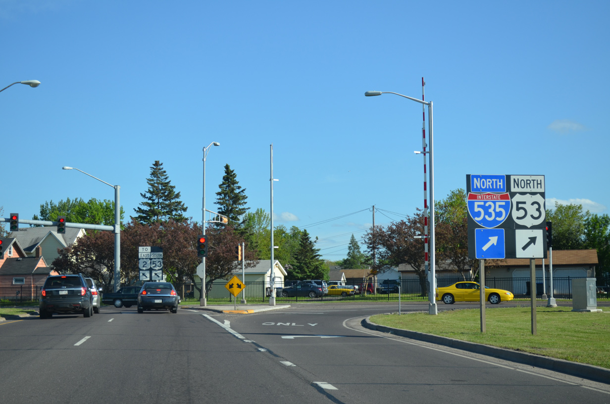
Ramps depart I-35 north simultaneously for U.S. 53 north (Exit 255A) and I-535/U.S. 53 south (Exit 255B) at the freeway enters the Can of Worms interchange. I-535 and U.S. 53 are linked seamlessly above, as U.S. 53 winds westward along an expressway to overtake Piedmont Avenue across the Lincoln Park street grid. 06/14/15
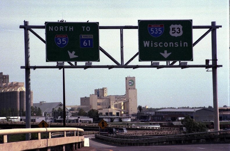
Throwback – North at 

These guide signs with centered exit tabs were replaced during 2011 road work to reconstruct I-35 through Duluth. Photo by Patrick Lilja (07/04/05).
These signs were also replaced during construction at the Can of Worms interchange. Older style guard rails remained along the adjacent ramps. Photo by Patrick Lilja (07/04/05).
![]() South at
South at ![]()
![]()
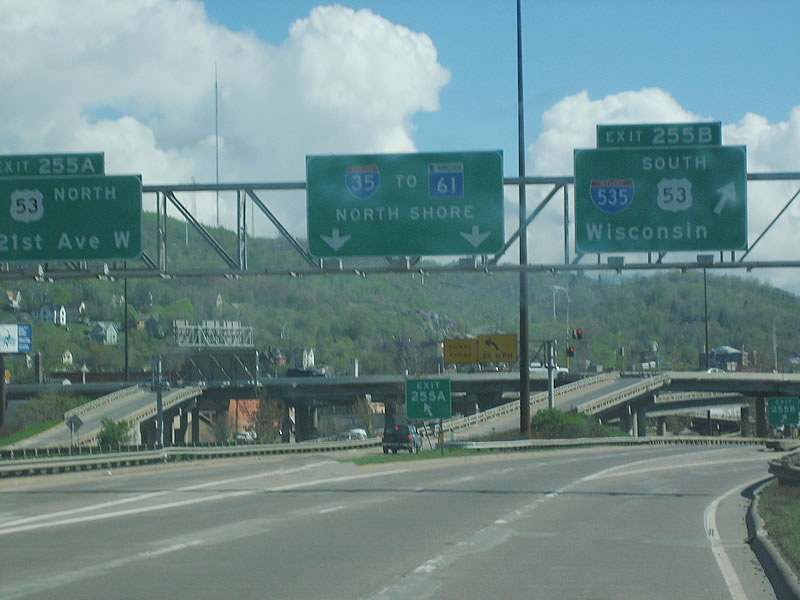
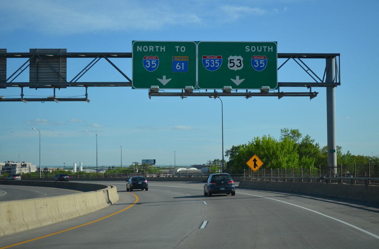
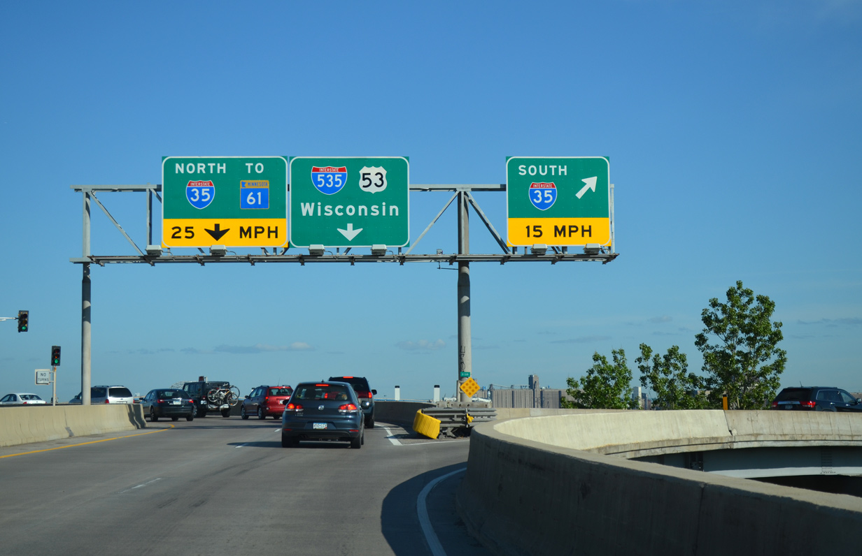
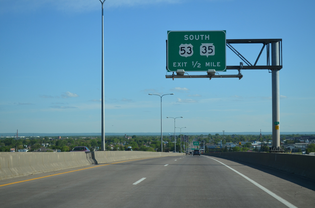
A wye interchange adds traffic from parallel Michigan Street (old U.S. 61) and Superior Street as Interstate 35 southbound approaches I-535 south and U.S. 53 (Exits 255B/A). 06/14/15
Two lanes merge onto I-35 south from Michigan Street to expand southbound freeway to three lanes. A lane drop occurs in one half mile for I-535/U.S. 53 south. 06/14/15
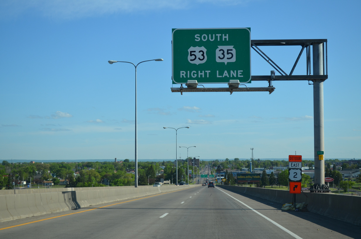
A flyover takes motorists onto I-535/U.S. 53 south to the Blatnik Bridge into Superior, Wisconsin. The ensuing exit departs in one fifth of a mile for the U.S. 53 freeway north and its ramp for adjacent 21st Avenue W. 06/14/15
![]() South at
South at ![]()
![]()

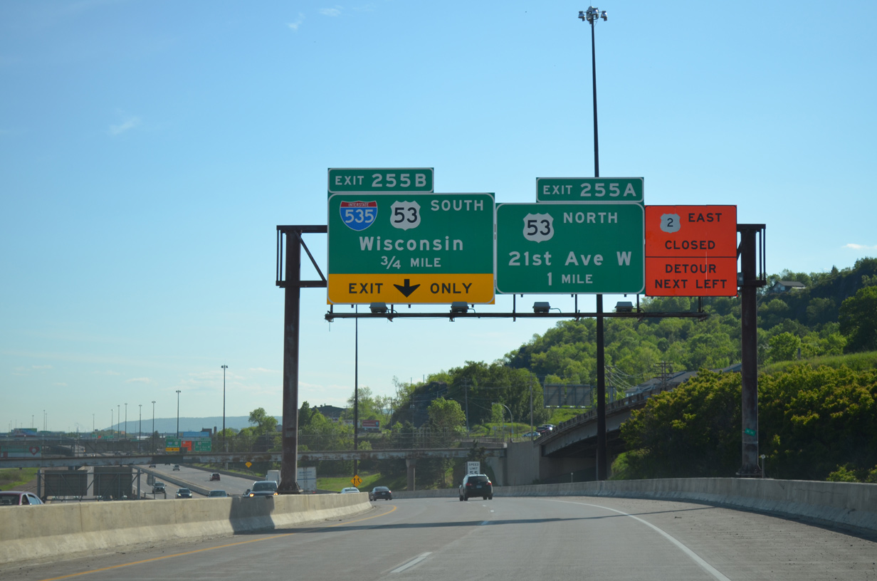
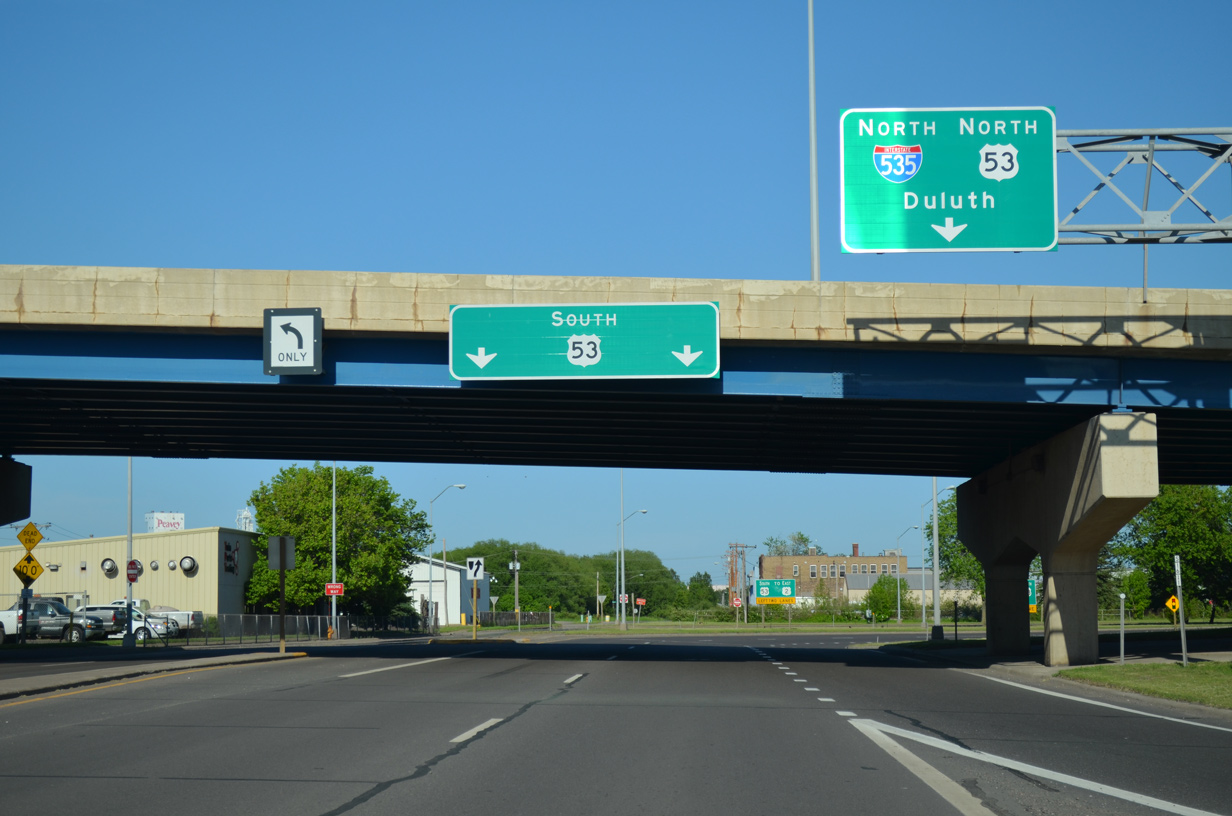
U.S. 53 transitions to a freeway south of W 6th Street as it lowers through the Lincoln Park neighborhood of Duluth into the Can of Worms interchange with I-35/535. 06/14/15
An entrance ramp joins the U.S. 53 viaduct from 21st Avenue W as the freeway approaches the off-ramp for Interstate 35 south to Minneapolis and St. Paul. 06/14/15
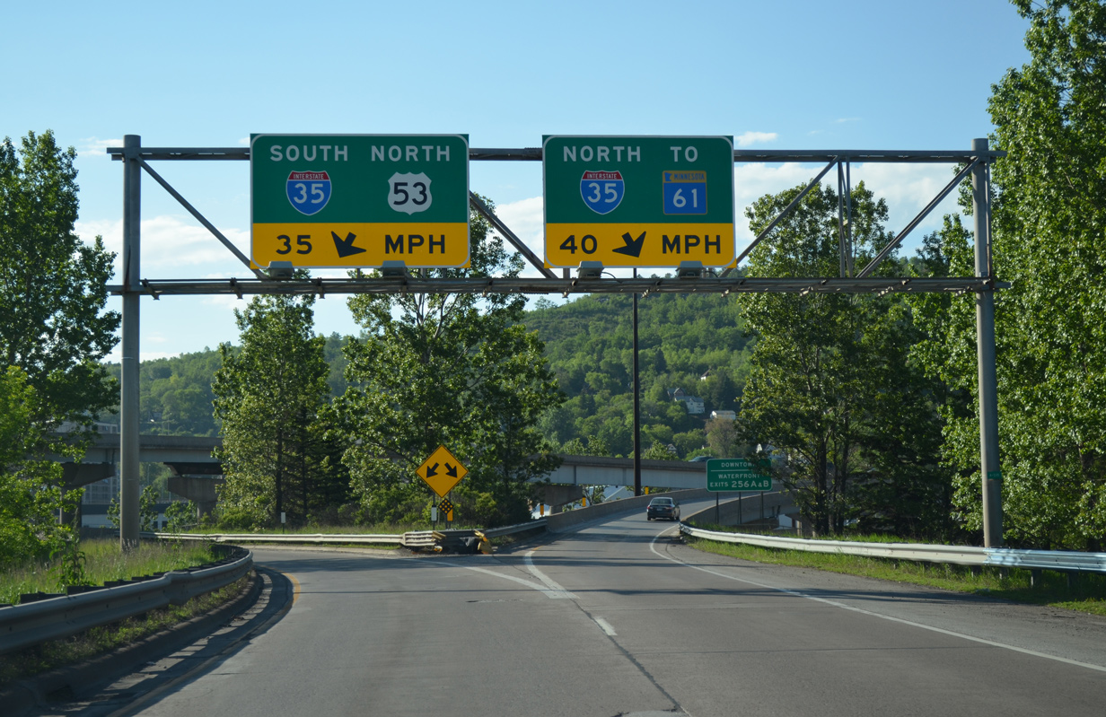
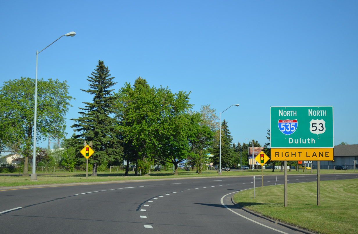
Traffic remaining along U.S. 53 south to I-535 encounters a signalized intersection with the northbound off-ramp from I-35 to U.S. 53 north. A traffic signal operating between an Interstate and other freeway is not unique to Duluth, as a similar configuration is at the exchange joining I-229 with U.S. 36 in St. Joseph, Missouri as well. 06/14/15
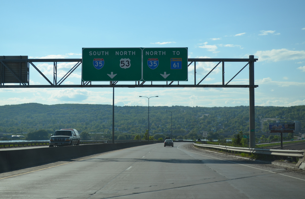
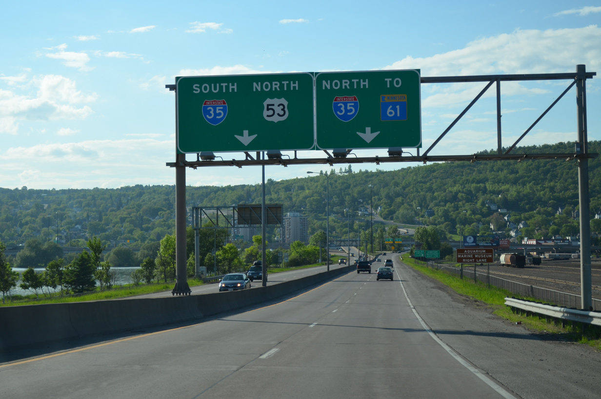
U.S. 53 separates into single lane ramps for both Interstate 35 north to Downtown Duluth and the North Shore and the continuation onto I-535 south to Superior, Wisconsin. 06/14/15
Bridges associated with the Can of Worms interchange were overhauled as part of the I-35 Mega Project completed in Spring 2012. This view looks at the old guard rail structure at the directional T interchange. Photo by Jeff Royston (10/00).
Leading out of the Can of Worms Interchange, I-535/U.S. 53 south runs along side a BNSF Railroad yard at Rice’s Point. A Canadian Pacific yard lines the east side of the freeway at the forthcoming exit for Garfield Avenue (old U.S. 53). 06/14/15
South End / Hammond Avenue – Superior, Wisconsin
![]()
![]() South at
South at ![]()
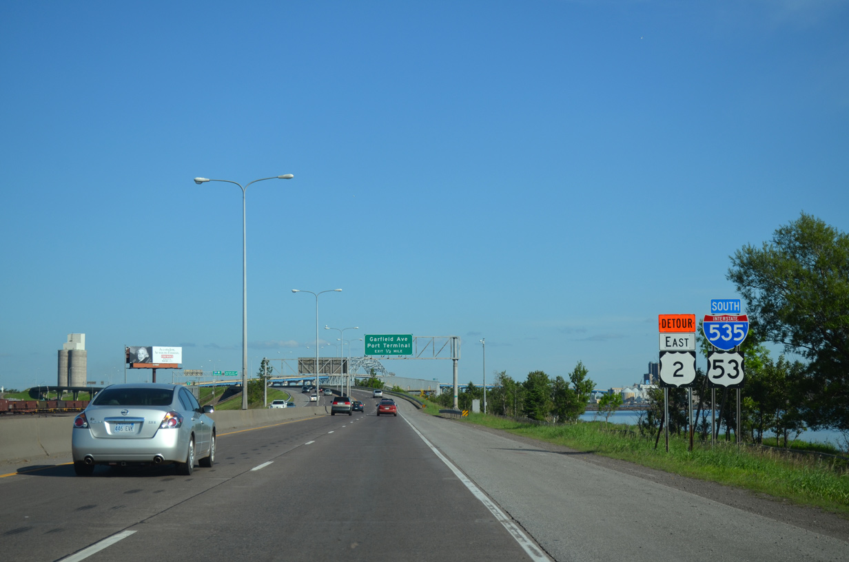
I-535/U.S. 53 lower from Howards Bay to a loop ramp with N 3rd Street at Hughitt Avenue. Wis 35 commences a 412-mile route there south to the Illinois state line at Kieler. 06/14/15
U.S. 53 leads away from I-535 at N 3rd Street. The US highway follows E 2nd Street, a four-lane boulevard running along the west bank of Superior Bay to East End in Superior. 06/14/15

Interstate 535 transitions into Hammond Avenue south as U.S. 53 departs for N 3rd Street and STH-35. STH-35 takes Tower Avenue south to Downtown Superior. The route formerly was a part of U.S. 53 Business. 06/14/15
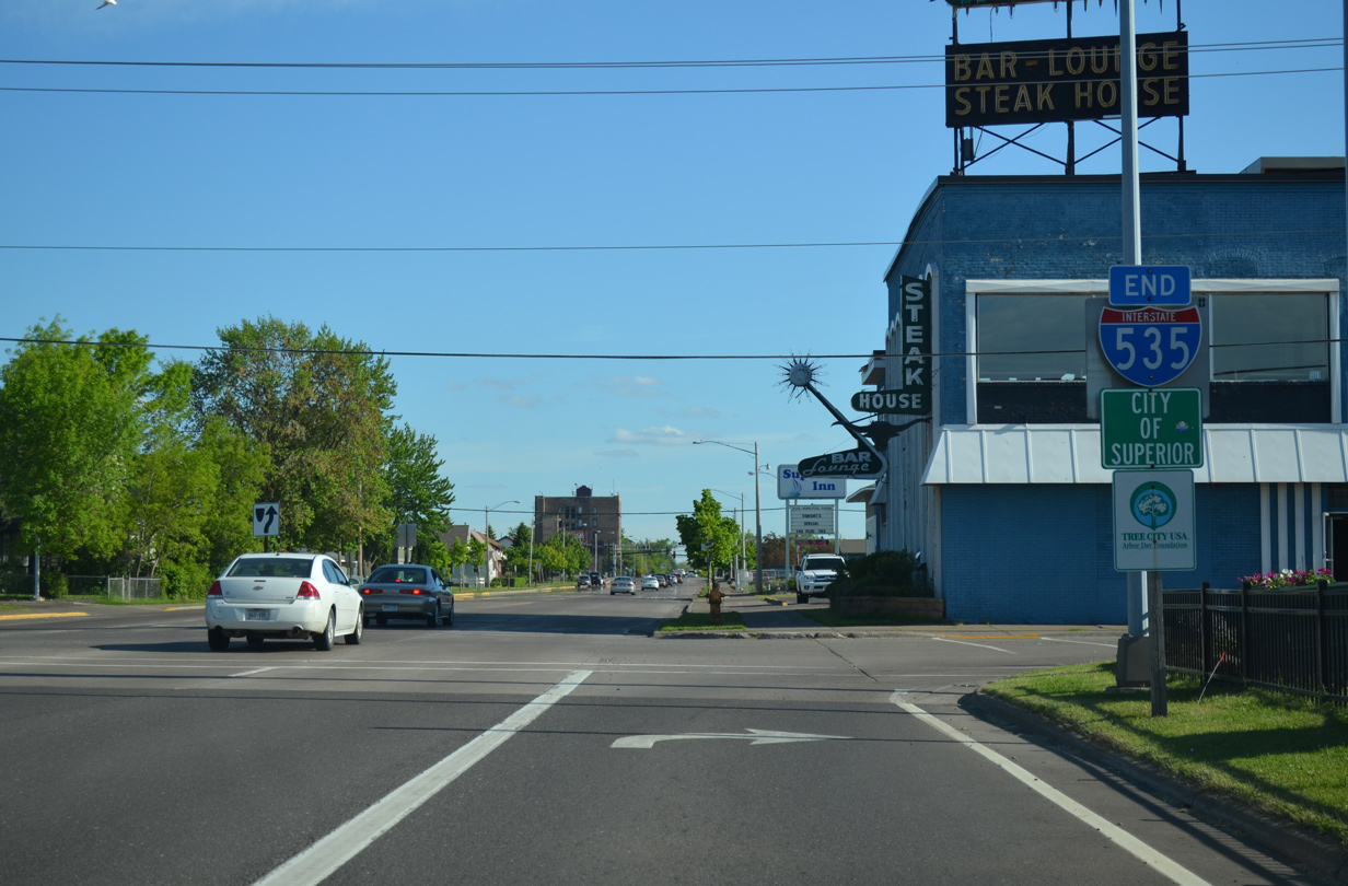
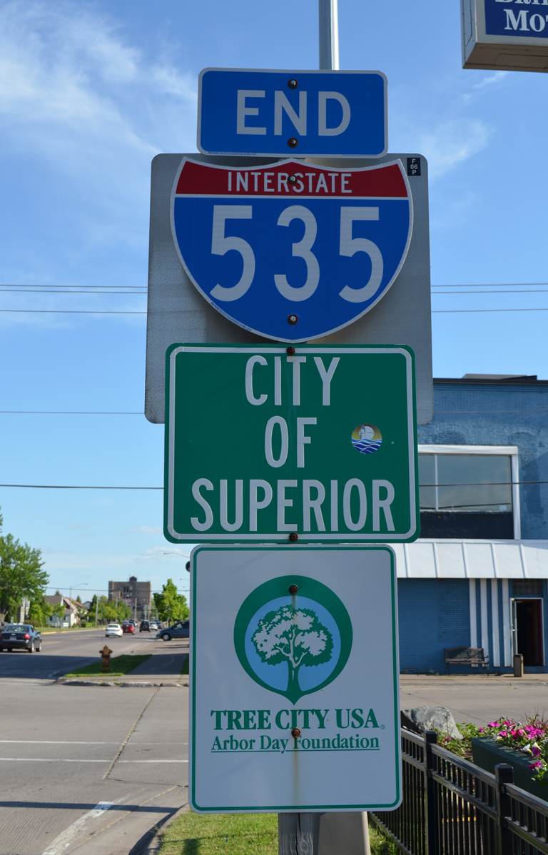
An end shield for Interstate 535 stands at the intersection of Hammond Avenue and N 5th Street. U.S. 2 crosses Hammond Avenue ten blocks ahead via Belknap Street. 06/14/15
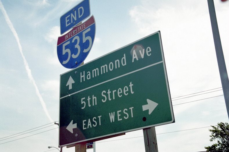
The previous end I-535 shield assembly was coupled with a small guide sign. Photo by Jeff Royston (10/00).
![]() North at
North at ![]()
![]()
U.S. 53 (E 2nd Street) curves west from the industrial Superior Bayfront to meet both the south end of Interstate 535 and north end of Wis 35. Wis 35 circles northward to pass under the Blatnik Bridge en route to Downtown Superior. 06/14/15
U.S. 53 proceeds through a signalized intersection to merge onto Interstate 535 north across Howards Bay and Connors Point into St. Louis County, Minnesota. 06/14/15
![]() North at
North at ![]()
![]()
Wis 35 curves east from Tower Avenue onto N 3rd Street to meet Interstate 535 and U.S. 53 a a pair of loop ramps below the Blatnik Bridge. U.S. 53 south joins N 3rd Street from the I-535 freeway end above. 06/14/15
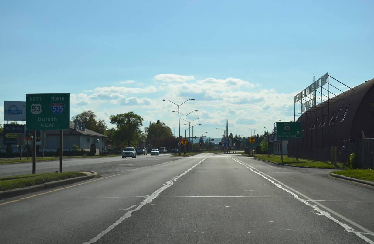
Wis 35 ends as U.S. 53 north joins I-535 from E 2nd Street to Duluth, Minnesota. Wis 35 is the longest trunk highway in the state. 06/14/15
I-535/U.S. 53 run north to Rice’s Point and Lincoln Park in Duluth, where they meet Interstate 35. U.S. 53 south combines with U.S. 2 on their southeast overlap to Amnicon Falls. 06/14/15
![]()
![]() North
North
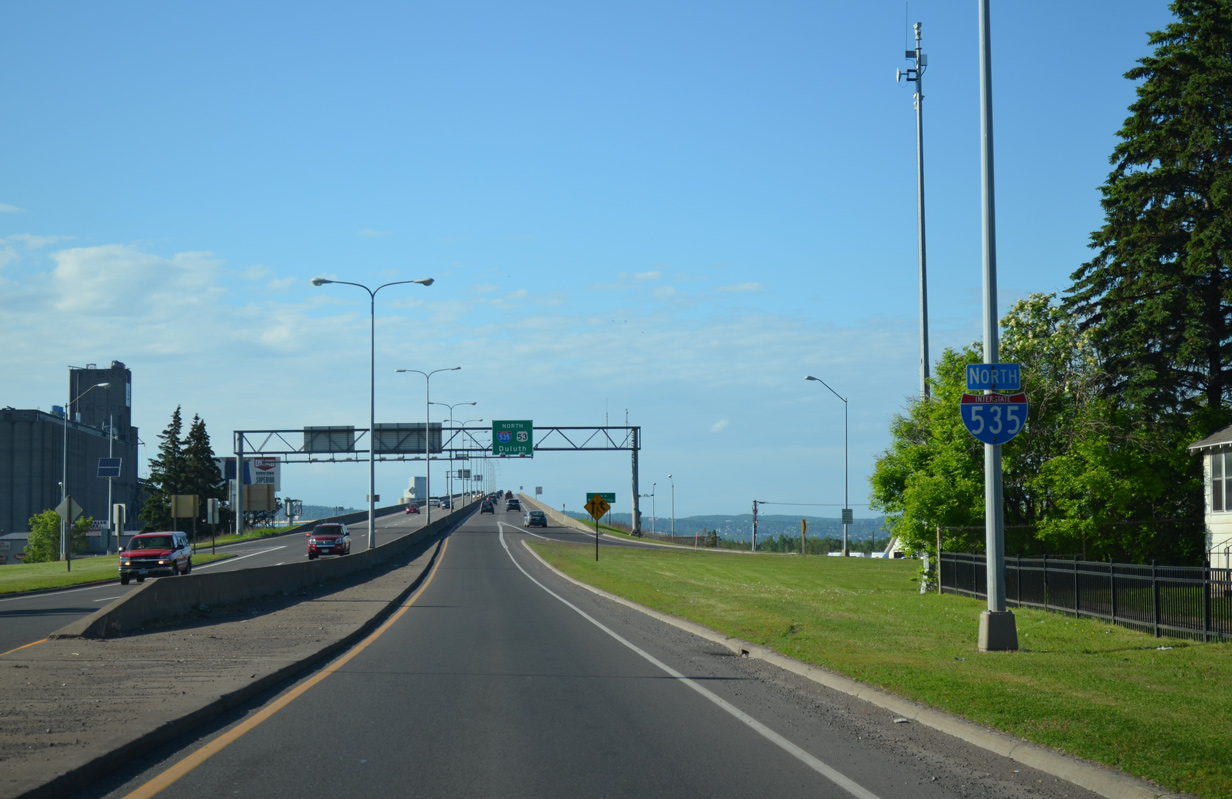
Hammond Avenue extends north with one lane onto the beginning of Interstate 535 from N Fifth Street. A reassurance marker stands along the transition to the Blatnik Bridge. 06/14/15
Sources:
- Blatnik Bridge – MnDOT Project web site.
http://www.dot.state.mn.us/d1/projects/blatnikbridge/ - “Interstate Openings.” Minnesota Highways, January 1972: 8. Print.
- “Load limit signs posted on Blatnik Bridge.” Superior Telegram, November 21, 2011.
- Interstate 535 John A. Blatnik Bridge, Fact Sheet. Minnesota Department of Transportation – District 1 – Duluth, March 2012.
- “Bong Bridge reopens with lane restrictions in time for Blatnik inspections.” Superior Telegram, October 30, 2015.
- Twin Ports Interchange 2020 – FASTLANE Grant Application – Minnesota Department of Transportation.
http://www.dot.state.mn.us/d1/ projects/twin-ports-interchange/images/TP-FASTLANE-Grant.pdfApril 14, 2016. - “MnDOT to defer portions of Twin Ports Interchange project.” Minnesota Department of Transportation (MnDOT), news release. November 25, 2019.
Page updated May 16, 2020.