Interstate 510 Louisiana
Overview

Interstate 510 provides a high speed route to St. Bernard Parish from I-10 in conjunction with Louisiana Highway 47 (Paris Road).
Cosigned with LA 47, Interstate 510 constitutes a freeway spur linking I-10 with Chalmette and St. Bernard Parish. The nearly three mile long route serves areas of New Orleans East, the Almonaster-Michoud Industrial District and NASA’s Michoud Assembly Facility.
LA 47 extends south from I-510 at Almonaster Avenue across the Chalmette Bridge spanning the Intracoastal Waterway. This bridge is below Interstate standards, but was previously included in the 2003 Louisiana Statewide Transportation Plan Update under Item LSTP-029. The megaproject outlined expansion of the bridge due to traffic demand.1
Route Information
North End – New Orleans, LA
South End – New Orleans, LA
Mileage – 3.04
Cities – New Orleans
- Junctions –

Source: December 31, 2021 Interstate Route Log and Finders List
I-510 Annual Average Daily Traffic (AADT)
| Location | Vehicles per day |
|---|---|
| Exits 1 to 2A | 31,542 |
| Exits 2B to 2C | 30,148 |
Source: 2016 AADT – Louisiana DOTD Traffic Monitoring
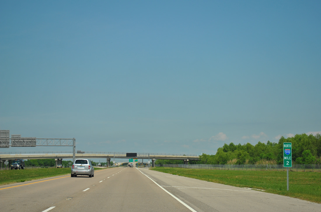
Milemarkers with the route shield were installed in Louisiana starting in 2011. 04/20/12
 History
Work to upgrade Paris Road (LA 47) to Interstate 510 commenced in 1985. The 2.7 mile long project cost $82 million and was constructed in several phases. The northbound lanes of the freeway were completed in October 1992. A ribbon cutting ceremony took place ahead of the southbound lane opening on November 13, 1992.2
Planning for Interstate 510 began in 1970 as a replacement for the congested, two lane Paris Road. The American Association of State Highway and Transportation Officials (AASHTO) approved the future Interstate on July 6, 1977. Environmentalist protests however delayed work, with the Environmental Impact Statement (EIS) not completed until 1981. Initial work focused on widening of the northern approach of the Paris Road bridge. Next a four lane at-grade road between the bridge and I-10 was built so that crews could dismantle existing Paris Road and commence construction on the new freeway. Work also focused on building a four lane frontage road and new roadway linking I-510 with Almonaster Road.3
Extensions of Dwyer Road and Lake Forest Boulevard coincided with construction of the freeway mainline during the penultimate phase of road work. This resulted in the completion of Interstate 510 between Dwyer and Almonaster Roads and the construction of the U.S. 90 (Chef Menteur Highway) interchange. It was hoped that I-510 would work in tandem with the Florida Avenue freeway project to better join St. Bernard Parish with New Orleans.3
Cancelled Interstate 410
I-510 and I-310 in St. Charles Parish were previously incorporated into the proposed Interstate 410 outer belt for the New Orleans metropolitan area. This alignment appeared on official Louisiana state maps in the mid 1960s. The plan for I-410 was deferred and eventually reemerged as a megaproject included in the Louisiana Statewide Transportation Plan Update under the same project that would expand the Chalmette Bridge (LSTP-029).1
The outer belt connection was envisioned along with proposed freeways along Florida Avenue northeast of Downtown New Orleans and the LA 3139 / Earhart Expressway Extension west to the New Orleans International Airport (MSY). The Florida Avenue freeway would have connected to I-10 and I-610 where they converge to the east and continue to Interstate 510. Providing a third freeway connection to the west in New Orleans, the extension of I-510 followed a portion of the previous I-410 proposal. Despite the inclusion in the Statewide Transportation Plan Update,1 plans for this freeway did not advance.
 Photo Guides
North End 
 – Little Woods, New Orleans, Louisiana
![]()
![]() North at
North at ![]()
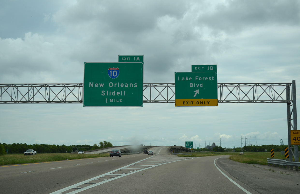
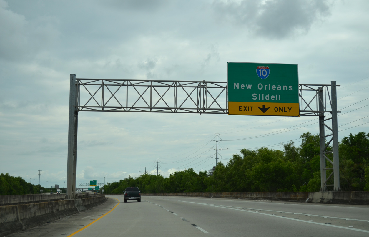
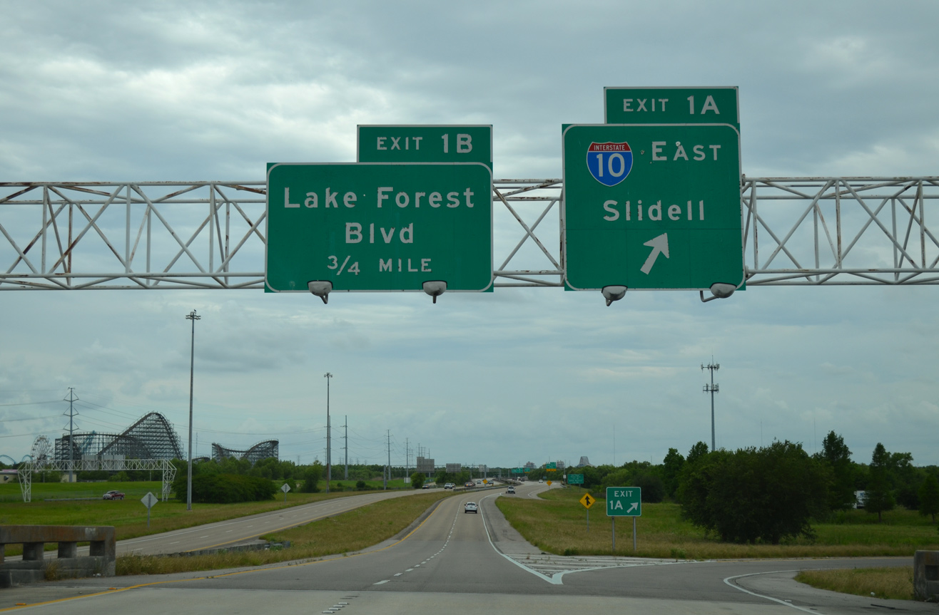
I-10/LA 47 continue one mile north from the diamond interchange (Exit 1B) with Lake Forest Boulevard to meet Interstate 10 at Exit 1A. 05/09/15
A viaduct carries I-510/LA 47 between Lake Forest Boulevard and Interstate 10. An auxiliary lane accompanies the northbound roadway between Exits 1B and 1A. 05/09/15
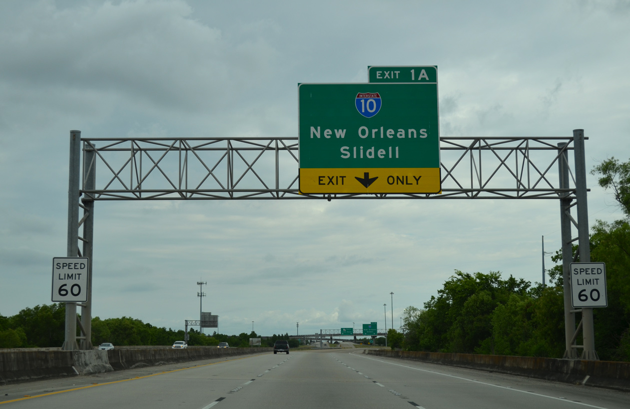
Interstate 10 travels 18 miles northeast from I-510 to Slidell and 15 miles and 12 miles southwest to Downtown New Orleans. 05/09/15
Exit 1A partitions from I-510 for both ramps to Interstate 10. LA 47 continues northward along Paris Road to Hayne Boulevard west at the Little Woods neighborhood. 05/09/15
A multi level systems interchange joins I-10 and I-510 to the west of Michoud Boulevard and Bayou Sauvage National Wildlife Refuge. Photo by Jeff Royston (05/27/00).
![]() South at
South at ![]()
![]()
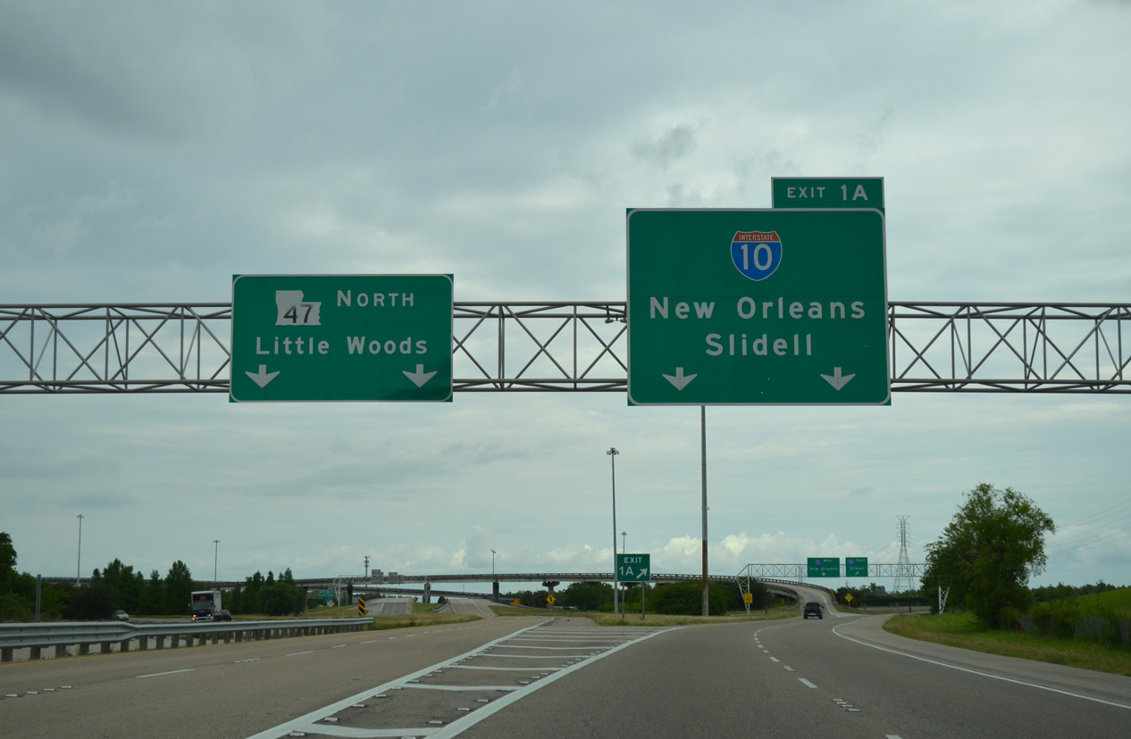
LA 47 (Paris Road) leads south from Hayne Boulevard at Little Woods and transitions into Interstate 510 south at the unnumbered off-ramp to I-10 west. 05/09/15
Exit 1A loops onto Interstate 10 east to Slidell and the Mississippi Gulf Coast. I-510/LA 47 pass by the former Six Flags New Orleans theme park ahead of Lake Forest Boulevard. 05/09/15
![]() West at
West at ![]()
![]()
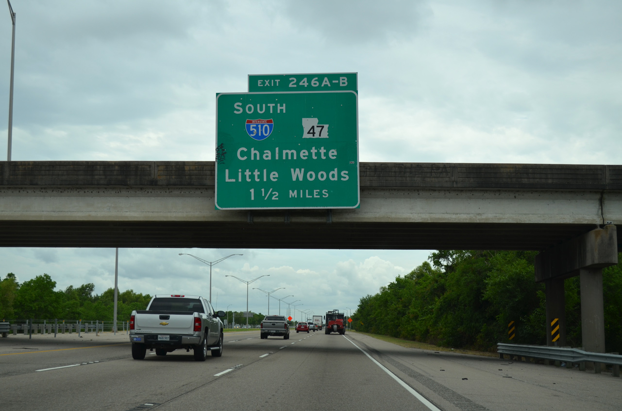
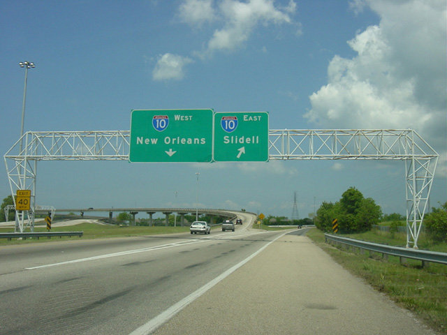
Interstate 10 west passes under Michoud Boulevard 1.50 miles ahead of I-510 south / LA 47 (Exits 246A/B). 05/09/15
Traffic from Michoud Boulevard merges onto I-10 west, 0.75 miles out from the cloverstack interchange with I-510 south / LA 47. 05/09/15
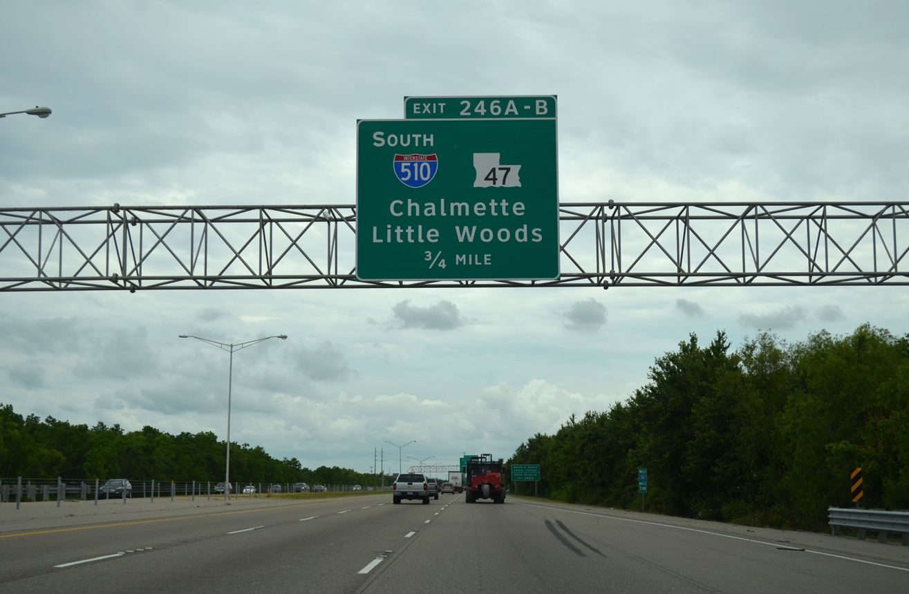
LADOTD recorded 70,738 vehicles per day (vpd) along I-10 leading west to Interstate 510 and LA 47 in 2016. 05/09/15
A single lane off-ramp carries all traffic to Interstate 510 south and LA 47 at Exit 246. Original construction of I-510 replaced the diamond interchange here with Paris Road. 05/09/15
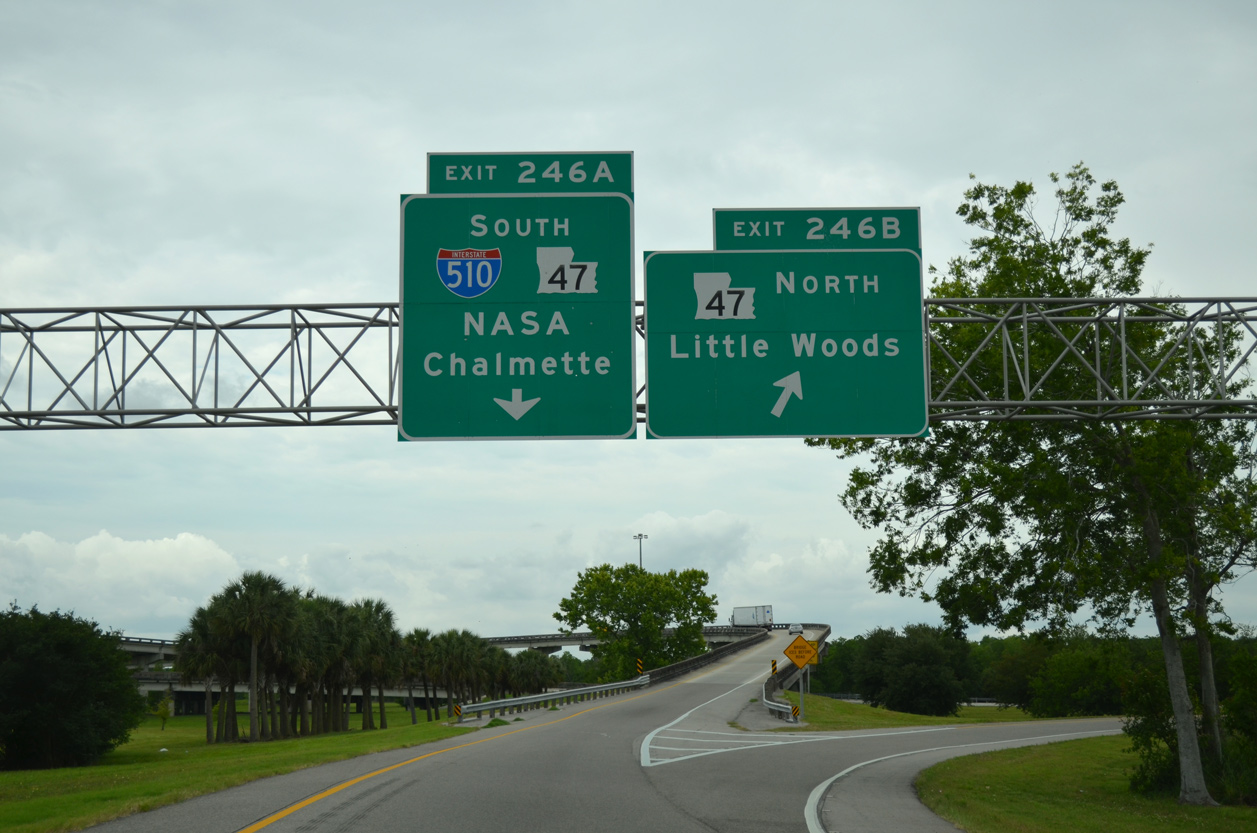
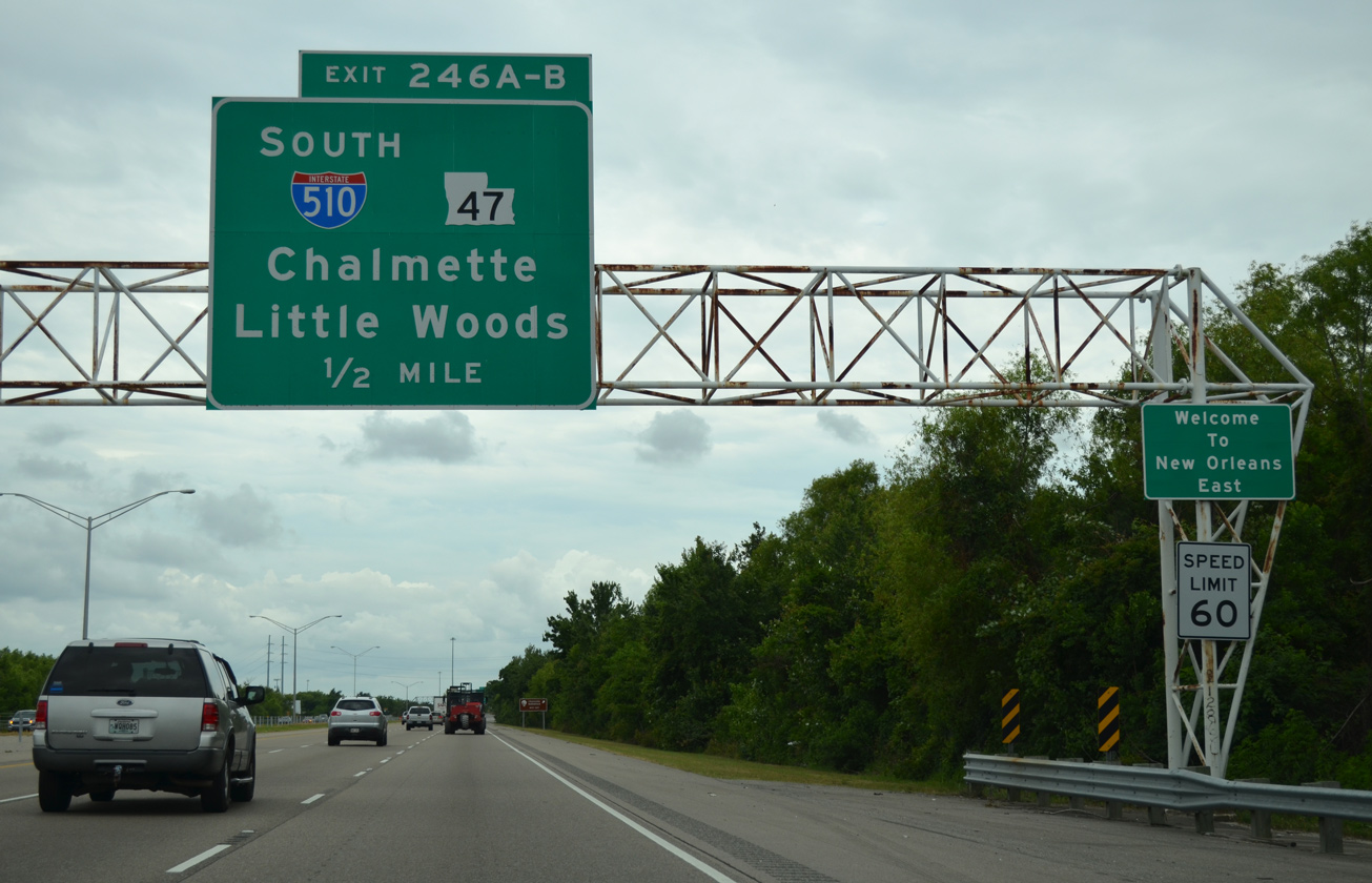
Exit 246 separates for LA 47 (Paris Road) north to Little Woods and I-510/LA 47 south to the NASA Michoud Assembly Facility and Chalmette. 05/09/15
![]() East at
East at ![]()
![]()
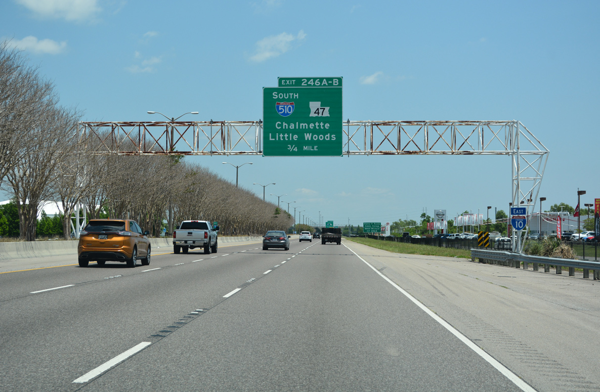
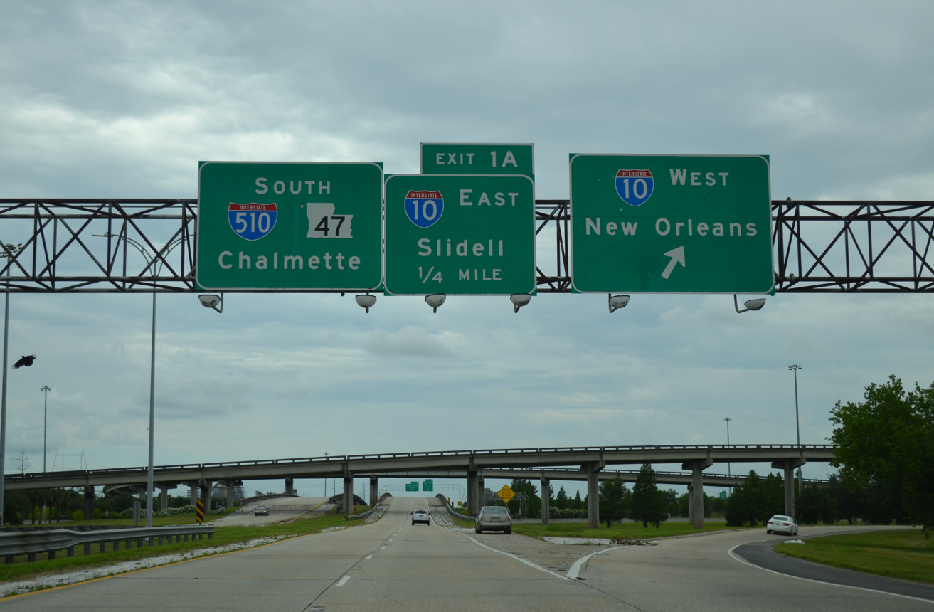
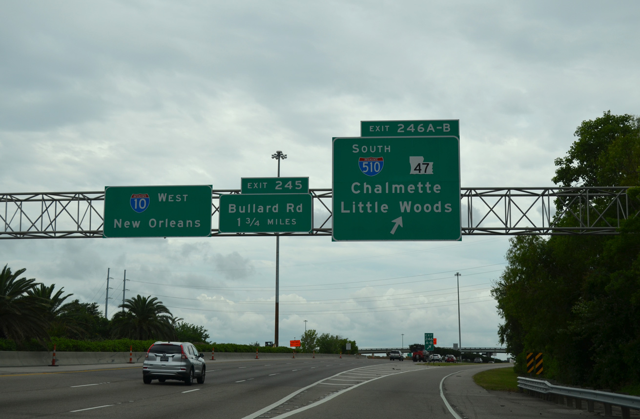
I-510 south / LA 47 join Interstate 10 east with Little Woods in New Orleans and the St. Bernard Parish seat of Chalmette from Exit 246 A in three quarters of a mile. 05/11/22
Advancing toward I-510 south and LA 47 on I-10 through New Orleans East. Interstate 10 maintains at least six lanes throughout New Orleans and northeast to I-12 and I-59 at Slidell. 05/11/22
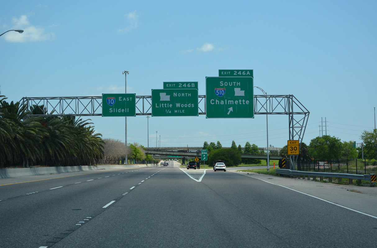
Separate ramps link I-10 east with I-510/LA 47 south to Chalmette and the Intracoastal Waterway bridge into St. Bernard Parish and LA 47 north along Paris Road. 05/11/22
South End / Almonaster Boulevard – New Orleans East, Louisiana
![]()
![]() South at Almonaster Boulevard
South at Almonaster Boulevard
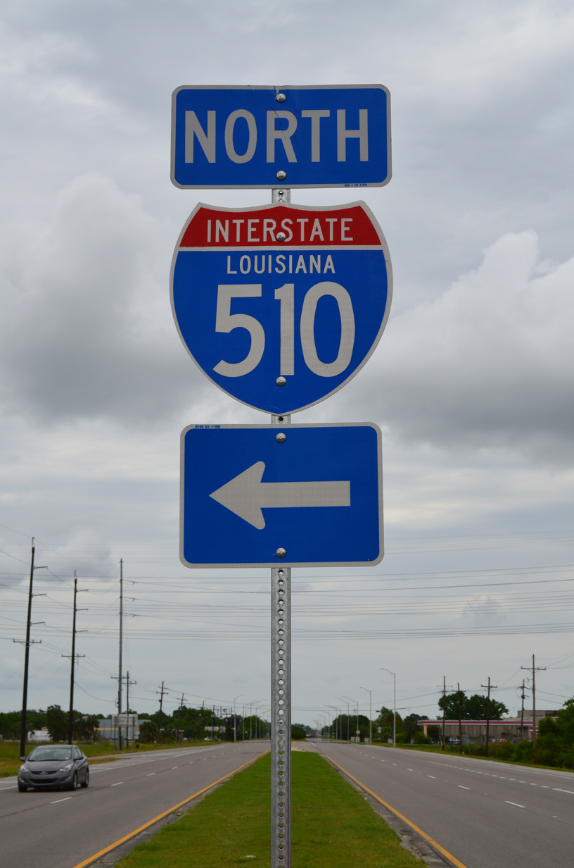
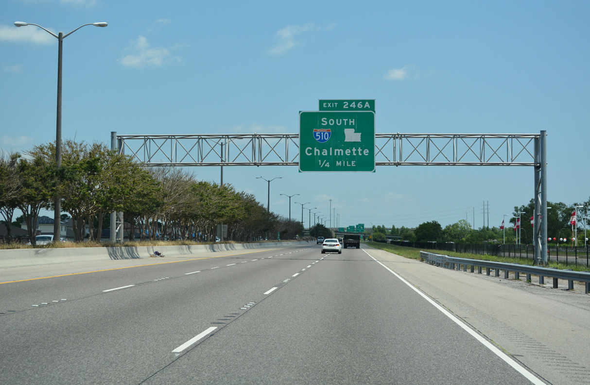
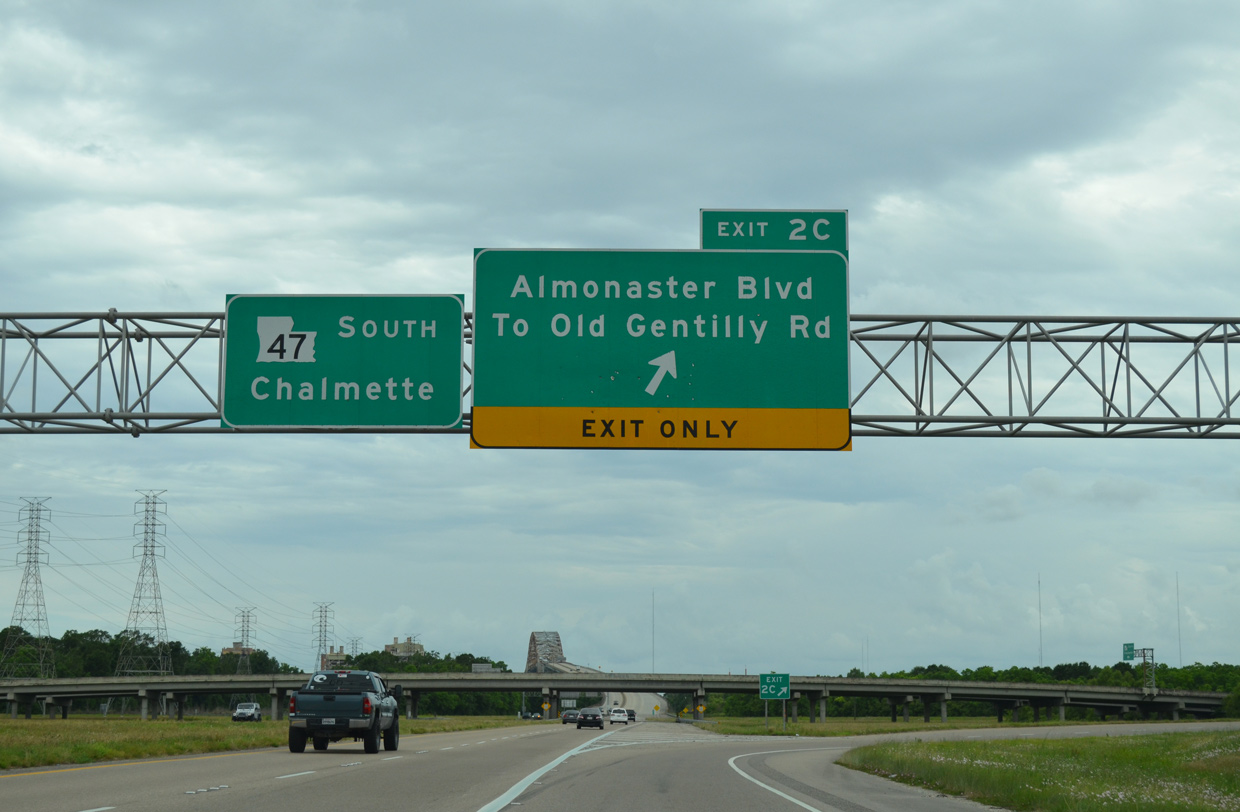
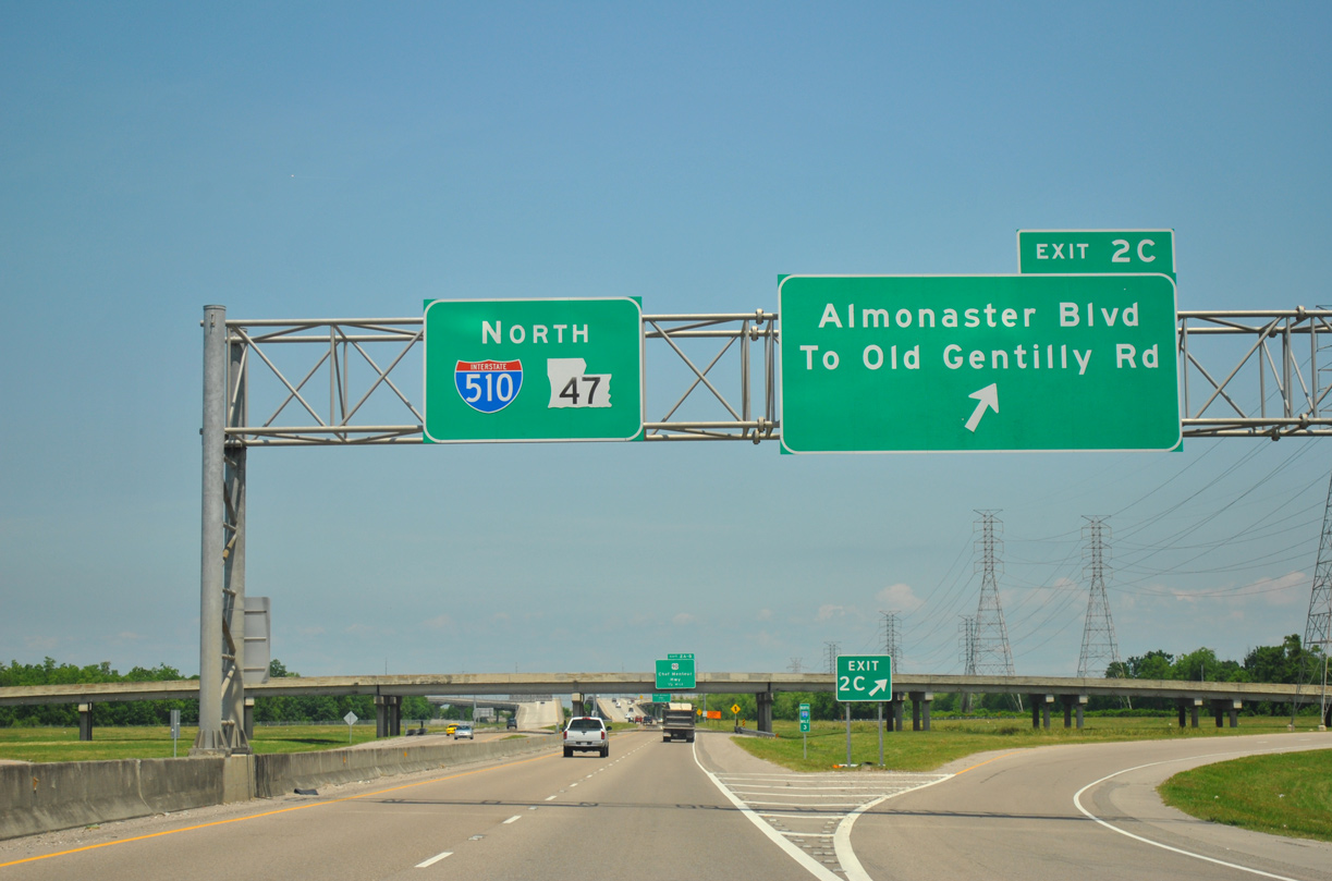
Interstate 510 concludes at a diamond interchange (Exit 2C) with Almonaster Boulevard. LA 47 (Paris Road) extends another six miles south across the Intracoastal Waterway to Chalmette in Saint Bernard Parish. 04/20/12
The Intracoastal Waterway bridge along LA 47 (Paris Road) south of I-510 opened in 1967. 05/09/15
![]() North at
North at ![]() Almonaster Boulevard
Almonaster Boulevard
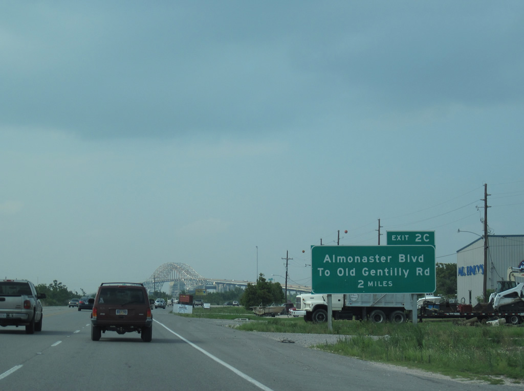
The initial guide sign for Exit 2C on I-510 north precedes the Intracoastal Waterway bridge along LA 47 (Paris Road) northbound. 06/09/10
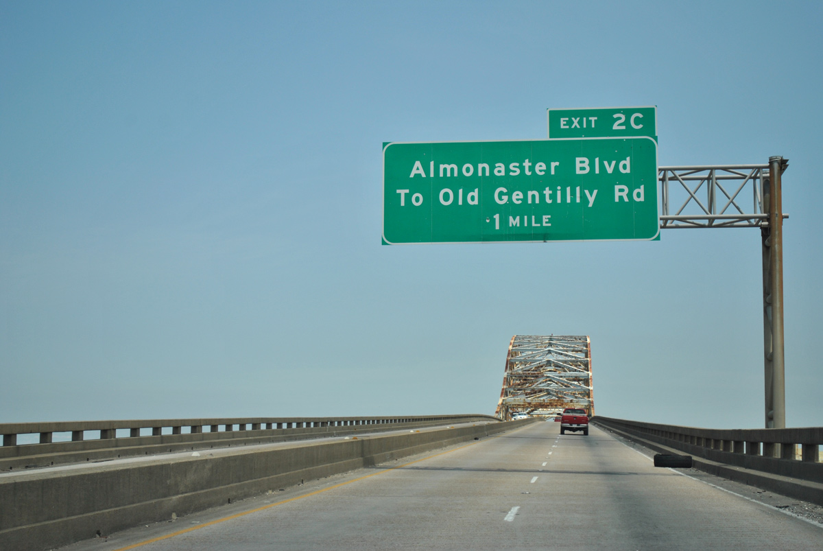
LA 47 north crosses a 135 foot high steel arch bridge over the Intracoastal Waterway leading to the exchange (Exit 2C) with Almonaster Boulevard at Interstate 510. 04/20/12
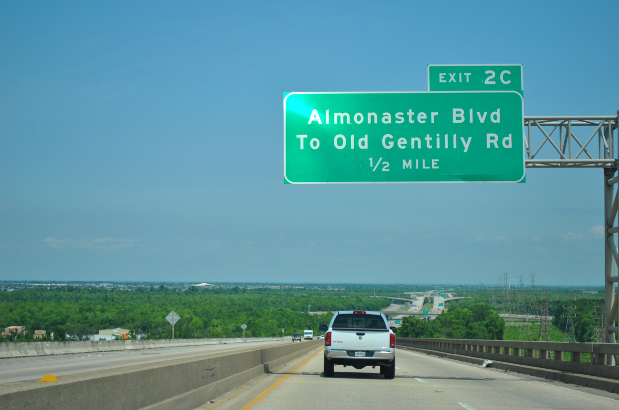
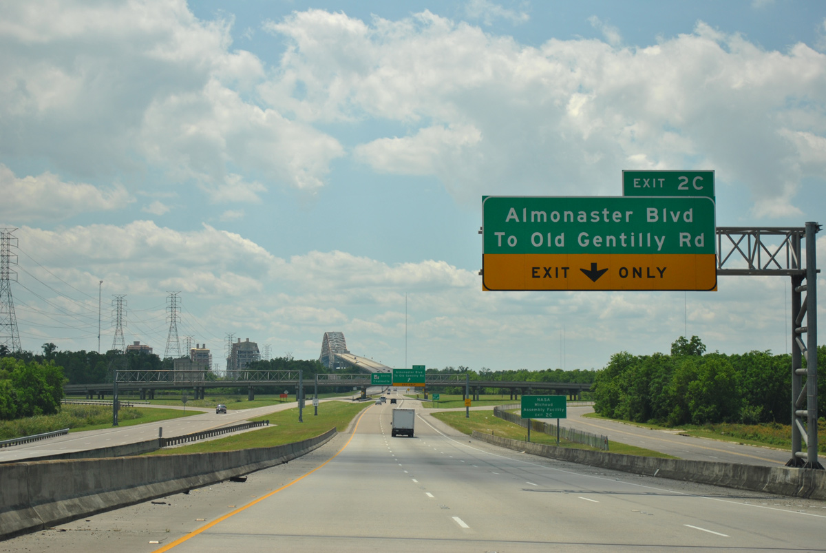
Forthcoming Almonaster Boulevard connects I-510/LA 47 with Old Gentilly Road east to the NASA Michoud Assembly Facility and west to the New Orleans Business and Industrial District. 04/20/12
Interstate 510 commences at the base of the Intracoastal Waterway bridge as Exit 2C departs from LA 47 north. 04/20/12
Sources:
http://www2.dotd.louisiana.gov/study/- “Edwards to Open I-510 Link.” The Times-Picayune (New Orleans, LA), November 14, 1992.
- “I-510 Link is Nearly Complete After 7 Years of Construction.” The Times-Picayune (New Orleans, LA), October 13, 1992.
Page updated July 2, 2022.