Interstate 495 Massachusetts
Overview
Interstate 495 is the outer beltway serving Boston metropolitan area commuters. Cities directly served by I-495 include Lowell, Lawrence and Haverhill. The highway also provides part of a bypass route from the Mass Pike south to Cape Cod and north to the New Hampshire Seacoast.
I-495 was the longest three-digit Interstate highway until 1996, when I-476 in Pennsylvania was extended north from Plymouth Meeting to Clarks Summit.
Interstate 495 north at the trumpet interchange and access road to the Mass Pike at Westborough. 10/06/14
I-495/I-90 Interchange Improvements
A five year project upgrades the interchange joining I-90/495 at the towns of Hopkinton and Westborough. With the Mass Pike switch to all electronic tolling (AET) on October 28, 2016, the toll plaza between the two trumpet interchanges linking the beltway and toll road was no longer needed. The removal of the toll barrier allows for the addition of flyovers and other high speed ramps to eliminate some of the weaving traffic patterns currently in place. Previously though to begin as early as 2021, the Massachusetts Department of Transportation (massDOT) provided an update on the design-build project on November 3, 2022.2
Commencing in May 2022, design work for the new exchnage runs through December 2024. Preliminary work got underway in October 2022. Work also expands I-495 northbound by a fourth lane between the Mass Pike and Route 9,2 and replaces the Fruit Street bridge over the beltway.
 History
Referred by the Massachusetts Department of Public Works as the outer circumferential highway in a letter sent to the American Association of State Highway Officials (AASHO) on April 10, 1958, the number selected for the beltway around Boston was Route 95W. The letter W was selected to indicate that the route lies west of Interstate 95. This eventually changed to Route 495, and on November 13, 1958, AASHO approved it as part of the Interstate Urban Numerology for Massachusetts. I-495 was outlined along a route north from I-95 along the Mansfield/Foxboro town line to I-95 at Salisbury.
Route Information
North End – Salisbury, MA
South End – Wareham, MA
Mileage – 121.56
Cities – Marlborough, Lowell, Lawrence, Haverhill, Amesbury
- Junctions –


Source: December 31, 2021 Interstate Route Log and Finders List
I-495 Annual Average Daily Traffic (AADT)
Source: 2016/17 MassDOT Transportation Data Management System
Interstate 495 was built in segments between 1958 and 1982.1 The route ended at Interstate 95 in Foxborough from the north until June 17, 1975, when the American Association of State Highway and Transportation Officials (AASHTO) approved the southeasterly extension to Interstate 195 at Wareham. This extension was previously approved by the Federal Highway Administration (FHWA) on May 23, 1974.
With mileage gained from the cancellations of both I-95 along the Southwest and Northeast Expressways through Boston, and the Inner Belt Expressway for I-695, the I-495 extension was added to the Interstate Highway System under the provisions of 23 U.S.C. 139(a) and 23 U.S.C. 139(e)(2). 14.2 miles of new construction lengthened I-495 southeast from Foxborough to the junction of Route 24/25 at Raynham. I-495 superseded an 18.5 mile long section of Route 25 from Raynham southeast to Middleborough and I-195 in Wareham. Interchanges were renumbered to start at Wareham instead of Foxborough.1
 Photo Guides
North End  – Salisbury, Massachusetts
![]() North at
North at ![]()
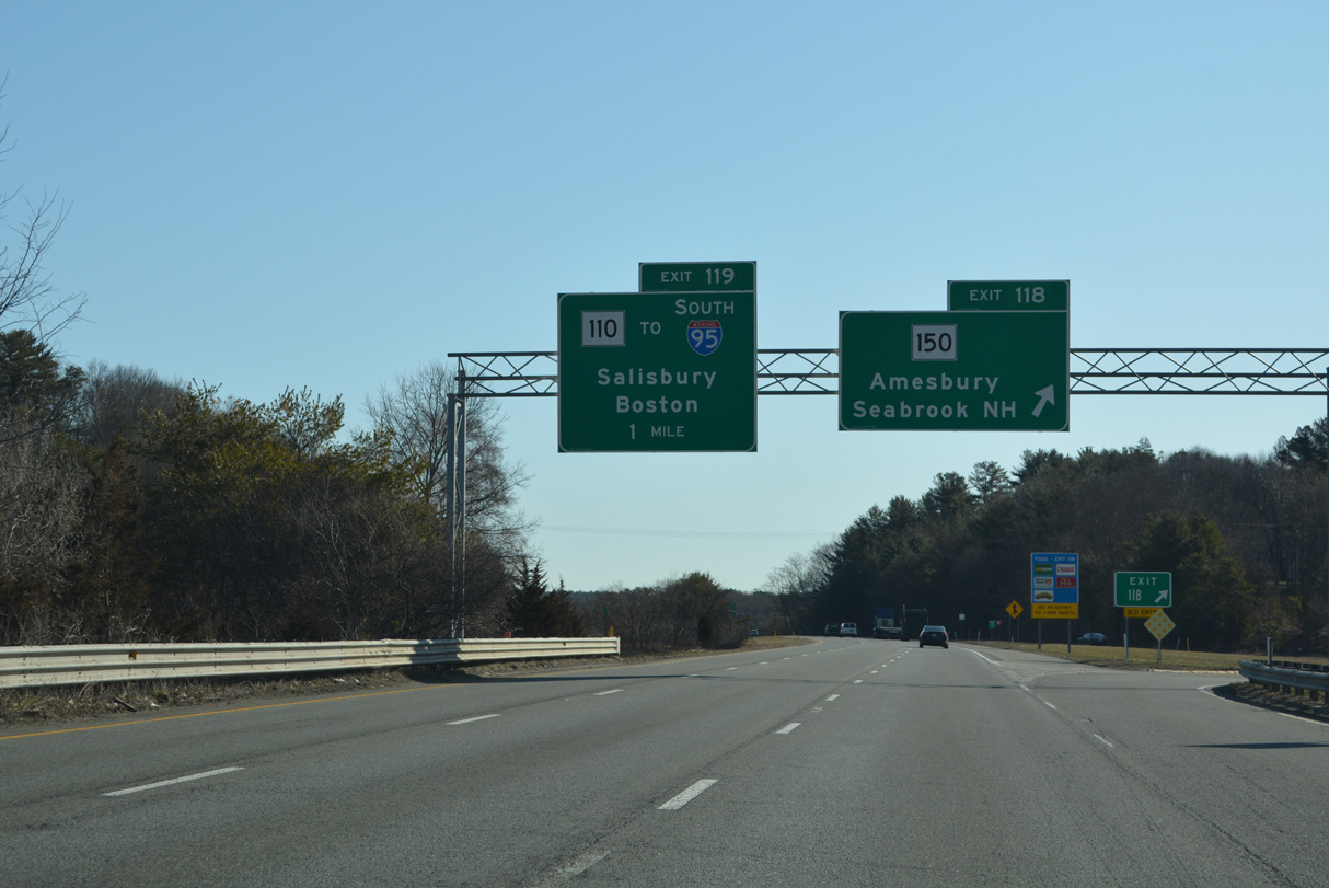
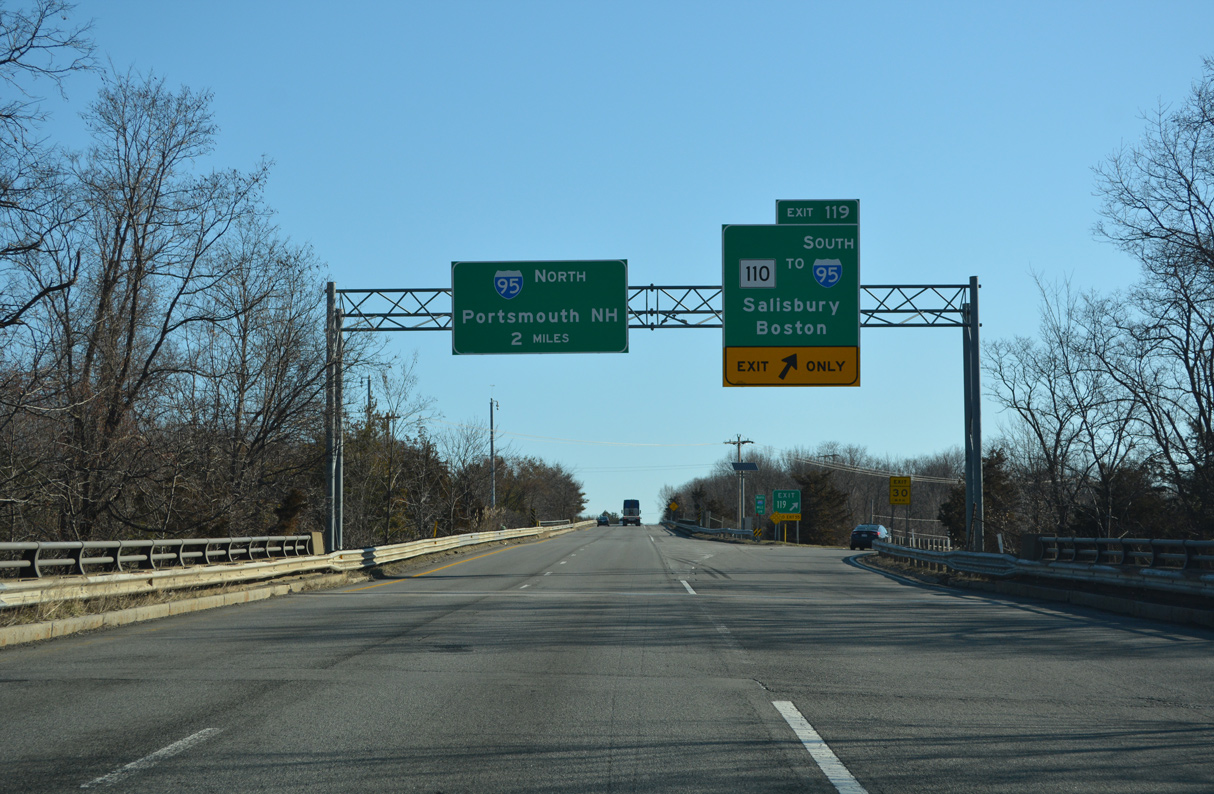
Forthcoming Route 110 (Macy Street) provides a Breezewood style connection to Interstate 95 south from I-495 north. 03/27/23
Route 110 leads east along a four lane arterial from Exit 119, three quarters of a mile to a parclo interchange with I-95 in the town of Saulsbury. 03/27/23
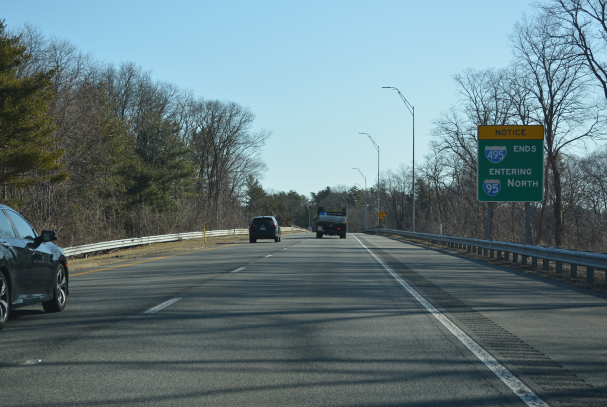
The remainder of Interstate 495 north beyond Exit 119 defaults onto I-95 north into Seabrook, New Hampshire. 03/27/23
I-95 transitions to the tolled Blue Star Turnpike in three miles. Portsmouth lies 16 miles to the northeast. 03/27/23
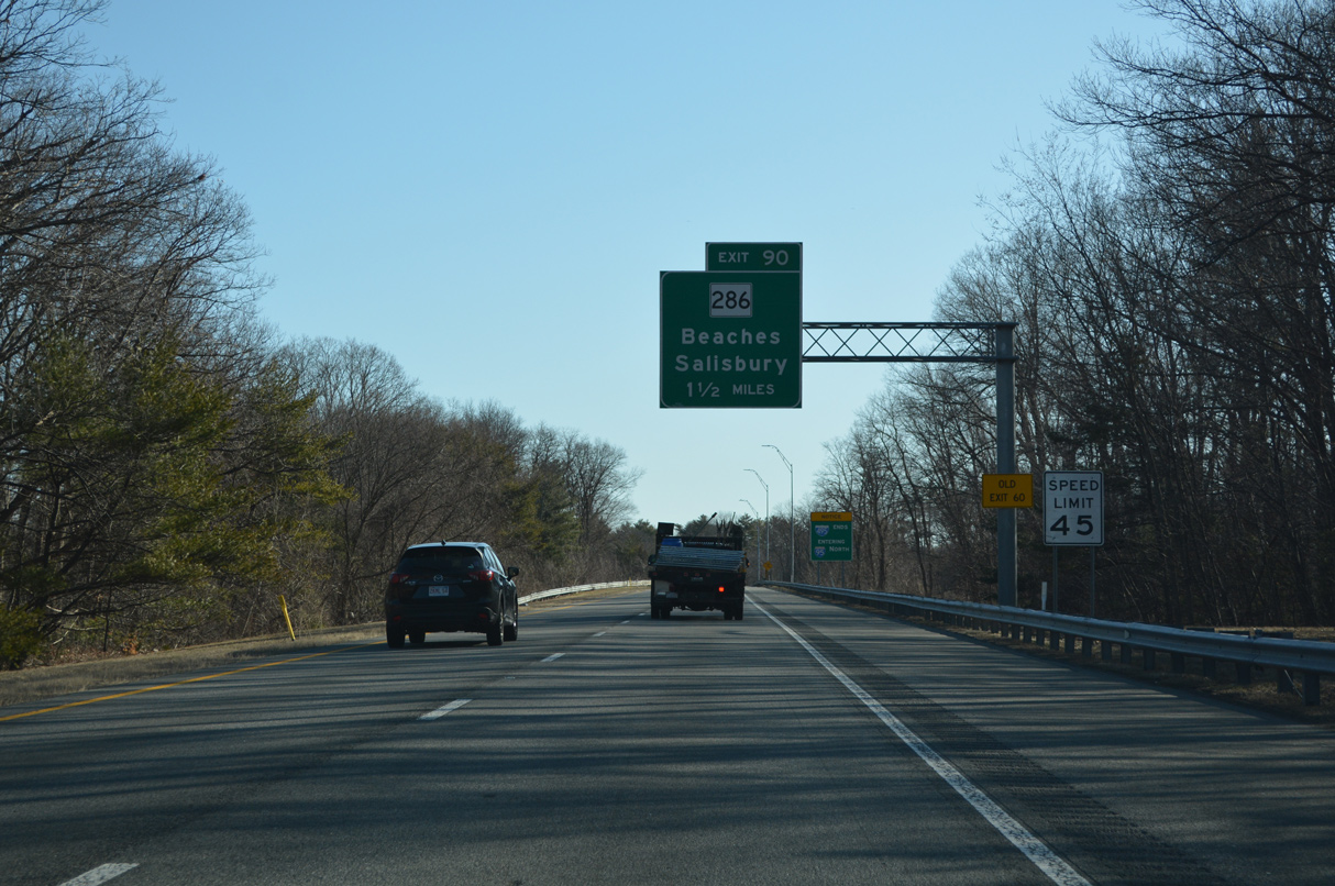
The ensuing exit beyond the north end of I-495 is for Multi State Route 286 (Main Street) west to Amesbury center and east to Seabrook, New Hampshire. 03/27/23
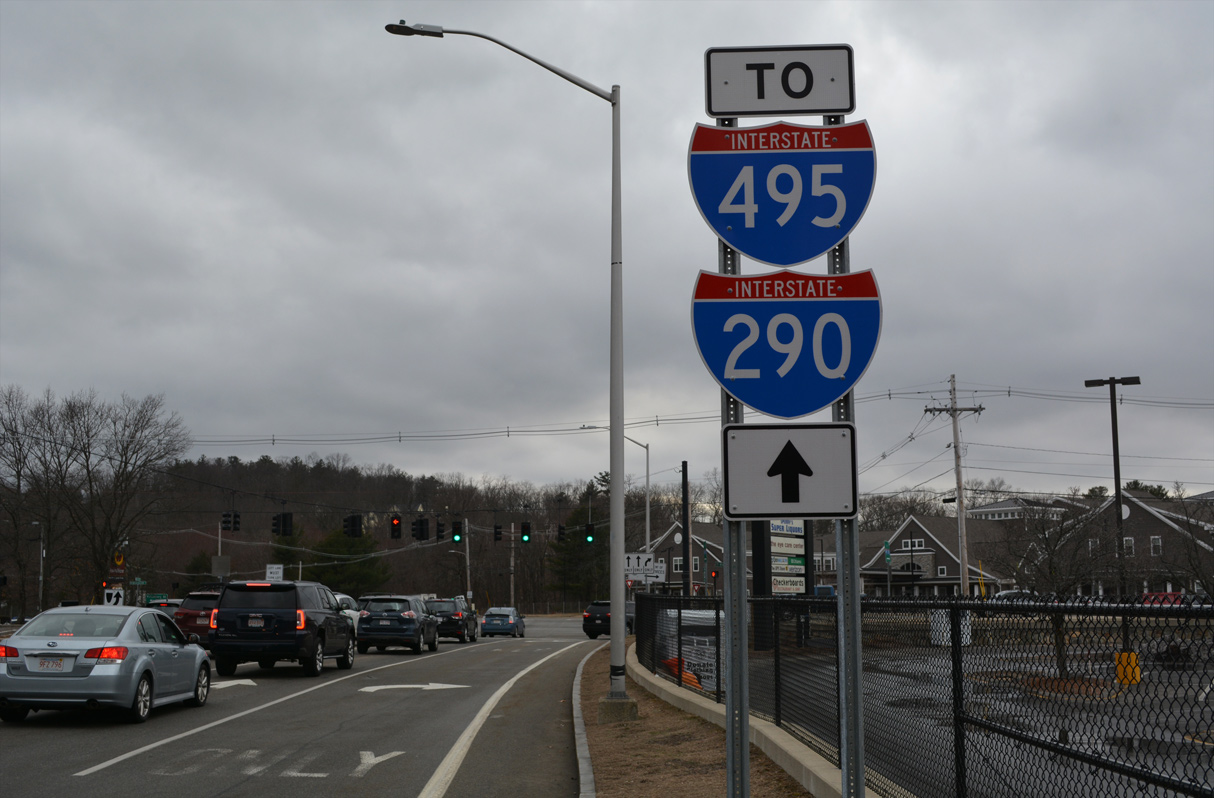
I-495 enters the town of Salisbury just ahead of Interstate 95. 03/27/23
![]() South at
South at ![]()
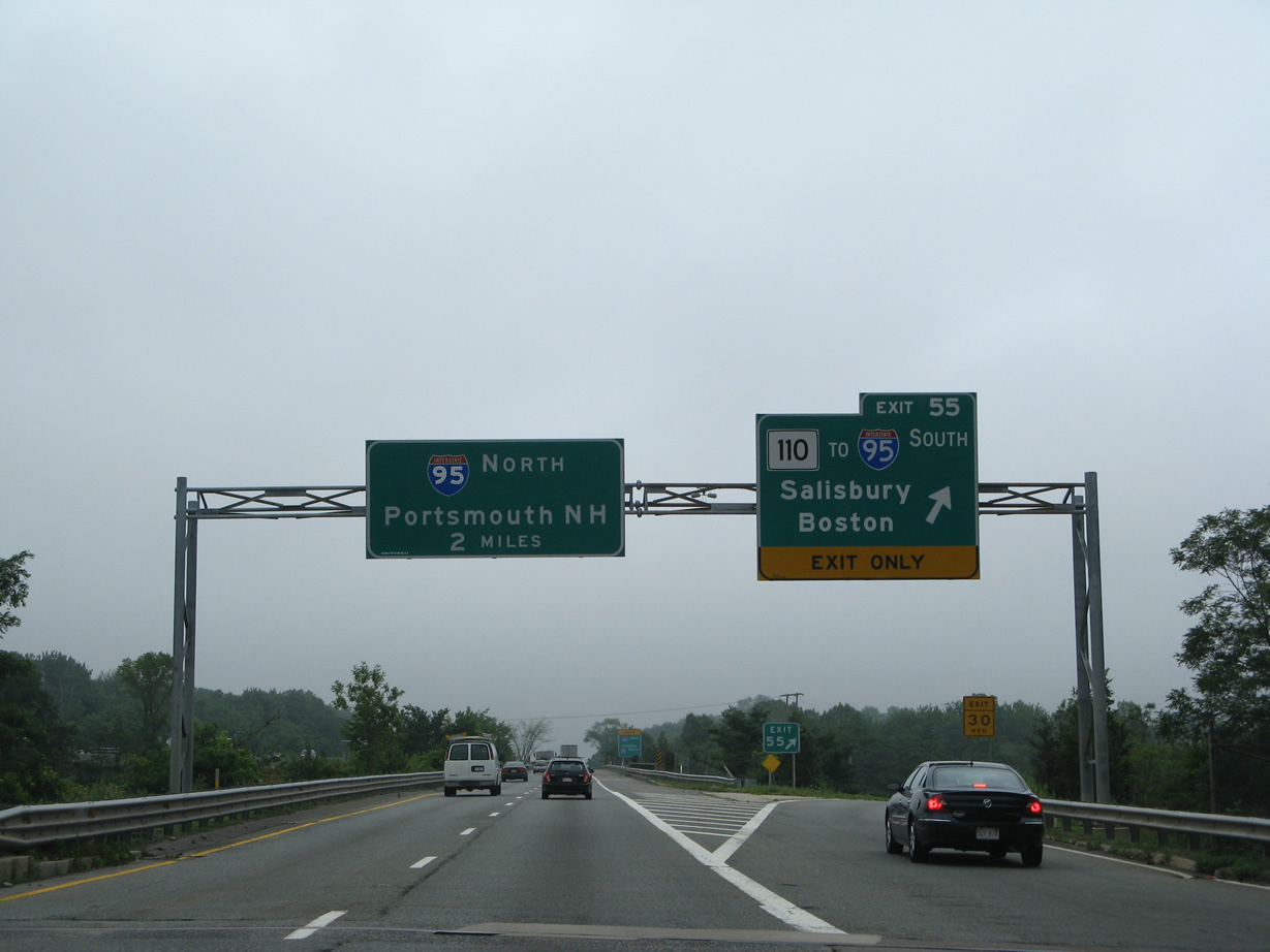
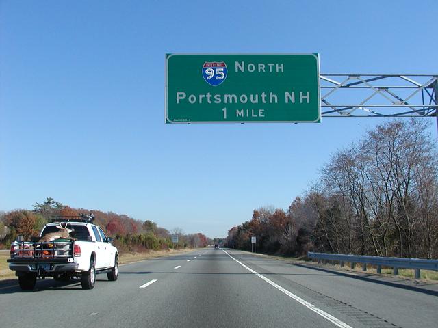
The first sign for Interstate 495 south appears in the town of Seabrook, New Hampshire, two miles ahead of the split from I-95 south. 03/27/23
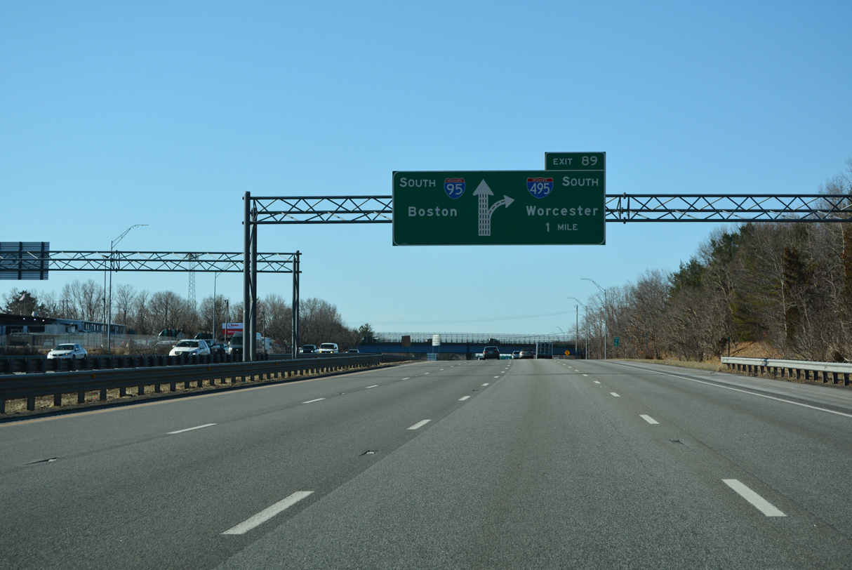
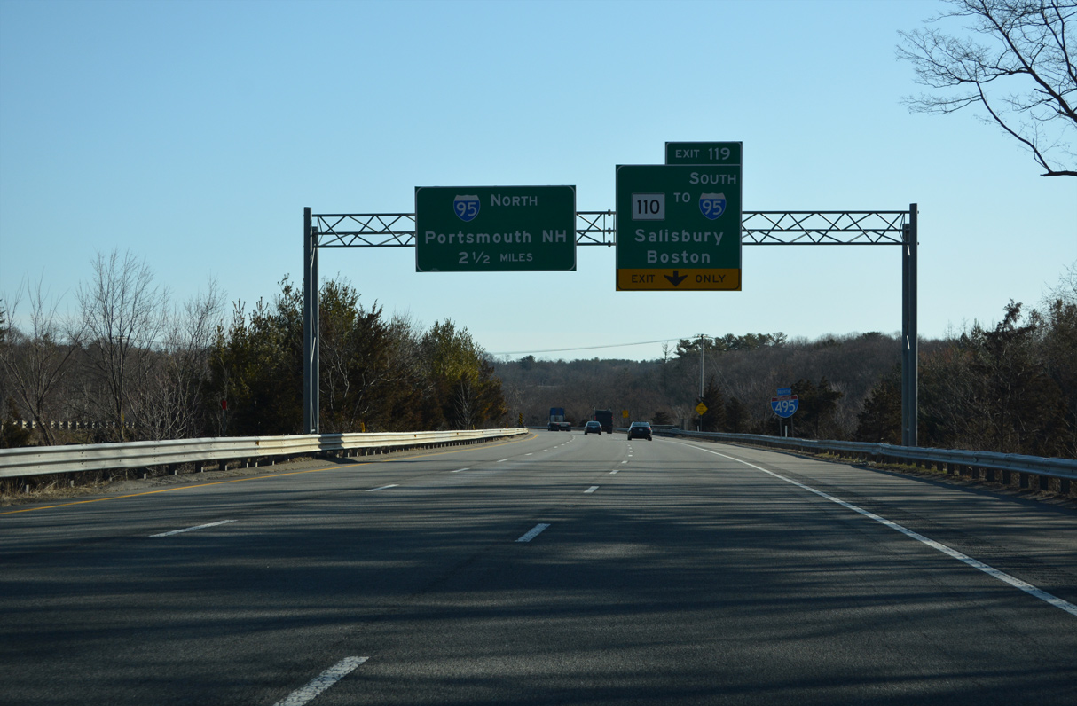
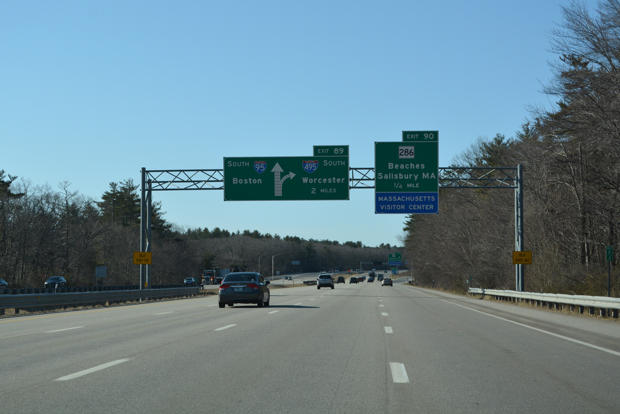
Just across the state line, a second diagrammatic sign outlines the forthcoming wye interchange (Exit 89) with Interstate 495 south. The initial stretch of the 122 mile long beltway parallels the Merrimack River west through the towns of Amesbury and Merrimac. 03/27/23

Continuing south from the wye interchange (Exit 90) with the connector to MSR 286 and U.S. 1 in Salisbury, I-95 proceeds one half mile to Interstate 495. I-495 loops southwest 11 miles to Haverhill while I-95 advances south to the John Greenleaf Whittier Bridge across the Merrimack River. 03/27/23
Interstate 495 travels southwest to Lawrence, Lowell, and Marlborough before returning southeast toward Cape Cod. Connections with Interstate 290 in 60 miles provide a direct route to Worcester. 03/27/23
![]() North at
North at ![]()
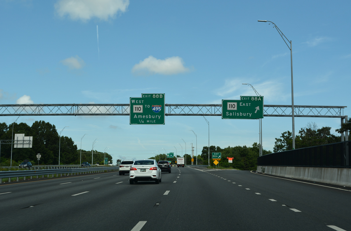
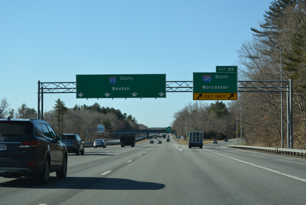
I-95 crosses the Merrimack River north ahead of the cloverleaf interchange (Exit 88) with Route 110. Route 110 west links I-95 north with I-495 south. 08/21/21
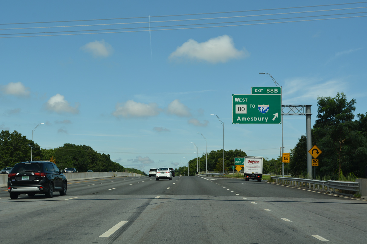
Route 110 leads one mile west from Exit 88 B to a loop ramp onto Interstate 495 south in Amesbury. 08/21/21
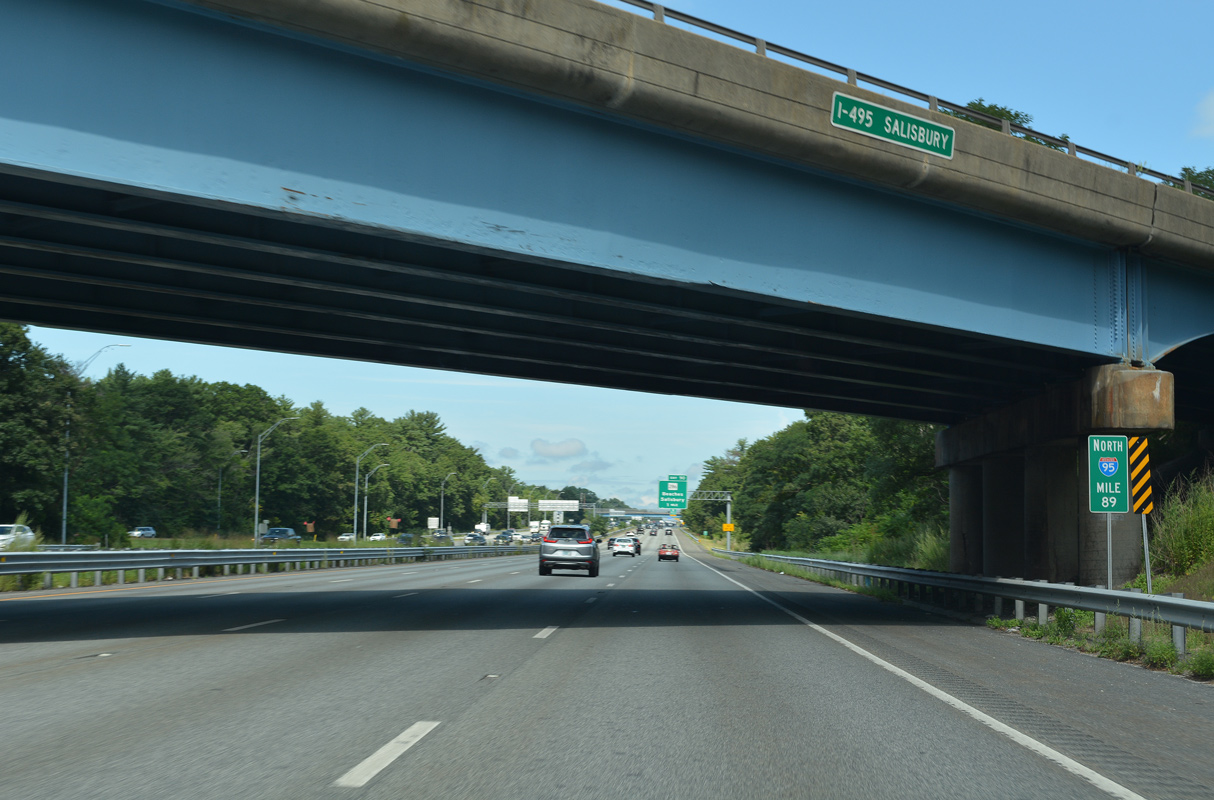
I-95 converges with the north end of I-495 at mile marker 89 just inside the town of Salisbury. 08/21/21
![]() South
South
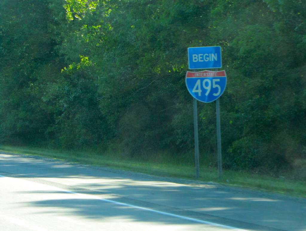
Leading away from Interstate 95, a begin shield stands along I-495 south by the Amesbury town line. Photo by H.B. Elkins (06/01/13).
North End Throwback
Replaced overheads at old Exit 55 for Route 110 (Macy Street) to I-95 south. 07/30/07
A pair of ground level signs replaced this overhead assembly for I-95 on I-495 north of Route 110. Photo by Jim Teresco (11/18/01).

An end shield formerly posted at the wye interchange with Interstate 95 north. Photo by Jim Teresco (11/18/01).
South End  – Wareham, Massachusetts
![]() South at
South at ![]()
![]()
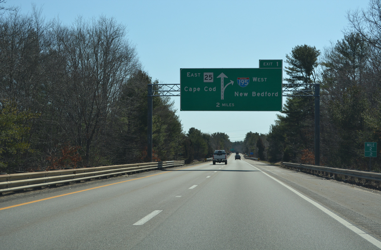
Southeast into the town of Wareham, the final two miles of Interstate 495 traverse an area of wetlands dotted by cranberry bogs. 03/27/23
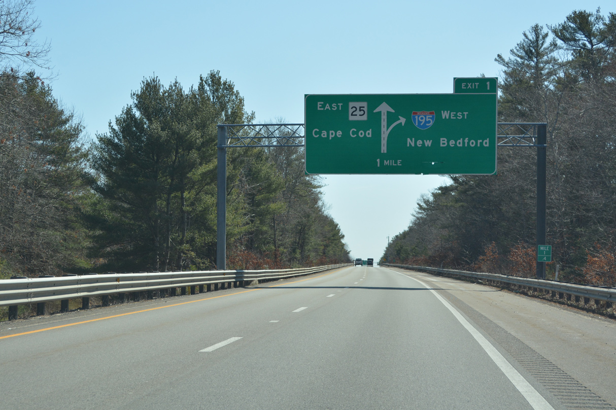
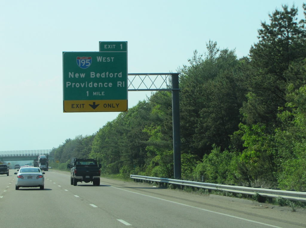
Advancing south of the Weweantic River, a second diagrammatic overhead outlines the forthcoming trumpet interchange (Exit 1) with Interstate 195 west and the freeway continuation onto Route 25 east. 03/27/23
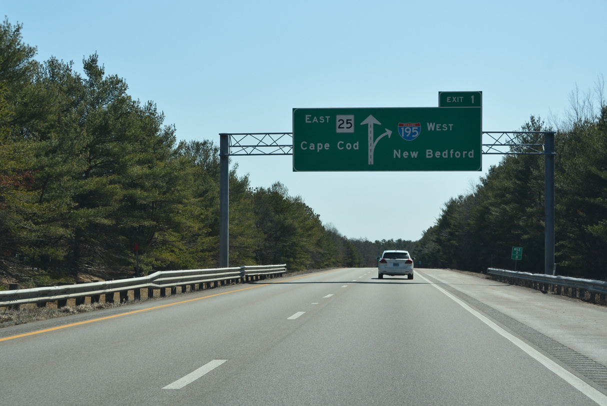
Interstate 195 arcs southwest from I-495 and Route 25 to Mattapoisett and New Bedford. Route 25 continues the freeway 10.04 miles east to U.S. 6 at Buzzards Bay. 03/27/23
Interstate 195 travels 45 miles west from Wareham and I-495 to Fall River and Providence, Rhode Island. 03/27/23
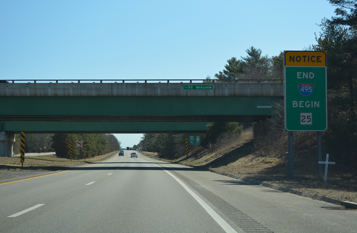
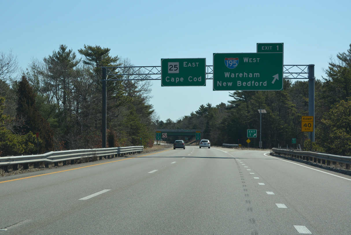
An end sign advises of the southbound transition of I-495 to Route 25 east. Route 25 provides a direct link to the Bourne Bridge across Cape Cod Canal and Route 28 south to Falmouth. 03/27/23
![]() West at
West at ![]()
Route 25 bee lines northwest from East Wareham to the trumpet interchange (Exit 1) joining the east end of I-195 with the south end of I-495. Photo by H.B. Elkins (05/31/13).

Interstate 195 travels 43.6 miles west from I-495/Route 25 in Wareham to I-95/U.S. 6 near Downtown Providence, Rhode Island. 03/27/23
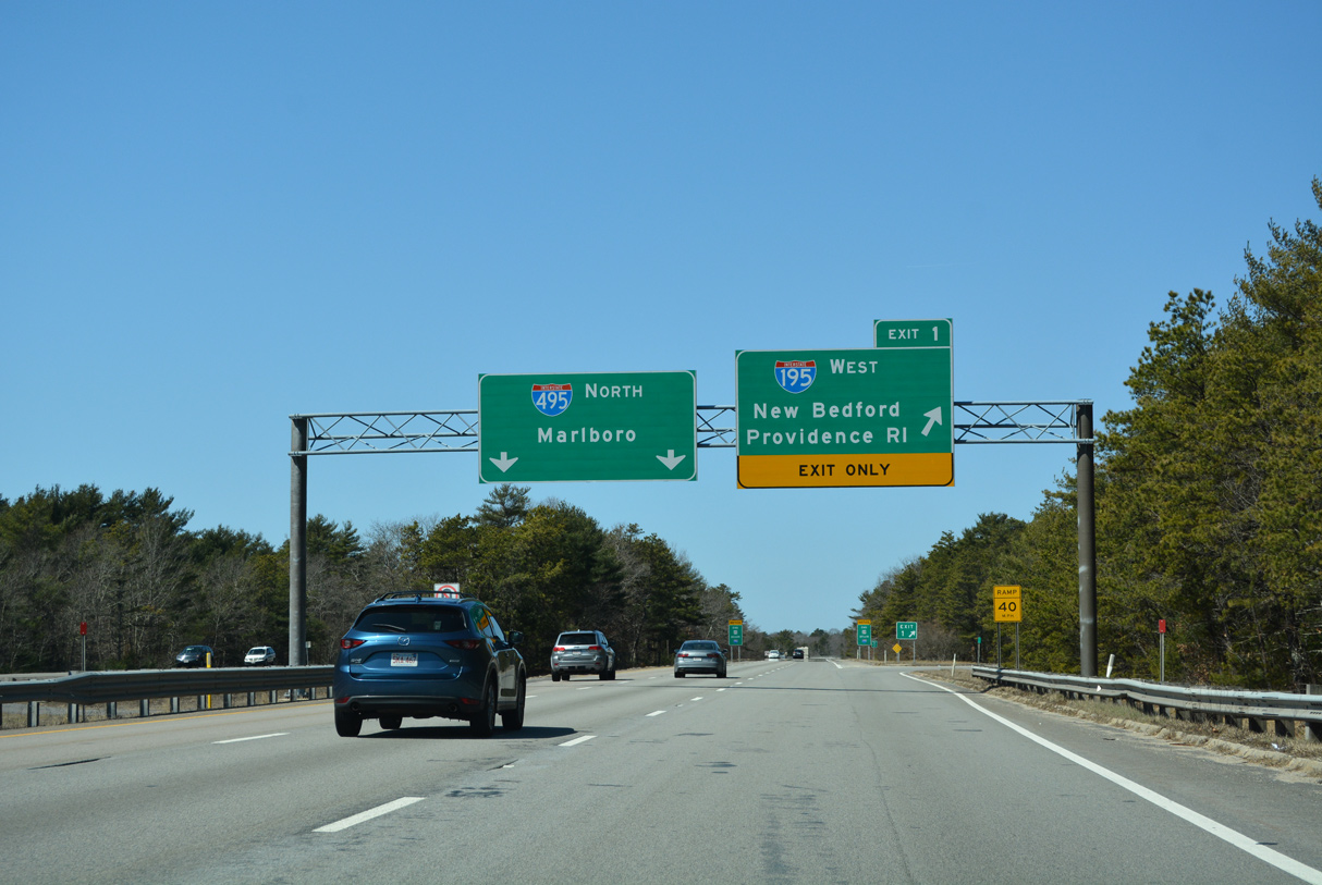
Interstate 495 commences northwest to Middleborough, Taunton and Mansfield from the exchange joining Route 25 with I-195 at West Wareham. 03/27/23
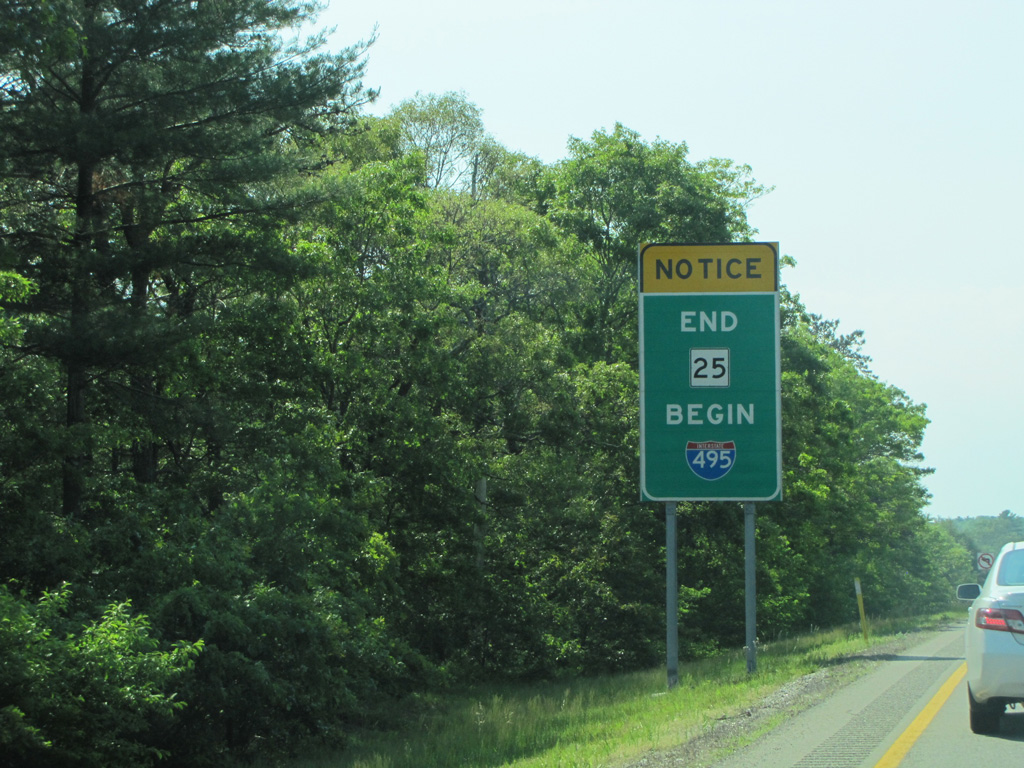
An end sign for Route 25 beyond the gore point for Exit 1 marks the transition onto Interstate 495. Photo by H.B. Elkins (05/31/13).
Sources:
- Outer Circumferential Highway (I-495). BostonRoads.com.
- “State prepares for $400M interchange replacement.” Community Advocate (Westborough, MA), November 16, 2022.
Page updated March 31, 2023.