Interstate 485 North Carolina
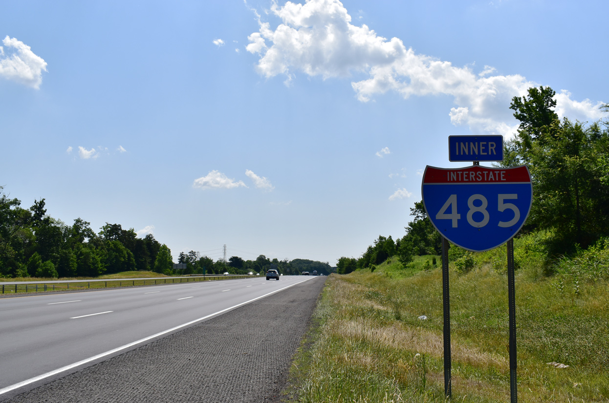
Overview
Interstate 485 is the Charlotte Outer Loop serving Mecklenburg County and metropolitan Charlotte. The 67 mile long beltway is both a bypass route for I-77 and I-85 and a commuter route for the Mecklenburg County suburbs. Mileposts originate at the four level interchange with I-77 in south Charlotte. Exit numbers increase clockwise.
The origins of the beltway began with planners in 1975. Powered by N.C. Board of Transportation member Seddon “Rusty” Goode starting in 1978,1 the often controversial freeway did not see construction until 1988 when work commenced on the southern leg.2 The beltway opened in stages to June 5, 2015, when the last section opened to traffic. The American Association of State Highway and Transportation Officials (AASHTO) approved the final link of the beltway as I-485 on May 15, 2015.
I-485 was originally envisioned as a four lane rural freeway. However, area development surrounding the oldest stretch of Interstate 485 in south Mecklenburg County eventually pushed traffic counts to 107,000 vehicles per day (vpd). This constituted the 10th most heavily traveled highway in the state at the time. Anticipating further growth, succeeding sections of the beltway were built with six or eight lanes.2 The North Carolina Department of Transportation (NCDOT) opted to use both cardinal directions and inner and outer belt signs along the Interstate 485 beltway. Mile markers are placed every two tenths of a mile.1
Route Information
East End – Charlotte, NC
West End – Charlotte, NC
Mileage – 66.68
Cities – Charlotte
- Junctions –

Source: December 31, 2021 Interstate Route Log and Finders List
I-485 Annual Average Daily Traffic (AADT)
Express Lanes
Construction started in March 2019 (STIP project I-5507) adds a tolled Express Lane in each direction of Interstate 485 between the systems interchange with I-77 and the Monroe Expressway (Toll U.S. 74). The State Transportation Improvement Program funded the $346 million project in 2015. The lanes will be implemented by the N.C. Turnpike Authority and include a new interchange at Weddington Road in Matthews and improvements to the exchange with John Street (Exit 52). Work runs through 2022 Winter 2024.
 History
As of March 2002, two sections of Interstate 485 were open to traffic: Three miles of the northeastern section connecting I-85 with NC 49, and the southern section linking NC 160 west of I-77 with N.C. 51 east of Charlotte. Interstate 485 was extended northeast to Lawyers Road, north of U.S. 74, by August 2002. Construction continued to NC 218. (Thanks to Ayan Kayal for providing the construction update.)
An additional 7.5 miles of the Charlotte Outer Loop, between Albemarle Road (NC 24-27) and NC 49, were completed on September 3, 2003. A series of weather related delays pushed back the planned opening of this segment initially from July 1 to mid August 2003.3 Joining I-85 with University City, the six lane freeway took 2.5 years to complete and cost $55.4 million.4 Interchanges along this section were built at Rocky River and Harrisburg Roads.
Interstate 485 was slated to open five miles from NC 49 to Lawyers Road at Mint Hill by mid October 2003. However engineering difficulties encountered with bridge design4 as well with problems associated with plans for sewer pipes hampered work on the segment.5 Delays caused by heavy rains during the Winter and Spring of 2003 pushed the planned opening beyond the scheduled date of July 1. The Mint Hill segment of I-485 ultimately opened to traffic on November 19, 2003. This ribbon cutting increased the total mileage of Interstate 485 to 39 miles, or about 60 percent complete.2
The aforementioned weather delays also pushed back the construction schedule on the southwestern leg of the Charlotte Outer Loop. This 7.4 mile long section extended I-485 to Wilkinson Boulevard and Interstate 85.2 Anticipated to open in December 2003 and then March 2004, the Beltway between I-77 and I-85 finally did October 19, 2004.6 Interchanges along the stretch were built at Arrowood Road, NC 160 (Steele Creek Road), Wilkinson Boulevard and I-85. The $100 million, six lane project also provided an alternate route to Wilkinson Boulevard for Billy Graham Parkway (former U.S. 521) into Charlotte Douglas International Airport (CLT).5 With 47 miles finished at this time, Interstate 485 was 70% complete.3
Construction of the cloverstack joining I-85 and I-485 in western Charlotte. The exchange opened on October 19, 2004, when the beltway debuted to motorists southward to Arrowood Road (Exit 3) and Interstate 77. 10/05/01
As of November 2004 every portion of the overall 67 mile loop was open or under construction with the exception of the six mile segment from NC 115 (Old Statesville Road) to Interstate 85 in northeast Charlotte. The unexpected growth that coincided with the construction of Interstate 485 swelled traffic counts to 112,000 vehicles per day (vpd) across areas of south Mecklenburg County. This resulted in expanding the design of the succeeding freeway segments with additional lanes and better interchanges to augment problems with development and increasing traffic expectations.1 Furthermore, a $14.7 million contract was awarded in 2004 to add an additional lane in each direction between Interstate 77 and Arrowood Road.5 That expansion project was completed in 2006.
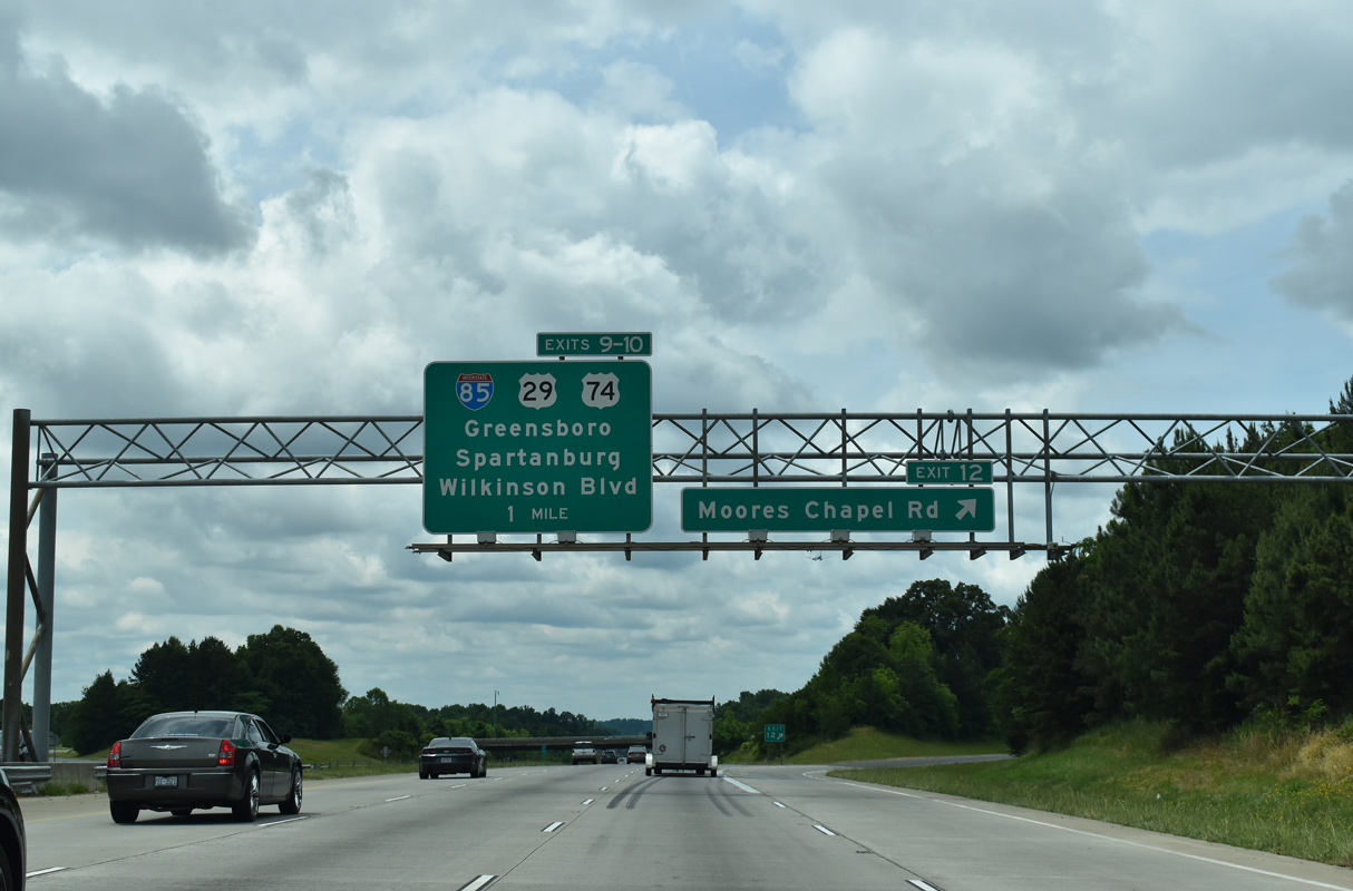
The next beltway section, from Interstate 85 north to NC 27 (Mount Holly Road), was scheduled to open in July 2005. A series of delays over an 18 month period extended construction until December 15, 2006.7,8 This portion of I-485 includes the roundabout interchange at Moore’s Chapel Road, the only of its kind on the Charlotte Outer Loop.
The extension of Interstate 485 from NC 27 (Mount Holly Road) north to NC 16 (Brookshire Boulevard) opened to traffic on May 8, 2007.9 Work simultaneously was underway along the northernmost reaches of Interstate 485 near I-77 at Huntersville. Started in December 2003, construction and weather delays pushed completion back two years3 to December 5, 2008. Costing $94 million, this portion of I-485 lengthened the beltway east to I-77 and NC 115 at Exit 23C.2 Pending Federal Highway Administration (FHWA) concurrence, AASHTO conditionally approved 11.95 miles of Interstate 485 clockwise from I-85 clockwise to I-77 on May 15, 2009.
The final segment of Interstate 485 built was the northeastern quadrant. Officials sought to accelerate work on the last 5.7 miles of I-485, from NC 115 east to I-85. If stimulus finds were secured in 2009, work was anticipated to start that year and end in 2012. The $231.7 million segment encountered several delays, pushing back scheduled opening of the freeway from December 2014 to Spring 2015.10 It was then announced on May 13, 2015 that a ribbon cutting ceremony would take place on June 5, 2015 around noon,11 officially completing Interstate 485.
Proposed interchanges at Oakdale Road in the northwest quadrant and NC 51 in the southeast quadrant at Mint Hill were not included in original construction of Interstate 485. This was because those areas were undeveloped, reducing the need for interchanges at that time.5 The postponement of work at NC 51 was requested by the town of Mint Hill. Several residents however petitioned the local government to rescind that request and have the interchange constructed. Mint Hill Mayor Ted Biggers was opposed to this, citing that the highway was only two lanes with traffic counts of just 8,200 vehicles per day (vpd). Biggers felt that the opening of I-485 would alleviate pressure from NC 51, as motorists used the route to access nearby Albemarle Road.12 The diamond interchange with NC 51 eventually opened by 2005.
The exchange at Oakdale Road was graded but remained unopened until July 2015, when NCDOT awarded a $4.8 million contract to finish the dumbbell interchange. Work followed a 1999 study that recommended completing the ramps once development spread to 75 percent of the land within a half mile radius of the crossroads with I-485. Construction wrapped up on the new exit in November 2016.13
 Photo Guides
East End  – Charlotte, North Carolina
![]() Inner Loop east at
Inner Loop east at ![]()
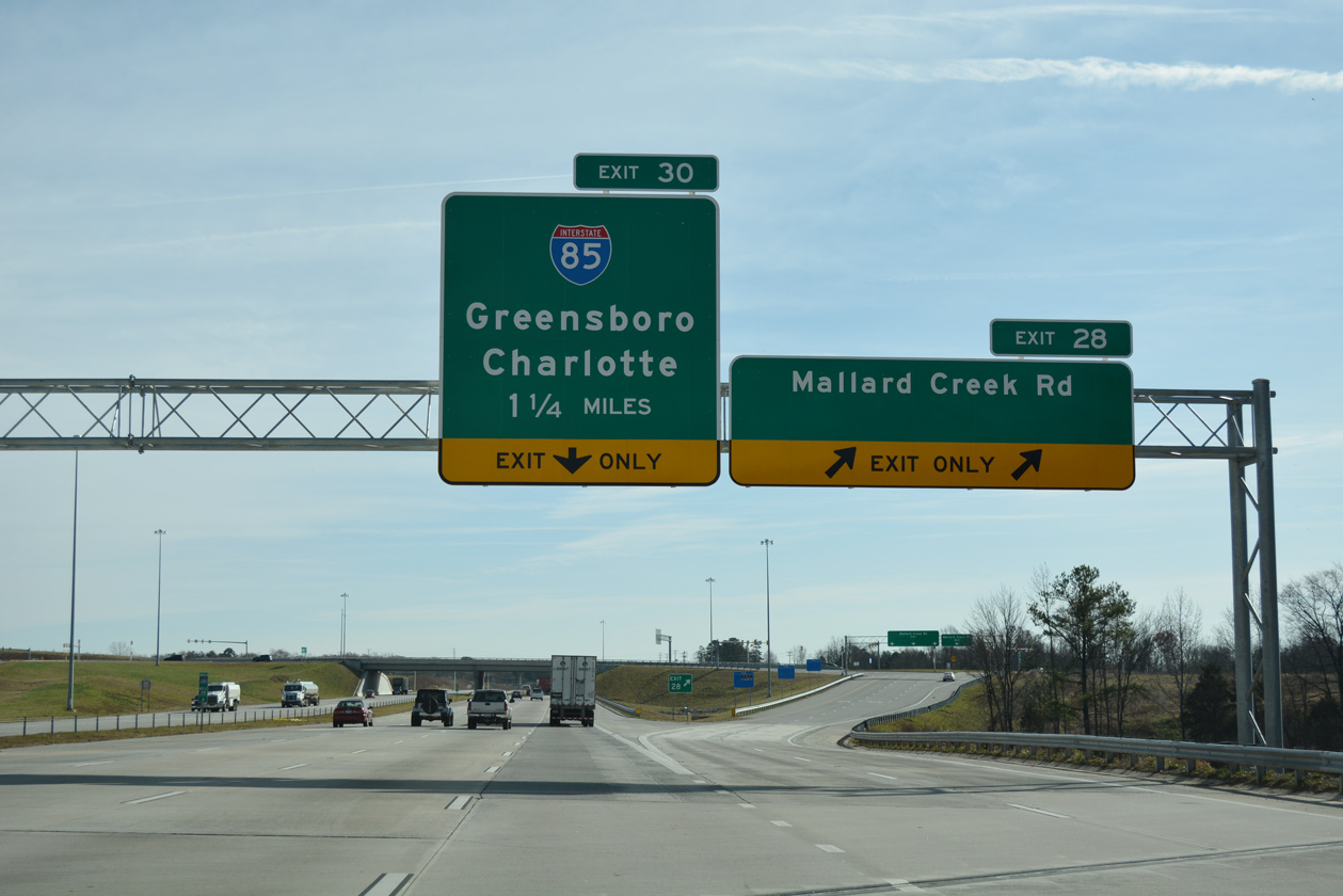
Interstate 485 turns southward from the diverging diamond interchange (Exit 28) with Mallard Creek Road to I-85. 12/15/16
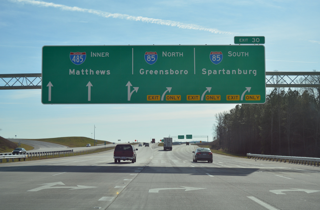
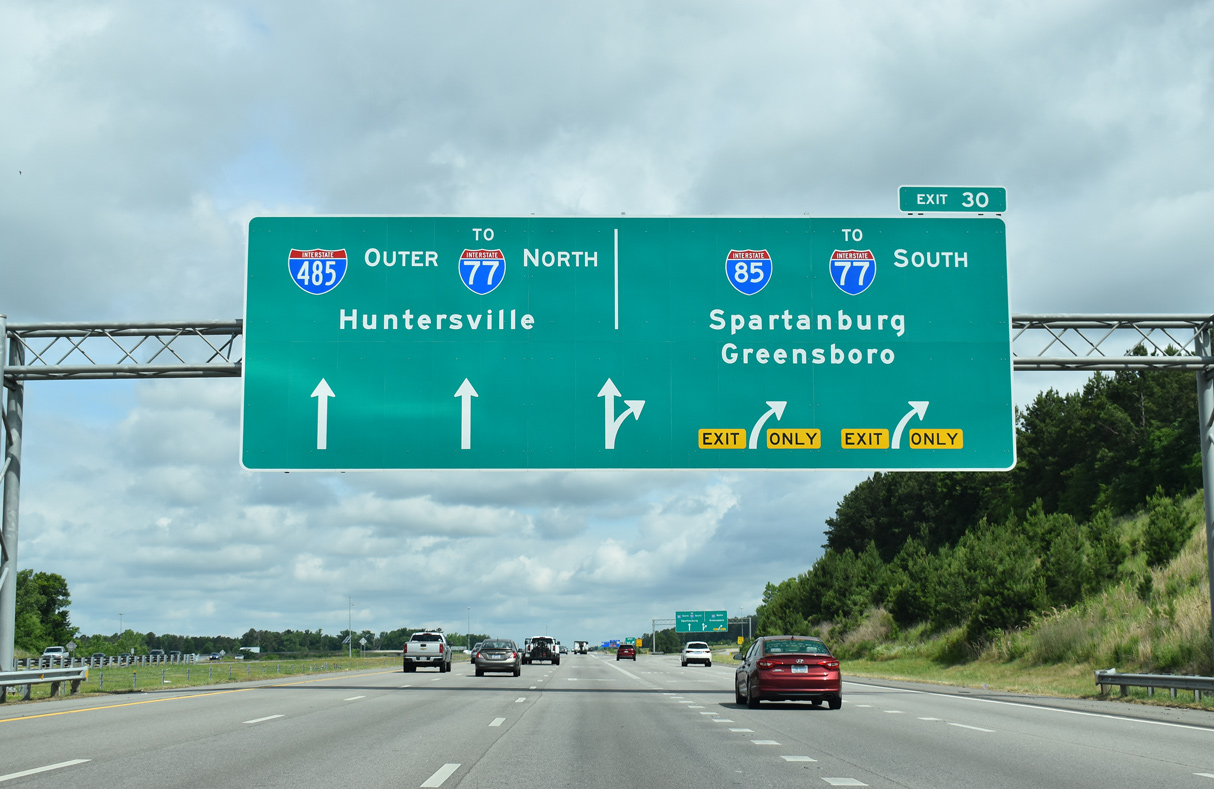
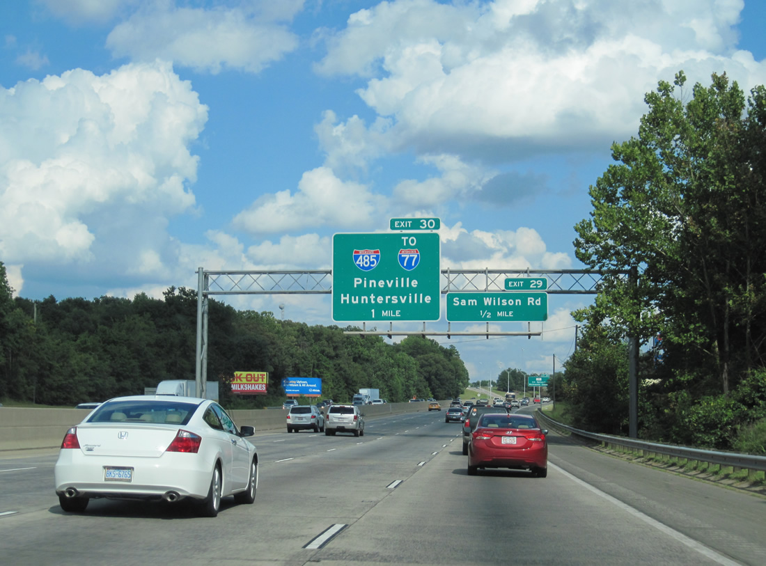
A pair of arrow-per-lane (APL) overheads precede the turbine interchange (Exit 30) joining the Charlotte Beltway with Interstate 85. 12/15/16
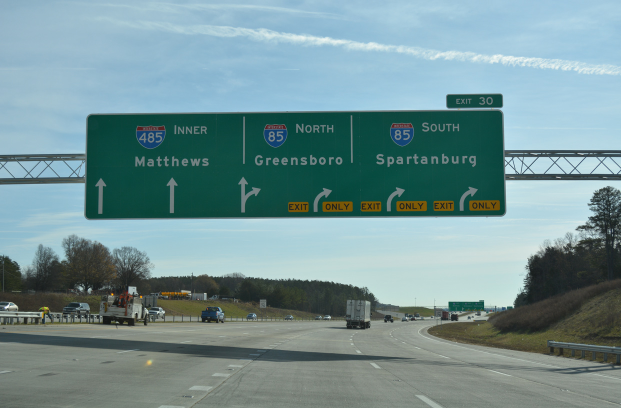
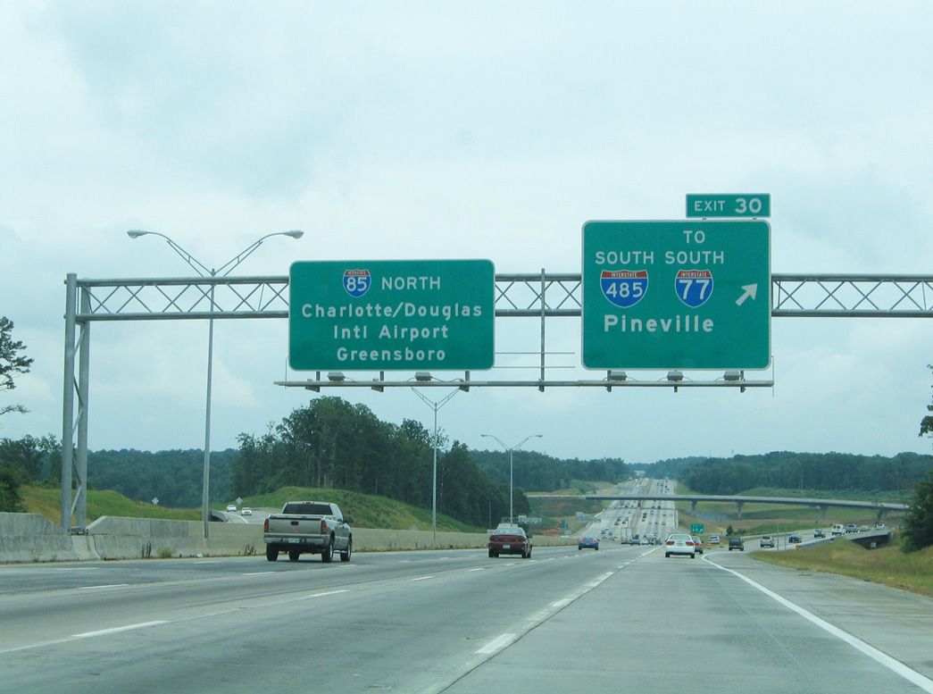
Four lanes separate from the I-485 inner loop for Interstate 85 south toward central Charlotte and north to Concord and Kannapolis. 12/15/16
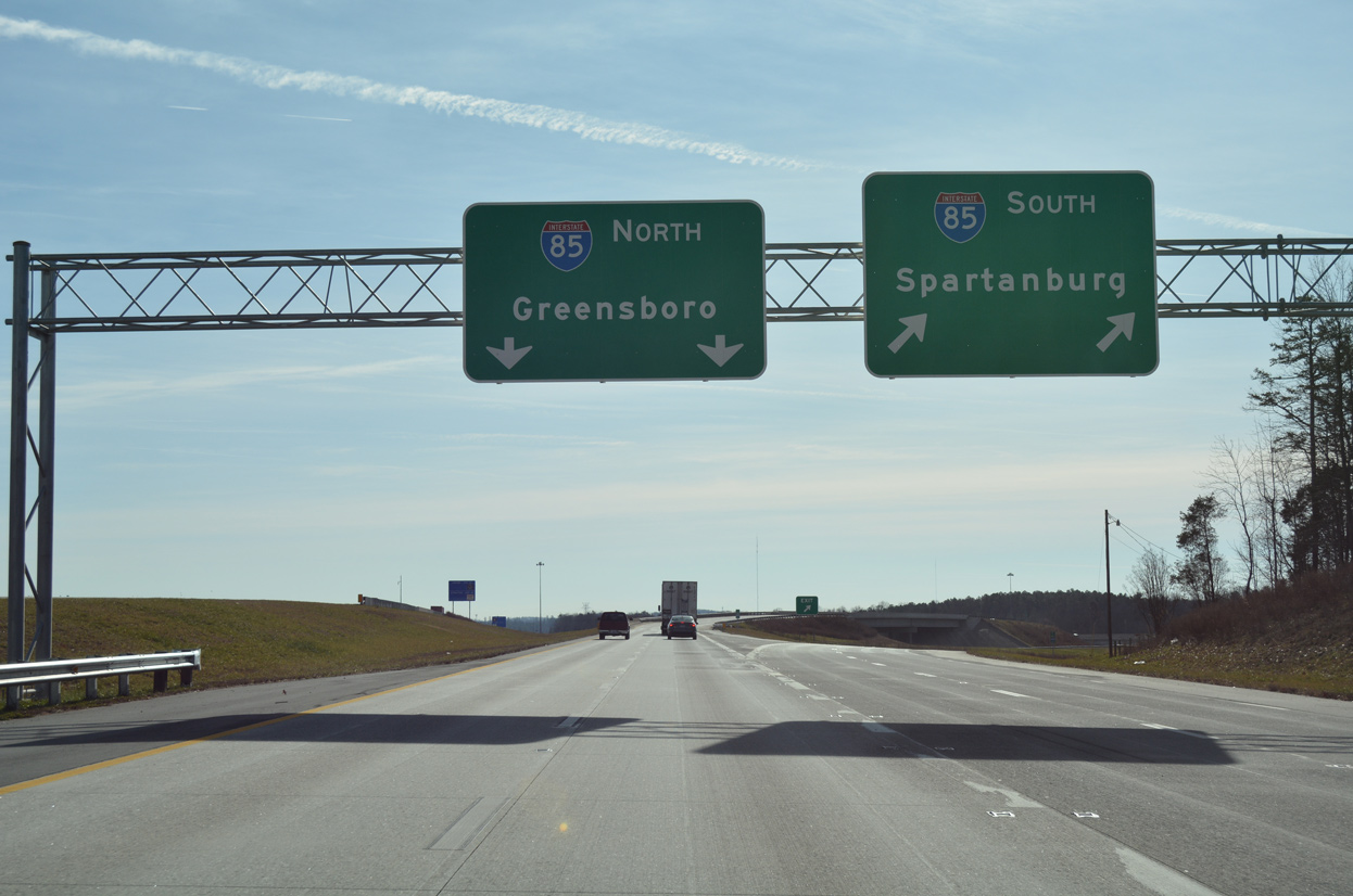
Exit 30 separates into dual lane ramps for Interstate 85 south toward Spartanburg, South Carolina and north to the Piedmont Triad. 12/15/16
![]() Outer Loop east at
Outer Loop east at ![]()
Exit 32 parts ways with Interstate 485 north for U.S. 29 (N Tryon Street) one mile south of I-85. 05/31/21
Interstate 485 expands to ten overall lanes between U.S. 29 and I-85 at Exit 30. 05/31/21
Three lanes depart from the Outer Loop of I-485 by the Mallard Lake development for I-85 south to University City in Charlotte and north to Concord Mills in Concord. 05/31/21
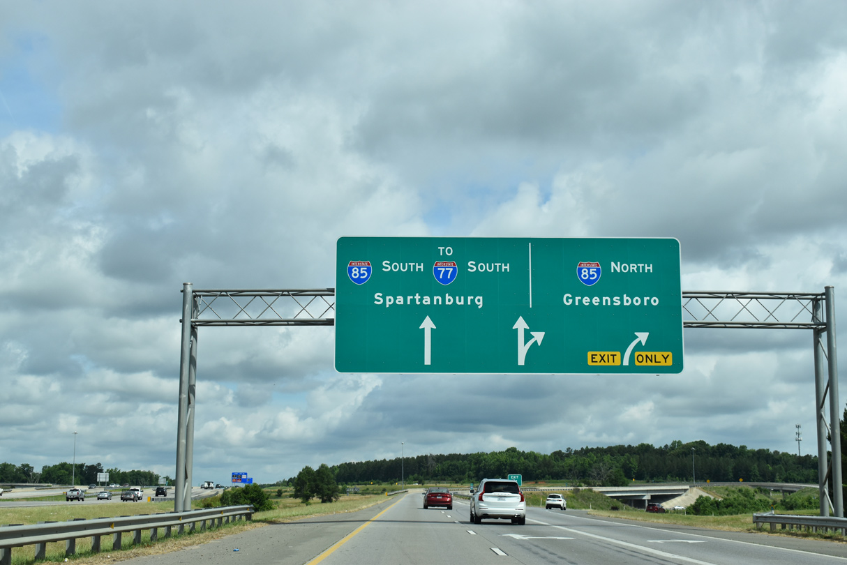
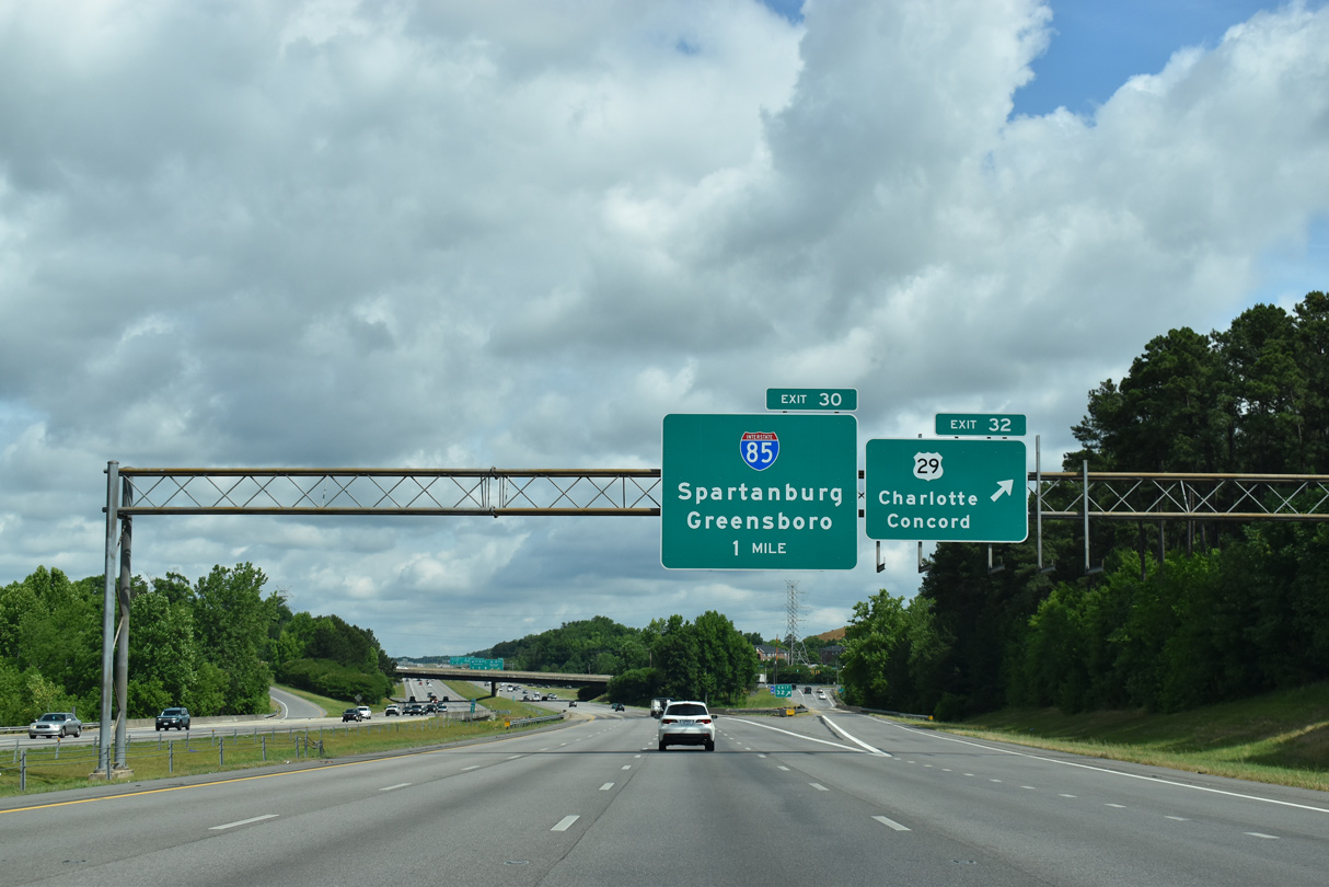
Exit 30 splits for Interstate 85 to Spartanburg, South Carolina and the Piedmont Triad. 05/31/21
![]() North at
North at ![]()
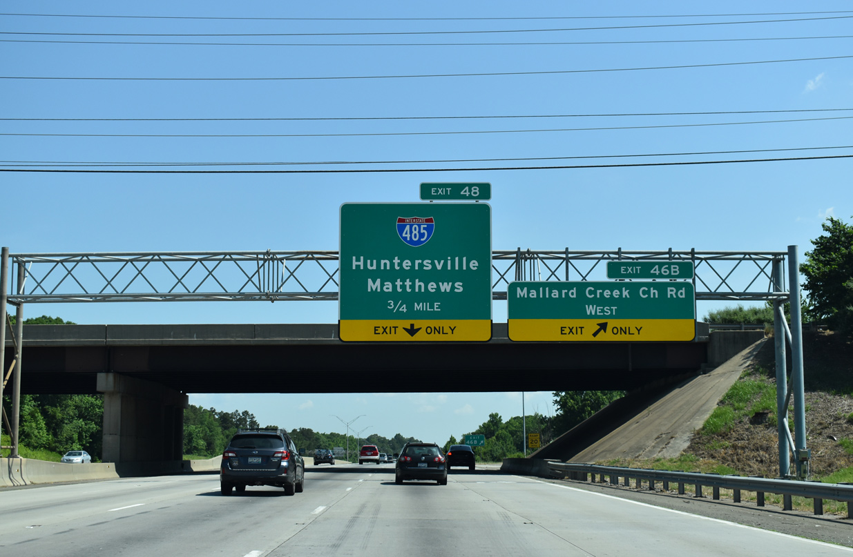
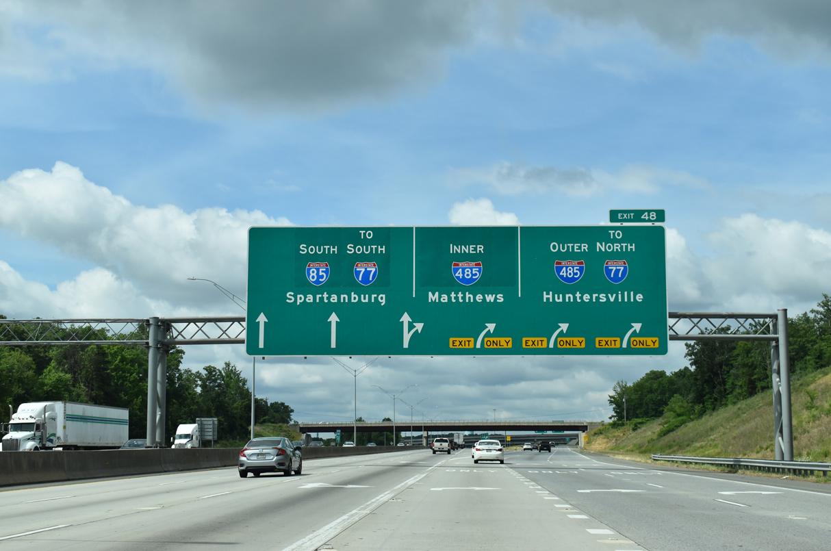
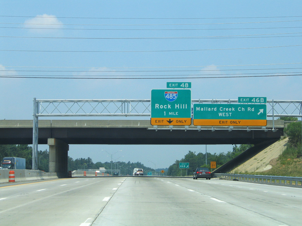
Interstate 85 was expanded from four to eight lanes between Mallard Creek Church Road (Exit 46B) and I-485 (Exit 48) between 2003-05. 05/26/19
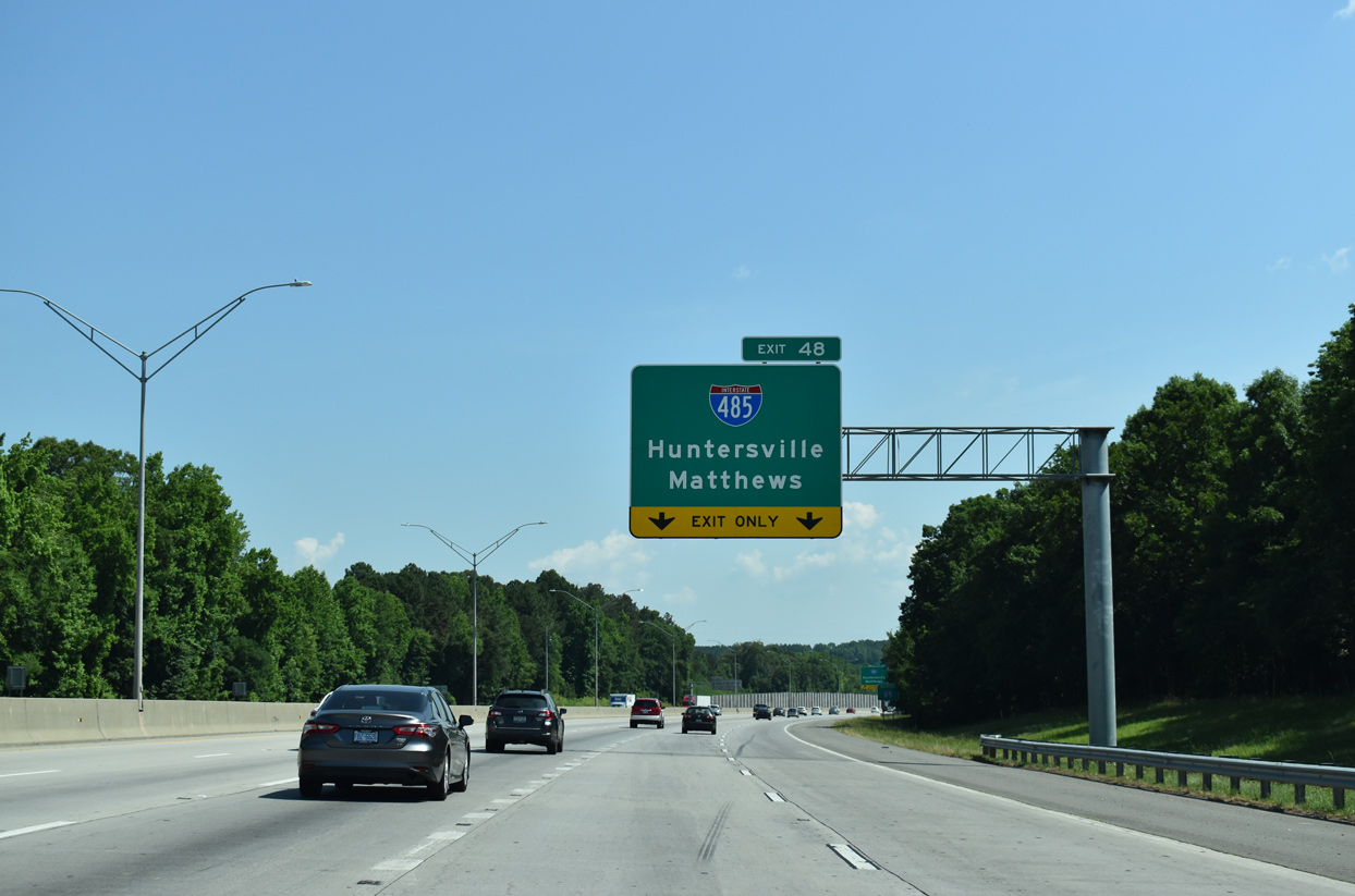
The oldest section of Interstate 485 opened to traffic was the expressway link between I-85 (Exit 48) and U.S. 29 in northeast Charlotte. 05/26/19
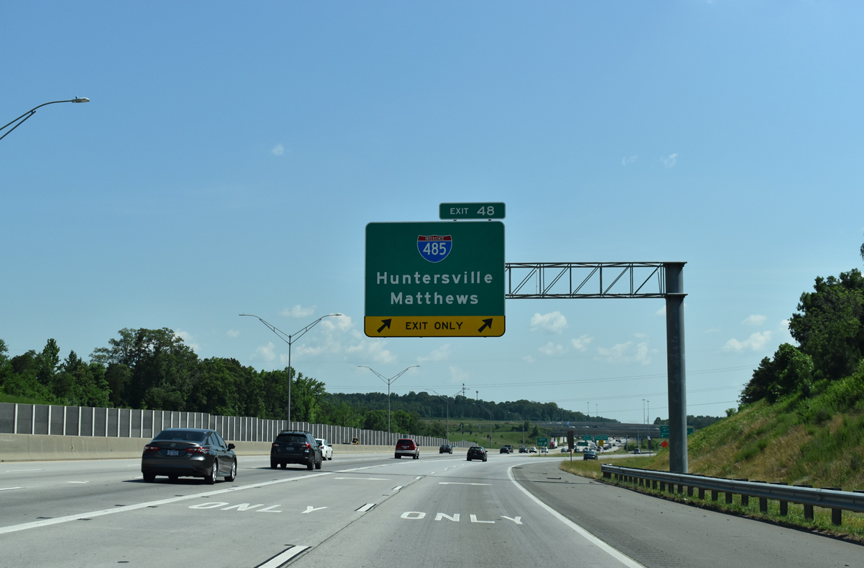
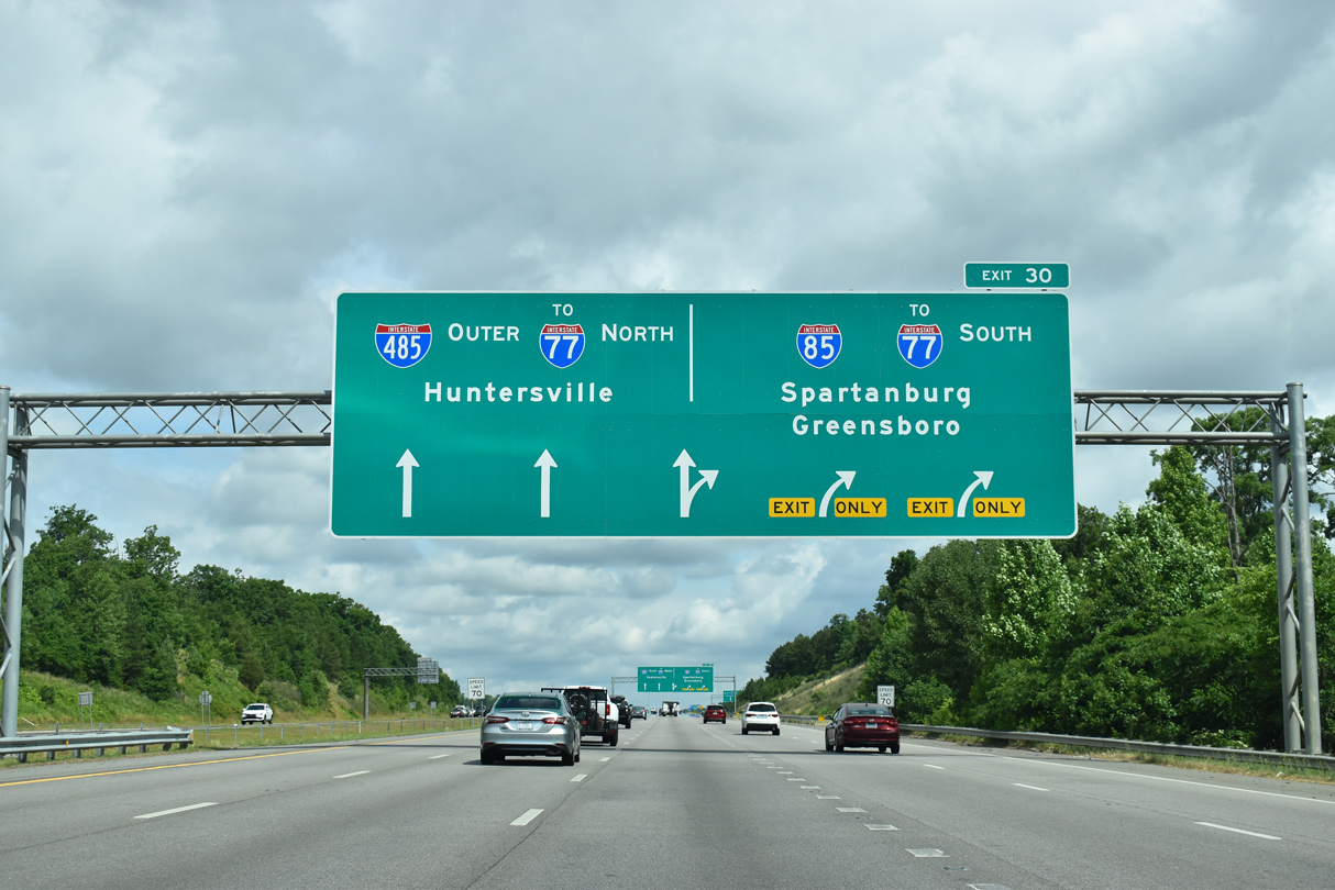
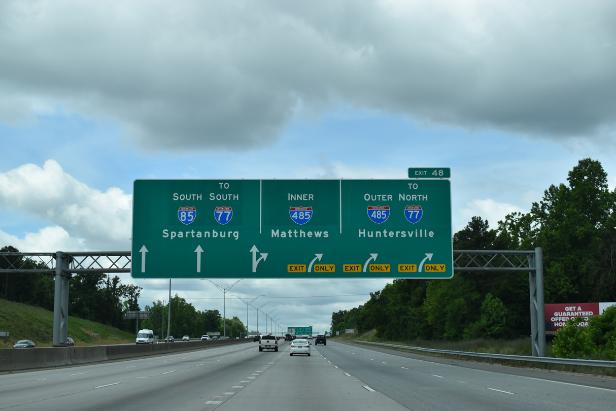
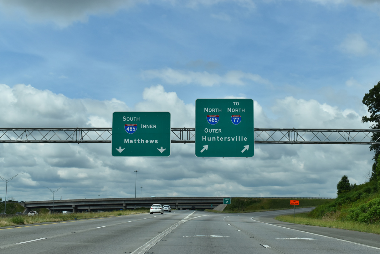
Traffic partitions at the turbine interchange with I-485 for the beltway west to I-77 near Huntersville and south to the suburbs of Mint Hill and Matthews. 05/26/19
![]() South at
South at ![]()
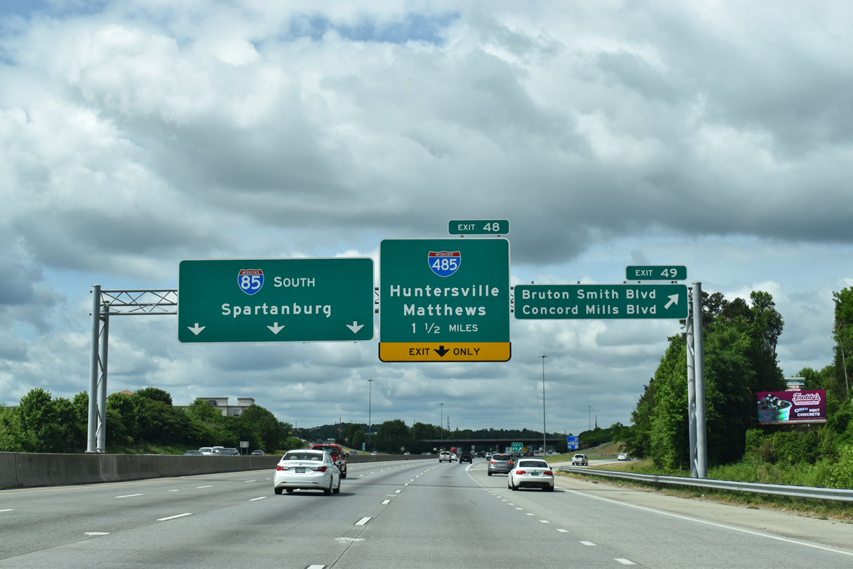
Interstate 85 proceeds southwest from Exit 49 at Concord Mills to I-485 in Mecklenburg County. 05/31/21
Interstate 85 expands to 12 overall lanes from the exchange with Concord Mills Boulevard and Exit 48 for the Charlotte Beltway. 05/31/21
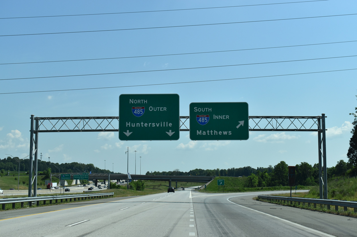
The outer loop of I-485 bypasses Charlotte west to I-77 near Huntersville. 05/31/21
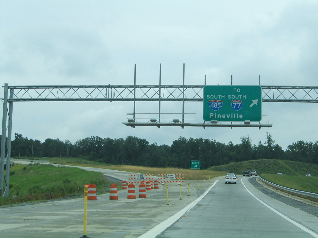
The inner loop of I-485 travel south to Mint Hill, Matthews and Pineville. 05/31/21
 East End Throwback
![]() North at
North at ![]()
The outer loop of I-485 approaching I-85 a decade before the completion of the beltway across north Charlotte. The northbound stretch between U.S. 29 and I-85 now accommodates five lanes with a pair of APL’s outlining the forthcoming turbine interchange (Exit 30). 05/30/05
The section of I-485 linking U.S. 29 and Interstate 85 in northeastern Charlotte replaced a short expressway linking the parallel routes. Traffic at the north end originally partitioned at a trumpet interchange. 05/30/05
![]() North at
North at ![]()
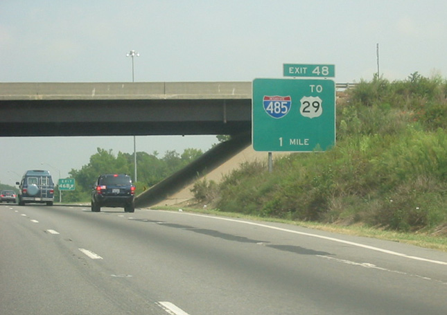
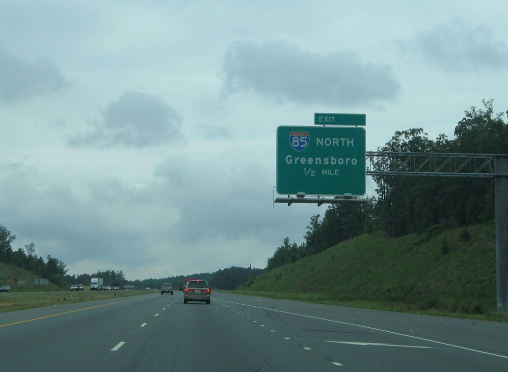
The first signs for I-485 at Exit 48 acknowledged the connection with U.S. 29. Photo by Jonathan Lebowitz (08/22/02).
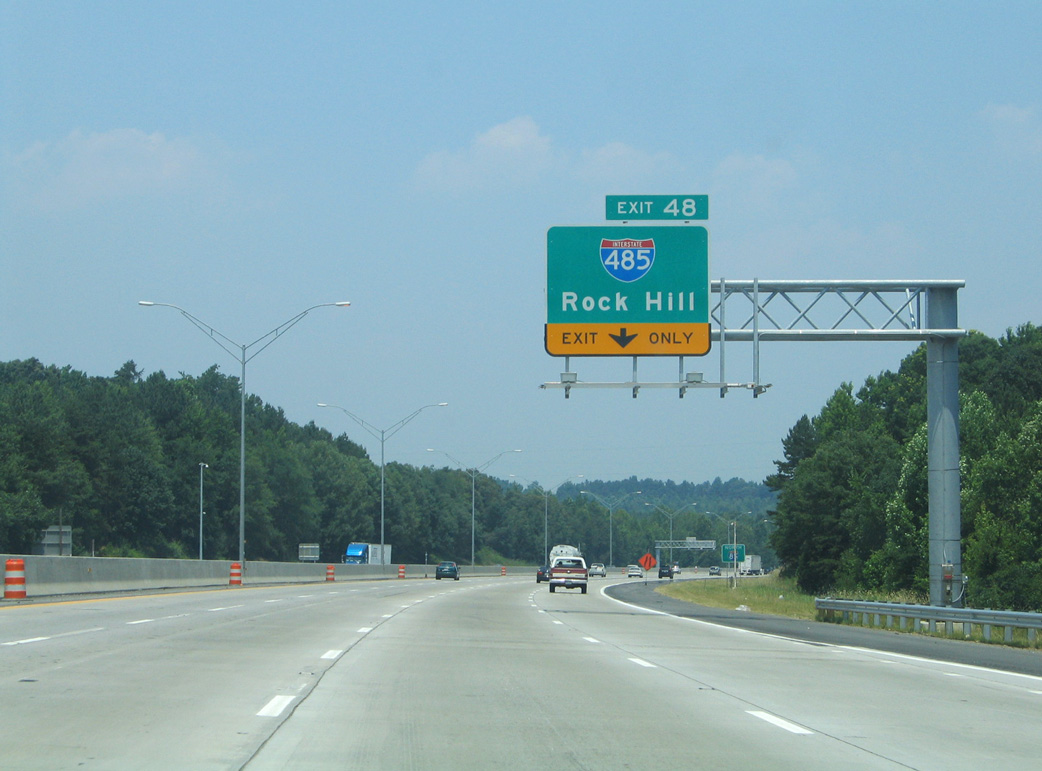
When the eastern half of Interstate 485 was completed, guide signs for the Charlotte Beltway referenced Rock Hill, South Carolina. 06/22/05
One half mile ahead of Exit 48 on I-85 north. Photo by Jonathan Lebowitz (08/22/02).
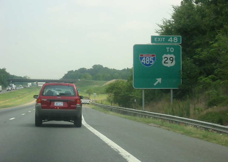
Entering the previous trumpet interchange (Exit 48) with the I-485 connector south to U.S. 29 (Tryon Street) on I-85 north. Photo by Jonathan Lebowitz (08/22/02).

Guide signs for I-485 were eventually changed to reference Matthews, a southeastern Charlotte suburb, instead of Rock Hill, South Carolina. 06/22/05
![]() South at
South at ![]()
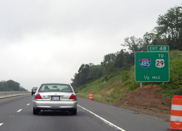
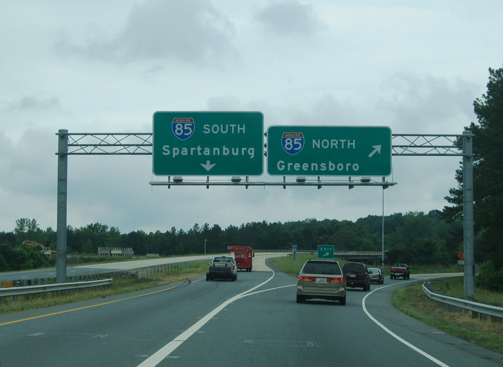
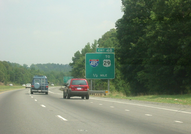
Ground level signs directed traffic on Interstate 85 south for the I-485 connector to U.S. 29 in northeastern Charlotte. Photo by Chris Patriarca (06/17/03).
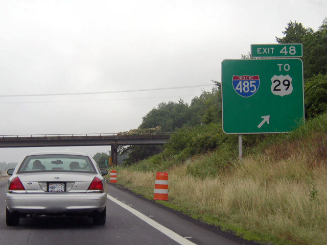
Exit 48 departed from I-85 south for Interstate 485. I-85 and U.S. 29 (Tryon Street) parallel each other west through the University Research Park area. Photo by Chris Patriarca (06/17/03).
West End – Charlotte, North Carolina
![]() North at
North at ![]()
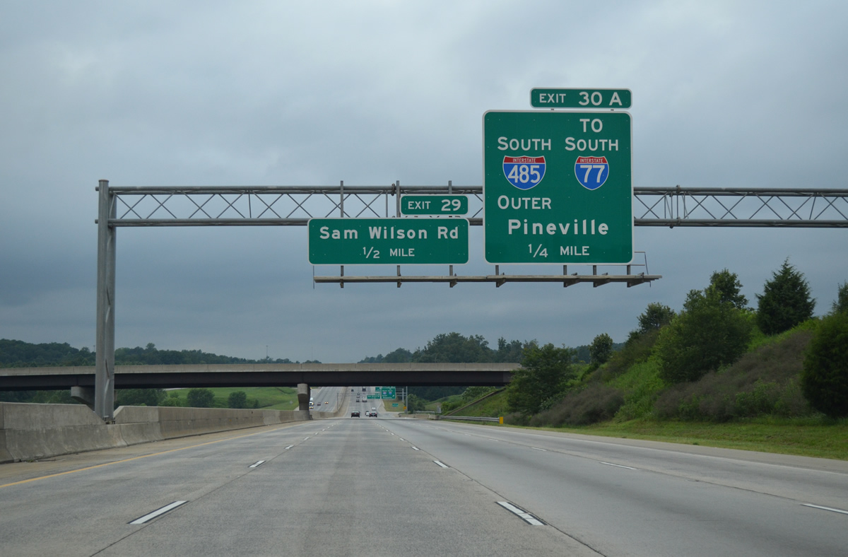
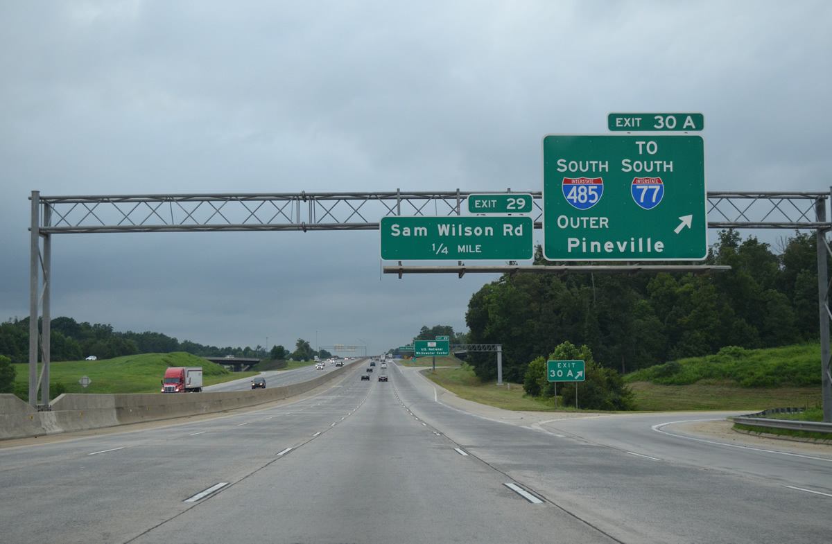
Interstate 85 proceeds east from the Catawba River to a diamond interchange (Exit 29) with Sam Wilson Road and the succeeding exchange with the Charlotte Beltway. Photo by Carter Buchanan (08/11/13).
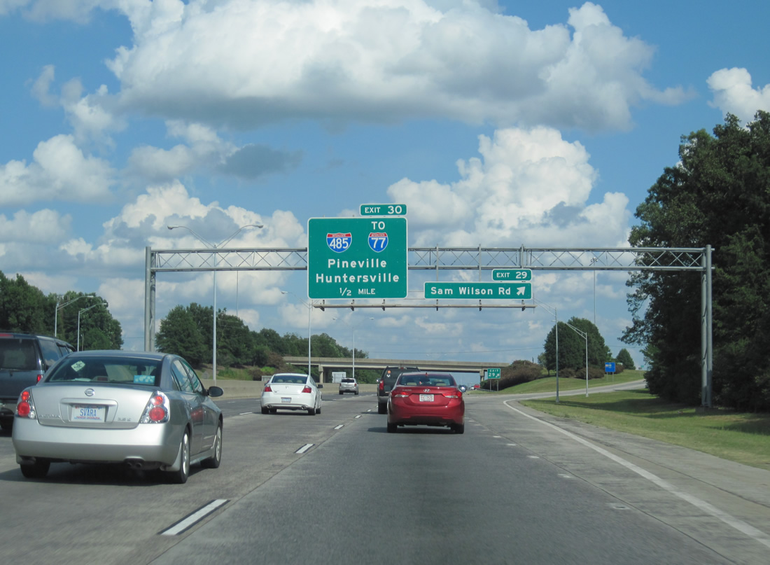
The half turbine interchange (Exit 30) with Interstate 485 lies one half mile east of Sam Wilson Road. I-485 runs along the west side of Charlotte Douglas International Airport (CLT) nearby. Photo by Carter Buchanan (08/11/13).
Exit 30 leads traffic to both I-485 south to I-77 near Pineville and I-77 north from Charlotte to Huntersville. Photo by Carter Buchanan (08/11/13).
![]() South at
South at ![]()

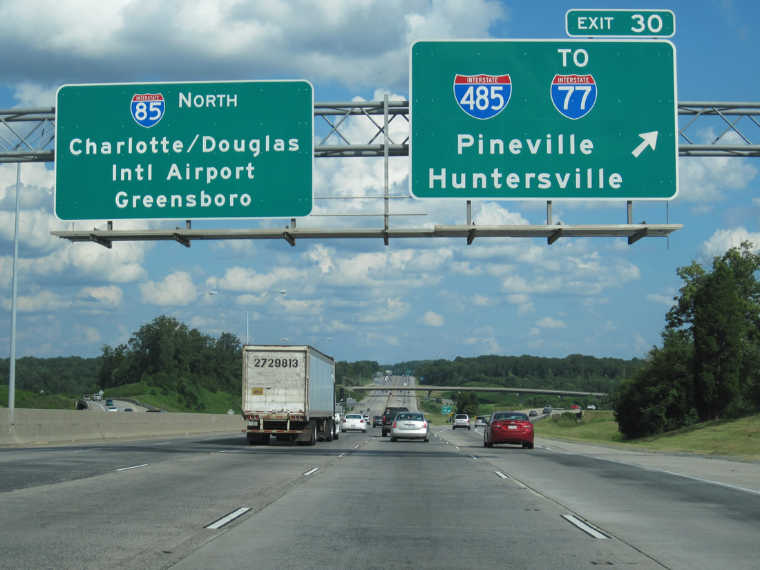
Interstate 85 advances west from the area of Charlotte Douglas International Airport (CLT) to meet I-485 at Exit 30. 01/17/19
Control points for I-485 reference Pineville, a suburb in south Charlotte located east of I-77. North of Charlotte and I-485, the town of Huntersville lies along I-77. 01/17/19
Exit 30B leaves Interstate 85 south for the inner loop of I-485 through northwest Charlotte near Mountain Island Lake. 01/17/19
A loop ramp (Exit 30A) follows from I-85 south for Interstate 485 to adjacent U.S. 29/74 (Wilkinson Boulevard) and the west side of CLT Airport. 08/06/13
Interstate 485 converges with I-77 at a systems interchange located just north of the South Carolina state line in ten miles. 08/06/13
![]() North at
North at ![]()
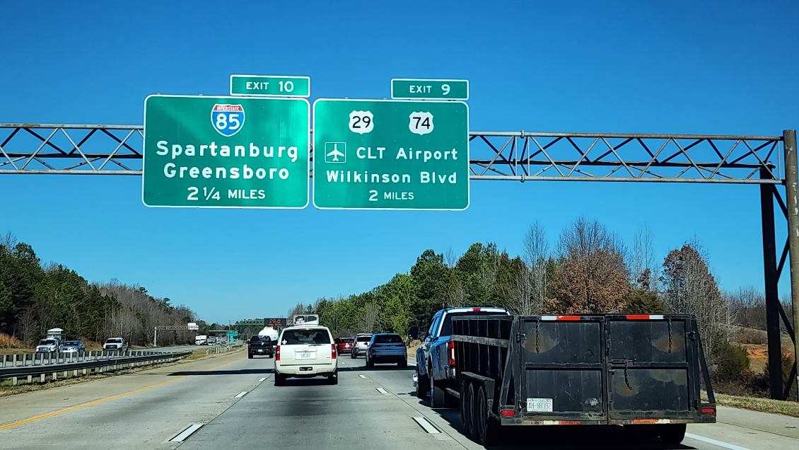
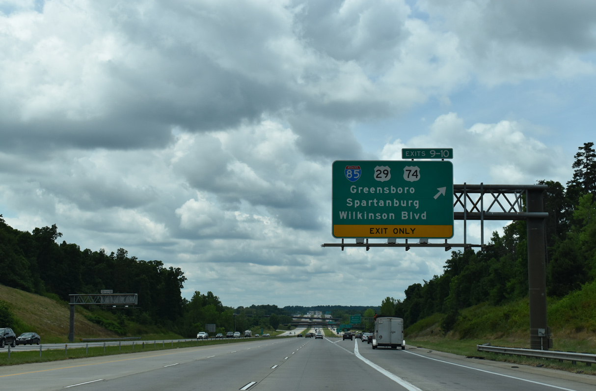
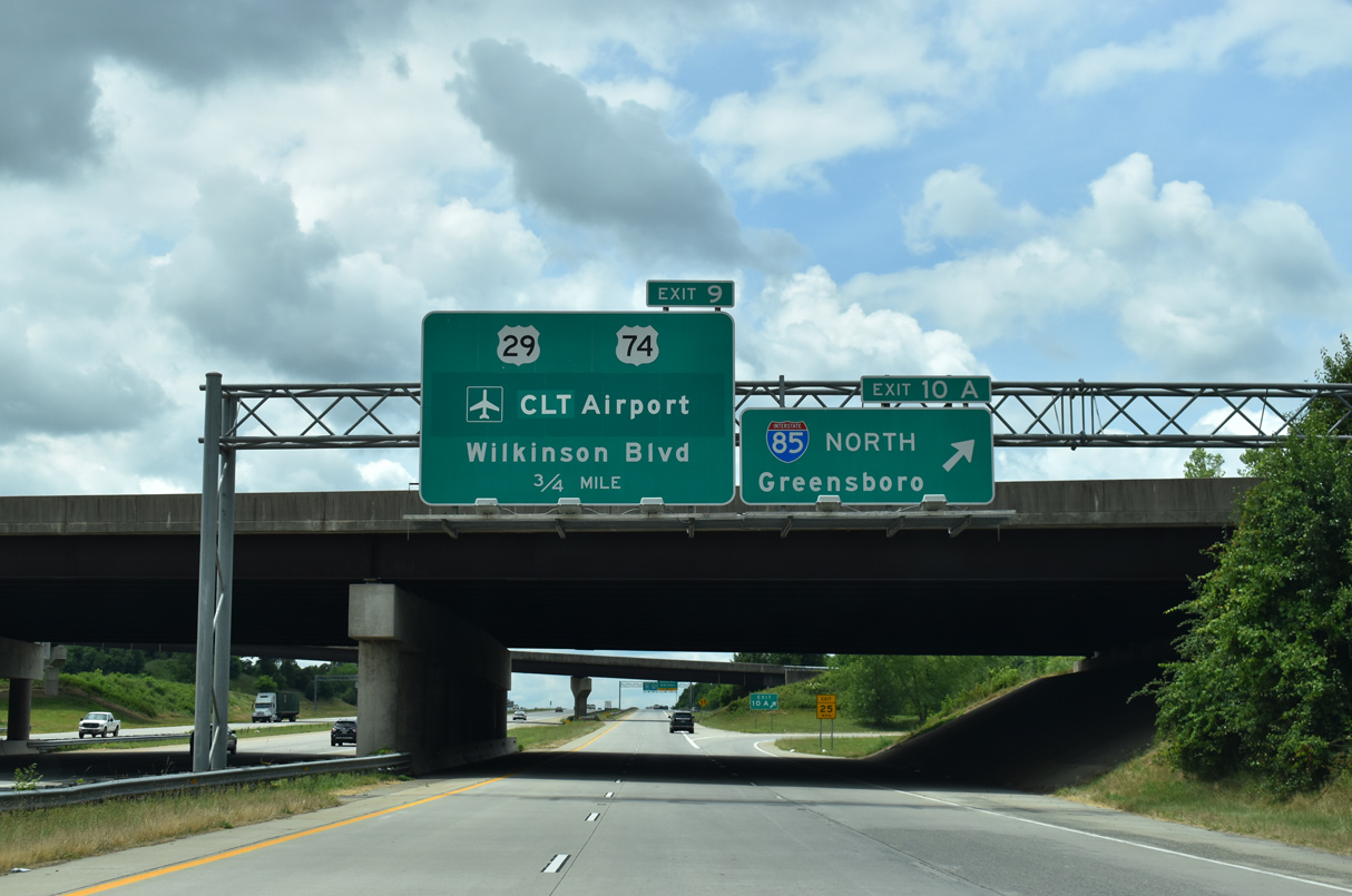
Interstate 485 travels adjacent to runways at Charlotte Douglas International Airport (CLT) northward to a folded diamond interchange (Exit 9) with U.S. 29/74 (Wilkinson Boulevard). 01/02/24
A collector distributor departs from within the exchange at Exit 9 for Interstate 85. 09/23/14
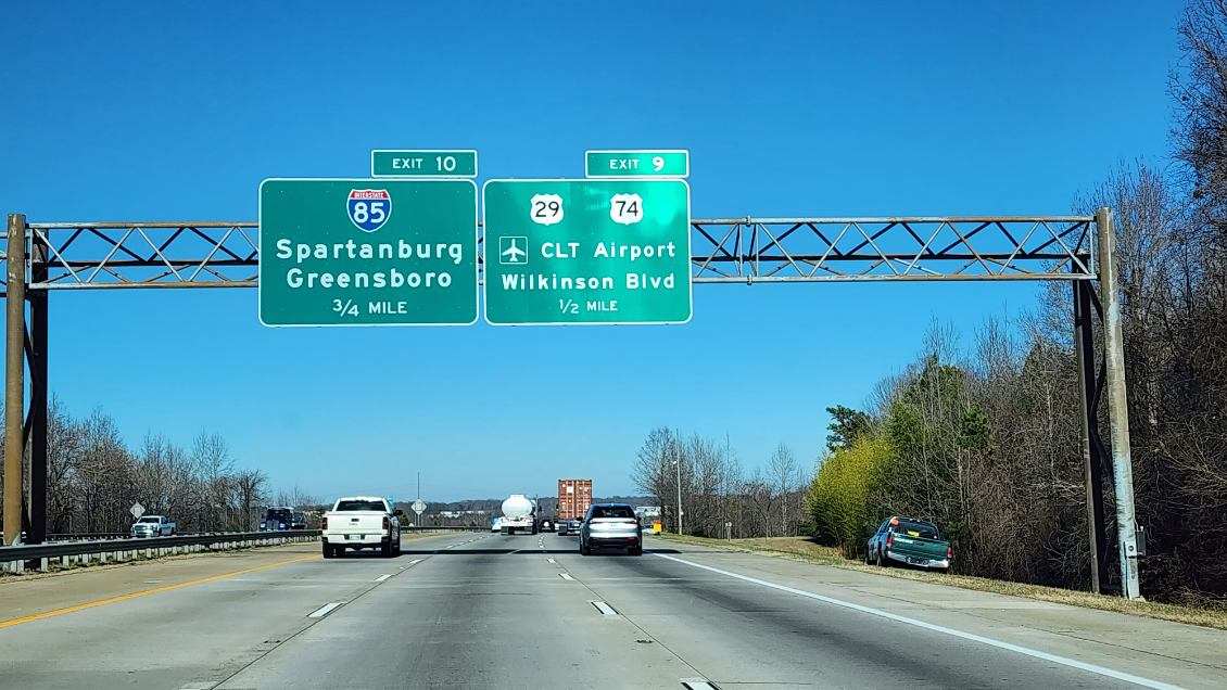
U.S. 29/74 (Wilkinson Boulevard) parallel Interstate 85 east into Charlotte and west to Gastonia. 01/02/24
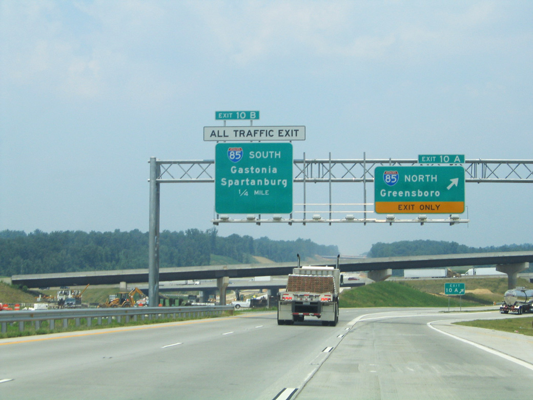
Interstate 485 proceeds north with three through lanes beyond the c/d roadway (Exit 10) for I-85 to Spartanburg, South Carolina and Greensboro. 01/02/24
Two lanes separate from the inner loop of I-485 for Interstate 85. The loop ramp from U.S. 29/74 merges onto the c/d roadway nearby. 01/02/24
![]() South at
South at ![]()
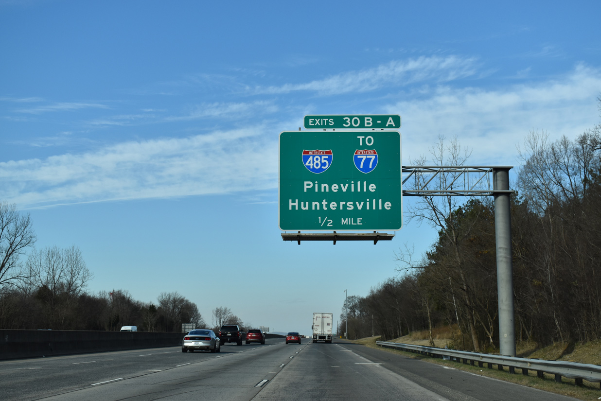
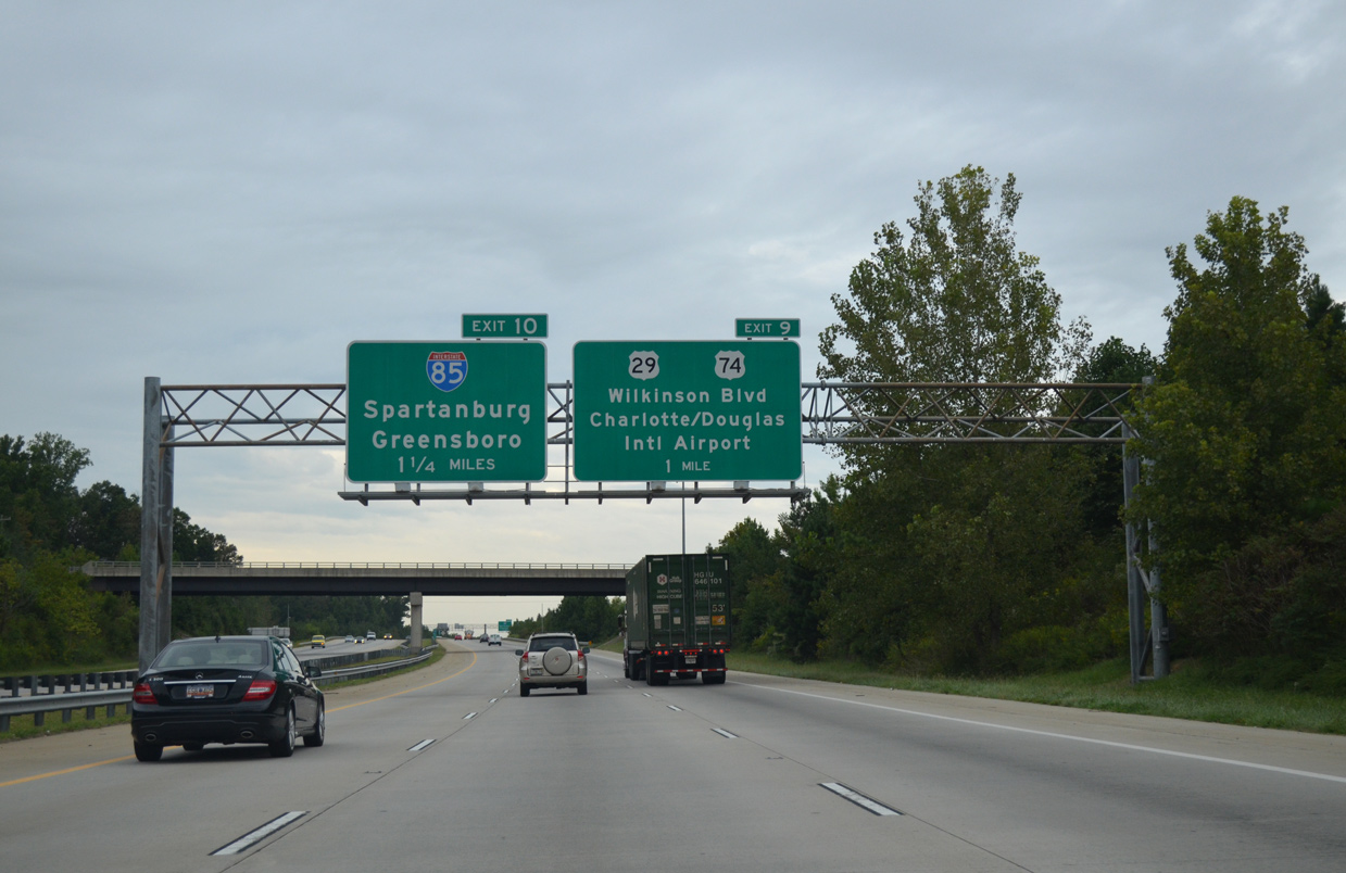
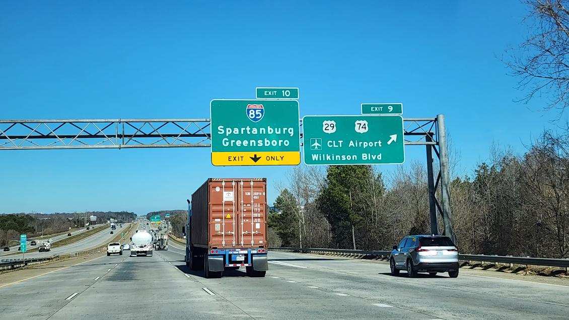
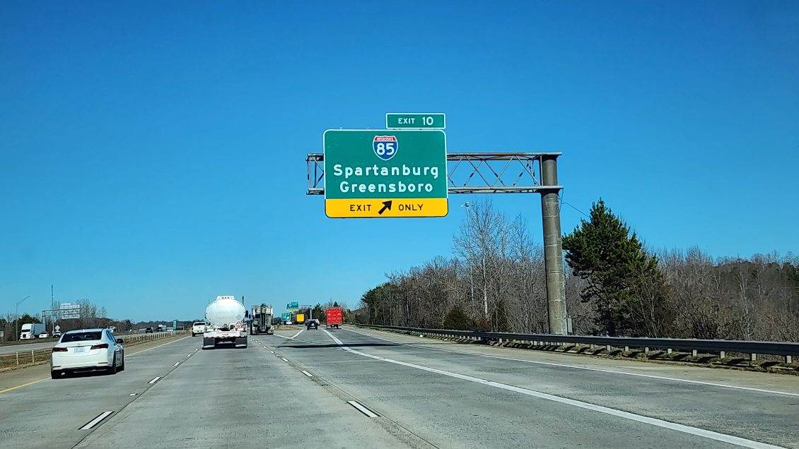
The Outer Loop of I-485 meets Interstate 85 one mile south of the dogbone (Exit 12) interchange with Moores Chapel Road (SR 1601). 05/31/21
A 2.17 mile long c/d roadway separates from I-485 south through the exchanges with both I-85 and U.S. 29/74 (Wilkinson Boulevard). 05/31/21
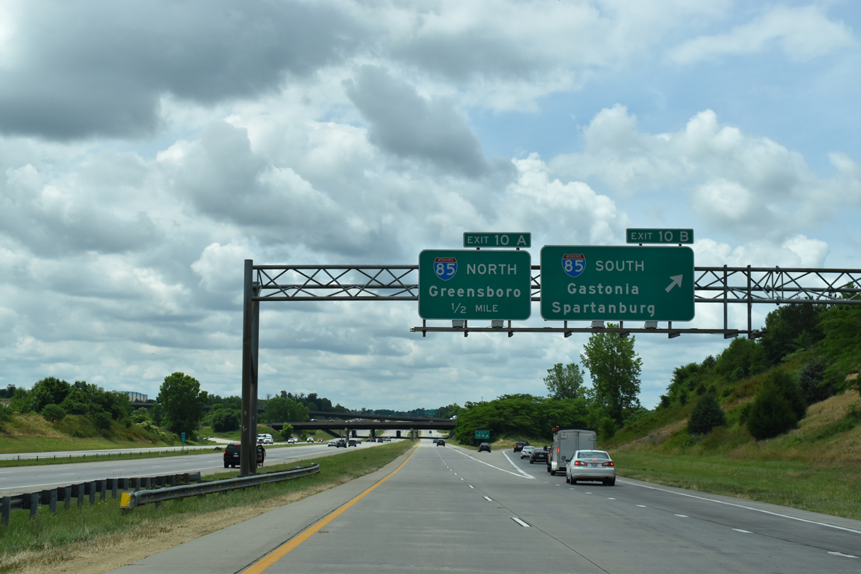
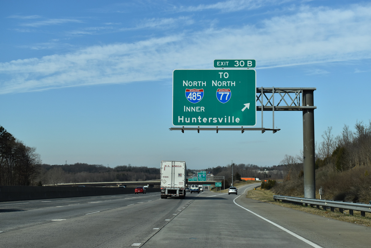
Exit 10B leaves I-485 south for Interstate 85 south to Gastonia, Kings Mountain and Spartanburg, South Carolina. 05/31/21
Exit 10A loops onto I-85 north to central Charlotte from the cloverstack interchange with Interstate 485. 05/31/21
West End Throwback
![]() North at
North at ![]()
Exit 30 defaulted traffic to Interstate 485 southbound until December 15, 2006, when the section north to N.C. 27 (Mount Holly Road) was finished. Photos taken 05/30/05.
![]() North at
North at ![]()
Northbound Interstate 485 temporarily ended at the split of Exit 10 for I-85 in west Charlotte. 06/22/05
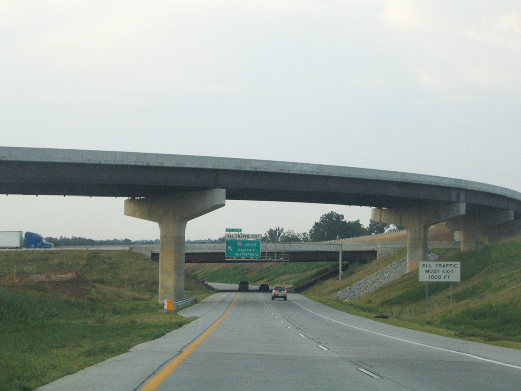
All traffic was directed to I-85 south (Exit 10B) to Gastonia and Kings Mountain until December 2006, when the ensuing section of I-485 opened north to NC 27. 07/12/05
Sources:
- “I-485 about to bring real I-85/I-77 bypass.” Charlotte Observer (NC), August 29, 2004.
- “I-485 arc takes shape.” Charlotte Observer (NC), November 20, 2003.
- “Eastern leg of the outerbelt delayed.” Charlotte Observer (NC), August 1, 2003.
- “Opening today adds 7.5 miles to eastern I-485.” Charlotte Observer (NC), September 3, 2003.
- “Key link in I-485 just days away.” Charlotte Observer (NC), October 9, 2004.
- “I-485 opens in west Charlotte.” Charlotte Observer (NC), October 19, 2004.
- “Opening on I-485 pushed back again: Repairs, final inspection needed on 2 new exits; new target is for about mid-December.” Charlotte Observer (NC), December 4, 2006.
- “9:43 am – New outerbelt section coming Friday.” Charlotte Observer (NC), December 14, 2006.
- “New Leg of I-485 to Open in Northwest Mecklenburg County Tuesday.” North Carolina Department of Transportation (NCDOT), news release.
- “Completion of I-485 Outer Loop In Mecklenburg County Scheduled For Spring 2015.” NCDOT, news release. October 24, 2014.
- “NCDOT Announces Opening Date for Final Segment of I-485.” NCDOT, news release. May 13, 2015.
- Lansford, John. “I-485 interchange delay questioned.” Online posting, misc.transport.road, October 12, 2003.
- “NCDOT Awards Contract to Complete I-485 Interchange with Oakdale Road.” NCDOT, news release, July 9, 2015.
Page updated February 1, 2024.