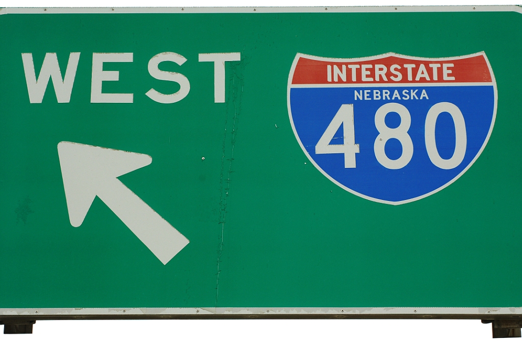
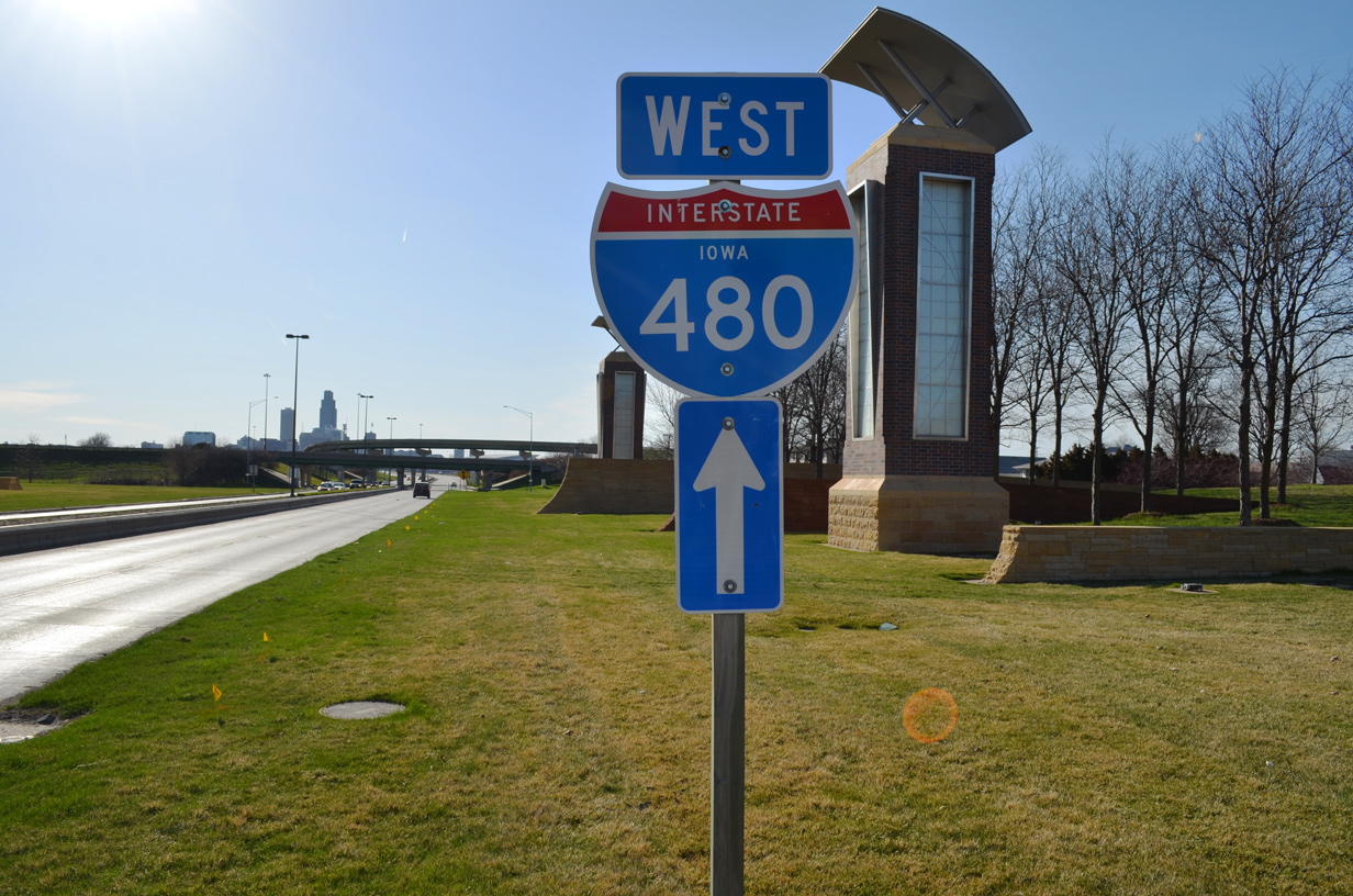
Interstate 480 Nebraska / Iowa

Interstate 480 and former I-580 along the North Freeway (U.S. 75) in central Omaha, Nebraska.
Overview
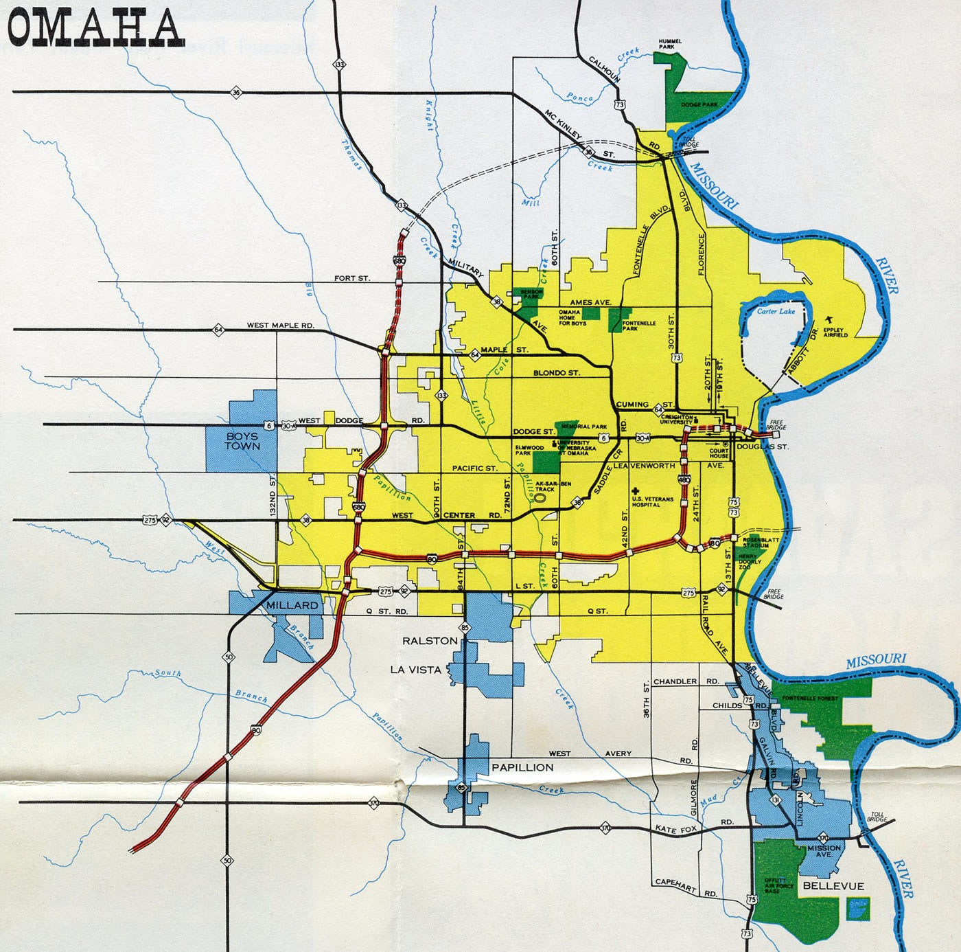
Interstate 480 forms the inner belt freeway around central Omaha between I-80 at the Hanscom Park neighborhood and I-29 at Council Bluffs, Iowa. The route serves commuters to Downtown and various points of interest including Creighton University, Charles Schwab Field Omaha (home of the College World Series) and the Midtown Crossing mixed use development along U.S. 6 (Dodge Street).
Interstate 480 doubles as U.S. 75 from I-80 to Exit 2 C and as U.S. 6 across the Missouri River to I-29 at Broadway. The interstate switches cardinal directions at the interchange with the North Freeway (U.S. 75 / former I-580), where it turns east from the Gifford Park neighborhood to Downtown Northeast.

West Broadway Interchange
Construction included in the multiyear Council Bluffs Interstate System Improvement Program addressed the substandard exchange at the east end of Interstate 480 with I-29 and West Broadway (old U.S. 6). Upgrades to the West Broadway Interchange include dnew access from Interstate 29 to Broadway, the relocation of the freeway mainline so that it no longer separates through the exchange, the construction of new flyovers from the outside lanes of I-29 instead of the inside, and new ramps to 2nd Avenue. Environmental study for the project was conducted between June 2015 and November 2017. Preliminary design and right of way acquisition commenced in 2017. Anticipated construction was between November 2020 and July 2023,19 and work finally got underway in April 2021. The last of the new ramps opened at the exchange in Fall 2023. Final punch list work continued into 2024, but major construction was completed six months ahead of schedule.
 History
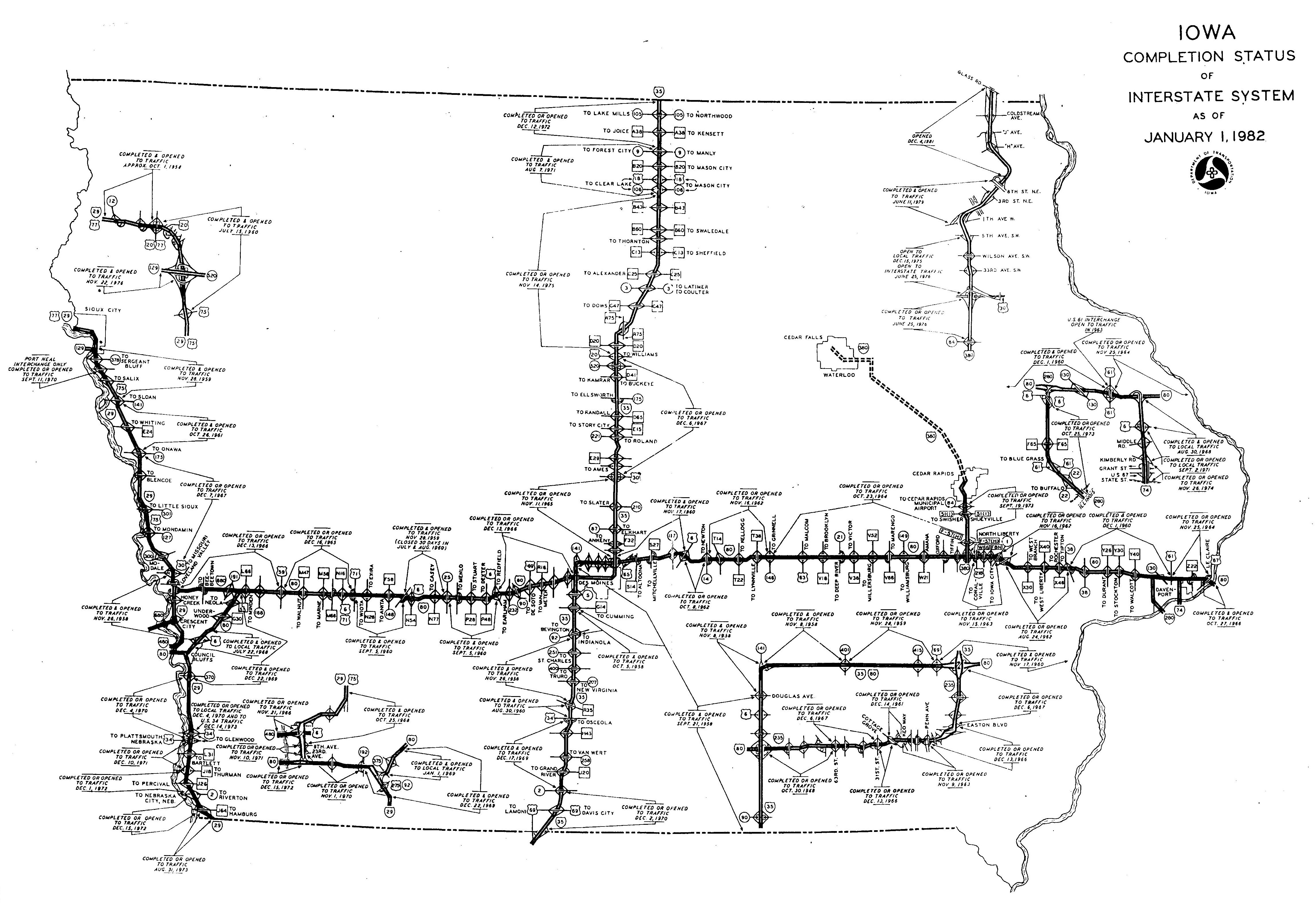
Interstate 480 between the Nebraska-Iowa State Line and I-29 in Council Bluffs opened on November 12, 1966.1 This included the 1,687 foot long Glenville Dodge Memorial Bridge.2 The eight lane steel plate girder bridge connected with the U.S. 6 couplet of Dodge Street west and Douglas Street east.
Bids for construction on the first leg of Interstate 480 in Omaha were received by Nebraska Department of Roads (NDOR) in 1960.3 The loop around Downtown Omaha in Nebraska was finished in 1970.4
The previous three wye interchanges joining Interstate 80 with both I-480 north and U.S. 75 (Kennedy Freeway) south were redesigned to eliminate left exit ramps and weaving traffic as part of a ten year, $320 million overhaul of I-80 across Omaha. Work started in April 1989 and was scheduled to wrap up in Fall 1993. Record rains during Spring and Summer 1993 delayed the project to a June 1994 completion. A portion of Interstate 480 was also expanded from four to eight lanes.5,6
Construction in 2001-02 demolished the 13th Street entrance ramp to I-480 west and replaced it with a new ramp from Cass Street that opened on December 27, 2002. Adjacent work realigned the 14th Street on-ramp to eastbound. The changes were made as part of the $280 million work for the adjacent convention center.7,8
Further west, where Interstate 480 meets the North Freeway (U.S. 75), a planned three and a half year project kicked off on July 18, 2005 to rebuild the exchange by Gifford Park. The $45 million project, delayed from a planned Fall 2004 start due to a lack of funding, focused on redesigning the interchange. Work realigned I-480 so that it travels through the junction seamlessly on new roadways, removed unused ramps built for the scuttled West Freeway, and replaced the remaining bridges and pavement.9,10
The West Freeway was formally canceled due to neighborhood opposition in 1973.12 It was proposed as a limited access route parallel to U.S. 6 (Dodge Street) through the Cathedral, Dundee and Memorial Park neighborhoods to Interstate 680. Ramps for the freeway opened in 1971 as local connectors from I-480 west to 30th and Chicago Streets and from Davenport at 31st Streets to I-480. These ramps eventually closed in 1984.9
Throughout the project to rebuild the North Freeway-Interstate 480 interchange, detours were in effect as various ramps were closed or replaced. Work removed seven bridges and built 13. The 30th Street on-ramp to the North Freeway (U.S. 75) also closed permanently due to safety concerns with the left side merge.11
Construction progressed through 2007, when funding issues arose due to revenue shortages for the Federal Highway Trust Fund. Phase two work completed by December 2008 included improvements to I-480 east and U.S. 75 north, with the on-ramps from Dodge and Cuming Streets built last. Work on I-480 west and U.S. 75 south was initially pushed back to 2011 as costs for the project increased to $52 million.12
Thanks to stimulus funding from the American Recovery and Reinvestment Act (ARRA), construction on the third and final phase of the US 75 / I-480 Interchange Project commenced in September 2009. The abandoned westbound on-ramp from I-480 to Davenport Street over 30th Street was demolished in November 2009.13, with the remaining work finished in December 2010. As the project neared completion, 2011 construction included incidental work along the ramps with 30th Street and the westbound mainline of I-480 through the interchange.14
Route Information
Nebraska – 4.15
Cities – Omaha
- Junctions –

Iowa – 0.75
Cities – Council Bluffs
- Junctions –
Source: December 31, 2021 Interstate Route Log and Finders List
I-480 Annual Average Daily Traffic (AADT)
Source: Nebraska Department of Transportation (NDOT) 2016 Statewide Traffic Flow Map
IowaDOT Traffic Flow Map of Council Bluffs – 2016 Annual Average Daily Traffic
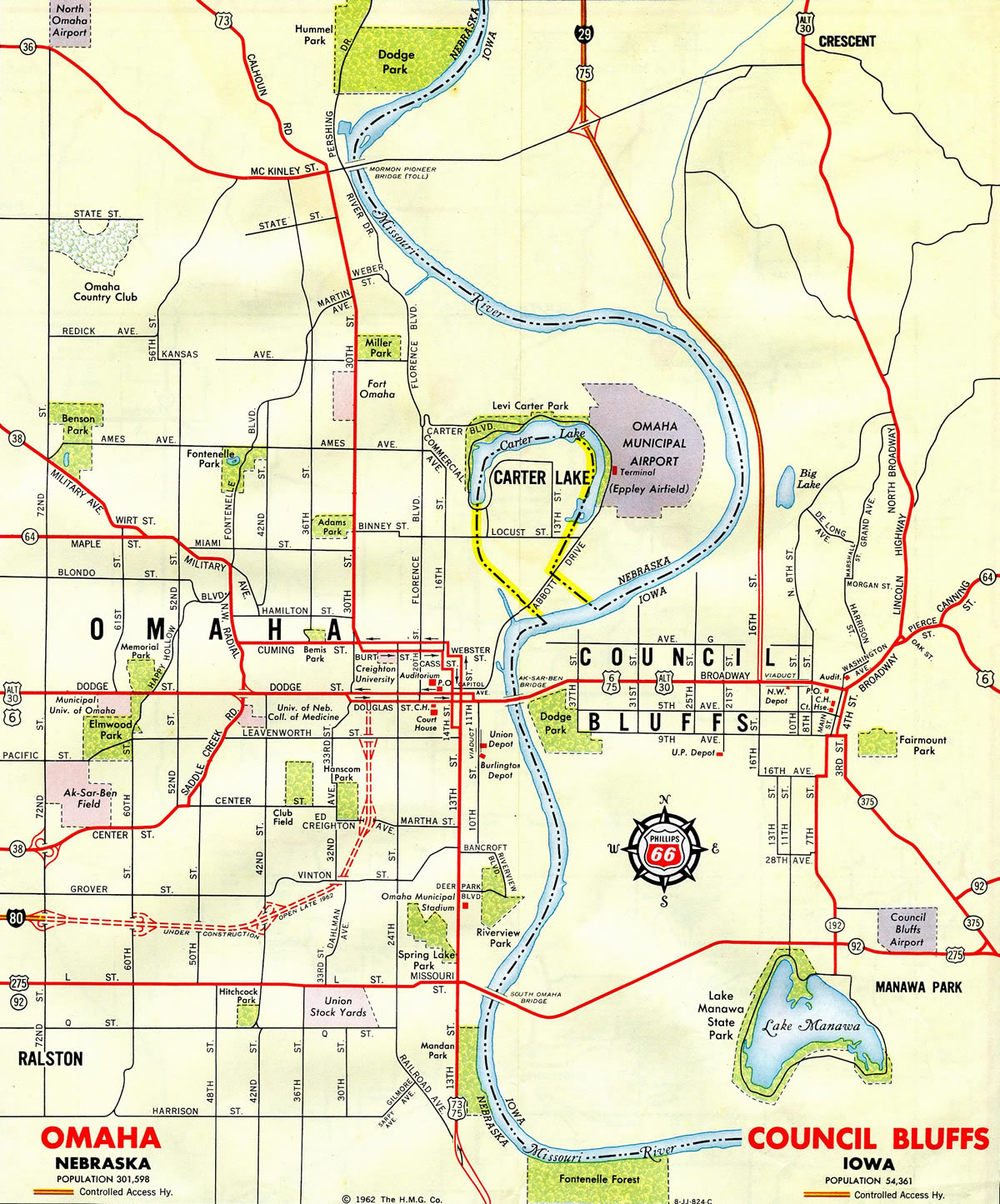
The Ak-Sar-Ben Bridge, which is Nebraska spelled backwards, carried U.S. 6, U.S. 75 and U.S. 30 Alternate across the Missouri River between Downtown Omaha and Council Bluffs until 1966. The two lane steel truss bridge was replaced by the Glenville Dodge Memorial Bridge and demolished by 1968.
I-480 was finished two years prior to the opening of the Missouri River Bridge along Interstate 80.
Interstate 480 Extension
Disputes in 1999 over the replacement of the Missouri River bridge (U.S. 34) at Plattsmouth led to an extensive proposal made by U.S. Representative Doug Bereuter R-Nebraska for an extension of Interstate 480 south. The new route would take I-480 along the Kennedy Freeway south past Bellevue to a new alignment east across the Missouri River to I-29 near Glenwood, Iowa. The loop would be built in addition to a replacement span for the U.S. 34 toll bridge at Plattsmouth.15
The Iowa Department of Transportation did not support this plan and instead favored rerouting U.S. 34 to the north and redesignating the former alignment into Plattsmouth as a local route. The 1995 costs for the two bridges were $40 million for the new four lane Sarpy bridge and $20 million for the replacement of the Plattsmouth toll bridge. City of Bellevue officials believed that the Bereuter plan involving I-480 would increase costs of the project by $10 million.16
State and federal lawmakers agreed on a single plan to build the two bridges in Sarpy and Cass Counties at a meeting at Plattsmouth City Hall held on May 13, 2000. The new four lane span in southern Sarpy County would become part of a new alignment for U.S. 34, and the replacement for the toll bridge at Plattsmouth would be part of U.S. 34 Business. Bereuter would support the realignment plan if the Cass County bridge was designated as a U.S. 34 business route. The realignment of U.S. 34 was sought by Iowa officials due to funding requirements.17
Construction on the $61 million Missouri River bridge for U.S. 34 broke ground in September 2010. Coupled with the approaches, the new alignment cost $115 million, with the federal government paying for 80 percent of the cost. The 3,276 foot long bridge was dedicated on October 22, 2014. It connects with a nearly 7 mile long stretch of divided highway slated for future economic development.18
The Plattsmouth toll bridge was not replaced and instead was purchased by the city of Plattsmouth from the Plattsmouth Bridge Company in 2007 for $1. The 1929 opened, 402 foot long cantilevered truss bridge was refurbished in 2008.18 It is not designated as U.S. 34 Business and instead carries County Road L35 in Iowa and no designation in Nebraska.
East End  – Council Bluffs, Iowa
![]()
![]() East at
East at ![]()
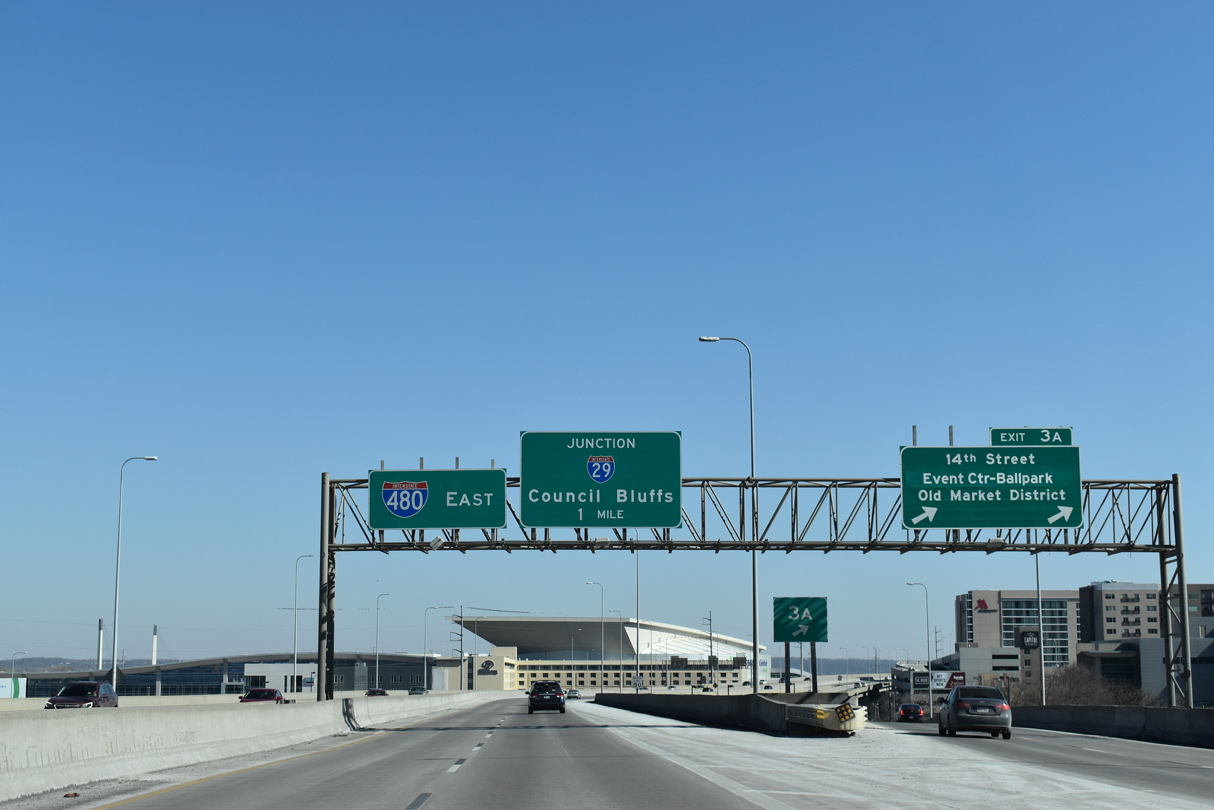
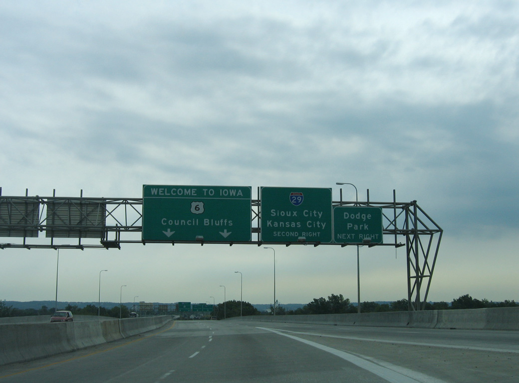
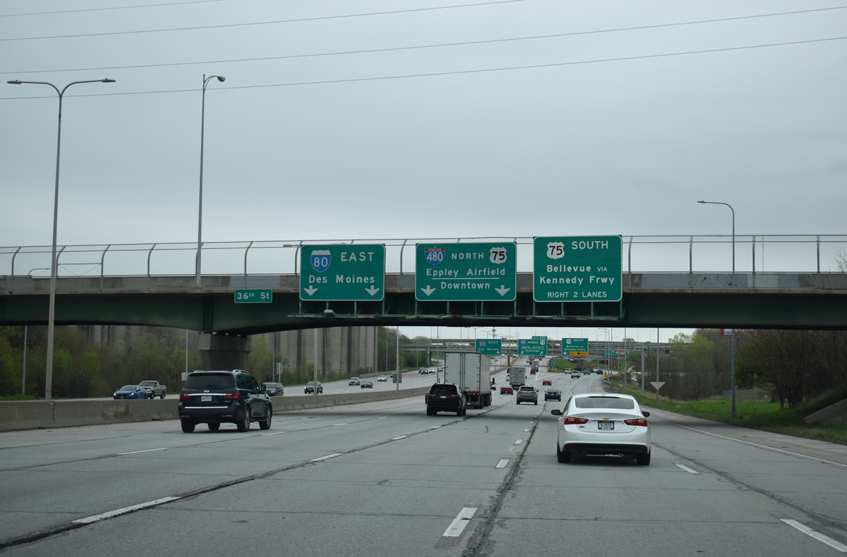
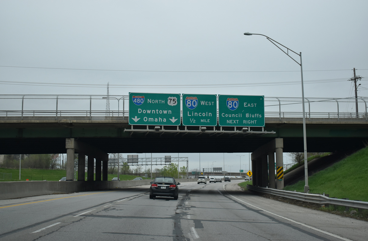
Exit 3A drops from the I-480 viaduct onto 14th Street in Omaha as the Gerald Ford Freeway shifts southeast to combine with U.S. 6 across the Glenville Dodge Memorial Bridge. CHI Health Center Omaha, an indoor sports and concert venue, rises just east of the elevated roadway. 02/22/20
U.S. 6 combines with Interstate 480 east from Douglas Street to cross the Missouri River into Iowa. Prior to 2016, U.S. 6 extended beyond the freeway end at I-29 onto Broadway through Council Bluffs. 02/22/20

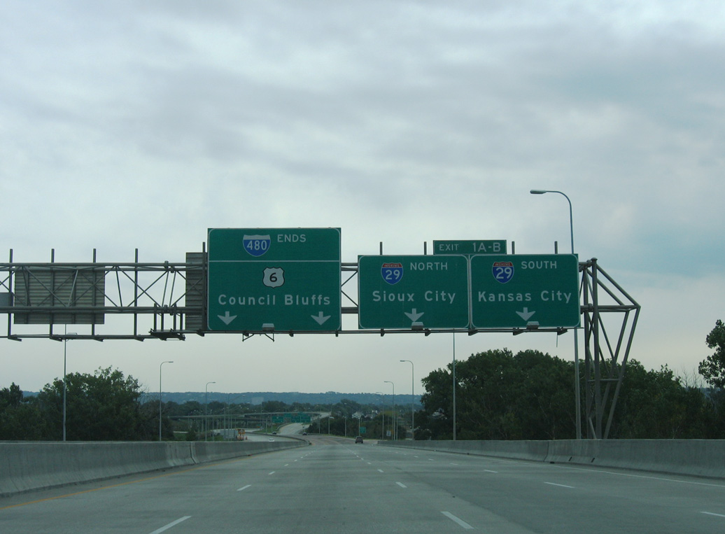
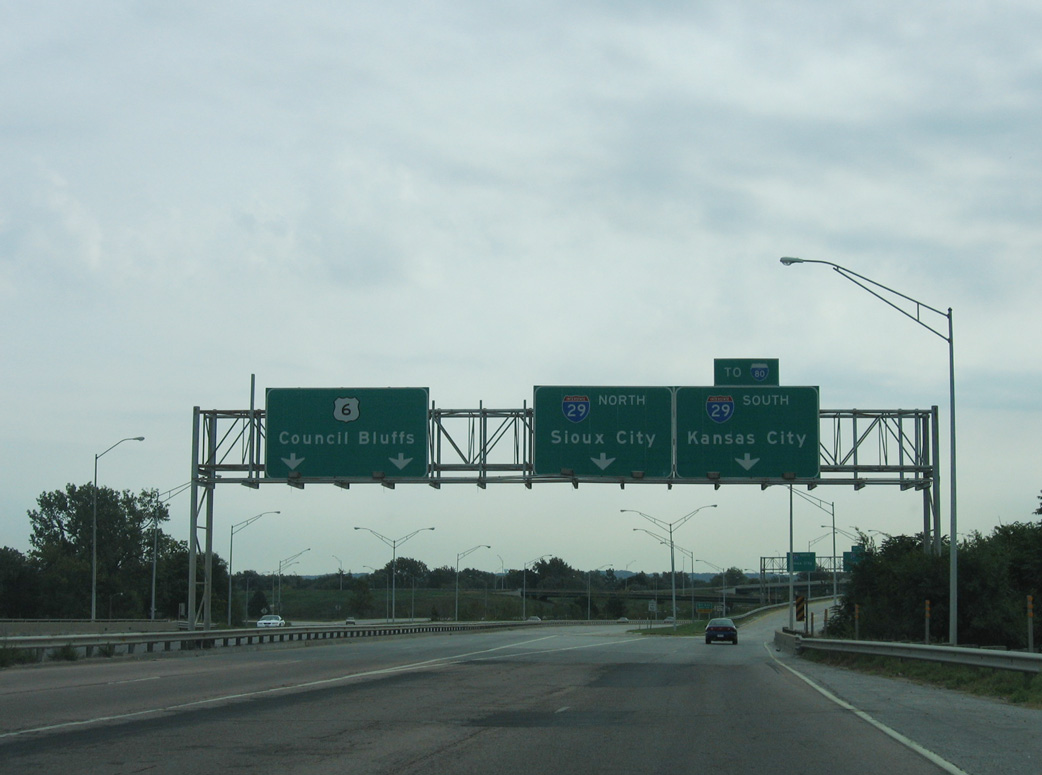
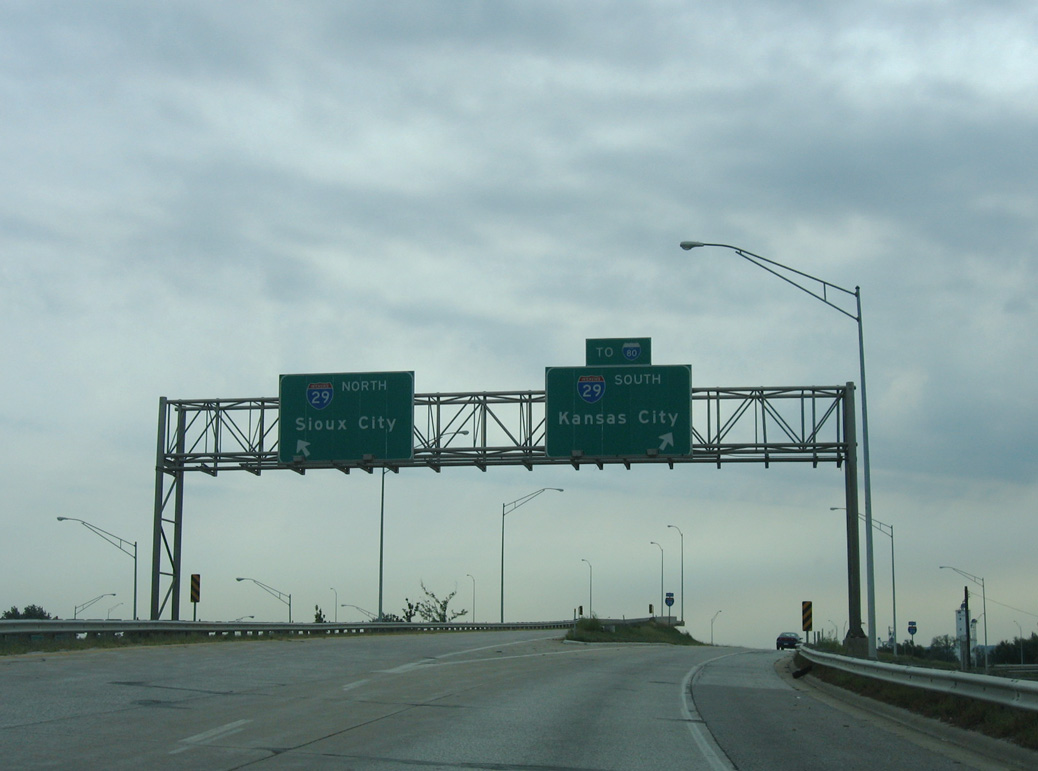
Interstate 480 ends at a directional T interchange with I-29. Two lanes depart for Sioux City and St. Joseph, Missouri while the mainline previously defaulted onto West Broadway. 2020-23 construction eliminated the freeway spur to Broadway. 02/22/20

Traffic separated for Broadway (former U.S. 6) east toward Downtown Council Bluffs and I-29. U.S. 6 combines with I-29 south two miles to I-80, where it turns east to bypass Council Bluffs. I-29 extends 183 miles southeast to Kansas City. 02/22/20
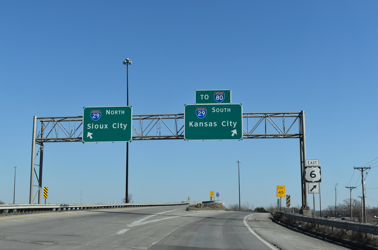
The east end of I-680 ties into I-29 at Crescent in eight miles. Sioux City is another 85 miles to the north. With approval by AASHTO on May 25, 2016, U.S. 6 was realigned 4.71 miles along I-29 south and I-80 east. 02/22/20
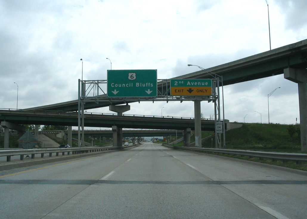
The freeway spur to Broadway (old U.S. 6) concluded with a ramps connecting eastbound with 2nd Avenue at 36th Street and to westbound from Avenue A west. This ramp system was removed during the 2020-23 I-29/I-480 Interchange Project. Broadway extends east along a commercial boulevard to Kanesville Boulevard by Downtown Council Bluffs. Photo by Steve Hanudel (05/15/06).
![]() South at
South at ![]()
![]()
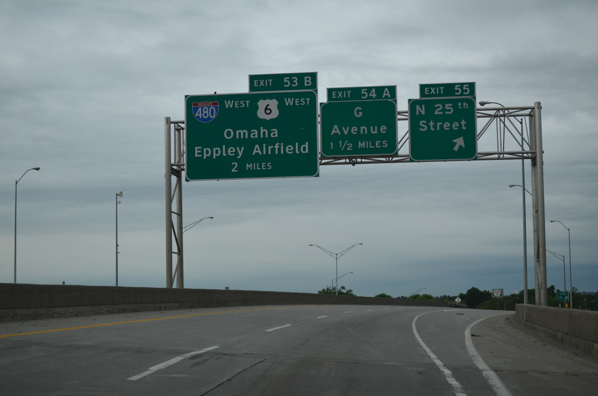
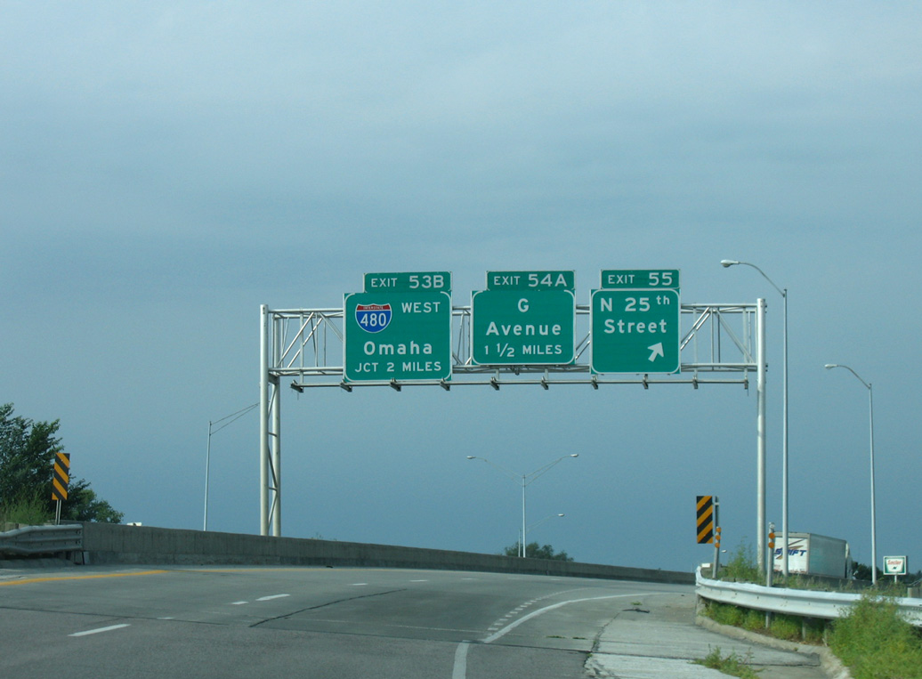
Interstate 29 encircles Council Bluffs from Exit 56 to I-80 by the east end of the Missouri River Bridge. Advancing toward I-480/U.S. 6, the freeway runs west along the Missouri River levee system from N 25th Street to G Avenue. 06/18/15
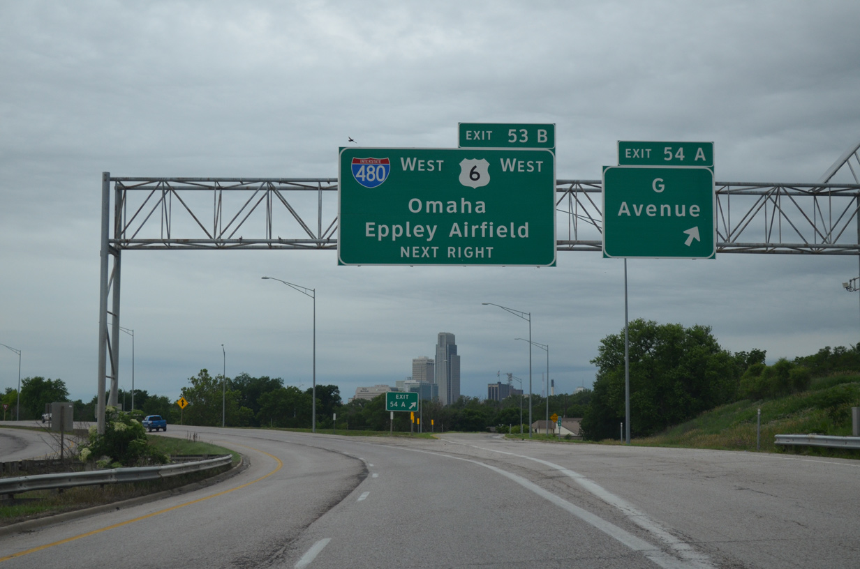
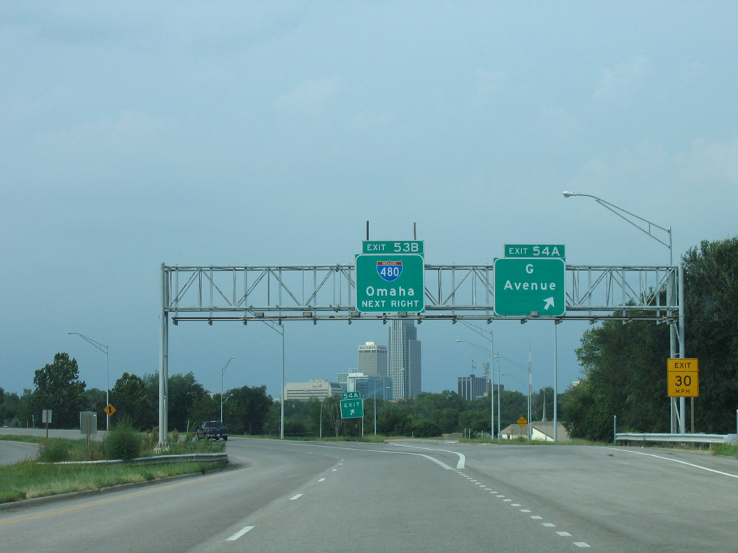
The Omaha skyline comes into view just ahead of the directional T interchange (Exit 53B) with I-480/U.S. 6 west as Exit 54A departs from I-29 south for G Avenue. 06/18/15
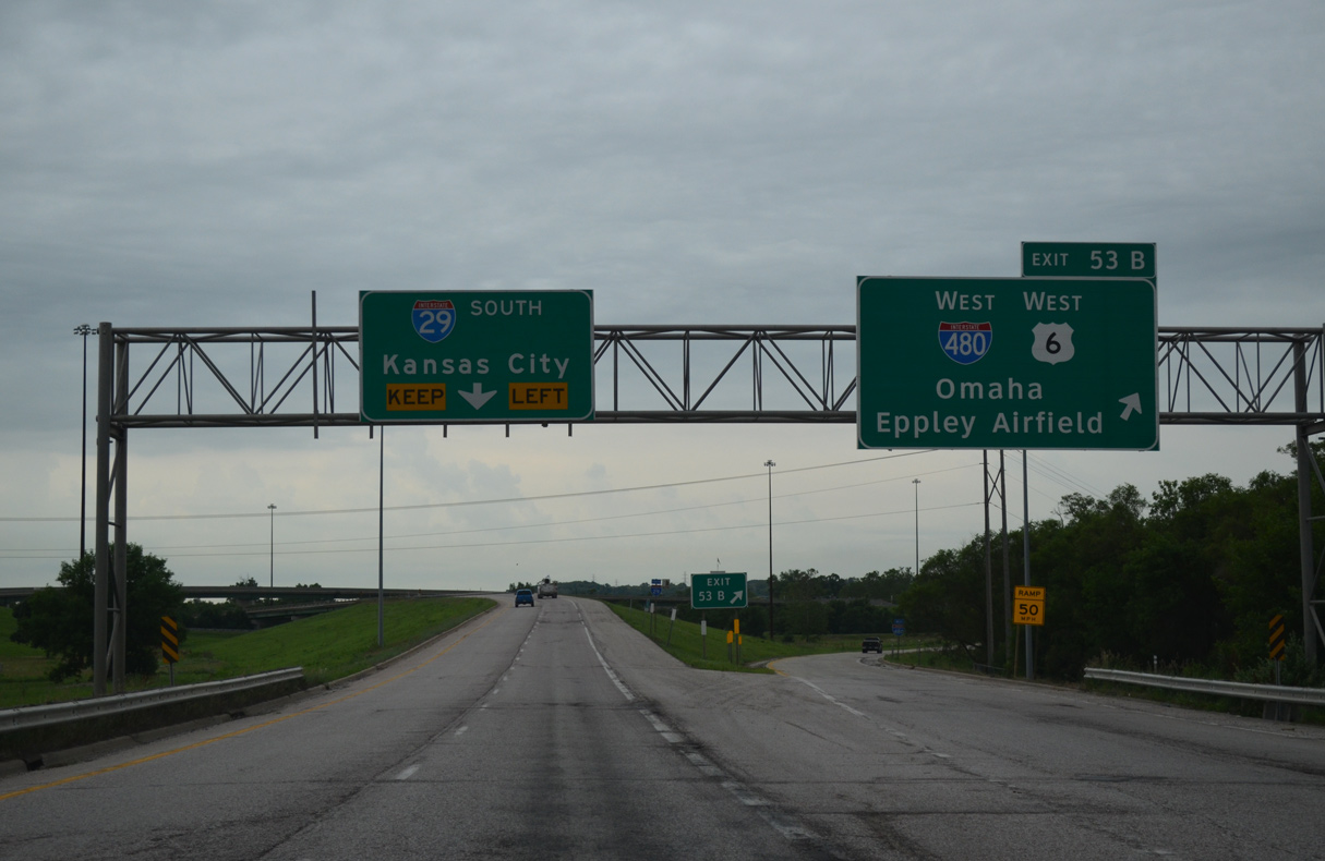
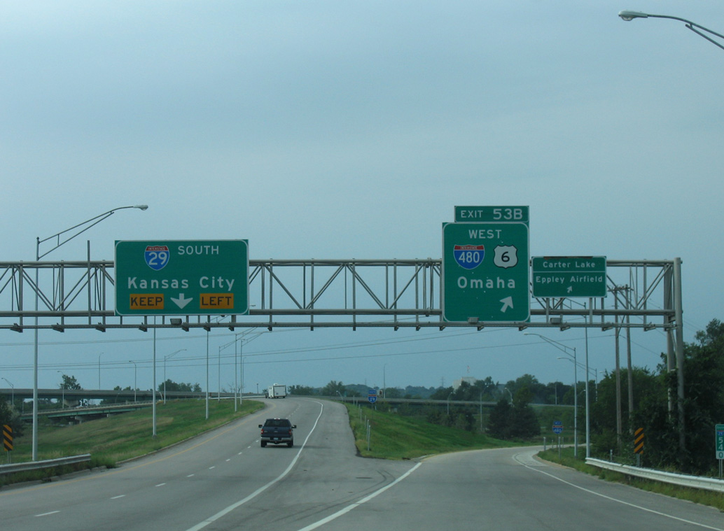
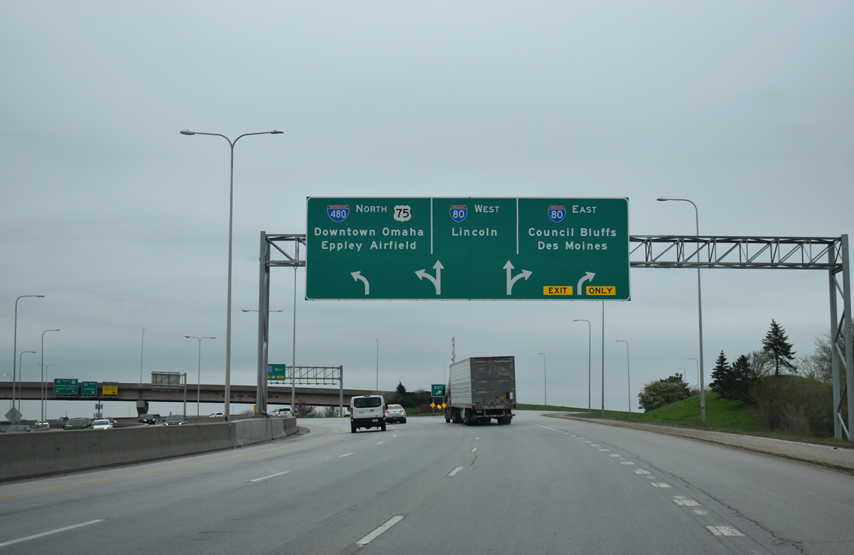
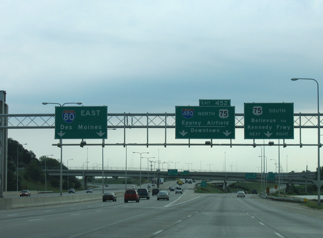
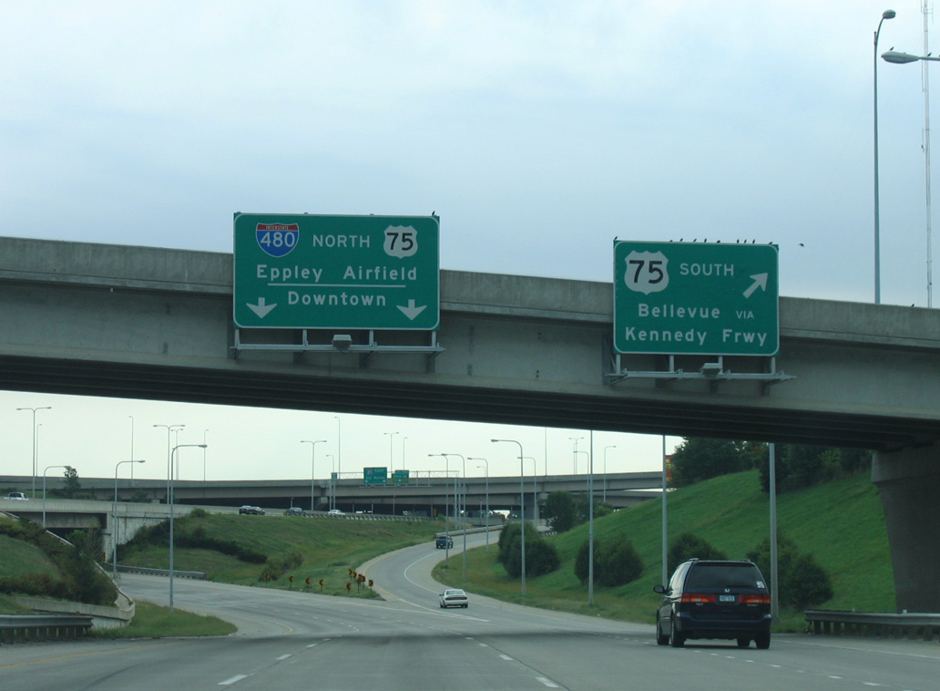
Exit 53B leaves I-29 south for I-480/U.S. 6 west across the Glenville Dodge Memorial Bridge into Downtown Omaha. I-480 connects with U.S. 75 (North Freeway) north toward Eppley Airfield (OMA) in 2.5 miles. 06/18/15
![]() North
North ![]() West at
West at ![]()

The first sign for Interstate 480 west along I-29 north / U.S. 6 west appears at the folded diamond interchange (Exit 52) with Nebraska Avenue to the riverboat casino complex off River Road. 02/20/20
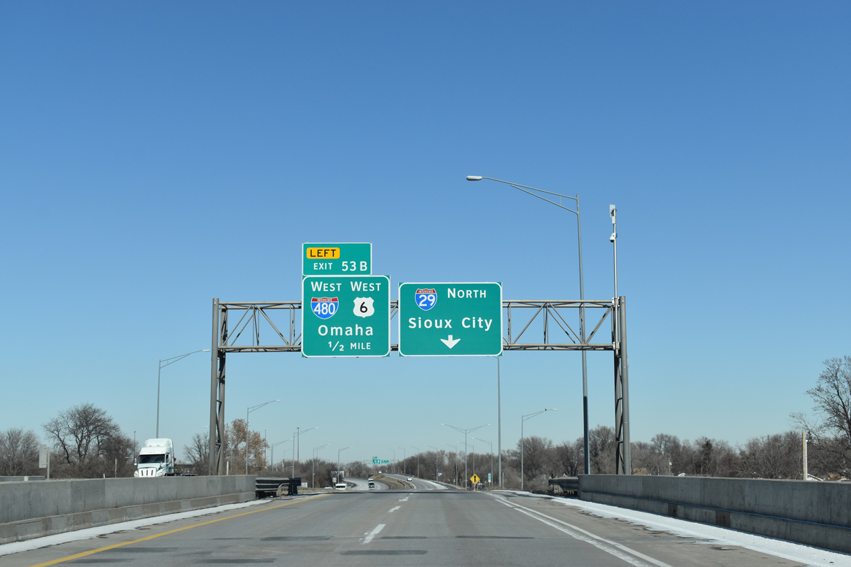
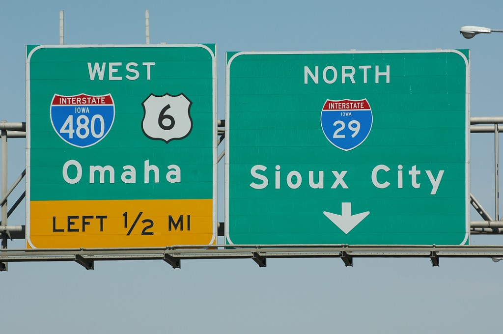
U.S. 6 west combines with I-480 west into Nebraska a half mile north of 9th Avenue along I-29 at Left Exit 53B. 02/20/20

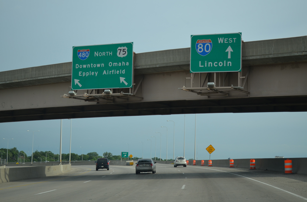
U.S. 6 overlaps with I-480 west to the couplet of Dodge and Douglas Streets through Downtown Omaha. I-480 combines with U.S. 75 south at the North Freeway in 2.5 miles. 02/20/20
 East End Throwback
![]()
![]() East at
East at ![]()
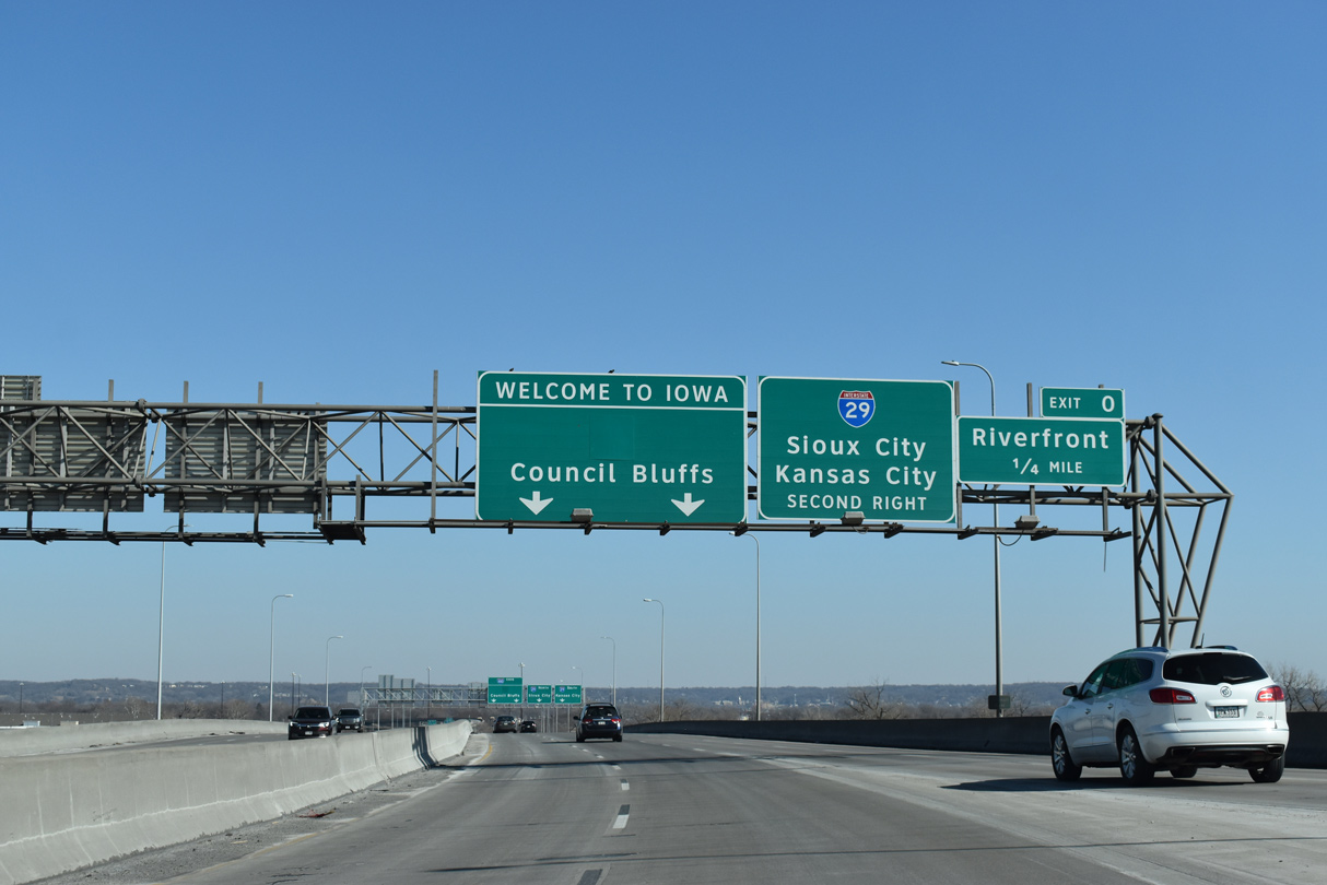
Although still in Nebraska, this set of signs was replaced by IowaDOT to use Clearview font. Dodge Park was switched out with a panel for Exit 0 to the Riverfront. 09/05/05
Sign changes made by 2014 on the Glenville Dodge Memorial Bridge removed the exit numbers for Interstate 29. 09/05/05
These signs were also replaced by 2014 to use Clearview font. The I-80 tab for I-29 south was not included. 09/05/05
Including the tab referencing I-80, the overheads posted at the ramp partition for Interstate 29 north to Missouri City and south to Glenwood were carbon copied by 2014. 09/05/05
![]() South at
South at ![]()
![]()
Previous signs for Exit 53B on Interstate 29 south omitted the overlap of U.S. 6 west along I-480 between Broadway in Council Bluffs and Dodge Street in Omaha. 09/05/05
Replaced signs at the parclo interchange (Exit 54) with G Avenue. 09/05/05
U.S. 6 was referenced for I-480 west at the ramp departure of Exit 53B. There was no access to U.S. 6 east along Broadway. 09/05/05
![]() North at
North at ![]()
![]()
These signs on I-29 north at 9th Avenue were replaced with Clearview font. A Left Exit 53B tab was included for I-480/U.S. 6 west. Photo by Jeff Royston (03/16/05).
South End – Omaha, Nebraska
![]()
![]() South at
South at ![]()
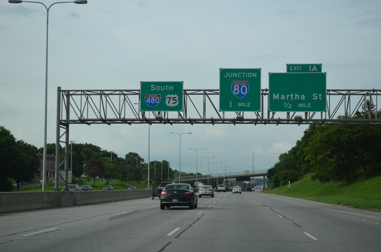
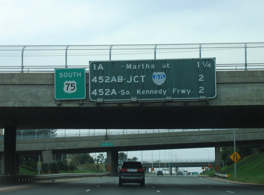
Heading south by the Columbus Park neighborhood, I-480/U.S. 75 meet Martha Street (former N-38) at Exit 1 A and reach Interstate 80 in one mile. 06/18/15
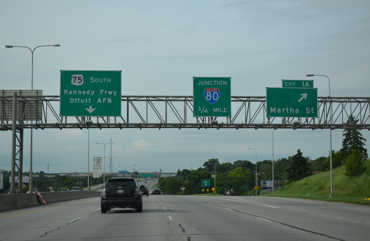
Entering the diamond interchange with Martha Street on I-480/U.S. 75 south at the Hanscom Park neighborhood. U.S. 75 transitions into the Kennedy Freeway in 0.75 miles.
N-38 was decommissioned on January 1, 2003 when the route was turned over to the city of Omaha.20 06/18/15
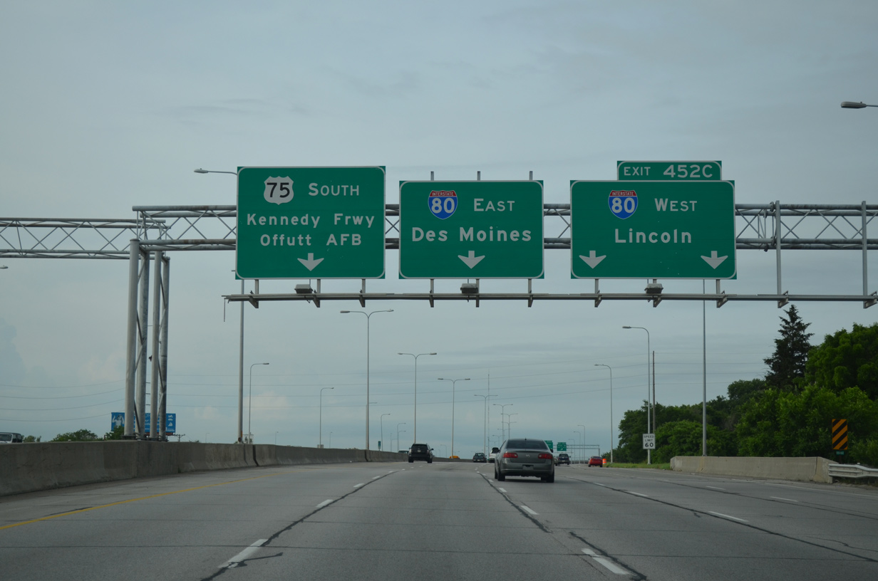
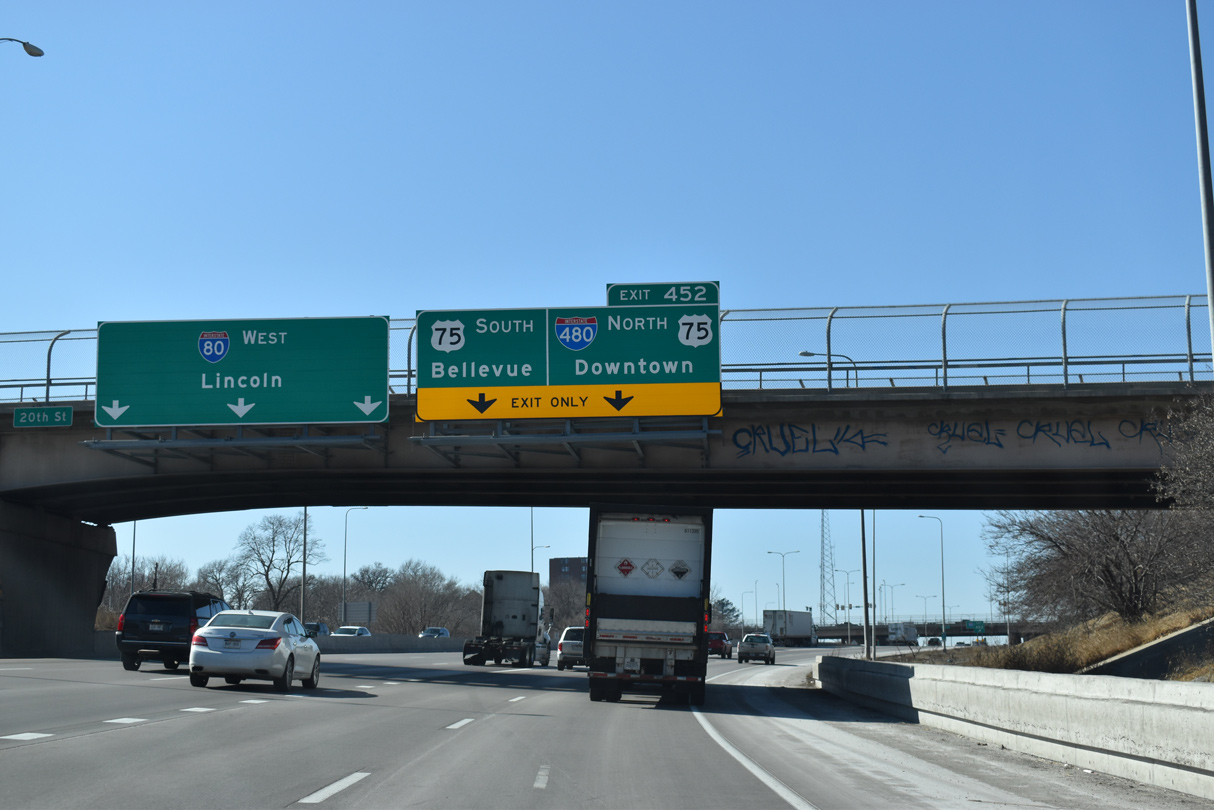
Two lanes depart next for Interstate 80 west to Lincoln. Using the mileage from I-80, this is the only connection assigned an exit number from I-480 south. 06/18/15
Exit 452 C parts ways with U.S. 75 south as Interstate 480 ends. U.S. 75 travels high above I-80 to the Kennedy Freeway, which winds southeast to Spring Lake and Brown Park through south Omaha. 06/18/15
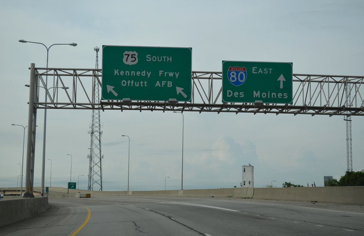
A high flyover departs for Interstate 80 east through the Deer Park neighborhood to Council Bluffs, Iowa. U.S. 75 continues south ten miles to combine with U.S. 34 between Offutt Air Force Base and Plattsmouth. 06/18/15
![]() East at
East at ![]()
![]()
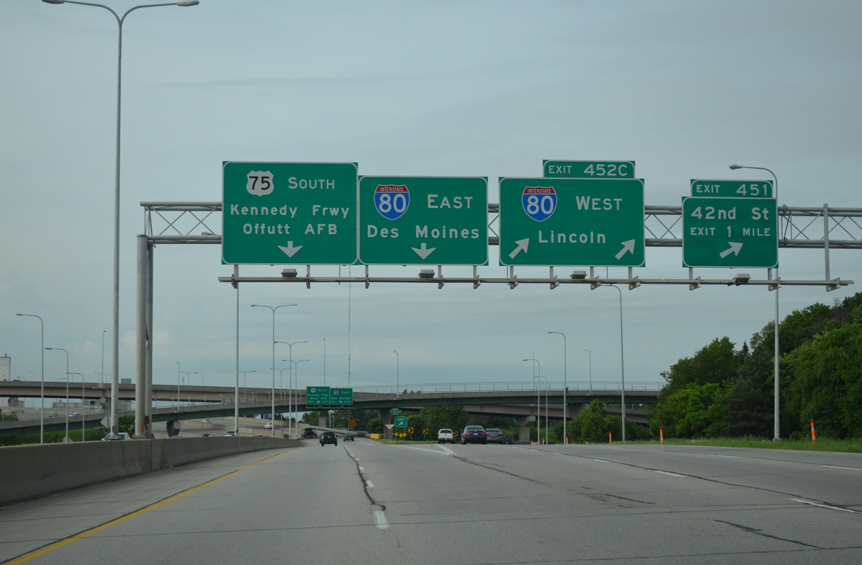
Advancing to 42nd Street alongside the Robin Hill neighborhood of Omaha, Interstate 80 is 1.5 miles out from the exchange with both I-480/U.S. 75 north and the Kennedy Freeway (U.S. 75) south. 05/08/22
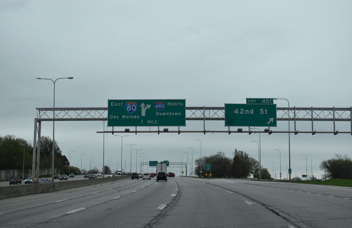
Exit 451 departs I-80 east for 42nd Street north to Hanscom Park and south to the Burlington Road neighborhood. A diagrammatic sign outlines the forthcoming partition of Exit 452 for I-480 north. 05/08/22
Interstate 480 and U.S. 75 combine northward from I-80 to the North Freeway, which joins Downtown with Eppley Airfield (OMA) and Florence. 05/08/22
With auxiliary lanes, Interstate 80 expands to 12 overall lanes between 42nd Street and the three wye interchange (Exit 452) with I-480/U.S. 75 north. 05/08/22
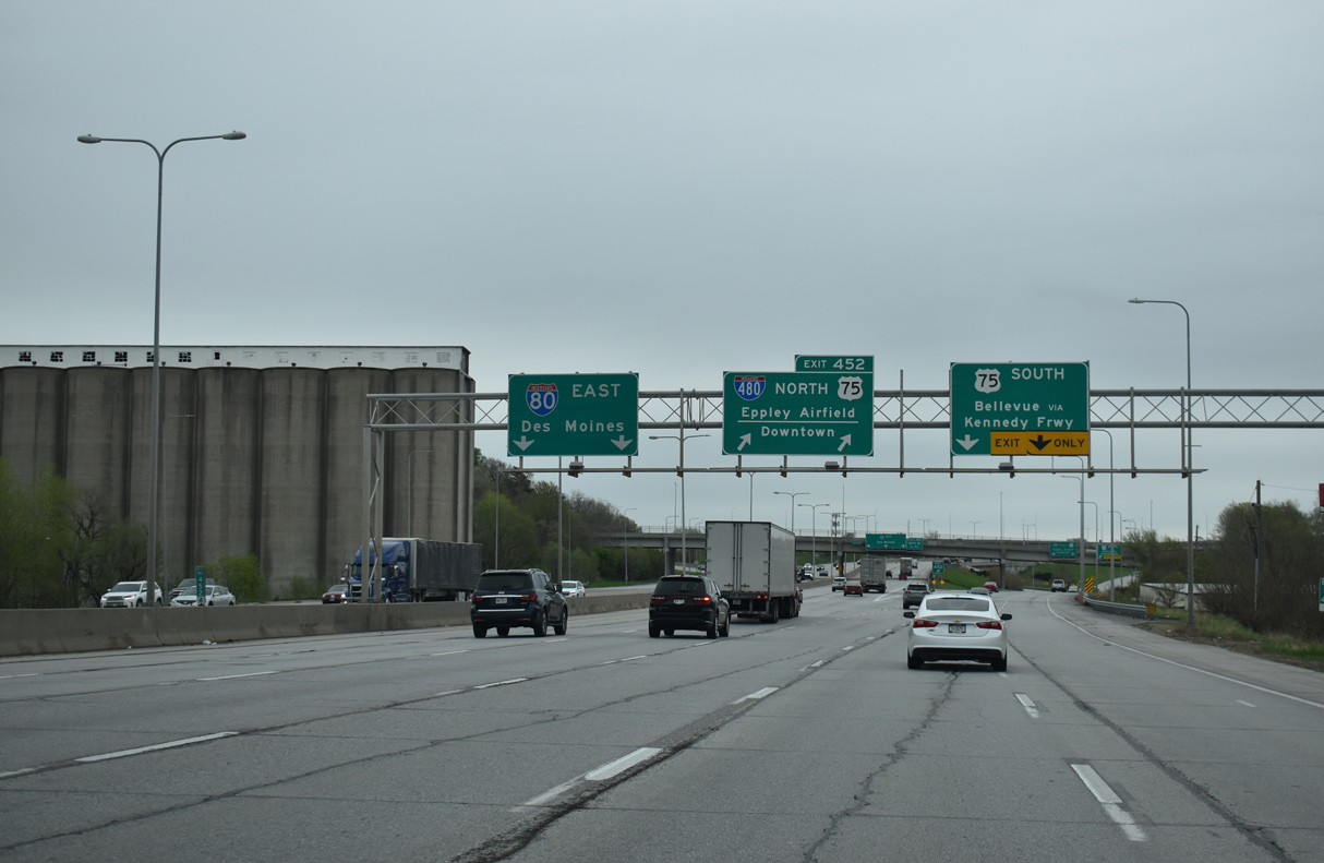
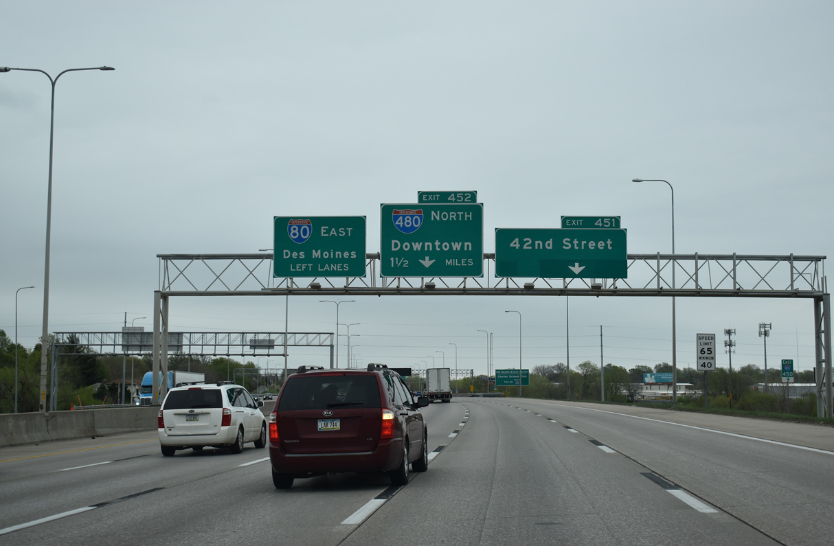
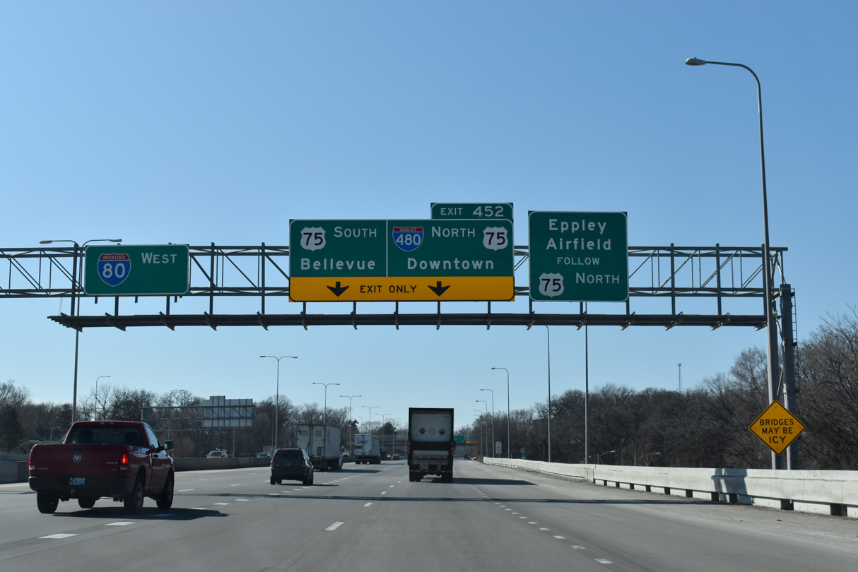
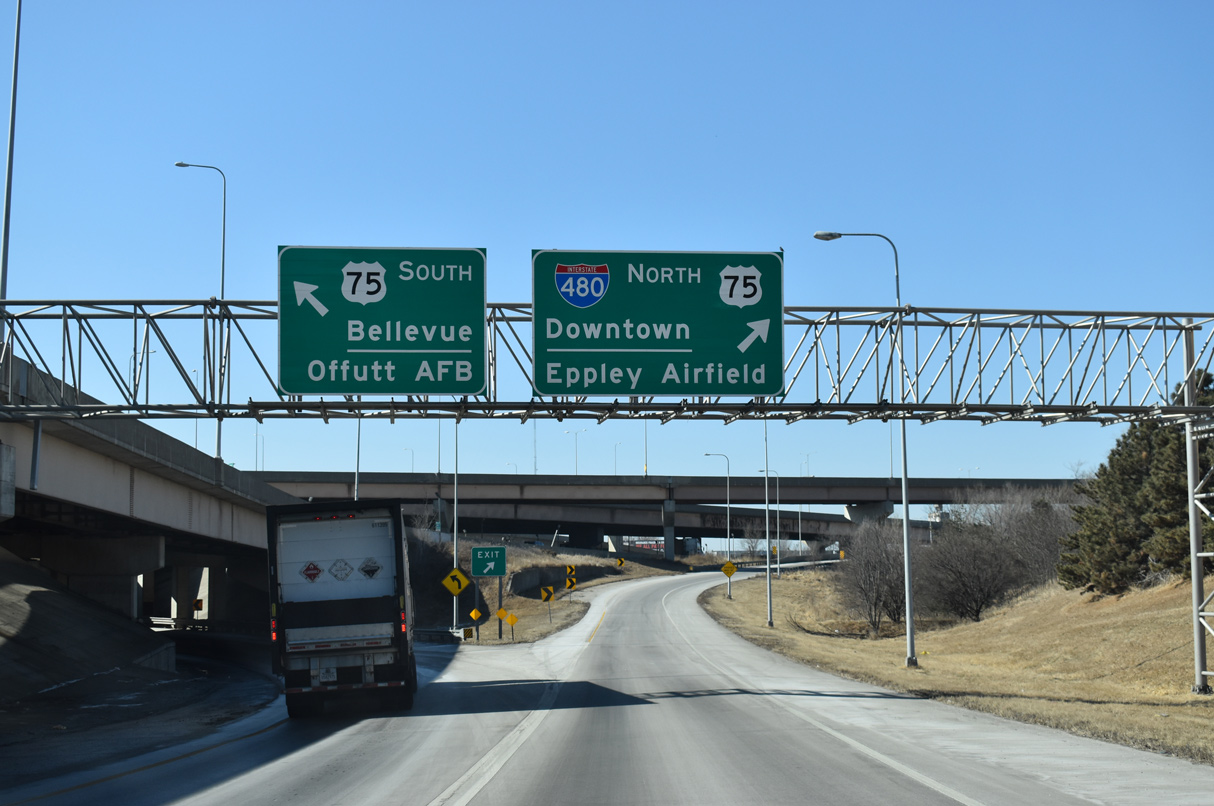
Traffic bound for I-480/U.S. 75 north to Downtown and the adjacent three-wye interchange with U.S. 75 (Kennedy Freeway) south to Bellevue departs in unison at Exit 452. 05/08/22
Exit 452 partitions with three lanes joining I-480/U.S. 75 north to Downtown Omaha and two lanes for U.S. 75 along the Kennedy Freeway south to Bellevue and Offutt AFB. 05/08/22
![]() West at
West at ![]()
![]()
Traveling west through the Deer Park neighborhood, I-80 meets 13th Street prior to the overlapping three wye interchanges (Exit 452) with U.S. 75 (Kennedy Freeway) south and I-480/U.S. 75 north. Prior to 1989, a second local exit departed just ahead for 24th Street. 02/22/20
Westbound I-80 previously reduced to a single lane through the exchange with U.S. 75 and I-480 north. Completed in 1994, construction added high speed flyovers and removed left exit ramps while expanding the I-80 mainline to four overall lanes. 02/22/20
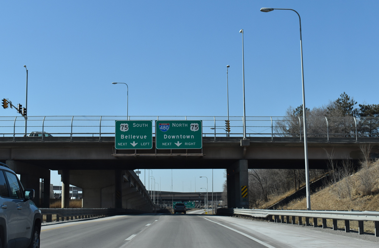
A half diamond interchange adds traffic to I-80 west from 24th Street as Exit 452 lowers toward the ramp separation for the Kennedy Freeway south to Bellevue and Offutt AFB and I-480/U.S. 75 north to Downtown and Eppley Field (OMA). 02/22/20
Originally named the South Freeway, the limited access highway carrying U.S. 75 through the Spring Lake and Highland South neighborhoods replaced 13th Street and Railroad Avenue as the alignment for U.S. 73/75. 02/22/20
![]() North at
North at ![]()
![]()
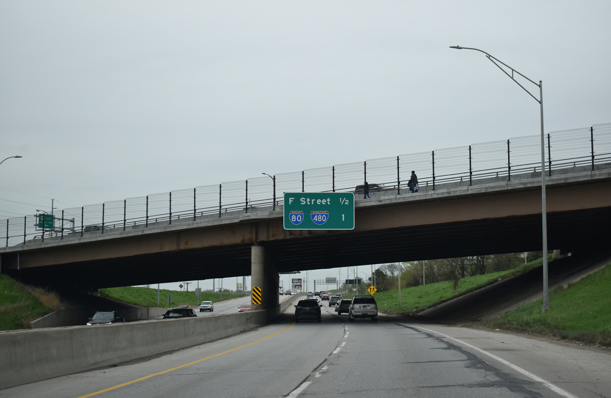
A diamond interchange joins U.S. 75 (Kennedy Freeway) with F Street and the Spring Lake neighborhood just south of the three-wye interchange with Interstate 80. 05/08/22
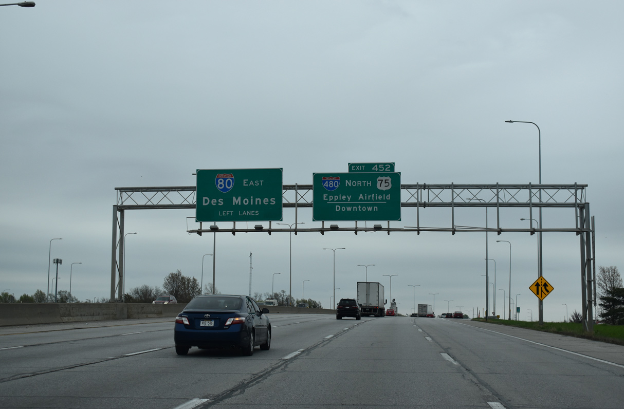
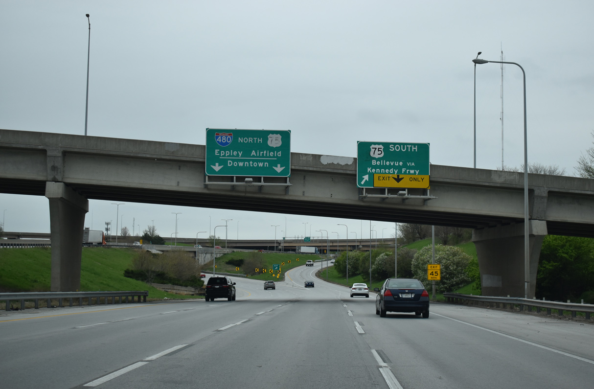
Northbound U.S. 75 transitions from the Kennedy Freeway onto I-480 as the eastbound off-ramp for I-80 departs. 05/08/22
Prior to the 1989-94 rebuild of this interchange, a left exit ramp connected U.S. 75 north with I-80 west adjacent to a folded diamond interchange with 24th Street. 05/08/22
A new sign bridge with an arrow per lane (APL) overhead replaced this assembly at I-80 east by 2021. 02/22/20
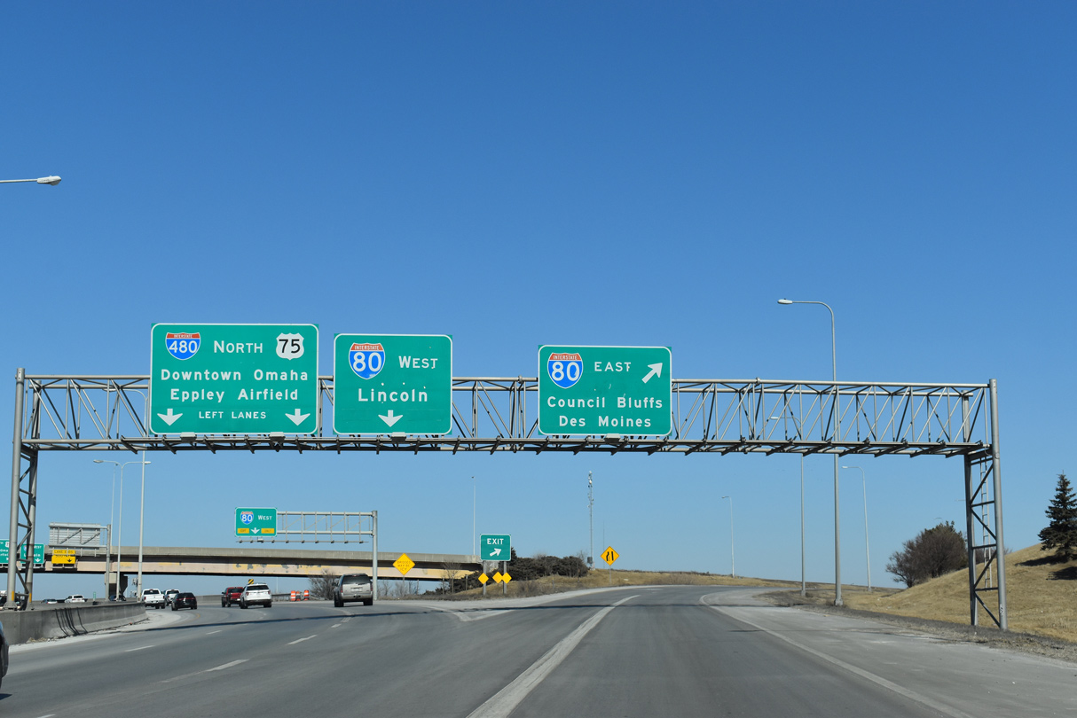
Two lanes separate for both I-480/U.S. 75 north to Downtown and Eppley Field (OMA) and I-80 west to Lincoln. All roadways and ramps are elevated due to the Union Pacific Railroad tracks below. 06/18/15
South End Throwback
![]()
![]() South at
South at ![]()
Non reflectorized interchange sequence sign at the Farnam Street overpass, two miles north of Interstate 80. The replacement made by 2008 did not retain the associated exit numbers. 09/05/05
Guide signs for Exit 452 were both replaced by 2009 when a fourth exit lane was added for U.S. 75 (Kennedy Freeway) south. 09/05/05
The ramp from Interstate 80 east to U.S. 75 (Kennedy Freeway) south was expanded to two lanes in 2008. 09/05/05
Sources:
- Iowa Completion Status of Interstate System as of January 1, 1982. Iowa Department of Transportation.
- Grenville Dodge Memorial Bridge, Johnweeks.com.
- 50 Years of Interstate – Nebraska and the Nation.
- “Coming in 2002: New 13th Street ramp to I-480.” Omaha World-Herald (NE), October 9, 2001.
- “Major Highway Interchange Nears Completion Interstate Engineer Hopes for No Repeat Of Wet ’93 Summer.” Omaha World-Herald (NE), January 2, 1994.
- “Kennedy – Interstate 80 – 480 Interchange Work.” Omaha World-Herald (NE), June 29, 1994.
- “13th Street ramp to I-480 opening The street, north of Capitol Avenue to the ramp, should open by midday Friday.” Omaha World-Herald (NE), December 25, 2002.
- “OMAHA TIME CAPSULE.” Omaha World-Herald (NE), November 23, 2011.
- “Freeway rebuilding will mean slow going.” Omaha World-Herald (NE), October 13, 2003.
- “Work slated for downtown freeway – Rebuilding I-480/U.S. 75 (North Freeway) interchange.” Omaha World-Herald (NE), February 14, 2005.
- “Freeway junction work to begin – Ramp closures – Rebuilding I-480/U.S. 75 (North Freeway) interchange.” Omaha World-Herald (NE), July 16, 2005.
- “Interstate plans hit 2-year snag – Work on the I-480 interchange is delayed until 2011; a lack of federal funds also affects Lincoln and Grand Island projects.” Omaha World-Herald (NE), December 5, 2008.
- “Celebrate demise of ‘bridge to nowhere’.” Omaha World-Herald (NE), December 5, 2008.
- US 75 / I-480 – Interchange Project
http://www.nebraskatransportation.org/projects/480-75/index.htm, NDOR Project Web Site, Updated January 2011. - “Bereuter Proposes 2 Missouri Bridges.” Omaha World-Herald (NE), September 20, 1999.
- “Plans for Bridges Keep Falling Dow.” Omaha World-Herald (NE), February 20, 2000.
- “Agreement Reached On Bridges Nebraska and Iowa can now go after funding for spans across the Missouri River in Cass and Sarpy Counties.” Omaha World-Herald (NE), May 17, 2000.
- “New bridge gives Nebraska drivers another link to I-29.” Omaha World-Herald (NE), October 21, 2014.
- “Changes to Council Bluffs Interstate interchange may be around the bend.” Omaha World-Herald (NE), March 15, 2016.
http://www.northernplainshighways.org/ nebraska/ne31-60.html#Old NE-38-2
Page updated February 27, 2024.