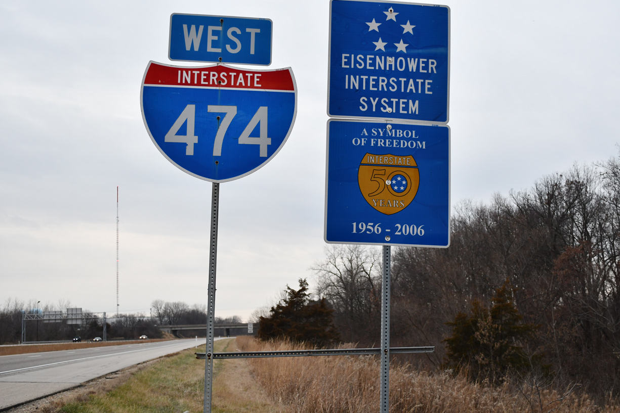
Interstate 474 Illinois
Overview
Interstate 474 provides a bypass of Peoria and East Peoria while serving General Wayne A. Downing Peoria International Airport (PIA) and the suburbs of Bellevue, Bartonville, Creve Coeur, Marquette Heights and North Pekin. I-474 ties directly into IL 6, a freeway spurring 10.10 miles north to Mossville. The south end connects with I-74 near the north end of I-155 at Morton. I-474 spans the Illinois River across the Shade-Lohmann Bridge, a pair of 3,420 foot long steel through truss bridges.
Eastern Bypass
Plans for the Eastern Bypass Project, a limited access extension of IL 6 east across the Illinois River at Mossville and southeast to East Peoria, would complete a full beltway of Peoria in conjunction with Interstate 474. The bridge and remaining freeway miles were initially estimated to cost $800 million. The passage of SAFETEA-LU in 2005 appropriated $2.4 million for design, engineering, and land acquisition for the eventual corridor. A corridor study for the beltway followed.1
Directed by the Illinois Department of Transportation (IDOT), Phase 1 (Corridor Selection and Alignment) of the Eastern Bypass Project narrowed a list of 20 potential corridors to 14 then six. Input from the Community Advisory Group (CAG) subsequently reduced the number to four. Those remaining generally traveled southeast from Mossville along a corridor east of Germantown Hills and west of Washington to varying locations along Interstate 74. The P2 alignment connected with I-74 at I-474, while M-10 and T-6 were further east near Main Street and Tennessee Avenue in Morton, leaving D-13 near Dee-Mack Road toward the village of Deer Creek. The city of Peoria passed a resolution supporting Corridor P2.2 Completion of the ring road with I-474 and IL 6 remained a regional priority as of 2015.3
A proposed “Peoria to Chicago” expressway was under consideration, with three corridors outlined in 1996. The corridor would branch north or northeast from IL 6 / Eastern Bypass to connect Peoria with I-39, I-55 or I-80. One route involved an upgrade of the IL 29 corridor northward from Mossville to I-180 while another paralleled IL 116 east to I-55 at Pontiac.4,5
Route Information
East End – East Peoria, IL
West End – Peoria, IL
Mileage – 14.88
Cities – Peoria
- Junctions –

Source: December 31, 2021 Interstate Route Log and Finders List

Construction of Interstate 474 across the Illinois River – 1971 Illinois Official Highway Map

The Shade-Lohmann Bridge opened as a local link between U.S. 24 and IL 29 in 1978. The remainder of the freeway opened the following year.
 History
Construction for Interstate 474 was underway by the early 1970s, but stopped in 1973 due to the need for an Environmental Impact Statement. Completed at the time was the Shade-Lohmann Bridge spanning the Illinois River. Work on the freeway resumed in 1976, with a 3.6 mile long stretch from U.S. 24 (McKinley Street) at Bartonville and south Peoria to IL 29 at Creve Coeur opened two years later. A dedication ceremony on August 30, 1978 opened the freeway and formally named the bridge in honor of former Pekin legislators J. Norman Shade and Martin Lohmann.6
Lohmann retired in 1952 after a 30 year career with terms in both the state House and Senate. Shade started his political career in 1908 and served in office for 40 years with terms as a state representative, Tazewell County Board and mayor of Pekin. He was a proponent for the 1930-built Pekin Bridge (IL 9) and for the construction of IL 121 (I-155). The blue paint scheme for their bridge was selected from a 1973 contest conducted by IDOT.6,7
The remainder of Interstate 474 north to IL 6 and east to I-74 at East Peoria opened to traffic on December 20, 1979. IL 6 extended the Peoria ring road north from I-74 / 474 to U.S. 150 on December 20, 1979, from U.S. 150 north to IL 40 (former IL 88) on December 28, 1982 and from IL 40 north to IL 29 on November 3, 1985.8
U.S. 24 was relocated from a route through Downtown Peoria along Adams and Washington Streets to overlap with Interstate 474 between Exits 6 and 9 by 2013. The reroute was the result of Peoria City Council actions to take over maintenance of Washington Street. While promoting development in the Warehouse District, the city planned on allowing on-street parking on both sides of the street while implementing measures to slow traffic and improve pedestrian safety. A $16 million lane narrowing project was eventually completed to reduce Washington Street between Edmund Street and Hamilton Boulevard.9
 Photo Guides
East End  – East Peoria, Illinois
![]() East at
East at ![]()

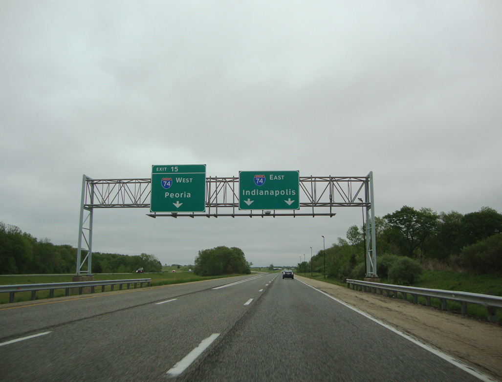
Forthcoming Exit 15 provides return access to Peoria from Interstate 74 east. The ramp also provides part of a truck bypass of U.S. 24 through Creve Coeur and East Peoria. Photo by Eric Stuve (04/20/12).

Bloomington is the ensuing control city for Interstate 74 east beyond Left Exit 15 from I-474. Photo by Eric Stuve (04/20/12).

Left Exit 15 loops onto I-74 west ahead of Pinecrest Drive in East Peoria. Pinecrest Drive spans I-474 ahead of the exchange with I-74. Photo by Eric Stuve (04/20/12).
I-474 defaults onto I-74 east with two lanes ahead of Interstate 155 south at the village of Morton. Photo by Eric Stuve (04/20/12).
![]() West at
West at ![]()

Construction during the I-74 and I-155 Improvement Project expanded Interstate 74 to six overall lanes from Exit 102 / Morton Avenue to I-474 at Exit 99. Work ran from April 2013 to Fall 2016. 12/21/23

Through traffic to Galesburg and the Quad Cities is directed to use Interstate 474 to bypass the Murray Baker Bridge and Downtown Peoria. 05/24/18

Pleasant Hill Road spans Interstate 74 west ahead of Left Exit 99 for I-474 to Creve Coeur, North Pekin and Bartonville. 12/21/23

Two lanes part ways for Interstate 474 west to PIA Airport and Bellevue as I-74 reduces back to four overall lanes between Exit 99 and the Murray Baker Bridge approach at U.S. 150. 12/21/23

Removed by 2022, these shields appeared at the Exit 99 gore point for I-74 and I-474 west. I-474 travels a mostly rural route west to the combine with U.S. 24 across the Shade-Lohmann Bridge. Photo by Joseph Barnes (08/13/16).
![]() East at
East at ![]()

I-74 and I-474 converge through eastern reaches of the East Peoria city limits. Exit 99 provides access to the Peoria bypass west to Creve Coeur and the Shade-Lohmann Bridge for local and truck traffic from Pinehurst Road and the city center. 05/24/18

Exit 99 departs just east of the diamond interchange (Exit 98) with Pinehurst Road for I-474 west to General Wayne A. Downing Peoria International Airport (PIA). 05/24/18

Interstate 474 connects I-74 with IL 29 south from Creve Coeur to North Pekin and the Tazewell County seat of Pekin. 05/24/18
 East End Throwback

This sign bridge for I-474 west at Exit 99 was replaced by a new assembly by 2015. The empty sign bracket to the left may have held a panel for I-155 south (Exit 101) at one point. Photo by Don Hargraves (09/02).

Diagrammatic overheads preceded the trumpet style interchange at the westbound split of I-74/474. They were replaced by APL signs during the I-74 and I-155 Improvement Project. Photo by Brian Dowd (12/01/02).

Older guide signs for Exit 99 include the city of Pekin for IL 29 south from I-474 and the village of Creve Coeur. Photo by Brian Dowd (12/01/02).

The sign bridge at Exit 99 was replaced by 2022. Pekin is no longer referenced for Interstate 474 west. 05/24/18
West End – Peoria, Illinois
![]() West at
West at ![]()
![]()

Leaving the village of Bellevue, the final two miles of Interstate 474 west are rural. 12/21/23

I-474 spans IL 8 (Southport Road) ahead of Left Exit 0 A for Interstate 74 west to Moline and Rock Island. 12/21/23

One half mile ahead of the directional cloverleaf interchange (Exits 0 A/B) with Interstate 74. I-74 leaves Peoria along a rural course west to Galesburg and north to I-80/280 at Colona. 12/21/23

Two lanes part ways from I-474 west for Interstate 74 as the mainline transitions to IL 6 north to Mossville and IL 29. 12/21/23

Exit 0A follows from I-474 west for I-74 east back into Peoria. Photo by Eric Stuve (05/28/17).

An I-474 end sign stands beyond the entrance ramp from I-74 west to IL 6. The ensuing freeway to north Peoria is the Gold Star Families Memorial Highway. Photo by Eric Stuve (05/28/17).
![]() East at
East at ![]()
![]()

I-74 travels 4.4 miles southeast from the Kickapoo interchange to Exit 87A for Interstate 474 in two miles. Photo by Joseph Barnes (06/13/16).

Through trucks were advised to take I-474 around Peoria due to the substandard design along I-74 through Downtown and across the Murray Baker Bridge. The recommendation was dropped following the completion of the Upgrade 74 project through Peoria in November 2006. Photo by Joseph Barnes (06/13/16).

I-74 traverses a series of forested hills through Kickapoo township to the Peoria city line at Exits 87A/B. I-474 wraps around the west side of the city southward to General Wayne A. Downing Peoria International Airport (PIA) and Bartonville while IL 6 extends north to Mossville. Photo by Joseph Barnes (06/13/16).

Arrow-per-lane (APL) signs were installed for the I-74/474 split by 2015. Indianapolis references the continuation of I-74 east beyond I-474 and East Peoria. However signs posted for I-74 east at I-155 reference Bloomington in place of the Indiana capital city. 05/24/18

High speed ramps connect I-74 to I-474 east and from I-474 to I-74 west. A cloverleaf interchange (Exit 87B) joins I-74 with IL 6 as it extends the Peoria ring road north to IL 29 ahead of Chillicothe. 05/24/18
![]() South at
South at ![]()
![]()

Heading south from U.S. 150, IL 6 travels between subdivisions to the directional cloverleaf interchange (Exits 0B/A) with Interstate 74. Photo by Joseph Barnes (08/13/16).

Clearview sign replacements made along IL 6 south by 2011 carbon copied the local control city of Galesburg for I-74 west and retained Exits A-B. A subsequent change by 2015 assigned the ramps as Exits 0B/A while increasing the font size for I-74 and I-474. Photo by Joseph Barnes (08/13/16).

IL 6 winds southward from the Charter Oak Road underpass ahead of Exit 0A for Interstate 74 west to Galesburg and Moline of the Quad Cities. Photo by Joseph Barnes (08/13/16).

Two banks of shields were posted at the south end of IL 6 for I-74/474. The assemblies included exit placards, an unusual sign practice once also found at the north end of I-155, but rarely elsewhere in the Interstate system. Photo by Don Hargraves (09/02).

IL 6 south becomes I-474 east to PIA Airport and Creve Cove in Tazewell County. The control city is Bloomington here, while Indianapolis is referenced from the I-74 eastbound mainline. Interests to Wildlife Prairie Park are directed onto Exit 0A. Photo by Joseph Barnes (08/13/16).

IL 6 south reaches milepost zero ahead of the loop ramp (Exit 0B) for Interstate 74 east to Downtown Peoria and East Peoria. Photo by Joseph Barnes (08/13/16).
![]() West at
West at ![]()
![]()

Passing by Northwoods Mall, Interstate 74 advances two miles west to the return of I-474 west at Exit 87A. 05/24/18

Interstate 74 west transitions to a rural freeway ahead of Big Hollow Creek and Exits 87B/A with IL 6 north and I-474 east. 05/24/18

The succeeding off-ramp (Exit 87B) departs for IL 6 to north Peoria. The state route extends the freeway ten miles to IL 29 at unincorporated Mossville. Photo by Joseph Barnes (08/14/16).

IL 6 to IL 29 leads 18 miles north to the Illinois River city of Chillicothe. 05/24/18

Interstate 474 travels south to the village of Bellevue and PIA Airport and southeast through the village of Bartonville to the Shade-Lohmann Bridge. Connections with IL 116 take travelers west to U.S. 67 north of Macomb. Photo by Joseph Barnes (08/14/16).
West End Throwback
![]() East at
East at ![]()
![]()

Sign changes made here by 2015 dropped the reference for IL 6 north to Chillicothe. 06/01/11

I-74 east at the split with I-474 (Exit 87A) prior to the addition of APL signage. 06/01/11
![]() West at
West at ![]()
![]()

This scene looks at the original location of the two mile guide sign for I-474/IL 6 at the Sterling Avenue overpass. The Upgrade 74 project added a diamond interchange with Sterling Avenue here. Photo by Brian Dowd (12/01/02).

Interstate 74 leaves the Upgrade 74 rebuilt section of freeway between Sterling Avenue and Exits 87B/A. Photo by Brian Dowd (12/01/02).
Sources:
- Pekin Area Regional Chamber Transportation Issues.
http://www.pekin.net/Transportation.htm– this web page laid out information on several Central Illinois transportation issues, including the Interstate 474 Ring Road, IL 336 expressway from Quincy to Peoria, IL 29 four-lane at-grade expressway, and proposed Peoria to Chicago Expressway - “Action Requested: Approve a Resolution Supporting Corridor P2 of the Proposed Eastern Bypass Project.”
http://cmx.peoriagov.org/Agenda/Agenda/MG75942/AS75946/AS75951/AI76004/DO76023/DO_76023.pdfCity of Peoria, request for council action, June 26, 2012. - “Peoria area has full ‘wish list’ of infrastructure projects.” Journal Star (Peoria, IL), February 21, 2015.
- “Leaders: City Needs Highways to Grow > Interstate 474, Peoria-to-Chicago Route Deemed Vital to City.” Peoria Journal Star, The (IL), June 30, 1996.
- “Road to Change > When Interstate 74 Cut Through Peoria in the Late ’50s, The Drive Toward Future Growth Began. The Interstate’s Impact on the City Has Been Significant During the Past Four Decades, But Officials Today are Still Looking Toward the Future.” Peoria Journal Star, The (IL), June 30, 1996.
- “What’s in a Name > Plenty, if It’s the Moniker of a Central Illinois Landmark.” Peoria Journal Star, The (IL), September 26, 1993.
- “Hotline – Bridge named for former Pekin legislators.” Peoria Journal Star, The (IL), October 31, 2003.
- “Road to Change > Building Interstates.” Peoria Journal Star, The (IL), June 30, 1996.
- “Route 24 may take new direction to allow Peoria development.” Peoria Journal Star, The (IL), June 11, 2010.
Page updated January 25, 2024.