Interstate 440 North Carolina
Overview
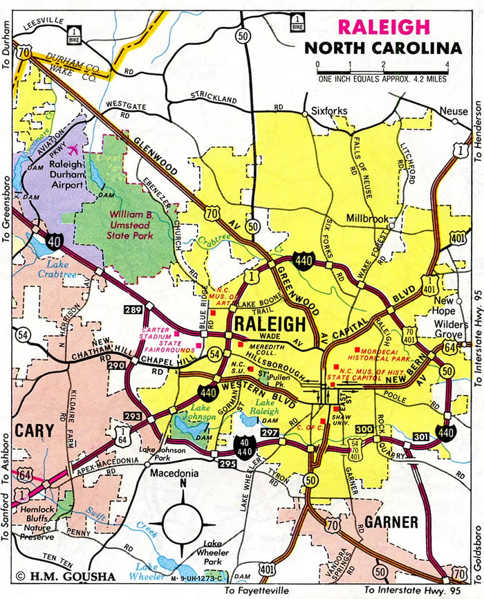
Known as the Cliff Benson Beltline, Interstate 440 forms the northern two thirds of the 25.2 mile long Raleigh beltway. Built in the 1960s, the freeway winds northeast from I-40 near Lake Jackson to North Carolina State University and U.S. 70 by Crabtree Valley Mall. U.S. 1 accompanies the route east to Exit 11, as I-440 turns back south. I-87/U.S. 64 combine with I-440 from west of Knightdale south 2.70 miles to I-40 at Southeast Raleigh.
Started in Fall 2019, $475 million in construction underway through 2024 expands and reconstructs U.S. 1/64 and Interstate 440 from southwest of Walnut Street (SR 1313) in Cary to north of Wade Avenue (SR 1728) in Raleigh. This is the oldest section of the Cliff Benson Beltline, having been built in the 1960s.
Future construction, anticipated to begin in 2027, both rebuilds the cloverleaf interchange joining I-40 and I-440/U.S. 1-64 and widens I-40 from the exchange to Lake Wheeler Road. Estimated to cost $194 million, the I-40/440 Interchange Preferred Alternative (Alternative 2) reconstructs the exchange into a partial turbine interchange with flyovers linking I-40 west to U.S. 1/64 south and from U.S. 1/64 north to I-40 west. The loop ramp from I-40 west to U.S. 1/64 south will be retained for local access to Buck Jones Road (SR 1315) and Crossroads Boulevard.
 History
The North Carolina Department of Transportation (NCDOT) submitted applications to the American Association of State Highway and Transportation Officials (AASHTO) ahead of the Spring 1999 meeting for an array of routes in the Raleigh urban area. Actions approved on June 9, 1991 established Interstate 440 along the Cliff Benson Beltline in conjunction with the elimination of I-40 Business and U.S. 70 Business and relocation for sections of U.S. 64, U.S. 70 and U.S. 401:
These several routes are presently assigned to various sections of the Raleigh Beltline thus creating a confusing signing arrangement. The relocation of the bulk of these US routes and the establishment of the Interstate route number for the entire facility will alleviate signing overload on the facility, and will facilitate map interpretation of the facility. A less confusing and resultant safter route numbering system will prevail, thus greatly benefitting the travelling public.
The Federal Highway Administration (FHWA) previously approved the requested addition of 16.74 miles of the Raleigh Beltline to the Interstate System under 23 U.S.C. 139(a). The proposed Interstate 440 included an overlap with I-40 to form a full circumferential route around the city. Two exceptions for Interstate design standards were noted in a March 26, 1991 letter to NCDOT:
1. Bridge width of 28 feet for three sets of bridges located at Lake Boone Trail, Yadkin Drive, and Old Wake Forest Road. As you have agree, these bridges will be widening to full Interstate standards as part of the projects already scheduled between 1991 and 1995.
2 A paved right shoulder width of 4 feet on a usable shoulder width of 12 feet from the I-40 southwest junction to the Raleigh-Chapel Hill Expressway. As you have agreed, the shoulder will be improved to full Interstate standards when this portion of the Raleigh Beltline is reconstructed.
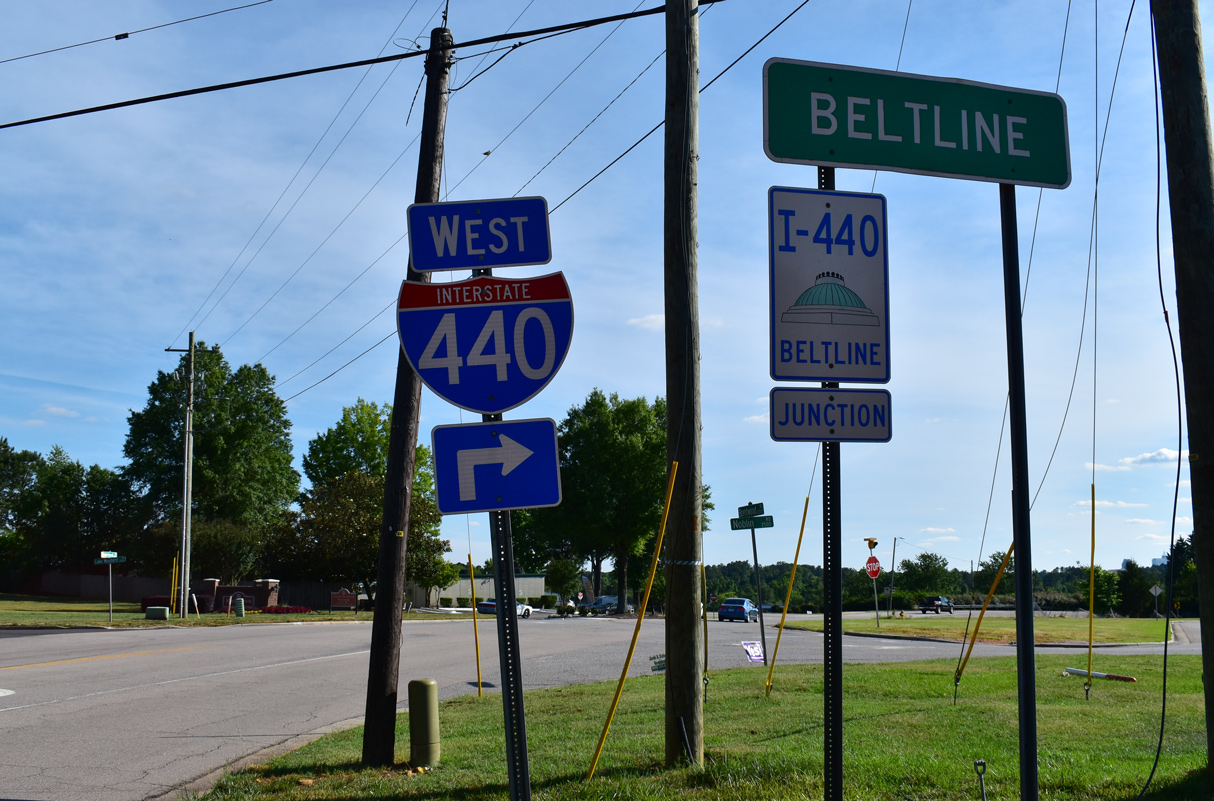
When Interstate 440 was first signed, it used cardinal directions based upon the direction of travel. So along the portion through the east side of Raleigh, I-440 used north/south banners, while the stretch to the north used east/west signage.1 The signing of I-440 was later changed to use an inner and outer orientation, similar to those found on the I-277 inner belt freeway around Downtown Charlotte and the I-485 beltway around Mecklenburg County.

Raleigh Beltline trailblazers were previously posted along Interstate 440 and along intersecting roads. These were mostly removed by 2009 when inner and outer direction banners for I-440 changed to east / west. 05/31/21
Prior to the designation of Interstate 440 along the Cliff Benson Beltline, U.S. 1, U.S. 64, U.S. 70 and NC 50 utilized portions of the freeway between Cary and the temporary east end at Poole Road. U.S. 401 was added to the route when the Tom Bradshaw Freeway (I-40) portion of the beltway was completed in 1984 as U.S. 64 shifted to the new I-40. Motorist confusion resulted and NCDOT returned portions of the U.S. 70, U.S. 401 and NC 50 back through the city center in 1991.1
Plans announced in August of 2003 removed the I-440 designation from the concurrency with I-40 along the southern third of the Raleigh belt line while restoring cardinal (east-west) direction banners along the remainder of the route. The renumbering was reinforced by local references to the I-440 segment as the “Beltline” and the I-40/440 portion as simply “I-40”.2
Route Information
East End – Raleigh, NC
West End – Raleigh, NC
Mileage – 16.77
Cities – Cary, Raleigh
- Junctions –

Source: December 31, 2021 Interstate Route Log and Finders List
I-440 Annual Average Daily Traffic (AADT)
Source: 2019 NCDOT AADT Mapping Application
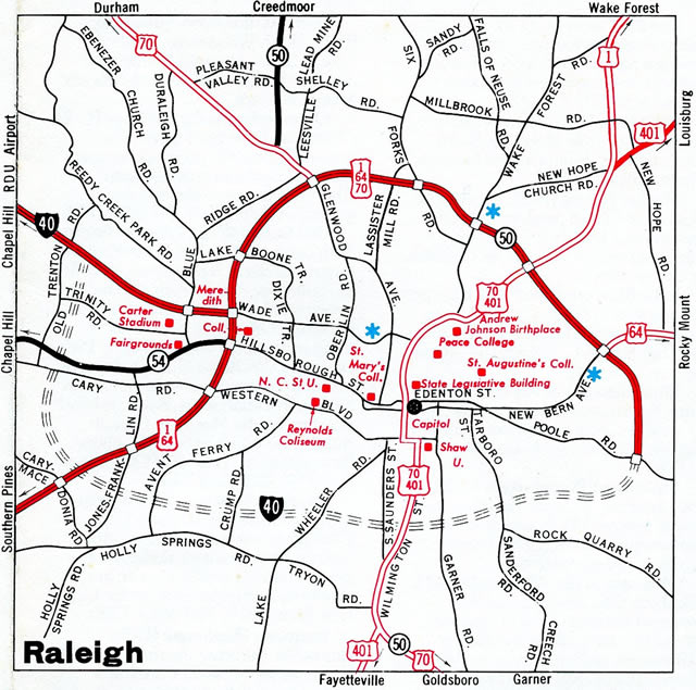
The initial potion of the Cliff Benson Beltline opened in 1960 as an extension of the U.S. 1 freeway from Chatham and southwest Wake Counties to end at Hillsborough Street. The route was extended another eight miles to Capitol Boulevard in 1963.
The I-40/440 concurrency was one of 2-digit Interstates overlapped with a branch route. Other entries include I-95/495 around Washington, DC, I-87/287 across the Hudson River in New York, I-94/694 in the Twin Cities, MN and I-80/580 at Berkeley, CA.
Citing some confusion and problems with the motoring public, NCDOT petitioned the FHWA on September 3, 2008 for the elimination of I-440 along the 8.36 mile long concurrent segment with I-40 between U.S. 1 and the I-40/U.S. 64 split. FHWA approval was granted, but subject to concurrence of AASHTO. A subsequent application for the elimination of I-440 was approved by AASHTO on October 17, 2008. It added that the dual designation also created inaccuracies in the reporting of crash data.
According to Brian LeBlanc’s former Wake County Roads web site, signs changes along I-40 where I-440 formerly overlapped were made by 2009.
 Photo Guides
East End  – Raleigh, North Carolina
![]() South
South ![]() East
East ![]() West at
West at ![]()
05/31/21
05/31/21
![]() West at
West at ![]()
![]()
![]()
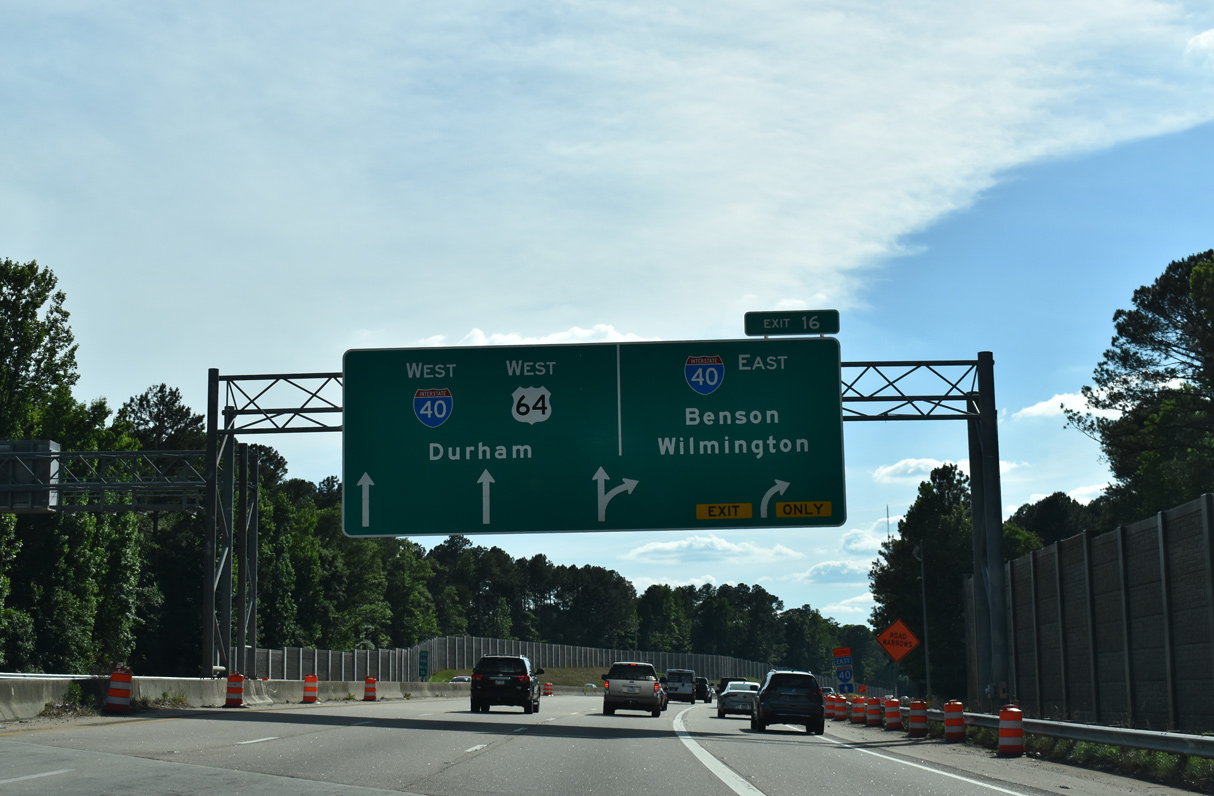
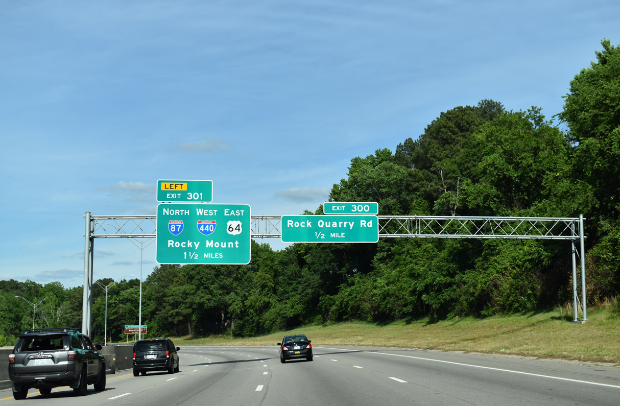
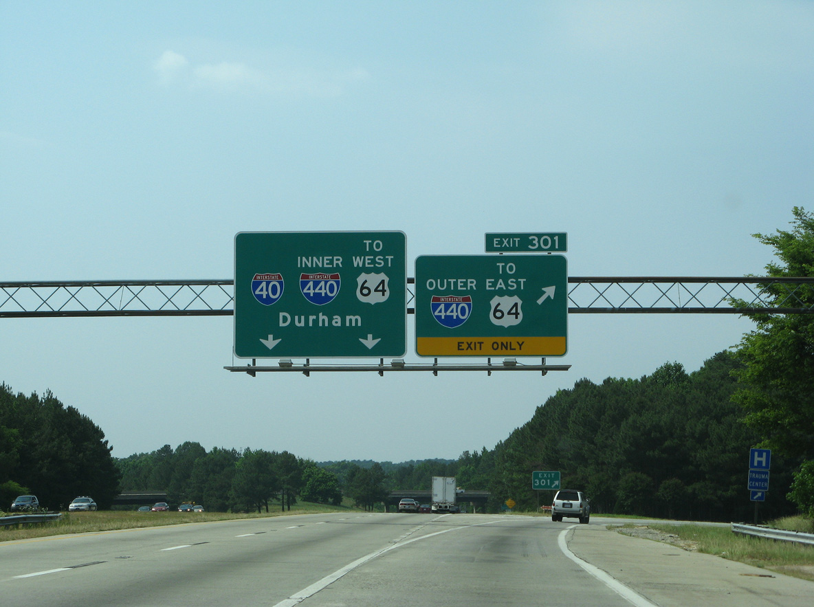
One mile south of the three-wye interchange (Exit 301) with I-87/440 and U.S. 64 on I-40 west. U.S. 64/Future I-87 join the city of Raleigh with I-95, Rocky Mount and the Outer Banks of North Carolina. 12/15/16
A lane drop occurs in one half mile at Exit 301 as I-40 turns west with two lanes to combine with U.S. 64 across the south side of Raleigh. Downtown Durham is 30 miles to the northwest. 12/15/16
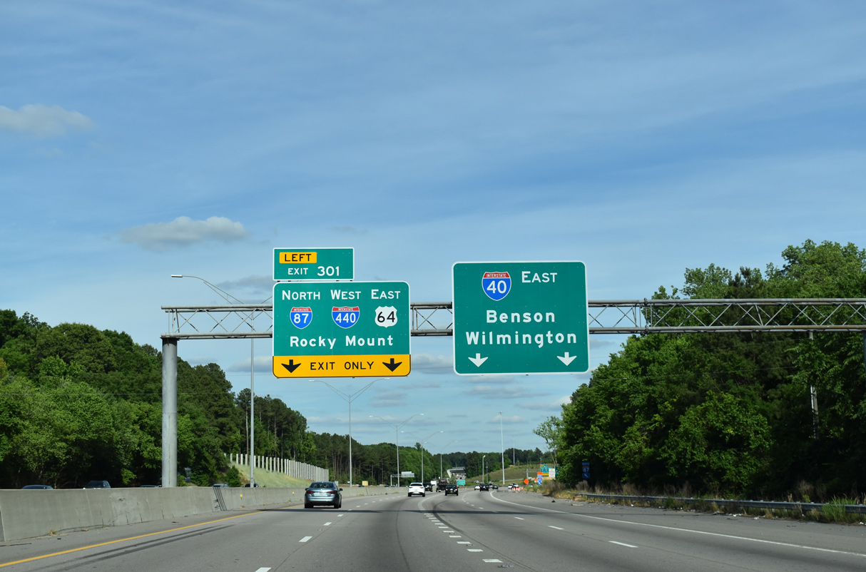
Interstate 440 west combines with I-87/U.S. 64 east the Knightdale Bypass and U.S. 264. I-440 turns northwest around East Raleigh to U.S. 1 south of Wake Forest. 12/15/16
![]()
![]() East at
East at ![]()
![]()
05/31/21
05/31/21
 East End Throwback
![]() West at
West at ![]()
![]()
![]()
Overheads referencing the former overlap of I-40/440 west from Southeast Raleigh to Southwest Raleigh. 05/30/07
A diagrammatic sign outlined the Interstate 40 entrance onto the Raleigh Belt Line. 05/30/07
U.S. 64 previously encircled Raleigh alongside I-440 west through Northeast Raleigh, North Hills and Southwest Raleigh. 05/30/07
![]()
![]() East at
East at ![]()
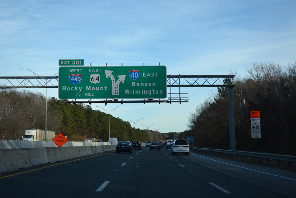
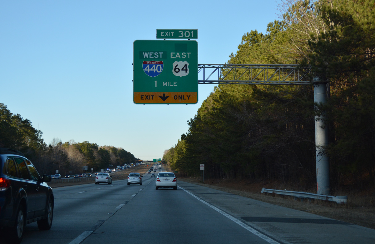
I-40/U.S. 64 east one half mile from Left Exit 301 to I-440 west. 12/15/16
West End – Raleigh, North Carolina
![]() West
West ![]() South at
South at ![]()
![]()
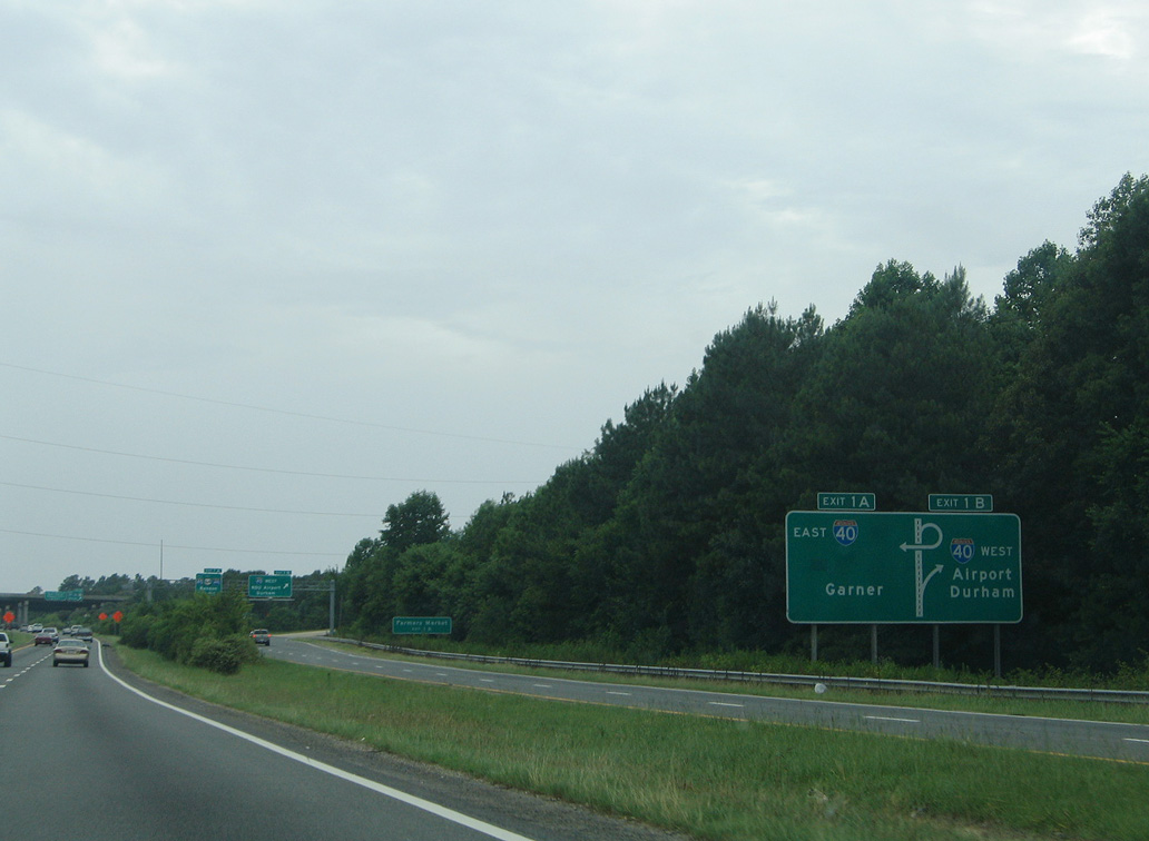
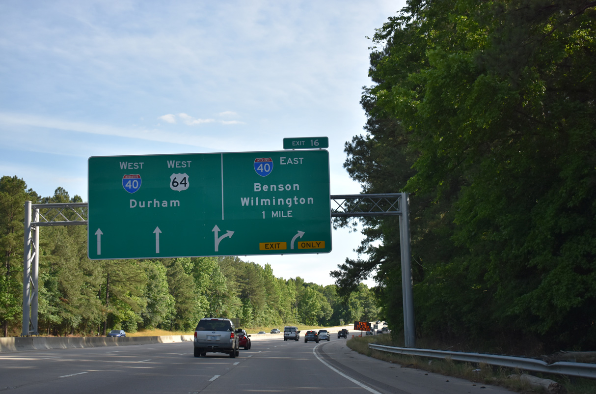
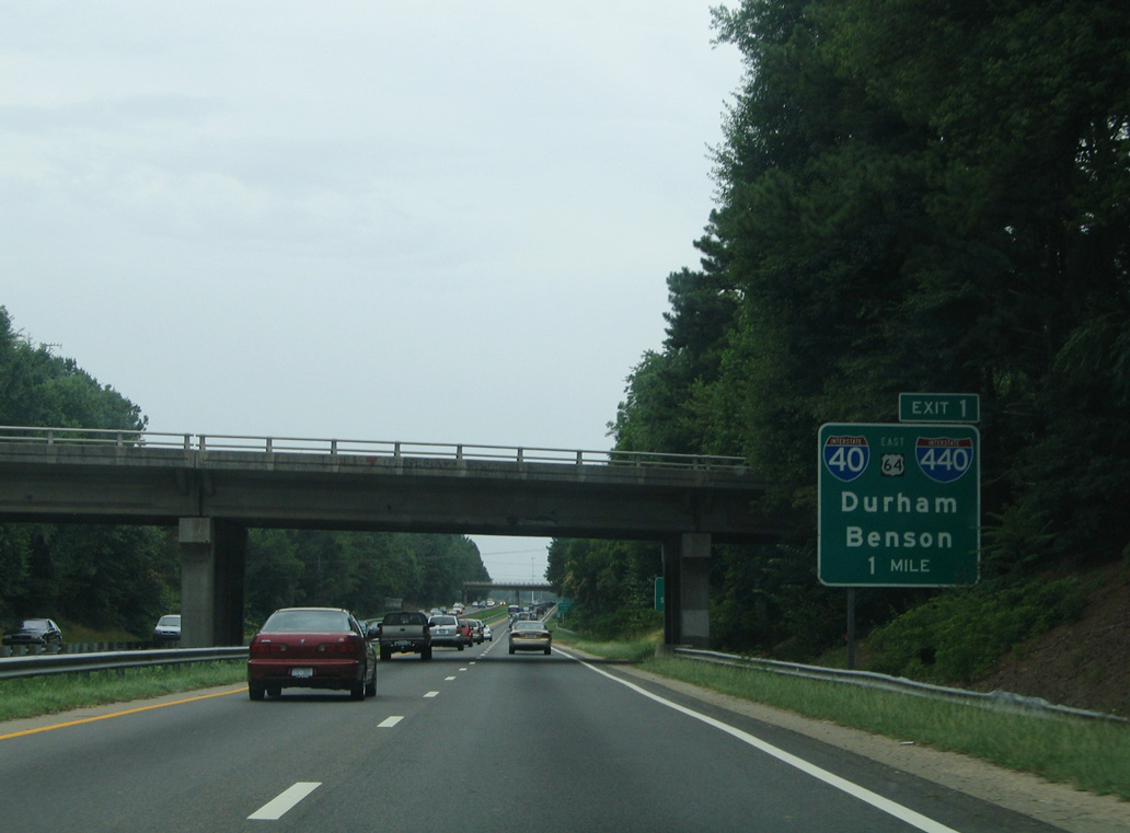
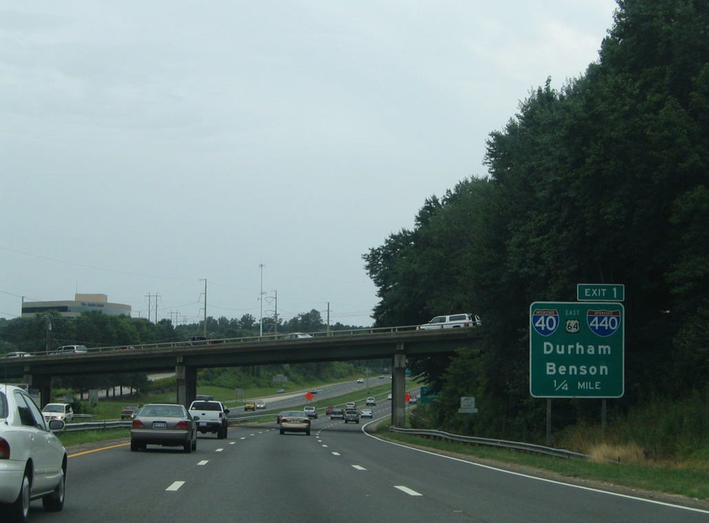
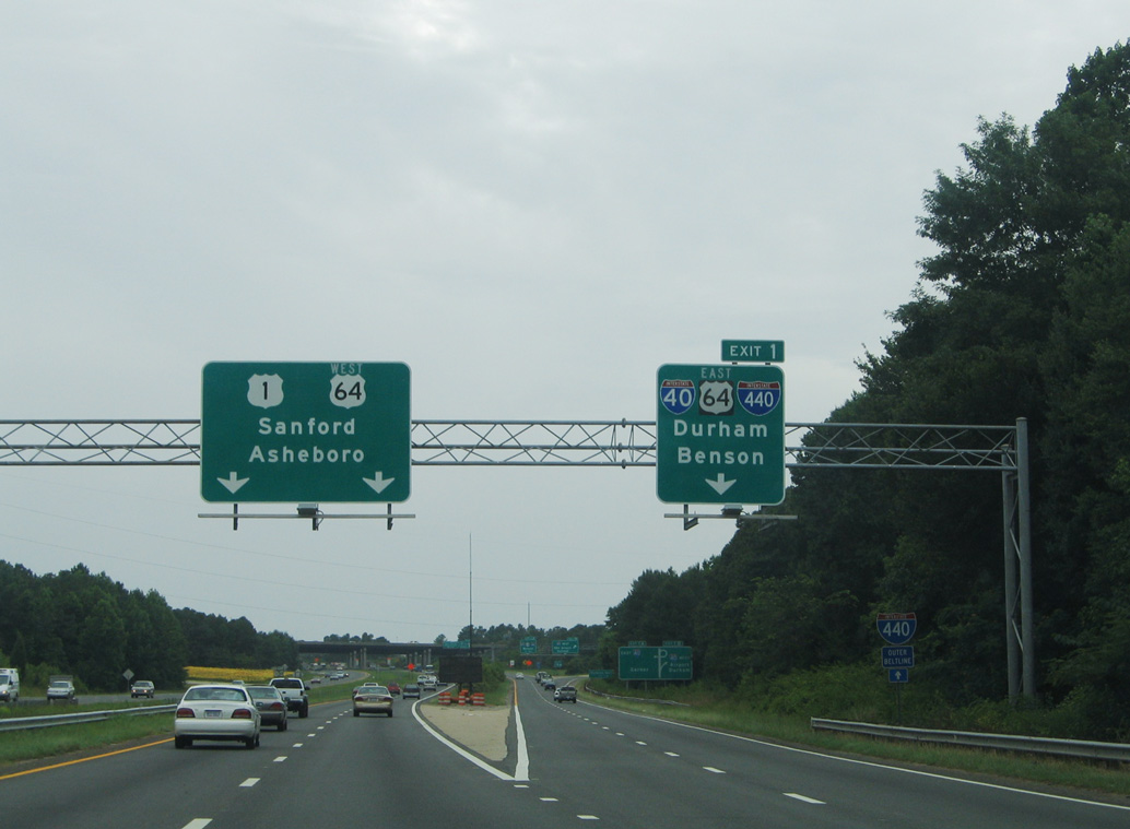
Interstate 440 west concludes at a cloverleaf interchange (Exit 1) with I-40 and U.S. 64. U.S. 64 branches west from U.S. 1 southbound toward Apex, Sanford and Asheboro. I-440 previously combined with I-40 east through Southwest Raleigh via the loop ramp at Exit 1 B. 07/12/05
![]() North
North ![]() East at
East at ![]()
![]()
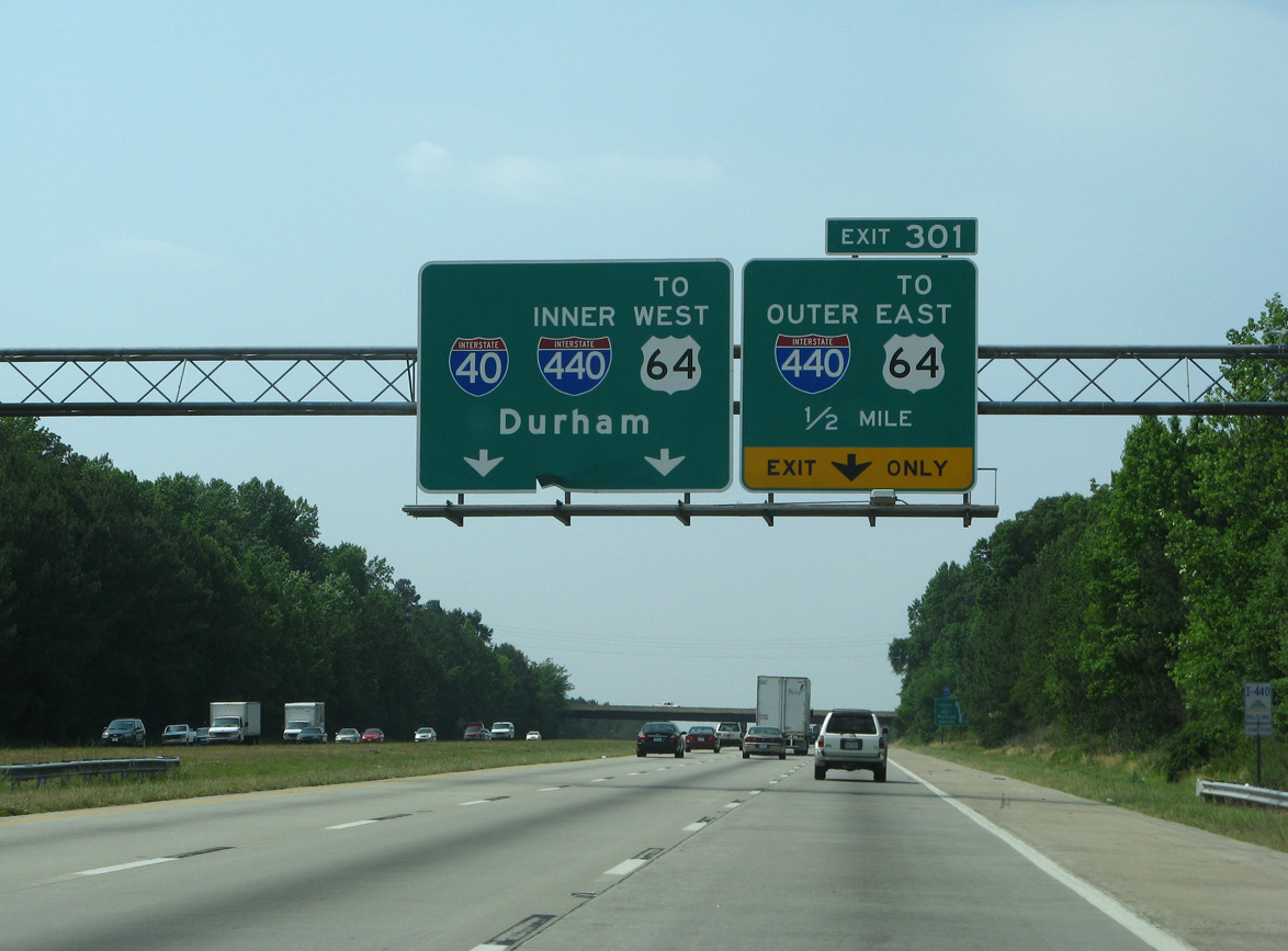
A half mile ahead of the cloverleaf interchange (Exit 1) where U.S. 64 shifts east from U.S. 1 north onto I-40 to Southeast Raleigh and Interstate 440 begins. 10/12/23
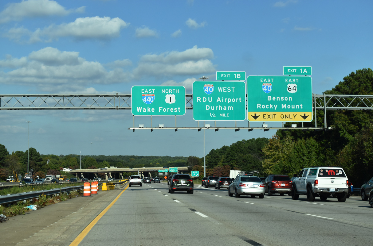
U.S. 1 north overlaps with I-440 east 10.73 miles to U.S. 401 en route to Wake Forest. U.S. 64 combines with Interstate 40 east 8.35 miles to I-87 north and the east end of I-440 at Southeast Raleigh. 10/12/23
Exit 1 B loops onto Interstate 40 west toward Durham and Chapel Hill. Work anticipated to start in 2027 replaces this ramp with a two lane flyover. 10/12/23
![]() East at
East at ![]()
![]()
![]()
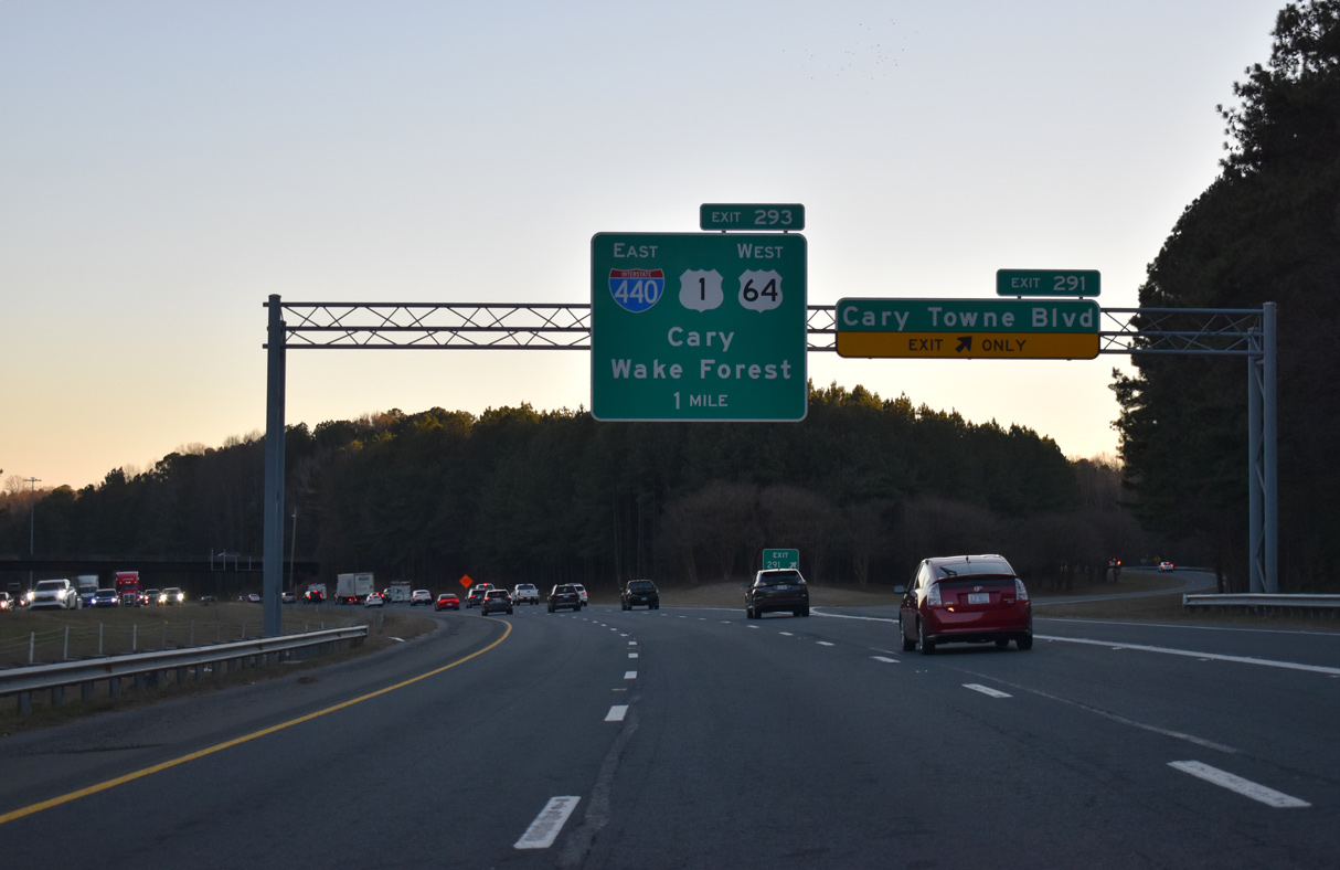
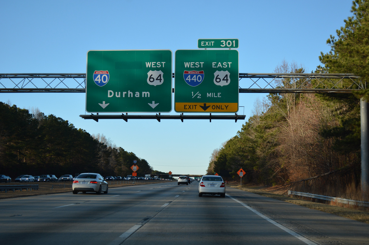
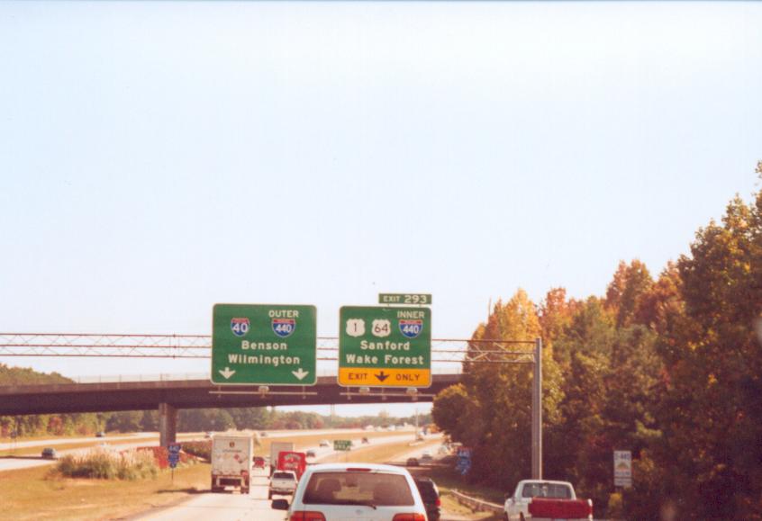
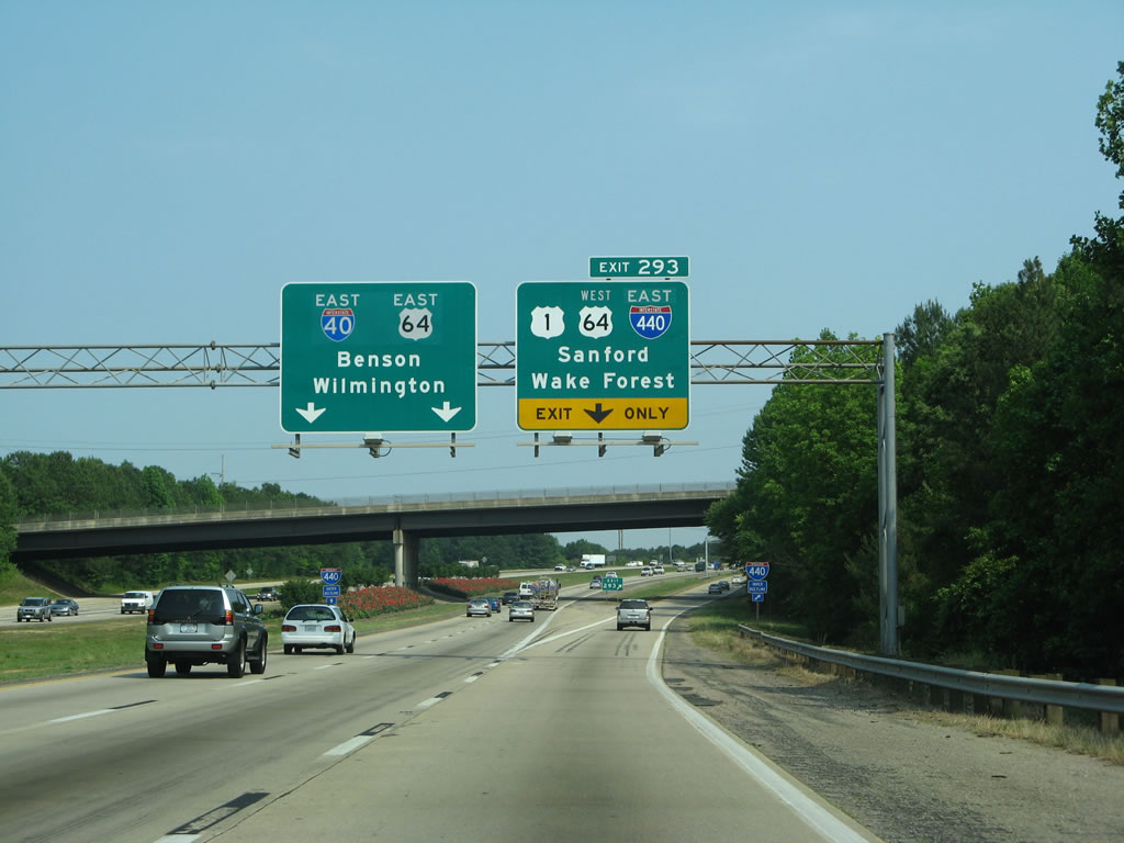
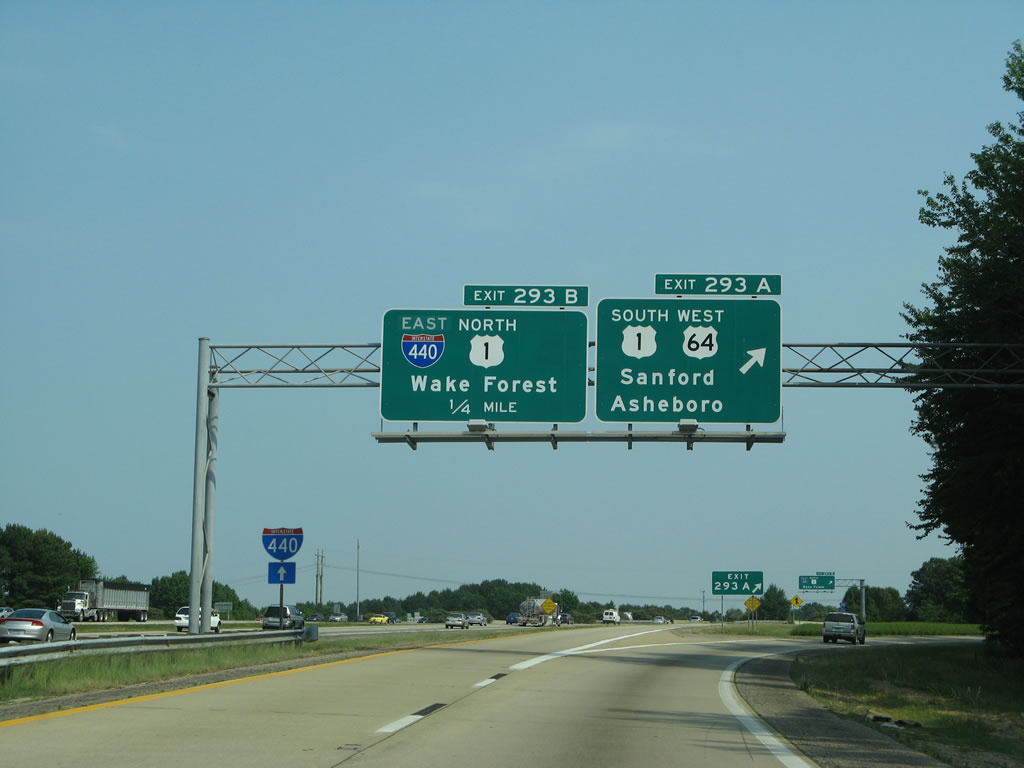
Wade Avenue (SR 1728) provides a cutoff from I-40 east to I-440/U.S. 1 (Cliff Benson Beltline) east from Exit 289. I-40 arcs southward from there to meet the Beltline directly at Exit 293. 12/27/22
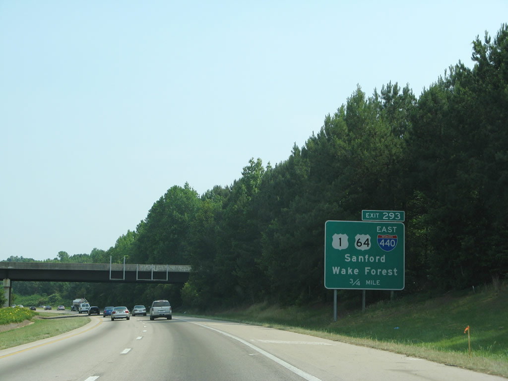
A collector distributor roadway (Exit 293) for I-440 east, U.S. 1 and U.S. 64 west separates from I-40 east beyond the exchange with Cary Towne Boulevard. 12/27/22
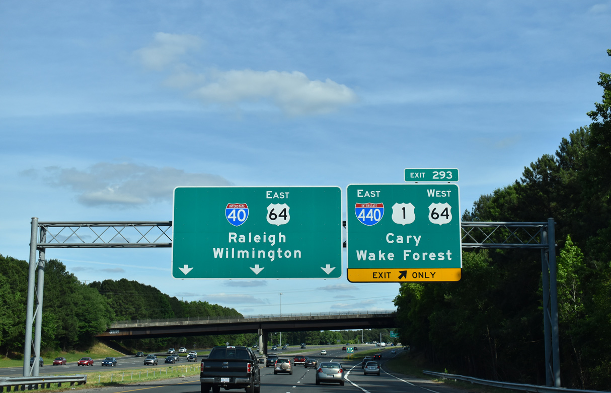
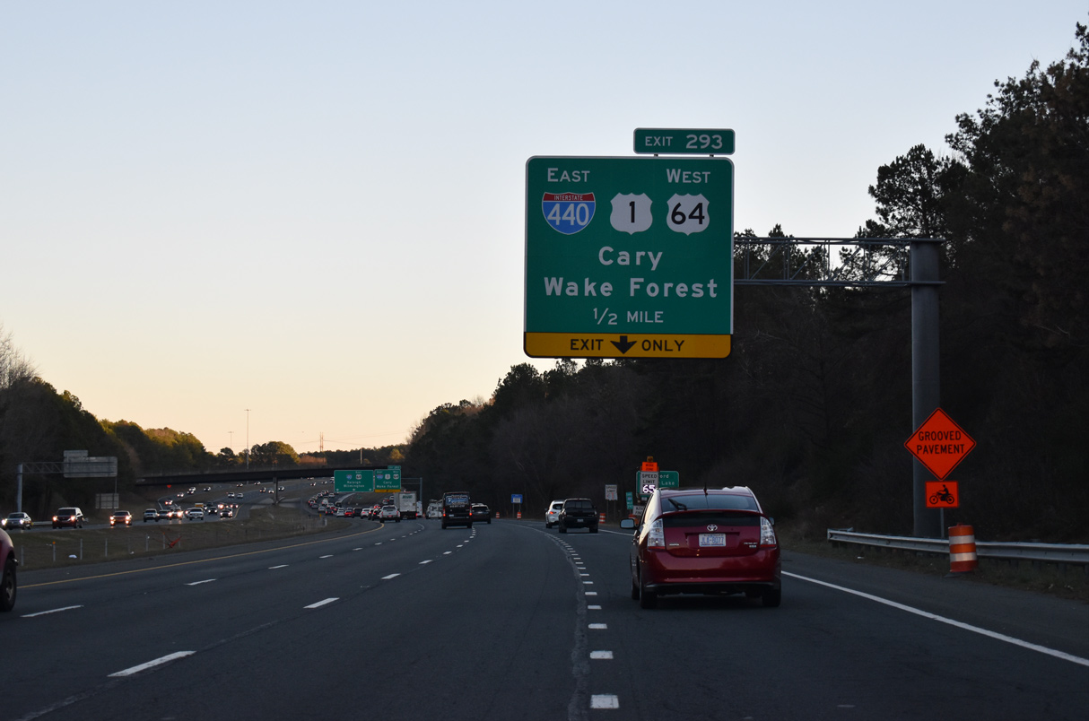
U.S. 1/64 overlap southwest through Cary. U.S. 1 north accompanies I-440 east to U.S. 401 (Capital Boulevard) at Northeast Raleigh. 05/31/21
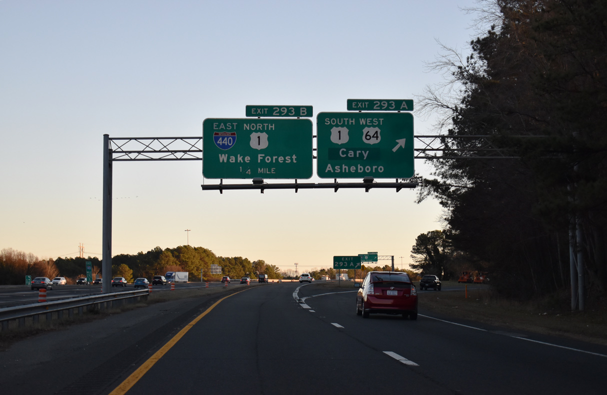
U.S. 1/64 overlap along a freeway southwest from I-40/440 through the town of Cary before separating ahead of Apex. 12/27/22
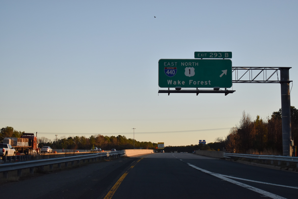
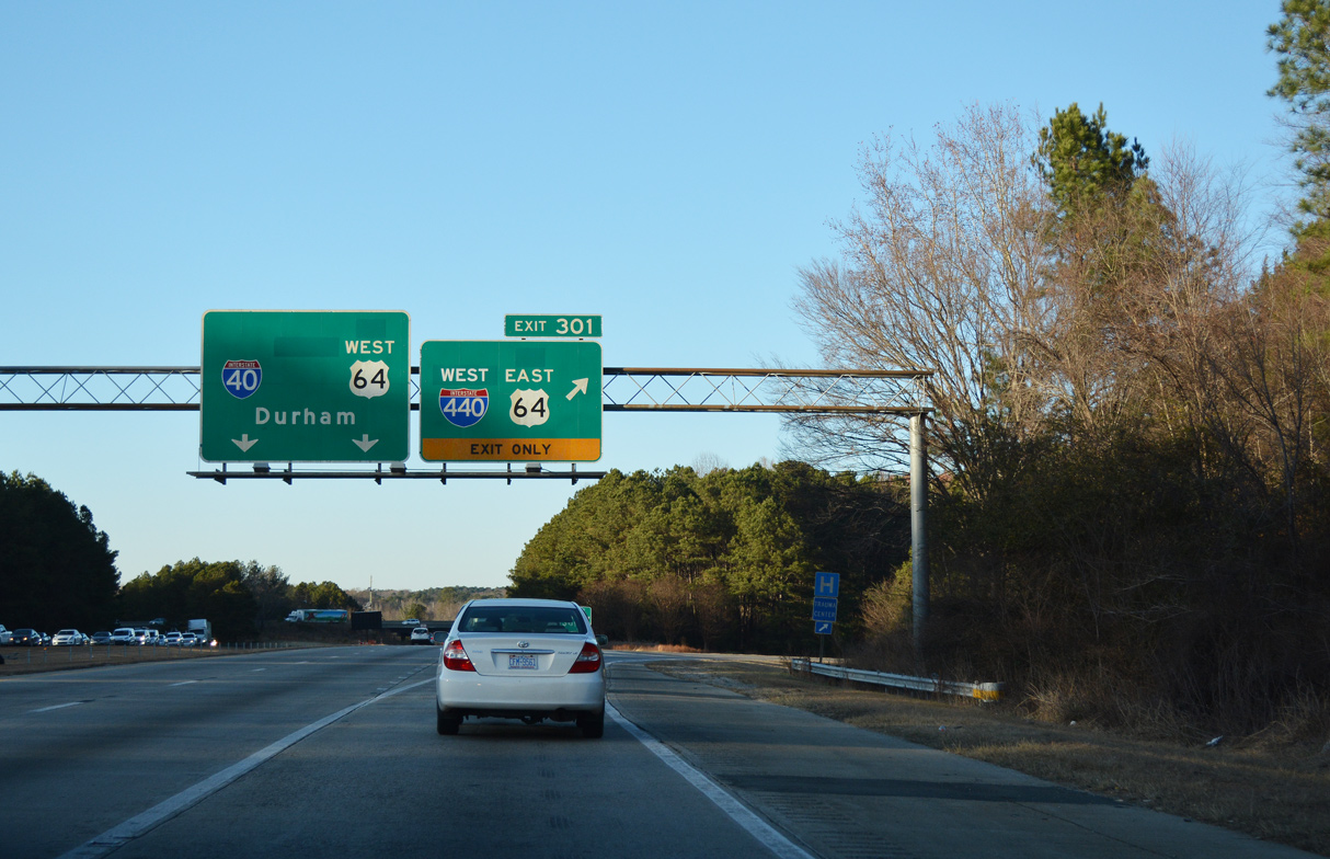
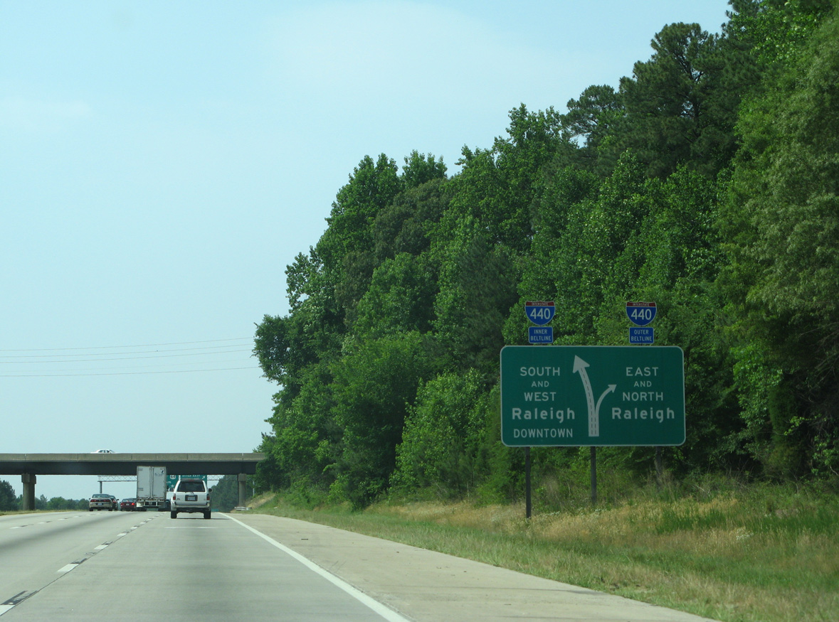
Exit 293 B loops onto a c/d roadway along I-440/U.S. 1 east to Southwest Raleigh, West Raleigh and Crabtree Valley. 12/27/22
West End Throwback
![]() East at
East at ![]()
![]()
![]()
This ground level guide for I-440, was replaced after 2009 when the Interstate 40 was expanded to six overall lanes. 05/30/07
Inner and outer direction banners were used along I-440 until 2007. Photo by Chris Curley (10/00).
Greenouts removed I-440 from I-40 east and added U.S. 64 for the relocation onto I-40 east to I-440 and the Knightdale Bypass (I-87). This sign bridge was replaced during 2011 widening of I-40, which extended the c/d roadway further west from the Buck Jones Road overpass. 05/30/07
Exit 293A connects I-40 east with U.S. 1 south and U.S. 64 west to Apex, Sanford and Pittsboro. Sanford was greened out here to display Cary. 05/30/07
![]() West
West ![]() South at
South at ![]()
![]()
Replaced by 2007, this guide was previously amended to show U.S. 64 east, referencing the relocation from the Beltline back to I-40. 07/12/15
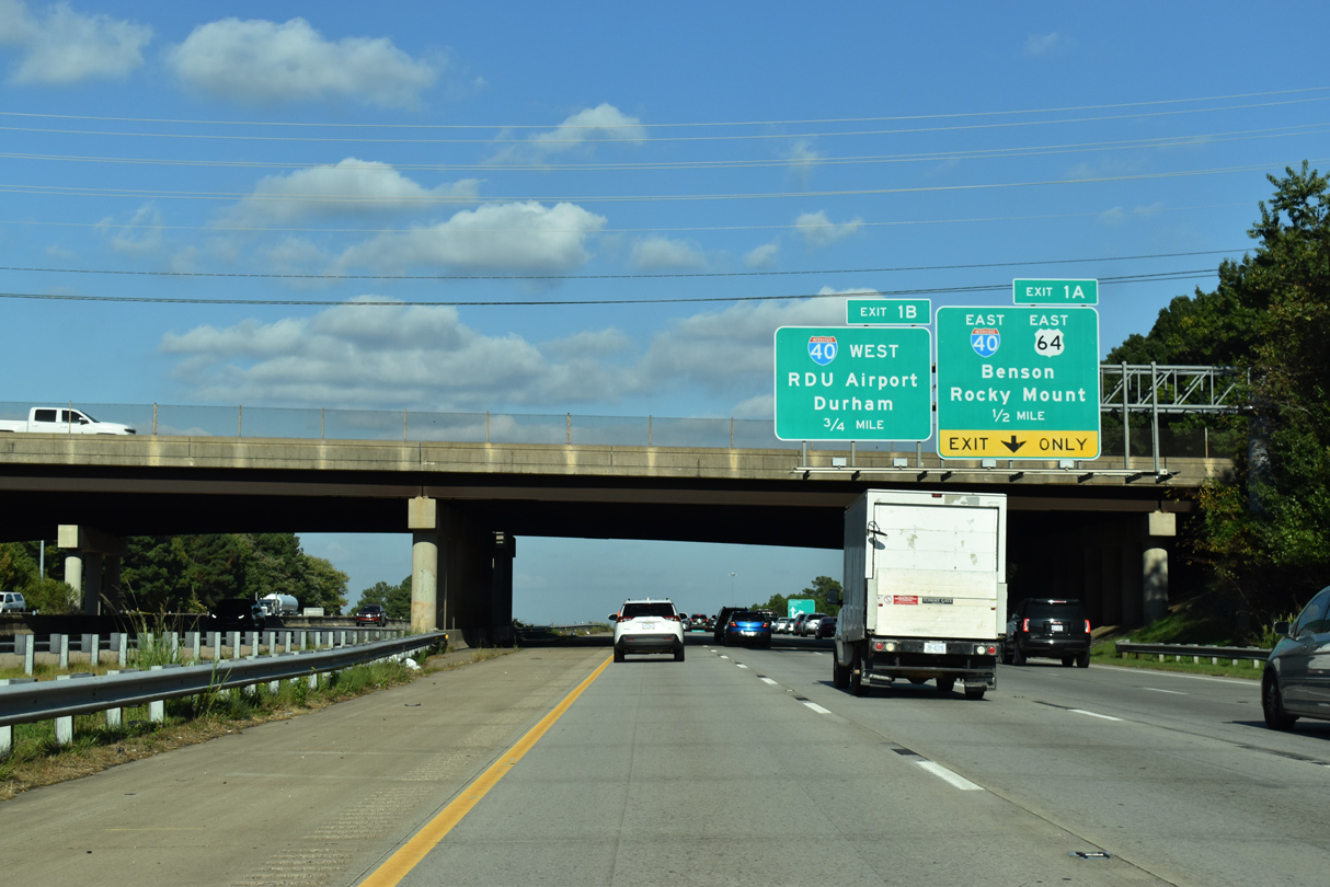
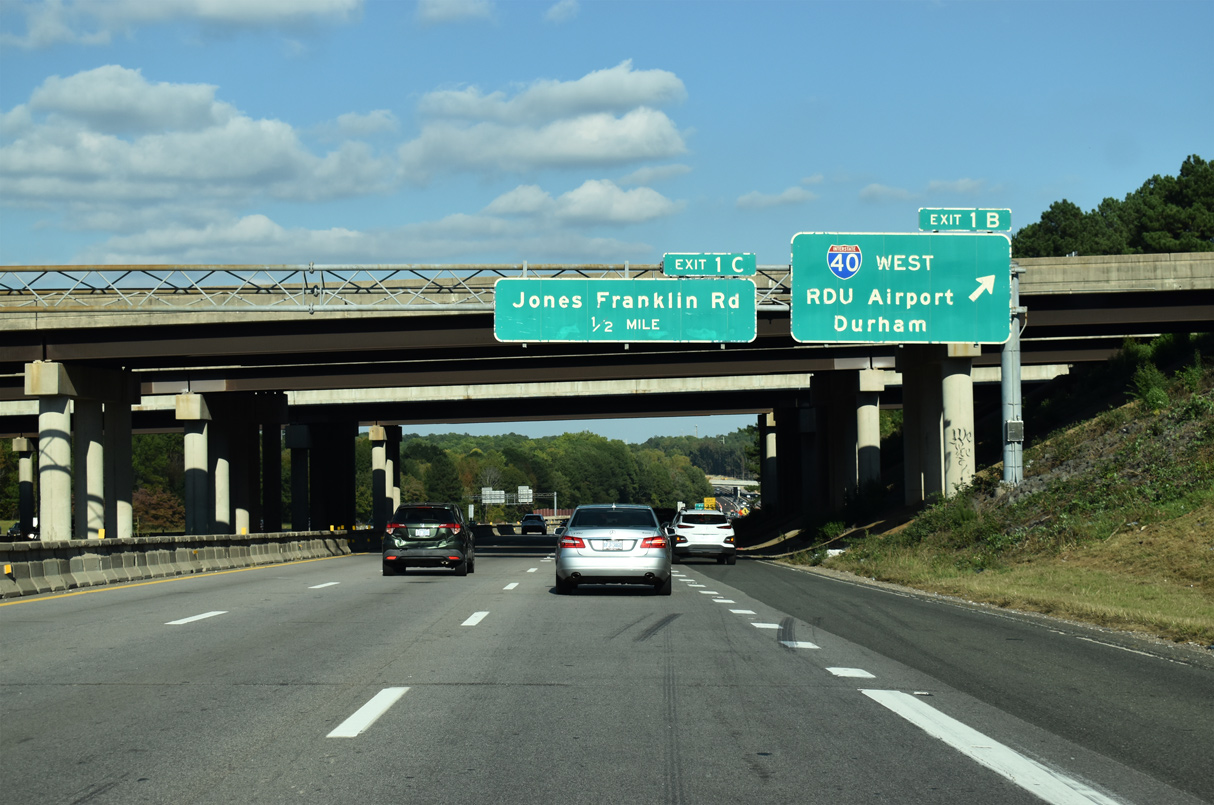
Continuing south from the parclo interchange (Exit 1C) with Jones Franklin Road, I-440 west / U.S. 1 south expanded to three lanes leading to the c/d roadway (Exit 1) with Interstate 40 and U.S. 64 east. 07/12/15
U.S. 1 extends southwest from I-440 along a freeway toward Sanford and Pinehurst. U.S. 64 overlaps with U.S. 1 southwest 3.7 miles to south Cary. 07/12/15
Sources:
- The Baffling Beltline – A Photo Essay of the Raleigh Beltline’s Colorful Past (Adam Prince)
http://www.gribblenation.com/ncpics/raleigh/beltline.html - Rhodes, S.D. “Raleigh Beltline to change signage yet again…” Online posting, Yahoo Groups – Southeast Roads and Transport, Aug. 30, 2002.
Page updated February 1, 2024.