Interstate 385 South Carolina
Overview
Interstate 385 is a 42 mile long route branching northwest from I-26 to the city of Greenville in the South Carolina Upstate. The freeway serves as a commuter route for the south Greenville County suburbs including Mauldin, Simpsonville and Fountain Inn, while joining the Greenville metropolitan area with Columbia via I-26. I-385 carries six or more lanes through the suburbs and city of Greenville, while southern reaches through Laurens County remain rural with four lanes.
An unsigned Business Spur for Interstate 385 extends 0.49 miles west from U.S. 276 (Laurens Road) along E North Street to S.C. 183 (Beattie Place) and U.S. 29 (Church Street) at Downtown Greenville.
The Gateway Project upgraded the systems interchange joining I-85 with Interstate 385. Originally planned from 2014 to 2017, construction was underway between January 2016 and mid 2020. Work replaced two loop ramps with high speed flyovers and added collector distributor roadways along I-385 from I-85 south to Woodruff Road. The final bridge of the $231 million project,5 the exit ramp joining I-385 south with S.C. 146 (Woodruff Road), opened to traffic on December 6, 2019. A ribbon cutting ceremony preceding the opening of the bridge marked the completion of the Gateway Project. Work continuing through the second quarter of 2020 included final asphalt paving, bridge painting, and installation of signs, fencing and dynamic message signs.
 History
Interstate 385 was one of four interstate urban connections proposed by the South Carolina State Highway Department to the American Association of State Highway Officials (AASHO) on March 28, 1958. The method of numbering branch routes was not finalized, so South Carolina numbered the spurs from I-85 in order of sequence, with I-185 and I-285 to Greenville, and I-385 to Spartanburg. The final proposed numbering of official interstate connections in the urban areas for South Carolina was submitted to AASHO on July 16, 1958, with I-285 at Greenville changed to I-385 and I-385 at Spartanburg changed to I-585.
Interstate 385 originally consisted of just a 6.21 mile long spur from a trumpet interchange with I-85 northwest into Greenville. The freeway leading south from Mauldin to I-26 by Clinton was built in conjunction with Interstate 26 between Columbia and Spartanburg. It opened in Fall 1960 as a new alignment for U.S. 276.1
Named the Golden Strip Freeway, construction to link the original I-385 at Greenville and U.S. 276 south from Mauldin was separated in two stages. The first phase got underway in 1978 and involved grading and drainage for the route south from I-85/385 to Gilder Creek south of Bridges Road (Exit 33).2
Initially the South Carolina Department of Transportation (SCDOT) planned to realign U.S. 276 onto the Golden Strip Freeway alongside I-385. An application for the relocation was approved by the American Association of State Highway and Transportation Officials (AASHTO) on October 1, 1983 along with redesignating the former route through Greenville and Mauldin as U.S. 276 Business.
The Federal Highway Administration (FHWA) approved the addition of the Golden Strip Freeway extension and U.S. 276 from Mauldin to Clinton to the Interstate System as Interstate 226 on February 13, 1984. However after study, it was determined that numbering the highway as Interstate 385 would be more suitable because of a portion of the Golden Strip Freeway was already numbered I-385. FHWA concurred with the change from I-226 to I-385 on April 5, 1984.
A separate application to AASHTO was sent for the extension of Interstate 385 and the truncation of U.S. 276 northwest to the Golden Strip Freeway at Mauldin. The AASHTO Route Numbering Committee approved the changes on May 23, 1984. The Golden Strip Freeway was completed in June 1985.23
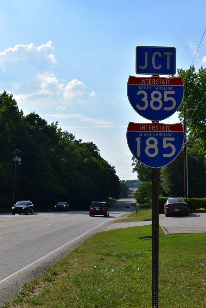
Construction of the Southern Connector extended Interstate 185 southeast to I-385, U.S. 276 and S.C. 417 (NE Main Street) in Mauldin. The toll road opened on February 27, 2001.
Interstate 385 was reconstructed to six lanes in the Greenville area between June 2001 and Fall 2004. Work expanded the northernmost arc of the freeway from I-85 to the diamond interchange (Exit 42) with U.S. 276. Widening replaced the median with a concrete barrier and raised area for landscaping. Additionally the project included the conversion of the exchange with S.C. 291 (Pleasantburg Drive) from a full cloverleaf to a six-ramp parclo interchange to eliminate weaving traffic patterns. The overpass for S.C. 291 was one of many replaced to increase the height clearance.4
A major resurfacing project took place along the southernmost 15 miles between January and July 2010. One direction of Interstate 385 closed for a period of time so that crews could rebuild the concrete roadways.
Route Information
North End – Greenville, SC
South End – Clinton, SC
Mileage – 42.16
Cities – Greenville, Mauldin, Simpsonville, Fountain Inn, Laurens
- Junctions –


Source: December 31, 2021 Interstate Route Log and Finders List
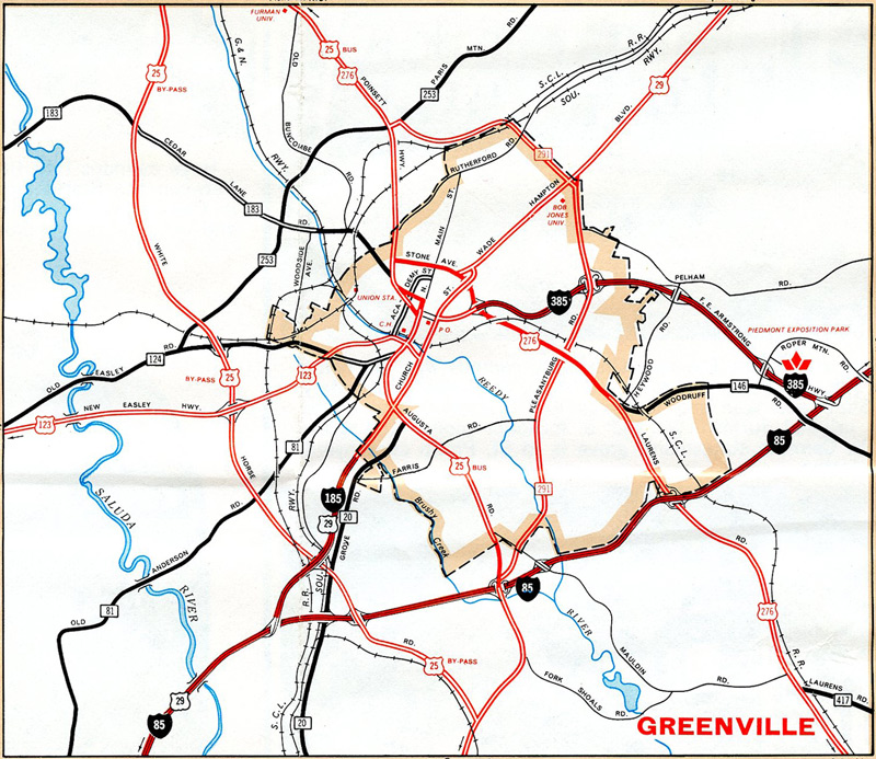
Greenville Inset – 1970 South Carolina Official Highway Map
I-185 and I-385 provided gateway routes into Downtown Greenville from Interstate 85 until 1985 and 2001, when they were extended south respectively.
Prior to the completion of the freeway from I-26 near Clinton to Mauldin, U.S. 276 ran along what is now S.C.14 from Laurens north through Gray Court, Fountain Inn and Simpsonville.
North End 
 – Greenville, South Carolina
![]() North at
North at ![]()
![]()
![]()
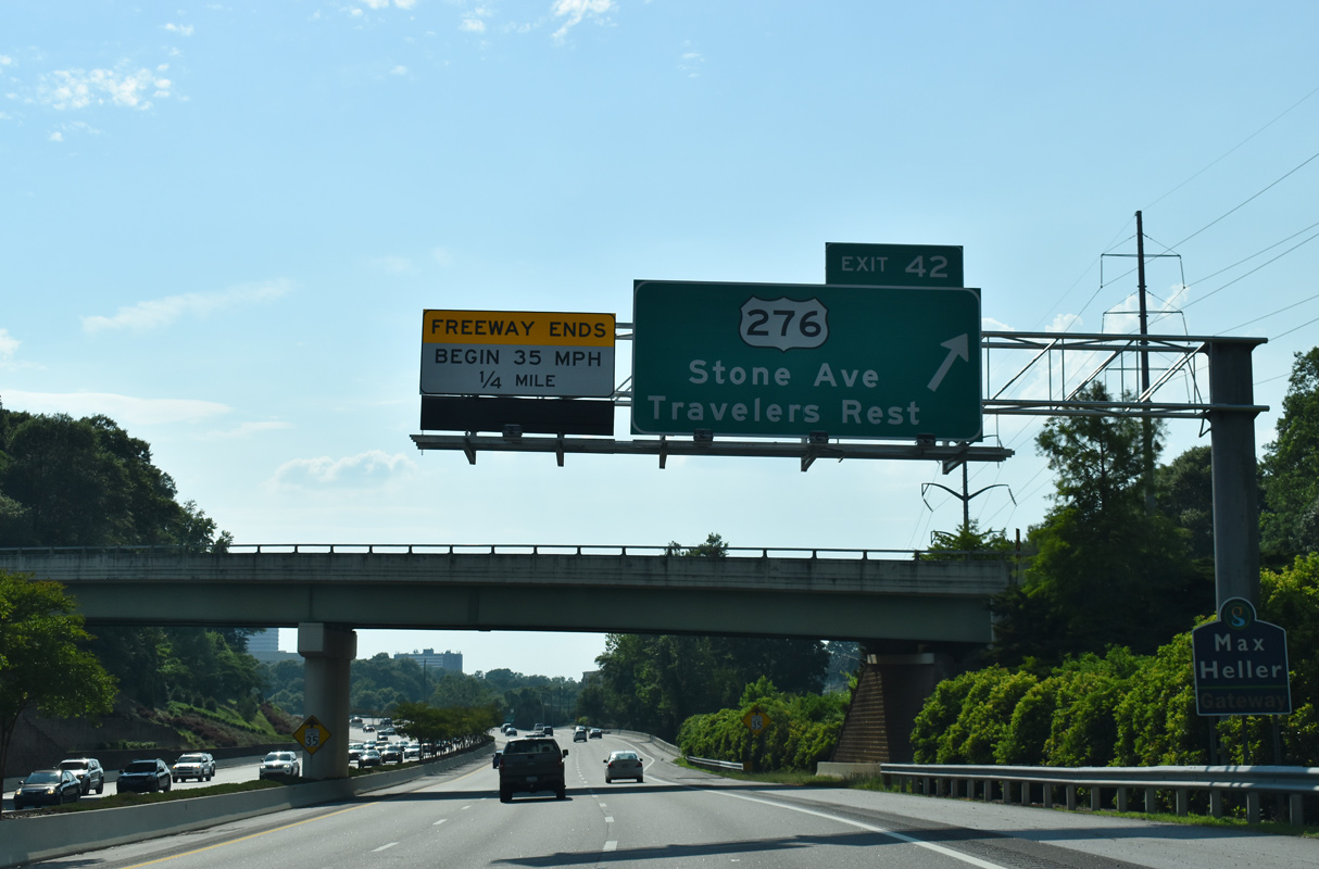
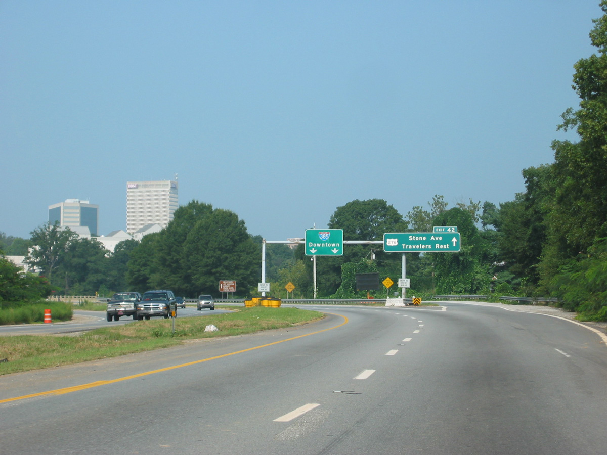
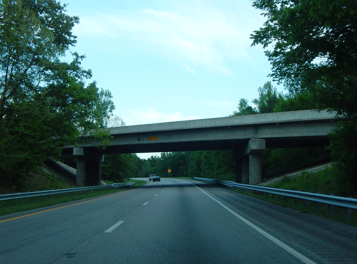
Interstate 385 turns west through a valley by the Arcadia Hills neighborhood to meet U.S. 276 (Stone Avenue) at a diamond interchange (Exit 42). 05/25/21
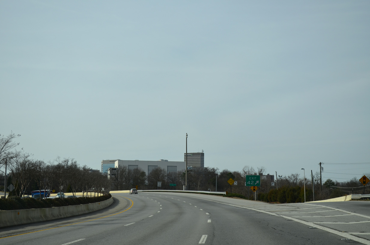
The freeway passes over U.S. 276 (Stone Avenue) with six overall lanes. This interchange was reconstructed as part of the I-385 widening in Greenville completed by Fall 2004. 12/31/13
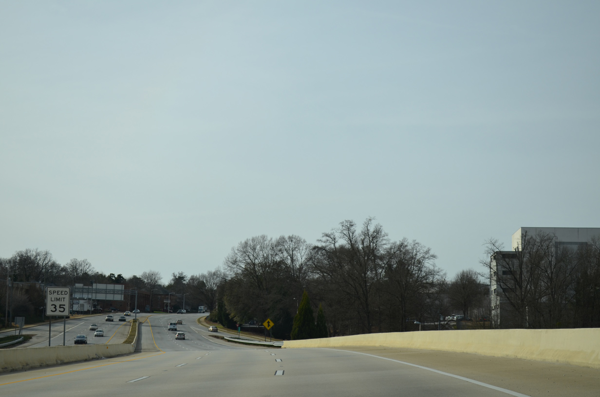
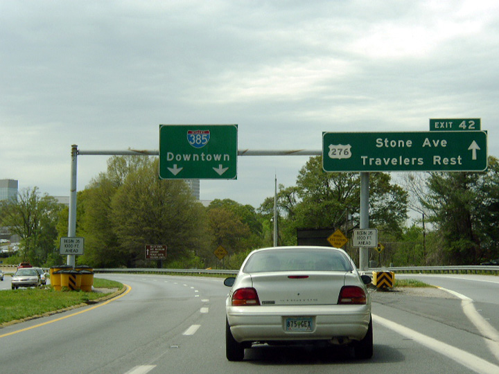
The speed limit reduces to 35 miles per hour as I-385 transitions to North Street, an urban boulevard extending west to the Bon Secours Wellness Arena and Downtown. The street doubles as unsigned Business Spur I-385 west to U.S. 29 (Church Street). 12/31/13
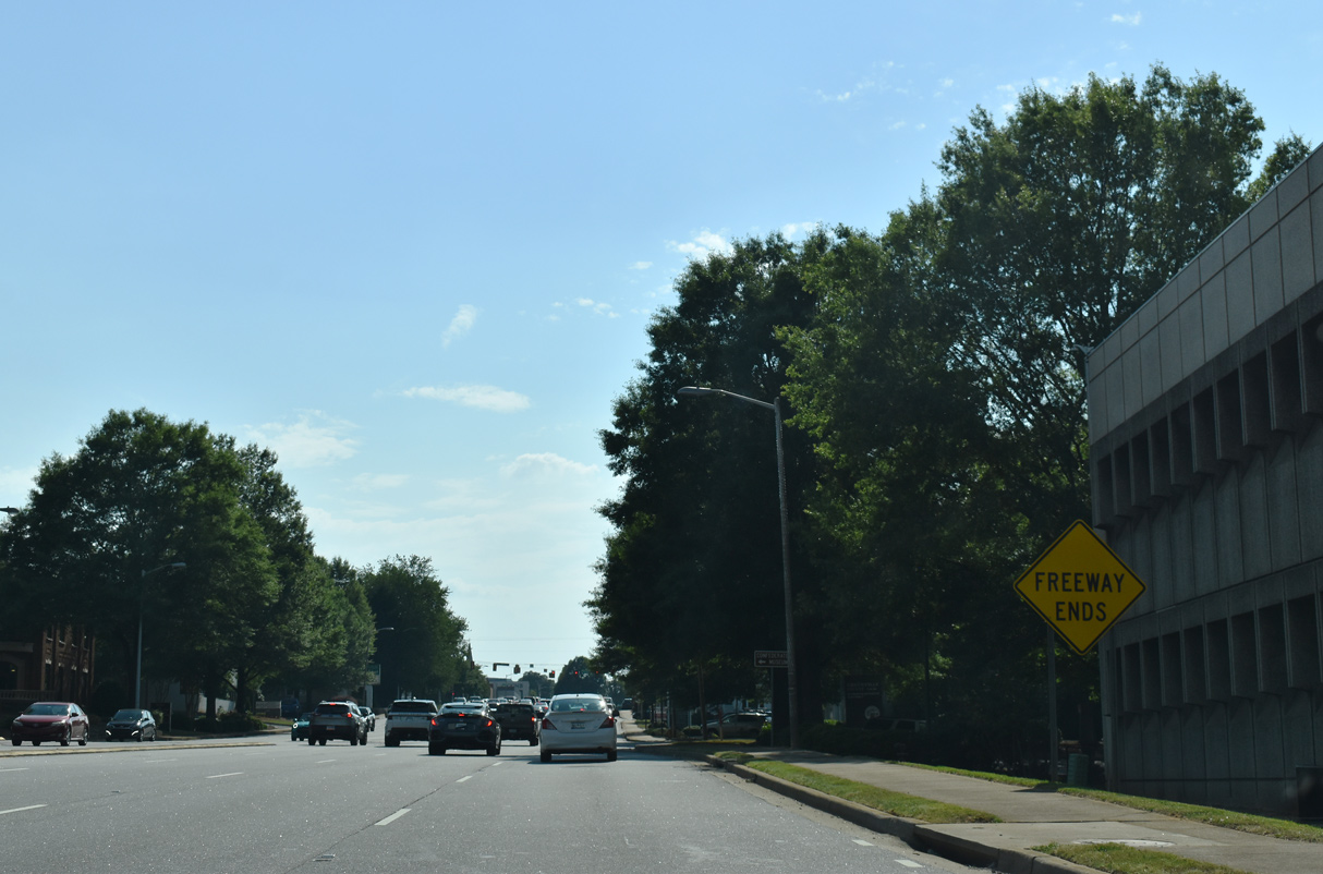
A formal end freeway sign stands just ahead of the intersection with McGee Street north and Boyce Avenue south. North Street proceeds two blocks to the westbound beginning of U.S. 123 at Academy Street. 05/25/21
![]()
![]() South at
South at ![]()
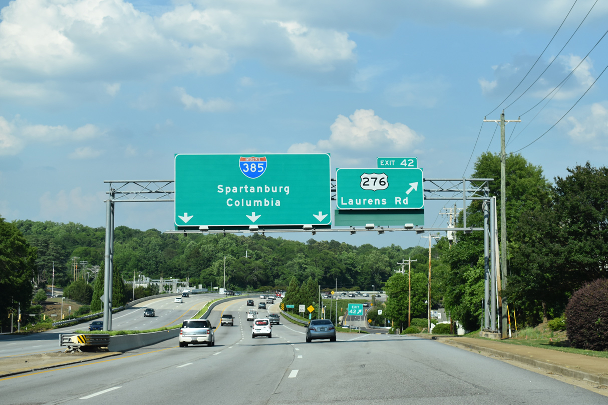
North Street (unsigned Business Spur I-385) east transitions into I-385 beyond the intersection with Boyce Avenue south and McGee Street north. Exit 42 follows for U.S. 276 (Laurens Road) south to Arcadia Hills in Greenville. 05/25/21
North End Throwback
The Downtown Greenville skyline appeared as Interstate 385 approached Exit 42 with just four lanes. 08/23/03
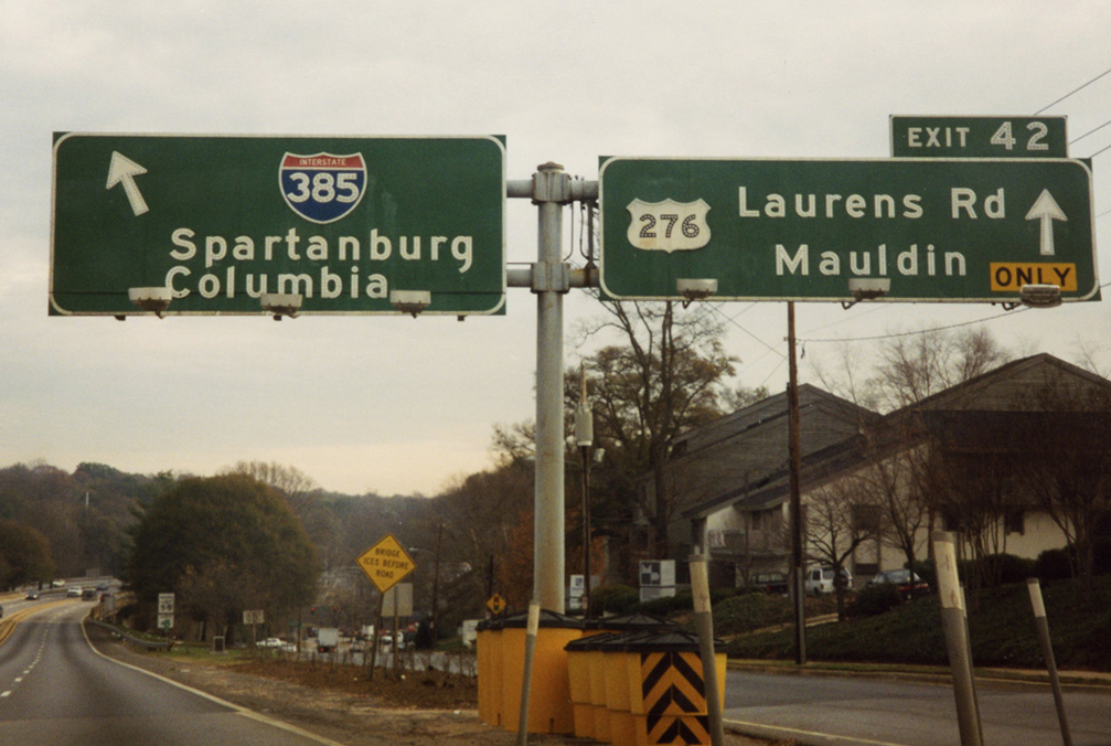
The diamond interchange (Exit 42) with U.S. 276 (Stone Avenue / Laurens Road) was revised with subsequent expansion of I-385. Photo by Chris Patriarca (04/06/03).
Original button copy signs at U.S. 276 were replaced reconstruction of I-385 in Winter 2003. Interstate 385 continues eastward through a valley below the Arcadia Hills neighborhood in Greenville. 12/08/99

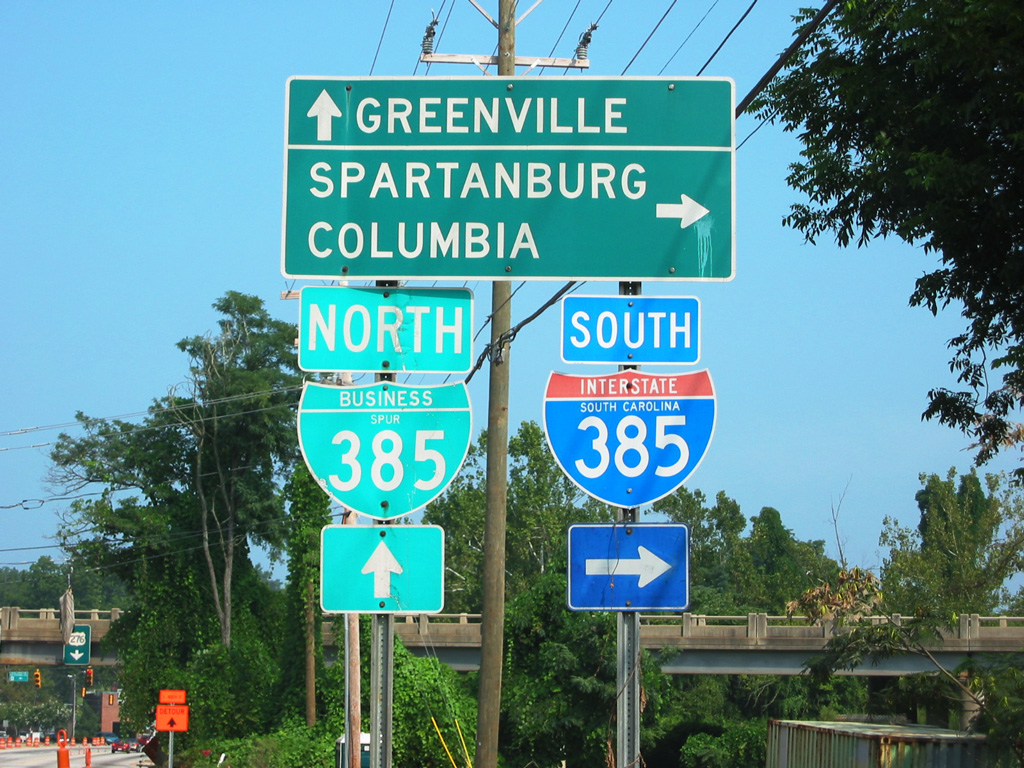
Business Loop I-385 was shielded at the entrance ramp joining U.S. 276 (Laurens Road) with E North Street until I-385 was reconstructed. Replacement signs reference the on-ramp as simply to “Downtown.” Photo by Carter Buchanan (06/00).
U.S. 276 west at the former southbound on-ramp to Interstate 385. This ramp was relocated to leave Laurens Road opposite the exit ramp from I-385 south during 2001-04 road work. 08/23/03
South End  – Clinton, South Carolina
![]() West at
West at ![]()
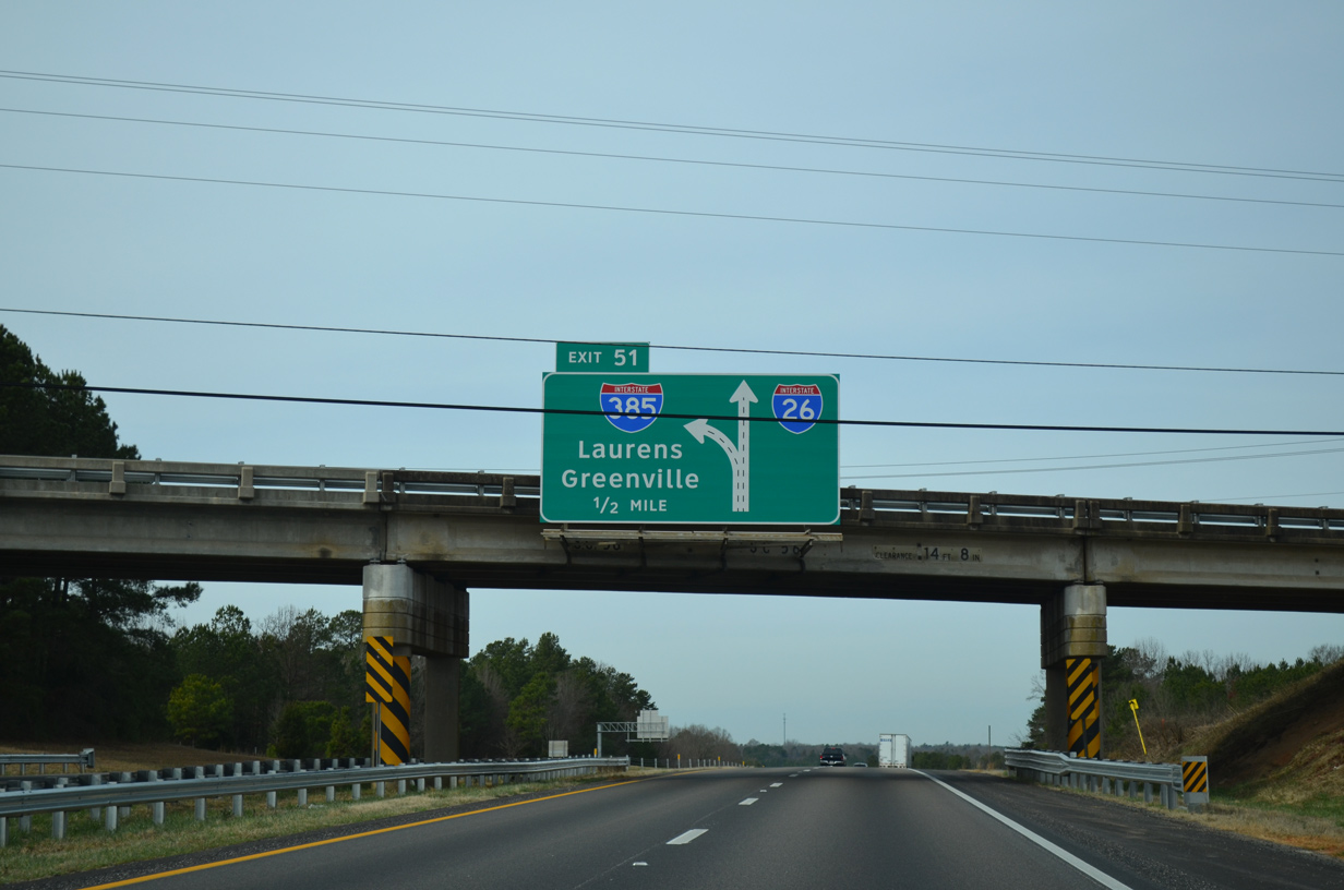
Interstate 385 north splits with I-26 west a half mile beyond the S.C. 56 overpass at Exit 51. 12/31/13
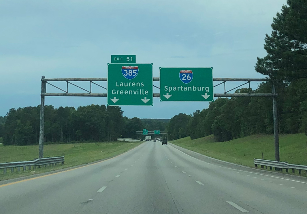
Interstate 385 departs with two lanes toward Laurens and Greenville at Left Exit 51 while I-26 turns more northward to Spartanburg. Photo by Peter Johnson (06/18/19).
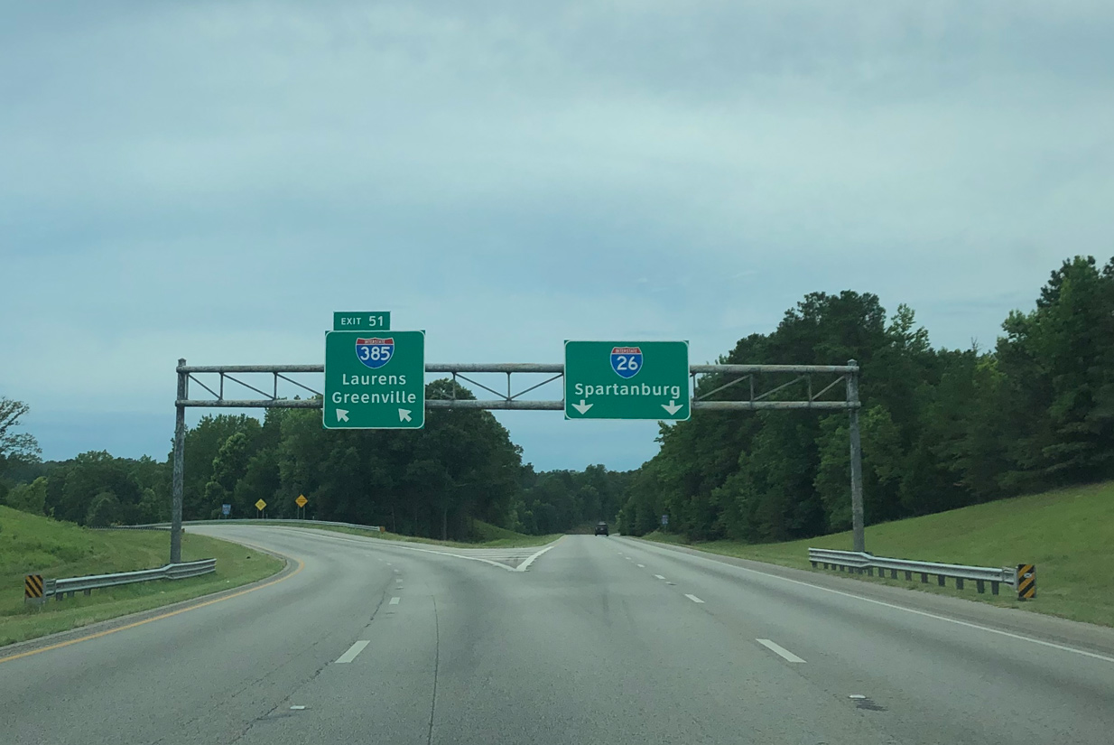
Entering the rural wye interchange with Interstate 385 north on I-26 west. Greenville is 39 miles to the north while Interstate 26 reaches Spartanburg in 30 miles. Photo by Peter Johnson (06/18/19).
![]() South at
South at ![]()
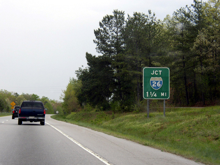
South from Fountain Inn to I-26 outside the city of Clinton, Interstate 385 comprises a rural freeway. Replaced by 2009, this button copy sign preceded the wye interchange with I-26. Photo by Chris Patriarca (04/06/03)
Interstate 26 merges with I-385 south at a wye interchange at northern reaches of the Clinton city limits. Photo by Carter Buchanan (04/22/17).
Sources:
- “S.C. Too Fast With Highway, Hits Dead-End.” Herald-Journal (Spartanburg, SC), Novermber 20, 1959.
- “New Freeway To Be Built Near Greenville.” Herald-Journal (Spartanburg, SC), January 3, 1978.
- “Big Industrial Park Planned For Fountain Inn.” Herald-Journal (Spartanburg, SC), August 27, 1986.
- I-385 Widening Project (Greenville County)
http://www.dot.state.sc.us/Projects/I-385/default.html. SCDOT. - “Largest road project to ever hit Upstate begins.” WYFF TV-4 (Greenville, SC), January 13, 2016.
- “Final bridge in Gateway Project opens to traffic.” WSPA TV-7 (Spartanburg, SC), December 6, 2019.
Page updated July 8, 2021.