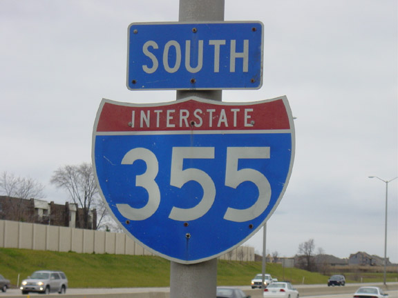
Interstate 355 Illinois

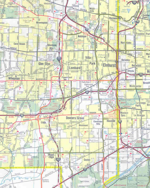
Interstate 355 (Veterans Memorial Tollway) converges with I-88 (Ronald Reagan East West Tollway) at a three wye interchange in the village of Downers Grove. The two routes run directly along side each another a short distance southwest to the village of Lisle. 09/03/05
Overview
Interstate 355 in Illinois is the Veterans Memorial (North-South) Tollway. Part of the Illinois Tollway System, I-355 connects I-80 in New Lenox with I-290 in Addison. The toll road meets I-55 in Bolingbrook and crosses Interstate 88 (Ronald Reagan Memorial Tollway) at Downers Grove.
Route Information
North End – Itasca, IL
South End – New Lenox, IL
Mileage – 32.51
Cities – New Lenox, Bolingbrook, Downers Grove, Glen Ellyn, Lombard
- Junctions –


Source: December 31, 2021 Interstate Route Log and Finders List

Interstate 355 extended south from the preexisting IL 53 freeway spur between I-290 and Army Trail Road. The state route was realigned away from the freeway following the completion of the North-South Tollway onto parallel Rohwing Road north to Biesterfield Road
 History
Legislature authorized the North South Tollway in 1984 and construction commenced on the $450 million project in October 1986.6 Interstate 355 was commissioned between I-55 and I-290 with the completion of the toll road on December 24, 1989.3 I-355 extended south from a previously constructed section of the IL 53 expressway between I-290 and Army Trail Road to I-55. I-355 was toll free until December 26, 1989, when rates of $1.00 per passenger vehicle went into effect.
The final section of I-355, from I-55 south to Interstate 80, opened on November 12, 2007 at a cost of $730 million.5 The American Association of State Highway and Transportation Officials (AASHTO) approved Interstate 355 for the completed extension on May 6, 2008.
Interstate 455
The 1988 official Illinois Tollway map showed the proposed North-South Tollway as Interstate 455. The following year, the route was changed to I-355. This information was conveyed to mapmakers in 1988, and as a result, I-455 appeared in a few commercial maps of the same vintage. I-455 was never signed – the North South Tollway was always Interstate 355 once it opened in 1989.
Tollway Extension
The 12.5 mile extension of Interstate 355 (North-South Tollway) was cleared for construction in 2002, following a series of delays due to environmental and other concerns. Even so, the I-355 extension remained listed by the Sierra Club in 2002 as a route that should not be constructed, so opposition to this road remained high.
Groundbreaking for the project was in November 2004. The tollway was designed with three lanes in each direction with interchanges at Interstate 80, U.S. 6, 159th Street, 143rd Street, 127th Street and I-55 at the north end.2,5 A “walk on the freeway” event was held on November 11, 2007 (Veterans Day), a day prior to the formal opening to traffic.1,4
South to Interstate 57 and Illiana Expressway
A further extension of I-355 south to Interstate 57 was proposed. Such an extension could potentially connect to the long-proposed Illiana Expressway, which would travel east through Will County to Interstate 65 in Indiana. Neither the extension to I-57 nor the link to the Illiana Expressway is currently projected for construction in the near term, but both routes have been proposed if not studied to some extent. If an airport is constructed in Peotone as was once proposed, then an extension of I-355 would be even more likely. Another consideration would be related to whether the Illiana Expressway is built to relieve the burdened Borman Expressway and Kingery Expressway corridor (I-80/94/294).
Brad Smetanko shed some light on the proposed southerly extension of Interstate 355 in an email dated November 28, 2002:
[According to the Will County] 2020 Transportation Plan, the county seems to feel that its residents are ardent supporters of the [recent extension of Interstate 355 south to Interstate 80]. Will County was one of the fastest growing in the state between 1990 and 2000, and the Census Bureau estimated almost 6% growth (to over half a million people) in just the first fifteen months following Census 2000.Also, as for a further extension, Will County at least seems to favor a western and southern bypass of New Lenox. That would mean travelers on future southbound Interstate 355 would have to merge onto westbound Interstate 80 for about a mile before continuing south [toward Interstate 57]. You can see their corridor, which extends across Interstate 57 to the Indiana border, at the above Transportation Plan link (no longer online). From firsthand experience trying to navigate the county even two years ago at rush hour, all of the above extensions would be put to good use.
These future plans depend heavily on the South Suburban Airport planned for Peotone. With Mayor Richard Daley in Chicago pushing for O’Hare Airport expansion, things are really up in the air, pun intended. While the O’Hare project isn’t a done deal, some land acquisition has started, but the same is true of the Peotone Airport. Governor Ryan was a big supporter of the Peotone project (he hailed from Kankakee County, immediately to the south of Peotone), but I think Governor-elect Blagojevich will be more inclined to go along with Mayor Daley.
In short, don’t look for any earth-movers in the next five years [not until well after 2007], either on Interstate 355 south of Interstate 80 nor on a South Suburban Airport. But plans are in the works, and if the growth continues, something will have to be done eventually. Plus, airport construction would make the highway a virtual certainty, at least in some form.
On September 30, 2004, the board of trustees for the Illinois Tollway approved a $5.3 billion construction plan, which included multiple tollway improvements along with the Interstate 355 extension southeast to Interstate 80. This plan was previously detailed on the official Illinois Tollway web page, under the Fiscal Year 2005 Budget approval on October 28, 2004. The following is a synopsis of some of what is included in the spending plan (thanks to Kevin Wheeler):
- Widening, resurfacing and/or reconstruction of 90+% of the tollway system.
- Converting the current toll system to “open road tolling” where I-PASS users would be able to pass through all toll plazas at posted highway speed, while cash paying customers are routed off the road. Tolls were doubled to $0.80 for cash paying customers and were raised to $3-$4 for trucks. I-PASS users a guaranteed a rate freeze for 10 years.
- Construction of the “next” leg of I-355 from the exchange with I-55 in Bolingbrook, to Interstate 80 near New Lenox. Ultimately plans call for I-355 to extend to Interstate 57 near Peotone, where it would connect to another road to be built by the Indiana Department of Transportation (the “Illiana Expressway”). Construction of Interstate 355 was expected to began around Thanksgiving 2004, and was completed in November 2007.
Illinois Route 53 Extension – North to Interstate 94
Studies involving the extension of IL 53 north to near Grayslake commenced in 2011, and by 2016, the Illinois Tollway agency allocated $4 million to planning consultants. Design of the route incorporates environmentally sensitive design with features to offset damages from road salt, noise and lighting to wetlands and parkland along the route. Costs for the extension were estimated between $2.3 and $2.65 billion.7
Delays and debate as to whether the extension should be built continued through 2016. The Illinois Tollway agency intended to move forward with a $40 million to $50 million feasibility study to extend IL 53 north to IL 120, despite the withdraw of support by Lake County Board Chairman Aaron Lawlor. The route was previously envisioned as a four lane parkway with a 45 mile per hour speed limit. However more formal design work, or a no build alternative, would follow an Environmental Impact Statement (EIS).7
North End  – Itasca, Illinois
![]() East at
East at ![]()

Interstate 355 travels through or near the western suburbs of Glendale Heights, Lombard, Glen Ellyn, Downers Grove, Lisle, Woodridge and Bolingbrook. Photo by Peter Johnson (03/13/20).
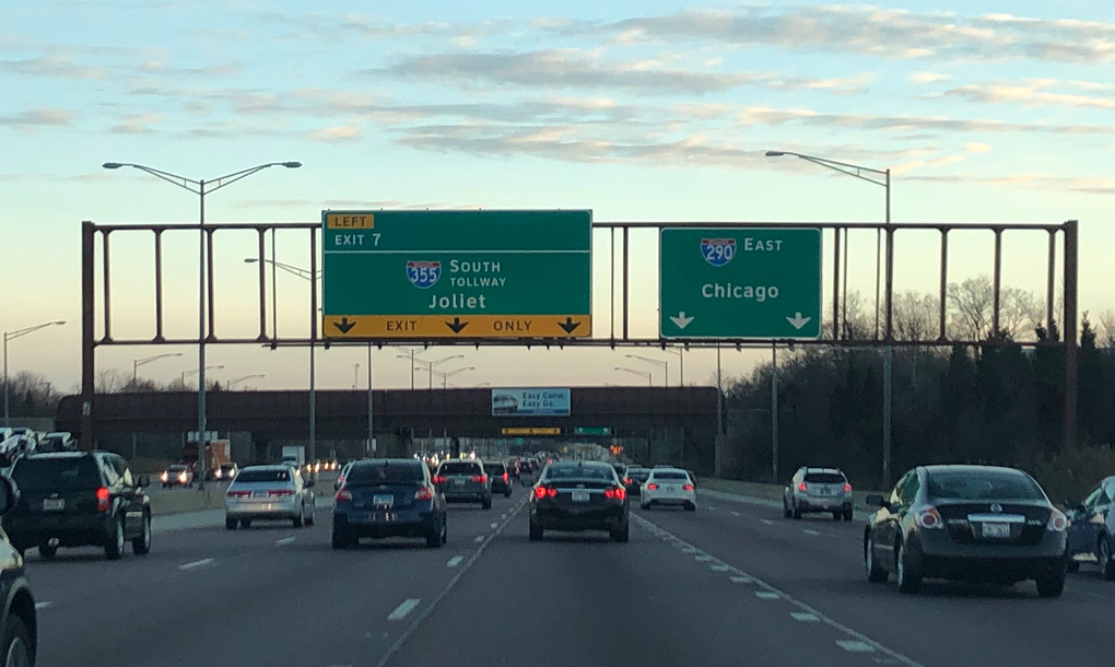
Passing east of an industrial park area, I-290 east advances with five lanes to Left Exit 7 for Interstate 355 south. Photo by Peter Johnson (03/13/20).
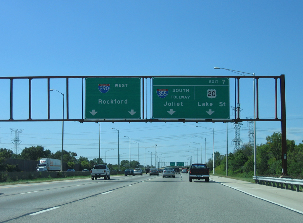
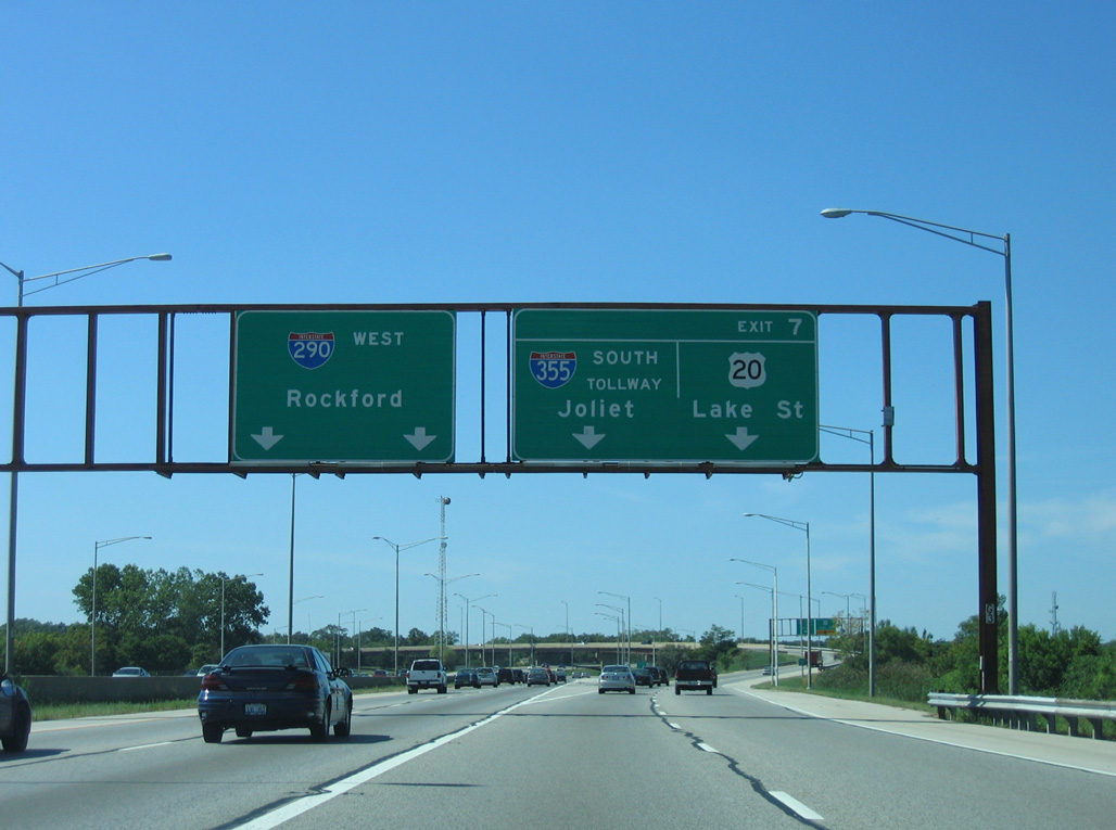
Exit 7 leaves Interstate 290 as the Eisenhower Expressway turns southeast toward Chicago. The 2007-opened extension of I-355 serves Lemont, Lockport and New Lenox as well as eastern Joliet. Photo by Peter Johnson (03/13/20).

Exit 31 departs from I-355 southbound just beyond the separation from I-290 (Eisenhower Expressway) east for U.S. 20 (Lake Street) at the village of Addison. Photo by Peter Johnson (03/13/20).
North End Throwback
![]() North at
North at ![]()
Beyond IL 53 (Rohlwing Road), Interstate 355 north expands to four then five lanes before partitioning into ramps for I-290. All signs leading to I-290 were replaced by 2012 with Clearview font based panels. 05/24/08
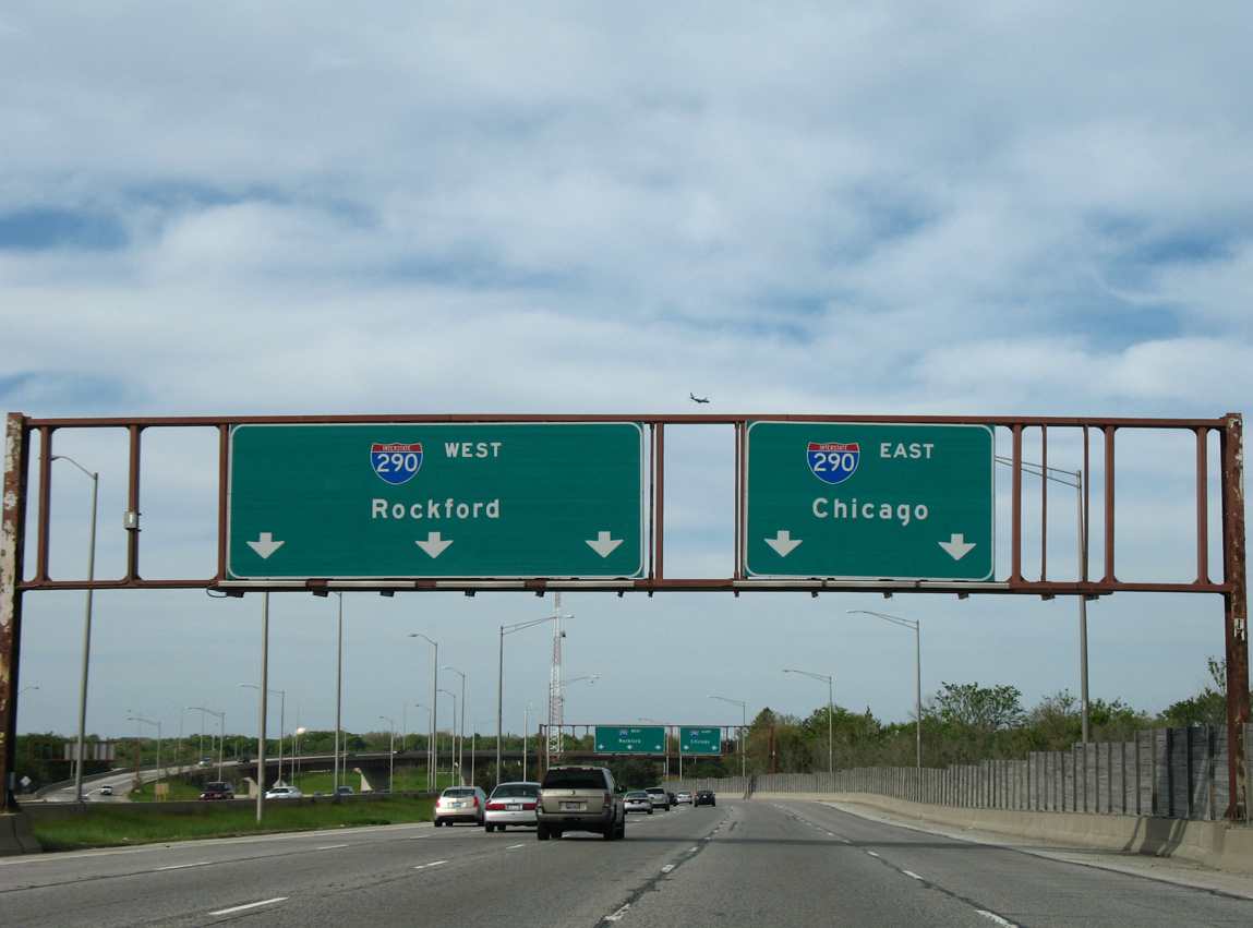
Entering the three-wye interchange with I-290 (Eisenhower Expressway) on I-355 north. Rockford lies 55 miles to the northwest via I-290 and I-90 west. I-290 turns southeast from I-355 through the suburbs of Addison and Elmhurst before meeting the I-88 (East-West Tollway) and Tri-State Tollway (I-294). 05/24/08
![]() East at
East at ![]()
SR 53 shifts west from I-290 onto parallel Rohlwing Road via Biesterfield Road, 2.5 miles north of Interstate 355 (North-South Tollway). These signs were replaced after 2012. 05/09/10
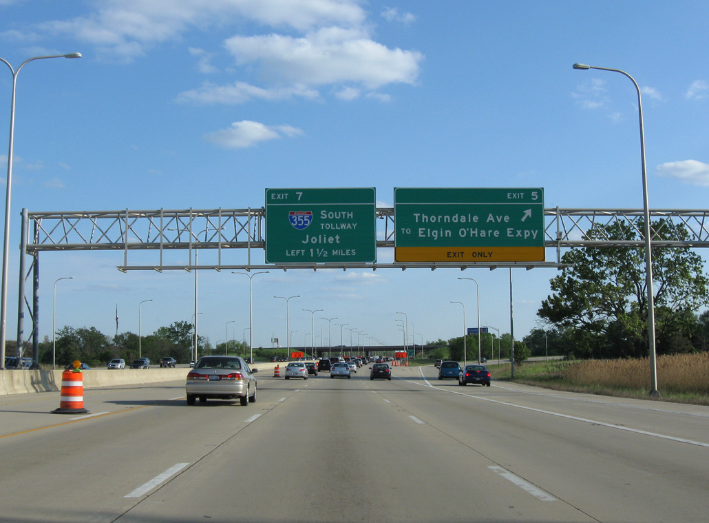
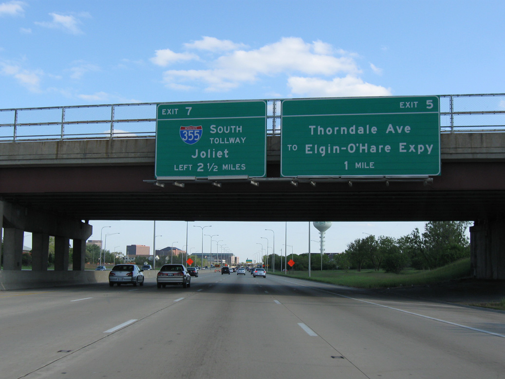
I-355 split from I-290 (Eisenhower Expressway) east beyond Exit 5 for Elgin-O’Hare Expressway and Thorndale Avenue. Construction underway here by 2015 upgraded this exchange as part of the Illinois Route 390 Tollway project. 05/09/10

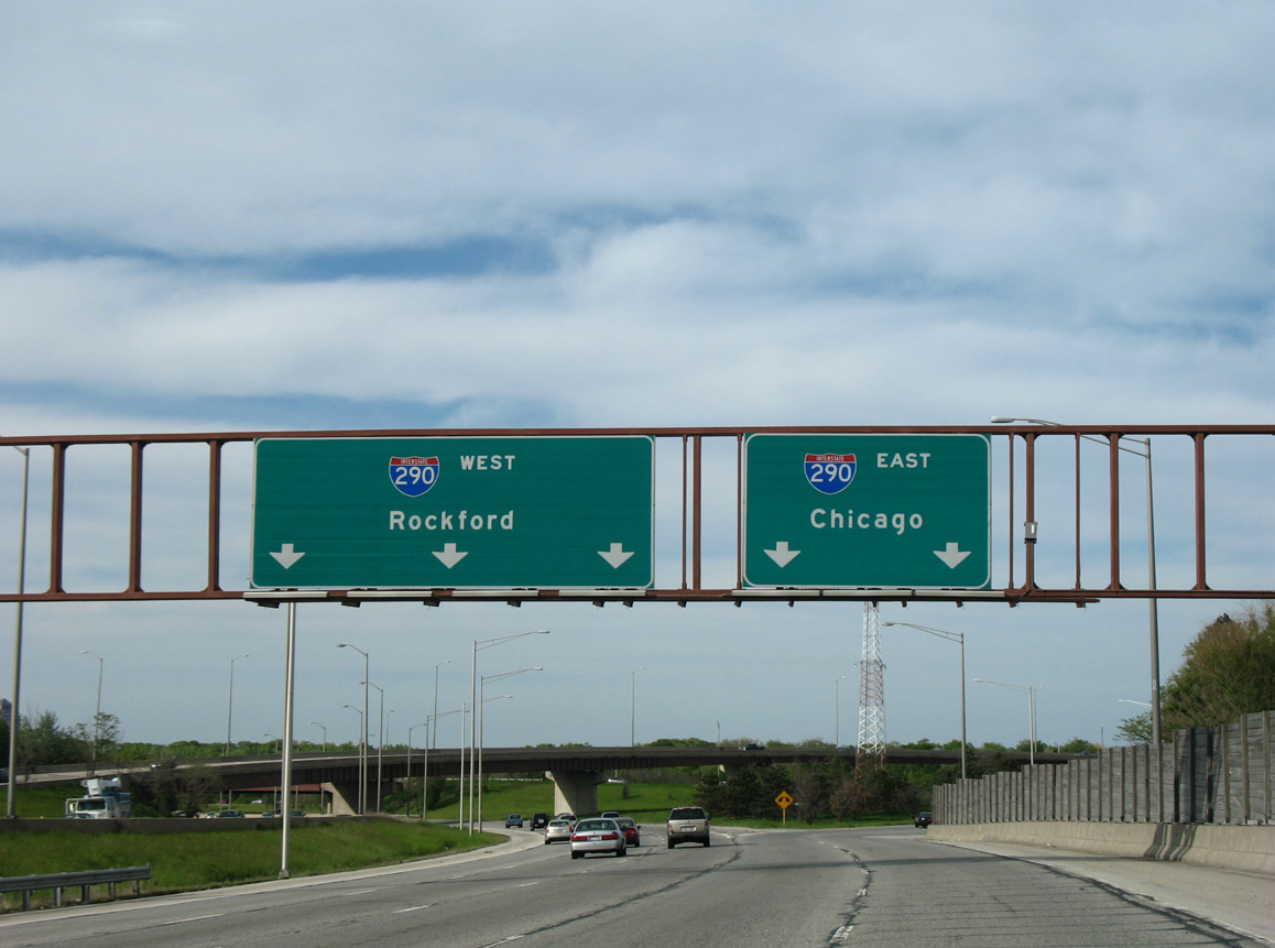
Overheads for I-290 and I-355 south of the Illinois Route 390 Tollway were replaced with Clearview signs by 2012. 09/03/05
IL 19 (Irving Park Road) spans Interstate 290 (Eisenhower Expressway) east just ahead of the three wye interchange (Left Exit 7) with the Veterans Memorial Tollway. 09/03/05
![]() West at
West at ![]()
Advancing northwest by Maple Meadows Golf Club and an older suburban street grid, Intestate 290 (Eisenhower Expressway) continues beyond the Mill Road overpass to Exit 7 for I-355. 09/03/05
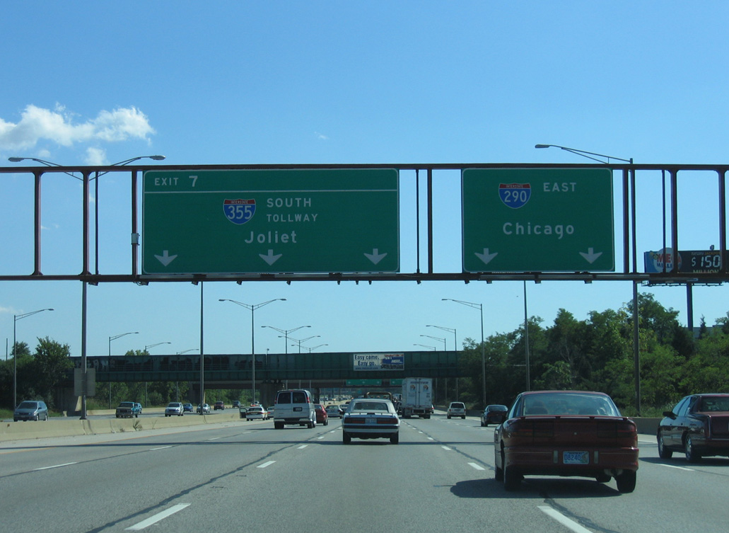
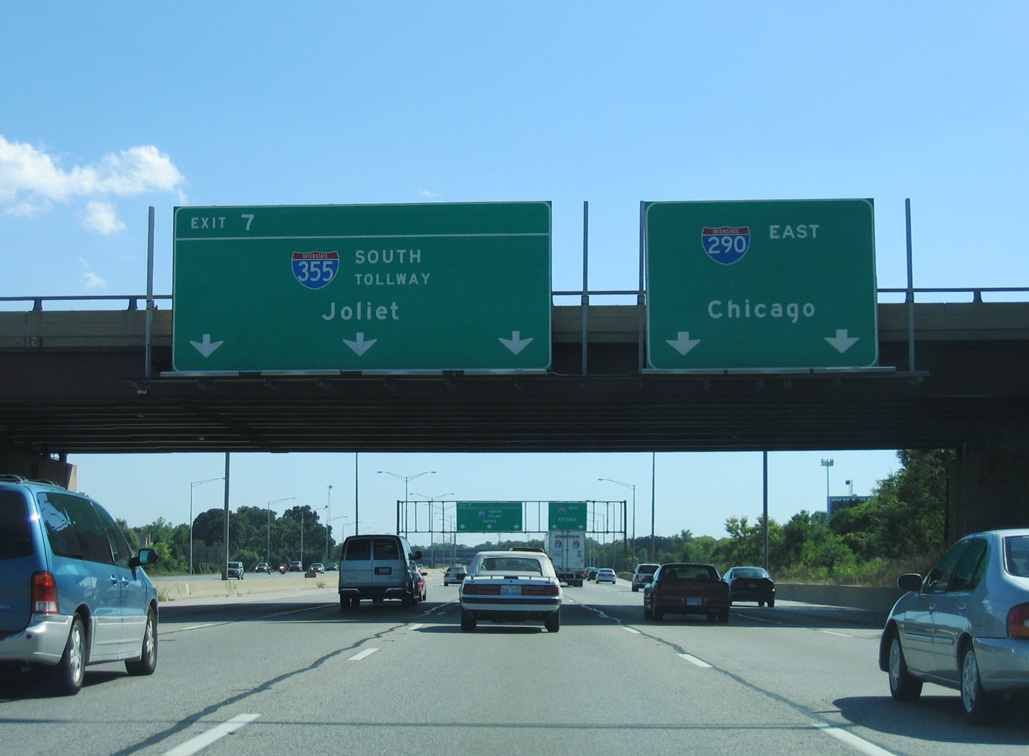
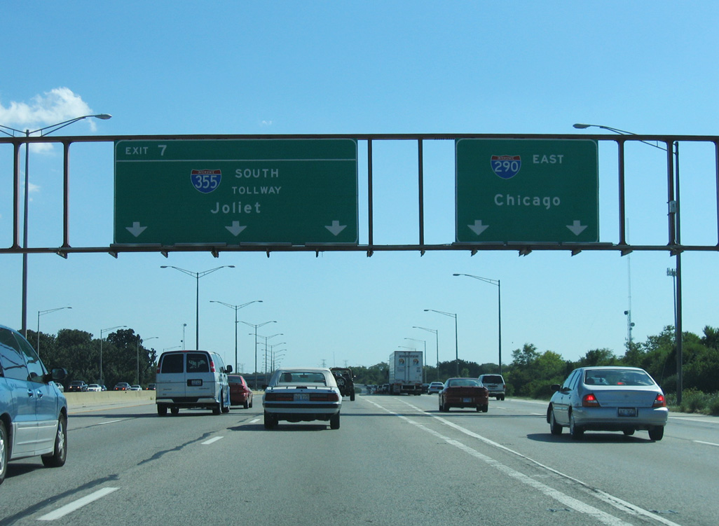
I-290 west runs along side Songbird Slough Forest Preserve to the two lane flyover (Exit 7) for Interstate 355 (North South Tollway). 09/03/05
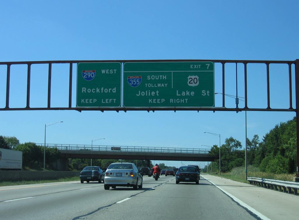
Interstate 290 turns north and converges with a three lane entrance ramp from the end of I-355 as Exit 7 parts ways for adjacent U.S. 20 (Lake Street) and I-55 near Joliet. 09/03/05
South End  – New Lenox, Illinois
![]() South at
South at ![]()
I-355 (Veterans Memorial Tollway) bends southeast from the city of Lockport toward U.S. 6 and I-80 at New Lenox. Photo by Peter Johnson (03/13/20).
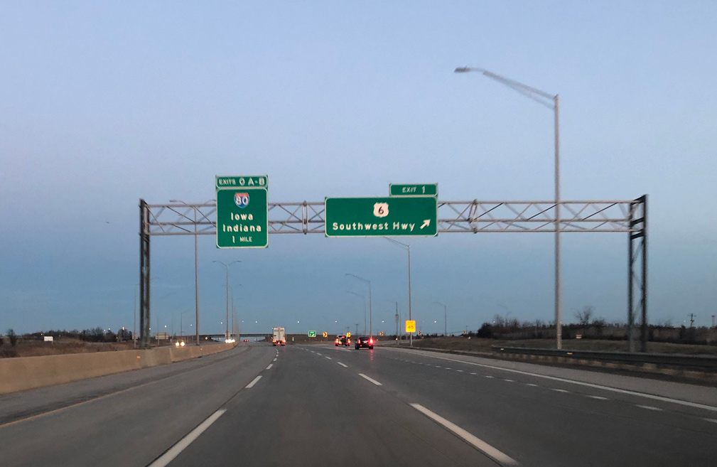
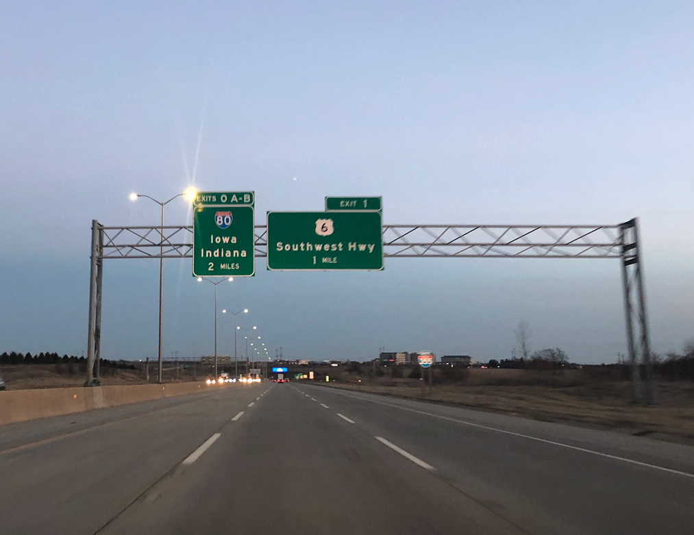
Southbound I-355 (Veterans Memorial Tollway) meets U.S. 6 (Southwest Highway) at a folded diamond interchange. Eastward, U.S. 6 passes through Marley en route to Cook County. U.S. 6 west travels to Downtown Joliet. Photo by Peter Johnson (03/13/20).
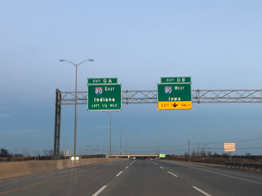
Exit 0A connects with I-80 east to Tinley Park, Landing and Gary, Indiana and Exit 0B with I-80 west to Joliet and the Quad Cities. Photo by Peter Johnson (03/13/20).

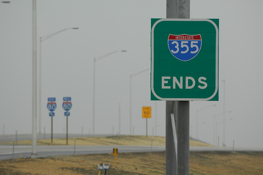
Interstate 355 concludes as Exit 0B departs for I-80 west toward Des Moines, Iowa. Photo by Peter Johnson (03/13/20).
The I-355 mainline defaults onto Interstate 80 east toward the Tri-State Tollway (I-294) at Hazel Crest and the Indiana Toll Road to South Bend. A single lane ramp joins westbound I-80 across south Joliet to Peru and Moline. Photo by Jeff Royston (11/19/07).
The south end of Interstate 355, one month prior to the opening of the Veterans Memorial (North-South) Tollway. Photo by Bill Burmaster (10/13/07).
The project manager indicated to Bill Burmaster that the interchange with Interstate 80 was designed to accommodate an extension of I-355 to the southeast, but that it was changed by July 2007. The original layout took the main line lanes through the middle of the exchange, which is why the median widens as I-355 approaches I-80.
![]() East at
East at ![]()
Interstate 80 curves northeast from U.S. 30 and Hickory Creek to pass under the Commonwealth Edison (Exelon) power line corridor just ahead of Interstate 355. These towers support 345kV and 138kV lines as they run along the west side of the tollway through the outer suburbs of Chicago. 06/20/15
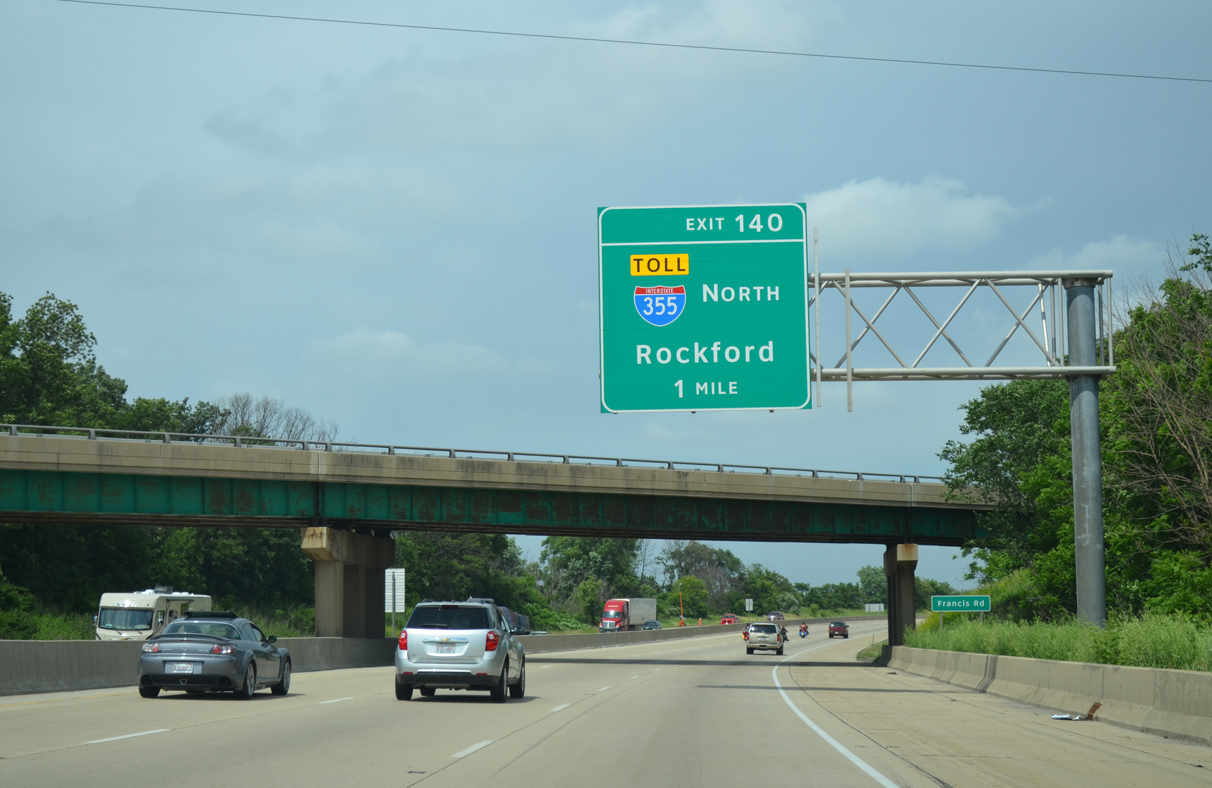
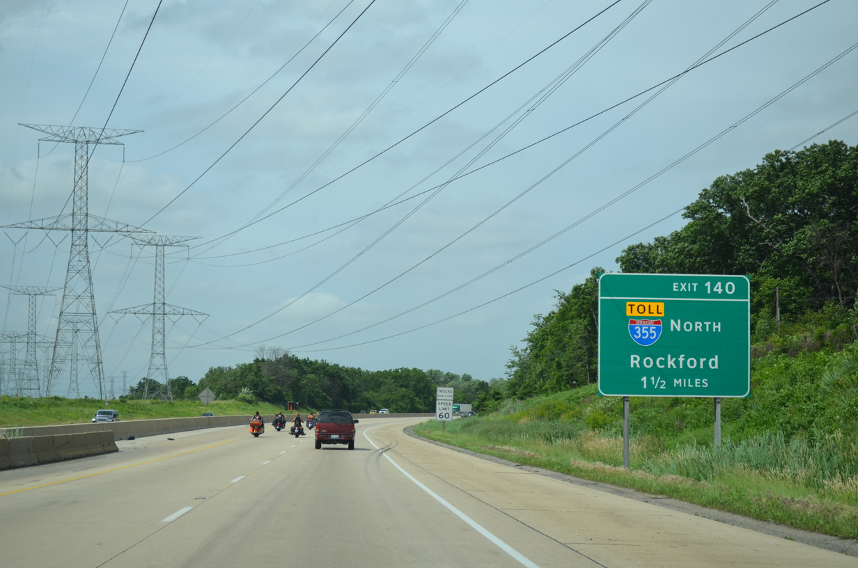
Francis Road spans I-80, one mile ahead of the directional T interchange (Exit 140) with Interstate 355 (Veterans Memorial Tollway) north. 06/20/15
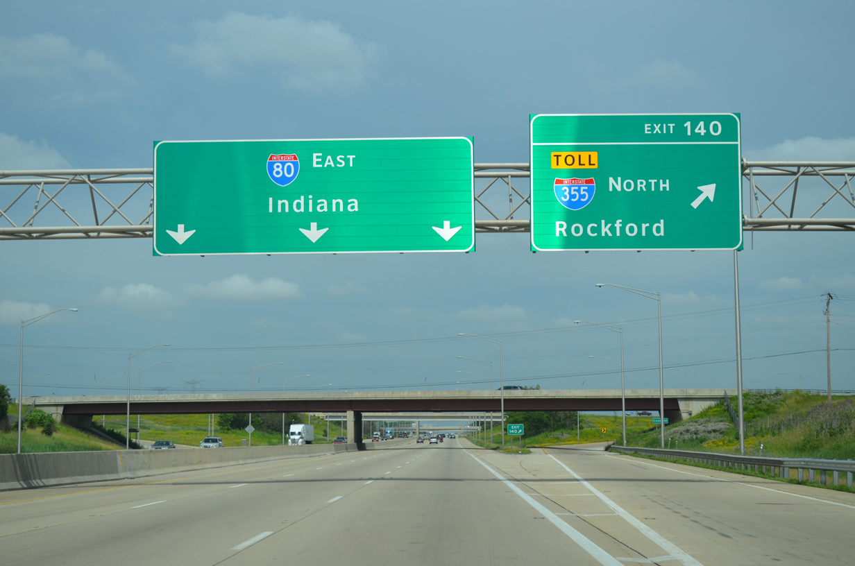
Exit 140 departs I-80 east at the Cedar Road overpass for Interstate 355 north. The tollway angles northwest by the Cedar Crossings development and remaining agricultural areas to the first mainline toll plaza. 06/20/15
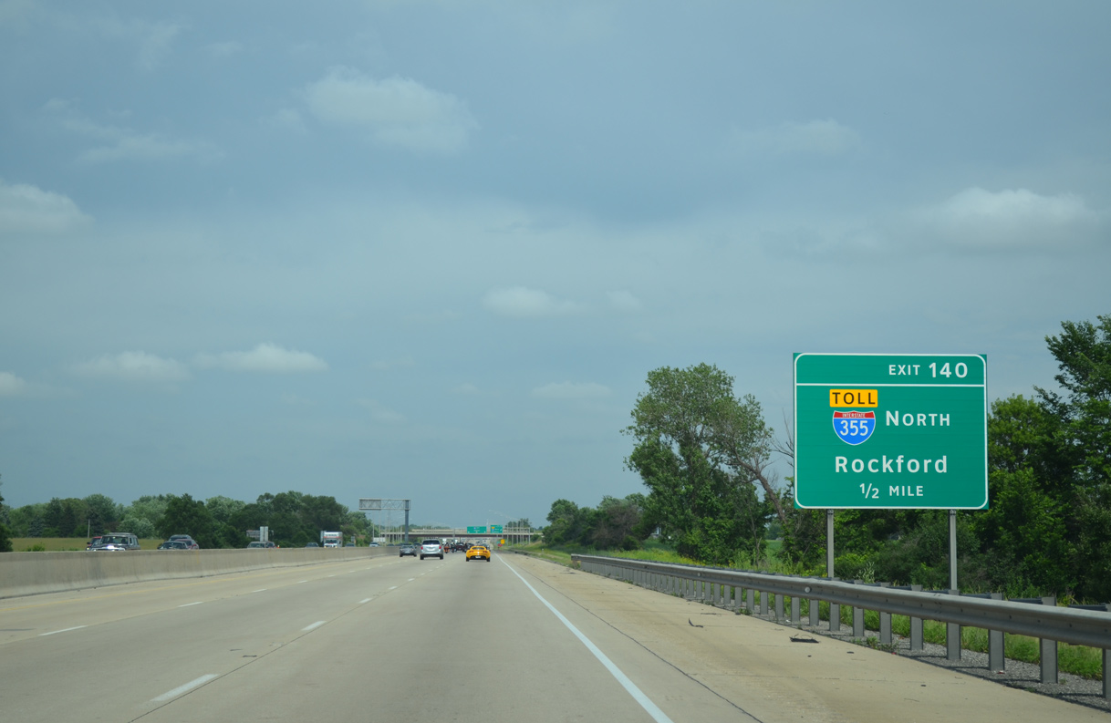
Rockford is the control city for I-355 north for the connection with Interstate 90 (Jane Addams Memorial Tollway) west via I-290. 06/20/15
![]() North
North
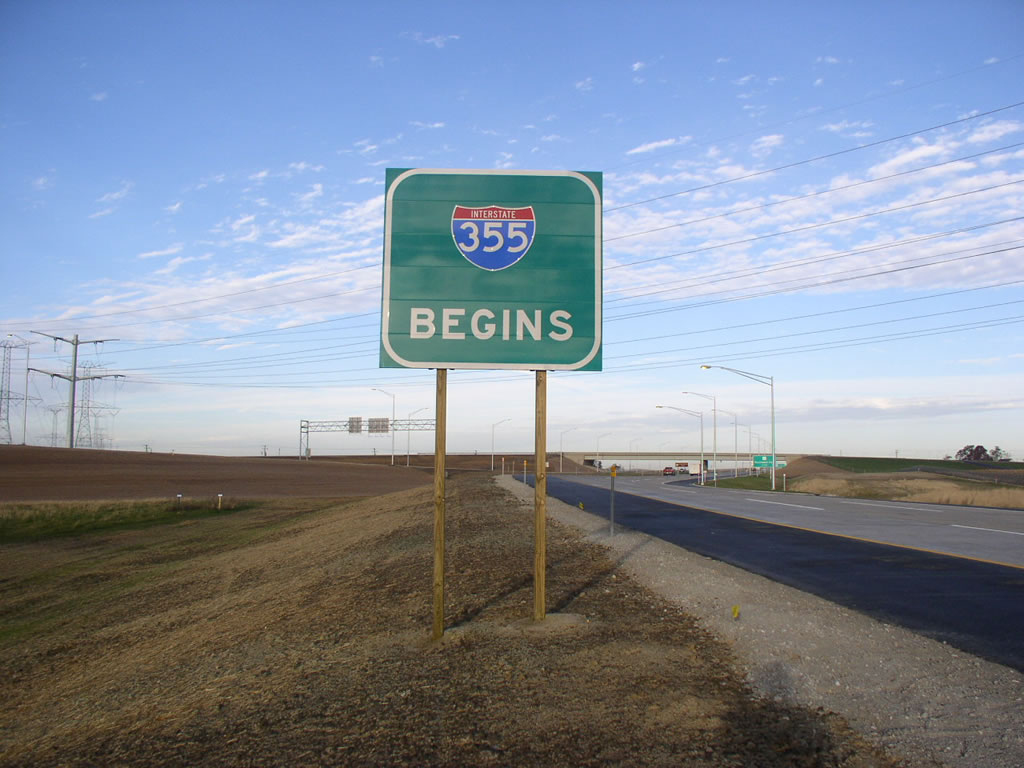
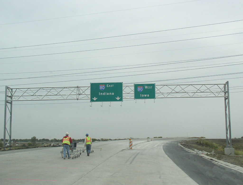
A begin sign for I-355 stands between the roadways just east of the Cedar Road overpass. Realigned as a result of the interchange construction, major power lines cross over the I-80/355 exchange. Photo by Bill Burmaster (11/13/07).
Former South End – – Bolingbrook, Illinois
![]() South at
South at ![]()
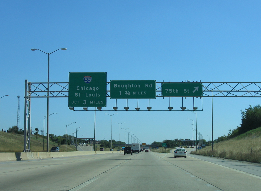
The first sign for the previous south end of Interstate 355 appeared at the diamond interchange with 75th Street. The penultimate exit is Boughton Road. 09/03/05
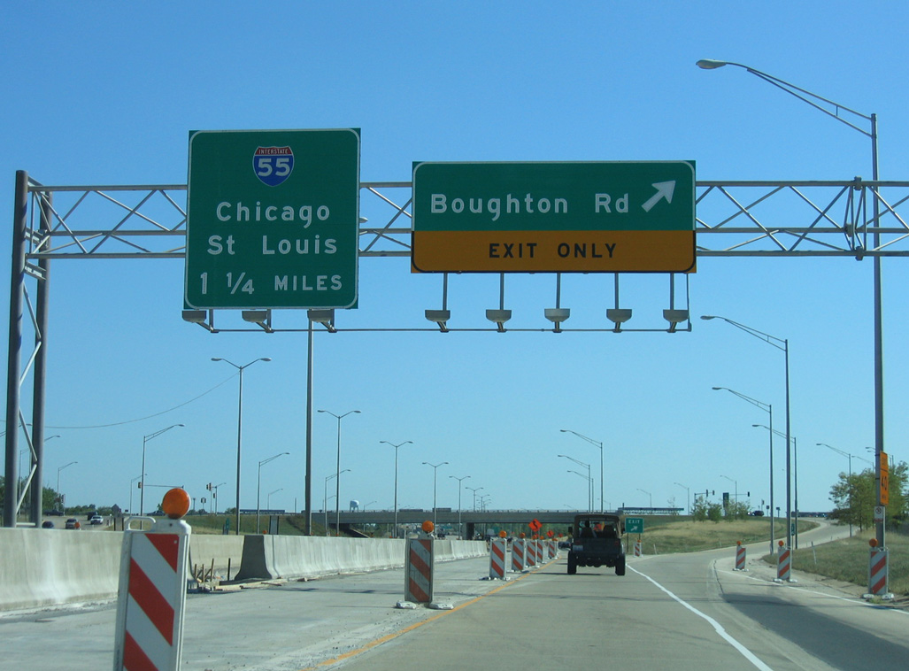
I-355 south at the diamond interchange with Boughton Road at Bolingbrook. These were posted above the cash lanes departing from the adjacent main line toll plaza. 09/03/05
The North-South Tollway concluded with four lanes prior to 2005. These button copy signs were eventually replaced with a diagrammatic overhead showing the third southbound lane. Photo by Jeff Royston (11/25/01).

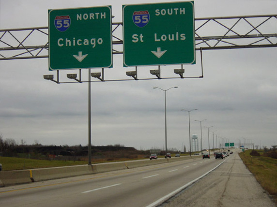
A trumpet interchange previously connected the south end of I-355 with Interstate 55. 09/03/05
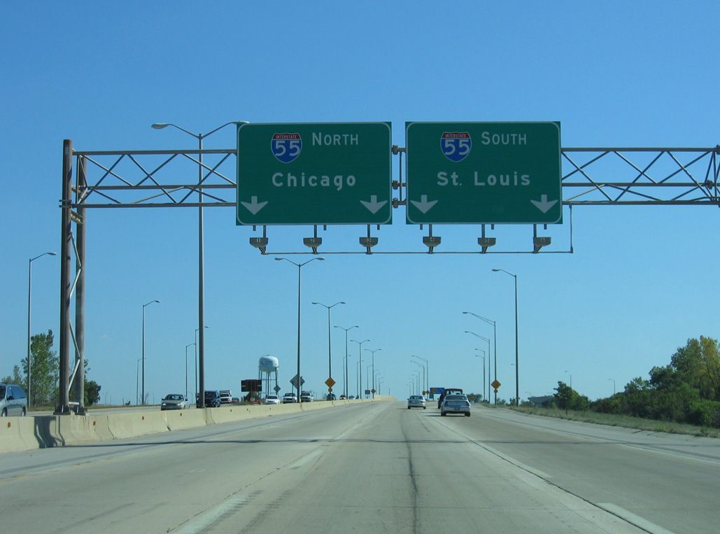
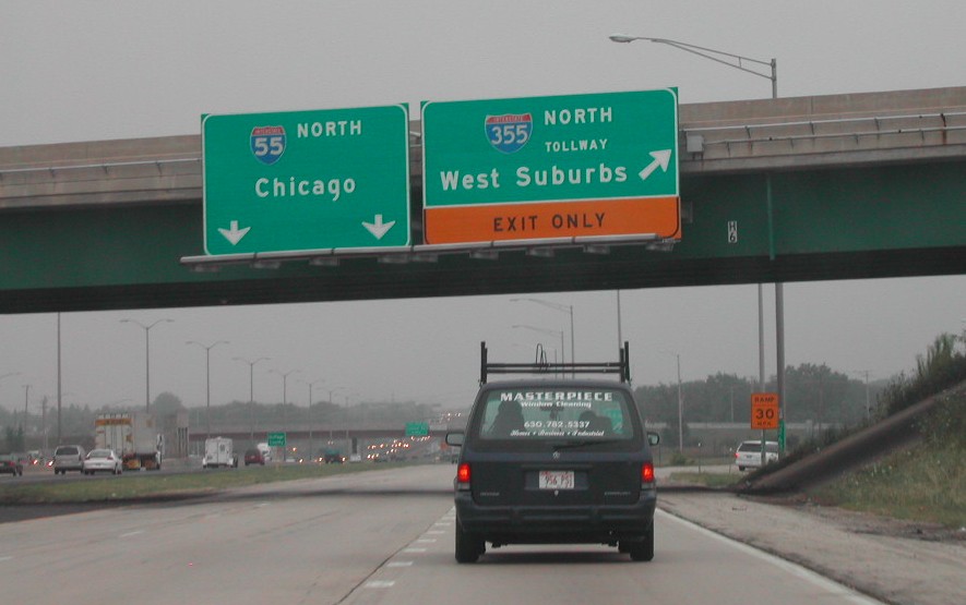
I-355 concluded as traffic partitioned for Interstate 55 northeast to Downtown Chicago and southwest to Joliet, Springfield and St. Louis. 09/03/05

A button copy end sign was posted on the transition ramp to I-55 north. Bridge supports were prebuilt for the eventual southern extension to New Lenox. Photo by Jeff Royston (11/25/01).
![]() North at
North at ![]()
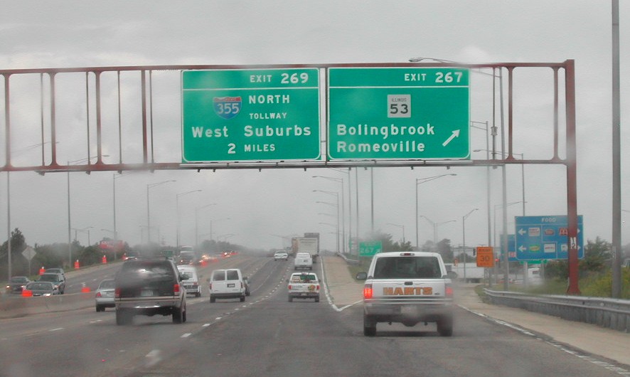
This set of button copy signs was posted at the diamond interchange (Exit 267) for IL 53. The overhead for I-355 was removed by 2008. IL 53 parallels I-355 northward to Interstate 290. Photo by Brian Dowd (06/02).
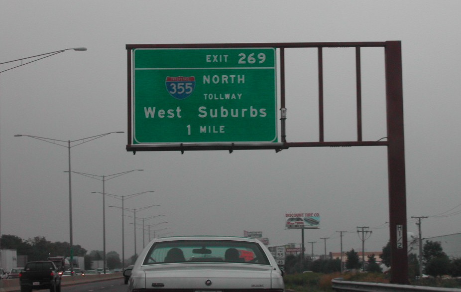
This one mile overhead for Interstate 355 was replaced by 2008 to reference just Tollway as the southern extension opened. West Suburbs was replaced with “Suburbs”. Photo by Brian Dowd (08/16/02).
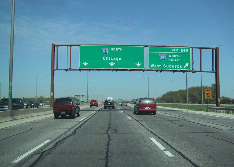
A collector distributor roadway (Exit 269) departed I-55 north for I-355 ahead of the wye interchange with Joliet Road (Historic U.S. 66). The North-South Tollway serves the Western Suburbs of Addison, Downers Grove, Glen Ellyn, Glendale Heights, Lombard and Woodridge. Photo by Eric W. Vander Yacht (04/01).
The former c/d roadway from Joliet Road (Historic U.S. 66) north to I-355. A distributor roadway replaced this set of lanes when the Veterans Memorial Tollway was extended south. Photo by Brian Dowd (06/02)
A loop ramp departed for Interstate 355 (North South Tollway) as I-55 continued another 14 miles to the Chicago city limits. Photo by Brian Dowd (08/16/02).
Sources:
- “Work under way on 355 South Extension in Illinois.” Tollroads News, April 1, 2005.
- Dan Hobson, personal email (“New toll rates on IL Tollways”), Saturday, May 14, 2005.
- Encyclopedia of Chicago: Expressways by Dennis McClendon of the Chicago Historical Society.
- Encyclopedia of Chicago: Tollways by David M. Young of the Chicago Historical Society.
- “New superhighway opening soon in Will.” Chicago Tribune, October 21, 2007.
- “Opening of I-355 will put some zip in Du Page traffic.” Chicago Sun-Times, December 22, 1989.
- “Lake County’s Lawlor pulls Route 53 support; study still on?.” Daily Herald, May 16, 2016.
Page updated July 19, 2021.