Interstate 310 Mississippi

Overview
Designated as Mississippi Highway 601, Interstate 310 was the proposed Canal Road – Port Connector in Gulfport.4 It was planned to begin at a new interchange with Interstate 10 and the south end of the proposed U.S. 49 Gulfport to Hattiesburg freeway (MS 601 North). South from there, I-310 would have extended south across U.S. 90 at 27th Avenue into the Port of Gulfport.
The highway was originally considered for designation as Interstate 210, but was later planned as I-310 since it would comprise a spur from I-10 to the Port of Gulfport and not return northward.2 Despite a $158.5 million expenditure by the state of Mississippi for preliminary engineering, rights-of-way, land clearing and utility relocation, the Port Connector project is uncertain due to the required restart of environmental permitting and lack of funds.5
The projected route of MS 601 took the Central Harrison Connector south from near the interchange joining I-10 with Canal Road to 30th Avenue in Gulfport. The project would have likely included a temporary access road linking the freeway with Canal Road until funding was made available for the systems exchange with MS 601 north and I-10.
Route Information
North End – Gulfport, MS
South End – Gulfport, MS
Mileage – 6
Cities – Gulfport
- Junctions –

Source: “Road plan for Biloxi in design stages.” The Clarion-Ledger (Jackson, MS)
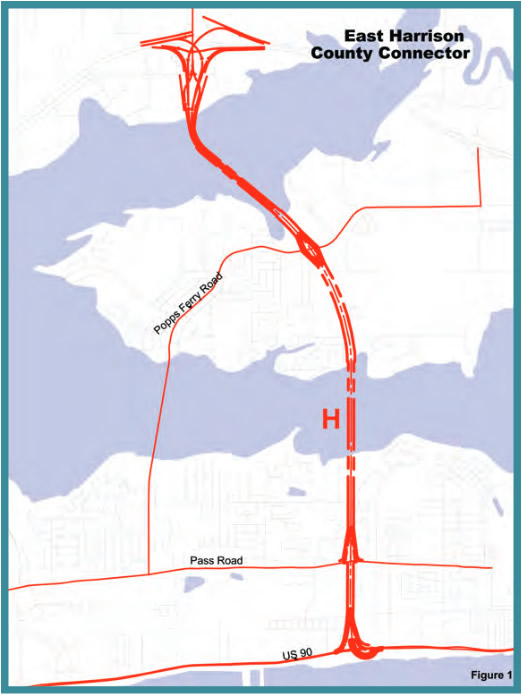
The “H” route was selected by Biloxi leaders by a split vote in 2001. Biloxi City Council asked for a reconsideration of the route in December 2005 after a Governor Commission recommendation against elevated highways.6
 History
Central Harrison Connector
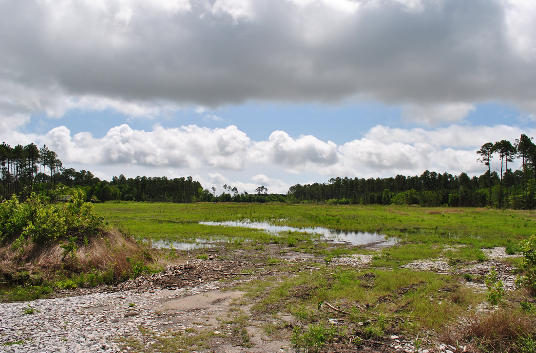
Planning commenced for the new six mile long freeway in 1994 and initial money for the project was allocated by the Mississippi Department of Transportation (MDOT) in 1996.5 The time table for construction in 2006 was thought to run between four and five years after funding was made available. Initial projections envisioned completion for the connector around 2012.3,4
Tentatively numbered as Interstate 310, the Central Harrison Connector was estimated to cost $300 million. Design began in 2005, with right of way acquisition following in 2006.4 Construction was scheduled to begin in 2008,2 but had not through May 2009. Had the freeway been built, the federal government would cover 90% of the maintenance costs. The Connector otherwise was added to the state highway network with Mississippi Department of Transportation (MDOT) footing the entire bill.1
The design of Interstate 310 preferred by the Mississippi Department of Transportation (MDOT) incorporated an elevated viaduct freeway. This drew immediate criticism from Gulfport Mayor Brent Warr, who preferred an at-grade alignment. The concern was that the areas below the elevated freeway would deteriorate in the same manner as the neighborhoods below elevated Interstate 110in Biloxi.2
The Central Harrison Connector gained importance following the federal government funded plan to expand the state Port of Gulfport. The $570 million expansion was expected to dramatically increase container cargo. Plans for the port changed however, and no new container-cargo tenants had signed on for the port by 2016.5
A number of delays pushed the port expansion completion date back to 2017. This effected plans for the Central Harrison Connector, with the route challenged in state and federal court. A court decision in 2011 required MDOT to restart the environmental process, setting back the route time table and increasing costs. The Connector needed an estimated $215 million as of 2016, which was unlikely given a lack of funding for projects statewide.5
East Harrison Connector
An adjacent freeway proposal that was under consideration involved another limited access highway, the East Harrison Connector. Plans for the route from Interstate 10 at the Woolmarket interchange (Exit 41) southward into Biloxi called for a four to six lane roadway over Popps Ferry Road en route to a high-level bridge across the Back Bay of Biloxi1. South onto the Biloxi peninsula, the connector would pass by Hiller park and then run south along Veterans Avenue to end at U.S. 90 east of Treasure Bay Casino.6
Sources
- “Road plan for Biloxi in design stages.” The Clarion-Ledger (Jackson, MS), August 1, 2005.
- “Elevated route from I-10 to port will divide city, Gulfport Mayor tells MDOT panel,” by Laura Hipp, The Clarion-Ledger (Jackson, MS), April 12, 2006.
- “Road projects in progress: Route would link Biloxi to I-10.” Sun-Herald (Biloxi, MS), December 17, 2006.
- Central Harrison County Connector Highway fact sheet.
http://sp.mdot.ms.gov/projectsfiles/CentralHarrisonConnector.pdfMississippi Department of Transportation (MDOT). - “MDOT has spent $158.5 million on road never built.” Sun-Herald (Biloxi, MS), July 15, 2016.
- “New connector highway on hold.” Sun-Herald (Biloxi, MS), December 14, 2006.
Page updated September 4, 2016.