Interstate 295 Maryland / District of Columbia
Overview
Interstate 295 follows the Anacostia Freeway northward from MD 210 (Indian Head Highway) and the Capital Beltway at Oxon Hill, Maryland to the 11th Street Bridge (I-695) in Southeast Washington, DC. The freeway originates at a systems interchange located at the east end of the Woodrow Wilson Bridge (I-95/495) and north of National Harbor. Northward into the District of Columbia, I-295 runs along the bluff line overlooking the Potomac River next to Joint Base Anacostia-Bolling (JBAB). DC Route 295 extends the Anacostia Freeway northeast onto the Kenilworth Avenue Freeway and Cheverly, Maryland.
A number of projects making improvements along Interstate 295 and DC Route 295 were undertaken by the District Department of Transportation (DDOT). The I-295/Malcolm X Interchange Improvement Project reconfigured the parclo interchange at Exit 2 with new southbound access while improving the existing loop ramps with northbound. An access road was built along the east side of I-295 to St. Elizabeth’s West Campus. This project was awarded on June 8, 2018. Construction commenced in Summer 2018 and was completed in April 2022.4
A year of construction started in June 2018 rehabilitated the Anacostia Freeway (I-295) bridges over Nicholson Street SE. The 1963 bridges along I-295 at S Capitol Street were rehabilitated during construction from January to October 2019.
Started in Summer 2017, the Frederick Douglass Memorial Bridge Project replaced the swing bridge taking S Capitol Street SE across the Anacostia River. Completed in April 2022, construction replaced the previous five lane crossing built in 1950 with a new six lane signature arch span. Changes along S Capitol Street include the addition of traffic ovals at both ends of the bridge, replacing the ramp system with Suitland Parkway. Reconstruction of Interstate 295 from Firth Sterling Avenue SE to Howard Road SE included redesigning the three loop cloverleaf with Suitland Parkway into a single loop parclo interchange with signalized intersections.
 History
Interstate 295 was approved along with I-695 at Washington, D.C. in 1958. I-295 was assigned from the Capital Beltway in Maryland northward into D.C. along the Anacostia Freeway. The route was assigned to the 11th Street Bridge over the Anacostia River to the East Leg Freeway north to Interstate 95. I-695 was approved as a short freeway linking I-295 west to the Center Leg Freeway (I-95).
The 1960s and 70s anti-freeway revolt in the District of Columbia resulted in the cancellation of several Interstate highways in Washington. Included was the East Leg Freeway taking I-295 northward. A separate proposal emerged to alleviate traffic associated with that missing connection in 1982. It outlined extending Interstate 295 east along the unconstructed Barney Circle Freeway, providing a high speed route between the central Washington and D.C. Route 295 (Kenilworth Avenue Freeway) northbound. The Barney Circle Freeway proposal was met with similar resistance to the East Leg Freeway. It was subsequently removed from consideration in 1996.
Plans commenced in 2007 to reconstruct the Southeast Freeway (I-695) and rebuild the 11th Street Bridge (I-295).1 Work replacing the Anacostia River crossing and upgrading the interchange between the bridges and Anacostia Freeway (I-295 south and D.C. 295 north) kicked off in December 2009.
The District Department of Transportation (DDOT) submitted an application to the American Association of State Highway and Transportation Officials (AASHTO) to eliminate and renumber potions of both I-295 and I-695:2
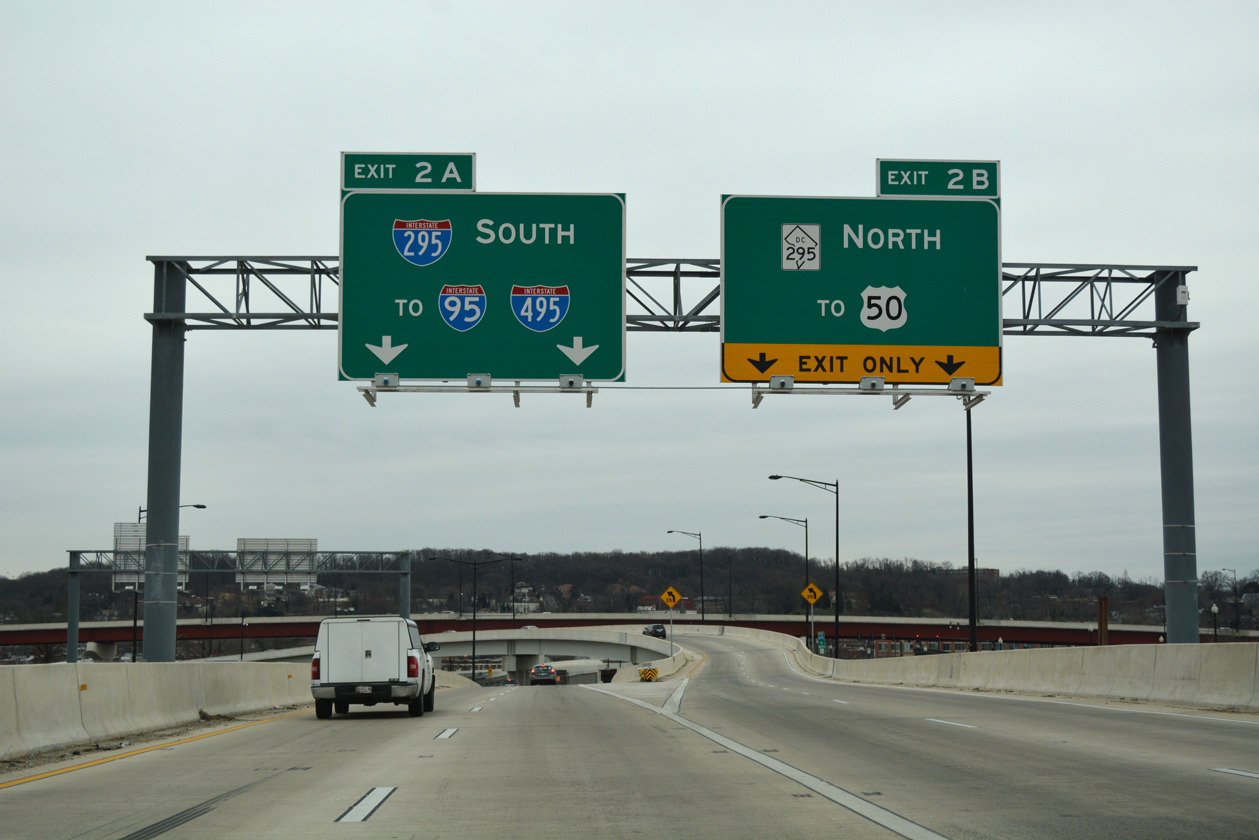
I-295 begins at I-95 in Maryland near the Woodrow Wilson Bridge. It runs north into DC where it turns west at an interchange with DC 295 to cross the Anacostia River via the 11th Street Bridges. On the west side of the river, I-295 turns north at an interchange with I-695 and extends to its terminus at Pennsylvania Avenue at the Barney Circle. The planned route for I-295 continues north from Barney Circle to East Capitol Street near RFK Stadium, and then northwest through the city to an interchange with other unbuilt freeways near New York Avenue. The segment of I-295 north of East Capitol Street was withdrawn in 1978. The unbuilt portion between Barney Circle and East Capitol Street was never officially withdrawn. Because I-295 was not completed, the system ramps that provide route continuity from the 11th Street Bridges to Barney Circle are operationally obsolete and have been closed to traffic for several years. The District is requesting de-designation of 2.05 miles of I-295 from the interchange with DC 295 to East Capitol Street. This includes 1.24 miles of existing I-295 and 0.81 miles of unbuilt I-295. After de-designation, I-295 will become a continuous freeway with DC 295, which will serve to rationalize the interstate system in the District. The portion of I-295 between I-695 and Pennsylvania Avenue will be converted to an urban boulevard with connections into the neighborhood street system. The future disposition of additional right-of-way no longer needed for highway purposes will be determined by the District and FHWA. The portion of I-295 between DC 295 and I-695 will be redesignated as I-695 under a separate request.
Subjected to Federal Highway Administration (FHWA) concurrence, AASHTO approved this request on May 15, 2009. Signs for I-695 were eventually unveiled in November 2011. The new 11th Street Bridge for I-695 west opened in December 2011. The eastbound span followed in January 2012. Upgrades to the interchange with I-295 and D.C. 295 were completed in phases throughout 2012.
Route Information
Mileage
Maryland – 0.80
Cities –
- Junctions –


District of Columbia – 5.20
Cities – Washington
- Junctions –
Source: December 31, 2021 Interstate Route Log and Finders List
I-295 Annual Average Daily Traffic (AADT)
Source: 2018 AADT Traffic Volumes Map – District Department of Transportation (DDOT)
2019 AADT GIS Traffic County Data – Maryland Department of Transportation (MDOT)

Overheads posted at the I-295 southbound ramps for the Capital Beltway. The sign on the left was later replaced to show MD 210. 02/23/99

The 11th Street Bridge (unsigned I-295 at the time) previously defaulted onto I-295 south to Maryland beyond a left exit to Martin Luther King, Jr. Avenue. 05/27/95
The south end of Interstate 295 was originally located at a cloverleaf interchange with the Capital Beltway. It included a roadway stub for an unconstructed extension of the freeway southward toward Indian Head. Eventually 1.7 mile long ramps were constructed between I-295 and MD 210 (Indian Head Highway) at Oxon Hill. Opened in 1990, these ramps are not inventoried in the Maryland Department of Transportation (MDOT) Highway Location Reference (HLR) log as either I-295 or MD 210.
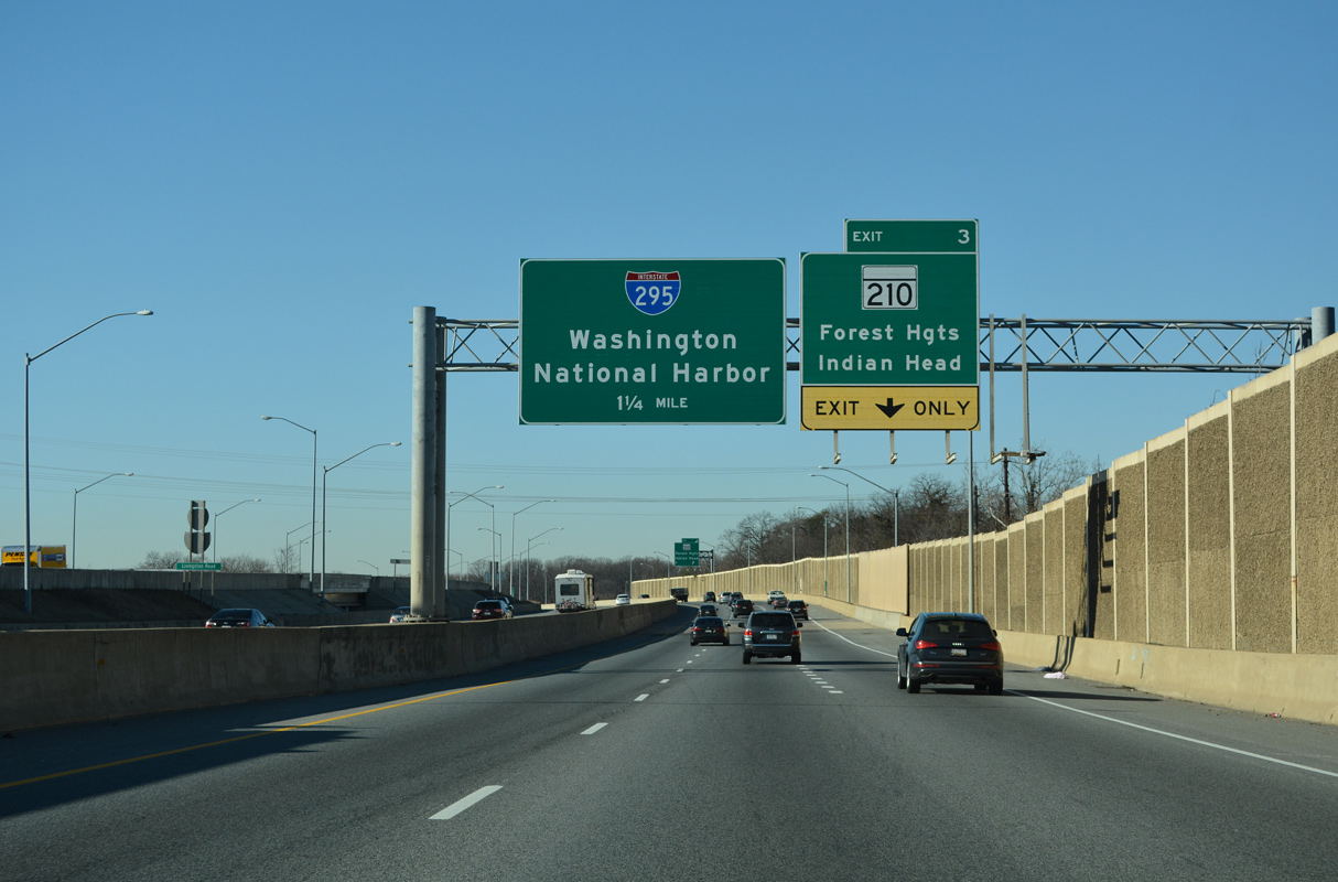
Indian Head, which is located in Charles County to the south, is connected to the Capital Beltway and I-295 along MD 210. Construction from Fall 2016 to Fall 2020 the end of 2021 late Summer 2022 converted a 1.8 mile section of Indian Head Highway into a limited access highway. Work on punchlist items continued into late Spring 2023.
The cloverleaf interchange joining I-295 with I-95/495 (Capital Beltway) was upgraded to a multi level systems exchange during the Wilson Bridge Reconstruction Project in the mid 2000s. Maryland DOT/SHA modified signs during that work on Interstate 295 southbound to read “MD 210 South – Indian Head” in place of “I-295 South – Indian Head.” Additional work completed in 2009 added ramps with newly constructed National Harbor Boulevard to the south.
Baltimore-Washington Parkway
Baltimore-Washington Parkway extends north from MD 201 (Kenilworth Avenue Freeway) through Prince George’s County to Fort George G. Meade, Jessup, Thurgood Marshall Baltimore-Washington International Airport (BWI) and Cherry Hill in the city of Baltimore. Maintenance of the limited access highway is split between the National Park Service (NPS) and MDOT.
The entire Baltimore-Washington Parkway was posted as Interstate 295 from January to July 1969. However, the cost of upgrading the parkway to modern design standards was prohibitive and not funded by Interstate funds. In the same year, the parkway Interstate mileage was reallocated to several proposed highways within the Washington Beltway. Many of these proposed freeways within the beltway were never constructed. With the completion of parallel eight-lane Interstate 95 in 1971, plans for further upgrading the parkway to modern standards were shelved.3
The parkway predates most of the Interstate system; it was constructed between 1947 and 1954. The first section completed was at the north end. Signed as MD 295, the state maintained section north from MD 175 into Baltimore opened in 1952. The NPS section from MD 175 south to U.S. 50 opened on October 22, 1954.3
North End 
 – Washington, D.C.
![]() North at
North at ![]()
![]()
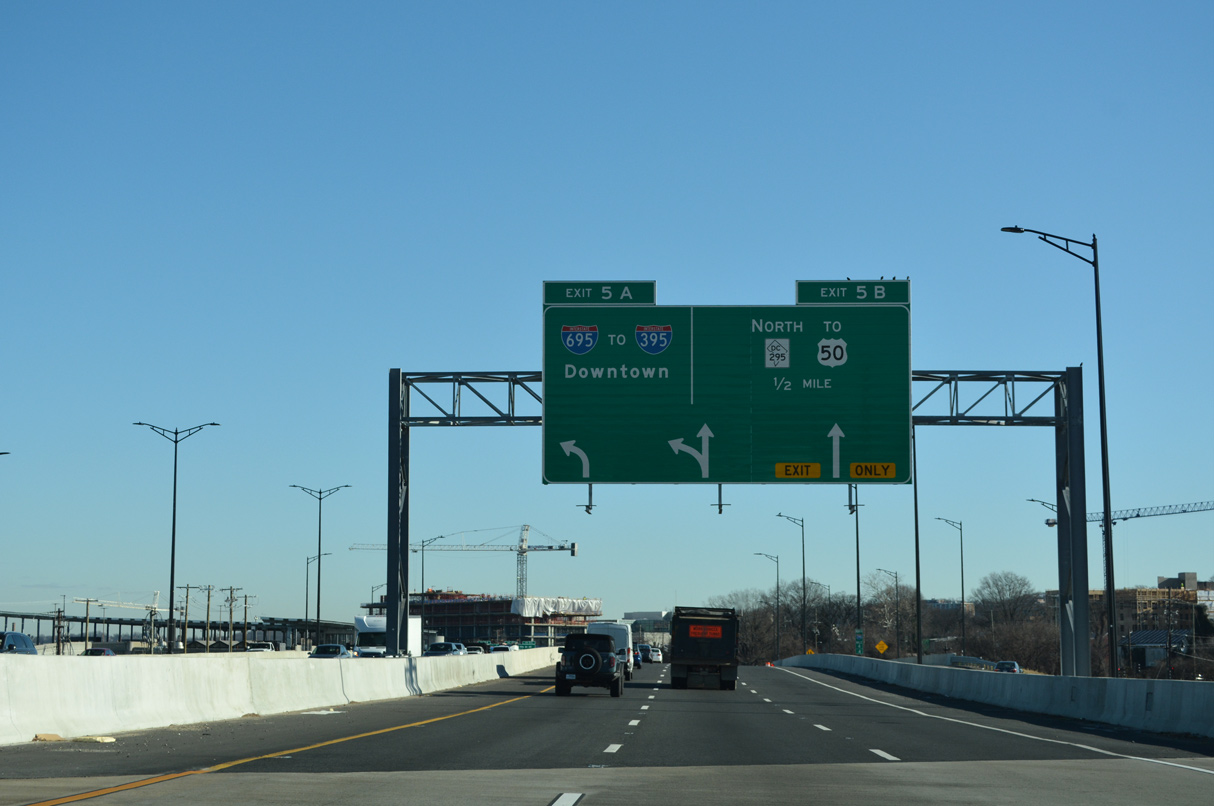
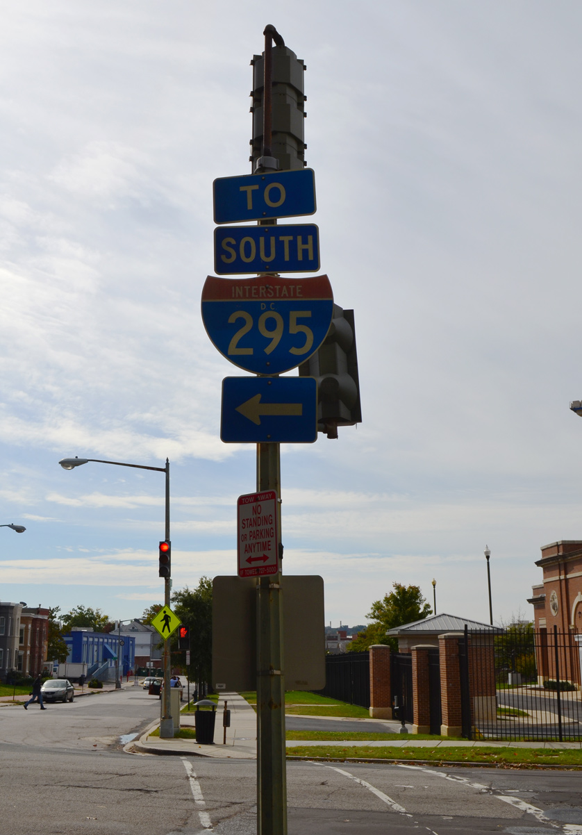
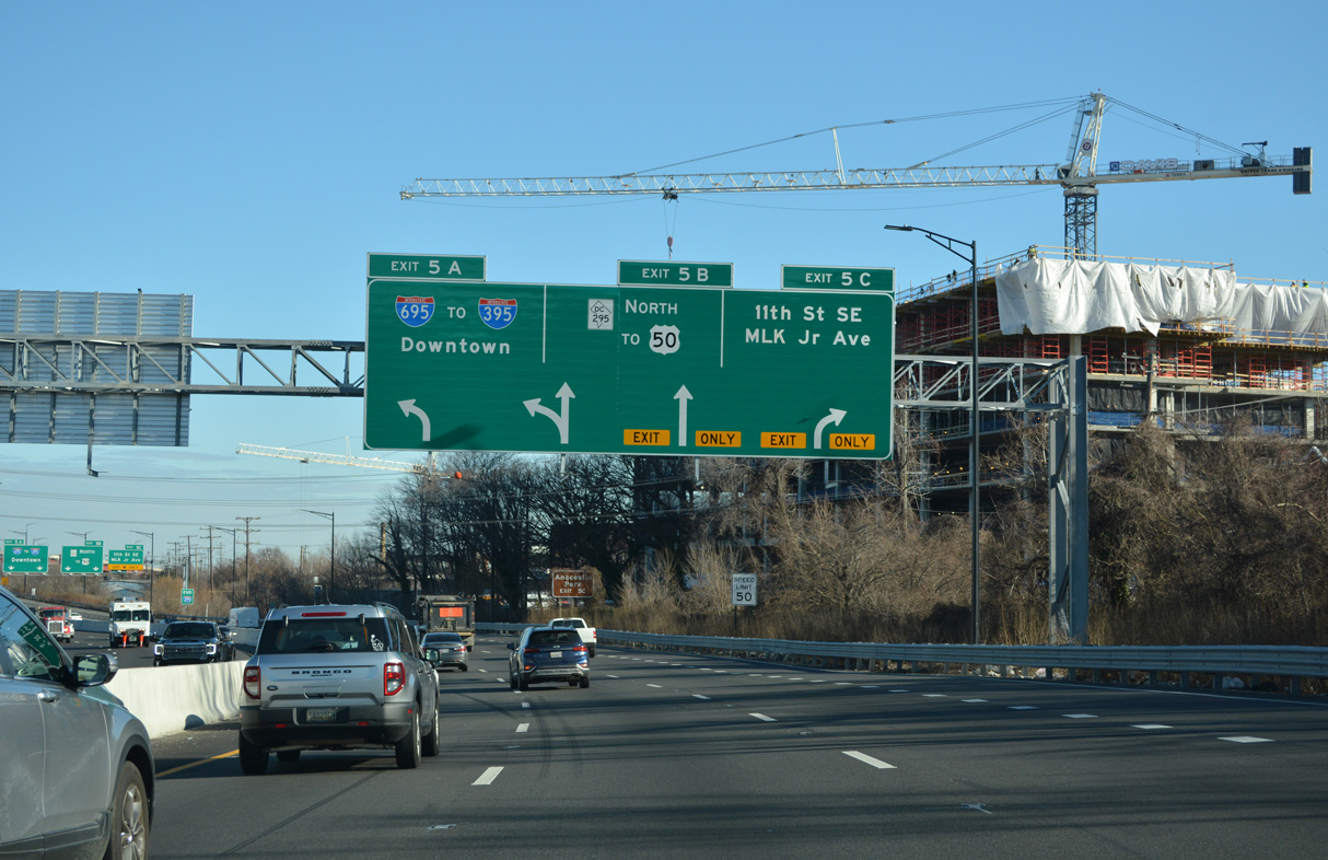
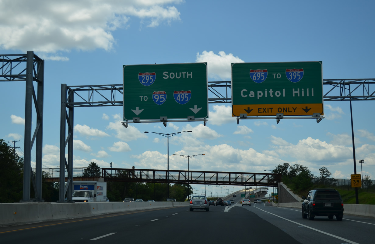
Continuing northeast from the exchange with Suitland Parkway and S Capitol Street, I-295 (Anacostia Freeway) meets I-695 west and D.C. Route 295 north at Exits 5 A/B. 12/27/22
Running along the west side of the Anacostia neighborhood, I-295 heads north to the three-wye interchange with I-695 west across the 11th Street Bridge to the Navy Yard District. 12/27/22
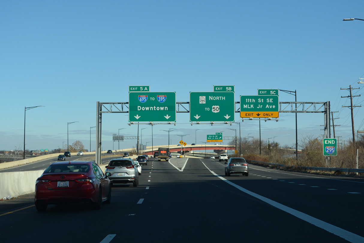
Interstate 295 ends at Left Exit 5 A for I-695 west toward Downtown Washington while D.C. Route 295 angles northeast toward Cheverly, Maryland and U.S. 50. 12/27/22
![]() South at
South at ![]()
![]()
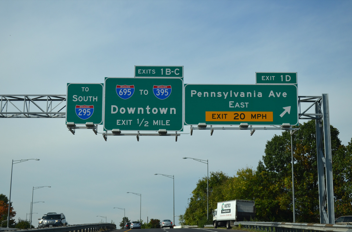
A cloverleaf interchange (Exit 1 D) joins the Anacostia Freeway with Pennsylvania Avenue east to Dupont Park and Randle Highlands a half mile northeast of the exchange with I-295/695. 10/12/14
A cloverleaf interchange (Exit 1 D) joins the Anacostia Freeway with Pennsylvania Avenue east to Dupont Park and Randle Highlands a half mile northeast of the exchange with I-295/695. 10/12/14
Interstate 695 heads north across the Anacostia River to the Navy Yard District while I-295 takes over along the Anacostia Freeway south to Joint Base Anaocista-Bolling (JBAB). 08/04/13
![]() East at
East at ![]()
![]()
Opened in January 2012, the southbound 11th Street Bridge (I-695 east) provides access to both I-295 south and D.C. 295 north, a change from the previous interchange that connected with the Anacostia Freeway south only. 12/16/16
North End Throwback
![]() North at
North at ![]()

A begin D.C. 295 shield was posted along I-295 (Anacostia Freeway) north ahead of the 11th Street Bridge. The continuation of I-295 to the Southeast Freeway (I-695) was signed as “To I-395.” Photo by Steve Hanudel (08/12/05).

The previous separation of I-295 and D.C. 295 north. Exit 4 represented the continuation of I-295 north to the Southeast Freeway (unsigned I-695), while D.C. 295 extended the Anacostia Freeway north to the Kenilworth Avenue Freeway at E Capitol Street. 09/25/04
![]() South at
South at ![]()

A begin Interstate 295 overhead at the 13th Street SE overpass referenced the Anacostia Freeway transition from D.C. 295 to I-295. 12/26/06

A second begin Interstate 295 sign was posted ahead of the entrance ramp from the old 11th Street Bridge south. 10/14/01
Former North End – at Pennsylvania Avenue SE – Washington, DC

The Southeast Freeway continued beyond the 11th Street Bridge (I-295 south) to Pennsylvania Avenue. The spur east of the 11th Street Bridge was an unsigned portion of I-295 remaining from the 1982 Barney Circle Freeway proposal to extend I-295 east to D.C. 295 east across the Anacostia River. 06/01/04

Just north of the Washington Navy Yard, Interstate 695 split into branches for Pennsylvania Avenue east (the north end of unsigned I-295) and I-295 south to Martin Luther King, Jr. Avenue. 06/01/04

A full-Y interchange joined the Southeast Freeway with the 11th Street Bridge. The Southeast Freeway spurred east a short distance to Pennsylvania Avenue SE ahead of the Anacostia River and ramps with D.C. 295. 06/22/05
South End 
 – Oxon Hill, Maryland
![]() South at
South at ![]()
![]()
![]()

An end sign precedes the Maryland state line for Interstate 295 south. This sign dates to the 1990s. 12/16/16

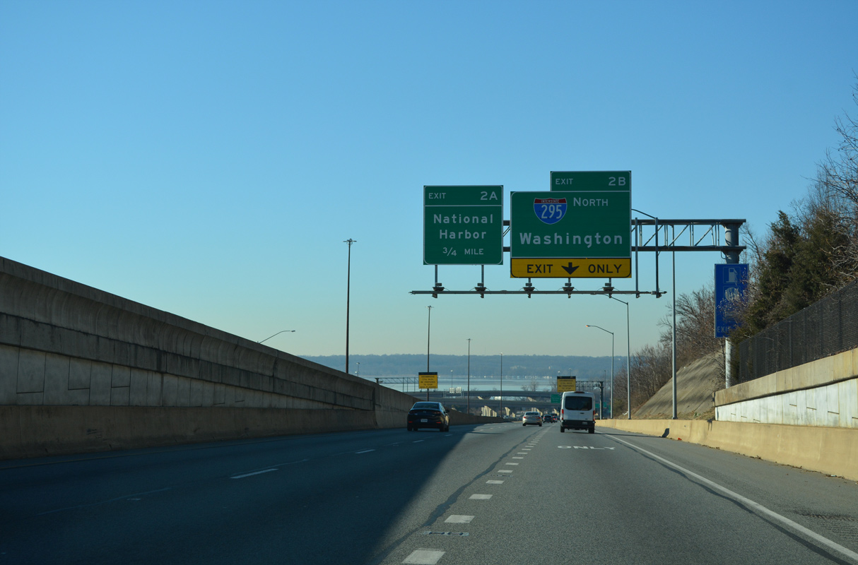
Just beyond the state line, Interstate 295 separates into four ramps. Exit 1C departs first for the Woodrow Wilson Bridge west to Alexandria, Virginia. Exit 1B follows onto National Harbor Boulevard south. 12/16/16

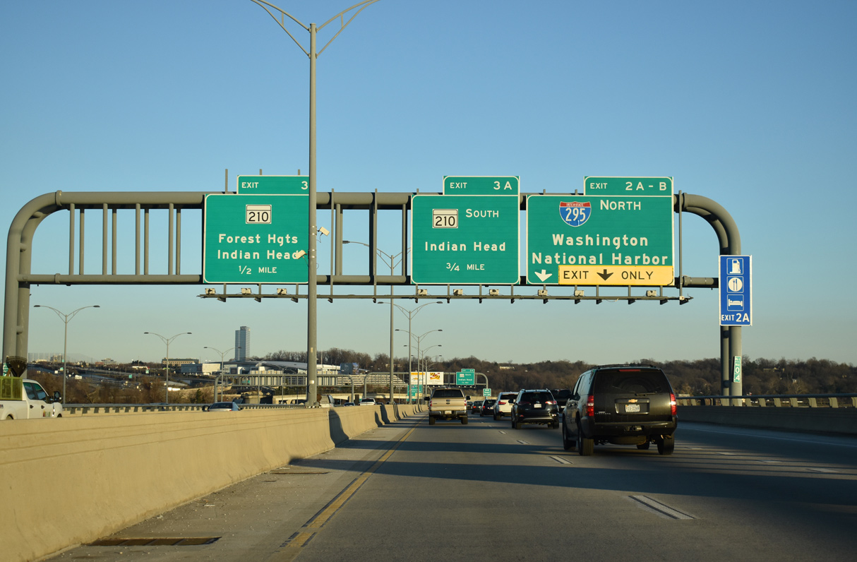
Interstate 295 south reaches Exit 1B to National Harbor, a mid-2000s upscale development along the east shore of the Potomac River. Signs for the mainline reflect the 1.7-mile extension east to MD 210. 08/04/13

The freeway connector curves east and parallels I-95/495 north before turning south to join MD 210 (Indian Head Highway). 06/01/04
![]()
![]() North at
North at ![]()

I-95/495 (Capital Beltway) advance east from the multi level interchange with U.S. 1 at Alexandria, Virginia onto the Woodrow Wilson Bridge leading to I-295. 12/17/20

Exit 2B departs from the Local Lanes of the Woodrow Wilson Bridge east for Interstate 295 north and National Harbor Boulevard south. There is no access to I-295 from the Express Lanes. 12/17/20
Traffic to both I-295 north into Washington, DC and south to the National Harbor development departs in unison from the east end of the Woodrow Wilson Bridge. 12/17/20
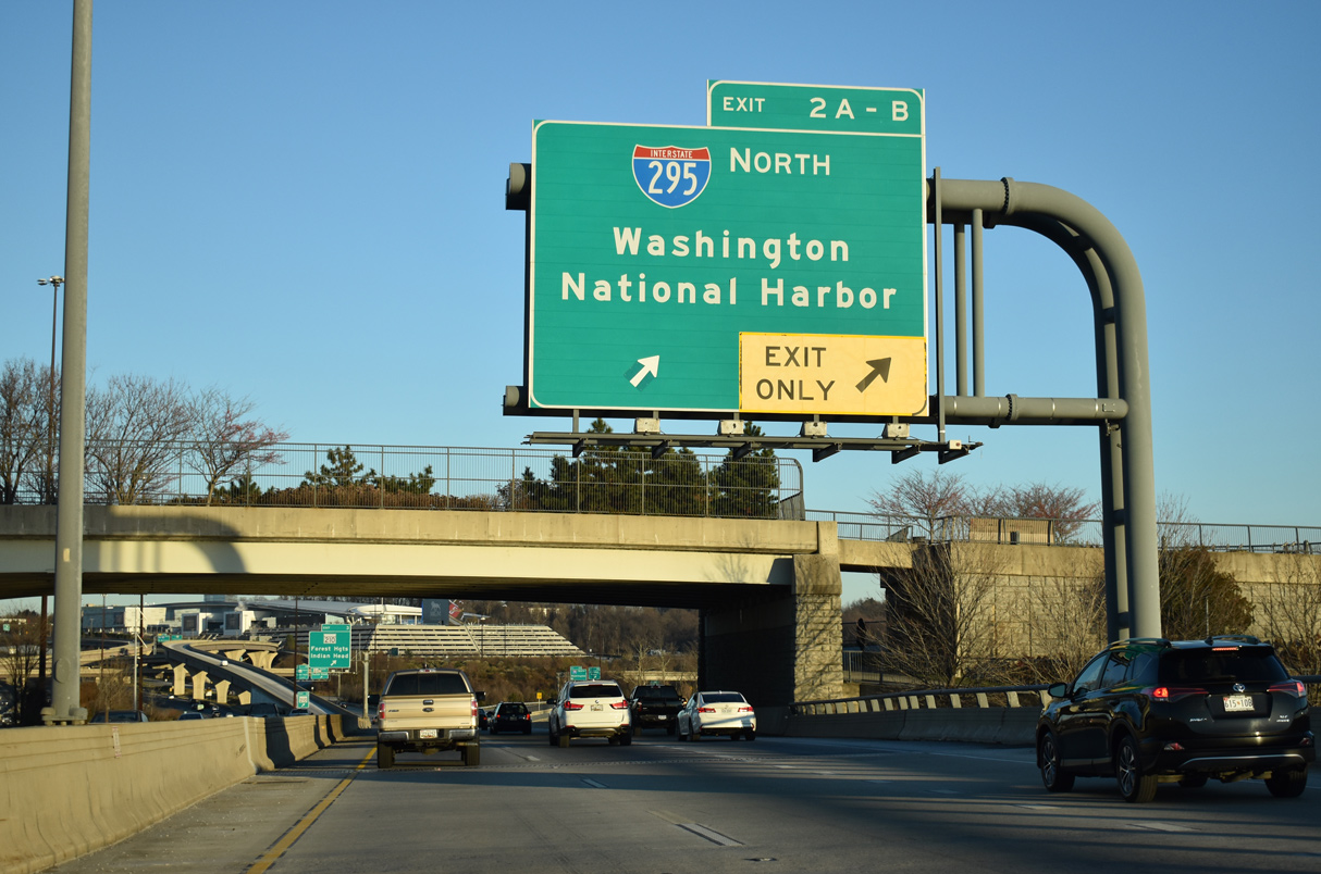
The Local Lanes of I-95/495 north reach the off-ramp (Exits 2A/B) for I-295 north to I-695 west to Downtown Washington and National Harbor. 12/17/20

Exit 2A separates from the ramp for I-295 north to both National Harbor Boulevard south and MGM National Avenue east to the December 2016 opened MGM National Harbor casino resort. 12/16/16
![]()
![]() South at
South at ![]()
I-95/495 southbound separates into a Local and Express configuration ahead of both I-295 north and the Woodrow Wilson Bridge. Exit 2 B to I-295 north departs from the Local roadway. 12/27/22
The Potomac River comes into view from I-95/295 as the Capital Beltway lowers into the systems interchange (Exits 2 B/A) with I-295 and National Harbor Boulevard. 12/27/22

Exit 2 B joins Interstate 295 north just ahead of the Washington, D.C. line. A loop ramp follows for the south end of I-295 into National Harbor. Photo by I.C. Ligget (03/26/10).
South End Throwback

I-95/495 north at Exits 2A/B for I-295 north and the MD 210 freeway spur during the Woodrow Wilson Bridge project. The ramp to I-295 north remains the same while Exit 2A serves National Harbor and Exit 3 constitutes a flyover ramp for MD 210 (Indian Head Highway). Photo by Carter Buchanan (06/25/05).

MD 210 (Indian Head Highway) north approaches the ramps for the Capital Beltway. Previously signs referenced I-295 here. New signs separate traffic to the Express and Through lanes. Photo by Chris Elbert (07/06).

Two lanes exit from MD 210 (Indian Head Highway) north to the Through lanes of I-95/495 and the 1.7 mile spur to I-295 north. A loop ramp ahead connects with the Local Lanes of the Capital Beltway south to Alexandria. Photo by Chris Elbert (07/06).
Sources:
- Southeast Freeway (I-695). DCRoads.net (Steve Anderson).
- Letter to FHWA from AASHTO on Application Regarding Interstate Route: Elimination of I-295 in Southeast Washington, DC and extend I-695 to maintain system continuity between I-395 and I-295/DC-295.
https://www.transportation.org/sites/ route/docs/AASHTO-FHWA DC I-295 and I-695.pdf - Baltimore-Washington Parkway (MD 295). DCRoads.net (Steve Anderson).
https://www.295malcolmxproject.com/
Page updated April 7, 2023.