Interstate 295 Massachusetts / Rhode Island
Overview
Interstate 295 serves as a western bypass of Providence and Pawtucket, Rhode Island. The freeway loop had also been proposed to extend east and southward from the north end at Attleboro, Massachusetts.
Rhode Island DOT renumbered all interchanges along Interstate 295 from I-95 at Warwick north to the Massachusetts border at Cumberland. Costing $340,000, the resigning ran from north to south over a two week period starting on November 27, 2017.1 The freeway along Route 146 was scheduled to be resigned in 2018, adding mileage based exit numbers to its previously unnumbered interchange array. The Route 146 project started in Summer 2019 and was completed by the end of the year. All remaining freeways using the sequential system were to be converted by 2020.2 See the Rhode Island Highway Exit Renumbering Program web page for more details.
High Priority Corridor
Interstate 295 is part of High Priority Corridor 60: Providence Beltline Corridor.
 History
Interstate 295 was approved as part of the Interstate Urban Numerology by the American Association of State Highway Officials (AASHO) on November 13, 1958. I-295 was planned in 1960, with construction commencing in 1965. Work on the freeway finished in June 1975.3
Dan Moraseski writes that current Interstate 295 was always planned as I-295. The beltway east of I-95 was later changed to Interstate 895 though, perhaps when transportation officials realized it would not extend straight across I-95 at the south intersection.
The original plan for the beltway in Rhode Island originated along Route 37, likely at Interstate 295, and took the route east across the Providence River. From there the loop turned north along the East Shore Expressway to Route 114 and further to the north end of I-295. The Narragansett Bay Crossing was eventually approved in December 1968.
The Rhode Island Department of Transportation (RIDOT) requested a substitution from the Federal Highway Administration (FHWA) for the route of I-895 in a letter dated August 23, 1973. Withdrawn was the 12 mile long route of I-895 east from I-295 in Cranston across Narragansett Bay to Warren. Substituted in its place was a 40 mile long route further south, from Interstate 95 in Richmond easterly to Newport and northerly to Warren, roughly along Route 138 and Multi State Route 136 to I-195. This was approved by the FHWA on January 17, 1974 under authorization of section 103(e)(2) of title 23, U.S. Code (Hower-Cramer Act). RIDOT requested the substitution to the American Association of State Highway and Transportation Officials (AASHTO) on March 6, 1974.
A $6 million project realigned the ramp from Interstate 95 south to I-295 south in Attleboro to both improve geometric deficiencies and reduce truck roll overs. The project replaced the original ramp designed to accommodate a loop ramp from unconstructed I-895 north to I-95 south. Work commenced in July 2015 and was completed in Spring 2017.4,5
Route Information
Mileage
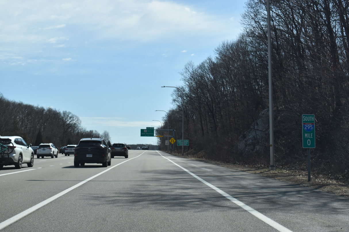
Rhode Island – 22.35
Cities – Providence, Cranston
- Junctions –

Massachusetts – 4.23
Cities – Attleboro
- Junctions –
Source: December 31, 2021 Interstate Route Log and Finders List
I-295 Annual Average Daily Traffic (AADT)
Source: 2015 AADT Rhode Island Department of Transportation (RIDOT) Traffic Flow Map 2016
2019 AADT – Mass Highway Traffic Data Management System
Completed sections of Interstate 295 in 1969 extended north from I-95 to Route 37 at Cranston and west from Attleboro, Massachusetts to Route 146 at Lincoln.
 Photo Guides
North End  – Attleboro, Massachusetts
![]() North at
North at ![]()

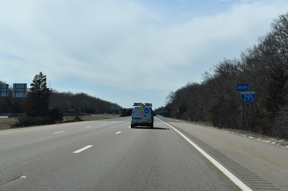
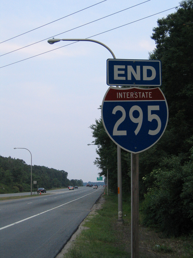
Interstate 295 concludes two miles east of U.S. 1 in North Attleborough within the city of Attleboro. 08/20/21
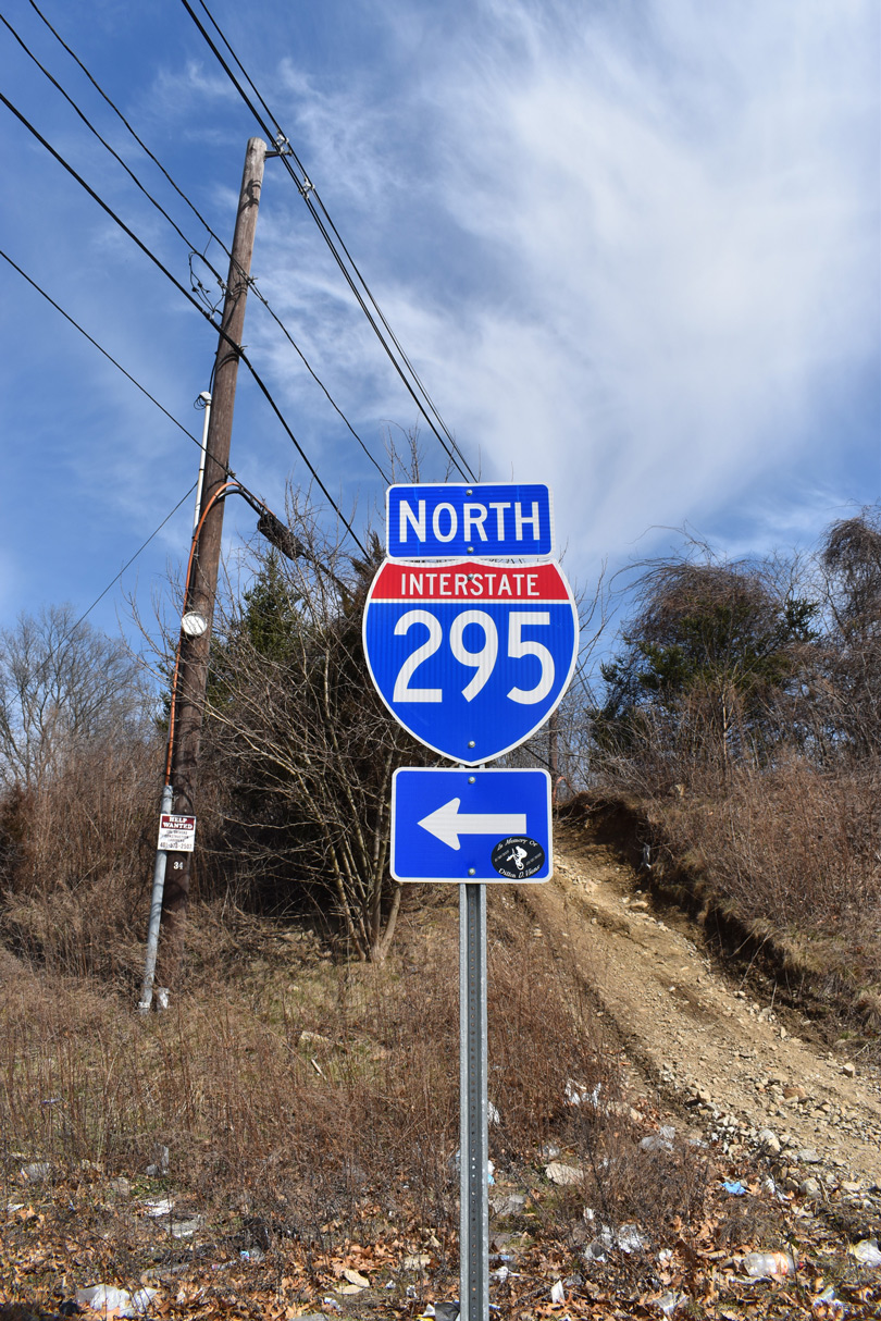
Exits 2 A/B were renumbered to Exits 4 A/B as part of the statewide renumbering from sequential to mile based exit numbers. 08/20/21
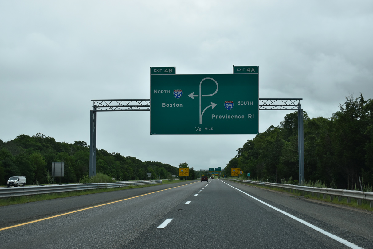
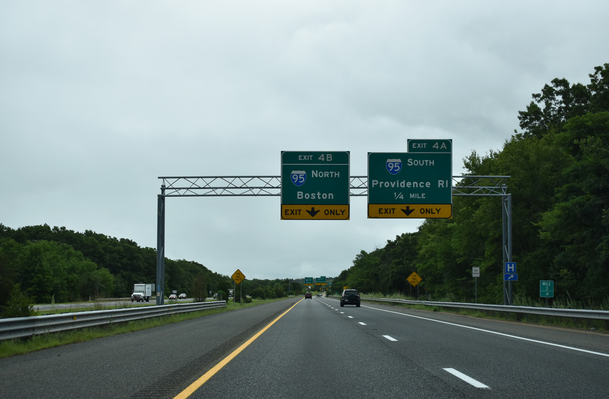
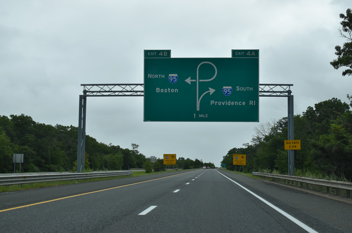
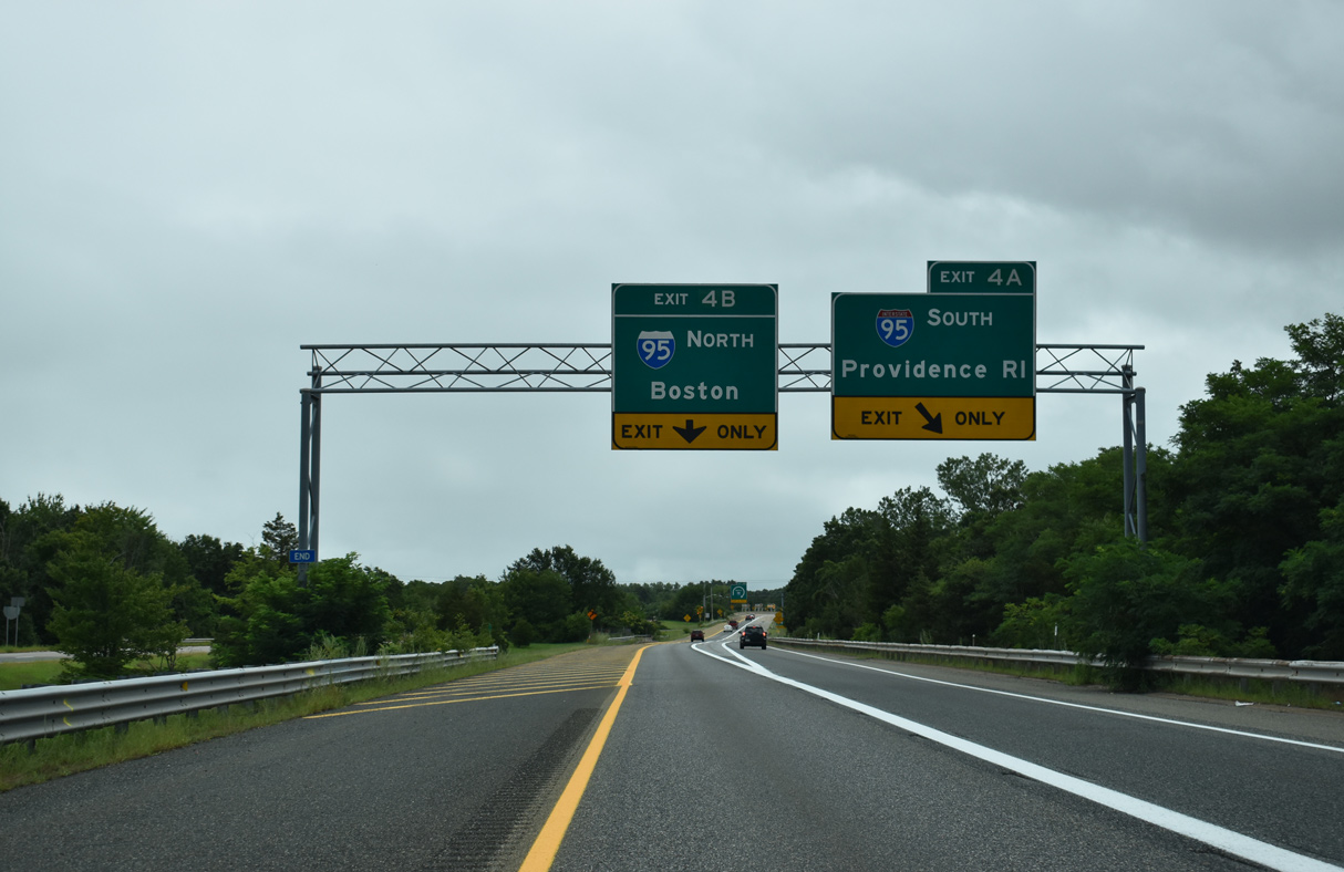
Interstate 295 ends with single lane ramps partitioning traffic for I-95 south six miles to Pawtucket and I-95 north six miles to I-495 at Mansfield. 08/20/21
Entering the cloverleaf interchange at Exit 4, large chevrons cover a swath of unused pavement built for the unconstructed route of Interstate 895 leading east from I-295 through Attleboro and south to I-195 between Seekonk and Fall River. 08/20/21
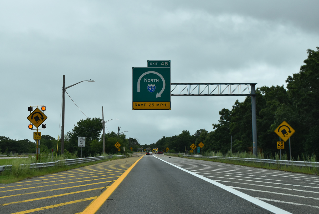
Leftover from unbuilt I-895, the northbound roadway of I-295 extends a short distance beyond a set of barriers at Exit 4 B. 08/20/21
![]() South at
South at ![]()
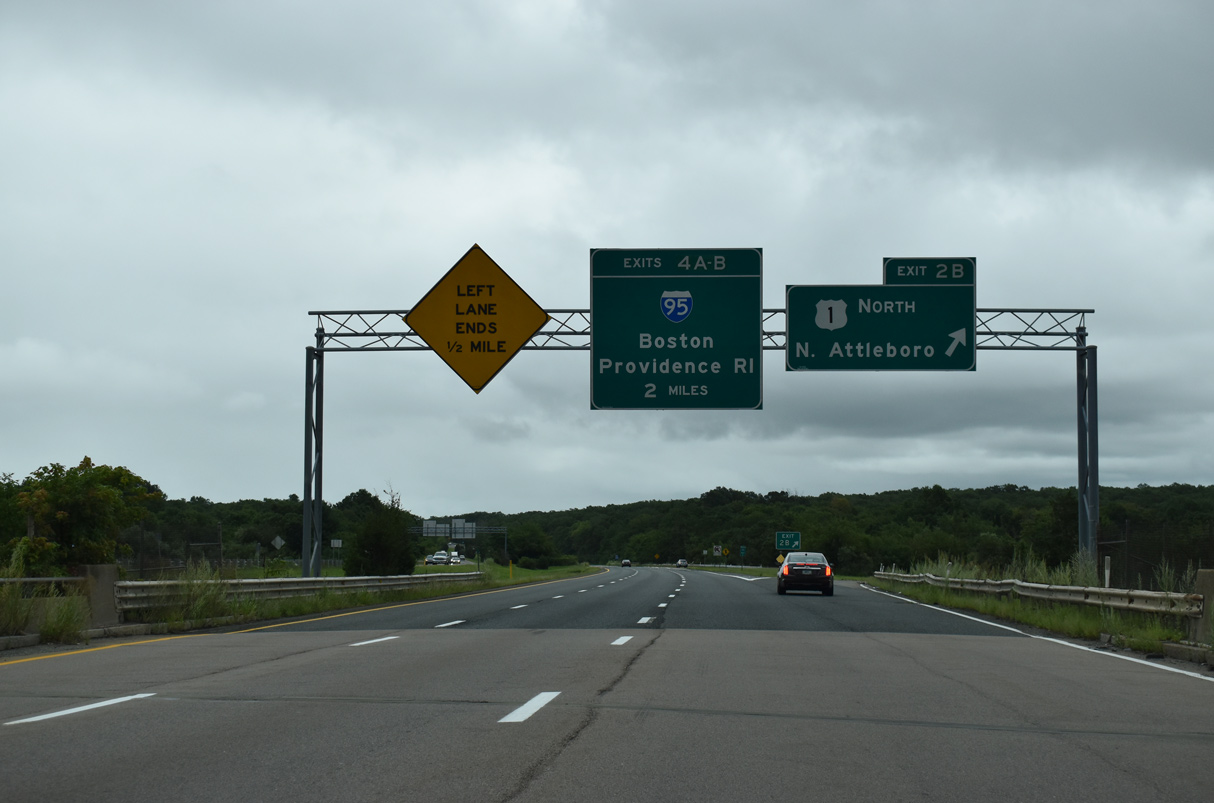
Curving southwest from I-495 and the Norfolk County line, I-95 enters North Attleborough on the two mile approach to Interstate 295 at Exit 4. 10/06/14
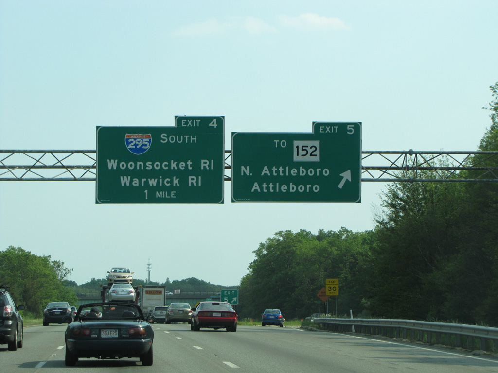
Exit 5 departs I-95 south for Robert Toner Boulevard one mile north of Interstate 295. Robert Toner Boulevard stems west from nearby Route 152 (Main Street) to Attleborough Falls. Photo by H.B. Elkins (05/31/13).
Interstate 295 constitutes a western bypass of Providence, Rhode Island for travelers bound for Warwick and points south. The freeway also provides a direct route to Woonsocket in conjunction with Route 99 and Route 146. 10/06/14

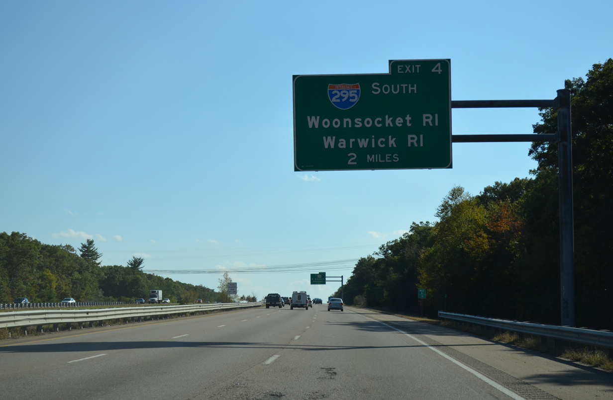
Exit 4 leaves Interstate 95 south for I-295 west to the Rhode Island state line at Abbott Run Valley. The Providence bypass meets U.S. 6 at Johnston in 19 miles.
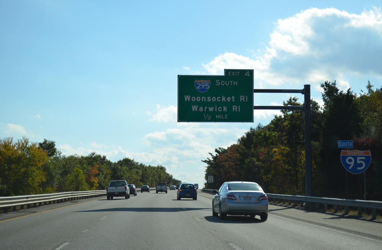
Exit 4 was realigned to improve the ramp geometry during a two-year project completed in 2017. Photo by H.B. Elkins (05/31/13).
![]() North at
North at ![]()
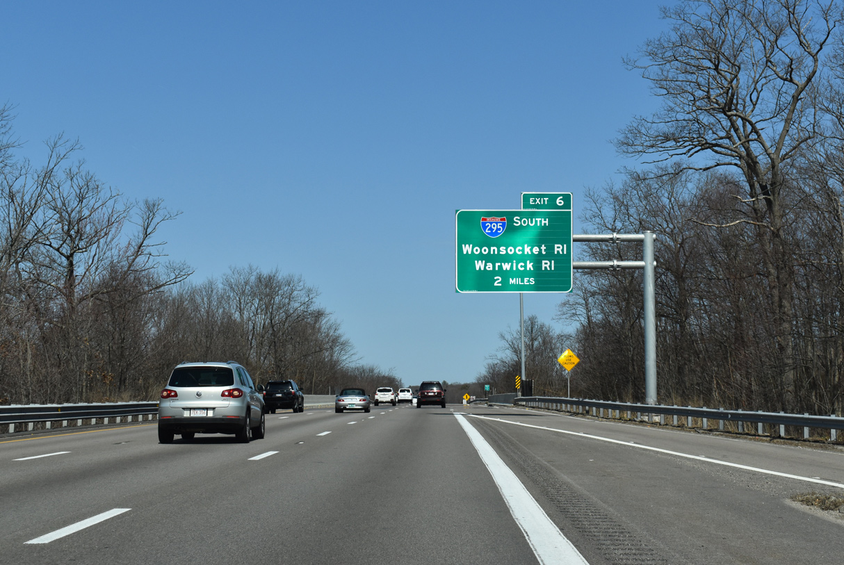
Advancing north from Route 123 (South Avenue), I-95 travels along side Manchester Pond to Interstate 295 south at Exit 6. 03/27/23
One half mile ahead of the loop ramp (Exit 6) for I-295 south to Woonsocket and Warwick, Rhode Island on I-95 north near the Clifton Street overpass at Attleboro. 03/27/23
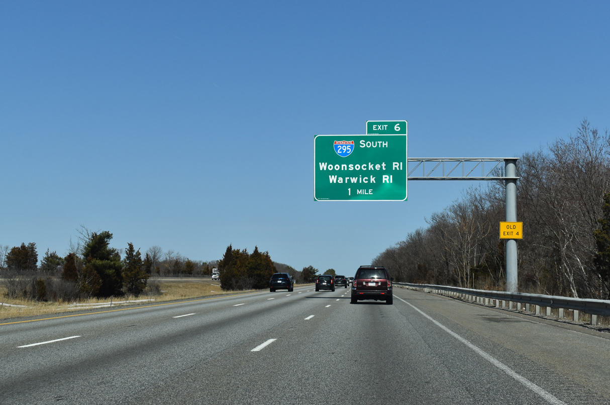
Interstate 95 crosses Tenmile River at the half cloverleaf interchange (Exit 6) with Interstate 295. Grading remains from unbuilt ramps for the cancelled route of Interstate 895 to the east. 03/27/23
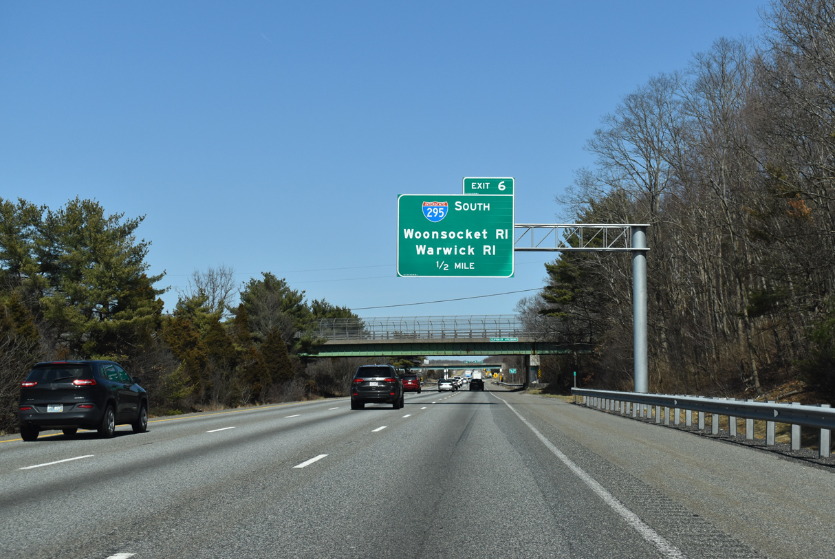
Interstate 295 travels west from Attleboro nine miles to the freeway along Route 146 (Eddie Dowling Highway) by Lincoln Mall. Route 146 extends north to Worcester, Massachusetts. 03/27/23
![]() South
South
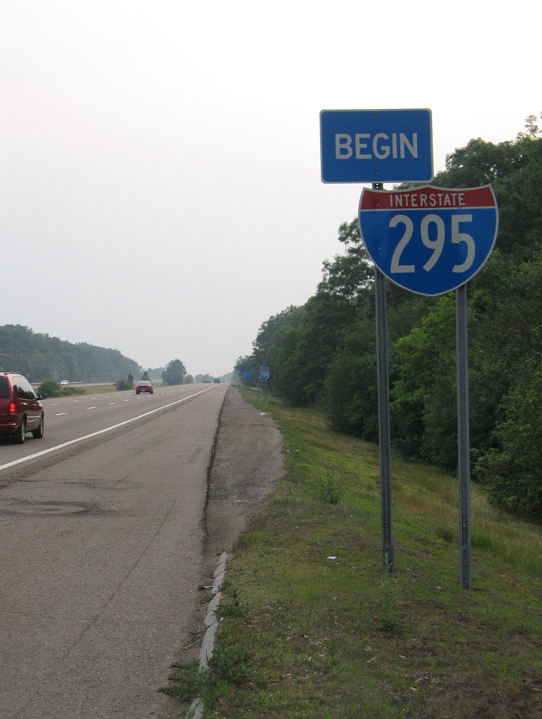
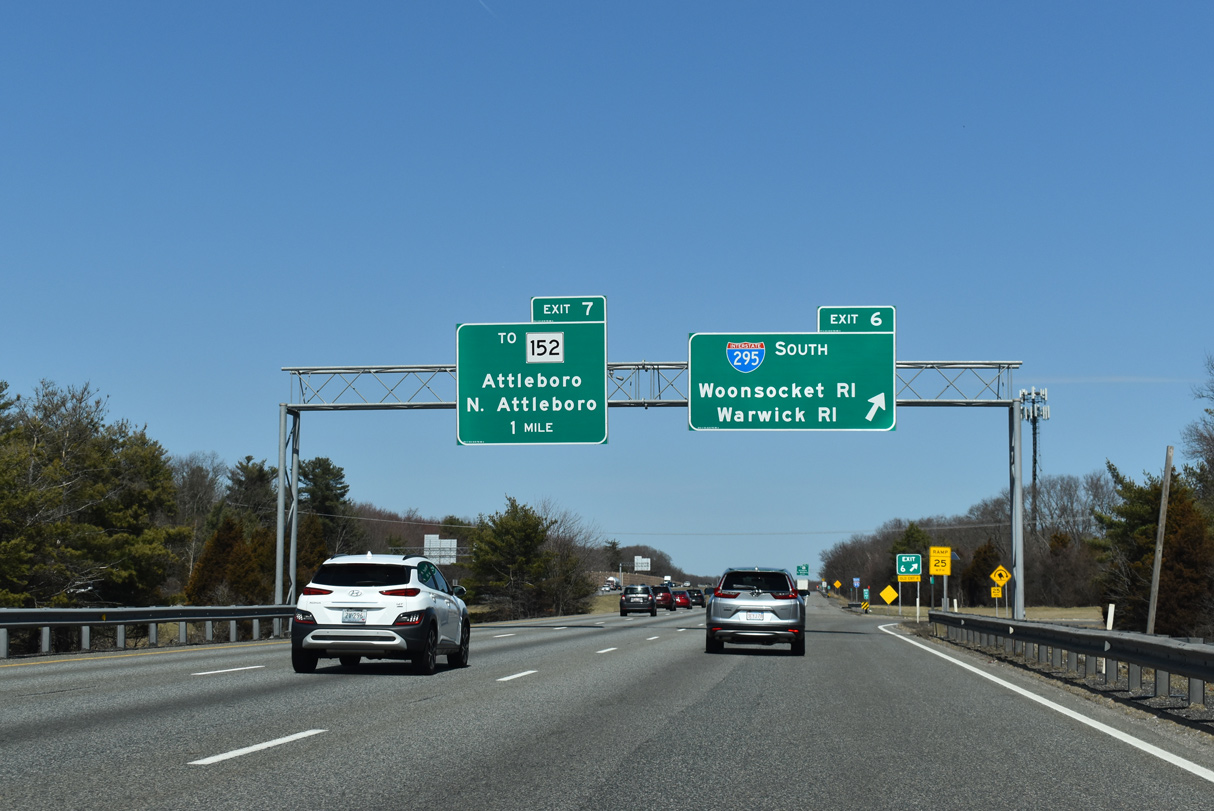
A begin shield for Interstate 295 appears just west of the exchange with I-95 in Attleboro. The Providence Beltway is six lanes wide southwest to the overlap with U.S. 6 at Johnston, Rhode Island. 03/27/23
 North End Throwback
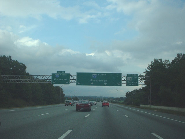
Previous overheads at the north end of I-295 with sequential based exit numbers. 07/28/07

A diagrammatic sign replaced this assembly ahead of the sharp loop ramp joining I-295 north with I-95 north by the stub for I-895. 07/28/07
South End – Warwick, Rhode Island
![]() South at
South at ![]()
Two miles north of I-95 on Interstate 295 south in Cranston. 03/27/23
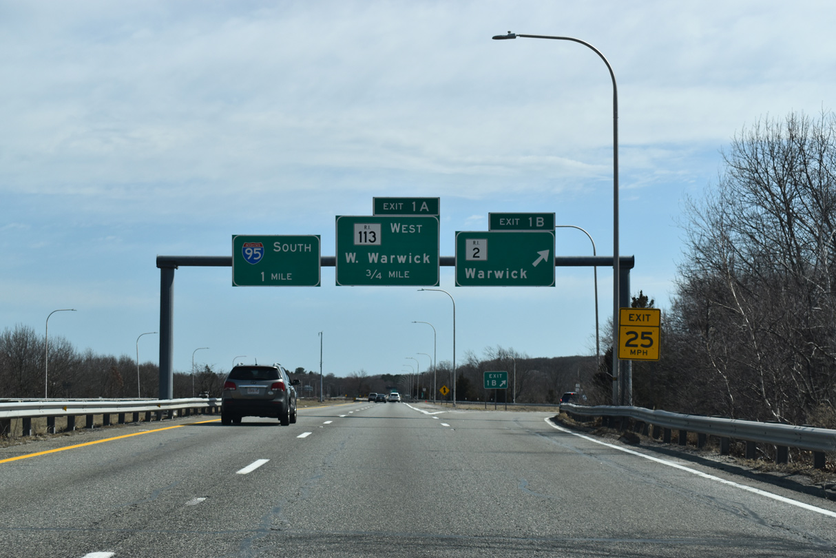
Exit 1 B leaves Interstate 295 south for Route 2 (Bald Hill Road) by Warwick Mall. Bald Hill Road intersects Route 113 (East Avenue) to the southwest, with East Avenue extending east across I-295 ahead of the wye interchange with Interstate 95. 03/27/23
An end shield for Interstate 295 previously appreared ahead of Exit 1 for Route 113 (East Avenue) west. 06/26/05
Traffic at the south end of I-295 joins Interstate 95 ahead of West Warwick. 03/27/23
![]() North at
North at ![]()
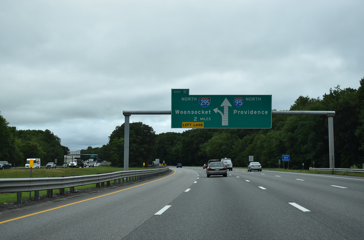
Two miles south of the split with I-295 at Left Exit 28 A (old Exit 11) on Interstate 95 north in Warwick. 08/20/21
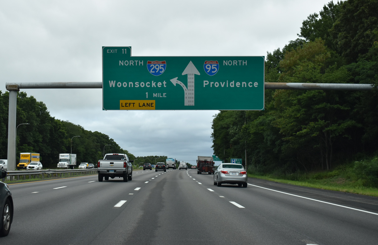
A second diagrammatic sign for the upcoming partition with Interstate 295 precedes the six-ramp parclo interchange (Exit 27) with Route 117 (Centerville Road). 08/20/21
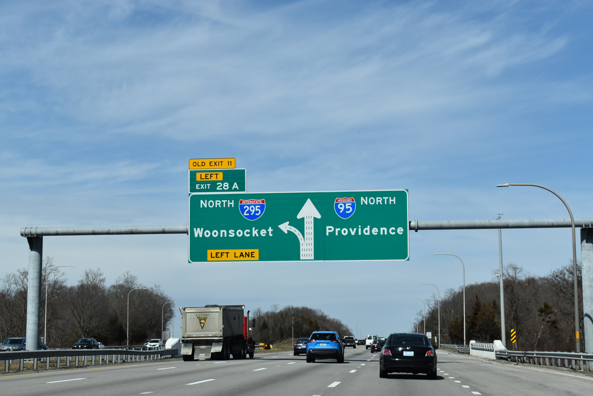
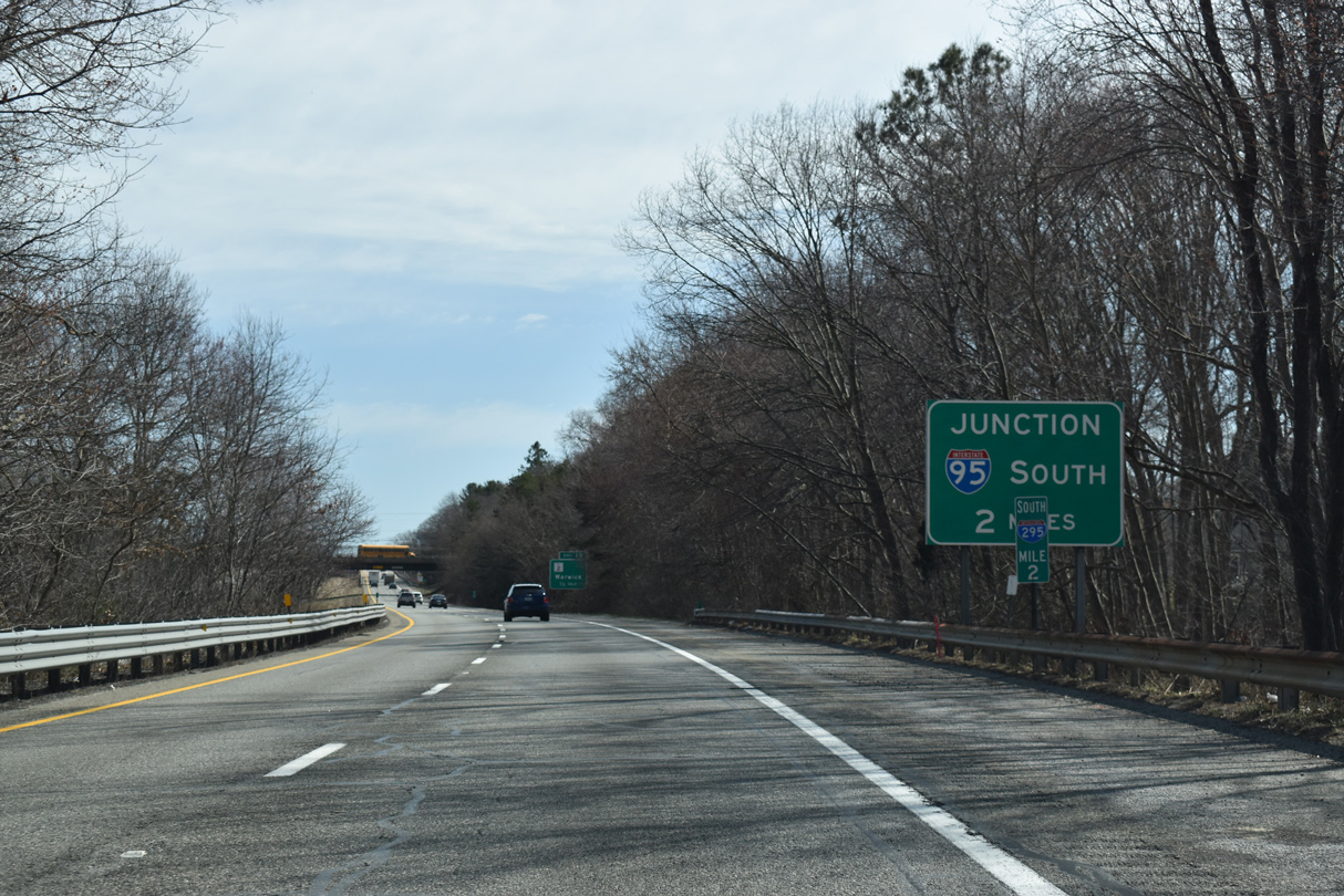
Interstate 95 passes over Route 115 (Toll Gate Road) one half mile ahead of the wye interchange (Left Exit 28 A) for I-295 north. I-295 travels 23 miles north to Woonsocket while I-95 continues seven miles to Downtown Providence. 03/27/23
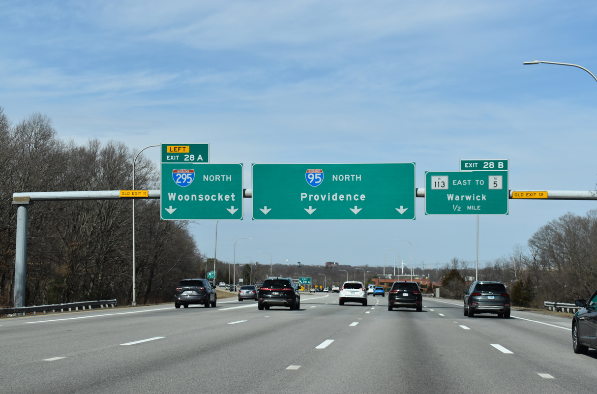
Interstate 95 maintains four through lanes at the separation with I-295 north. The freeway turns northeast toward T.F. Green Airport (PVD) while I-295 branches northwest to Cranston. 03/27/23
![]() South at
South at ![]()
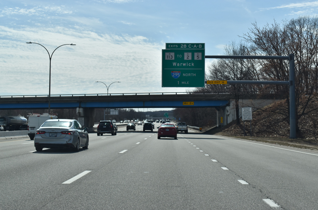
Paralleling the Pawtuxet River, Interstate 95 heads southwest from the T.F. Green Airport Connector one mile to Exits 28 C/A for Route 113 and I-295 north. 03/27/23
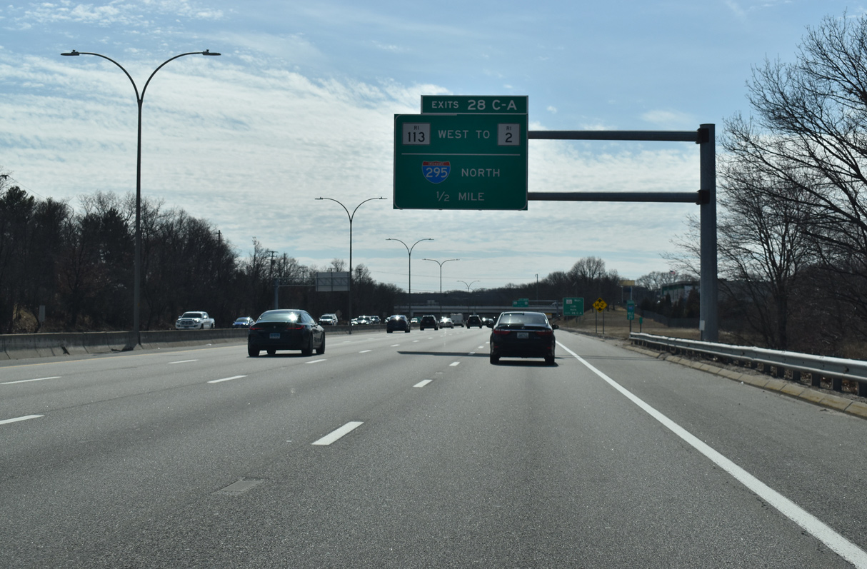
Route 113 (East Avenue) constitutes a four lane arterial linking Interstate 95 with Route 2 (Bald Hill Hill Road) to the west and Route 5 (Greenwich Avenue) to the east. The ramp for Route 113 west includes a direct connection to adjacent I-295 north. 03/27/23
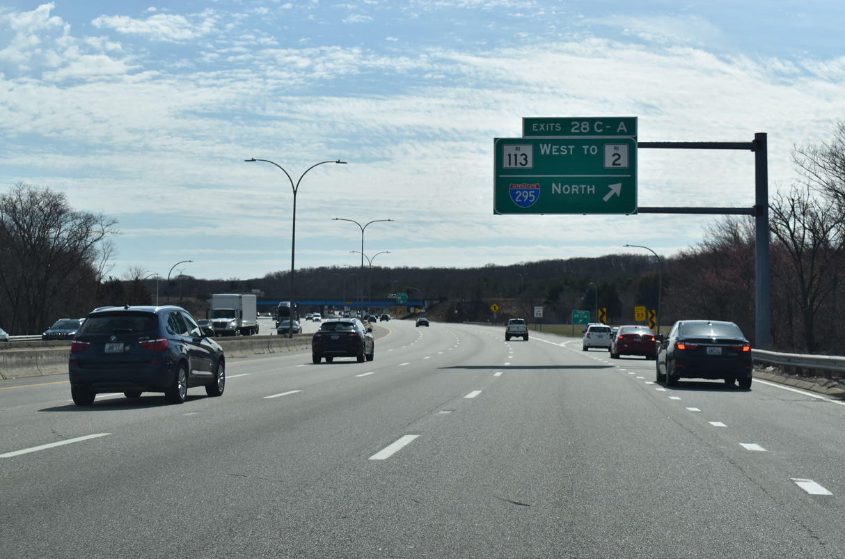
Exit 28 C/A separates from I-95 south for I-295 north ahead of Route 2 by Warwick Mall and Route 113 (East Avenue) west to retail areas south of the Pawtuxet River. 03/27/23
South End Throwback
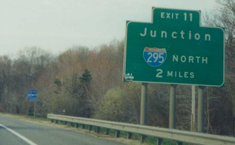
The two mile guide sign for Interstate 295 north was replaced with a full sign bridge by 2005. Photo by Dan Moraseski (Winter 2001).

The diagrammatic overhead for Interstate 295 (Exit 11) on I-95 northbound at the Route 3 (Cowesett Road) overpass was replaced by a new sign bridge located further north. Photo by Douglas Kerr (09/28/01).
Former sign bridge along northbound Interstate 95 at the split with I-295 (Exit 11). Photo by Douglas Kerr (09/28/01).
Sources:
- “New exit numbers begin to appear on I-295.” WJAR TV-10 (Providence, RI), November 28, 2017.
- “Rhode Island set to renumber all highway exits.” Providence Journal (RI), October 4, 2017.
- Interstate 295-Rhode Island (Boston Roads).
- “Rebuilding roads: Major area highway projects set to begin within a year.” Sun Chronicle, The (North Attleboro, MA), June 15, 2015.
- Project 606733: Attleboro – Ramp Reconstruction & Realignment, from Route I-95 (SB) to Route I-295 (SB) https://hwy.massdot.state.ma.us/ ProjectInfo/Main.asp?ACTION= ViewProject&PROJECT_NO=606733. massDOT web site.
Page updated April 3, 2023.