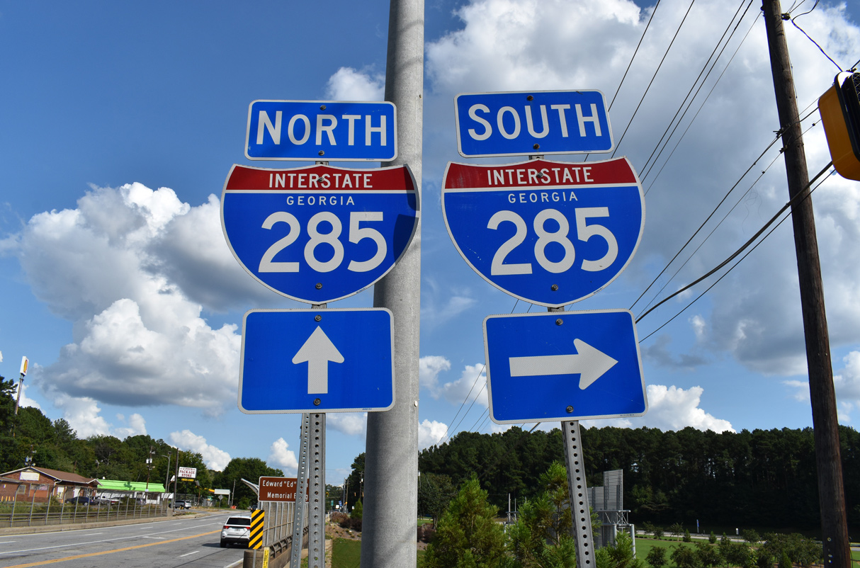
Interstate 285 Georgia
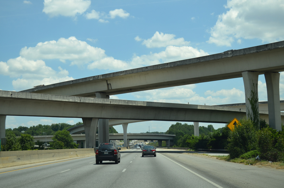
“Spaghetti Junction” is a four-level interchange joining I-85 and I-285 in northern Dekalb County. The Georgia Department of Transportation (GDOT) named the exchange after Tom Moreland, a former GDOT Commissioner and Chief Engineer. 07/05/14
Overview
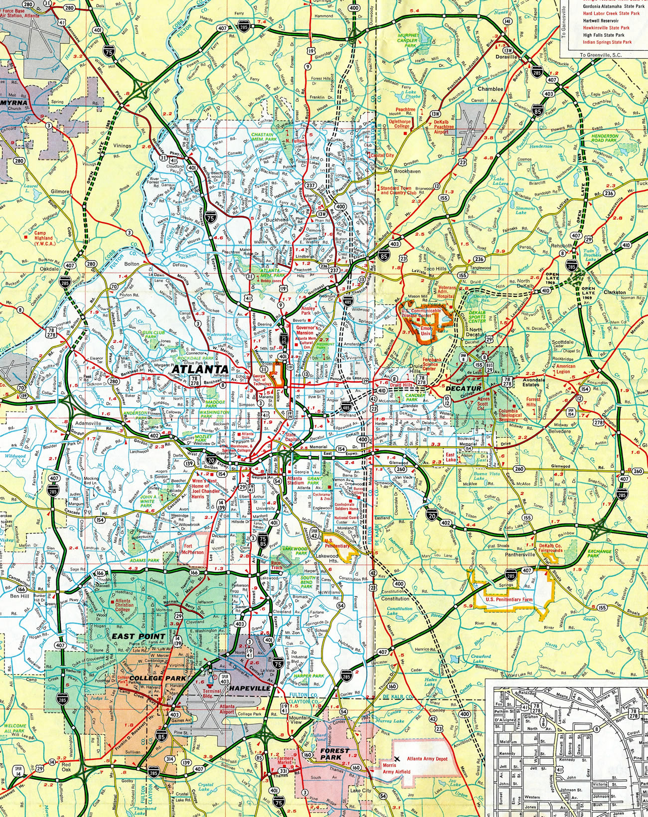
Interstate 285 forms a beltway around the city of Atlanta through Cobb, Dekalb and Fulton Counties in north Georgia. The mostly urban route runs north-south through western reaches of the city while entering East Point, College Park, Forest Park, Doraville and Sandy Springs. Originally intended to allow through traffic to bypass the city, the freeway is heavily used by local traffic as a result of suburban growth.
Atlanta has been fast growing for decades now, and area development has reached far beyond the scope of the Atlanta Beltway. Many corporations established their presence near beltway interchanges, as opposed to center city. This can be seen in the many high-rise buildings along the northern portion of I-285 through Sandy Springs.

Eastbound Interstate 285 passes through a pair of tunnels, totaling 1,500 feet in length, on the south side of Hartsfield-Jackson Atlanta International Airport (ATL). 04/13/12
 History
Route Information
- North Parent Jct – Doraville, GA
- South Parent Jct – College Park, GA
Mileage – 63.98*
Cities – Atlanta
- Junctions –


Source: December 31, 2021 Interstate Route Log and Finders List
* – 1.21 miles on I-85
A number of other freeways may have alleviated traffic in the Atlanta area had they been constructed. Of ones shown here, SR 400 between I-285 and I-485, I-485 east of Boulevard, and SR 410 between I-485 and U.S. 29/78 (Lawrenceville Highway) were never built.
Prior to the “Freeing the Freeways” upgrade, a simple cloverleaf interchange joined I-85 and I-285 in Dekalb County. Today this exchange is commonly known as “Spaghetti Junction”.
Relief for I-285, the Outer Perimeter
Due to increasing congestion along I-285, a 211 mile long Outer Loop, 20 to 25 miles beyond the Perimeter Highway,2 was proposed from the 1980s onward to alleviate area traffic and provide a new bypass for regional travelers. An Atlanta Regional Commission (ARC) planning document released in 1992 scheduled construction of the Outer Perimeter northern section. Included was a $64 million interchange on Interstate 575 in Cherokee County, slated to begin in early 1993. This would tie into a 12 mile or so stretch from I-575 east to the Forsyth County line. Total costs were estimated to be $91.8 million with completion sometime in 1995. Work would follow on the majority of the over $700 million northern section by 2000.1
Funding woes ensued by November 1992, leading to the dropping of the I-575 interchange from the priority list under consideration by the Atlanta Regional Commission. This allowed for environmentalist opposition to continue to mount against the Outer Loop.2
A portion of the Outer Loop, the Northern Arc, was still under consideration by 1999. It was supported by Governor Roy Barnes in a transportation initiative introduced on January 25, 1999. The 59 mile long road would connect I-75 near Cartersville to I-85 at Buford, mostly parallel to SR 20. Interchanges in Cherokee County included those proposed at SR 20 in Macedonia, I-575 in north Canton, SR 140 south of Waleska and SR 108 north of Sutallee.3
By 2002, costs for the project ballooned to $2.2 billion with plans calling for the Northern Arc to be built as a toll road. Governor Barnes no longer supported the road by the 2002 elections. When Governor Sonny Perdue took office, he formally canceled the Northern Arc. $38 million in right of way had been acquired for the scuttled project by that point, including 750 of 1,200 acres needed for the 12.6 mile segment between Peachtree Industrial Parkway and SR 316 in Gwinnett County.4
 Photo Guides
North End  – southeast of Doraville, Georgia
![]() East at
East at ![]()
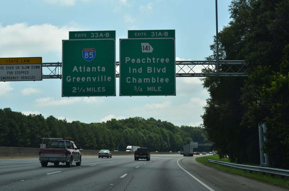
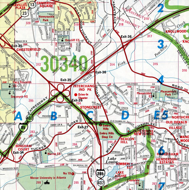
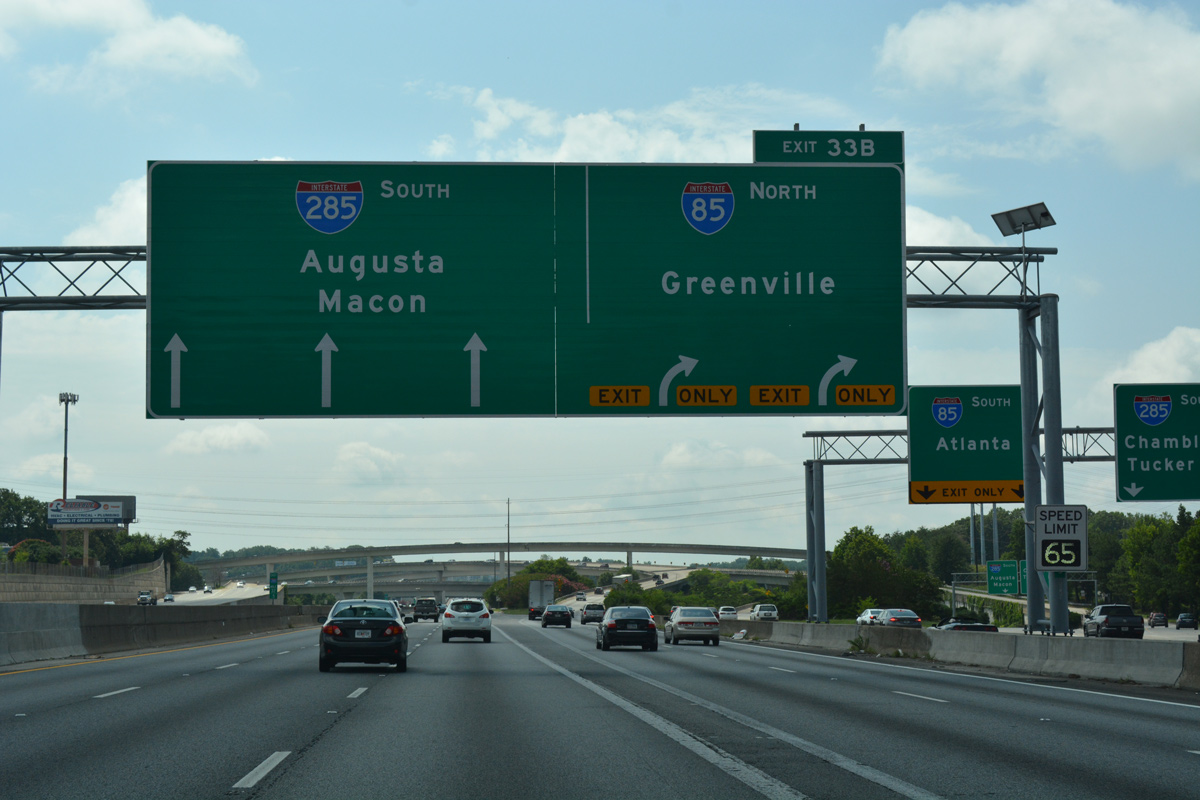
Interstate 285 arcs southeast from Dunwoody through Doraville on the 2.25 mile approach to Exit 33 for I-85. SR 141 (Peachtree Industrial Boulevard), a freeway leading northeast to Norcross, meets the beltway at the ensuing exit. 07/02/17
Advancing south by the site of the Doraville GM Plant, the inner loop of I-285 approaches U.S. 23 (Exit 32) and Interstate 85 (Exits 33A/B). U.S. 23 (Buford Highway) parallels I-85 southwest to Chamblee and northeast to Norcross, Duluth and Suwanee. 07/02/17
Advancing south by the site of the Doraville GM Plant, the inner loop of I-285 approaches U.S. 23 (Exit 32) and Interstate 85 (Exits 33A/B). U.S. 23 (Buford Highway) parallels I-85 southwest to Chamblee and northeast to Norcross, Duluth and Suwanee. 07/02/17
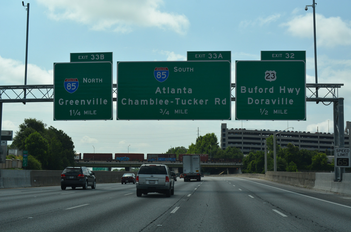
A c/d roadway stems south from the parclo interchange with U.S. 23/SR 13 (Buford Highway) to the four-level interchange (Spaghetti Junction) with Interstate 85. The c/d roadway also connects with Chamblee Tucker Road, an arterial south of the exchange. 07/02/17
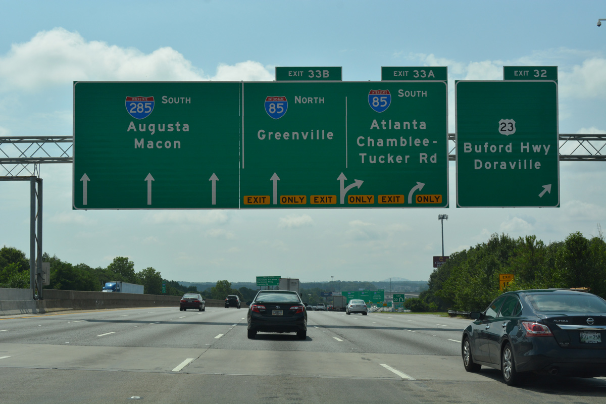
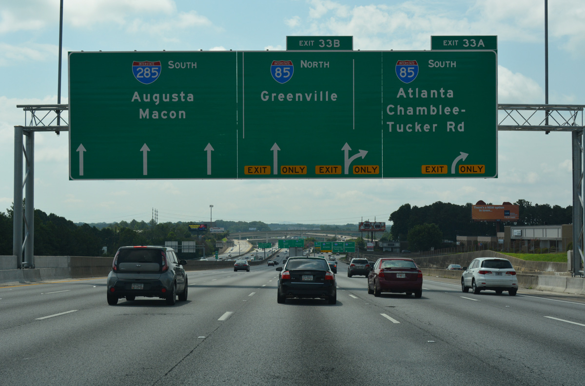
A high flyover takes motorists from I-285 south to a c/d roadway along Interstate 85 north ahead of Northcrest Road. Express toll lanes line Interstate 85 northeast to the split with I-985 and SR 20 near Buford. 07/02/17
![]() North at
North at ![]()
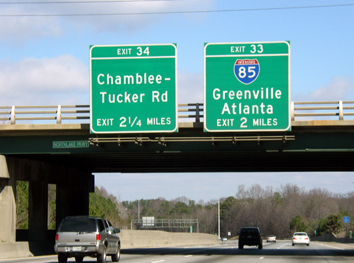
Interstate 285 straddles the Tucker city line northward to Henderson Road. A long c/d roadway (Exit 33) branches away from the freeway mainline a short distance beyond there for Interstate 85. Photo by Chris Patriarca (02/23/03).
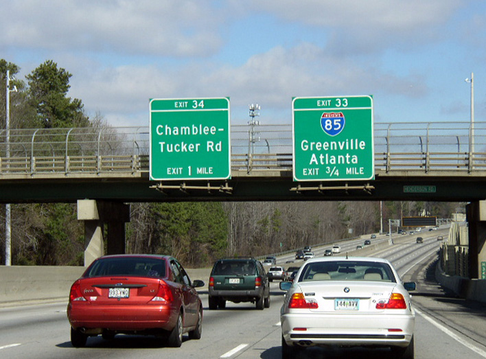
The c/d roadway to Spaghetti Junction (Exit 33) lines the beltway north through the subsequent interchange (Exit 32) with Chamblee Tucker Road. Photo by Chris Patriarca (02/23/03).

Two lanes continue along the c/d roadway below Chamblee Tucker Road. The succeeding split takes motorists onto a high flyover for I-85 south toward Buckhead in Atlanta and north into Gwinnett County. Photo by Chris Patriarca (02/23/03).
![]() South at
South at ![]()

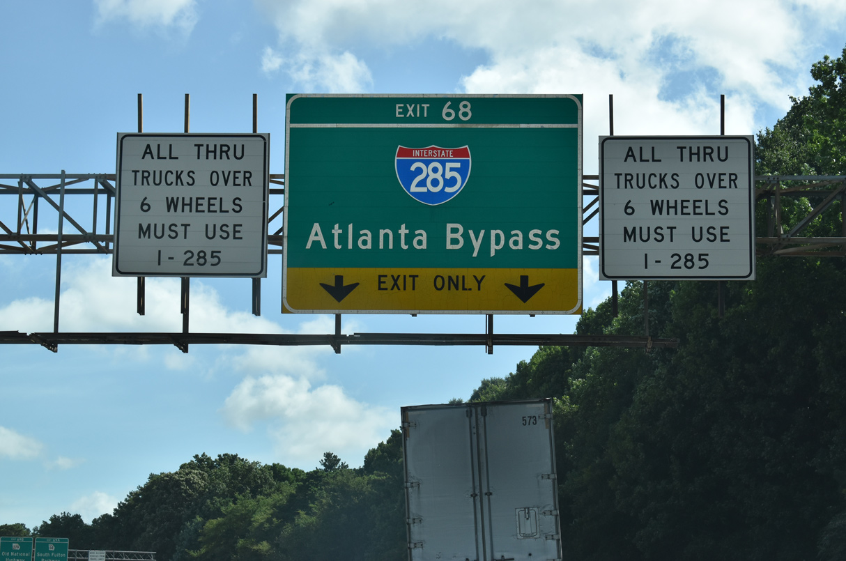
1.5 miles ahead of the Tom Moreland Interchange (Exits 95B/A) with I-285 on Interstate 85 south. All through trucks are directed to use the Perimeter Highway in lieu of I-85 and the Downtown Connector. Photo by Carter Buchanan (08/10/13).
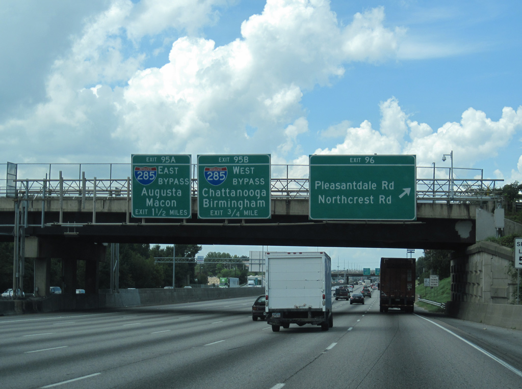
A distributor roadway (Exit 95B) separates from I-85 south just beyond the Pleasantdale Road overpass for the outer loop of Interstate 285 to Dunwoody, the Perimeter Center and Sandy Springs. Photo by Carter Buchanan (08/10/13).
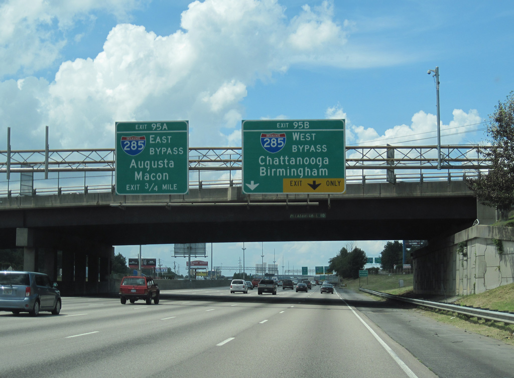
Succeeding lane drops take place along Interstate 85 south for Exits 95B/A (I-285), with through traffic reduced to four general travel lanes and a Express Toll Lane inbound to Atlanta. Photo by Carter Buchanan (08/10/13).
The distributor roadway (Exit 95B) to Interstate 285 west travels at grade level through Spaghetti Junction. The ramp splits with access to a c/d roadway for U.S. 23 (Buford Highway) at Doraville and the beltway west to I-75 at Smyrna. Photo by Carter Buchanan (08/10/13).

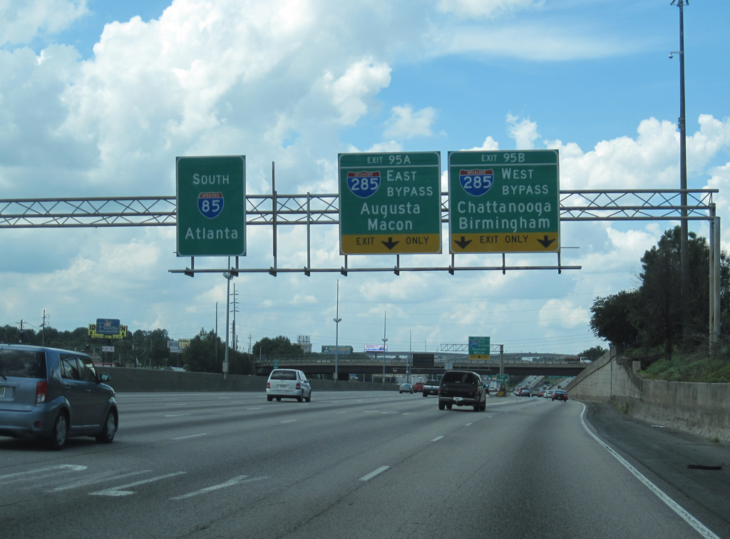
A two lane flyover (Exit 95A) takes motorists southward onto Interstate 285 ahead of Tucker. I-285 navigates through Dekalb County to Clarkston, Avondale Estates and Panthersville, where it meets Interstate 20. 08/07/13
Interstate 285 travels 19 miles south from Exit 95A to I-675 and 28 miles to converge with I-85 again at College Park. 08/07/13
![]() North at
North at ![]()
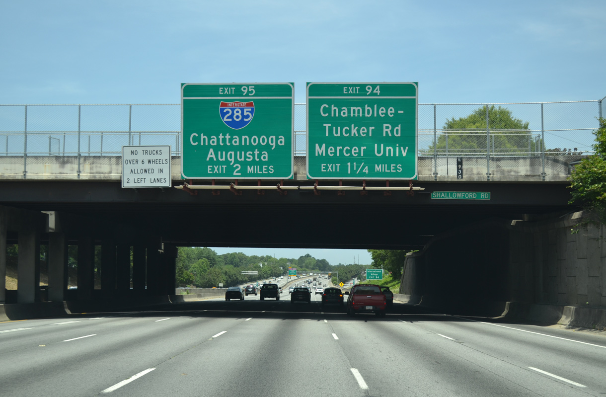
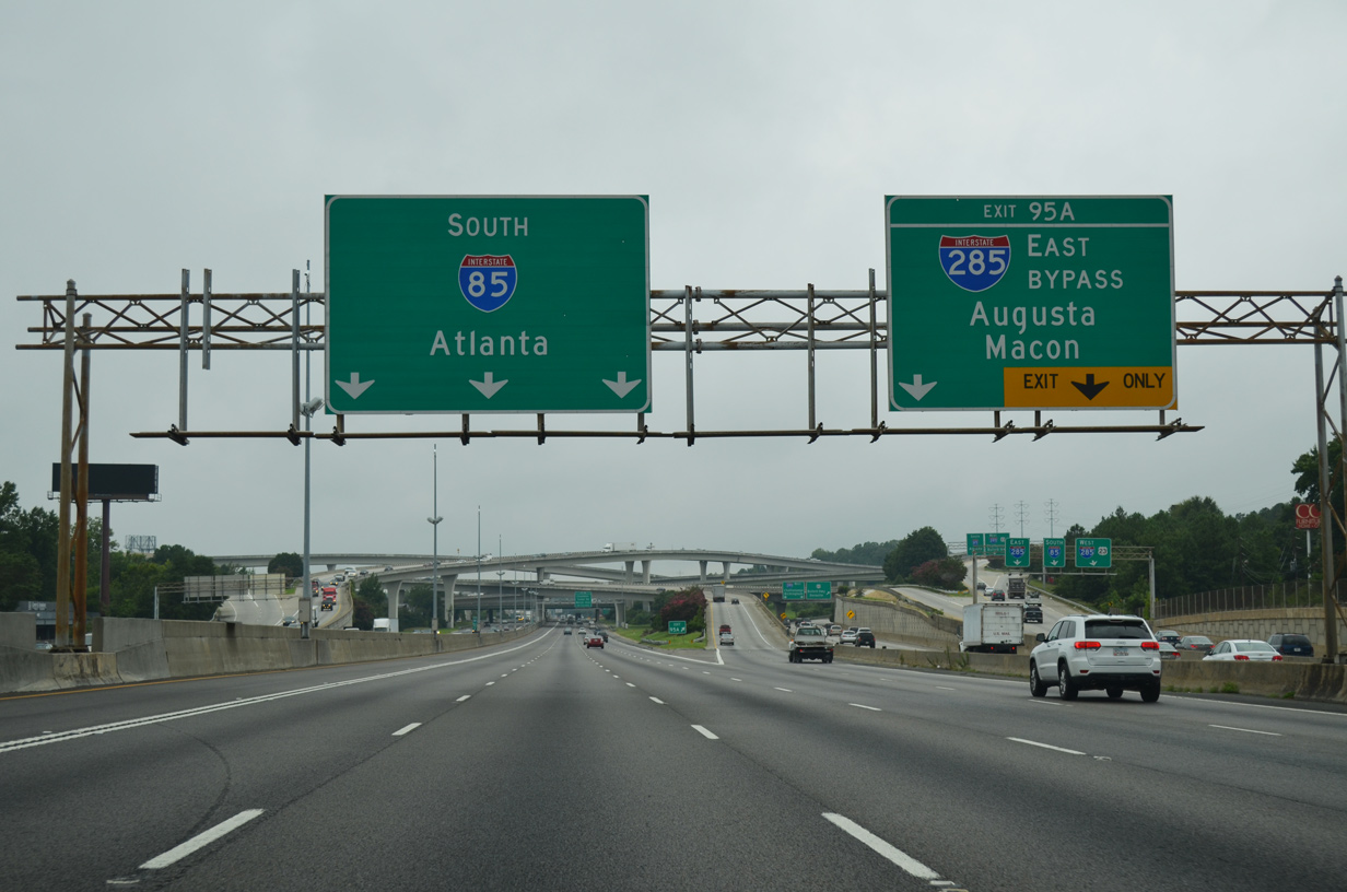
Two miles south of the Tom Moreland Interchange (Exit 95) with Interstate 285 on I-85 north at the Shallowford Road overpass by Chamblee. 07/02/14
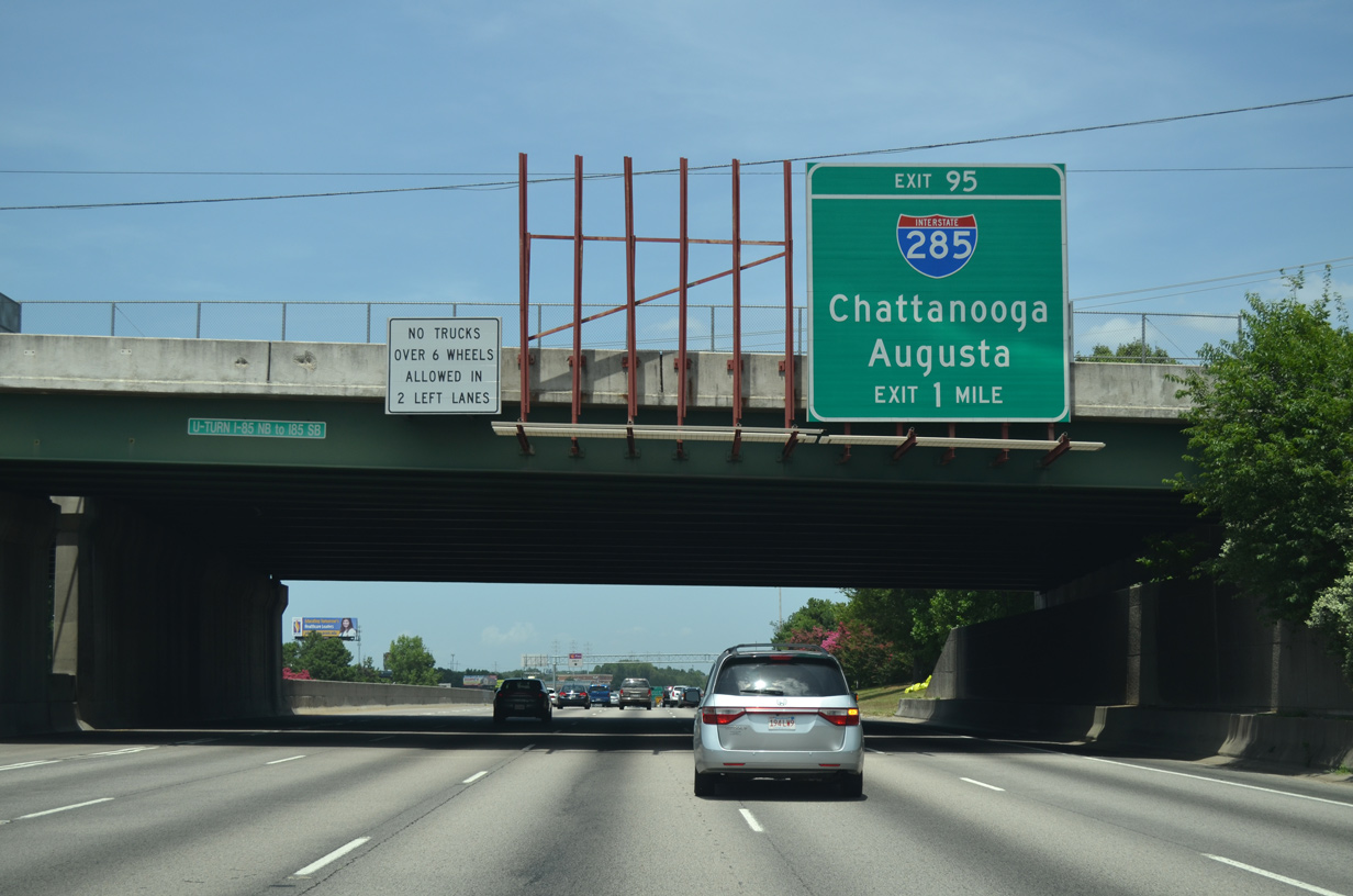
Interstate 85 advances one mile north from the diamond interchange (Exit 94) with Chamblee Tucker Road to Spaghetti Junction with I-285. 07/02/14
A series of office buildings and business parks line both sides of Interstate 85 to the exchange with the Atlanta Beltway. I-285 arcs northwest through Doraville to Dunwoody and south to Tucker and U.S. 78 (Stone Mountain Freeway). 07/02/14
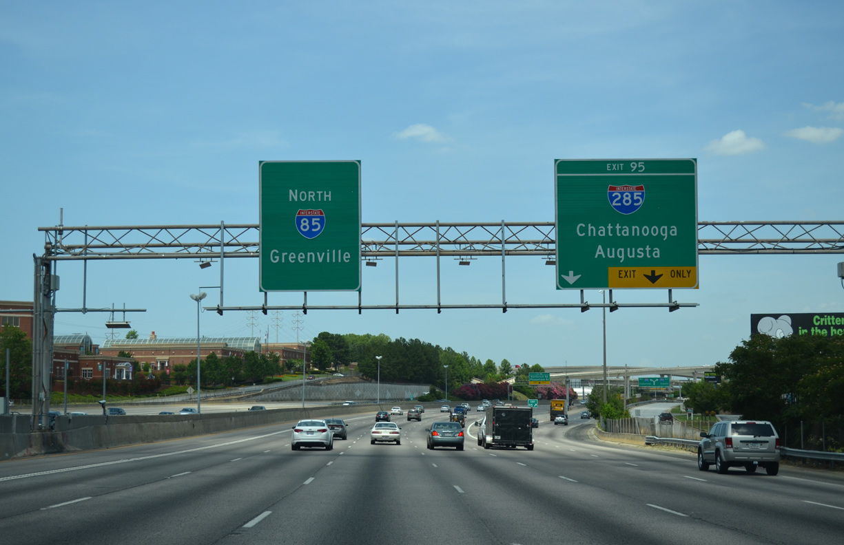
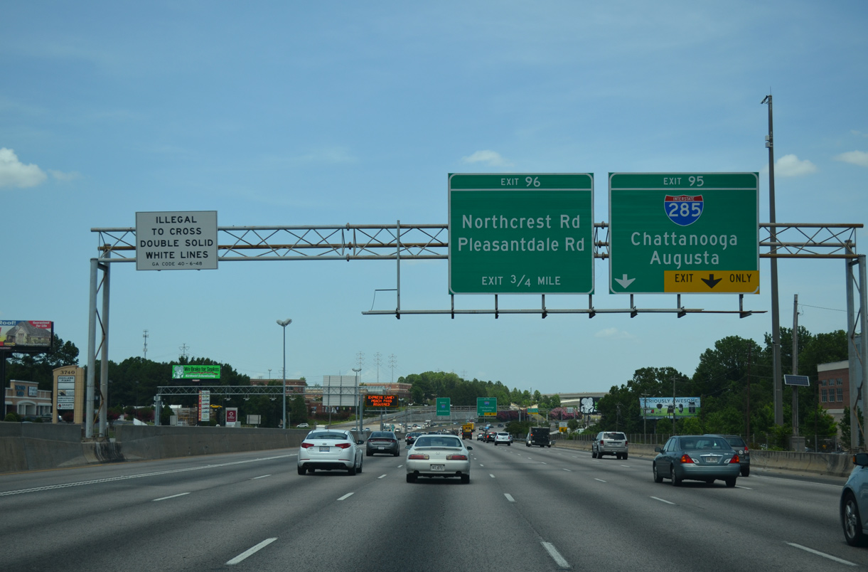
Exit 95 carries all traffic in unison from Interstate 85 north for the Perimeter Highway inner loop to I-20 east and Augusta and the outer loop to I-75 north and Chattanooga. 07/02/14
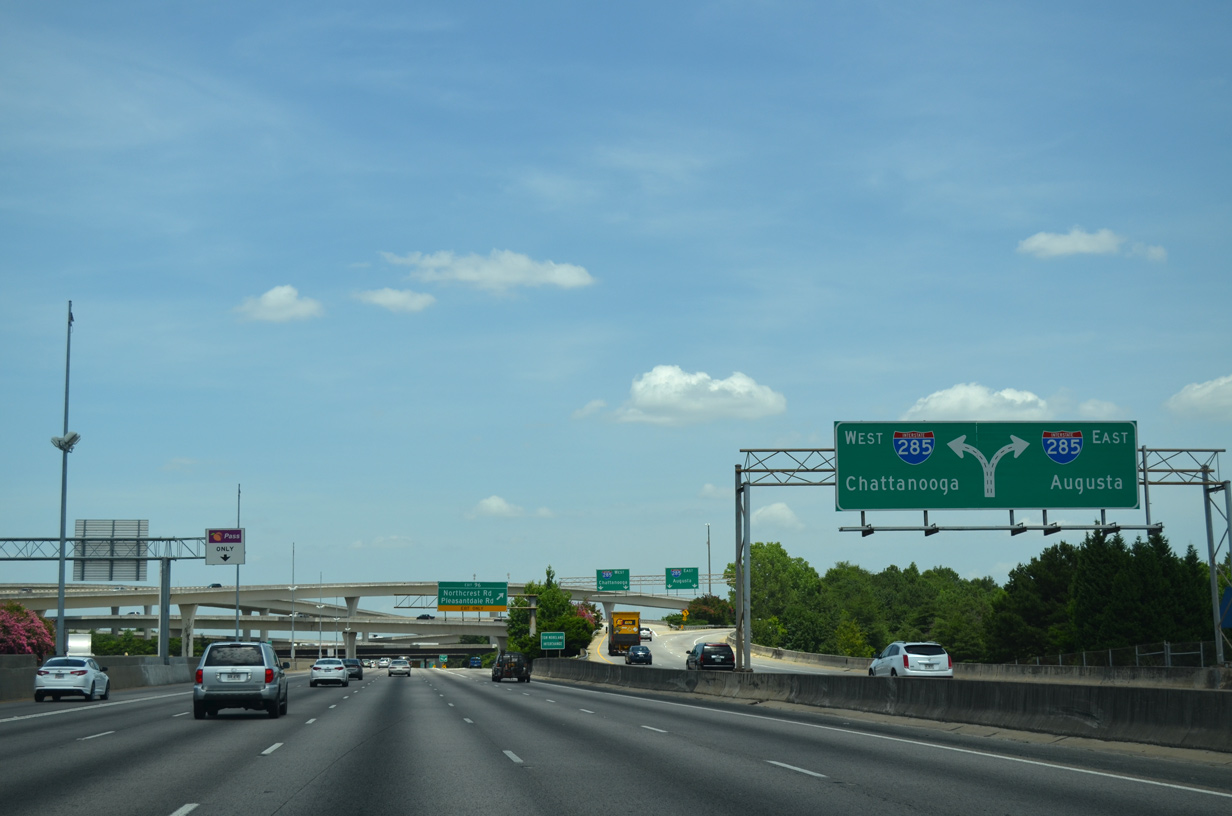
Diagrammatic sign outlining the two lane flyover for I-285 north and the lower ramp for I-285 south. Both ramps tie into c/d roadways along the Perimeter Highway. 07/02/14
South End – College Park, Georgia
![]() South at
South at ![]()
![]()
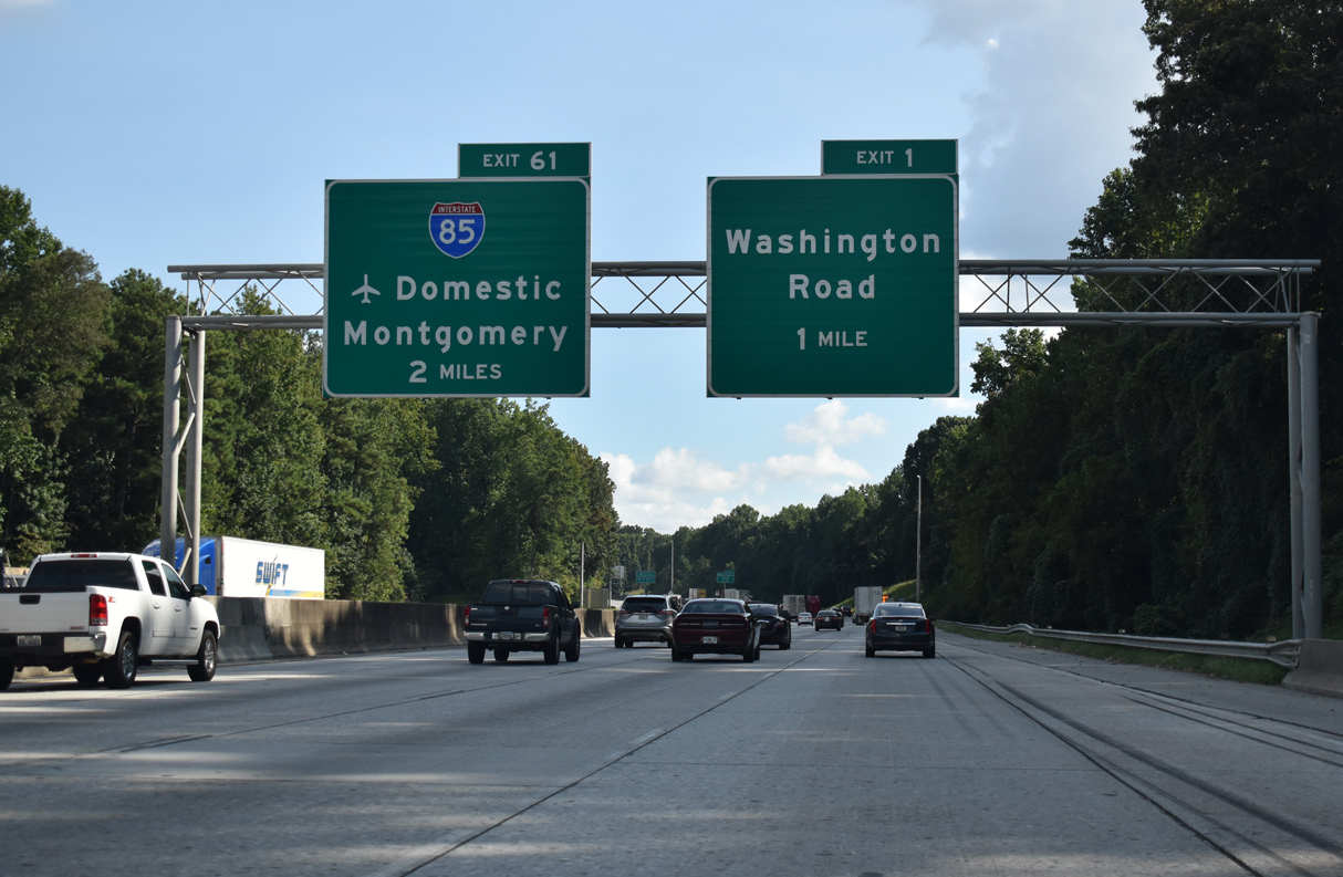
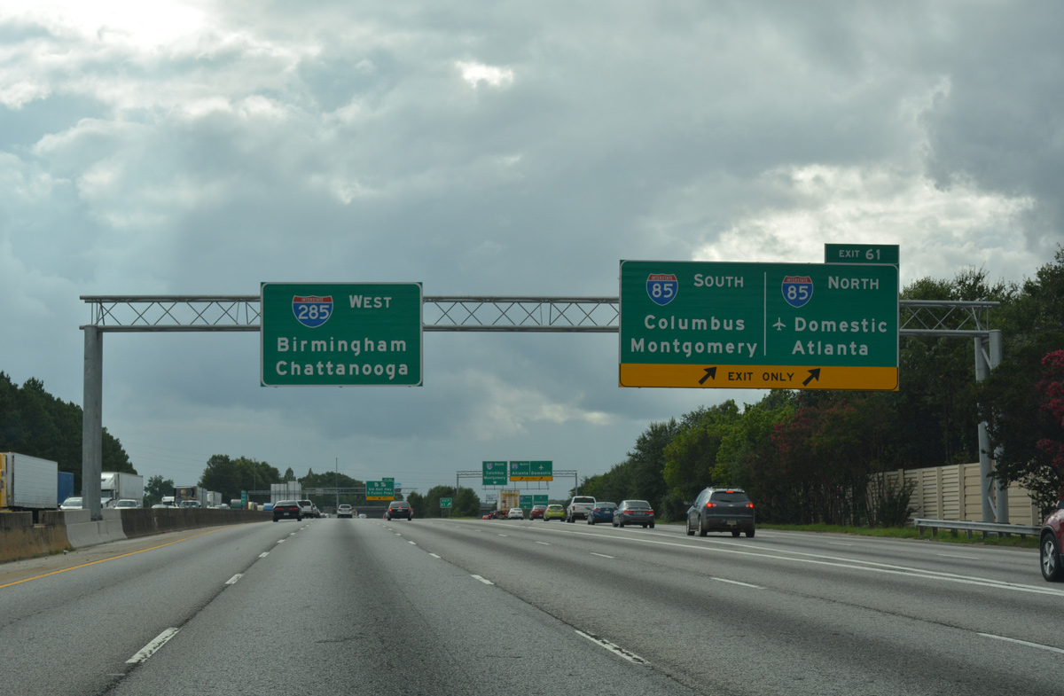
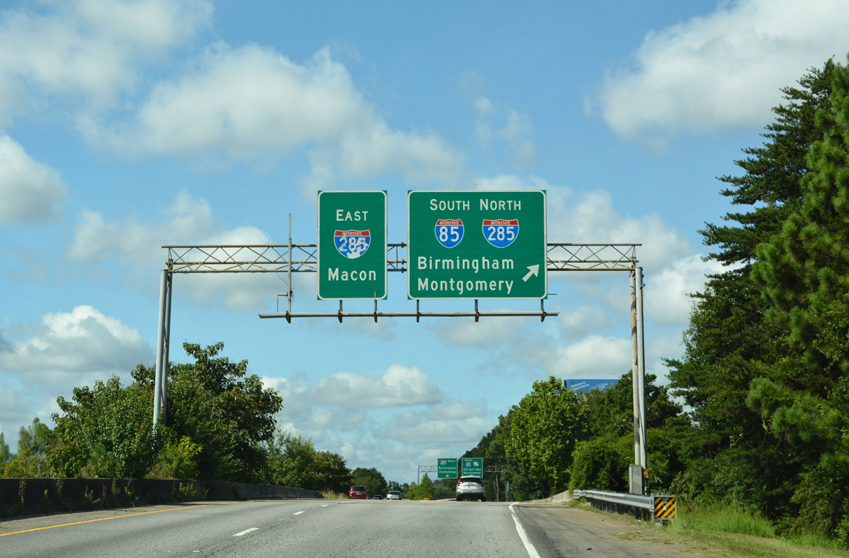
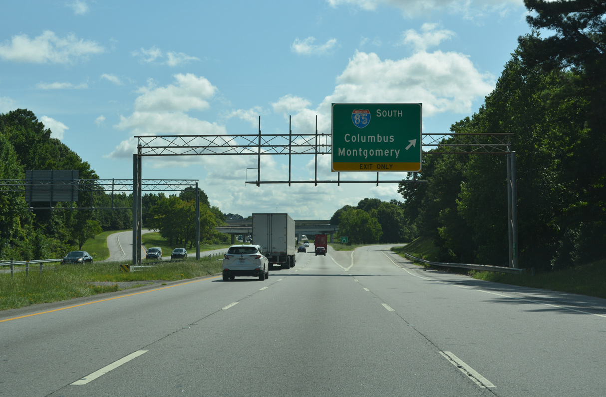
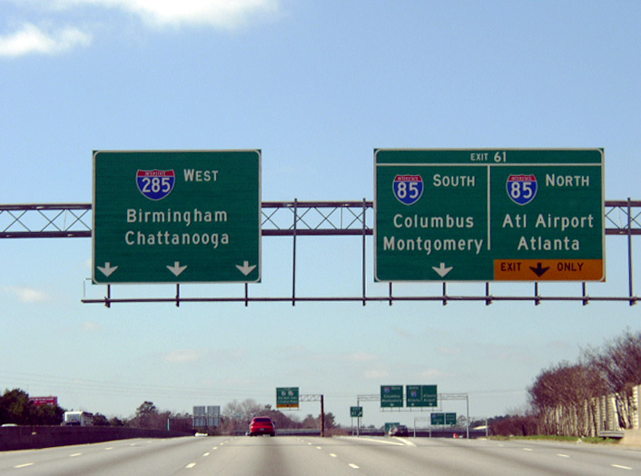
Two miles north of Interstate 85 (Exit 61) on I-285 southbound. The succeeding two exits of the beltway serve the city of College Park. 09/11/20
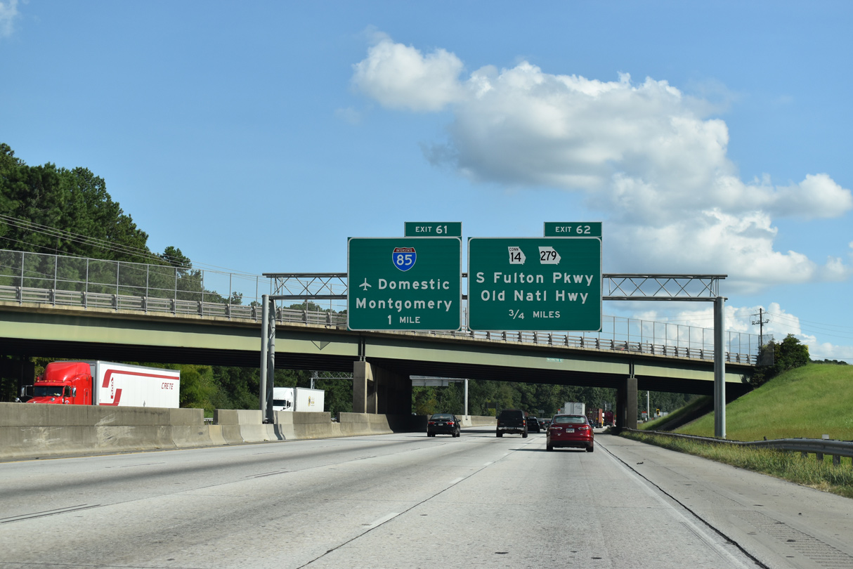
Ramps to Interstate 85 depart just after the exit ramps to SR 14 Connector (S Fulton Parkway). SR 14CO was designated as SR 14 Spur prior to 2007. 09/11/20
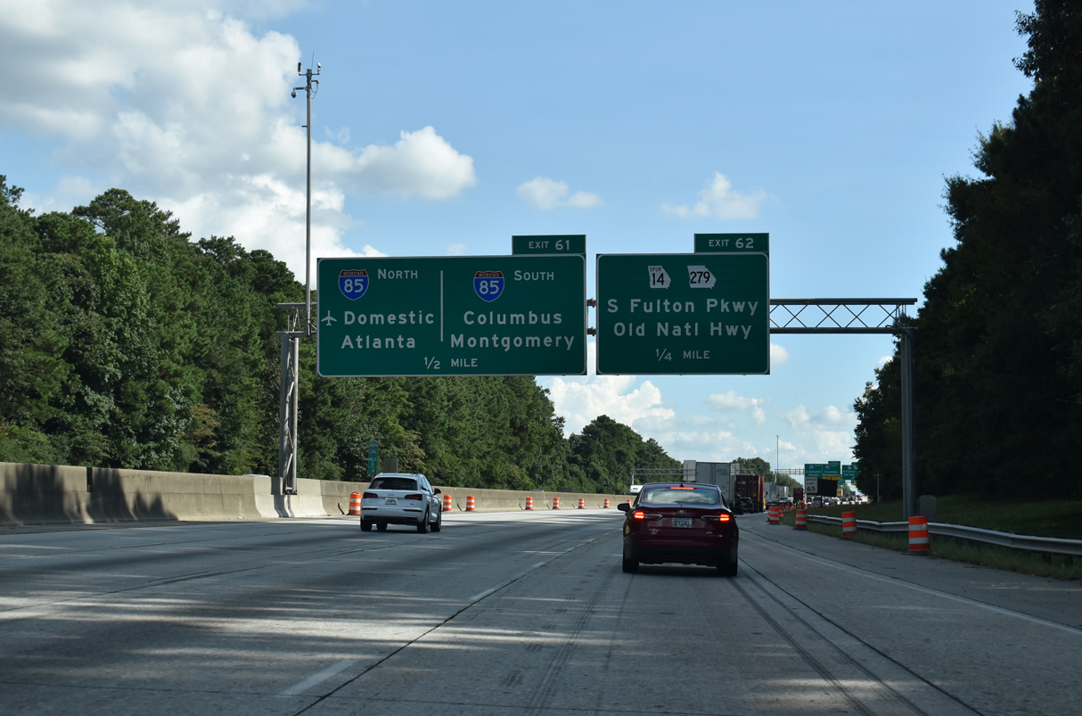
In addition to connecting Atlanta with Montgomery, I-85 south also serves the city of Columbus and Fort Benning via connections with Interstate 185. 09/11/20
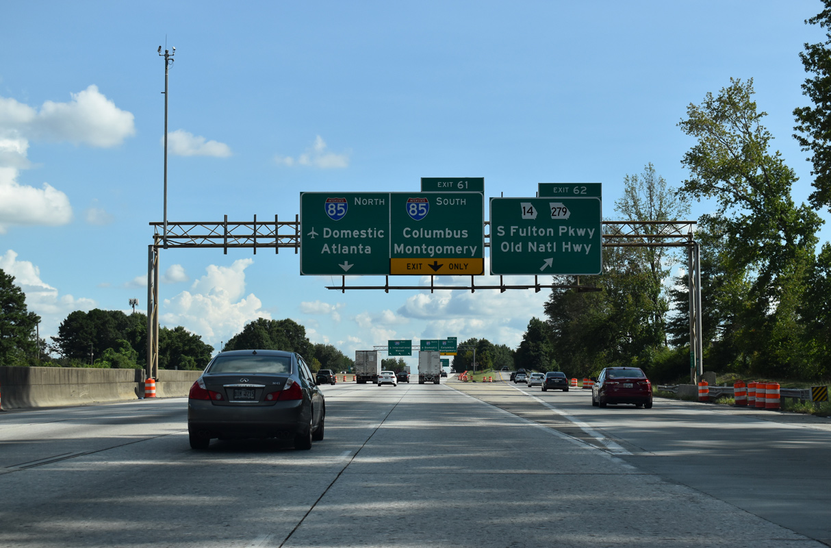
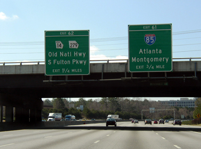
Exit 62 connects with not only SR 14SP (S Fulton Parkway) west, but also a collector distributor roadway extending east from SR 14SP to SR 279 (Old National Highway). I-285 turns east beyond Exit 61 to run alongside I-85 in a dual freeway configuration. 09/11/20
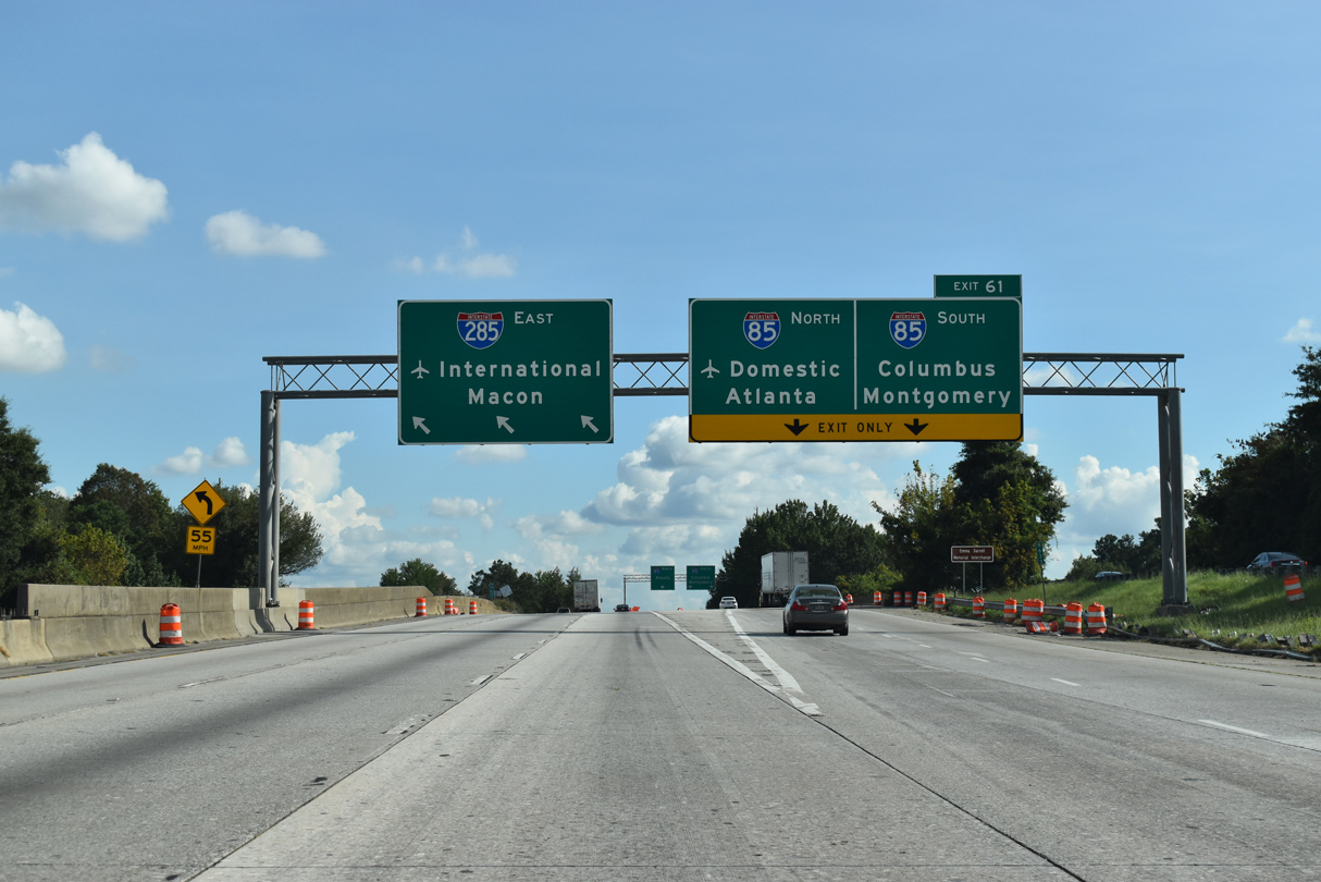
Interstate 285 curves east with three through lanes as Exit 61 separates for I-85 south to Montgomery, Alabama and the parallel northbound lanes of I-85 to the Domestic Terminal of Hartsfield-Jackson Atlanta International Airport (ATL). 09/11/20
![]() West at
West at ![]()
![]()
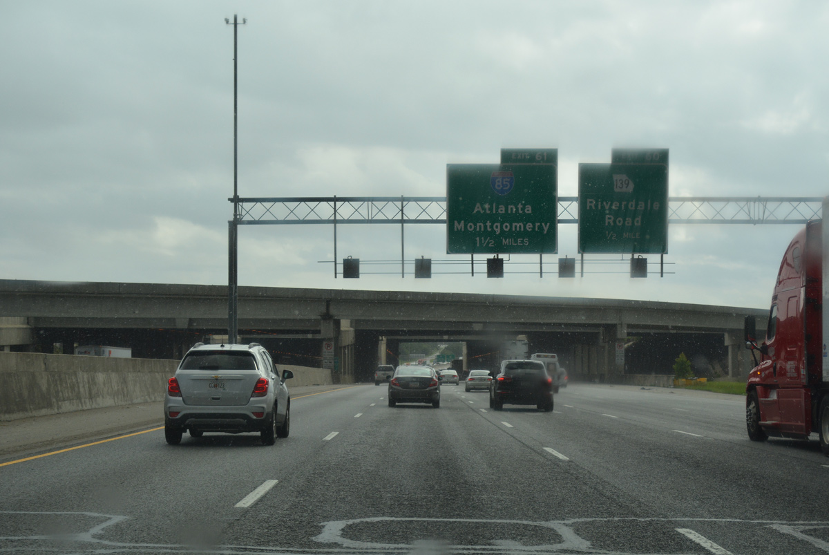
Interstate 285 angles southwest and passes under a pair of tunnels below the 5th Runway of Hartsfield-Jackson Atlanta International Airport (ATL), 1.5 miles from the exchange with I-85. 06/30/17
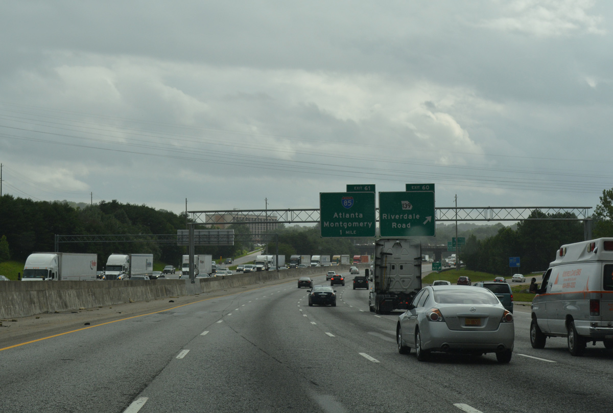
Exit 60 departs from the inner loop of Interstate 285 one mile ahead of I-85. SR 139 meanders west and north to meet Interstate 85 by parking facilities of ATL Airport. 06/30/17
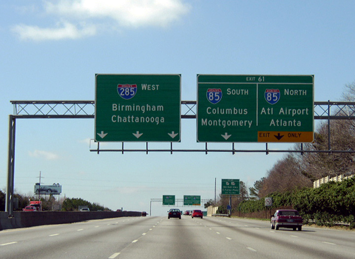
Two lanes part ways from Interstate 285 west for I-85. West from the three wye interchange at Exit 61, a dual freeway unfolds with the roadways of I-85 running in between those of the Perimeter Highway. Downtown Atlanta is 14 miles to the northeast at this point. 06/30/17
A third ramp from Exit 61 emerges to join a c/d roadway accompanying Interstate 85 north to both SR 139 (Riverdale Road) and N Terminal Parkway to the Domestic Terminal of ATL Airport. 06/30/17
![]() North at
North at ![]()
![]()
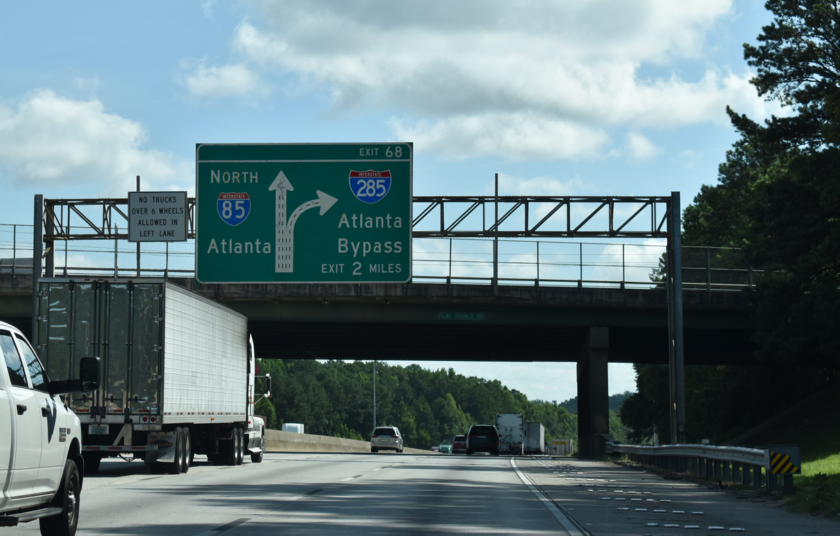
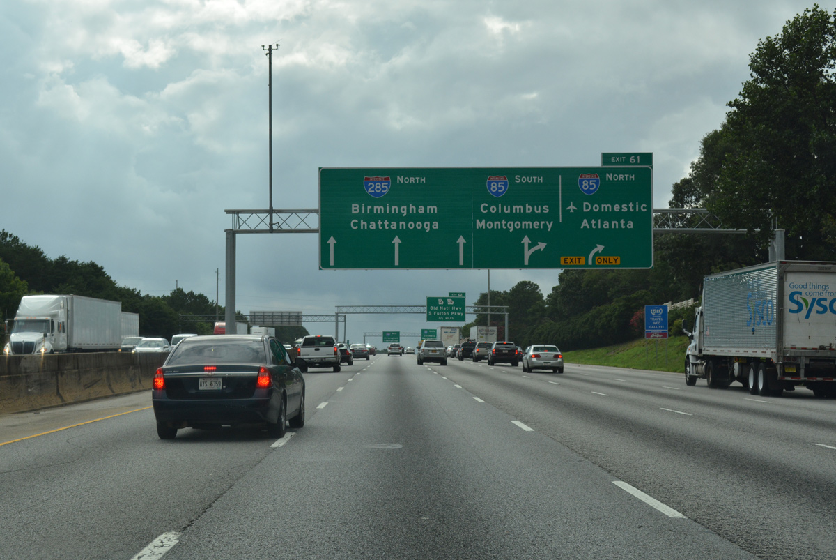
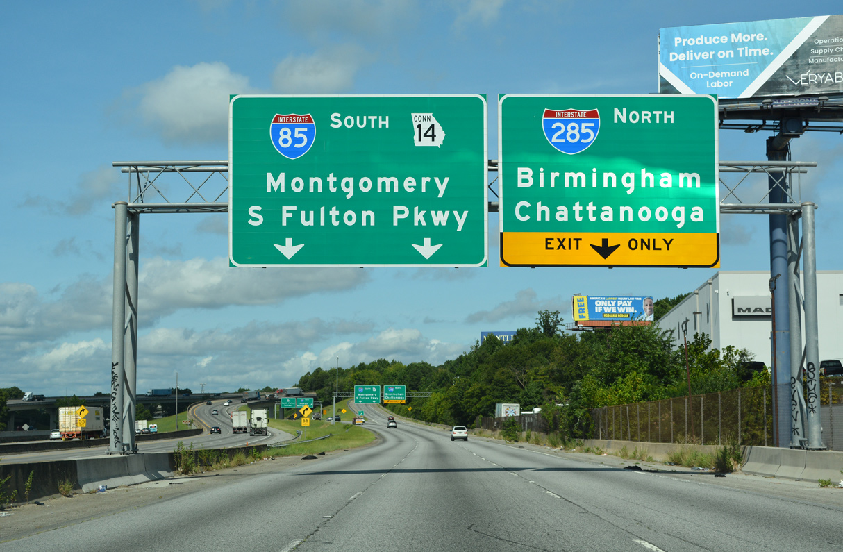
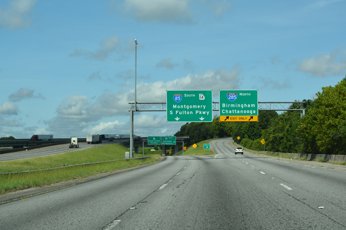
Two miles ahead of the cloverstack interchange (Exit 68) with Interstate 285 and SR 14 Connector (S Fulton Parkway) on I-85 north at the Flat Shoals Road overpass. 07/26/22
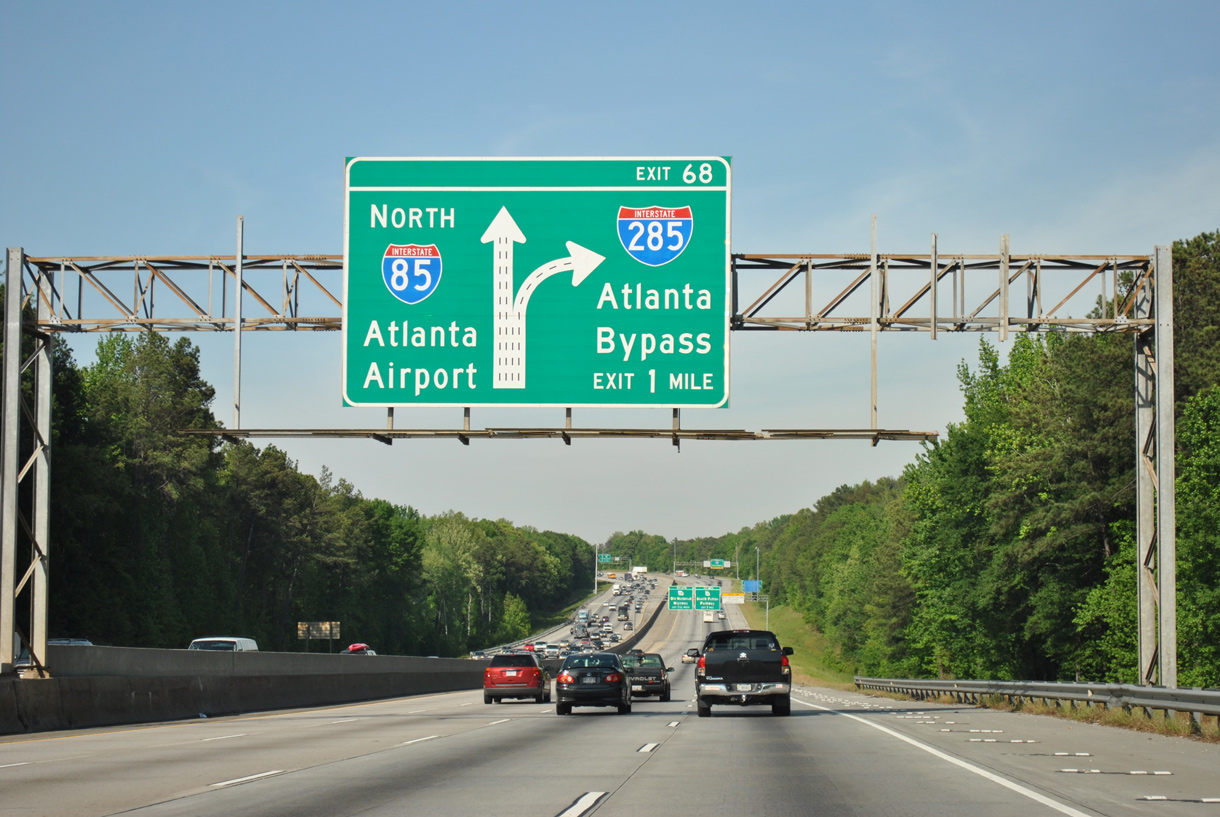
I-85 curves northward toward Exit 68 for I-285 and SR 14CO (S Fulton Parkway), maintaining three through lanes for the Domestic Terminal of ATL Airport and Downtown Atlanta. This overhead was removed in Spring 2021 and the sign bridge subsequently dismantled by Spring 2022. 04/13/12
Succeeding guide signs for Interstate 285 reference the beltway as the Atlanta Bypass. 07/26/22
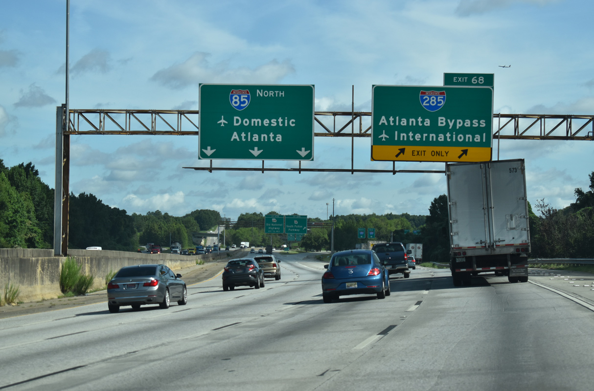
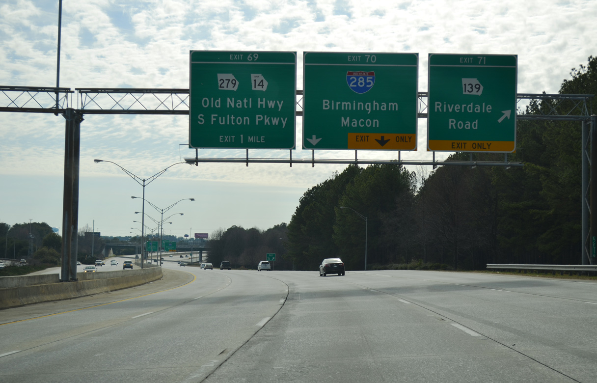
Exit 68 branches away from I-85 northbound for I-285. Exit 69 A departs nearby onto a flyover departs for SR 14CO (S Fulton Parkway), a freeway extending 1.92 miles west from the Perimeter Highway to U.S. 29/SR 14 (Roosevelt Highway) near Red Oak outside College Park. 07/26/22
The Perimeter Highway doubles as both a heavily traveled commuter route and freight corridor throughout the Atlanta metro area. 07/26/22
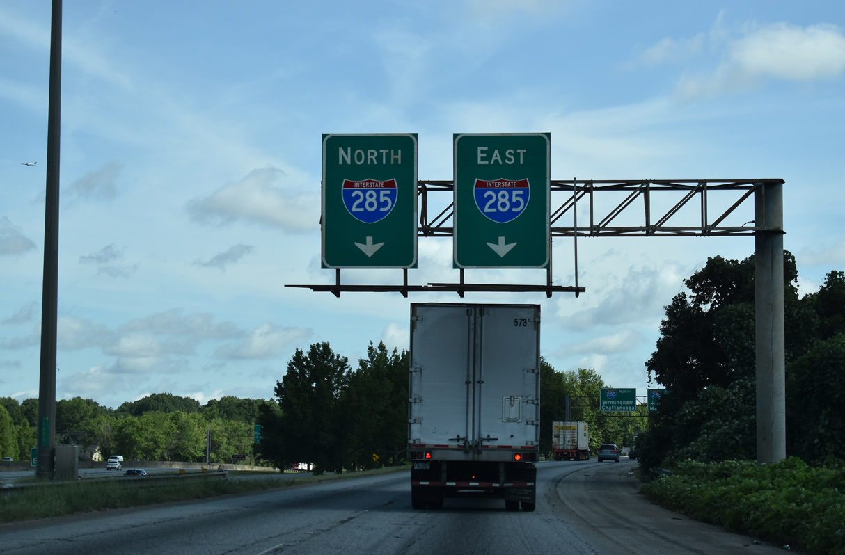
Interstate 285 eastbound runs between the roadway for I-85 north and the c/d roadway for SR 279 (Old National Highway) before diverging from Interstate 85 to SR 139 (Riverdale Road) on the south side of ATL Airport. 07/26/22
![]() South at
South at ![]()
![]()
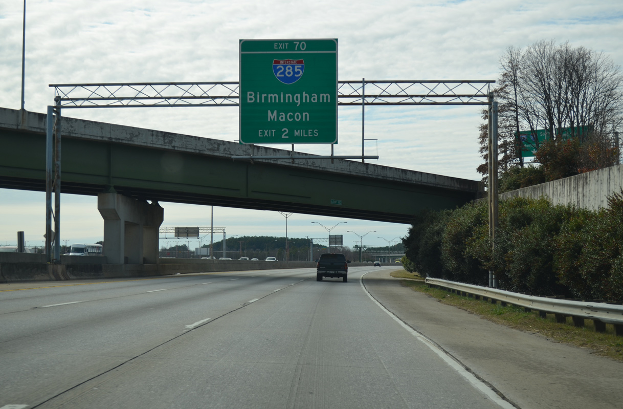
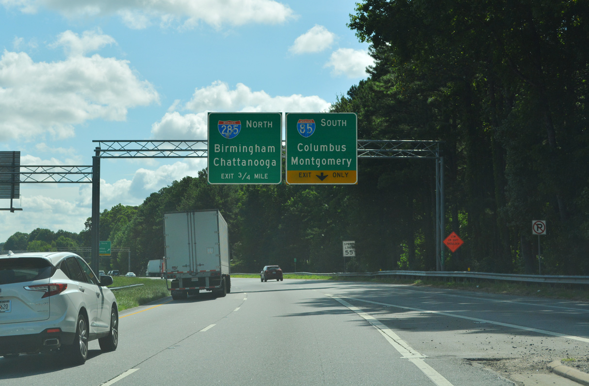
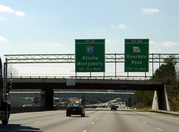
I-85 south makes a gradual S-curve from the Domestic Terminal of Hartsfield-Jackson Atlanta International Airport (ATL) to Exit 70 with the Perimeter Highway. 12/31/12
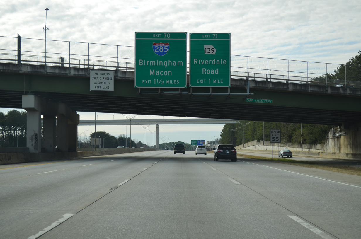
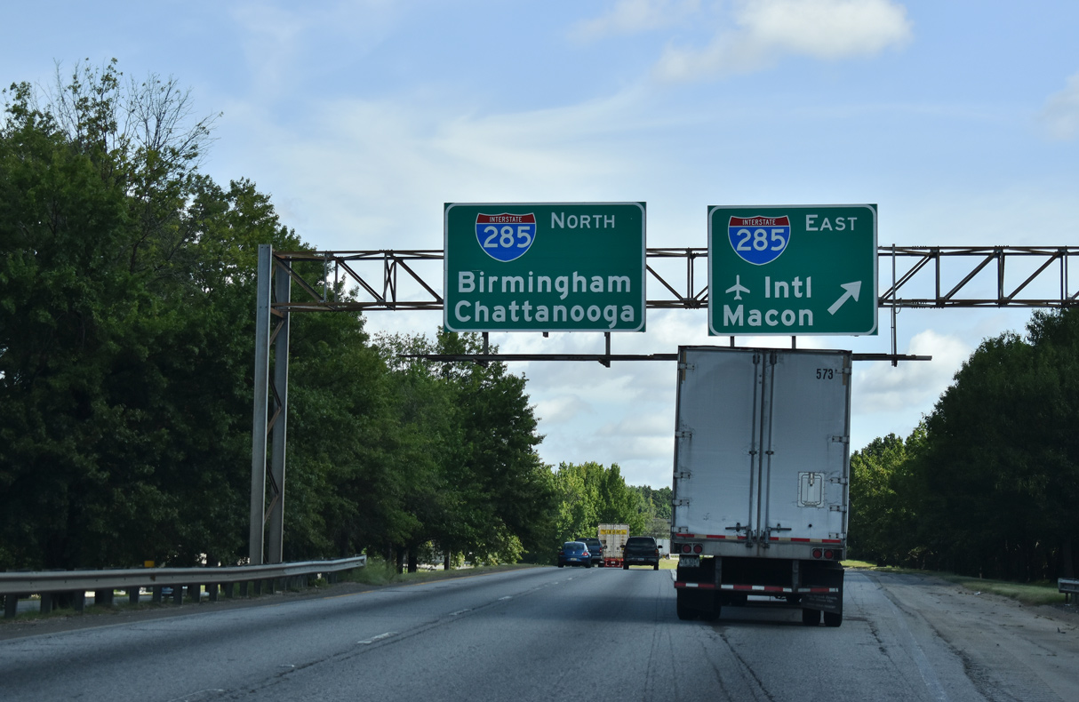
I-285 uses the control cities of Macon and Birmingham for the connections with I-75 south and I-20 west respectively. 12/31/12
SR 139 (Riverdale Road) takes a circuitous route around the southwestern boundary of ATL Airport, connecting with both Interstate 85 at Exit 70 and the Atlanta Beltway at Exit 60. 12/31/12
Exits 71 and 70 depart in quick succession from I-85 south for both SR 139 (Riverdale Road) and Interstate 285 (Atlanta Perimeter Highway). 12/31/12
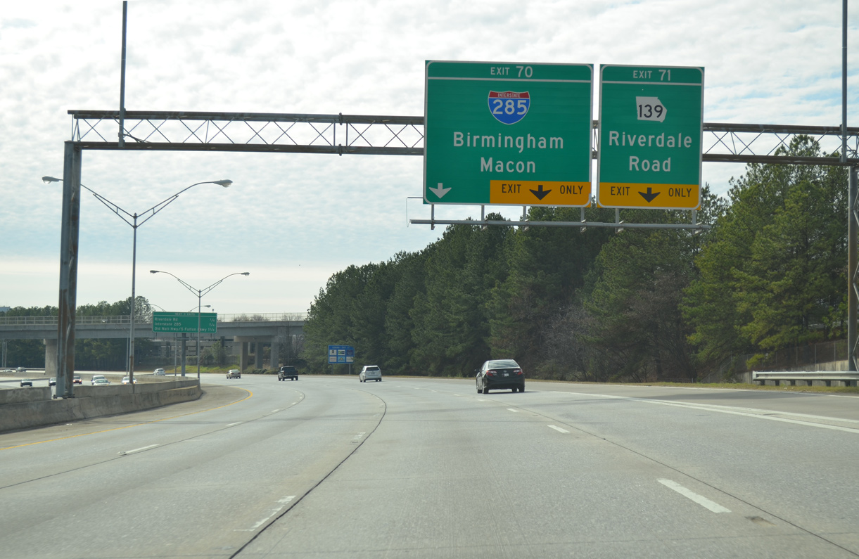
Exit 70 separates from Interstate 85 to form a c/d roadway from SR 139 southwest to both the inner loop of I-285 and SR 279 (Old National Highway). 07/26/22
Traffic taking Exit 70 partitions into a flyover for Interstate 285 east (outer loop) to Forest Park and Dekalb County, I-85 south to Union City and Fairburn, and SR 279 (Old National Highway) to College Park. 07/26/22

SR 279 (Old National Highway) spans the six roadways for I-85, I-285 and the c/d roadway joining both with the arterial at College Park. 07/26/22
I-85 and I-285 parallel one another for 1.6 miles without directly overlapping. The two routes were separated during the “Freeing the Freeways” project from 1982 to 1988.7 07/26/22
The c/d roadway along I-85 southbound links SR 139 (Riverdale Road) with SR 14CO (S Fulton Parkway) extending west from the exchange with I-285 to U.S. 29 ALT. 07/26/22
![]() East at
East at ![]()
![]()
SR 14CO (S Fulton Parkway) links U.S. 29/SR 14 (Roosevelt Highway) with both I-85 and I-285 in southwestern reaches of College Park. 07/26/22
The exit for I-85 south to Columbus (via I-185) and Montgomery, Alabama departs S Fulton Parkway ahead of Interstate 285. 07/26/22

A loop ramp joins the east end of SR 14CO with I-285 north to East Point and west Atlanta. The remainder of SR 14CO defaults onto the c/d roadway joining I-85/285 with SR 279 (Old National Highway). 07/26/22
 South End Throwback
![]() West at
West at ![]()
I-285 curved westward around the periphery of ATL Airport with five lanes from Airport Loop Road toward SR 139 (Exit 60) and I-85 (Exit 61). Completed in 2006, the 5th Runway project added two tunnels along the Atlanta Beltway on this stretch. Photo by Chris Patriarca (02/23/03).
The Perimeter Highway bends northward from the parclo interchange (Exit 60) with SR 139 to the exchange with Interstate 85. The bridge mounted sign for SR 139 was removed by 2007, but a replacement was added for it and I-85 by May 2016. Photo by Chris Patriarca (02/23/03).
An array of sign changes were made throughout Atlanta to reflect the opening of the International Terminal for ATL Airport. These included new overheads for I-85 north, directing motorists to the Domestic Terminal. Photo by Chris Patriarca (02/23/03).
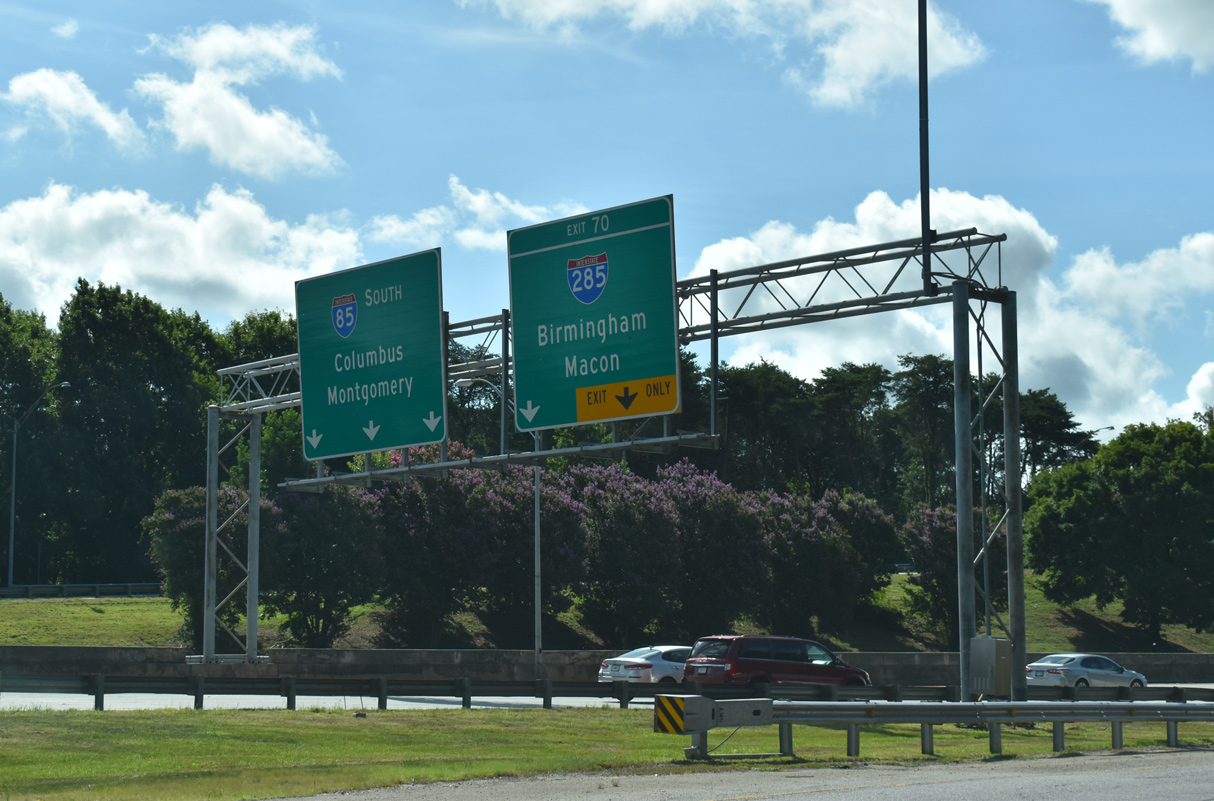
Two lanes partition from the beltway inner loop for Interstate 85. Travelers taking I-85 south will reach Columbus (via I-185) in 93 miles and the Alabama capital city in 146 miles. Photo by Chris Patriarca (02/23/03).
Sources:
- “New report puts dates on start of Outer Loop.” The Atlanta Journal and The Atlanta Constitution (GA), October 22, 1992.
- “Outer Loop on back burner again.” The Atlanta Journal and The Atlanta Constitution (GA), November 5, 1992.
- “Northern arc through Cherokee endorsed by Barnes.” Cherokee Tribune (Canton, GA), January 16, 1999.
- “Counties eye Arc right-of-way – Gwinnett floats parkway plan.” The Atlanta Journal and The Atlanta Constitution (GA), February 20, 2003.
- “Happy Birthday to the open road.” Gwinnett Daily Post (Lawrenceville, GA), June 25, 2006.
- “I-75, I-285 on north side to be widened … again.” The Atlanta Journal and The Atlanta Constitution (GA), May 28, 1986.
- “Light at end of the tunnel for Interstate 85 construction.”” The Atlanta Journal and The Atlanta Constitution (GA), September 17, 1987.
Page updated July 29, 2022.