Interstate 275 Florida

Overview
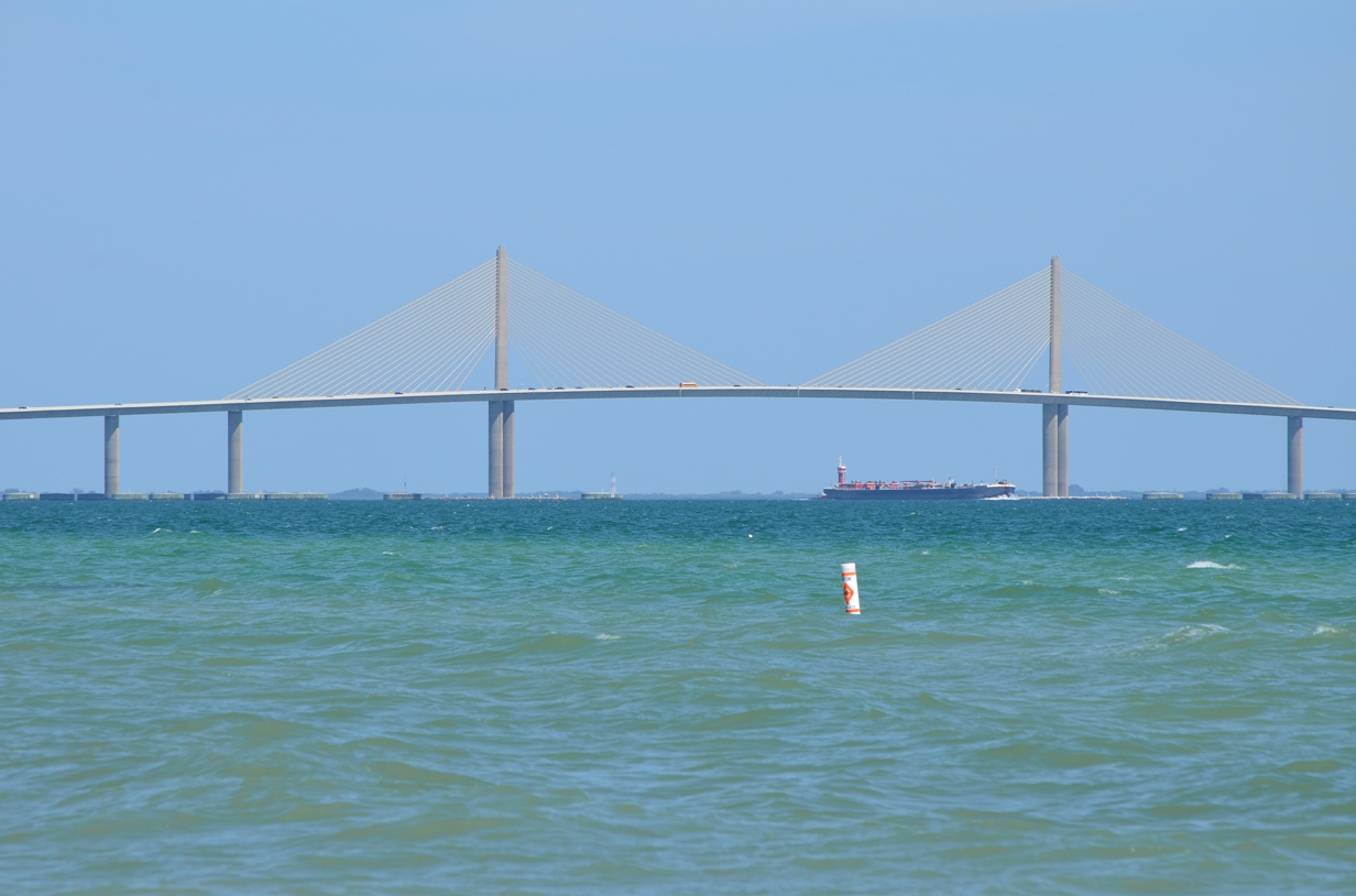
A freighter passes below the Sunshine Skyway to the east of Fort DeSoto Park on a windy afternoon. 04/04/14
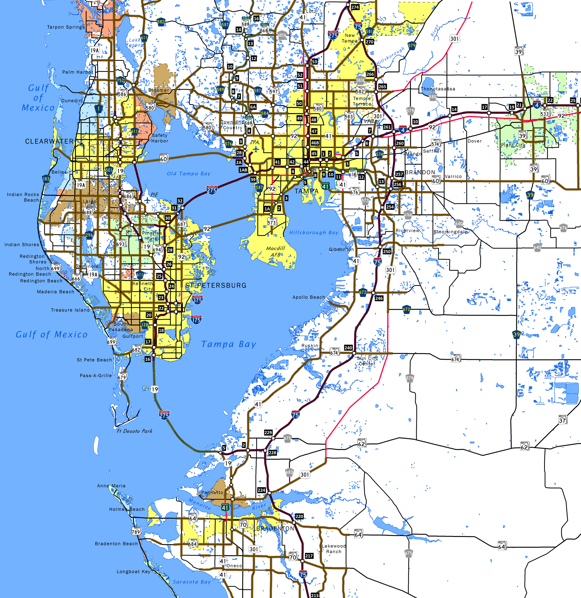
Interstate 275 in Florida loops through urban areas of Pinellas and Hillsborough Counties in the Tampa Bay area. The freeway joins Downtown Tampa with Downtown St. Petersburg while connecting Pinellas County with Palmetto and Bradenton in Manatee County. I-75, by contrast, bypasses both cities to the east, doubling as a commuter route for Gibsonton, Brandon, New Tampa and Wesley Chapel and carrying regional traffic between Southwest Florida and the Nature Coast.
Interstate 275 starts at a three-wye interchange with I-75 outside Palmetto and extends west through Terra Ceia to the tolled Sunshine Skyway Bridge across Tampa Bay. Northward the freeway winds through St. Petersburg to the eight lane wide Howard Frankland Bridge across Old Tampa Bay. The span turns I-275 east to Westshore in Tampa en route to the central business district and Downtown Interchange with Interstate 4. There the freeway turns almost due north through north Tampa to unincorporated areas of Lutz. Located along the Pasco County line at Wesley Chapel, the northern merge point of I-75/275 is known as the Apex.
Howard Frankland Bridge
An $814 million project scheduled from early 2020 to late 2024 replaces the northbound crossing of the Howard Frankland Bridge. Accommodating four general travel lanes, two tolled Express Lanes, and a multi use trail, a new 168 foot wide bridge will be built along the north side of the southbound span. Upon completion, southbound traffic will shift onto the new span and northbound traffic will be moved from the 1959 bridge onto the current southbound bridge. Subsequent work to expand the northbound bridge to 111 feet in width with two Express Lanes can accommodate rail transit in place of two managed lanes on the new southbound span.
Route Information
North End – Wesley Chapel, FL
South End – Ellenton, FL
Mileage – 60.64
Cities – St. Petersburg, Pinellas Park, Tampa
- Junctions –


Source: December 31, 2021 Interstate Route Log and Finders List
I-275 Annual Average Daily Traffic (AADT)
Source: 2019 AADT Florida Traffic Online (FDOT)
The Howard Frankland Bridge initially opened with four lanes in 1960. A second span was added in 1990.
 History
The original layout for the Tampa Bay Interstate network took I-4 west from Tampa to St. Petersburg and I-75 south from Pasco County to the Downtown Interchange near Ybor City. Changes were announced by the U.S. Department of Transportation in January 1969, when I-75 was routed southward over I-4 west from Downtown Tampa to Pinellas as part of its extended alignment south to Naples.
The Tampa Bay Regional Planning Council requested Federal approval of an Interstate highway loop on January 20, 1967. This included the missing link of the I-75 extension from Tampa to Miami and a separate beltline route through Pinellas County. The plan outlined routing I-75 around Tampa from a point near Bearss Avenue southward to the end of the four-laned Sunshine Skyway. The existing I-75 south to the Downtown Interchange would become a spur, and Interstate 4 would continue south through St. Petersburg to the Sunshine Skyway.1
Eventually Federal officials approved a designation of I-75W through Pinellas County and I-75E for the bypass through the Hillsborough County side of the bay. $14 million in construction to connect I-75 with the Sunshine Skyway and to bring the span to Interstate standards was underway by 1973. This included $6.1 million for the highway from Gandy Boulevard to 46th Avenue N, $3.4 million for the portion from 46th Avenue N to 38th Avenue N, and $4.3 million for the link from 38th Avenue N to 22nd Avenue N. Those were to be completed by mid-1974. The $7.3 million segment from 22nd Avenue N to 5th Avenue N went to bid in June 1973.2
Concerns over costs to bring the Skyway up to Interstate standards resulted in discussion about potential renumbering. Possibilities for redesignating I-75 through Pinellas County included extending I-4 south to the Skyway or renumbering it as a spur route (I-175) or a loop (I-275).2 The American Association of State Highway Officials (AASHO) ultimately approved a Florida Department of Transportation (FDOT) request to redesignate I-75 as Intertate 275 on June 26, 1973.3
The following are key dates in the history of Interstate 275 in Florida:4
- 1973 – I-275 created when I-75 is realigned from the St. Petersburg-Tampa route to the Tampa Bay bypass. I-275 was complete at that time from 38th Street N in St. Petersburg north to Lutz. The portion of I-275 between the Sunshine Skyway (near Maximo Point) and 38th Street N was unconstructed.
- 1975 – I-275 under construction from 5th Avenue S north to 38th Street N.
- 1977 – I-275 opened from 5th Avenue S north to 38th Street N in St. Petersburg.
- 1980 – I-275 under construction from I-75 near Gillette west to Terra Ceia. Tragedy struck I-275 when the ship Summit Venture collided with the original Sunshine Skyway. 35 people died in this accident, and one of the two spans collapsed.
- 1981 – I-275 under construction from Maximo Point north to 5th Avenue S. The northern apex of I-275 tied into I-75 near Worthington Gardens in Pasco County.
- 1983 – Two sections of I-275 opened: the southern apex with I-75 and the section of I-275 from Maximo Point north to 5th Avenue S.
- 1984 – Replacement Sunshine Skyway (a new cable-stayed bridge) was under construction.
- 1987 – New Sunshine Skyway opened on April 30th. At that point, Interstate 275 was complete.
Interstate 275 crosses the cable stayed Sunshine Skyway Bridge over the mouth of Tampa Bay. On May 9, 1980, the southbound span of the original Sunshine Skyway Bridge (a steel truss bridge) collapsed when the Summit Venture freighter collided with a bridge support. This led to two-way traffic on the remaining northbound span until the replacement was built. Ultimately, the old bridge was removed, though portions of the approach in both directions were retained for use as fishing piers run by the state park system.
Sunshine Skyway
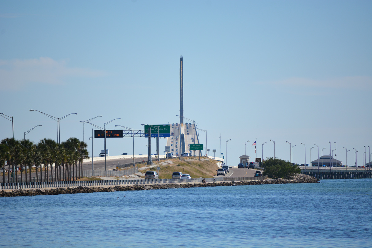
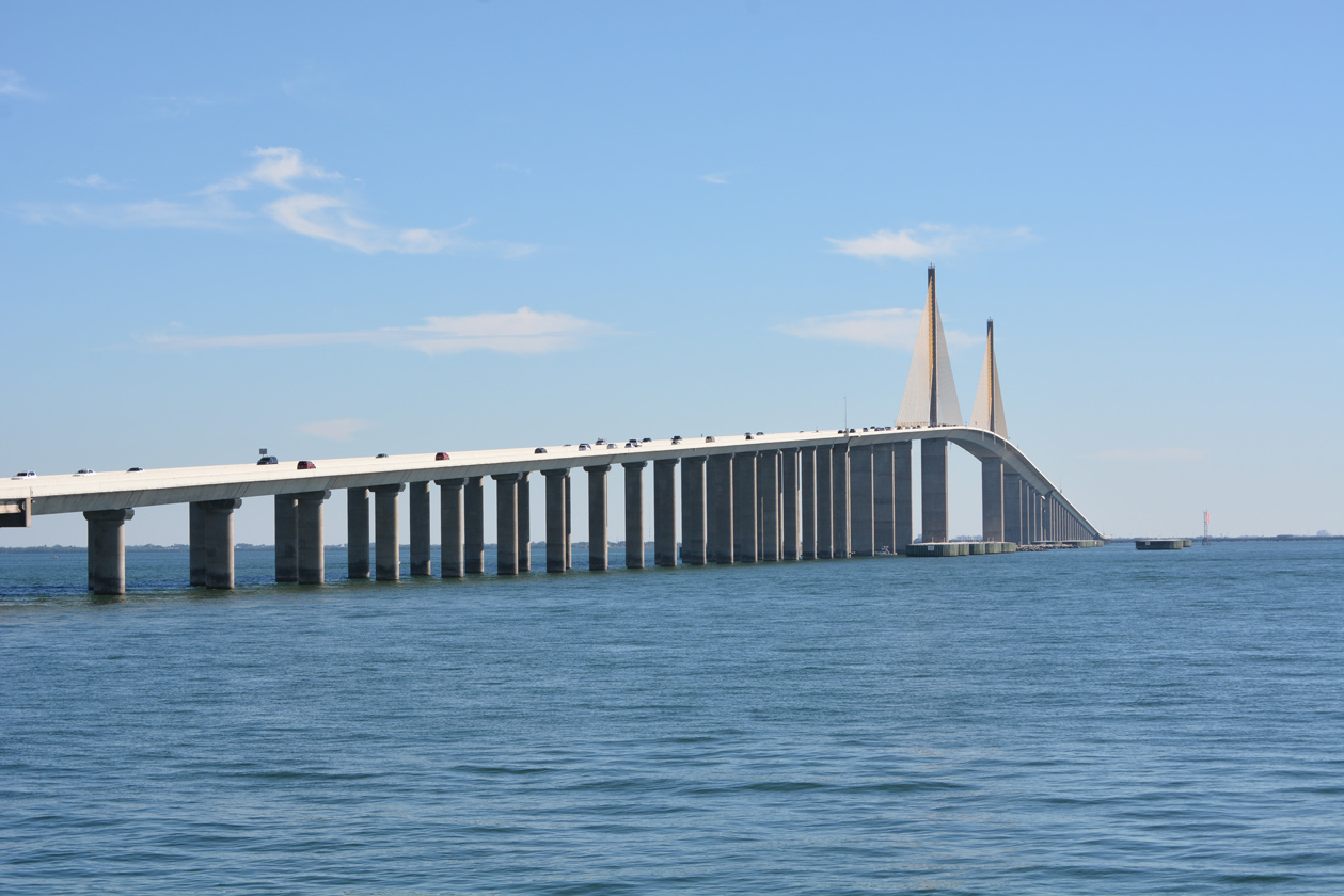
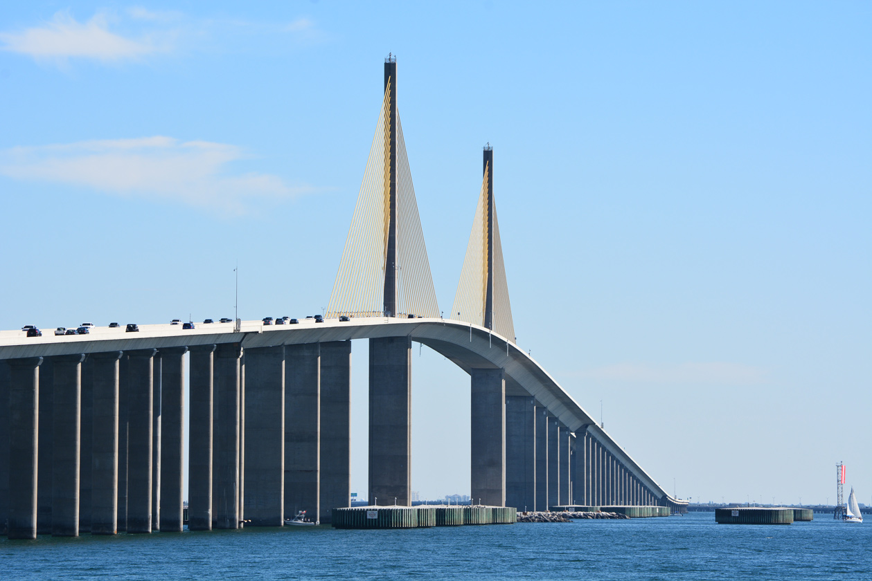
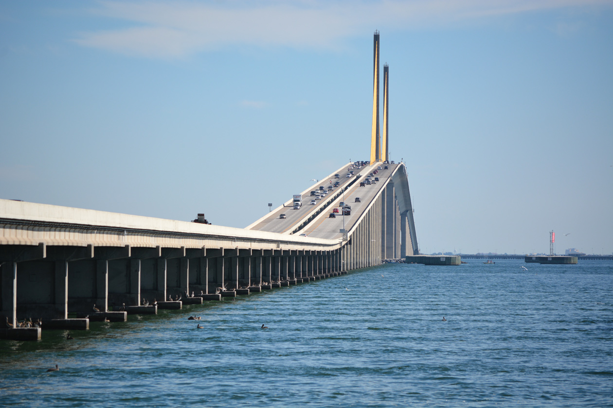
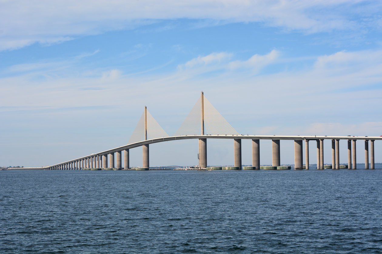
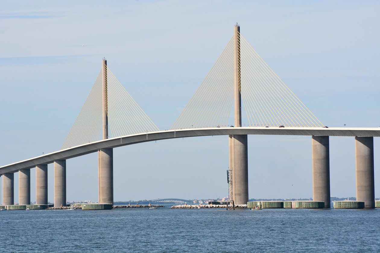
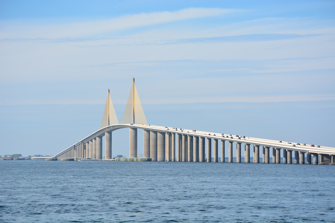
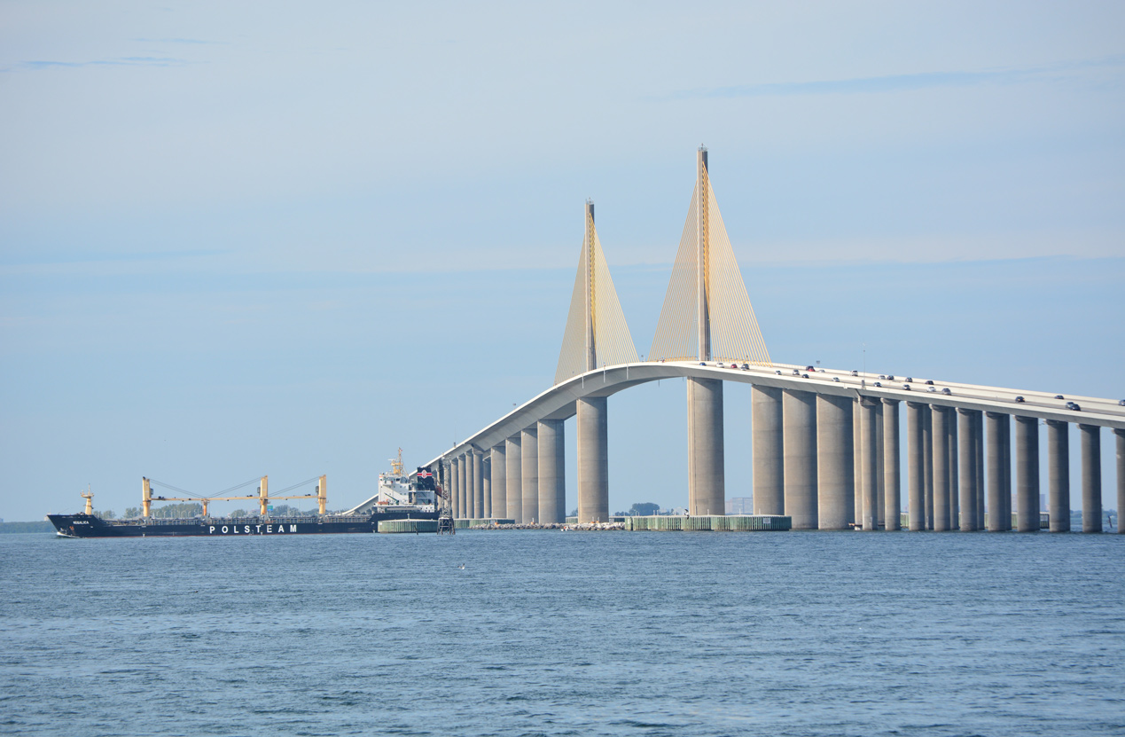
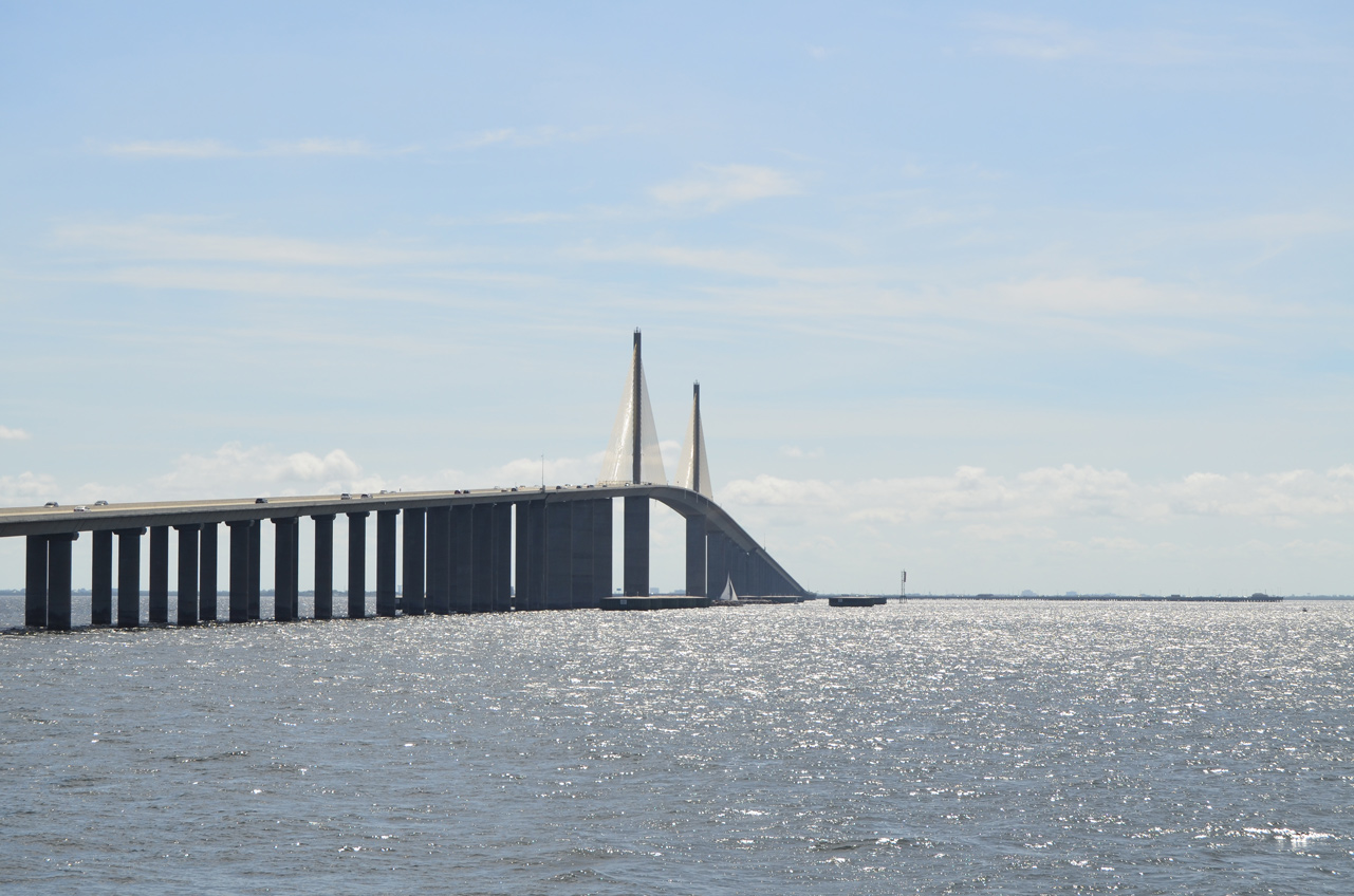
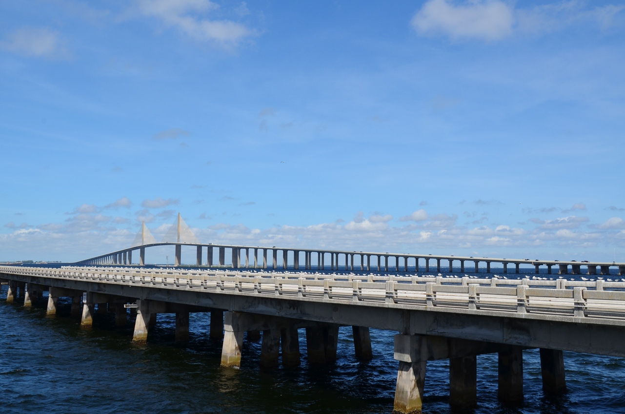
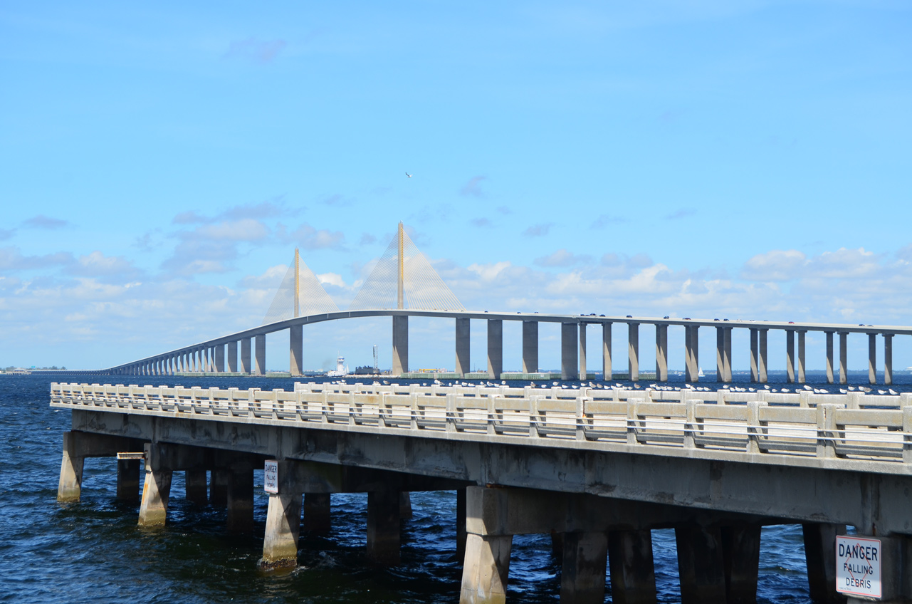
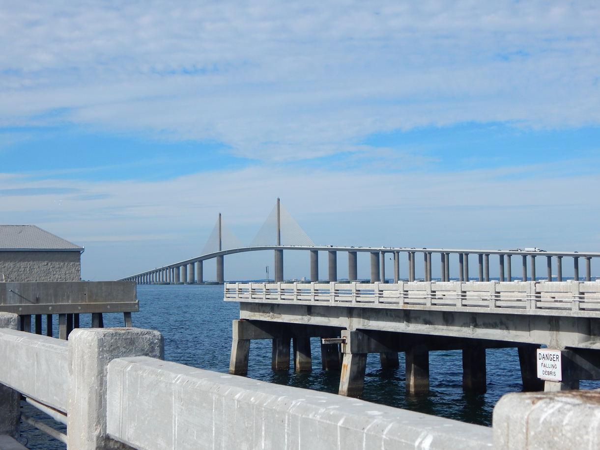
The Sunshine Skyway opened to traffic following a ribbon cutting ceremony on April 30, 1987.5 Festivities were held for the $240 million span on February 7, 1987. Events included a public bridge walk a parade along the north causeway and a dedication ceremony held at Blackthorn Park.6 Construction of the 76 foot diameter concrete pillars supporting the concrete segmental bridge got underway September 24, 1982. The pillars were placed at 1,200 foot intervals, 400 feet farther apart than the old Skyway Bridge.7 The 24 piers holding the northern half of the cable-stayed span were in place by February 1985 as work progressed on the 40 foot wide roadway decks. Construction on the piers for the Skyway’s southern half continued along with the pylons for the two 425 foot high towers.7,8 The 1,200 foot long main span provided 175 feet of navigational clearance.8
Work on the Skyway fell behind schedule due to cracks forming in the concrete segments. Although $16 million over budget, it was previously scheduled to open in August 1986.9 Further delays plagued the project when a gantry used to lift a 220 ton section of concrete roadway collapsed on July 30, 1984. Bridge contractors also took longer to cast the roadway segments than previously anticipated, pushing back completion to Fall 1986.10
When the 22,000 foot long Sunshine Skyway opened to traffic, portions of the former bridge were repurposed into fishing piers. 3,360 feet of the Pinellas County pier were retained while the Manatee County pier represented one of the longest piers in the world at 8,400 feet in length. The steel superstructure of the old bridge was dismantled and sold as scrap. Some of the rubble from the concrete support columns from the old span was used to create artificial reefs nearby.8
 Photo Guides
North End  – Wesley Chapel, Florida
![]() North at
North at ![]()
![]()
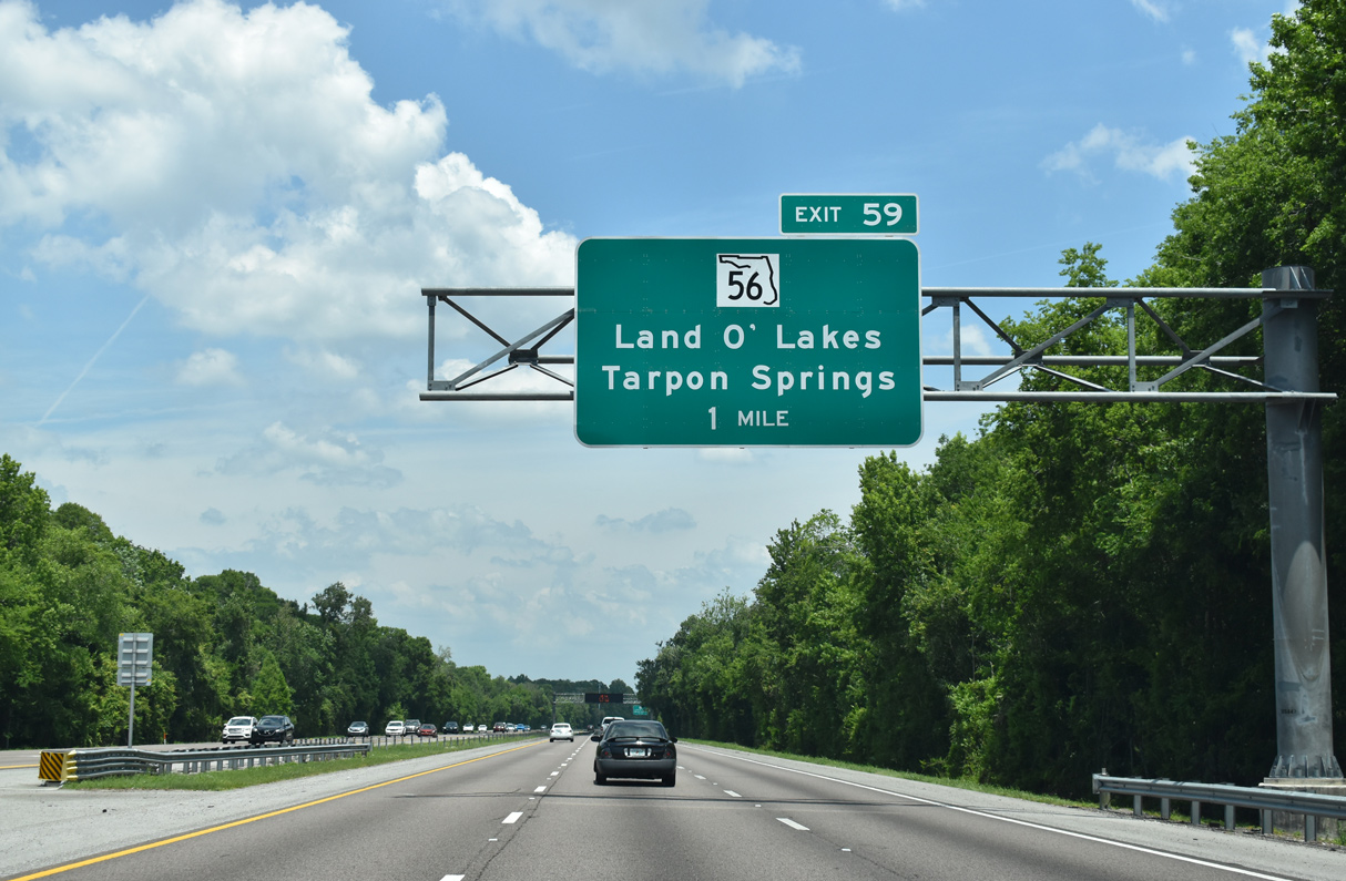
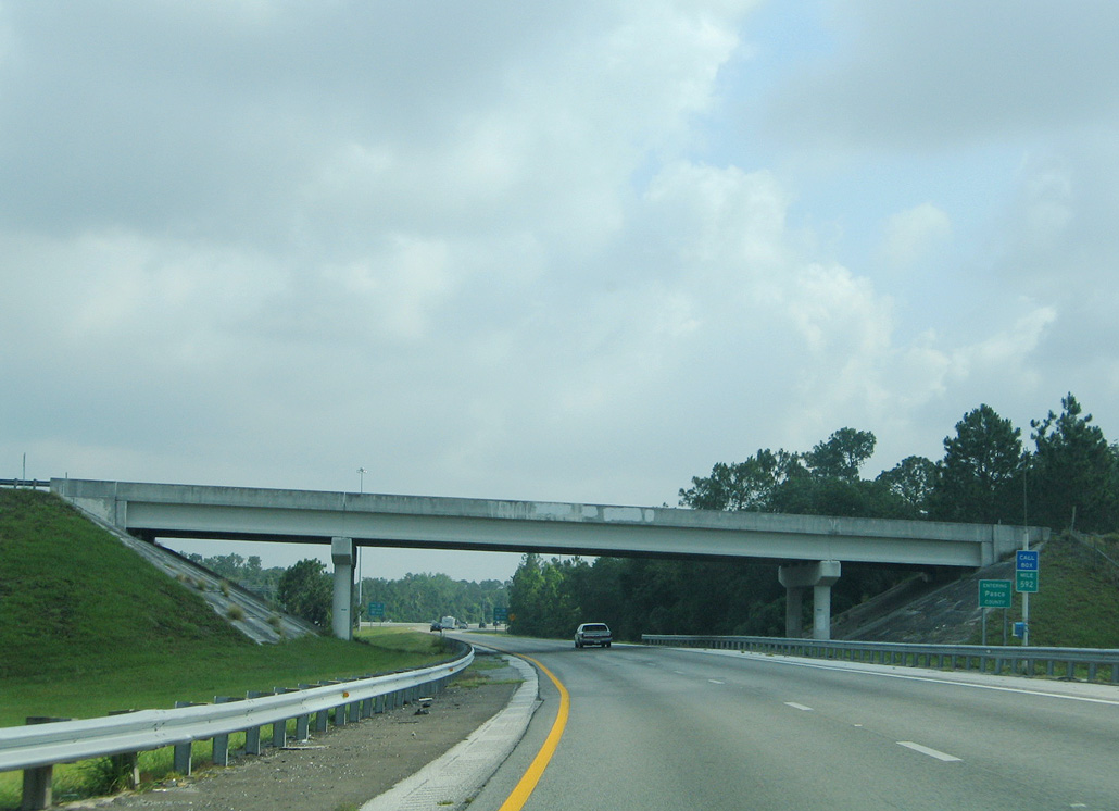
I-275 advances 6.1 miles north from Bearss Avenue (SR 678) to the split with ramps for I-75 north and SR 56. Construction between October 17, 2009 and September 17, 201211 added the ramp at Exit 59 for SR 56 at a cost of $32.7 million. 04/25/16
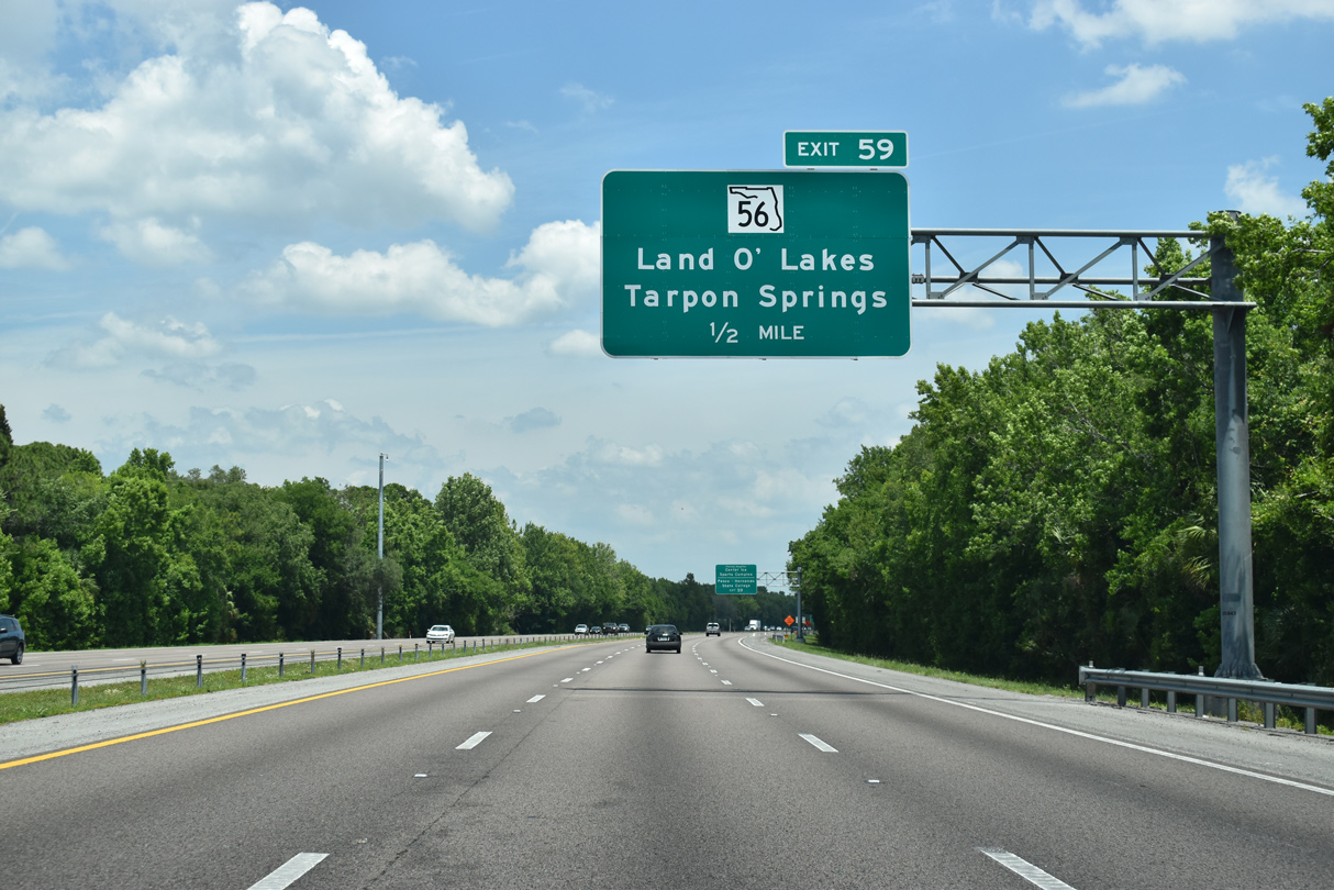
Exit 59 constitutes a flyover spanning the I-75 mainline to the adjacent northbound ramp (Exit 275) to SR 56 for Land O’ Lakes, Wesley Chapel and New Port Richey. The addition of this ramp eliminated weaving traffic between the north end of I-275 and the adjacent exchange with SR 56. 09/17/19
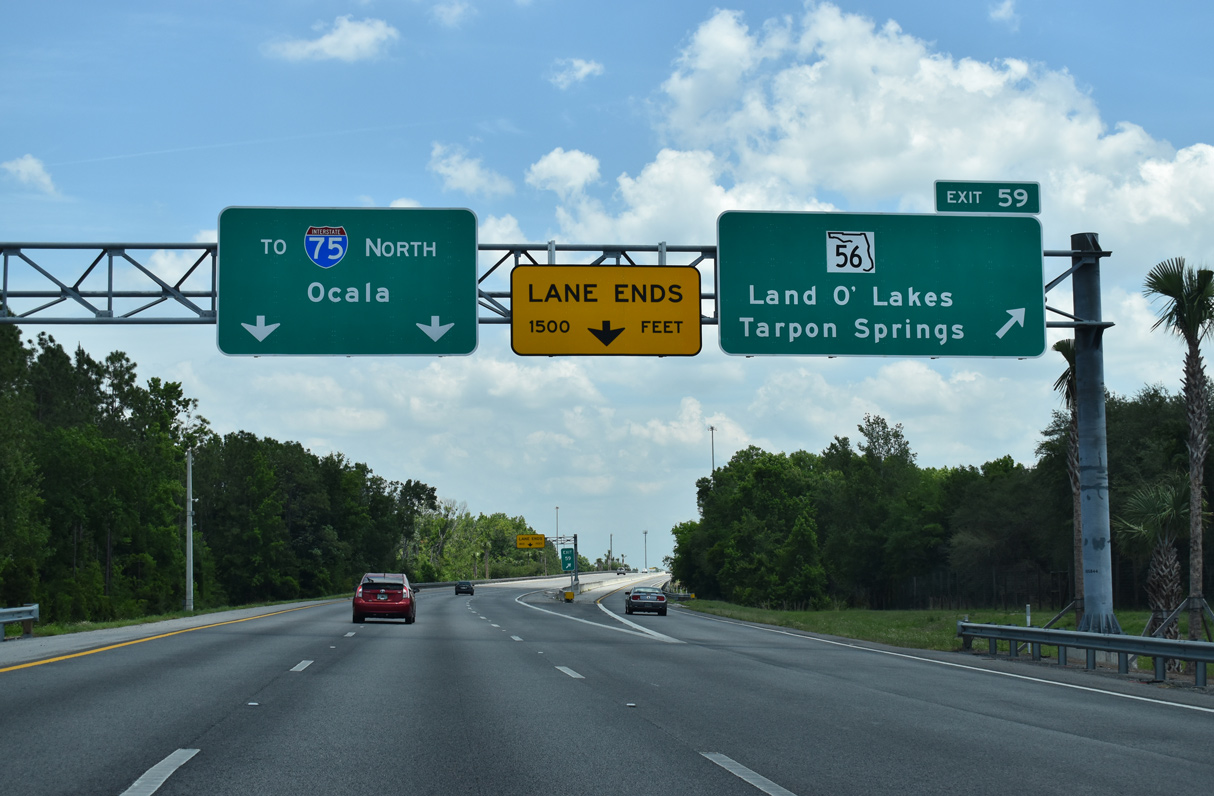
Two lanes join Interstate 75 northward toward Ocala, Gainesville and Atlanta, Georgia. Exit 59 serves commuter interests to the burgeoning suburbs of southern Pasco County. 04/25/16
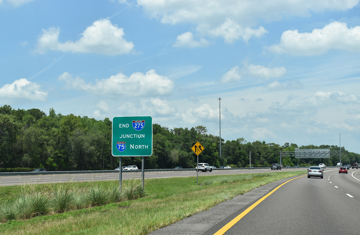
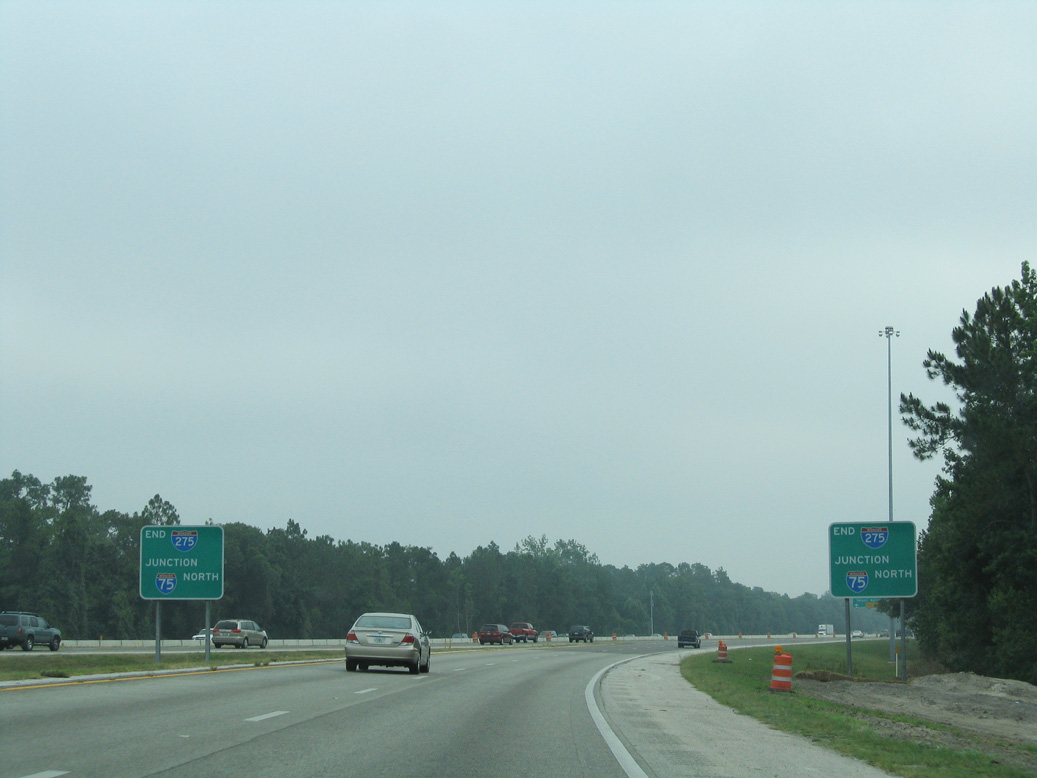
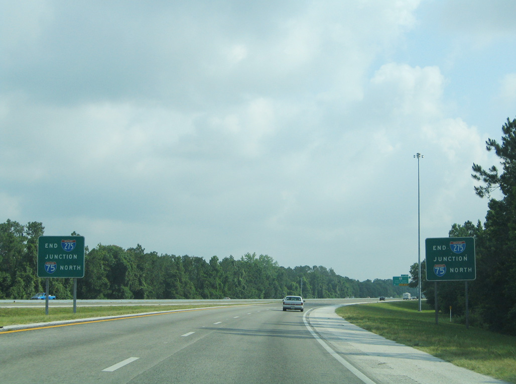
An end sign for Interstate 275 stands at the gore point where traffic merges onto I-75 north. The freeway continues with six to eight lanes to CR 54 at Wesley Chapel. 09/17/19
![]() South at
South at ![]()
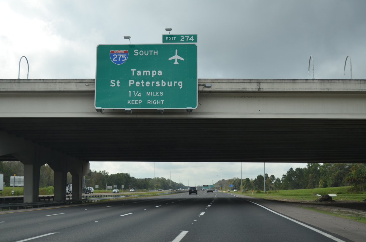
Construction expanded Interstate 75 from four to six or eight overall lanes from north of CR 54 (Exit 279) to a point just south of SR 56 (Exit 275) between March 2011 and November 2014. Subsequent road work widened I-75 through the wye interchange (Exit 274) with I-275 between October 2011 and Spring 2016. 12/14/15
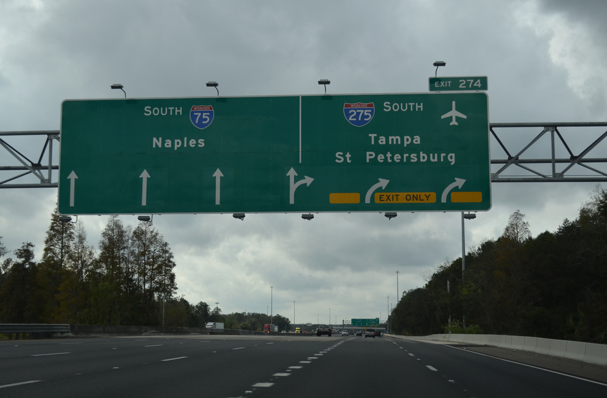
Exit 274 was expanded to three lanes for Interstate 275 south into Tampa in 2014. I-75 curves southeasterly across New Tampa toward Temple Terrace and Brandon while I-275 straddles western reaches of New Tampa to the University of South Florida (USF) area. 12/14/15

Heavy commuter traffic from Wesley Chapel and Land O’ Lakes expands I-75 southbound to six lanes. Interstate 275 splits with I-75 beyond Cypress Creek. 12/14/15
 North End Throwback
Interstate 275 consists of a rural like freeway between Bearss Avenue (SR 678) and the merge with I-75 north. A wye interchange joins the two freeways at the Pasco County line. 05/28/05
A sweeping ramp joined the Interstate 75 mainline beyond the County Line Road overpass. Opened in 2012, the exit ramp to SR 56 to Wesley Chapel joins a distributor roadway to the right of these end signs now. 05/29/06
The previous set of end signs posted at the northbound merge of I-275 onto Interstate 75. I-75 continues 76 miles northward to Ocala and 113 miles to Gainesville. 05/28/05
A diagrammatic overhead at the SR 56 overpass outlined the forthcoming apex with I-275 south. The interchange (Exit 275) with State Road 56 opened in March 2002. Photo by J.P. Nasiatka (06/30/03).
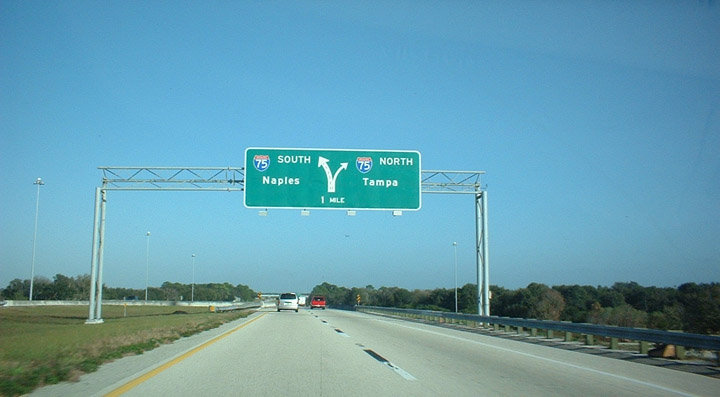
One mile north of the I-75/275 split. The lone interchange along I-75 within the Tampa city limits lies four miles ahead at Bruce B. Downs Boulevard (CR 581) in New Tampa. Photo by J.P. Nasiatka (06/15/03).
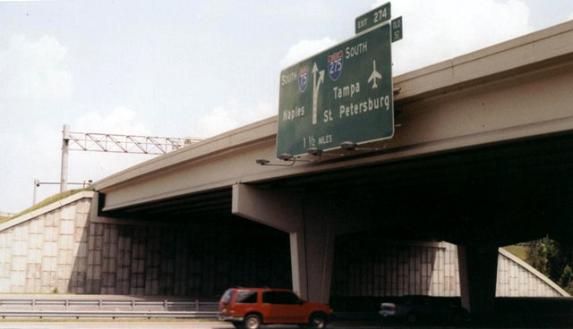
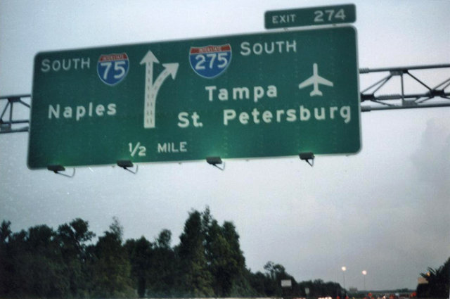
Interstate 75 southbound at Exit 274 (old Exit 57). I-275 enters the city limits of Tampa in nine miles. 174 miles separate Wesley Chapel from the city of Naples along I-75. Photo by Gene Janczynskyi (10/25/00).
South End – Ellenton, Florida
![]() South at
South at ![]()

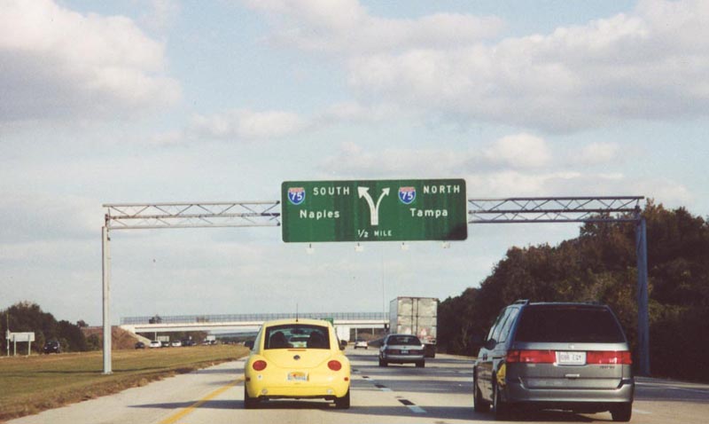
Passing over U.S. 41, a diagrammatic sign outlines the forthcoming three-wye interchange with Interstate 75. 12/24/16

East of Frog Creek, I-275 enters the half mile approach to Interstate 75. Two lanes default onto the freeway south to Sarasota, Fort Myers and Naples. 12/24/16

Passing under 36th Avenue E (former SR 683), the ramp for I-275 north to Sun City Center, Ruskin and Tampa departs for a high speed flyover. Milepost zero stands along the southbound connection. 12/24/16
![]() South at
South at ![]()

I-75 meets Interstate 275 north just southwest of the diamond interchange (Exit 229) with Moccasin Wallow Road. I-275 arcs northwest to the Sunshine Skyway Bridge and St. Petersburg. 03/01/13

Interstate 275 heads one mile west from Exit 228 to U.S. 41 at Rubonia. U.S. 19 north overlaps with I-275 from Terra Cela to 54th Avenue S (Exit 17) in south St. Petersburg. 03/01/13
![]() North at
North at ![]()

Interstate 75 north expands to four lanes on the one mile approach to Exit 228 with I-275 west. Interstate 275 joins Southwest Florida with St. Petersburg and Clearwater while I-75 continues north toward Tampa via Brandon. 09/28/13

The two lane flyover for Interstate 275 north separates from I-75 at the 69th Street SE overpass. I-275 leads west in Manatee County to Terra Ceia and the Sunshine Skyway. 03/22/20
South End Throwback

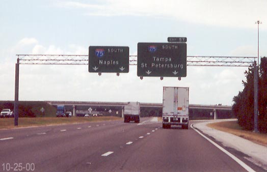
Original guide signs on I-75 north at the southern apex with Interstate 275. Photo by Gene Janczynskyi (10/25/00).
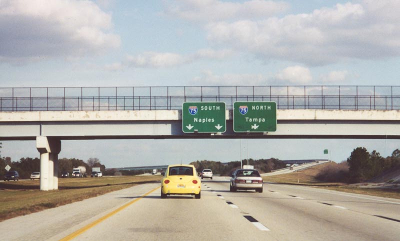
The original diagrammatic overhead posted one mile out from the I-275 south end. Photo by Gary S. Peterson (01/03).
Naples, where I-75 ended until signs went up along Alligator Alley in 1992, remains the control city for I-75 south from Tampa. December 2000
Original guide signs for I-75 posted at the end of I-275. All of the Interstate 75 overheads on I-275 were replaced by January of 2003. The city of Sarasota is 18 miles to the south, followed by Fort Myers in 88 miles. December 2000
Sources:
- “Four-County Loop for Roads Asked.” St. Petersburg Times (FL), January 21, 1967.
- “Cost of Revamping Skyway Estimated at $14 million.” The Tampa Tribune (FL), April 3, 1973.
- “Interstate in Pinellas Now I-275.” St. Petersburg Times (FL), June 28, 1973.
- Florida’s Interstates: A Half-Century of Progress
http://www.fl-interstate.com(official Florida Department of Transportation site). - “New Skyway opens Thursday.” St. Petersburg Times (FL), April 29, 1987.
- “Good chance of rain for Skyway dedication.” St. Petersburg Times (FL), February 7, 1987.
- “Concrete poured for new Skyway.” St. Petersburg Times (FL), September 25, 1982.
- “New bridge, new design — but the same spirit.” St. Petersburg Times (FL), April 6, 1987.
- “New bridge begins to poke toward sky.” St. Petersburg Times (FL), February 12, 1985.
- “New bridge comes with new problems.” St. Petersburg Times (FL), July 7, 1985.
http://mytbi.com/projects/projectinfo.asp?projectID=172&RoadID=1.
Page updated October 23, 2020.