Interstate 240 Oklahoma
Overview
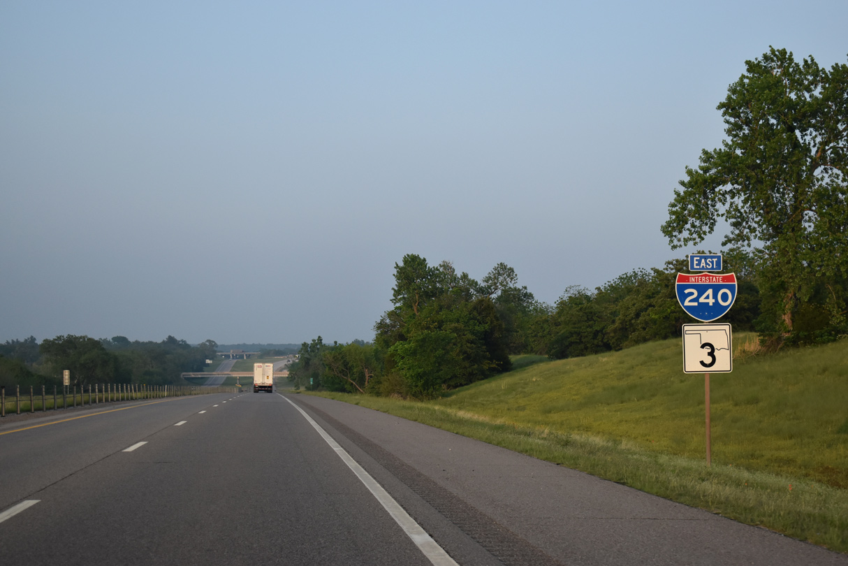
Interstate 240 forms a southerly bypass of central Oklahoma City for I-40 west to El Reno and east to Shawnee. The freeway also provides connectivity with Interstate 44 leading southwest to Lawton and I-35 south to Dallas. I-240 serves commuters to Tinker Air Force Base, Will Rogers World Airport (OKC) and the south suburbs including Moore.
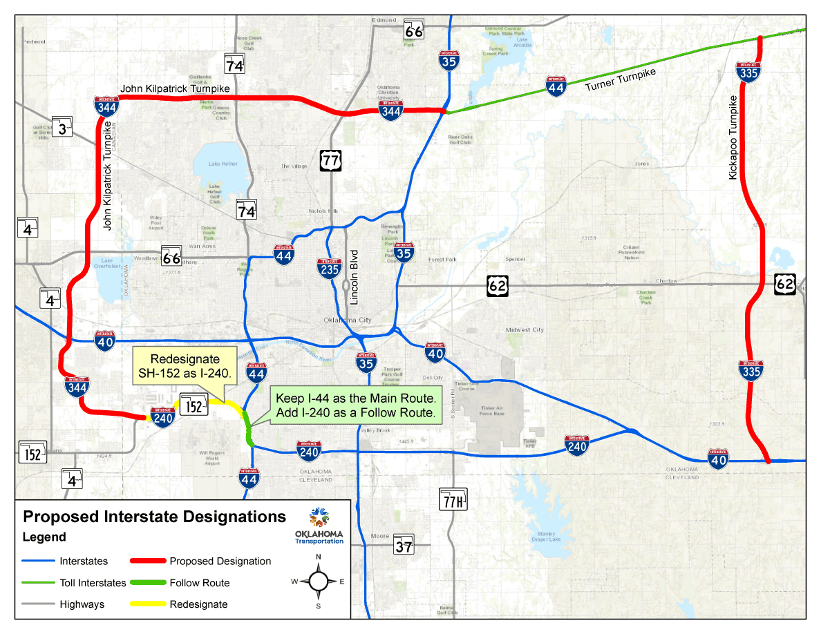
The agenda for the August 2, 2021 Oklahoma Transportation Commission Meeting included a spate of state highway system numbering revisions. Among the approvals, designating Interstate 240 in place of SH 152 for 4.8 miles between I-44 and the John Kilpatrick Turnpike in Oklahoma City. I-240 was also added along 30.97 miles of the John Kilpatrick Turnpike to Northwest Oklahoma City and I-35/44 near Arcadia Lake, and along the Kickapoo Turnpike for 18.71 miles between I-40 near Newalla in eastern Oklahoma City and I-44 (Turner Turnpike) at Luther.
A 1.4 mile long overlap with I-44 will link the SH 152 segment and the current west end of I-240. Overlaps will also include 13.7 miles along the I-44 (Turner Turnpike) and 5.81 miles along I-40 to link the various segments, forming a 93 mile long loop.
This item is necessitated to give the traveling public a more definitive loop to follow around the Greater Oklahoma City Area and to better identify the un-numbered Turnpikes.
Although approved by the State Transportation Commission, the changes require approval from the Federal Highway Administration (FHWA) and the American Association of State Highway and Transportation Officials (AASHTO). Pending concurrence by the FHWA. AASHTO subsequently approved the 75.48 mile long extension of I-240 at the Fall 2021 Route Numbering Committee Meeting.
State Highway System Number Revisions (Agenda Item Number 131) proposed by the Oklahoma Transportation Commission at the meeting of September 11, 2023 did not reference the previously approved extension of Interstate 240. Instead, a new set of designation changes for the Oklahoma City area were outlined:
- Overlapping I-240 along I-44 for 1.4 miles between the current west end and the exchange with SH 152
- Replacing SH 152 between I-44 and the John Kilpatrick Turnpike with a 4.8 mile long western extension of I-240
- Designating the John Kilpatrick Turnpike as Interstate 344 for 30.97 miles from I-240/SH 152 to I-35/44 in north Oklahoma City
- Designating the Kickapoo Turnpike for 18.71 miles between I-40 and I-44 (Turner Turnpike) as Interstate 335
Agenda Item No. 131 references:
This item is necessitated to give the traveling public a more definitive route numbering to follow around the Greater Oklahoma City Area and to better identify the un-numbered Turnpikes in the City of Oklahoma City.
The Oklahoma Department of Transportation (ODOT) submitted applications for the establishment of I-335 and I-344 for the AASHTO 2023 Fall Meeting. Both were approved. However while the request for I-344 referenced the proposed extension of I-240, a formal application for redefining Interstate 240 was not included.
Route Information
East End – Oklahoma City, OK
West End – Oklahoma City, OK
Mileage – 16.22
Cities – Oklahoma City
- Junctions –

Source: December 31, 2021 Interstate Route Log and Finders List
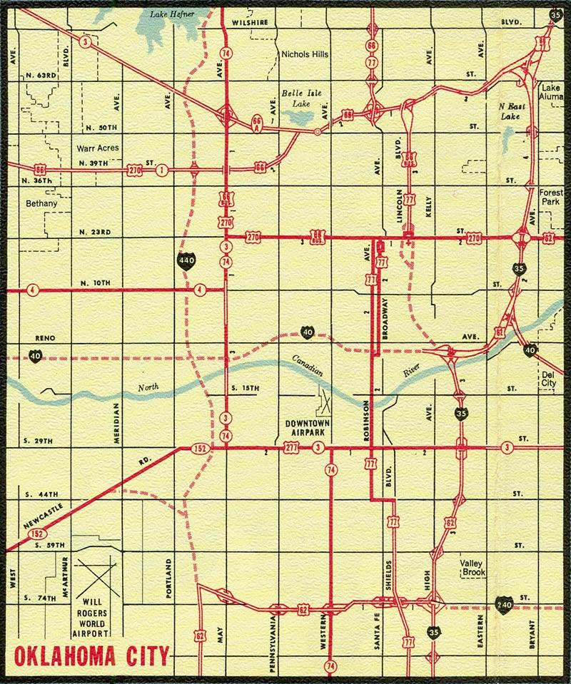
The initial section of Interstate 240 completed was the Southwest Expressway extending west from I-35 to the freeway along U.S. 62 south to Newcastle. This segment was posted as U.S. 62.
Interstate 240 extended north over former I-440 along both the West Bypass and east along side U.S. 66 (Northeast Expressway) to form a three quarter beltway around Oklahoma City.
I-35/I-240 Interchange improvements
Formerly named Crossroads Renewal 240, construction on the project upgrading the cloverleaf joining I-240 and I-35 into a multi level exchange started in June 2016. The four phase project runs through 2023 2026 2028. Completed in May 2017, Phase 1 work reconstructed the Southwest Expressway east from Santa Fe Avenue / Exit 3 B to past Shields Boulevard. The $12 million phase included interim ramp changes at Shields Boulevard.

Phase 1A rebuilt the frontage road along the southwest quadrant of the exchange joining I-35 and I-240. It also permanently closed the entrance ramp to I-240 east from Shields Boulevard and the southbound off-ramp from I-35 to SE 82nd Street. Started in June 2017, the $10.6 million project was completed in Summer 2018.
Costing over $75 million, the contract for Phase 1B was awarded by the Oklahoma Transportation Commission in January 2023. Redesigning the remaining frontage roads, construction for Phase 1B got underway on June 2, 2023.
Phase 2 will construct the flyovers from I-35 north to I-240 west and from I-35 south to I-240 east. It will also replace the eastbound span for Interstate 240 over I-35. Phase 3 will complete work along Interstate 240 east between Shields Boulevard and Eastern Avenue, while Phase 4 upgrades the westbound direction along the same stretch. Phase 4 also includes work on a new bridge for I-240 over I-35. Previously estimated to cost $90.64 million, Phases 2, 3 and 4 were scheduled for fiscal year 2023 in the ODOT Eight year Construction Work Plan. They are scheduled to begin in 2025.
 History
A section of Northeast Expressway, between Eastern and Lincoln Boulevards, was the first four lane highway to open in Oklahoma. It was completed in October 1950.2 The urban Interstate numerology approved by the American Association of State Highway Officials (AASHO) on November 10, 1958 assigned Interstate 440 along a loop formed by the Will Rogers Expressway and U.S. 66 between I-40 (Stanley Draper Expressway) and I-35 (Northeast Expressway). Interstate 240 was assigned to the completed portion of the Southeast Expressway, from I-35 (South Central Expressway) east to I-40 beyond the Oklahoma City urban area. The southwest quadrant of I-240 along the Southwest Expressway and Will Rogers Expressway was referenced as Tentative Future Interstate Highway 240. Because the loop was incomplete, separate numbers were designated.
The Oklahoma Department of Highways eventually requested the renumbering of I-440 as part of an extended I-240 in a letter to the American Association of State Highway and Transportation Officials (AASHTO) dated December 3, 1974.
In our original submission for Interstate Status, the Southwest Quadrant of Oklahoma City was denied; therefore, the routes were divided as I-240 and I-440. The Southwest Quadrant was later approved. These routes have a common interchange with I-40 and the signing would be simplified with the use of just one intersecting number. This change was recommended by the Federal Highway Administration, and this revision has been submitted to them for their formal approval. Construction on these routes is nearing completion.
I-240 and I-440 encircling Oklahoma City – 1971 Official Oklahoma Highway Map. I-240 west from Santa Fe Avenue is the Southwest Expressway, while the freeway east to I-40 is the Southeast Expressway.
The exit numbering system along Interstate 240 was originally based off the mileage for I-40. I-240 was completed in 1975 and on June 17 of that year AASHTO approved a request from the Oklahoma State Highway Commission for the renumbering of I-440 as part of Interstate 240. Reasons cited for the change:
To combine Interstate Routes 240 and 440 as 240 simplify the route marking.
The two numbers originated when the southwest quadrant of route 240 was denied in its original submission. Route 240 is near completion; segments of 440 are under construction. This revision has been recommended by the Federal Highway Administration and by the State Traffic Engineer.

I-40 east ahead of the exchange with Interstate 240 in 1978. Photo by Bill Manning.
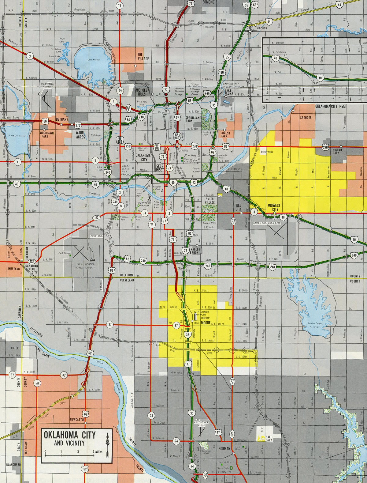
Further changes for I-240 were made, with Interstate 44 overtaking both the original 10.8 mile long I-440 section, and the western leg of I-240 as part of its extension from the Turner Turnpike near Edmond south to Lawton and Wichita Falls, Texas. The elimination of I-240 over the newly designated I-44 was approved by FHWA and by AASHTO on June 28, 1982.
AASHTO and FHWA has approved the extension of Interstate Route 44 from its old terminus at I-35 in N.E. Oklahoma City southwesterly to Wichita Falls, Texas. Within the Oklahoma City area, the extension of I-44 over I-240 creates a myriad of problems related to the signing of duplicate Interstate Routes within an urbanized area.
The problem of duplicate signing and its related confusion to the motoring public warrants the elimination of overlapping routes. Therefore, it is recommended that the designation of I-240 be removed from that portion of I-44 beginning at the US 62 – I-240 interchange and extending north and east to its junction with I-35.
I-44 leading south from I-240 to the H.E. Bailey Turnpike north end at Newcastle was designated as U.S. 62 from 1965 to 1982. I-240 from U.S. 62 to U.S. 66 opened on March 23, 1976. From 1978 to 1980, U.S. 66 was detoured along Portland Avenue north to NW and NE 63rd Streets east and Kelley Avenue south while Interstate 240 was constructed.3
East End 
 – east of Oklahoma City, Oklahoma
![]()
![]() East at
East at ![]()
![]()
I-40 and I-240 converge 13 miles east of Downtown Oklahoma City in a rural area. The final confirming marker stands east of Anderson Road. 05/09/22
Two lanes continue from I-240/SH 3 onto I-40/U.S. 270 east ahead of Shawnee. There are no signs indicating the end point. 05/09/22
![]()
![]()
![]() West at
West at ![]()
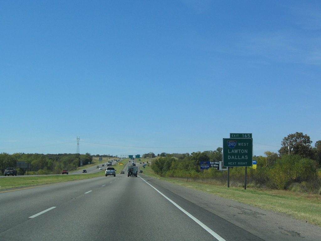
A $75 million widening project underway from January 2018 to Summer 2020 expanded I-40/U.S. 270-SH 3 to six overall lanes west from Peebly Road to the split with I-240. Additionally the parclo B2 (Exit 166) with Choctaw Road was reconstructed into a diamond interchange.4 10/04/21

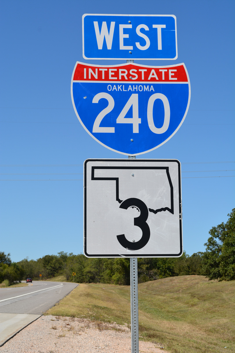
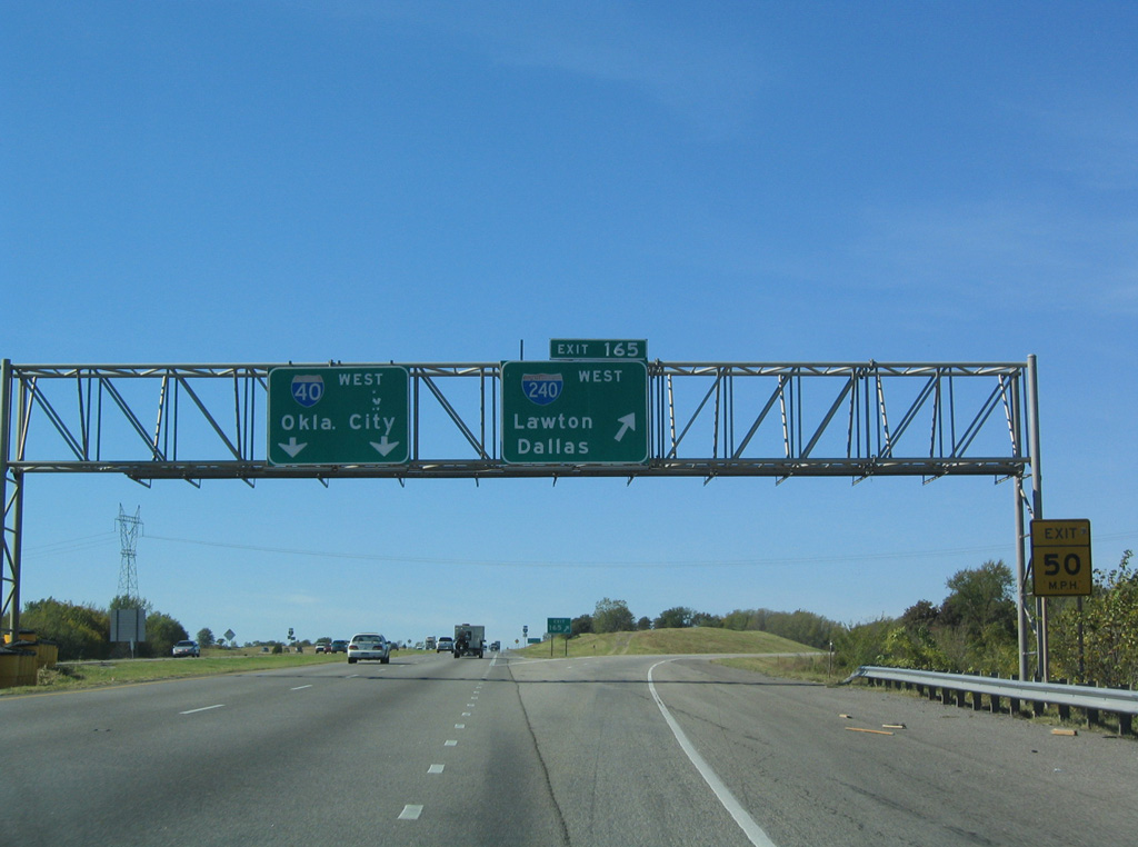
Interstate 240 provides part of a direct route to I-35 south to Dallas and I-44 southwest to Lawton. 10/04/21
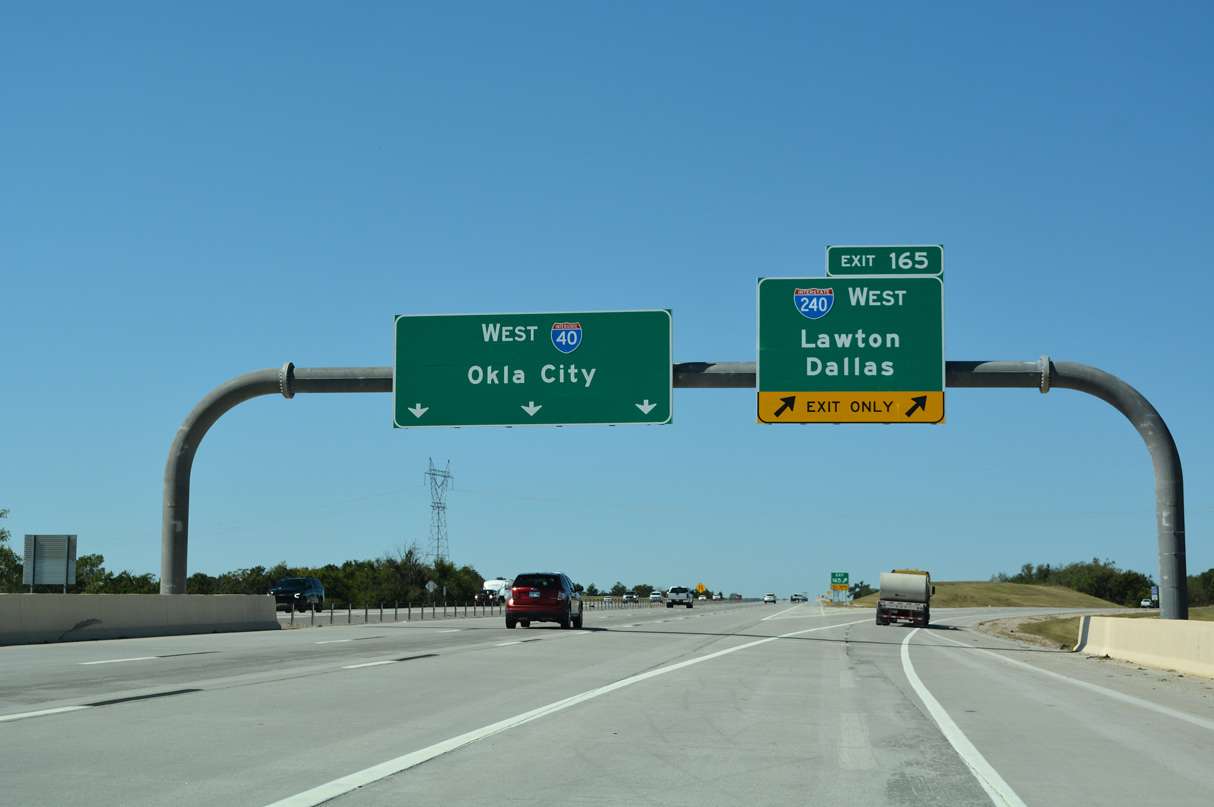
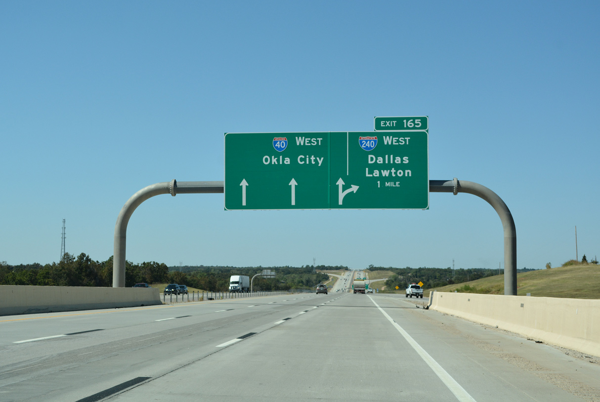
I-40/U.S. 270 west enter the wye interchange (Exit 165) with I-240/SH 3 west to south Oklahoma City and Will Rogers World Airport (OKC). 10/04/21
 East End Throwback

Button copy signs formerly posted on I-40 west at Choctaw Road (Exit 166). Clearview font based signs were installed along this stretch of Interstate 40 by 2011. 10/20/03
2011 sign replacements moved the reference to SH 3, which overlaps with the entirety of I-240 west, to a point east of Choctaw Road. This sign was also replaced. 10/20/03
Interstate 240 is the last branch route of I-40 for the remaining 1,227 miles west to Barstow, California. 10/20/03


IH 40/U.S. 270-SH 3 west at IH 240 prior to the 2018 expansion project. Photo by Eric Stuve (03/23/14).
West End – Will Rogers Airport, Oklahoma City, Oklahoma
![]()
![]()
![]() West at
West at ![]()
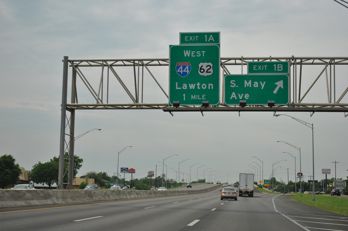
Westbound I-240/U.S. 62-SH 3 meet S May Avenue (Exit 1B) at a diamond interchange, one mile ahead of Interstate 44. 05/06/12
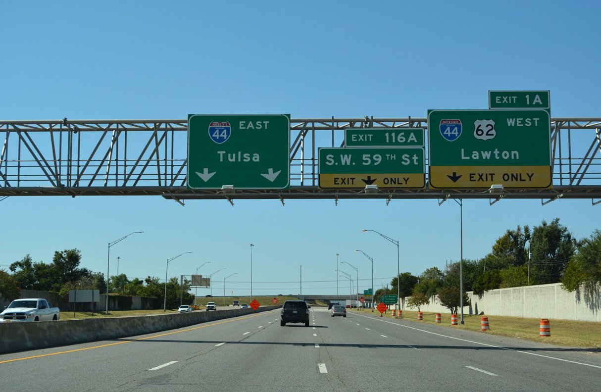
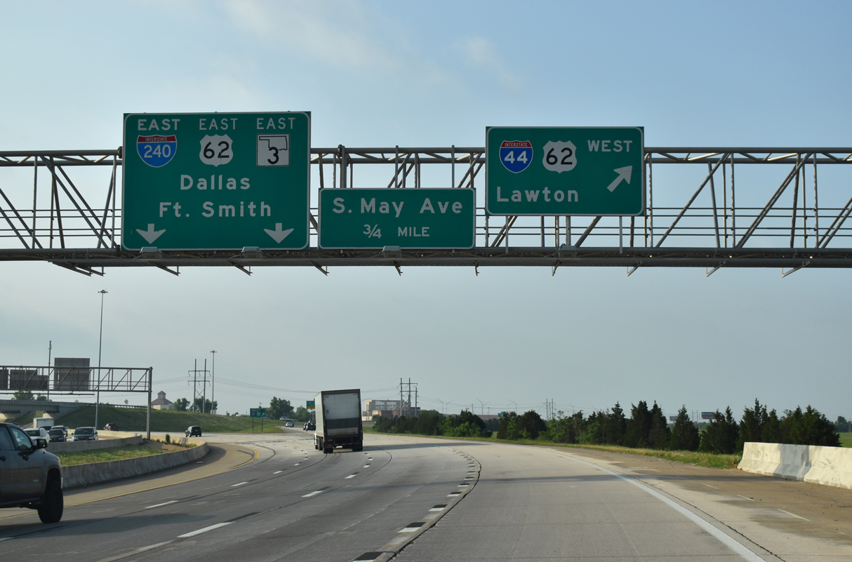
Advancing west with four lanes, traffic along I-240 generally defaults onto I-44 leading north to both SH 152 (Airport Road) and the west side of Oklahoma City. Succeeding lane drops follow for the continuation of U.S. 62 southwest along I-44 toward Newcastle and SW 59th Street. 10/04/21
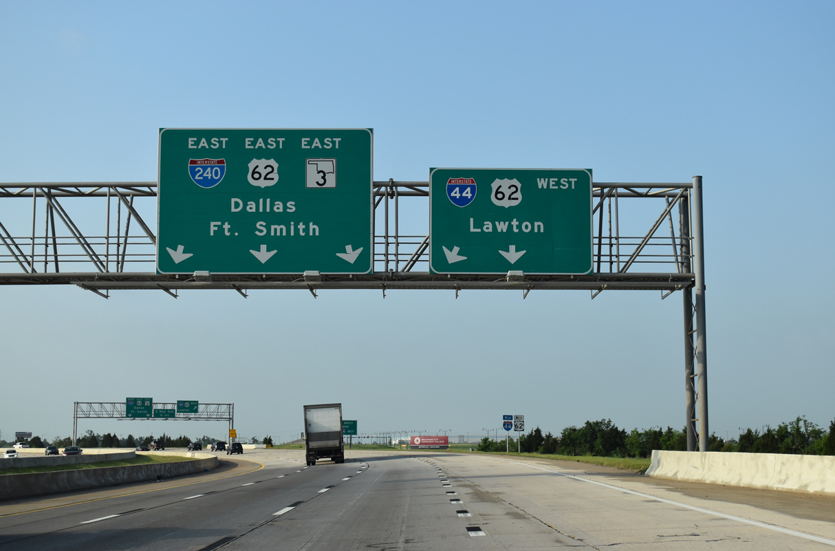
Interstate 240 west curves north to merge onto the inside lanes of I-44 eastbound. SH 3 overlaps with I-44 to the Northwest Expressway. Westbound I-44 travels 77 miles southwest to Lawton, mostly along the tolled H.E. Bailey Turnpike. 10/04/21
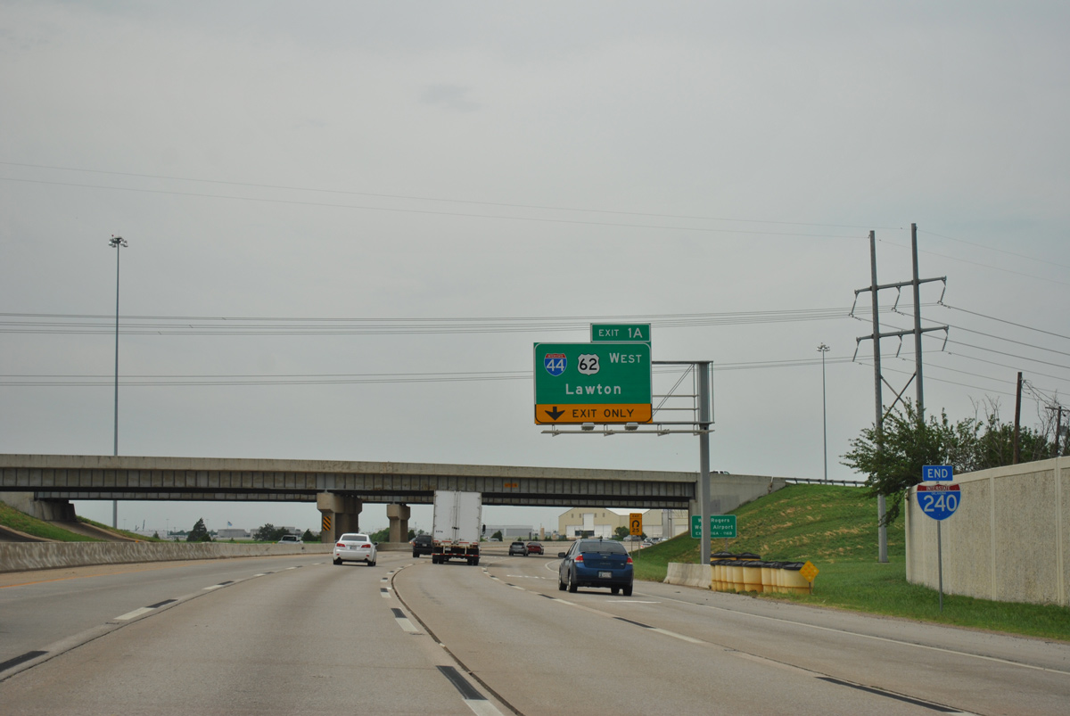
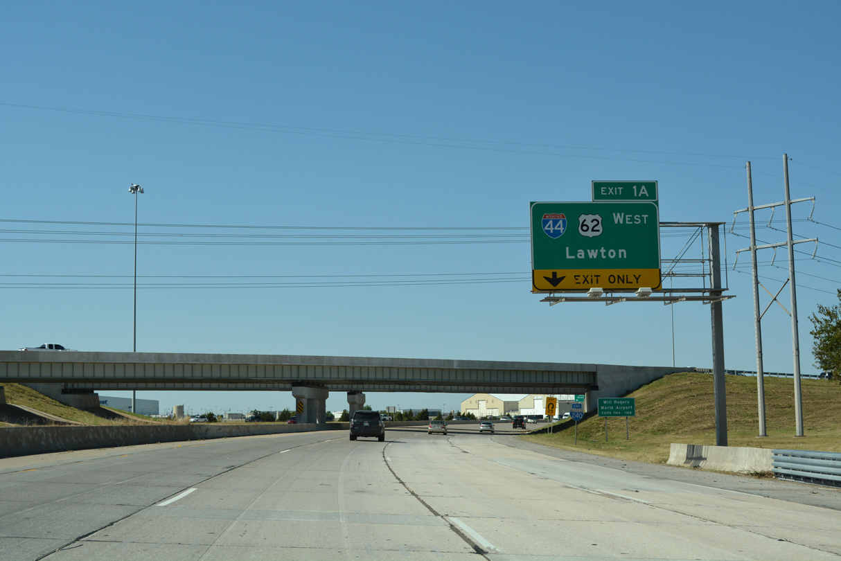
Since relocated adjacent to the I-44 overpass, an end shield for Interstate 240 stands within the trumpet interchange (Exit 1A) joining the two freeways. 05/06/12
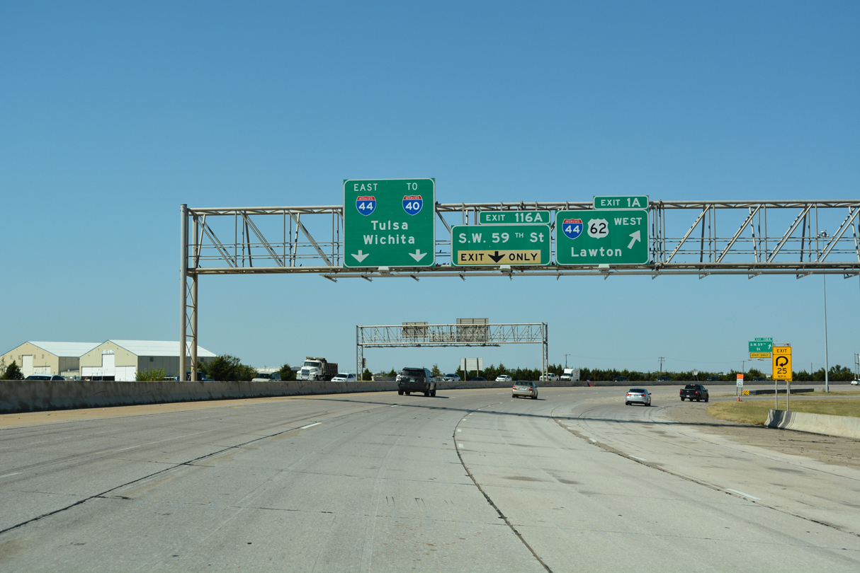
A weaving traffic pattern unfolds north along IH 44/SH 3 to the three-wye interchange (Left Exit 116B) with SH 152 west. This movement will be further complicated by the addition of IH 240 west along IH 44 east.10/04/21
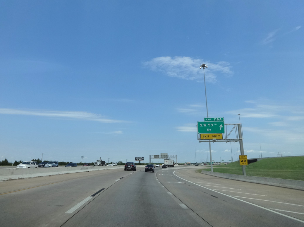
Exit 116A separates from I-240 just ahead of I-44 east for SW 59th Street. SW 54th Street extends west from 59th Street as an alternate to SH 152 (Airport Road) to Will Rogers World Airport (OKC). Photo by Eric Stuve (07/25/16).
![]()
![]() East at
East at ![]()
![]()
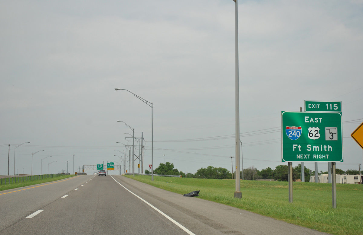
A ground level sign posted within the folded diamond interchange (Exit 114) at SW 74th Street provides short notice for Exit 115 to I-240, U.S. 62 and SH 3 east. I-240 forms a commercial corridor east to I-35, and a through route for Fort Smith, Arkansas via I-40, located 182 miles to the east. 05/06/12

An auxiliary lane formed from SW 74th Street parts ways with I-44 east at Exit 115. U.S. 62 accompanies Interstate 240 east to I-35 north through Oklahoma City. 05/06/12
Replaced button copy guide signs at the split of U.S. 62 and Interstate 44 east by Will Rogers World Airport (OKC). Photo by Eric Stuve (09/11/02).
![]() West
West ![]() East at
East at ![]()
![]()
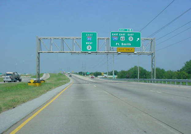
I-44 and SH 3 split just south of SH 152 and SW 59th Street at the unnumbered trumpet interchange with I-240/U.S. 62 east. 05/10/22
I-44 combines with U.S. 62 along the east side of Will Rogers World Airport southward toward Newcastle. I-240 and SH 3 run east across the south side of OKC between Valley Brook and Moore. 05/10/22
Sources:
- Celebrate the Interstate: America’s Interstate Highway System Turns 50!
http://www.okladot.state.ok.us/okinterstate50/Oklahoma Department of Transportation, web site. - “Interstate Highway System Celebrates Silver Anniversary.” The Daily Oklahoman (Oklahoma City), November 15, 1981.
- Darrell Brunson, email: “The H.E. Bailey Turnpike & I-44 at OKC,” August 13, 2017.
Page updated February 2, 2024.