Interstate 240 North Carolina
Overview
Interstate 240 comprises an urban loop north from I-40 through Asheville. The freeway serves commuter traffic through West Asheville and Downtown and also disperses Future I-26 traffic south from Weaverville and Woodfin to points west and east along I-40. The western half of I-240 takes a convoluted path as it utilizes a portion of original bypass routes constructed for U.S. 19/23 east to U.S. 70 east and Town Mountain Road (NC 694).
The west end of I-240 also marks the historic west end of Interstate 26. I-26 was extended north along the U.S. 23 corridor to Johnson City on August 5, 2003. This resulted in a four mile overlap with I-240 through West Asheville, where cardinal directions are posted opposite for each route.
Interstate 240 heads west from the Montford Avenue overpass to a directional T interchange with the U.S. 19-23-70 (Future I-26) freeway and Patton Avenue outside Downtown Asheville. 10/25/15
Route Information
East End – Asheville, NC
West End – Asheville, NC
Mileage – 9.54
Cities – Asheville
- Junctions –

Source: December 31, 2021 Interstate Route Log and Finders List
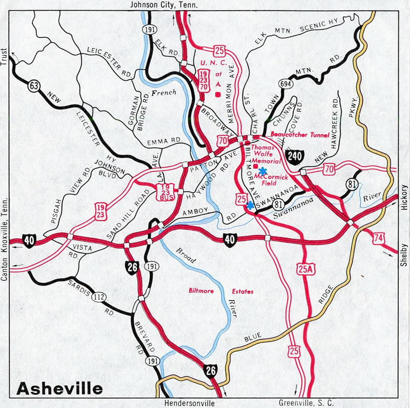
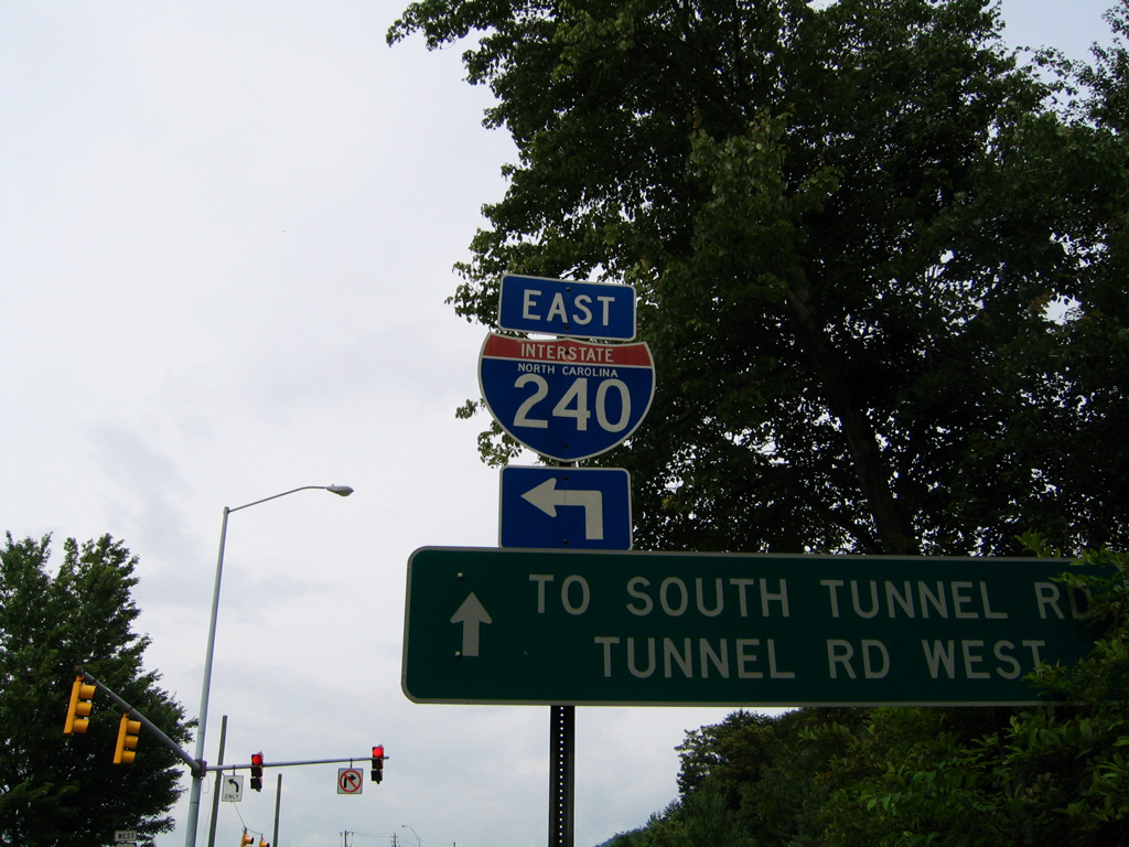
The final section of I-240 completed linked the original U.S. 70 bypass of Downtown with U.S. 70 along Tunnel Road. This portion bypassed the two lane Beaucatcher Tunnel along U.S. 70/74A.
I-26 Connector
The freeway along U.S. 19-23-70 leading north from Interstate 240 and Patton Avenue in Downtown Asheville remains below interstate standards. The Bowen / Smoky Park Bridge across the river is equally substandard, with no shoulders and heavy traffic. As such, the freeway built in the 1960s north to Woodfin is designated as Future I-26 until upgrades are made along the corridor. A portion of the route will be bypassed by the I-26 Connector, a new alignment and bridge across the French Broad River planned to meet 2025 forecast traffic counts.5
The I-26 Connector includes upgrading 4.3 miles of I-26/240, from the junction with I-40 northeast to the Patton Avenue interchange. North from there, a new 2.6 mile long alignment will be constructed taking Interstate 26 across the French Broad River to U.S. 19-23-70 south of Broadway Street. Included in the project are interchange improvements for exits to I-40, NC 191, Amboy Road, U.S. 19-23 Business/Haywood Road, and Patton Avenue. A Draft Environmental Impact Statement (DEIS) on the I-26 Connector was released in October 2015. Construction on the estimated $1.2 billion project is anticipated to start in Fall 2023.1
In May 2016, The North Carolina Department of Transportation (NCDOT) finalized a route for Section B of the I-26 Connector, clearing a major hurdle in relation to the overall project. Dubbed Alternative 4B, and heavily favored by local residents3, this selection for I-26/240 separates local and through traffic.4 The new configuration will take I-240 traffic from Downtown along U.S. 19/23 north before turning west near Hill Street to cross over the French Broad River. New spans will cross the river in a sweeping arc, returning the I-240 mainline in the vicinity of Patton Avenue. The existing Bowen Bridge will be refitted to provide additional space for bicyclists and pedestrians and repurposed for local traffic between Asheville and West Asheville. The present exchange between I-240 and U.S. 19/23 near the east end of the Bowen Bridge will be also be modernized as part of the project. As a result of selecting this alternative, the I-26/240 concurrency will be extended by up to 0.7 miles. Estimated costs for Section B were $332 million, and construction was originally anticipated to begin in late 2023 or 20244 and run for at least three years.3
 History
The Asheville loop was originally proposed as a 3.9 mile long spur from I-40. The Federal Highway Administration (FHWA) conditionally approved the route on December 19, 1975. It was tentatively assigned the designation of Interstate 140. Subsequent correspondence from the North Carolina Department of Transportation (NCDOT) with the FHWA on March 17, 1976 cited the connection from the I-40 spur to other existing freeway facilities to form a loop.
The loop function of the approved I-40 spur is of equal or greater importance than its function as a spur.
Asheville is a tourist mecca. Present loop access is designated by a confusing multiplicity of signed routing: US 19, US 23, US 70, US 74, and NC 191. By designating the existing loop facility, including the previously approved I-40 spur route, as an Interstate System Loop, the signing confusion could be avoided.
The FHWA approved the 5.2 mile extension of Interstate Route 140 in Asheville from U.S. 70/74 southwesterly to I-40/26 on April 21, 1976, with the revised designation of Interstate 240. The American Association of State Highway Officials (AASHO) concurred with the the establishment of I-240 on July 13, 1976.
The first portion to open was the original U.S. 70 bypass freeway north of Downtown in the early 1960s. Another three miles of Interstate 240, between I-40 and Patton Avenue, were completed by 1970. This portion was designated as North Carolina Route 191. The eastern portion of freeway across Beaucatcher Mountain was completed in late 1980.2
 Photo Guides
East End 
 – east of Asheville, North Carolina
![]()
![]() East at
East at ![]()
U.S. 74A parallels the Swannanoa River southeast from Asheville Mall to N.C. 81, where it turns southwest along Fairview Road to join Interstate 240 east at Exit 8. 05/26/21
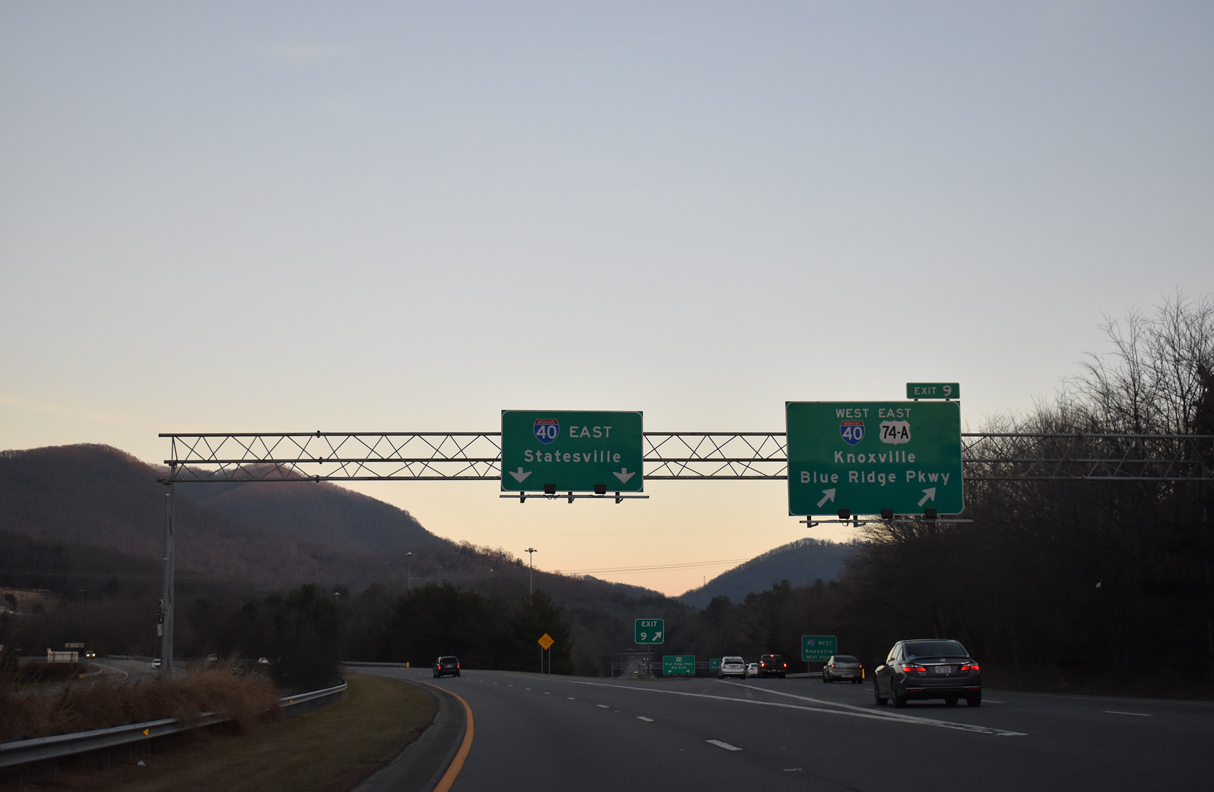
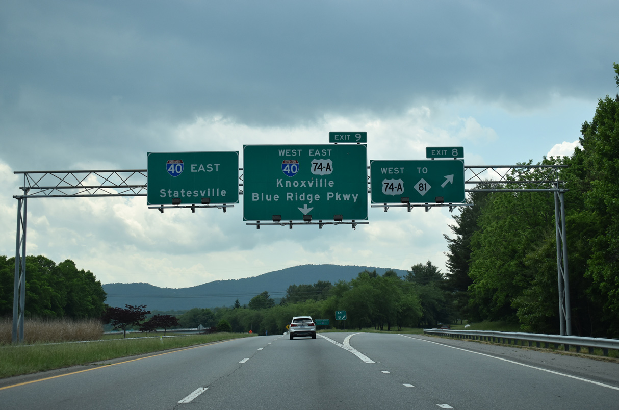
Traffic partitions into two lane ramps for Interstate 40 east to Hickory, Statesville and Winston-Salem and U.S. 74A southeast to I-40 west and Blue Ridge Parkway. 01/16/19
The Interstate 240 eastbound mainline defaults onto I-40 east via a wye interchange south of Fairview Road (U.S. 74A) and west of Hemphill Knob. 01/16/19

The ensuing exit from U.S. 74A joins Interstate 40 west across the Biltmore Estate to Canton and Knoxville, Tennessee. 05/26/21
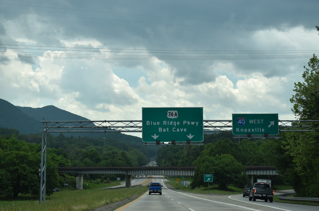
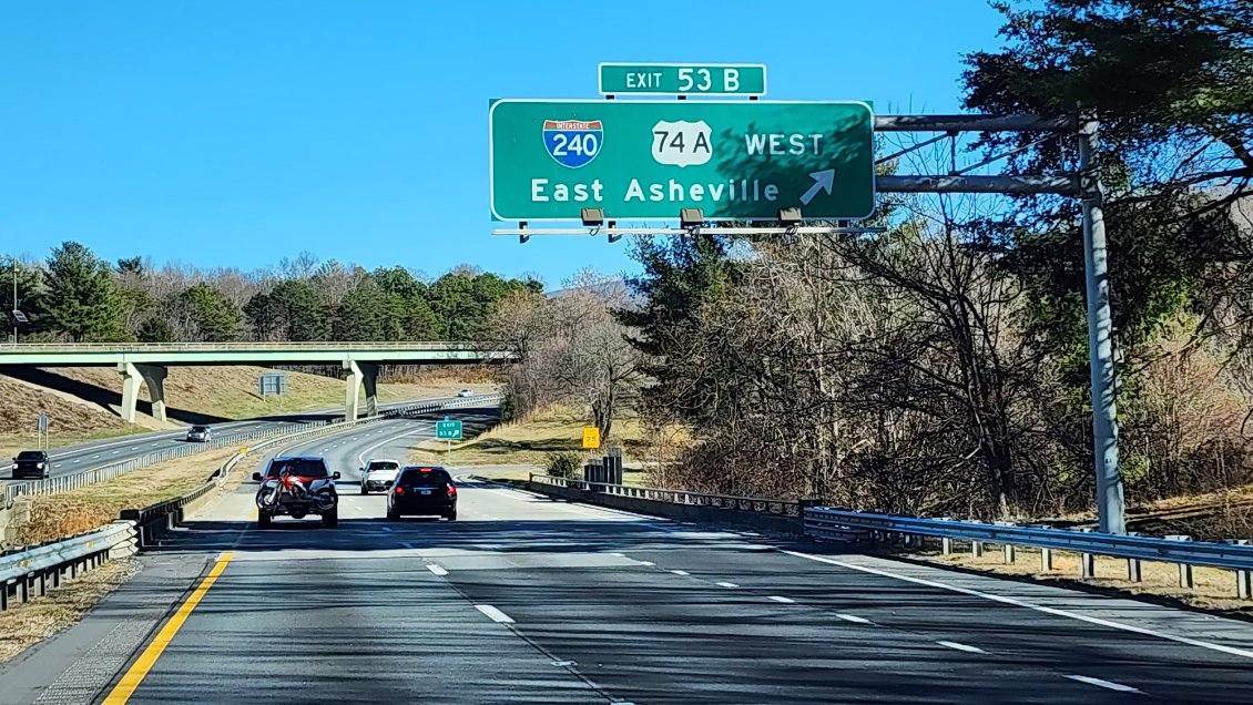
Interstate 240 lowers below a CSX Railroad line and the I-40 mainline ahead of the freeway end at Gashes Creek Road. I-40 travels west 118 miles to Knoxville while U.S. 74A meanders southeast 18 miles to Bat Cave. 05/26/21
An I-240 end shield stands along U.S. 74A (Charlotte Highway) east between Gashes Creek Road and Blue Ridge Parkway. 05/26/21
![]() West at
West at ![]()
![]()
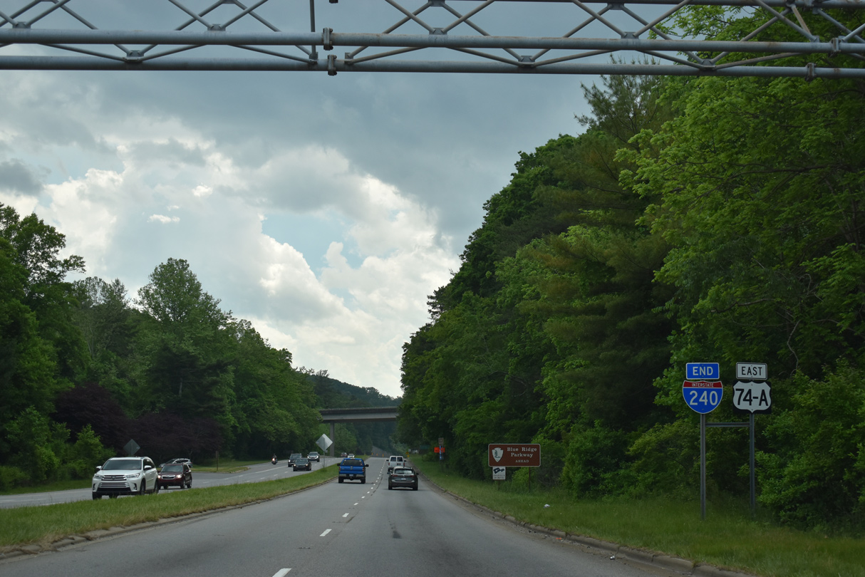
U.S. 74A (Charlotte Highway) transitions into Interstate 240 west at the turn off for Gashes Creek Road (SR 2834) and the eastbound entrance ramp to I-40. 05/26/21
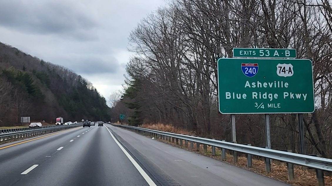
A loop ramp follows from I-240/U.S. 74A west for Interstate 40 west toward Knoxville, Tennessee. U.S. 74A splits from the freeway at a parclo A2 interchange with Fairview Road a half mile to the north. 10/24/15
![]() East at
East at ![]()
![]()
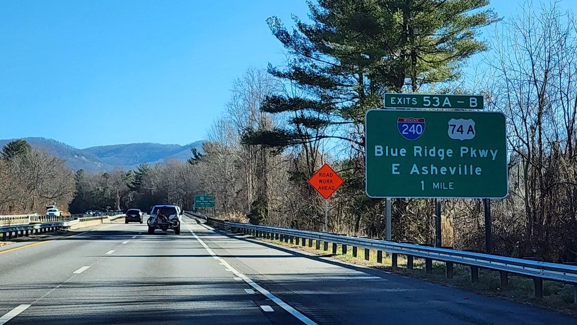
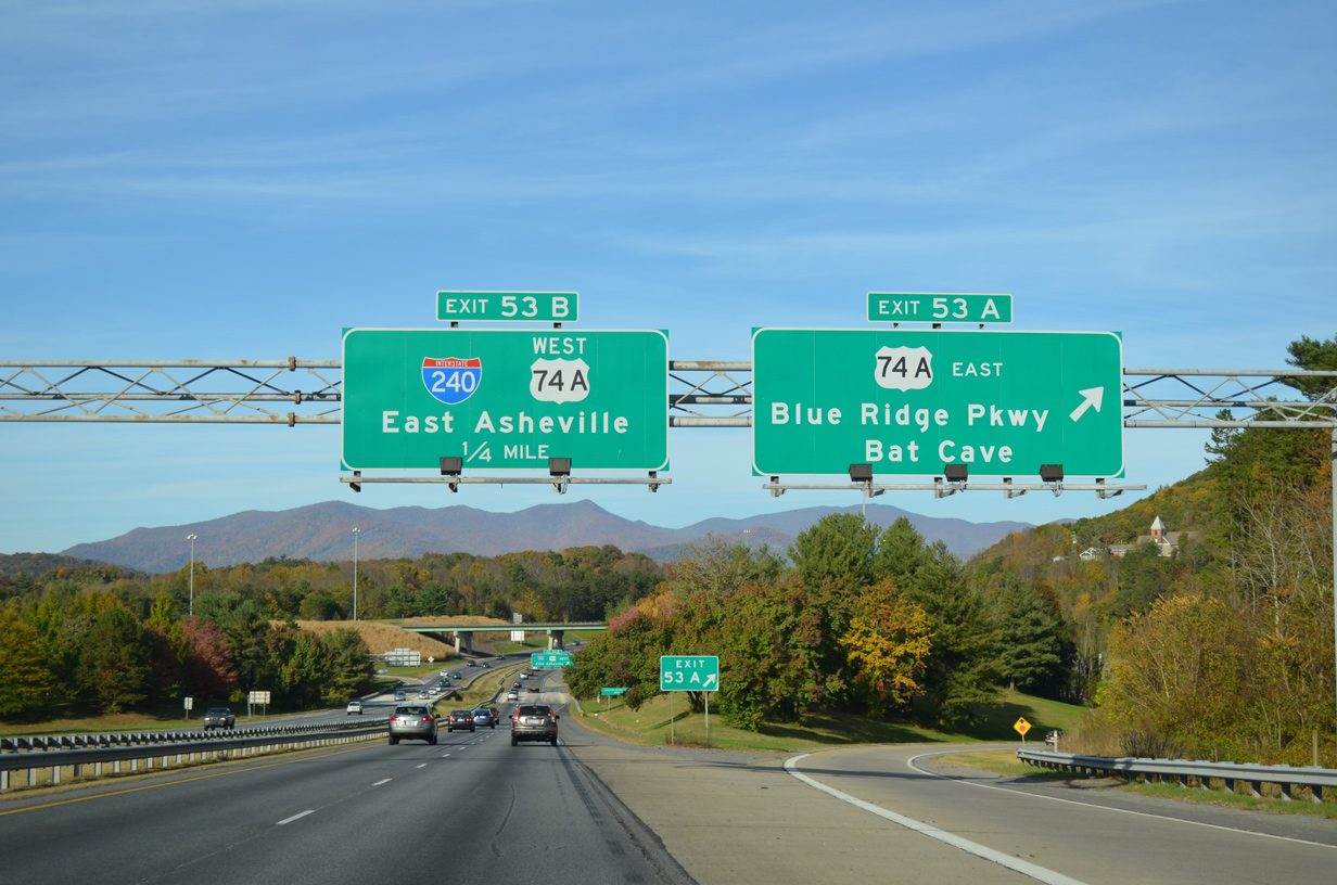
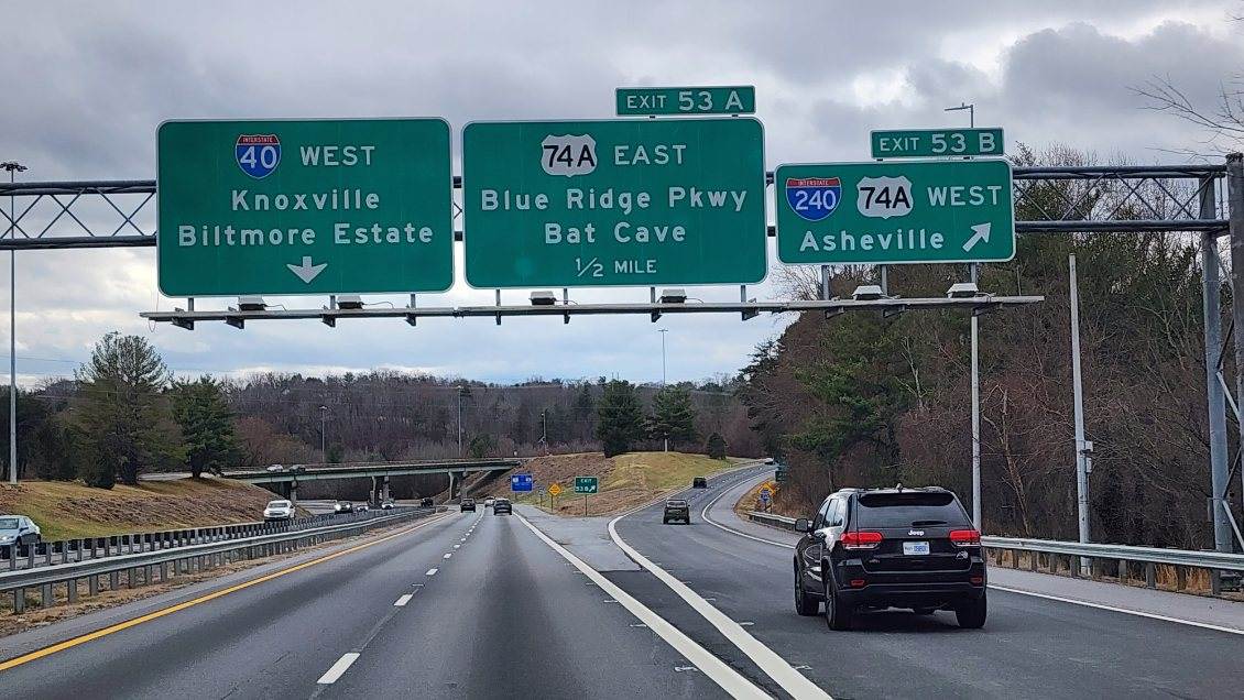
Little Cedar Mountain appears to the east as I-40 advances from U.S. 25 Alternate to the three quarter cloverleaf interchange (Exits 53 A/B) with U.S. 74A (Charlotte Highway) and Interstate 240 west. 12/31/23
I-40 curves northeast by the Oakley community to Exit 53 A for the scenic route along U.S. 74A (Charlotte Highway) east to Bat Cave, Chimney Rock and Lake Lure. 10/23/15
A tractor trailer struck the support for this sign bridge on the morning of September 20, 2019. The felled structure blocked traffic along I-40 eastbound until after 1 p.m. that day.6
Exit 53 B loops away from I-40 east to U.S. 74A west to adjacent Fairview Road and Interstate 240 west to Downtown Asheville. 12/31/23
![]() West at
West at ![]()
![]()
Interstate 40 runs along the north side of Hemphill Knob on Swannanoa Mountain to the wye interchange (Exit 53 B) with I-240/U.S. 74A west to Asheville. 12/30/23

U.S. 74A was designated in 1994 when U.S. 74 shifted south onto a new freeway from I-26 to Columbus. The alternate route east connects with the Blue Ridge Parkway nearby and suburban areas to Fairview. Westward U.S. 74A parallels I-240 as a local route to Downtown Asheville. 12/30/23
Exit 53 B parts ways for I-240 west ahead of the cloverleaf interchange joining I-40 with U.S. 74A (Charlotte Highway). 12/30/23

Replaced sign bridge for Exits 53B/A on Interstate 40 west. Photo by Chris Patriarca (06/19/03).
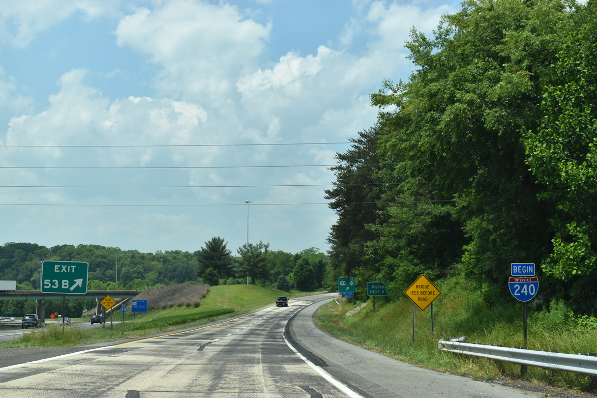
U.S. 74A turns onto Fairview Road just beyond the begin shield for I-240 west to an adjacent array of retail anchored by Asheville Mall. I-240 bee lines northward to Beaucatcher Mountain. 05/26/21
West End – Asheville, North Carolina
![]() West at
West at ![]()
![]()
![]()
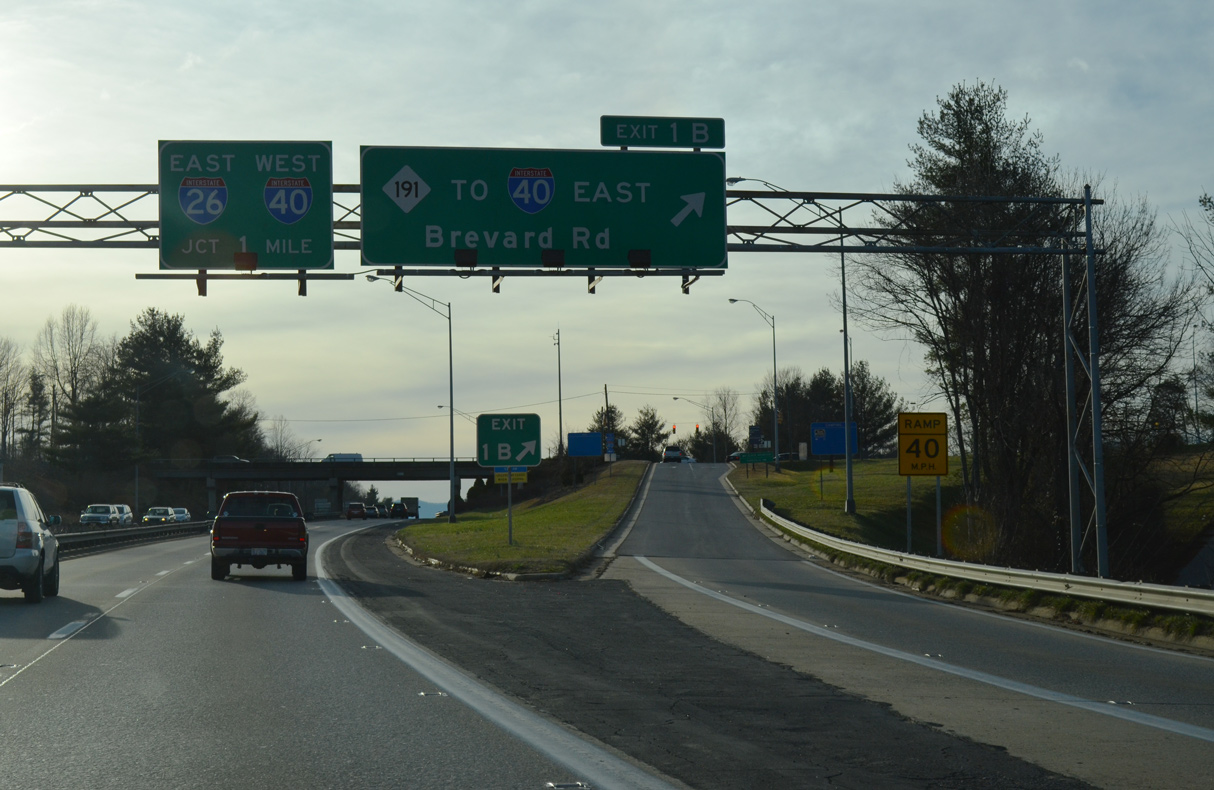
A wye interchange adds traffic to I-26 east / I-240 west from Amboy Road just prior to Exit 1B for NC 191 (Brevard Road). NC 191 provides the connection to I-40 east as the forthcoming exchange between the two freeways is incomplete due to area topography. 12/31/13
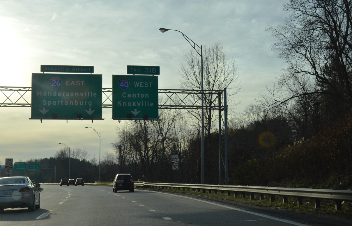
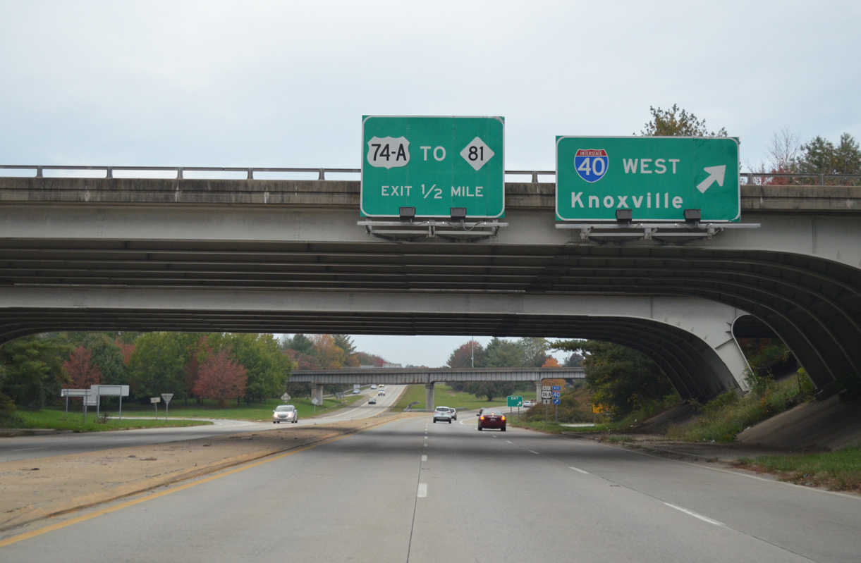
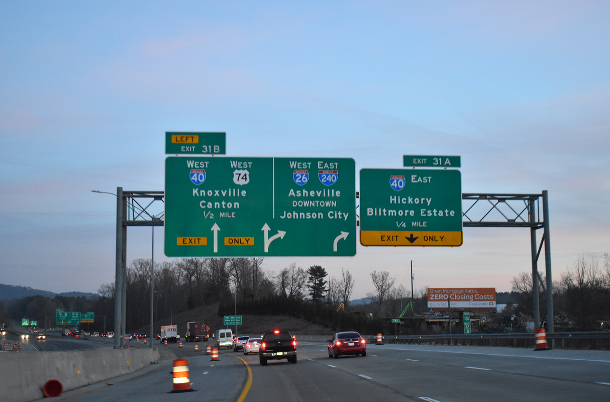
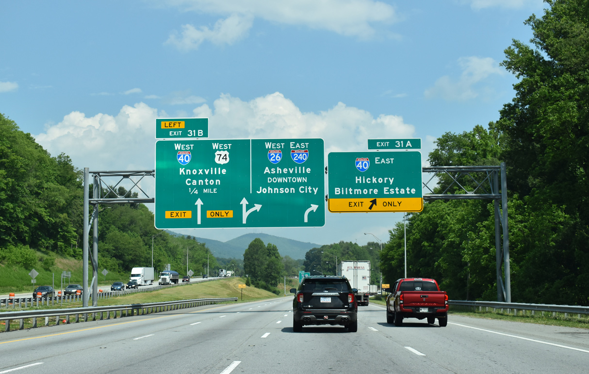
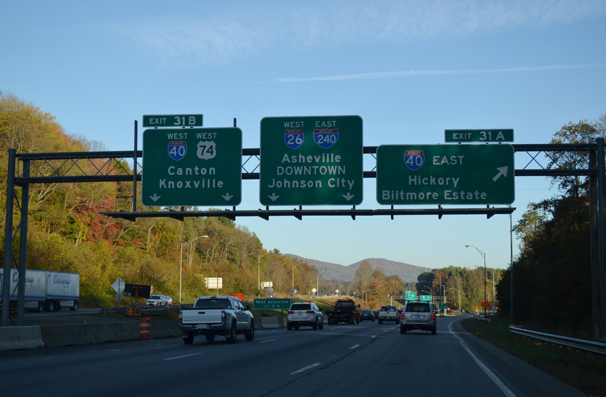
Spanning Hominy Creek, a third lane opens westbound for Exit 31B to I-40/U.S. 74 west to Canton. Prior to the 2003 extension of I-26, the westbound ramp was assigned as Exit 1A. 12/31/13
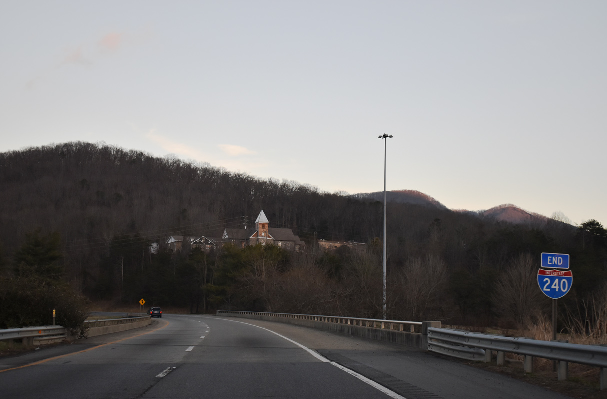
Interstate 240 west ends as I-26 continues southward alongside U.S. 74 east to Asheville Regional Airport (AVL), Hendersonville and Columbus. 12/31/13
![]()
![]() West at
West at ![]()
![]()
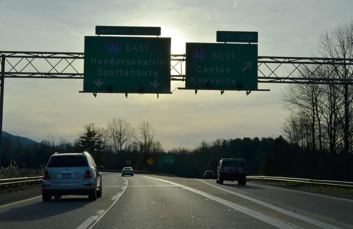
I-26/U.S. 74 west make an S-curve across Hominy Creek a half mile from the exchange with I-40/240. Completed in Fall 2016, an $11.9 million project replaced the bridges over Hominy Creek.5 05/26/21
Improvements at Hominy Creek are part of the long term expansion plan through 2025 for I-26 throughout Buncombe and Henderson Counties. 03/14/22
Interstate 40 passes through the Biltmore Estate, which spreads to the east and south of the French Broad River nearby, to Morganton and Hickory. 05/26/21
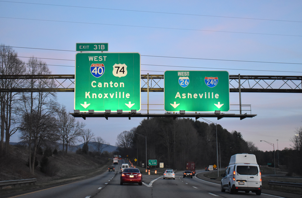
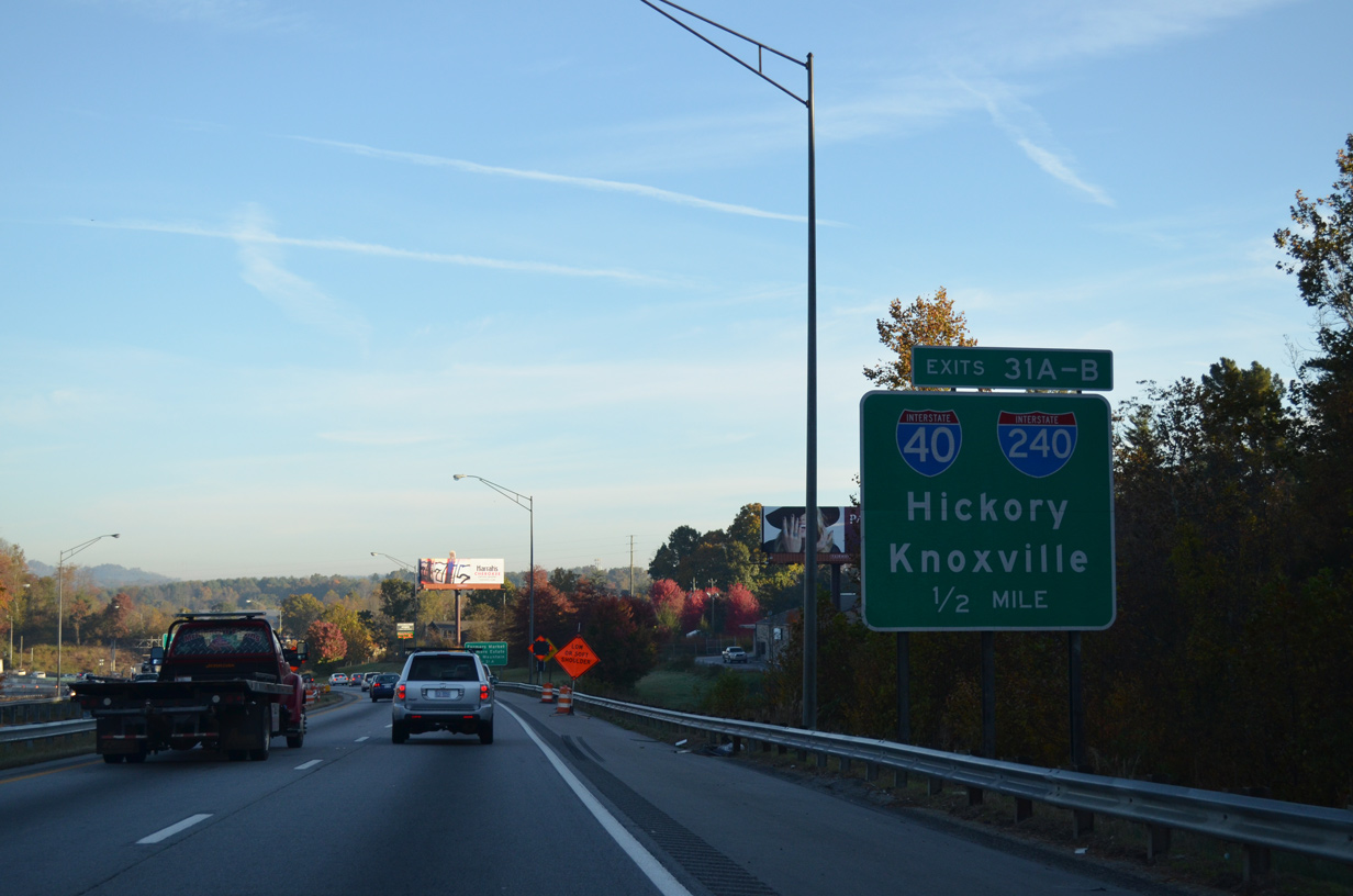
Left Exit 31 B follows for the continuation of U.S. 74 west along Interstate 40 to Canton and Lake Junaluska. Interstate 26 overlaps with I-240 from this point northeast to West Asheville and Downtown. Ensuing exit numbers reset to U.S. 19-23-70. 03/14/22
![]()
![]() East at
East at ![]()
![]()
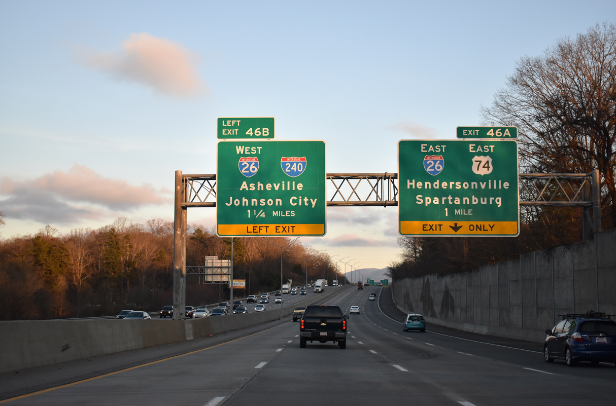
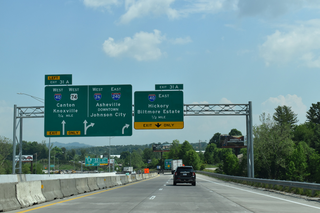
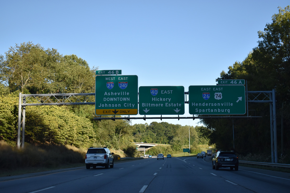
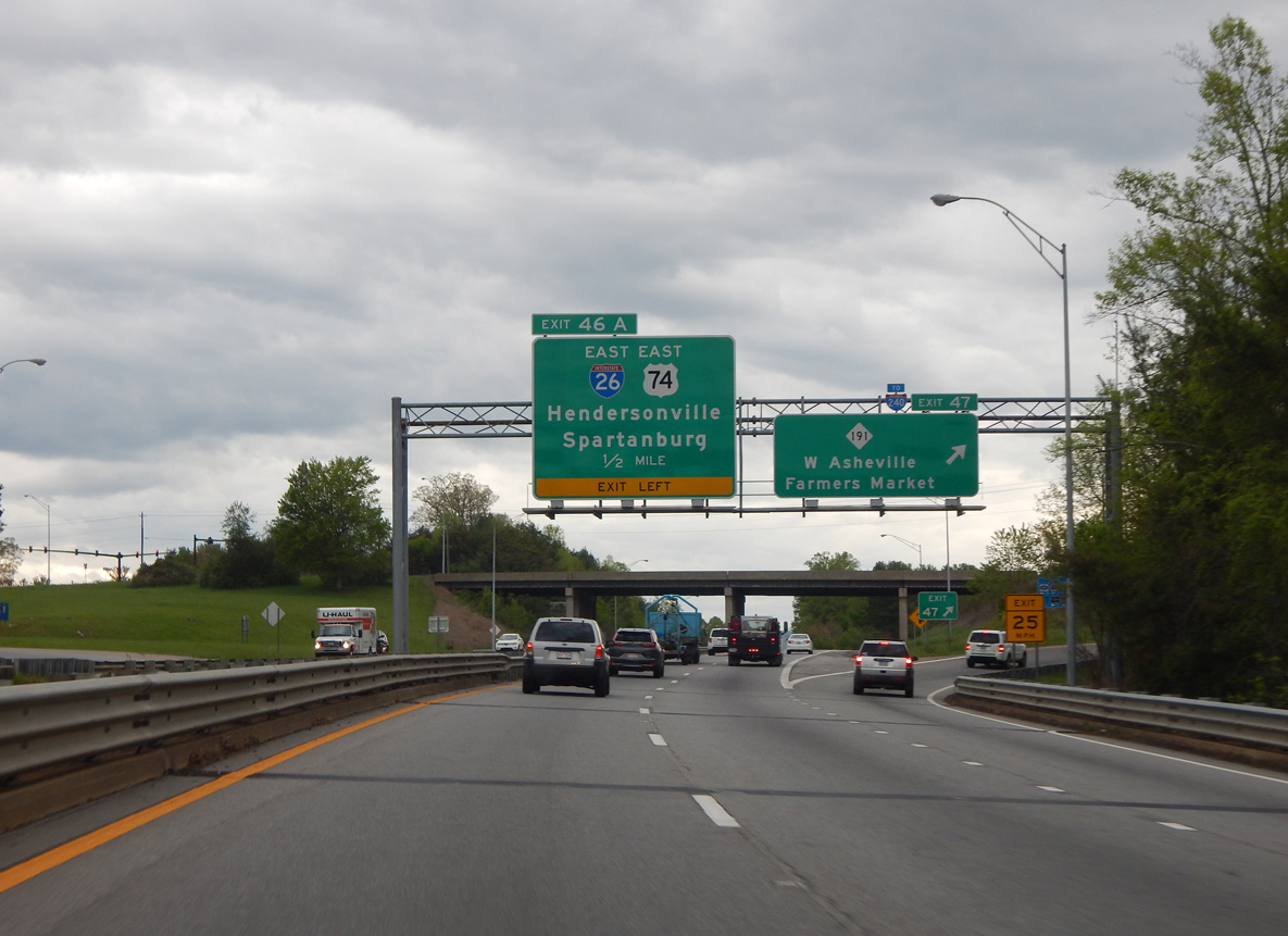
Heading east from U.S. 19-23 and Enka, I-40/U.S. 74 advance with four lanes to the directional interchange (Exits 46A/B) with I-26 and I-240 east. 01/16/19
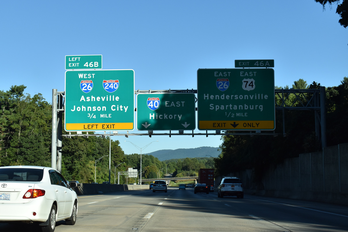
Back to back lane drops occur at the succeeding ramps for I-26/U.S. 74 east to Hendersonville and I-26 west / I-240 east to Downtown Asheville. Future road work upgrades the substandard exchange with a high speed flyover departing from the right for I-26/240 into Asheville. 09/23/22
Interstate 26 extends south from the west end of I-240 as an busy commuter route to Fletcher and Hendersonville. I-26 also acts as a gateway to the Appalachian Mountains from South Carolina and the Southeast coast. 09/23/22
Left Exit 46 B follows for the winding freeway along I-26/240 through West Asheville. I-40 continues east with four overall lanes across the Biltmore Estate to the communities of Biltmore and Oakley. 09/23/22
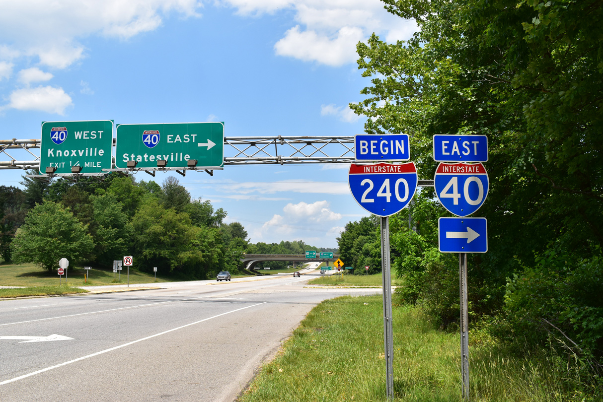
I-40 east at Interstate 240, just prior to the signing of I-26 north to Johnson City, Tennessee. 08/23/03
![]() West at
West at ![]()
![]()
![]()
I-40 and I-26/240 converge southwest from respective interchanges with NC 191 (Brevard Road) by the French Broad River. NC 191 provides a Breezewood connection from I-40 west to I-26/240 east into Asheville. A collector distributor roadway will be built further west to provide direct access to the Asheville loop as part of Section C of the I-26 Connector project. Photo by Carter Buchanan (04/22/17).
 West End Throwback
A sign bridge for the upcoming ramps (Exits 31B/A) to I-40 was removed during construction replacing the bridges over Hominy Creek. 10/23/15
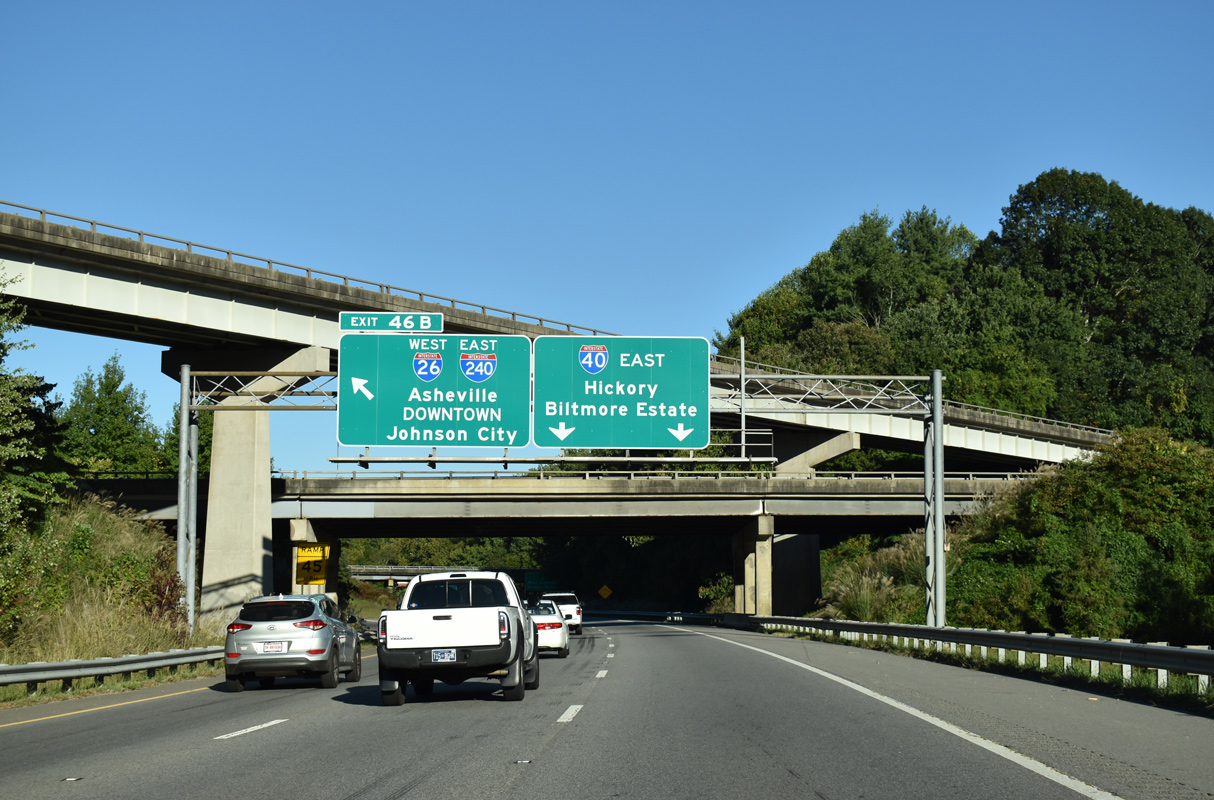
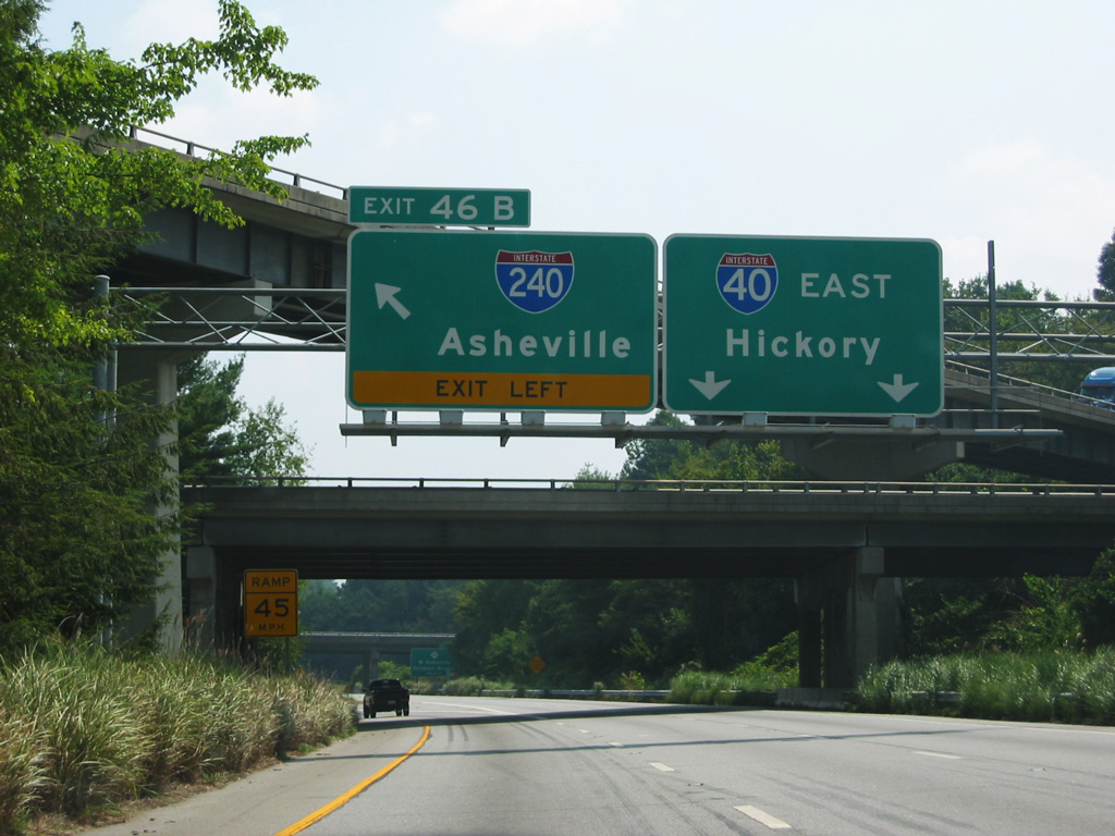
Sign replacements made at Exits 31A/B added Biltmore Estate for I-40 east and Johnson City for the continuation of I-26 west onto Interstate 240 east. 10/23/15
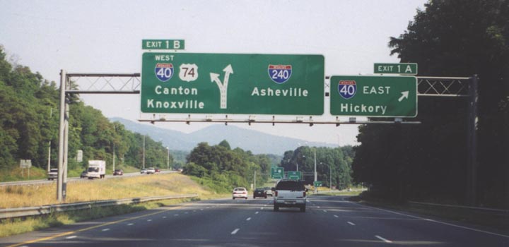
Former diagrammatic sign posted at the westbound ramp from I-26/U.S. 74 for I-40 east. Prior to sign changes made in July and August 2003, I-26 ended opposite from the eastbound beginning of I-240. Photo by Carter Buchanan (06/00).
Sources:
- I-26 Connector, Asheville, NC Public Information Website. North Carolina Department of Transportation (NCDOT).
- NCRoads.com: I-240.
- “Local backing helped make I-26 Connector route choice.” Citizen-Times (Asheville, NC), May 19, 2016.
- “Connector route taking traffic off Bowen Bridge picked.” Citizen-Times (Asheville, NC), May 19, 2016.
- “Answer Man: I-26 bridge work over Pond Road halted?” Citizen-Times (Asheville, NC), February 17, 2016.
- “Semi carrying frozen foods flips, fells highway sign, freezes traffic on I-40 East.” Citizen-Times (Asheville, NC), September 20, 2019.
Page updated February 1, 2024.