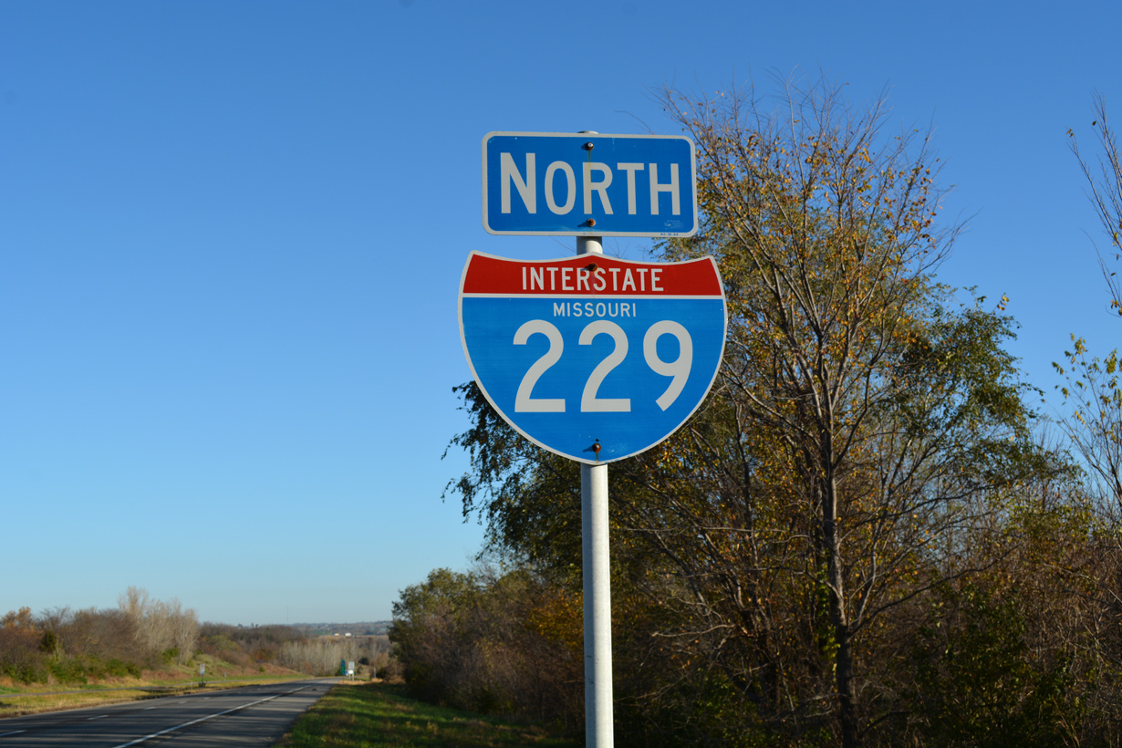
Interstate 229 Missouri
Overview
Interstate 229 forms an urban loop west from I-29 through the city of St. Joseph. The freeway carries four overall lanes with rural stretches leading through Buchanan County to the south and Andrew County to the north. Through Downtown and along the Missouri Riverfront, I-229 combines with U.S. 59 along a double deck freeway.
2015 traffic counts recorded by the Missouri Department of Transportation (MoDOT) peaked at 16,810 vehicles per day (vpd) east of Exit 1 D (Route 752), while the roadway north of Exit 11 (Highway K) was lightly traveled with just 4,646 vpd. St. Joseph is also served by a business loop from Interstate 29 along a combination of surface streets and shared alignments with U.S. 59 and U.S. 169.
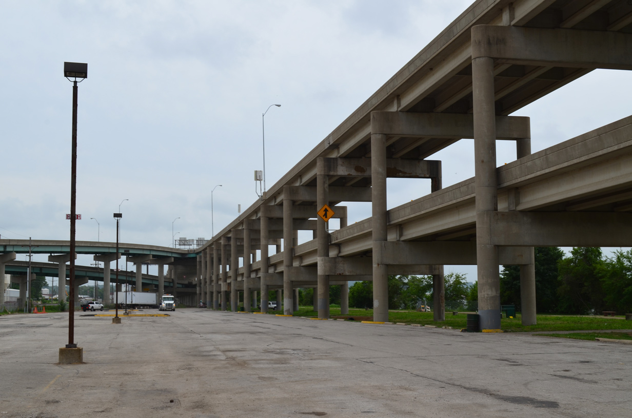
Flyovers join the double deck freeway with Downtown St. Joseph as I-229/U.S. 59 travel between railroad lines and the St. Joseph Riverwalk. 06/18/15
An emergency closure of the double deck section of I-229 followed reports of falling debris recorded on June 4, 2015.2 The aging structure and increasing repair costs to maintain it have engineers evaluating the future of the route. A 2016 estimate for a major rehabilitation of the bridge was about $50 million. If completed, the work would extend the lifespan of the elevated structure by 20 to 25 years. An alternative discussed by city leaders, highway engineers and residents involves replacing the freeway with an at-grade parkway. Costing less to maintain, the non-freeway design might also open up riverfront areas for redevelopment.3
Originally planned for a 16 to 18 month period, a Missouri Department of Transportation (MoDOT) study with public input considers an array of alternatives for the future of Interstate 229 through St. Joseph. Options range from retaining the existing Double Decker Bridge, replacing it with a new elevated structure, removing it and partitioning I-229 into separate spurs into Downtown, and replacing I-229 with an at-grade boulevard or a parkway option with roundabouts. Other options considered upgrading existing streets through Downtown with the elevated structure demolished.
 History
Lobbying efforts from the publisher of the News-Press, Henry D. Bradley and others pushed for Interstate 229 through St. Joseph. The route was intended to draw traffic back into St. Joseph that was otherwise bypassing the city to the east along I-29. Land acquisition difficulties led to the double deck design through the Downtown area as a way to complete the route.1
Interstate 229 opened initially from I-29 south of St. Joseph to Missouri Route 371 (S 22nd Street) by 1970. Costing $20 million, the double deck section of I-229 was built in phases between 1977 and 1986. A weather-damaged portion of the viaduct was completed in 1979.2,3
Route Information
North End – Amazonia, MO
South End – St. Joseph, MO
Mileage – 14.97
Cities – St. Joseph
- Junctions –

Source: December 31, 2021 Interstate Route Log and Finders List
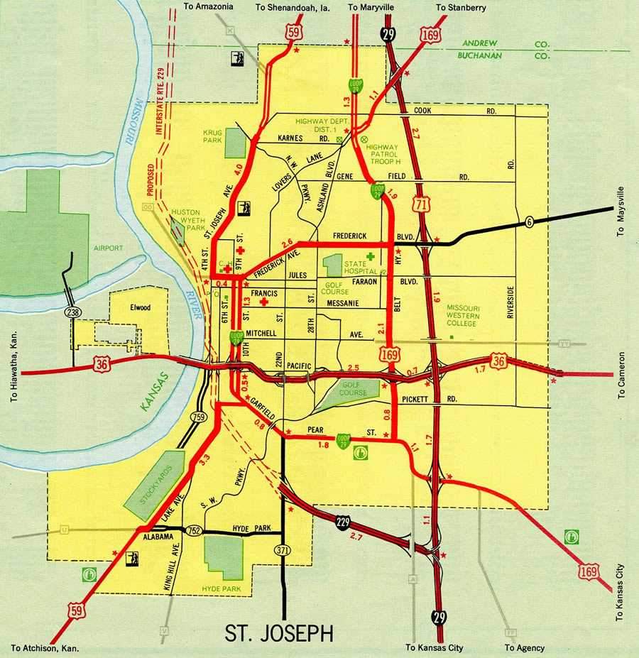
A 1970 Missouri map shows this southernmost segment open to traffic.
The I-229 freeway winding north from the U.S. 59 (St. Joseph Avenue) split was constructed through bluffs rising from the Missouri River.
North End  – Amazonia, Missouri
![]()
![]() North at
North at ![]()
![]()
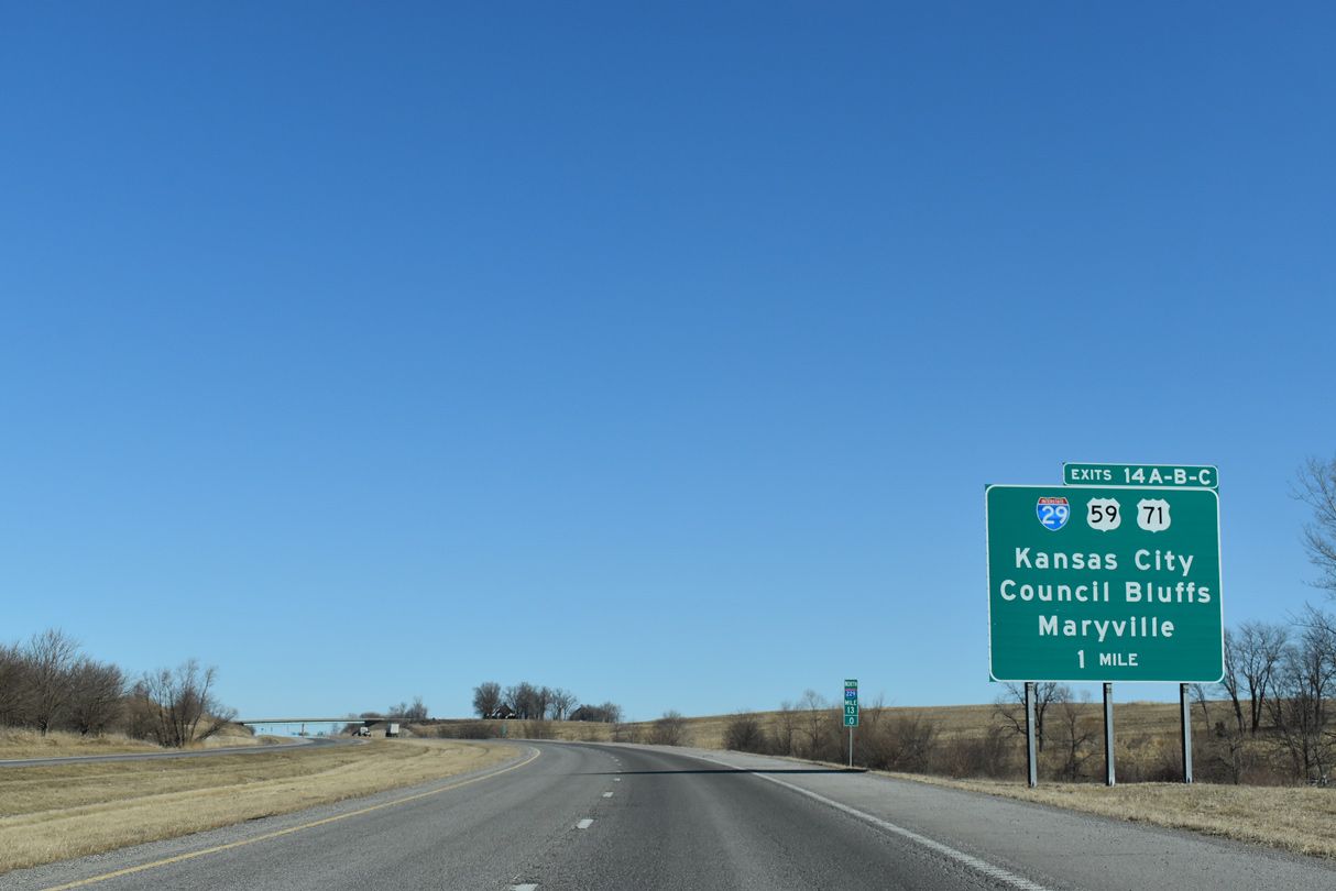
Interstate 229 rises from Dillon Creek by agricultural areas one mile ahead of Exits 14 A/B/C with I-29 and U.S. 59-71 north. 02/20/20
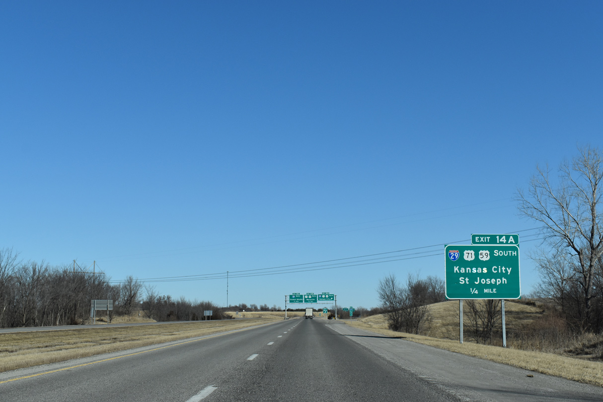
Exit 14A leads back to the southeast along I-29/U.S. 71 to Business Loop I-29/U.S. 59 south to Country Club and U.S. 71 Business north to Savannah. 02/20/20
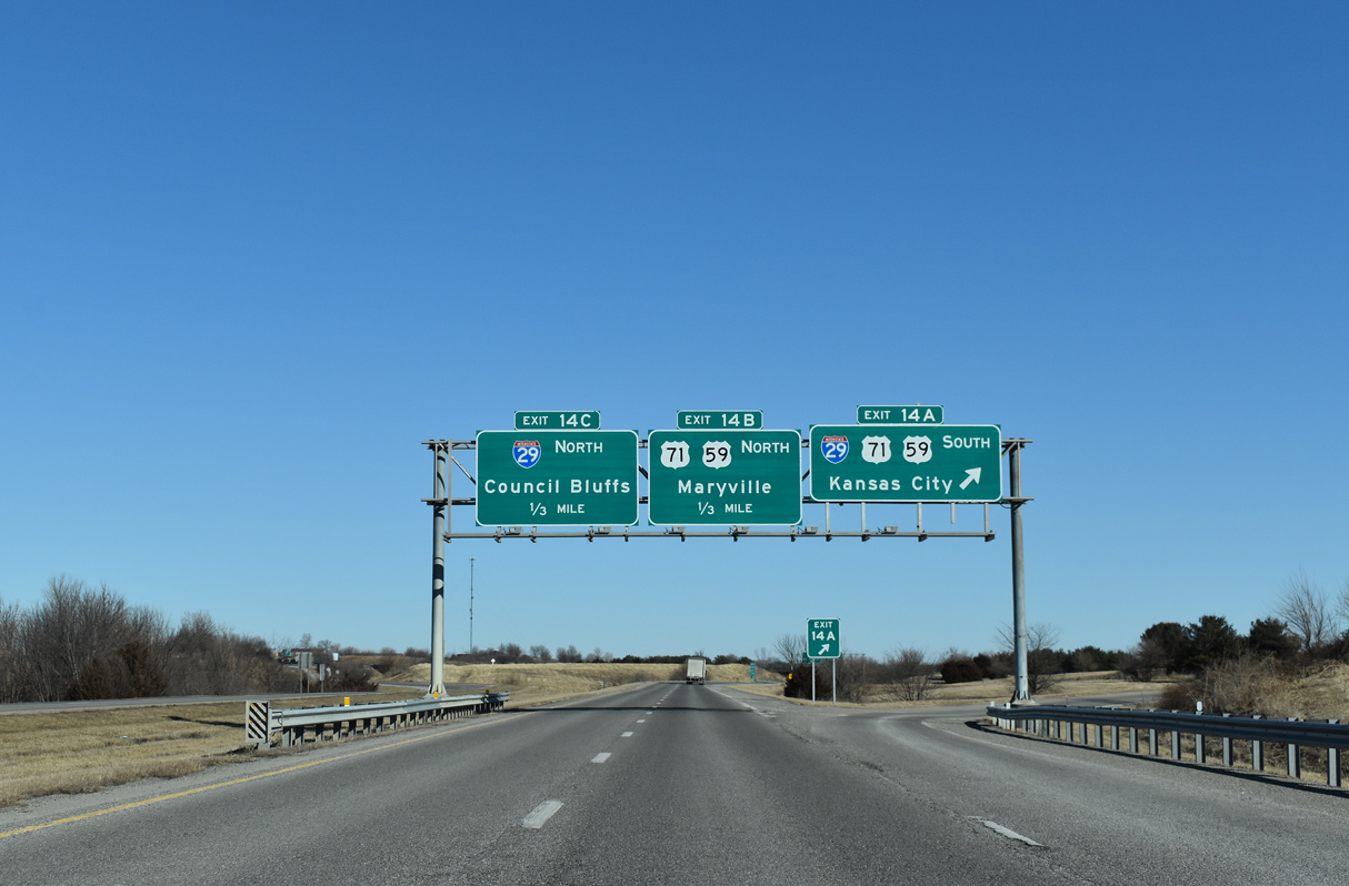
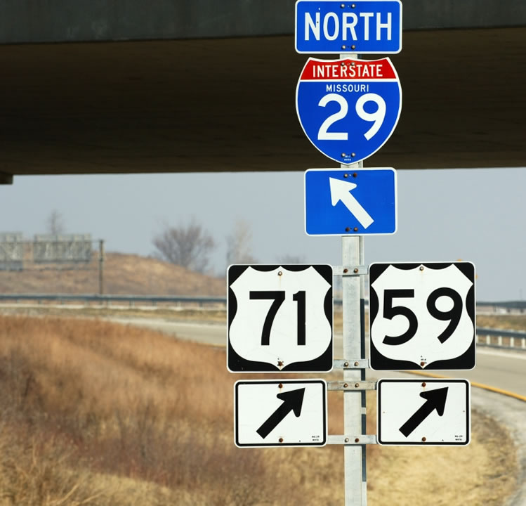
Exit 14B represents the I-229 northbound mainline transition to U.S. 59/71. U.S. 59/71 split with I-29 north to bypass Savannah. U.S. 71 advances northward from there to the Nodaway County seat of Maryville while U.S. 59 turns west to combine with Interstate 29 across the Nodaway River to Oregon. 02/20/20
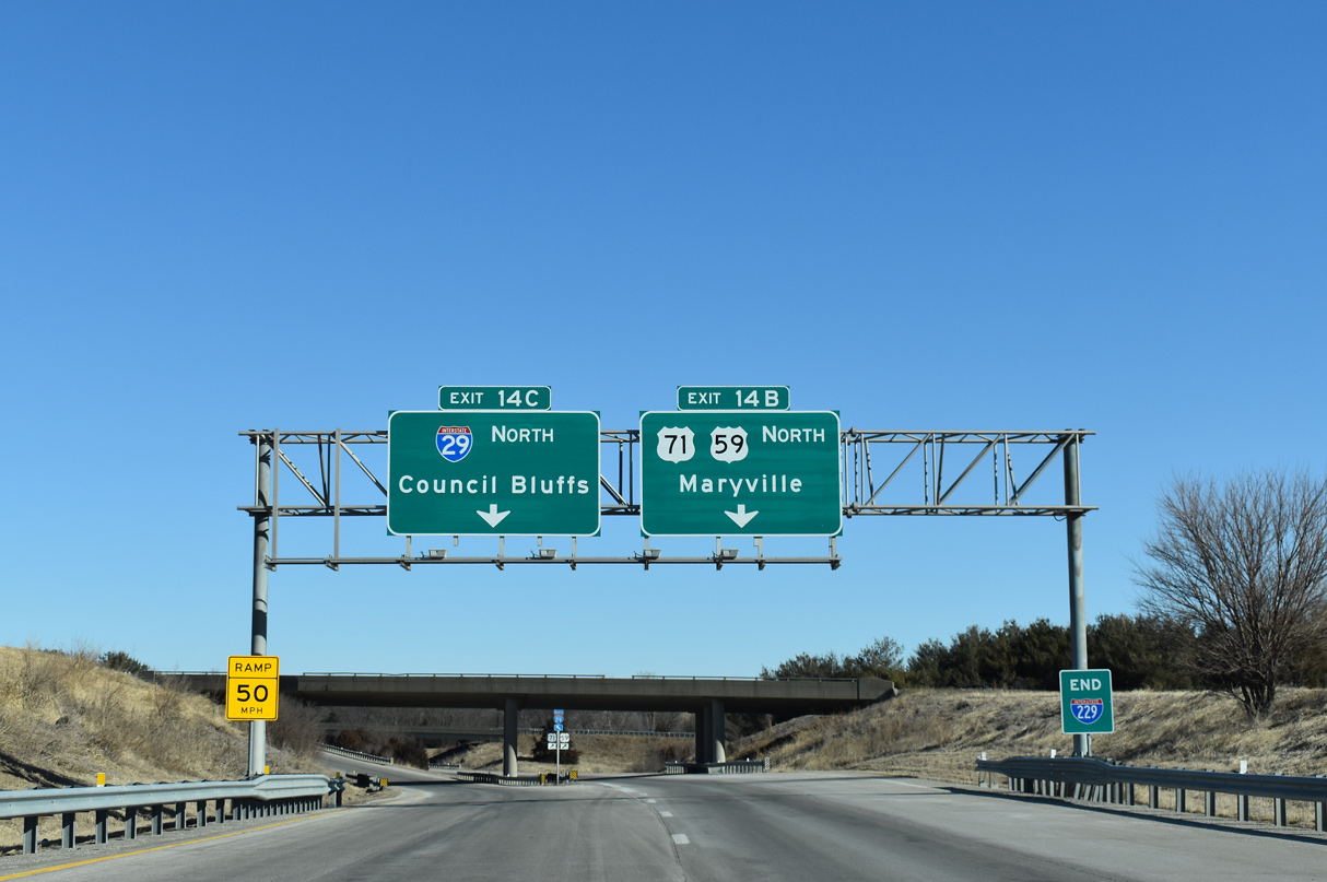
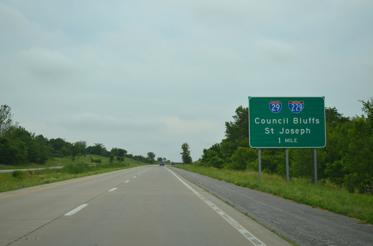
An end sign appears for I-229 as Left Exit 14C departs for Interstate 29 north to Council Bluffs, Iowa and Omaha, Nebraska. 02/20/20
A set of shields stand at the Exit 14C gore point. U.S. 71 leaves the I-29 corridor here for a rural route north to International Falls. U.S. 59 intertwines with the freeway northwest to Craig. Photo by Jeff Royston (03/16/05).
![]()
![]()
![]() North at
North at ![]()
One mile south from the return of Interstate 229 north from St. Joseph on I-29. 11/03/16
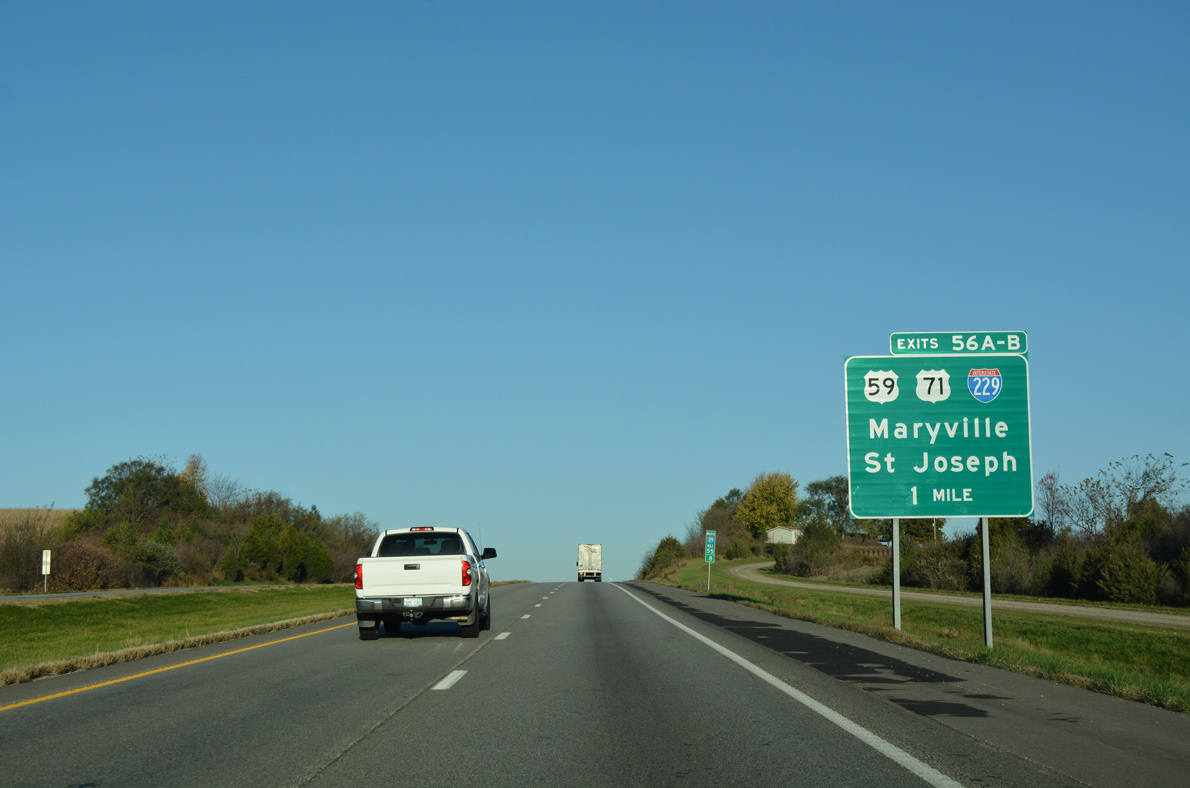
U.S. 59 overlaps with I-29/U.S. 71 for 2.8 miles from near Country Club to a freeway extending north from I-229 to Savannah. 11/03/16
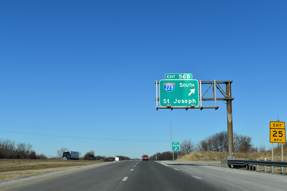
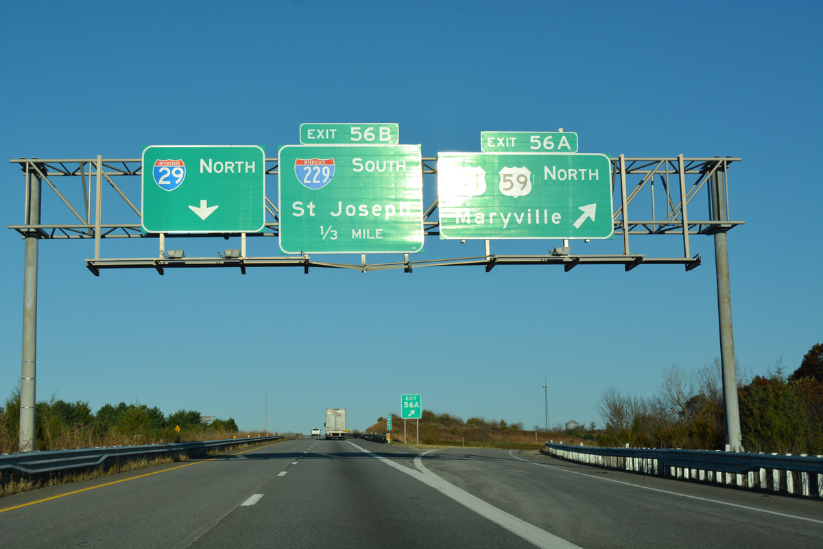
Exit 56B joins Interstate 229 for return access to St. Joseph as I-29 travels solo to the northeast of Amazonia. 02/20/20
![]() South at
South at ![]()
![]()
![]()
U.S. 59/71 travel a freeway south from the Andrews County seat of Savannah that directly transitions onto Interstate 229 south at forthcoming Exit 56. 06/18/15
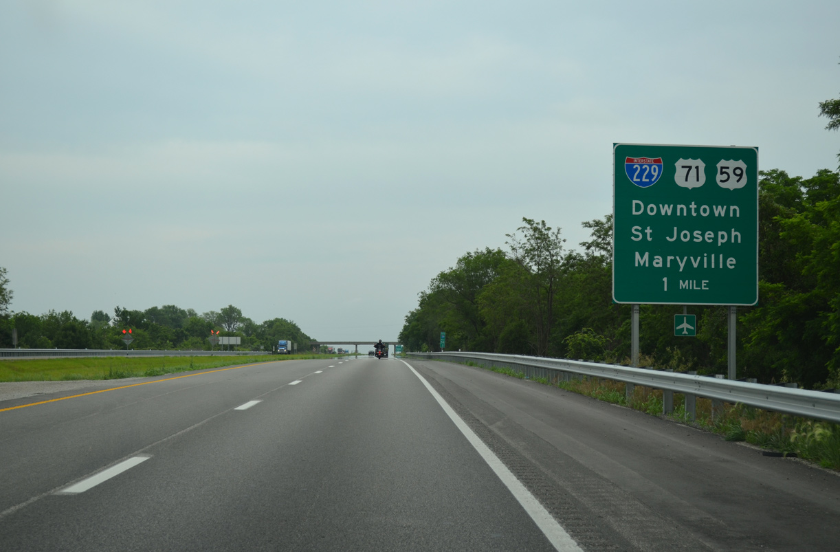
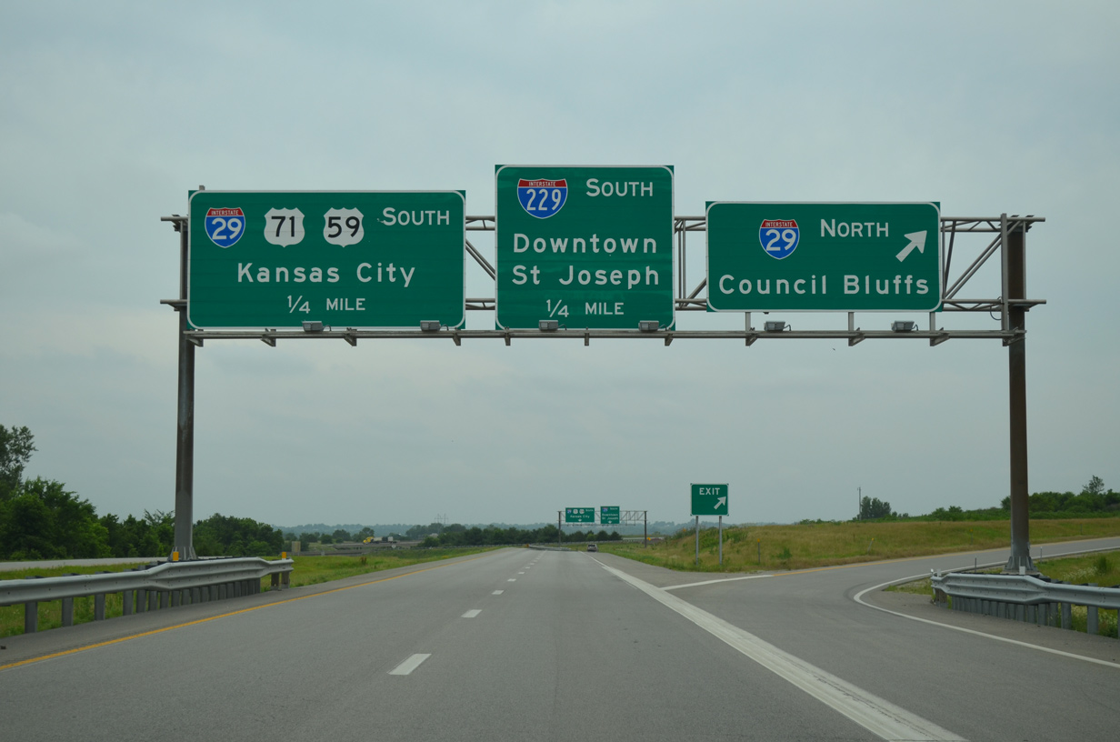
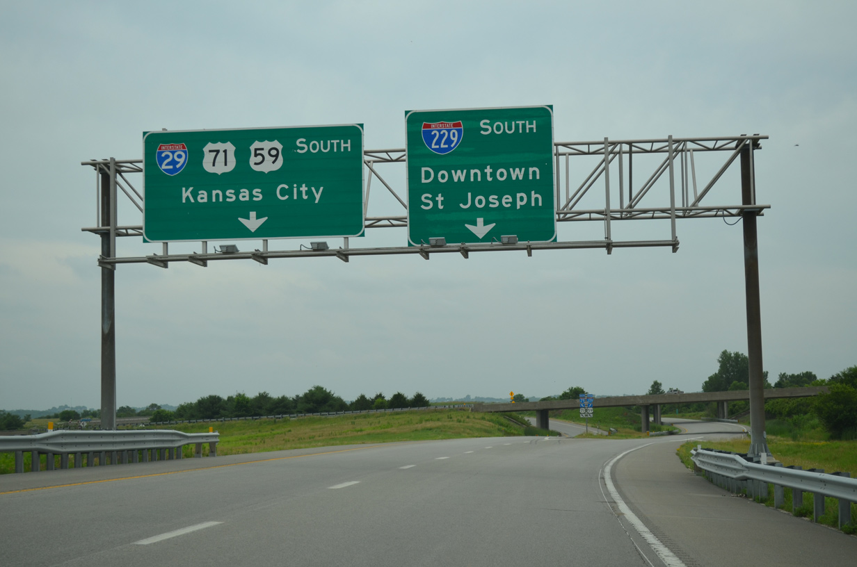
I-20 converges with Interstate 229 south to Downtown St. Joseph and U.S. 71 north to Maryville at a directional cloverleaf interchange with left side ramps. 06/18/15
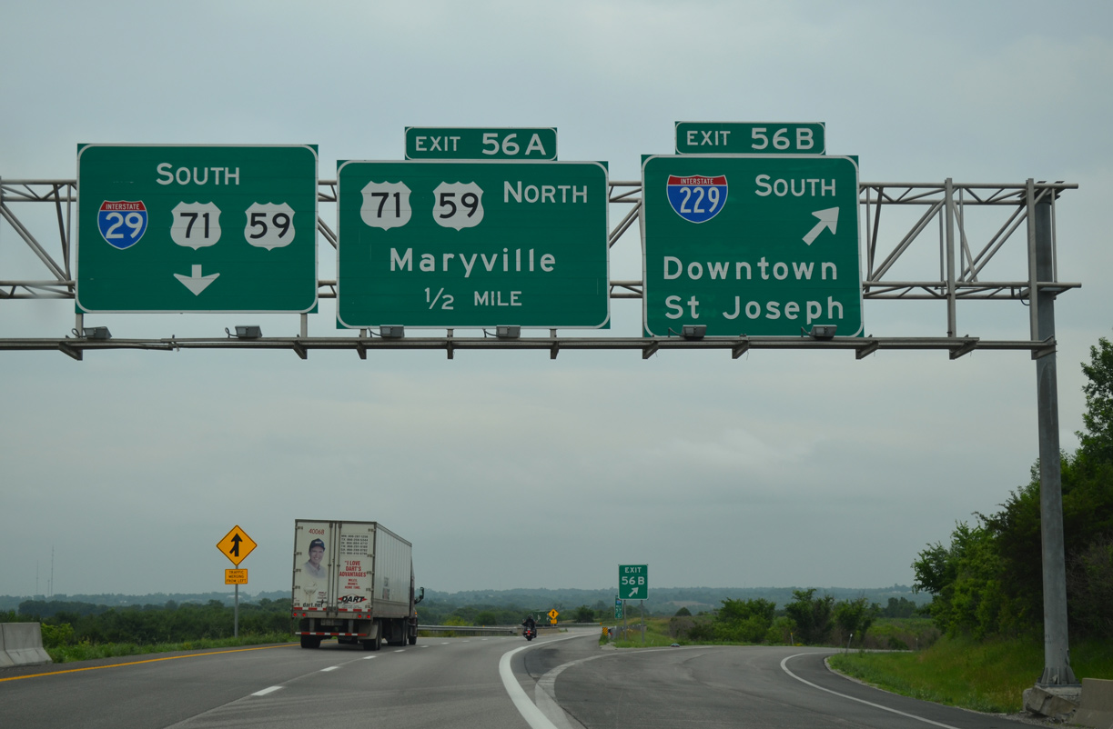
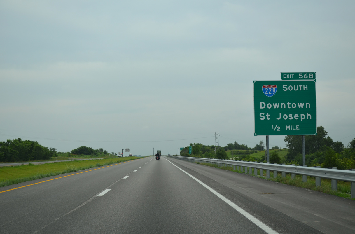
Exit 56 B leaves I-29 south for I-229 as U.S. 59/71 join the freeway south. U.S. 59 briefly overlaps with I-29, before combining with Business Loop I-29 south to the village of Country Club.
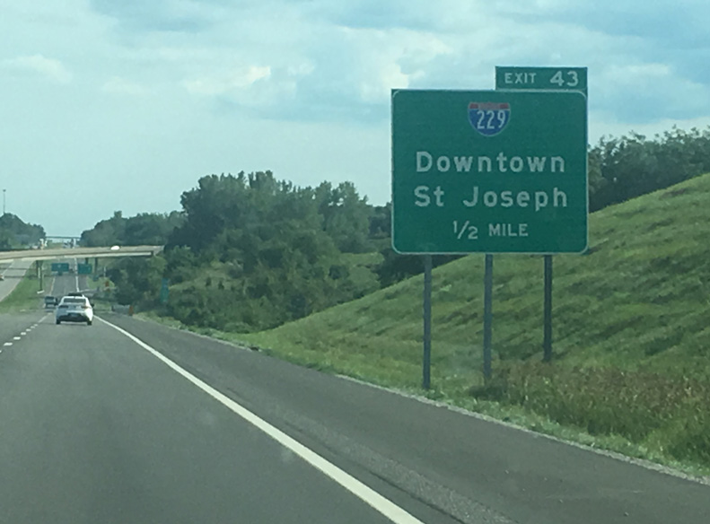
U.S. 59 also serves Downtown, where it joins the Double Decker Bridge along I-229. 06/18/15
![]()
![]() South at
South at ![]()
![]()
U.S. 59/71 traverse hilly terrain south from Hopkins Creek to the unnumbered interchange with I-29 and I-229. 06/18/15
Interstate 29 angles northwest along the Missouri River bluffs to Mound City, Craig and Hamburg, Iowa on the 116 mile drive to I-80 at Council Bluffs. 06/18/15
A left exit ramp follows for the continuation of U.S. 59/71 south onto I-29 as they bypass St. Joseph to the east. 06/18/15
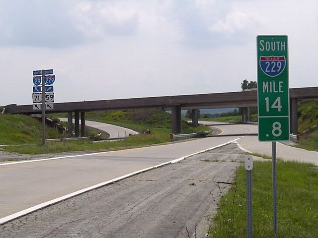
The first mile marker for I-229 south once stood adjacent to the entrance ramp from I-29 north. Milepost 14.8 was removed by 2013. Photo by Jeff Morrison (08/21/06).

Photo by Jeff Morrison (08/21/06).
South End – St. Joseph, Missouri
![]() South at
South at ![]()
![]()
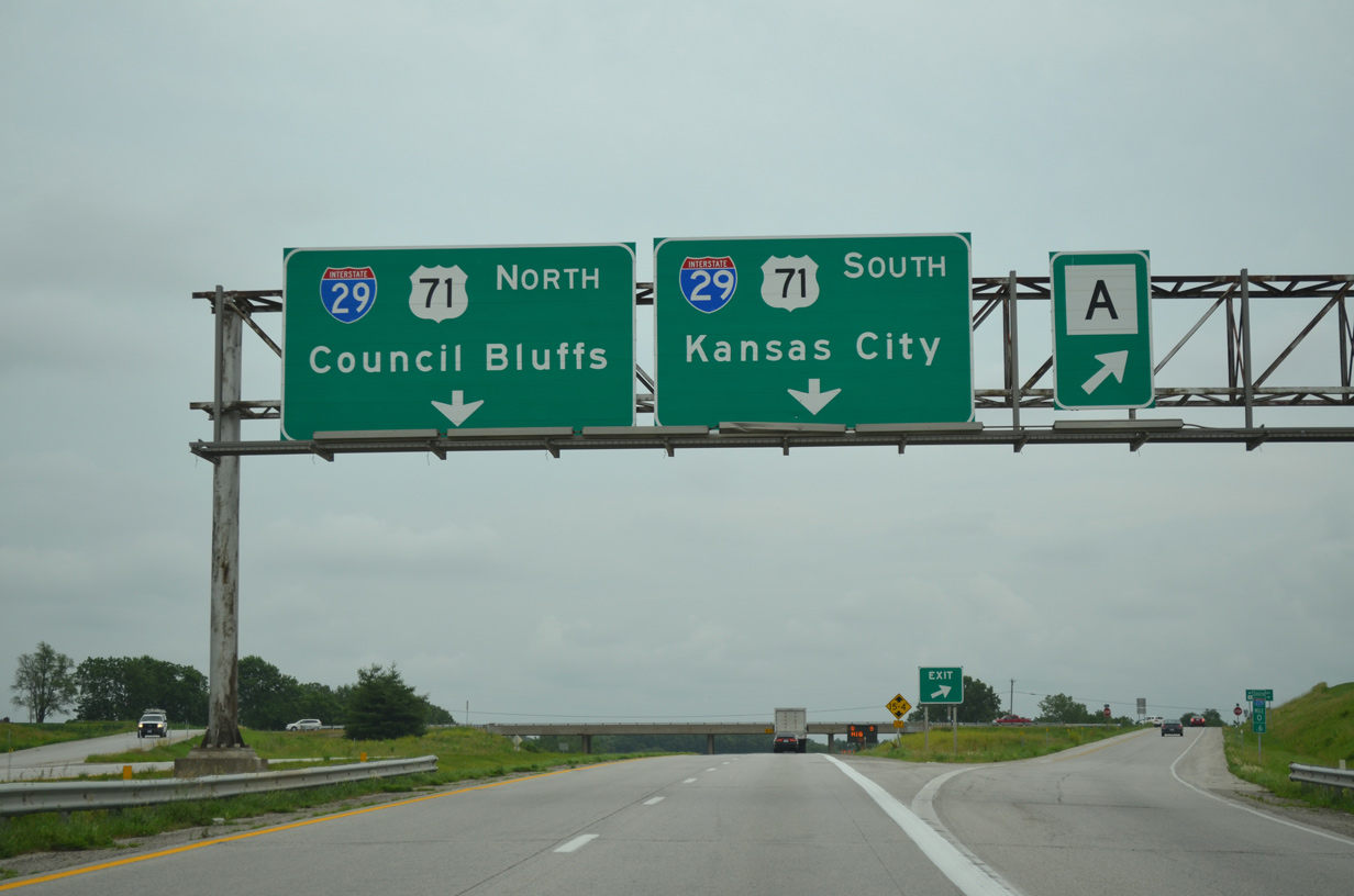
The final three ramps from Interstate 229 south are unnumbered. Departing first is the exit for Highway A (40th Street) to the south suburbs of St. Joseph. 06/18/15
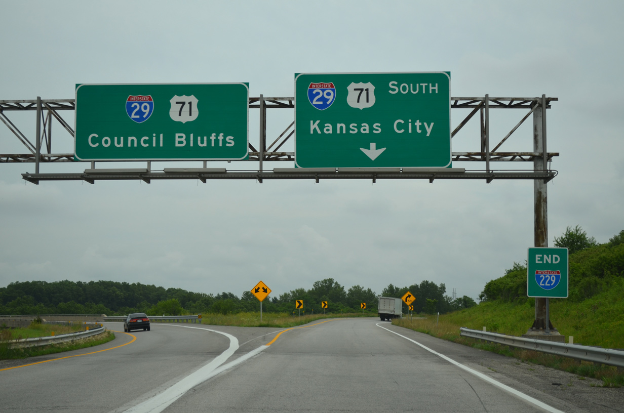
An end I-229 sign accompanies the ramp separation for I-29/U.S. 71 north back through St. Joseph to Council Bluffs, Iowa and I-29/U.S. 71 south to Kansas City. 06/18/15
![]()
![]() North at
North at ![]()
I-29/U.S. 71 traverse a series of rural hills by the Pigeon Hill Conservation Area ahead of Interstate 229 and the St. Joseph area. 02/20/20
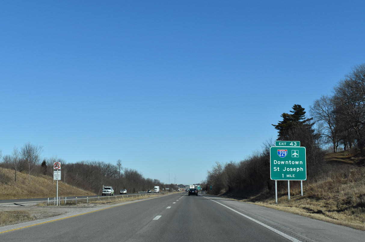
Interstate 229 provides a direct route to the U.S. 36 freeway west across the Pony Express Bridge to Elwood, Kansas and Rosecrans Memorial Airport (STJ). 02/20/20
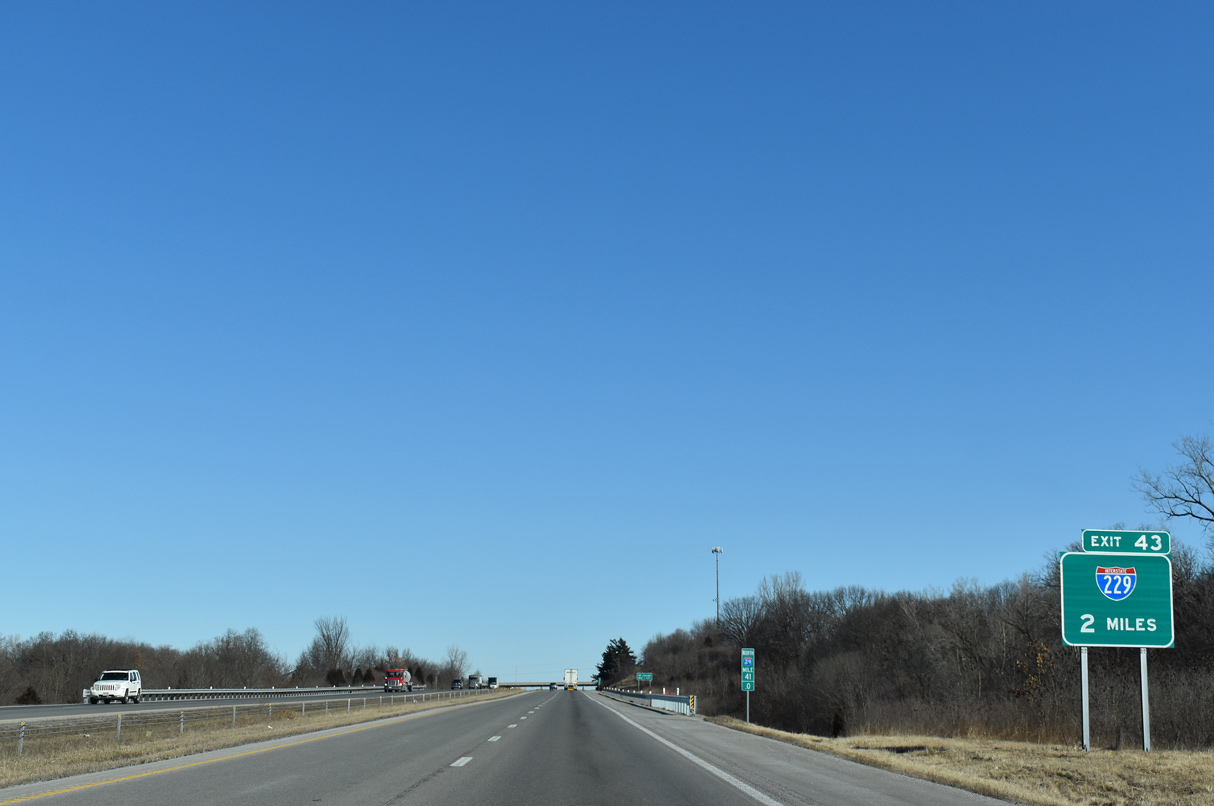
Exit 43 is the first of five interchanges for St. Joseph along I-29/U.S. 71. I-29 passes through eastern reaches of the city by Missouri State Western University while I-229 branches northwest toward the St. Joseph Stockyards along the Missouri River. 02/20/20
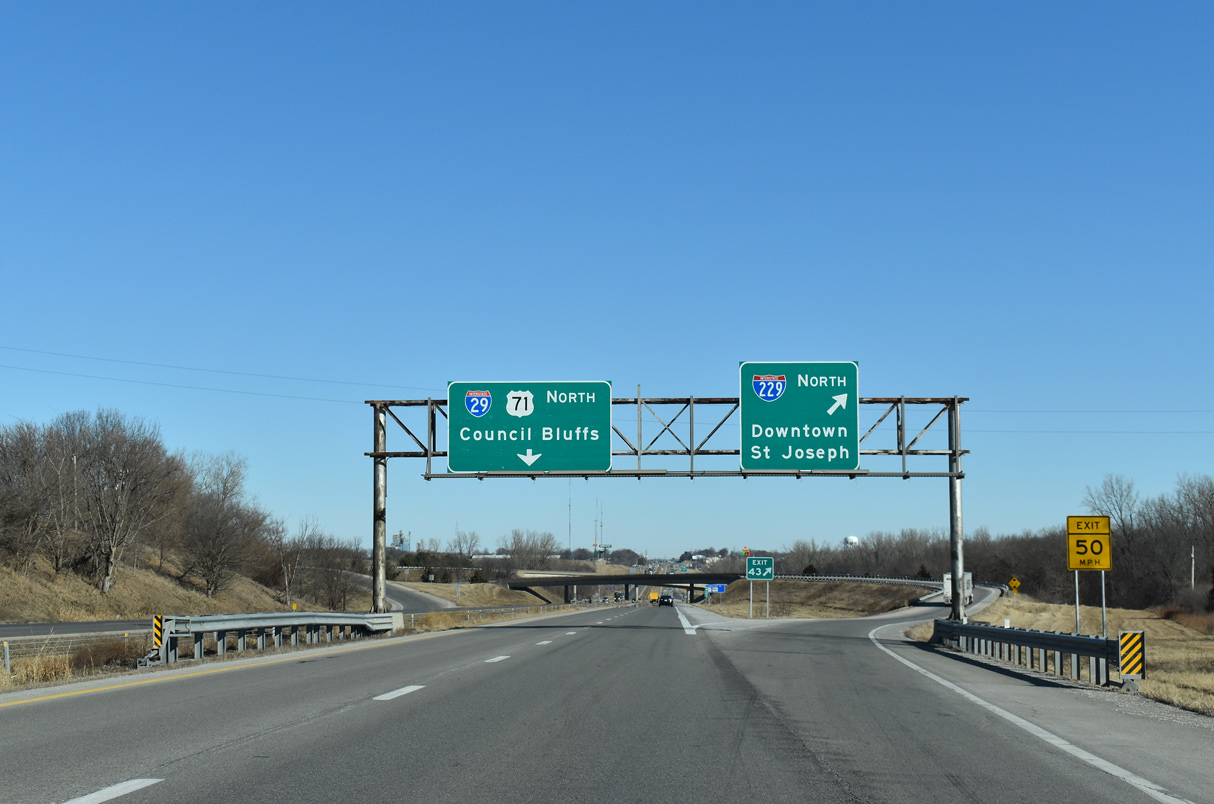
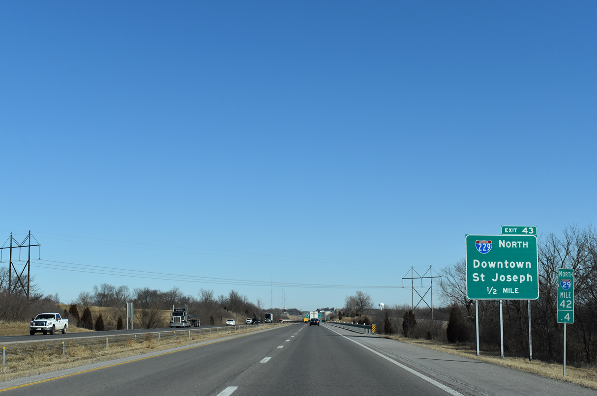
Exit 43 parts ways with I-29/U.S. 71 north for Interstate 229. The freeway loop reaches Downtown in 6.5 miles. 02/20/20
![]()
![]() South at
South at ![]()
I-29/U.S. 71 advance south from U.S. 169 and the end of Business Loop I-29 to a directional T interchange (Exit 43) with Interstate 229 leading back north to St. Joseph. Photo by Joseph Barnes (08/14/16).
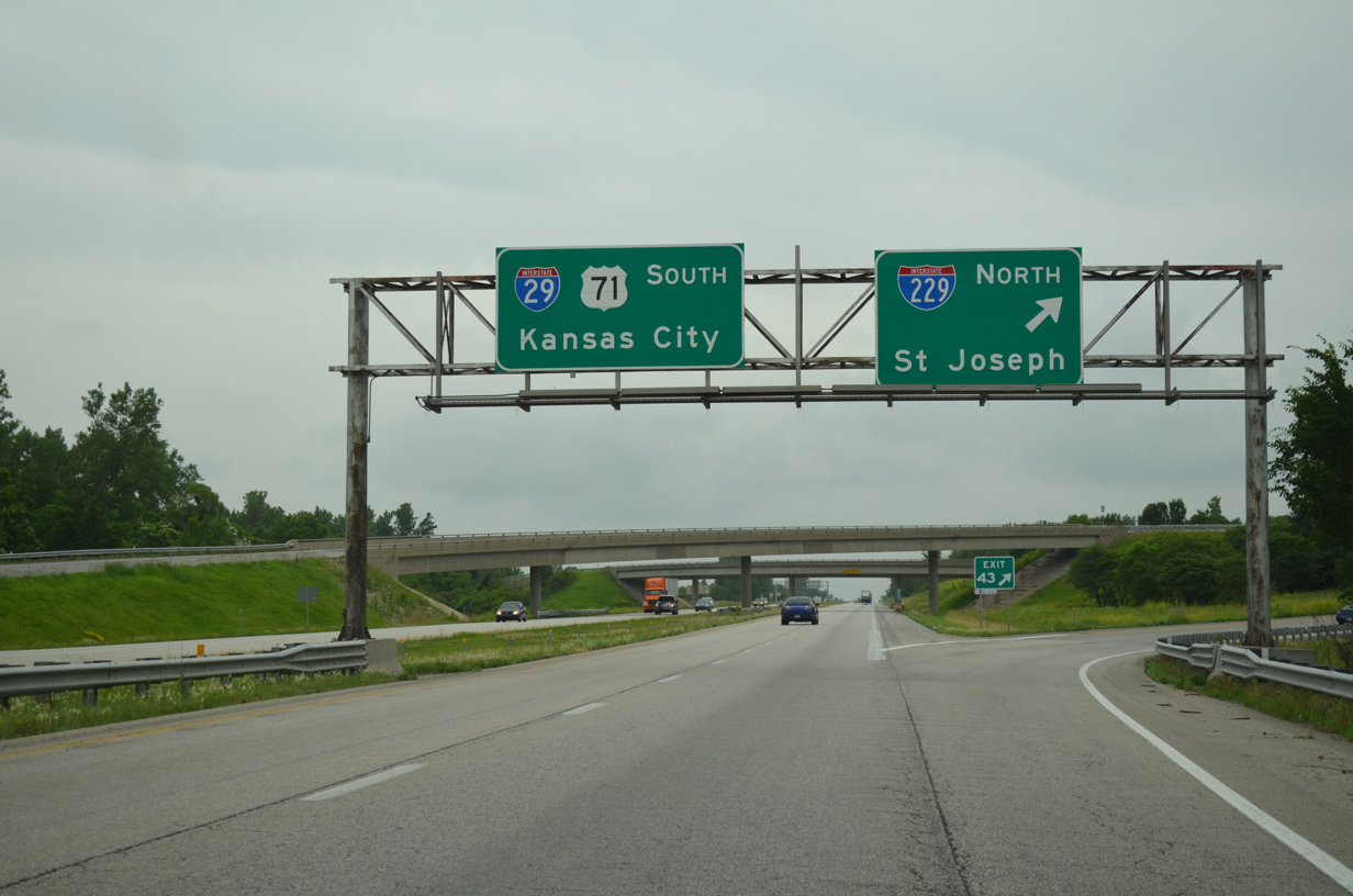
I-29/U.S. 71 continue uninterrupted south seven miles to Faucett while Exit 43 provides a direct route to Route 752 west for south St. Joseph and U.S. 59 southwest to Atchison, Kansas. 06/18/15
Sources:
- “What’s the future of the double-decker?” St. Joseph News-Press (MO), July 6, 2016.
- “MoDOT finds no evidence of falling I-229 concrete.” St. Joseph News-Press (MO), June 4, 2015.
- “Interstates celebrate golden anniversary Last section of I-29 opened in July 1976 ” St. Joseph News-Press (MO), June 26, 2006.
Page updated November 4, 2020.