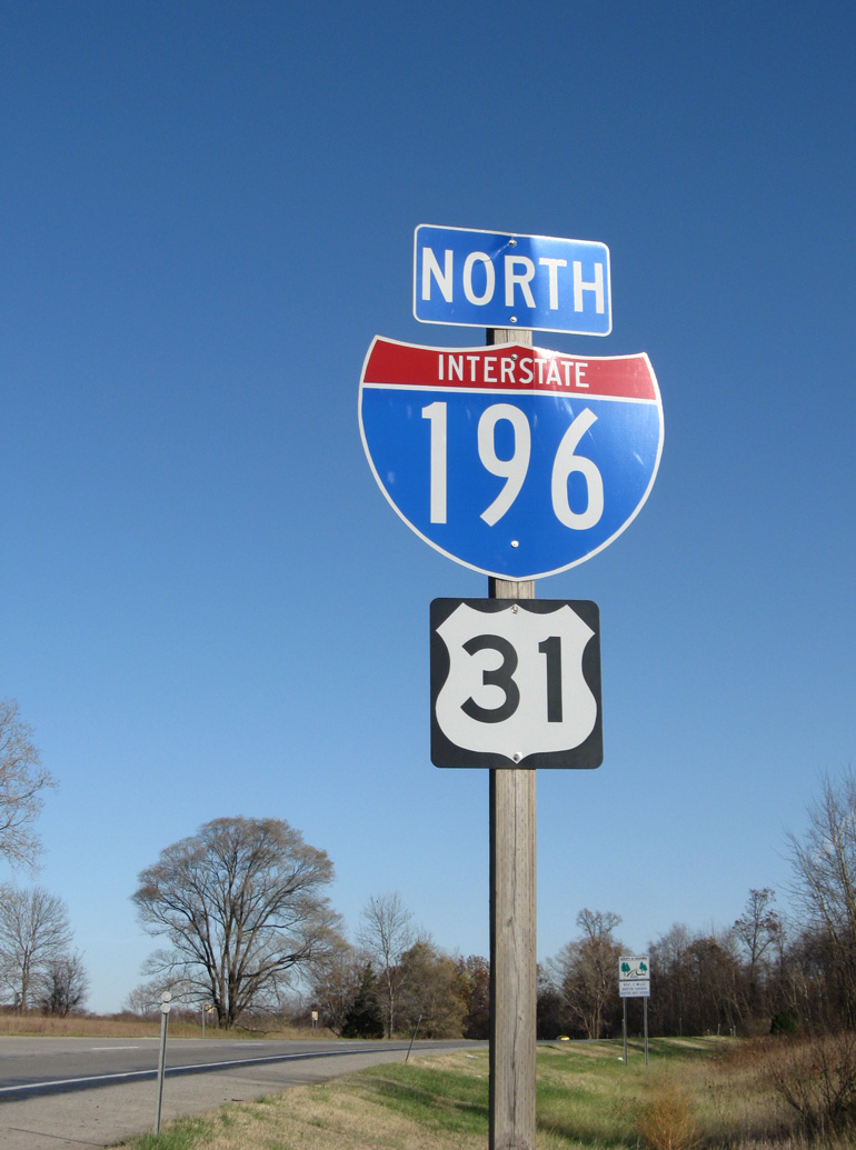
Interstate 196 Michigan
Overview
Interstate 196 provides a regional connection in part with Interstate 94 from the Chicagoland area and Michiana north to Grand Rapids and Muskegon along the east shore of Lake Michigan. Named after Gerald R. Ford, the freeway honors the 38th President of the U.S. 2016 Michigan Department of Transportation (MDOT) traffic counts along I-196 peak at 89,600 vehicles per day (vpd) north of Downtown Grand Rapids. With 20,915 vpd, the least traveled section of I-196 is the segment between Exits 13 and 18 near South Haven.
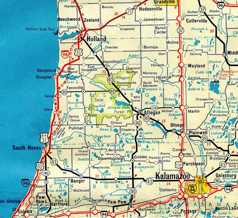
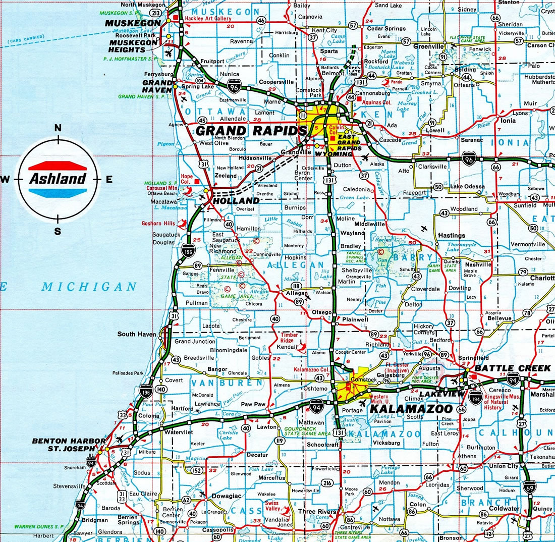
Doubling as U.S. 31, I-196 branches north from I-94 in a rural area outside the city of Benton Harbor. The two cross the Paw Paw River en route to Lake Michigan Beach, where they begin mirroring Lake Michigan coastline north into Van Buren County.
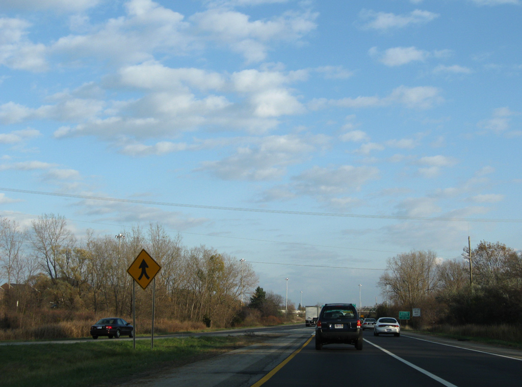
Heading north to Van Buren State Park, I-196/U.S. 31 travel just inland from the lake along a rural course populated by forested hills. Advancing to the city of South Haven, the first of three business routes from I-196 separates with the freeway. I-196 bypasses the city of 4,400 to the east, while Business Loop I-196 forms an L-shaped route to the city center.
Crossing into Allegan County, I-196/U.S. 31 resume a rural course and shift slightly further east before nearing the lake shore again near Saugatuck. Turning east to bypass the small city, the freeway crosses the Kalamazoo River adjacent to Douglas Bayou as I-196 begins to trend northeast toward Grand Rapids.
U.S. 31 separates from Interstate 196 at Holland, initially traveling an expressway along side Business Loop I-196. I-196 skirts the south side of Holland and the adjacent city of Zeeland to Exit 55, where Business Loop I-196 returns. A rural stretch ensues from there leading to Hudsonville and the Grand Rapids metropolitan area.
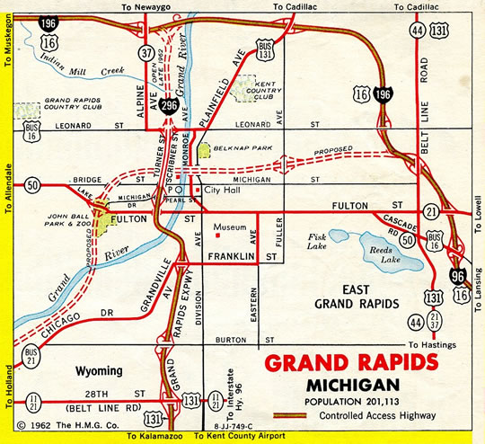
M-6 constitutes a freeway bypass south of Grand Rapids by way of Cutlerville and Gainesville Township to Interstate 96 leading east to Lansing. I-196 meanwhile curves northward into Kent County through urban areas of Grandville, Wyoming and the west side of Grand Rapids. A directional interchange where the roadways of U.S. 131 switch sides, connects the north to south freeway with Interstate 196 at its second crossing of the Grand River. The remainder of the freeway east passes through Downtown en route to the route end at Interstate 96.
 History
The Recommended Numbering plan for Interstate Highways in Michigan, compiled by the Michigan State Highway Department in the 1950s, outlined Interstate 67 along the freeway corridor leading southwest from Grand Rapids to Holland and Benton Harbor. I-196 was proposed as an urban loop encircling the west and south sides of Grand Rapids. Interstate 296, later the unsigned route for U.S. 131 through Grand Rapids, was proposed for what is now I-496 through Lansing.1
By 1958, the Michigan Interstate system was finalized, with I-96 designated along the U.S. 16 corridor west from Detroit to Lansing and Grand Rapids, and along the previously proposed route of Interstate 67 leading southwest to Holland and south to Benton Harbor. Interstate 196 was assigned to the freeway connecting Grand Rapids with U.S. 31 at Muskegon to the west.2
The I-196 freeway between Muskegon to Grand Rapids was finished in 1961, as was I-96 extending east from Grand Rapids to Lansing. Construction was underway to build the urban stretch of freeway through Grand Rapids, when AASHO approved a request by the state in 1963 to switch Interstates 96 and 196 west from Grand Rapids so that I-96 continued to Muskegon and I-196 would follow the route south to Benton Harbor. A 12.5 mile section of I-196 was completed in December 1964 from M-121 / Chicago Drive (Exit 69) east to I-96.2
Route Information
North End – Grand Rapids, MI
South End – Benton Harbor, MI
Mileage – 80.80
Cities – Benton Harbor, Holland, Grand Rapids, Grandville, Wyoming
- Junctions –


Source: December 31, 2021 Interstate Route Log and Finders List
I-196 Annual Average Daily Traffic (AADT)
| Location | Vehicles per day |
|---|---|
| Lake Michigan Beach | 23,811 |
| South Haven | 25,260 |
| Saugatuck | 28,021 |
| Holland | 17,650 |
| Zeeland | 33,005 |
| Hudsonville | 60,584 |
| Grandville | 72,671 |
| Grand Rapids | 87,785 |
Source: 2017 AADT – MDOT Traffic Volumes Map
Prior to the designation swap of I-96 and I-196, I-96 west defaulted onto I-196 west.
Initial construction of Interstate 196 (then I-96) along the east shore of Lake Michigan in 1963.
The final segment of Interstate 196, from Exit 44 near Holland to Exit 69 in Grandville, was completed in 1973.2
North End  – Grand Rapids, Michigan
![]() West at
West at ![]()
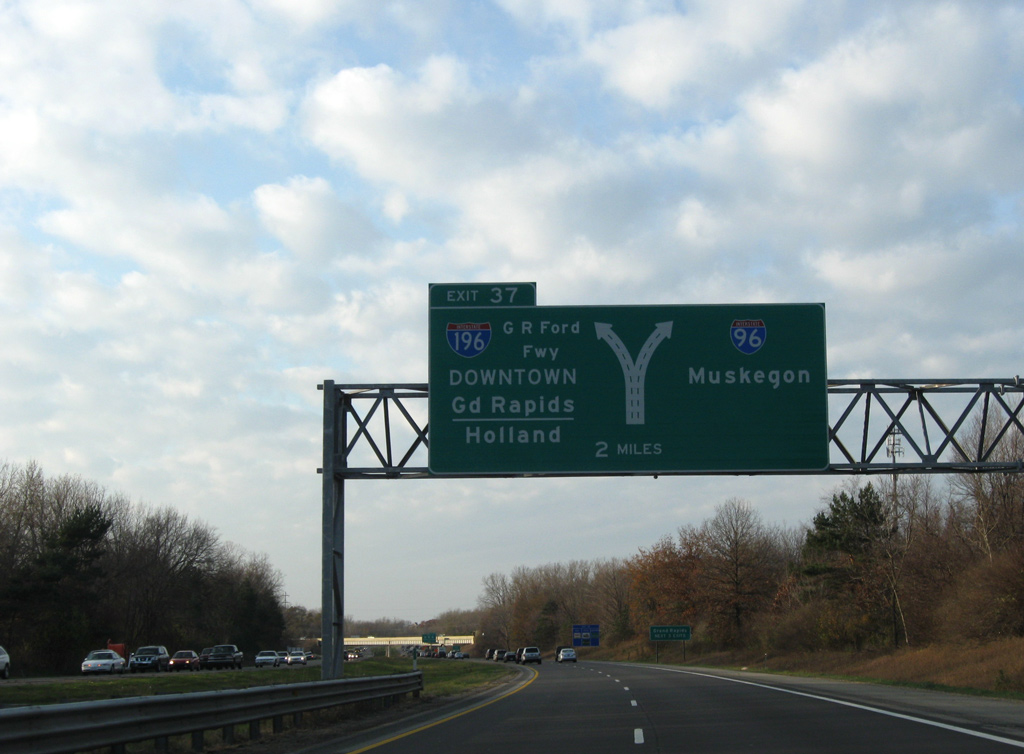
Curving northwest ahead of ramps from M-21 west and to M-44 and M-37, a diagrammatic sign precedes the westbound split of I-96/196 at Exit 37 in two miles. This assembly was replaced by 2011 with an arrow per lane (APL) sign. The APL sign was missing by 2014, and a new panel without any arrows was installed by 2015. 11/05/09
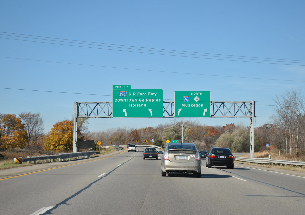
Two lanes partition for both Interstate 196 (Gerald R. Ford Freeway) west to Downtown Grand Rapids and the continuation of I-96 west / M-37 north to Comstock Park and Muskegon. New signs added here include an exit only placard for the left side ramp to I-196. 11/05/11
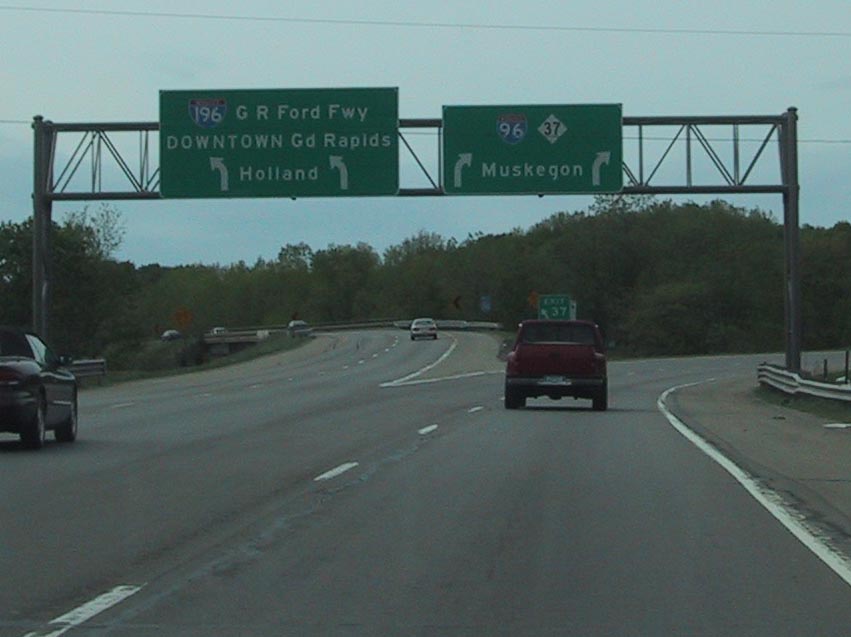
The previous set of guide signs posted at the separation of I-96 and I-196 westbound. Holland was dropped as a control city for I-96 by 2015. Photo by Eric W. Vander Yacht (04/01).
![]() East at
East at ![]()
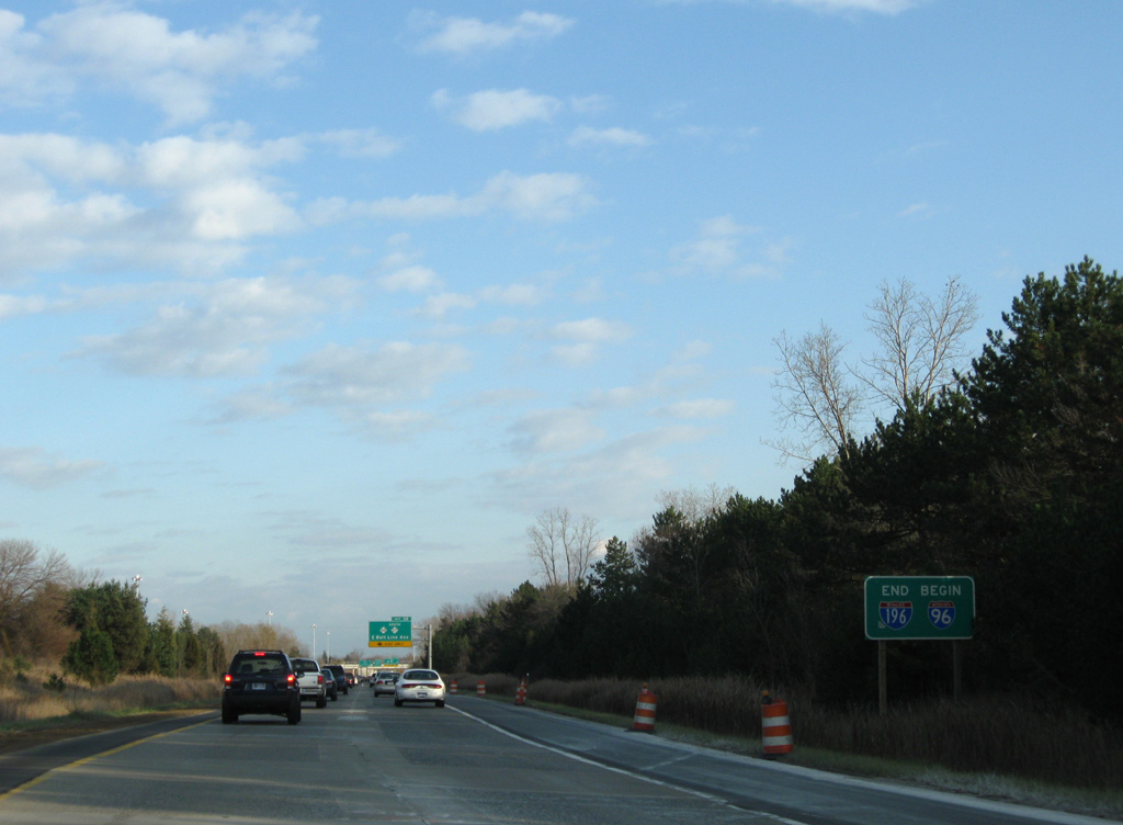
Paralleling Oak industrial Drive and the Grand Rapids Eastern Railroad, Interstate 196 defaults onto I-96 east from Fuller Avenue / Exit 79. 11/05/09

The merge with Interstate 196 expands I-96 east to four overall lanes to the adjacent parclo A2 interchange (Exit 38) with the departing M-37 south and M-44 (E Belt Line Avenue). 11/05/09
Interstate 196 east concludes at a wye interchange with I-96. 11/05/09
South End – Benton Harbor, Michigan
![]()
![]() South at
South at ![]()
Interstate 196 leads three quarters of a mile south from a parclo A2 interchange (Exit 1) with Red Arrow Highway to I-94. 11/05/11
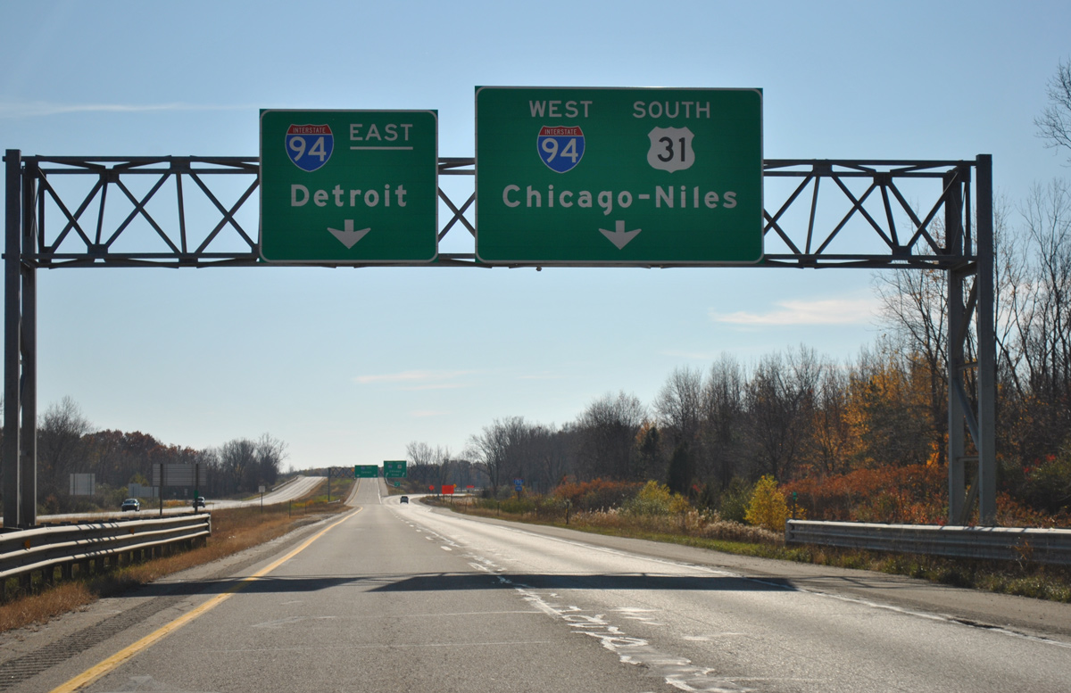
Traffic separates into dual lane ramps for I-94 west / U.S. 31 south to Benton Harbor and I-94 east to Kalamazoo. Construction for the link just south of here to the freeway along U.S. 31 south to Niles and South Bend, Indiana commenced in Fall 2020. Guide signs here for the I-94 were replaced to use Clearview font by 2012. 11/05/11
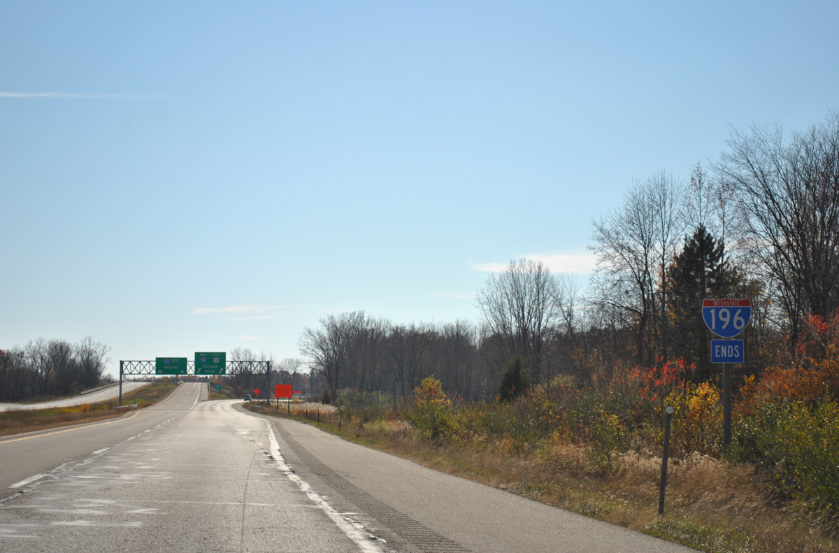
An end shield for Interstate 196 precedes the trumpet interchange with I-94. 11/05/11
With traffic added from I-196/U.S. 31 south, 2016 counts recorded by MDOT along I-94 increased from 38,038 vpd ahead of I-196 to 61,700 vpd after I-196. Leading away from Benton Harbor, I-94 continues west to Michigan City and Gary, Indiana and Chicago. U.S. 31 heads south ultimately to Indianapolis. 11/05/11
![]() East
East ![]() North at
North at ![]()
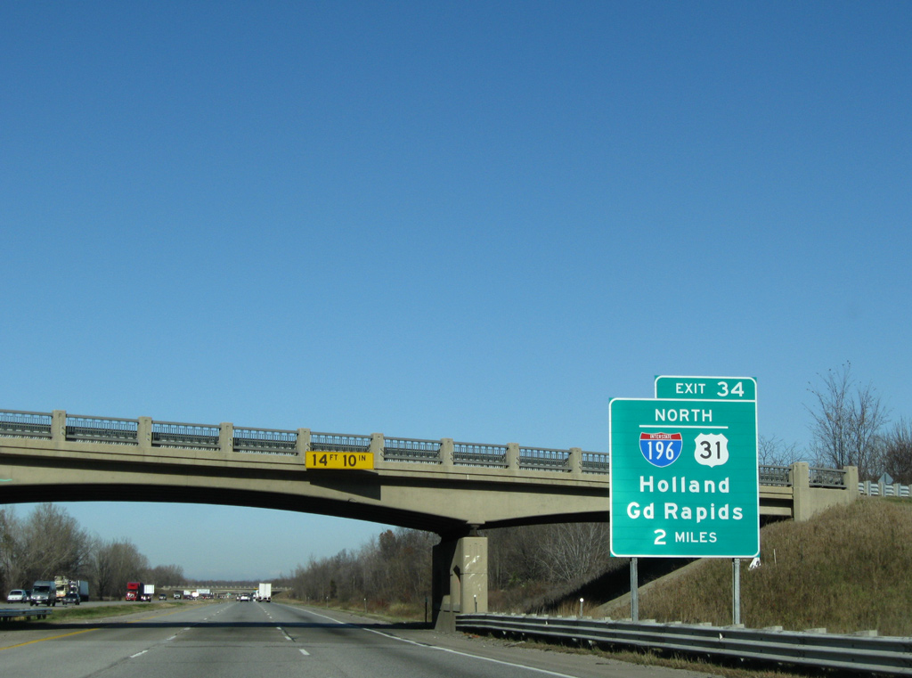
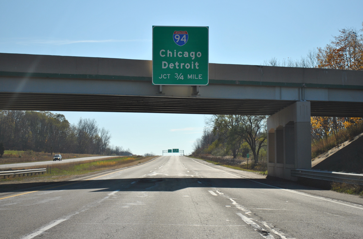
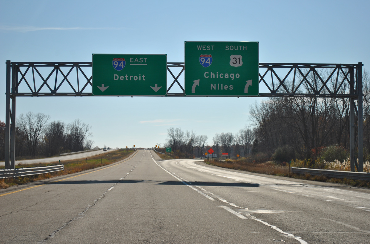
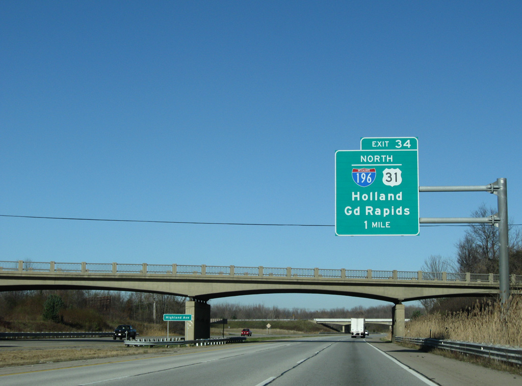
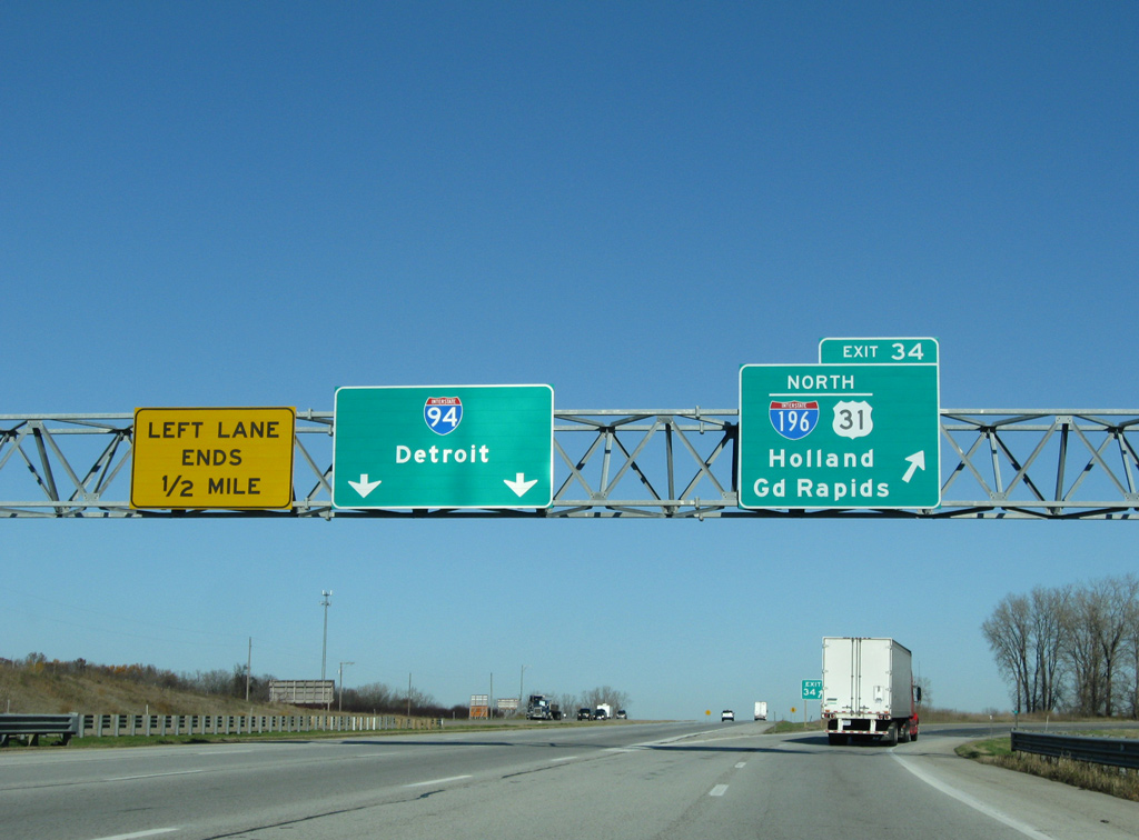
I-94/U.S. 31 combine from Napier Avenue (Exit 30) north to Interstate 196 (Exit 34). Construction completing the freeway along U.S. 31 north from Berrian Springs to I-94 at Business Loop I-94 extends along this stretch to May 2023. The two mile guide sign for I-196 at the Empire Avenue overpass here was replaced to use Clearview font by 2015. 11/05/09
One mile ahead of the trumpet interchange (Exit 34) with Interstate 196 and the northbound split with U.S. 31 on I-94 east. Highland Avenue spans the freeway here, followed by the east end of the Benton Harbor business loop for I-94. 11/05/09

Interstate 94 east / U.S. 31 north cross over Blue Creek and below Benton Center Road just ahead of Exit 34 for I-196. I-196 runs north along Lake Michigan to South Haven, Douglas and Saugatuck. Bridge repainting in late 2011 resulted in the replacement of this overhead. 11/05/09
U.S. 31 accompanies Interstate 196 north for 45 miles to Holland and Business Loop I-196. U.S. 31 varies between a four lane, divided highway or freeway northward to Muskegon and Ludington. I-196 turns east from the split with U.S. 31 to Zeeland and Grand Rapids. 11/05/09
 South End – Throwback

The first confirming marker for Interstate 196 was posted along the eastbound off-ramp (Exit 34) from I-94. It was removed by 2011. Photo by Jeff Morrison (06/24/07).
Sources:
- Stephen Summers’s Interstate system route numbering, former web site.
- Michigan Highways: Highways 180 through 199.
Page updated June 29, 2022.