Interstate 185 Georgia

Overview
Interstate 185 in Georgia is a 49 mile long freeway that links Columbus and Fort Moore with I-85 at LaGrange. The route doubles as unsigned Georgia State Route 411, with the southernmost ten miles comprising an urban route with six lane sections, and the remainder north across Harris and Troup Counties as a four lane rural freeway.
Lindsey Creek Parkway extends south from I-185 as a freeway into Fort Moore, with three additional interchanges. The route is restricted to military traffic south of U.S. 27-280/SR 520 (Victory Drive).
The Georgia State Transportation Board designated 39 miles of I-185, from Exit 12 northward to Interstate 85, as a “Scenic Byway” on October 18, 2007.1 Within Harris County in November 1997, the Georgia Department of Transportation (GDOT) named Interstate 185 as the “Chet Atkins Parkway”, in honor of the legendary country guitarist who lived in the area during his teenage years.
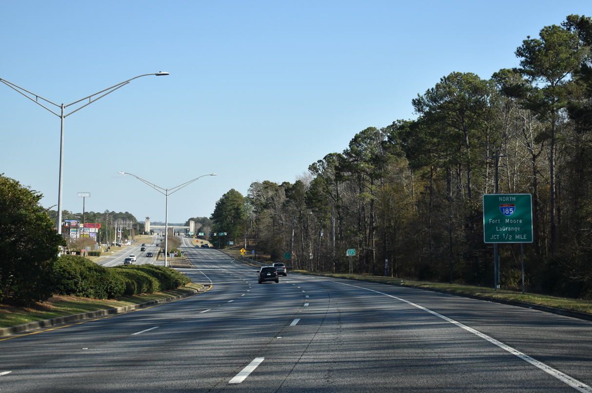
The north end of Interstate 185 includes provisions for an extension. Plans in 1995 involved constructing a five-mile bypass route for U.S. 27, between I-85 and eastern reaches of West Point Lake. $70 million in highway improvements scheduled for the LaGrange area in 1999 included building the bypass and redesigning the exchange between I-85 and I-185 at a cost of $17.7 million.2 Those plans never moved forward however and by 2007, GDOT indicated that the LaGrange Bypass no longer had a projected date.3
Efforts from Albany business and government leaders in 2006 involved lobbying GDOT for an extension of Interstate 185 south from Fort Moore to Monticello, Florida by way of Albany. Benefits cited included the generation of jobs and economic growth for southwest Georgia in addition to traffic relief on Interstate 75. The suggested corridor utilized SR 520 (Corridor Z) south from Columbus to Albany, and U.S. 19 from there to Camilla, Pelham, Thomasville and Interstate 10, south of Monticello.4,5
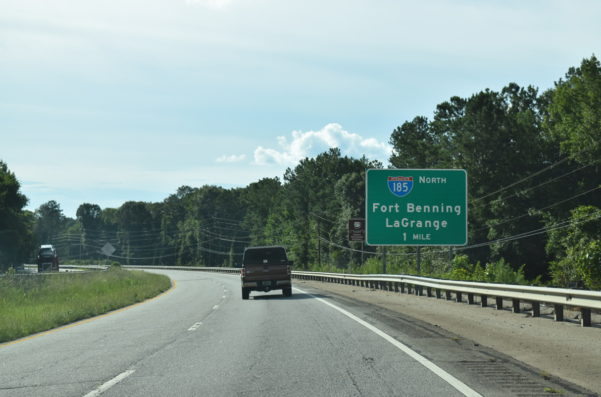
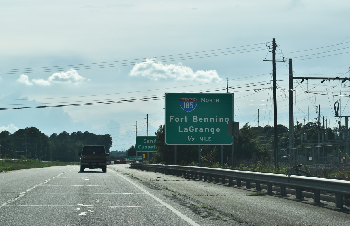
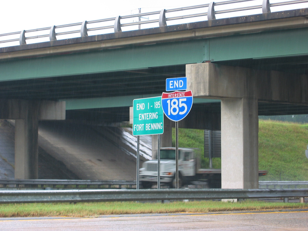
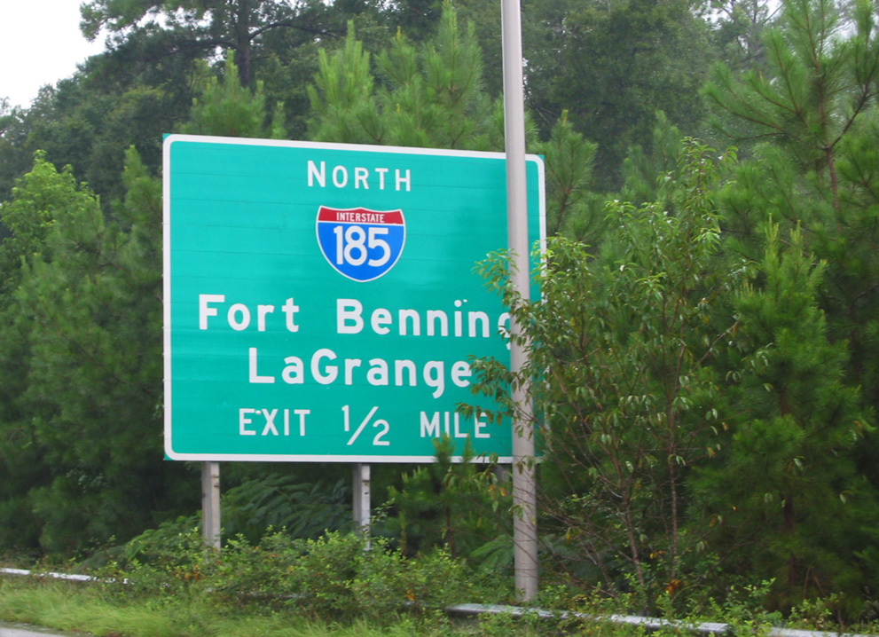
Fort Benning was renamed to Fort Moore by the U.S. Army as part of a national effort to remove references of the Confederate States of America. A ceremony rededicating the Army training base for Lt. General Harold “Hal” G. Moore, Jr.. and Julia “Julie” Moore took place at Doughboy Stadium near Columbus on May 11, 2023.6 Signs showing Fort Benning for Interstate 185 were amended to display Fort Moore by July 2023.
 History
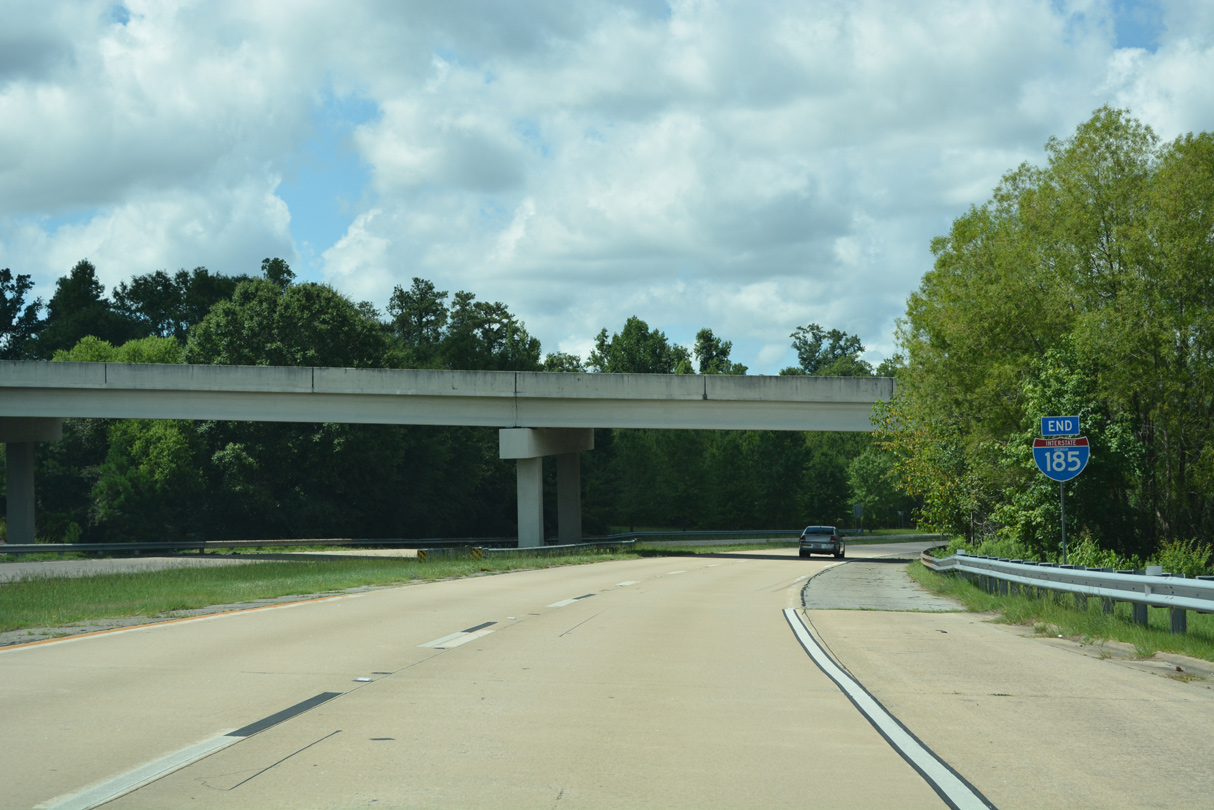
Designated by the American Association of State Highway Officials (AASHO) on June 23, 1969, Interstate 185 was constructed between September 1964 and February 1981.7,8 The route was formally extended southward from SR 22 to U.S. 27 by the American Association of State Highway and Transportation Officials (AASHTO) on December 7, 1984 over what was previously signed as just State Route 411.
$60 million in construction upgraded a 2.3 mile long stretch of Interstate 185 north from U.S. 27-280/SR 520 (Victory Drive) to St. Marys Road / Exit 3. The six lane expansion project ran from 2007 to July 2011.9 Freeway widening was underway in conjunction with a $17.6 million contract to replace the loop ramp from Victory Drive east to I-185 north with a two lane directional ramp.10
Route Information
North End – Fort Moore, GA
South End – LaGrange, GA
Mileage – 49.30
Cities – Columbus
- Junctions –

Source: December 31, 2021 Interstate Route Log and Finders List

Interstate 185 overtook the original Lindsey Creek Bypass of Columbus. The freeway was built as a new alignment for Georgia State Route 1, the counterpart of U.S. 27 throughout Georgia.
The final segment of I-185 under construction between Exit 14 / Smith Road and Exit 42 / U.S. 27. 1979 Georgia Official Highway Map
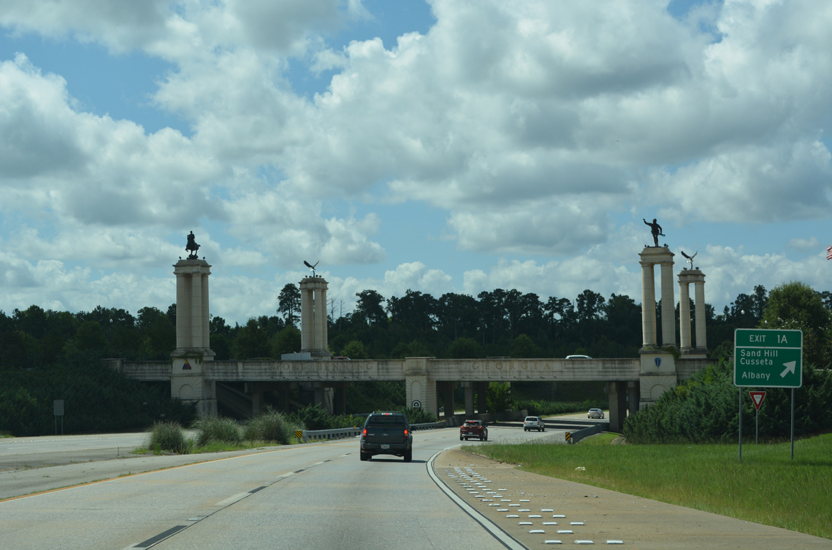
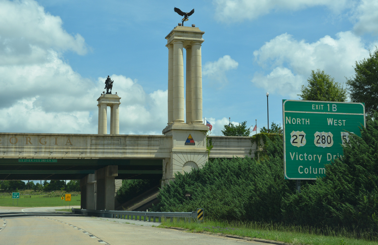
An additional $6.8 million in enhancements at the south end of I-185 redesigned the directional cloverleaf interchange with aesthetic improvements including four towering monuments, 20 water fountains and twenty 50 foot high flag poles that are illuminated at night. The monuments represent the Infantry and Armor Schools at the Maneuver Center of Excellence located in Fort Moore. Statues adorning the tops of the 50 foot towers include two American eagles, the Follow Me Soldier and the Trooper on the Plains. A ribbon cutting ceremony for the completed project was held at the National Infantry Museum & Soldier Center on October 13, 2011.10 An aerial photograph of the improved interchange graced the cover of the 2013-14 Georgia Official Highway and Transportation Map.
 Photo Guides
North End  – LaGrange, Georgia
![]() North at
North at ![]()
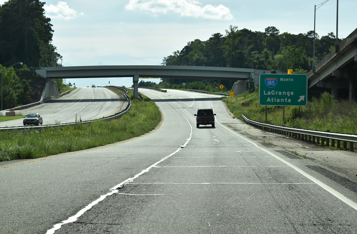
The first guide sign for Interstate 85 appears along I-185 north at Long Cane Creek. 07/29/22
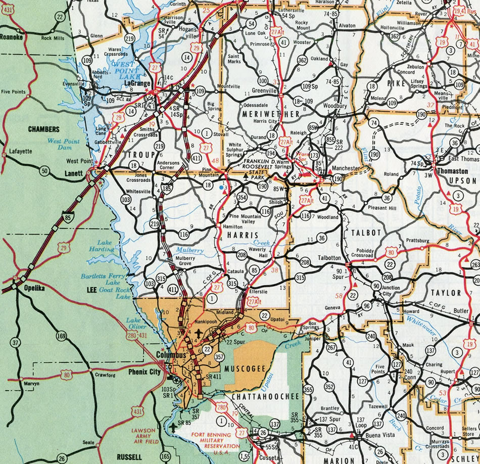
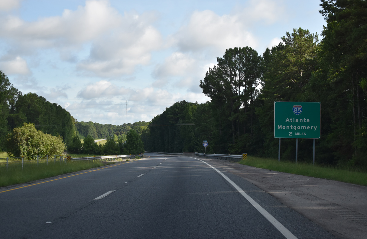
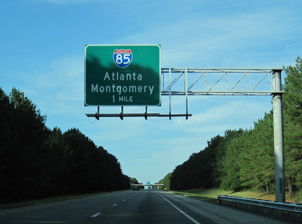
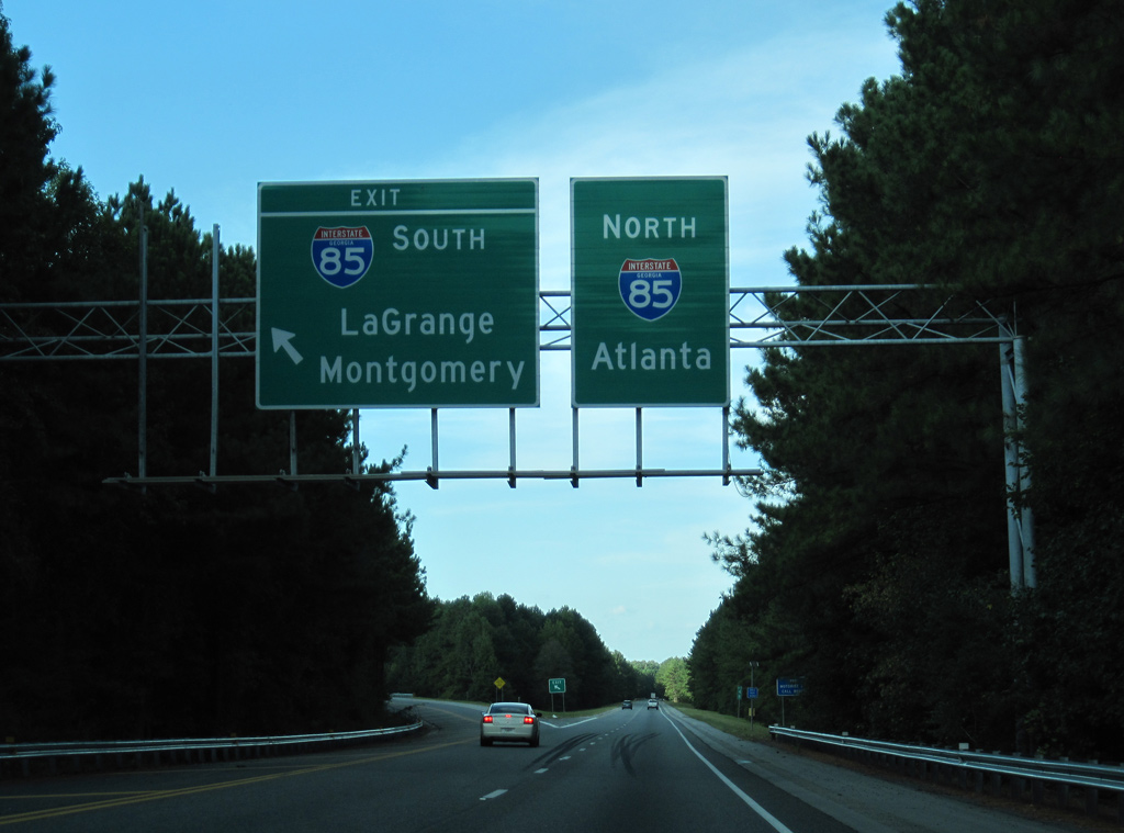
One mile south of Interstate 85 on I-185 northbound. The city of Atlanta is 55 miles to the northeast while the capital of Alabama is 95 miles to the southwest. 07/29/22
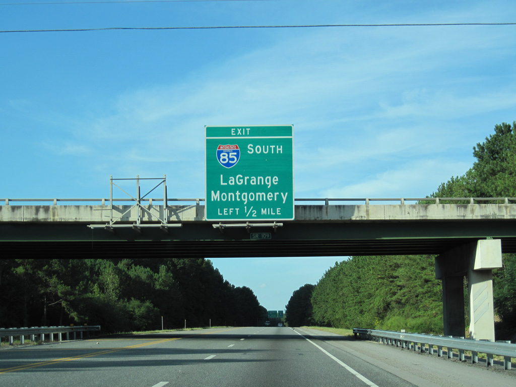
SR 109 (Greenville Road) spans I-185 a half mile ahead of the separation of traffic for Interstate 85. 07/29/22

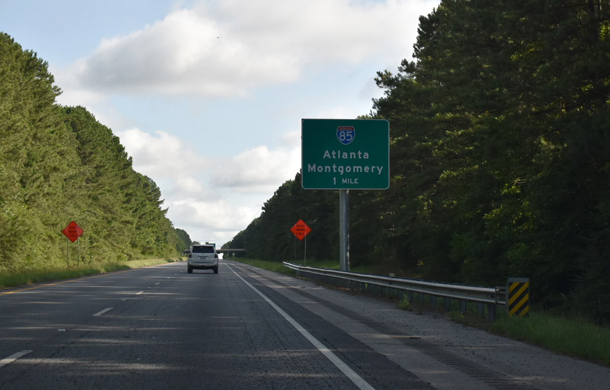
The unnumbered left exit for I-85 south extends 0.8 miles north to a loop ramp. The entrance ramp for I-85 north continues another 1.4 miles onto a 7.5 mile long exit less stretch to SR 54/100 at the city of Hogansville. 07/26/22
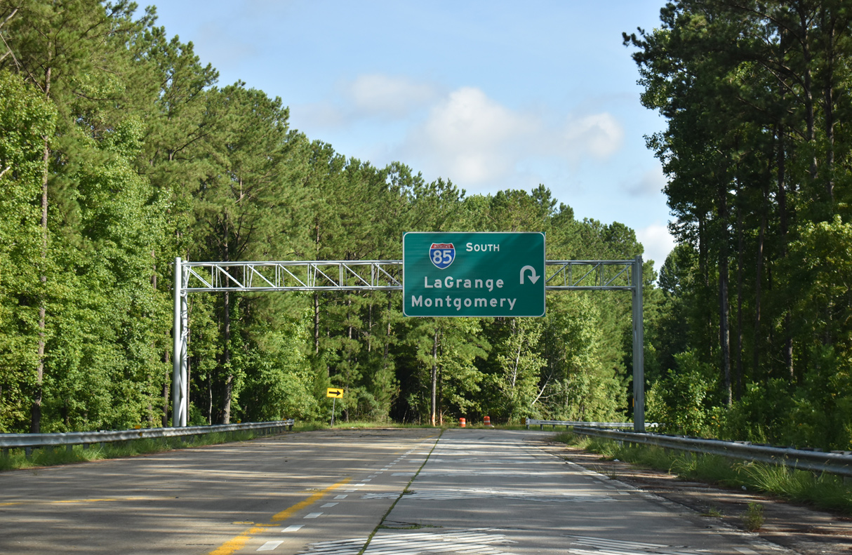
A stub follows for the unbuilt LaGrange bypass. LaGrange, the seat of Troup County, lies just to the west of I-85 via SR 109. 07/26/22
![]() South at
South at ![]()

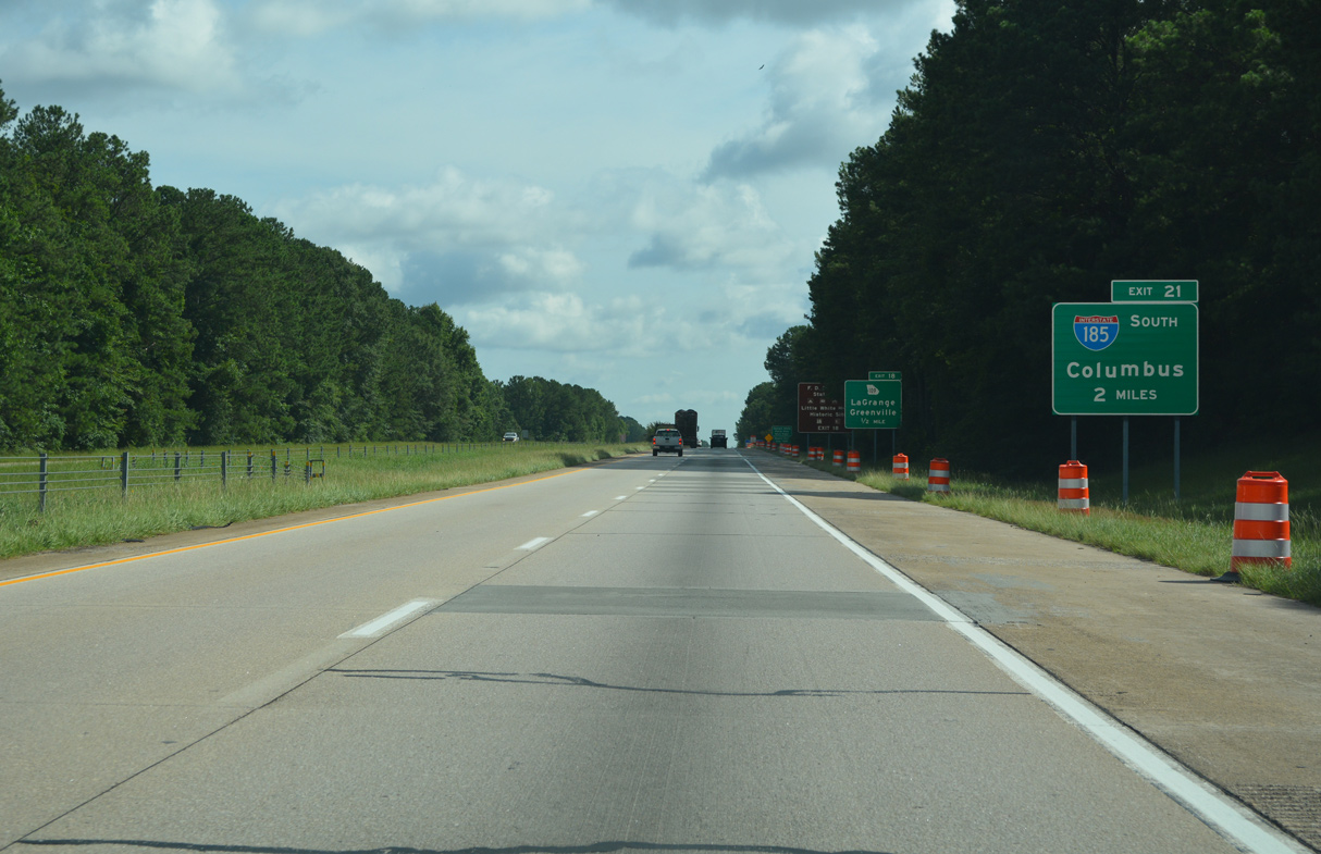
Interstate 85 spans Beech Creek ahead of a weigh station along the two miles preceding Exit 21 for I-185 south. 12/31/12
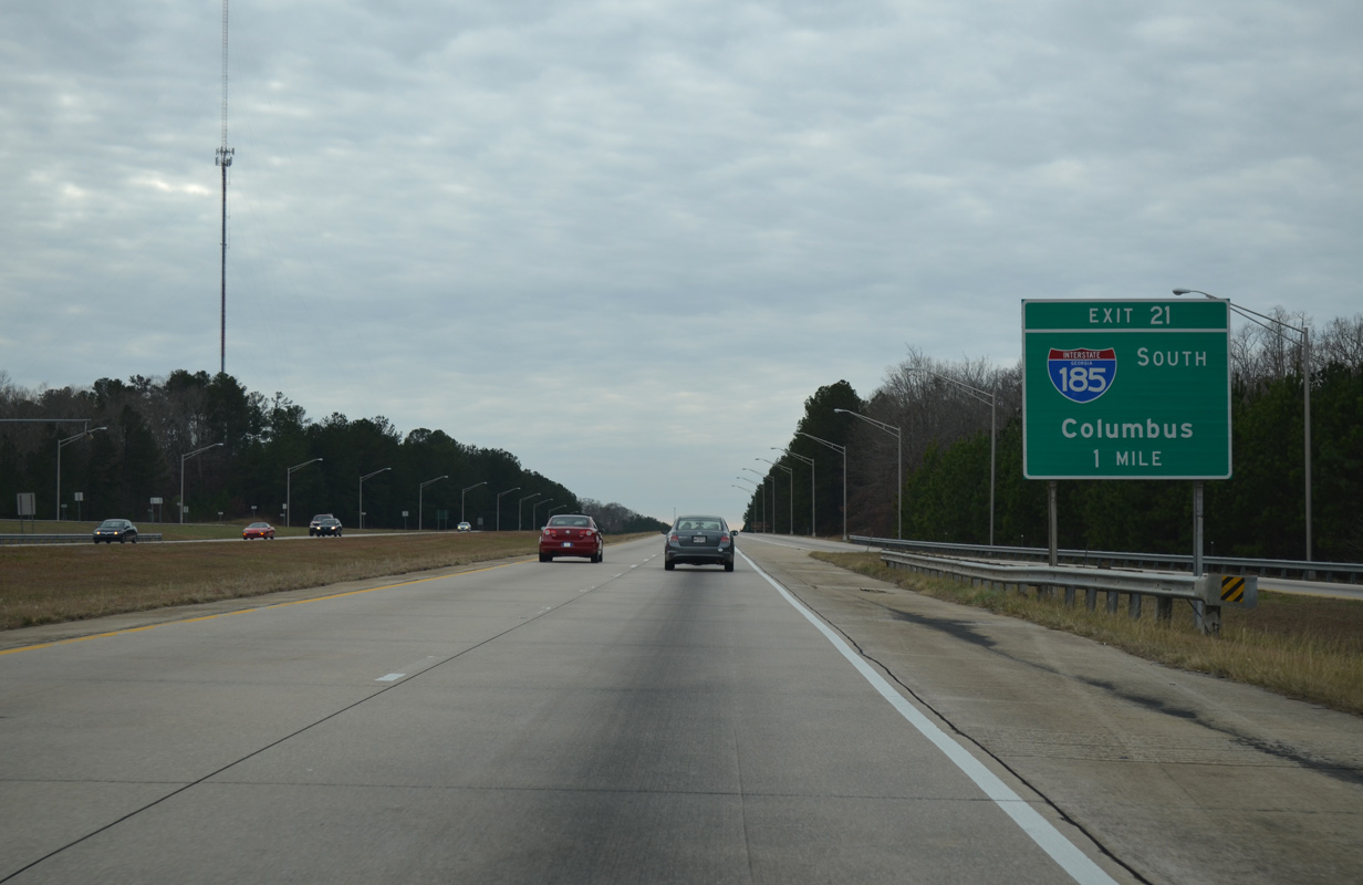
A sweeping off-ramp at Exit 21 departs one mile south of the weigh station for the rural drive across southern Troup County to Harris County and Columbus. 12/31/12
A third southbound lane opens along I-85 south at the Hines Road overpass for Exit 21 / I-185. A set of sign brackets remains from what would have been an overhead for the unbuilt ramp to the LaGrange bypass (U.S. 27). U.S. 27 travels along a four lane corridor from north of LaGrange to Franklin, Carrollton and Rome. 12/31/12
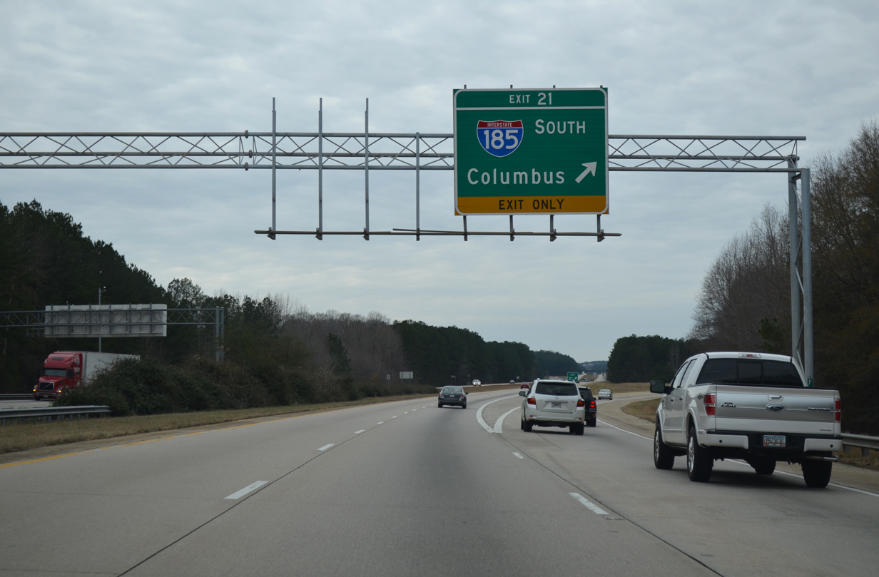
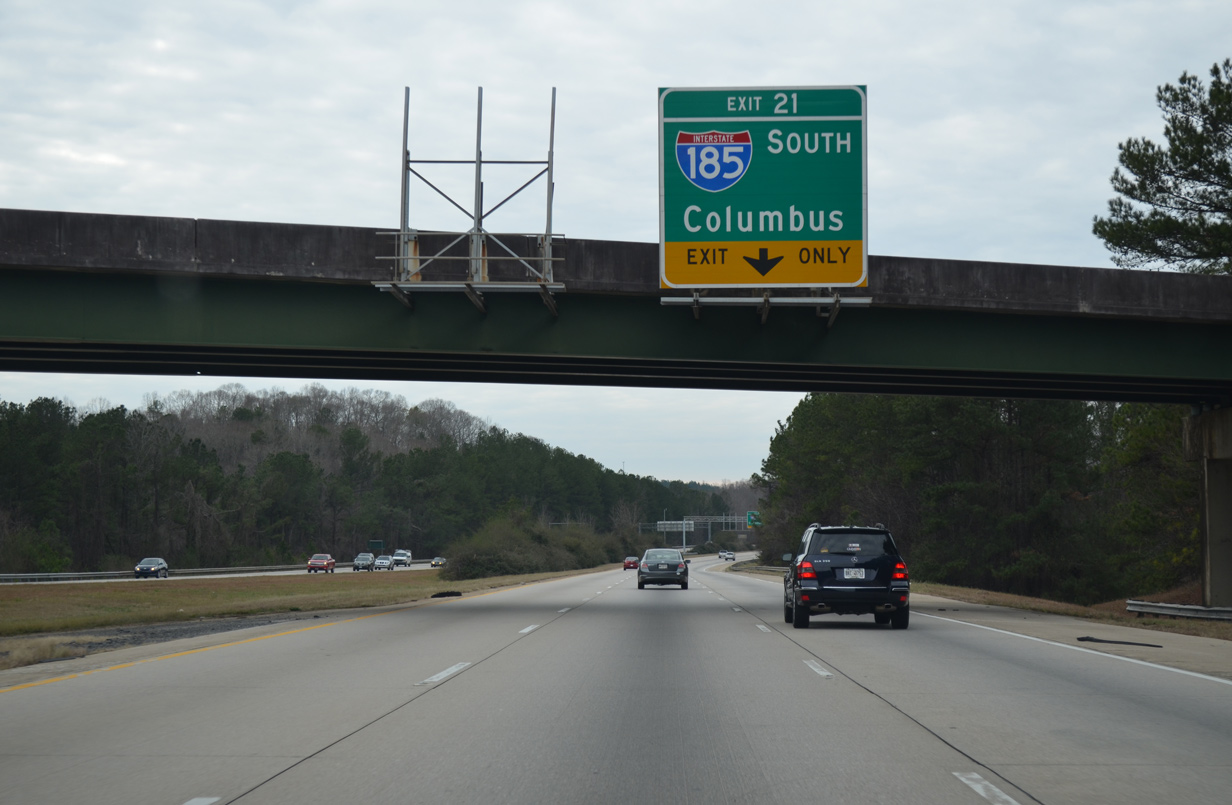
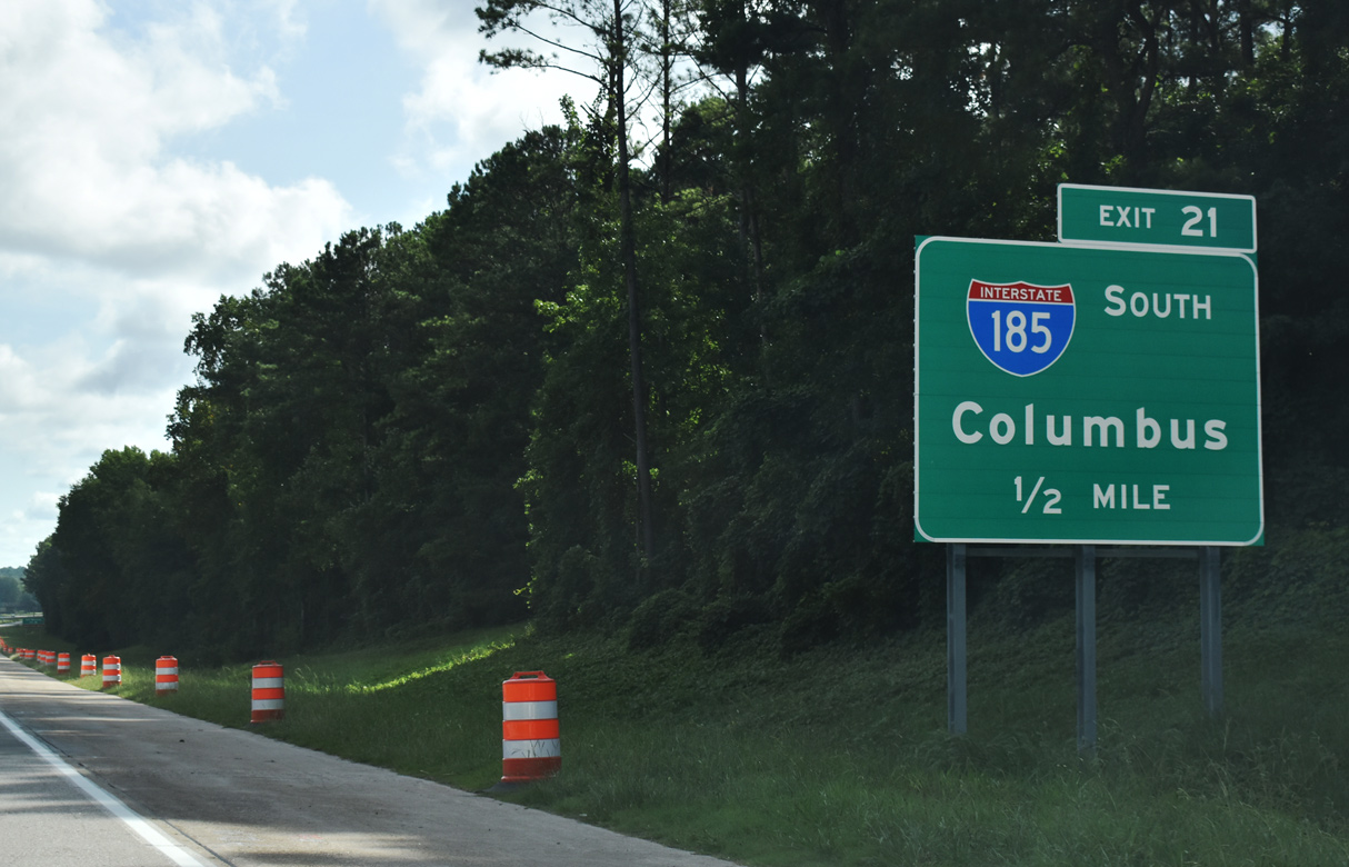
Exit 21 leaves I-85 south for Interstate 185. The freeway reaches the Columbus city limits in 35 miles. 12/31/12
![]() North at
North at ![]()
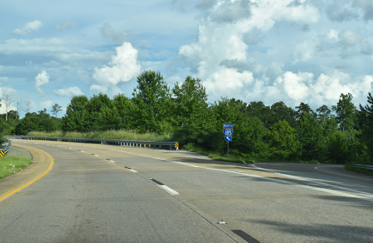
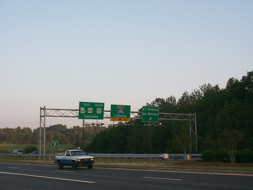
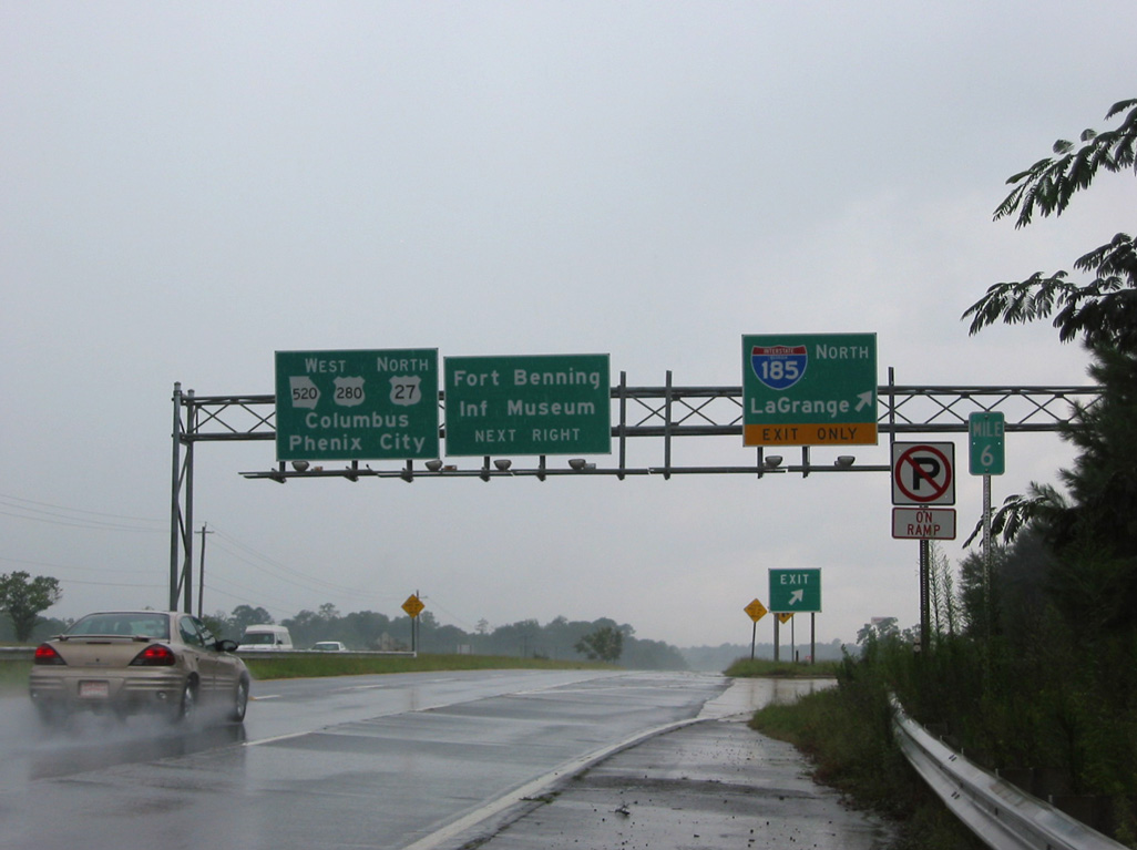
The two mile sign for Interstate 185 precedes the diamond interchange (Exit 18) with SR 109 on the east side of LaGrange. 07/27/22

Exit 18 departs from I-85 north, 1.25 miles ahead of Exit 21 for Interstate 185. SR 109 connects LaGrange with the Meriwether County seat of Greenville. There is no access to I-185 from the state route. 07/27/22
The entrance ramp from SR 109 joins I-85 north just ahead of Exit 21 to Interstate 185. I-185 serves Phenix City, Alabama via a connection from U.S. 80 (J.R. Allen Parkway), 40 miles to the south. 07/27/22

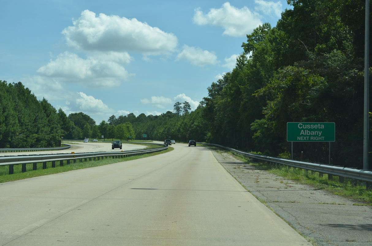
Exit 21 departs from I-85 northbound at mile marker 19 as the I-185 exit number is derived from the southbound off-ramp. I-185 leading south to Exit 14 is designated a Scenic Byway as it traverses low rolling hills and Pine Mountain. 07/27/22
 North End Throwback
![]() North at
North at ![]()

The previous first sign for I-85 on I-185 north was posted 1.75 miles out instead of two. 09/28/10
The overhead assembly for I-85 preceding the SR 109 overpass was replaced between March and July 2022. 09/28/10
An empty sign bracket along the SR 109 (Greenville Road) overpass alluded to an unconstructed LaGrange bypass for U.S. 27. 09/28/10
Chevrons are painted both over the wide inside shoulder and along the southbound connection for Interstate 85. 09/28/10
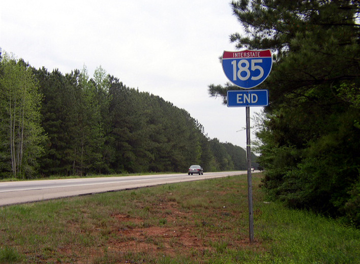
A pair of end shields for Interstate 185 were posted along the ramp to I-85 northbound. These were removed by 2008. Photo by Chris Patriarca (04/06/03).
![]() North at
North at ![]()

Ground level guide signs along Interstate 85 north in Troup County were replaced after February 2019. 04/13/12
The guide sign posted a quarter mile from I-185 on I-85 northbound was replaced with a new assembly preceding Exit 21 by a half mile. 04/13/12
![]() South at
South at ![]()
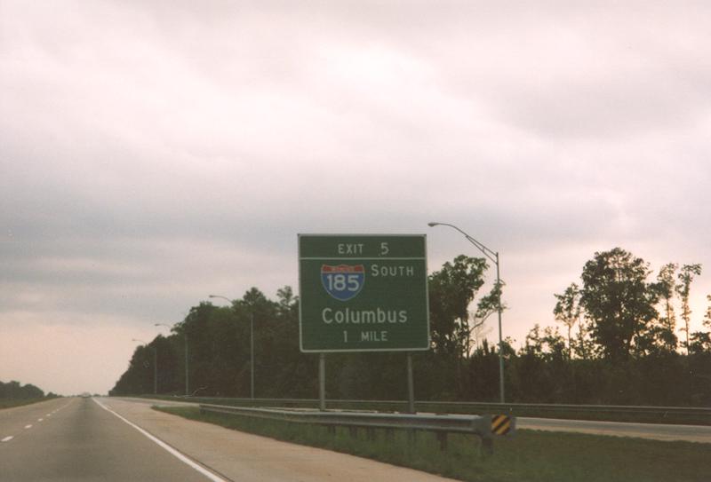
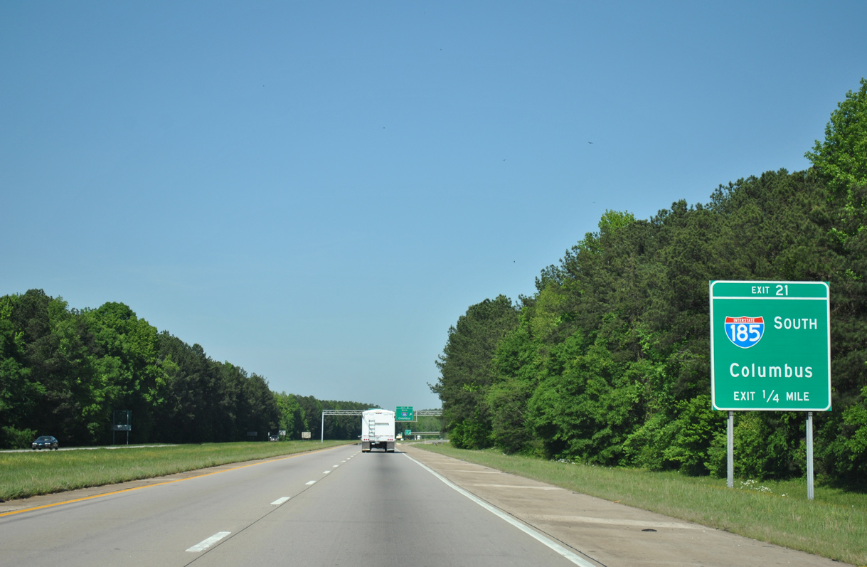
This guide sign for Exit 5 and I-185 south was replaced during the 1999 statewide exit renumbering project. 04/95
South End 
 / Lindsey Creek Parkway – Fort Moore, Georgia
![]() South at
South at ![]()
![]()
![]()
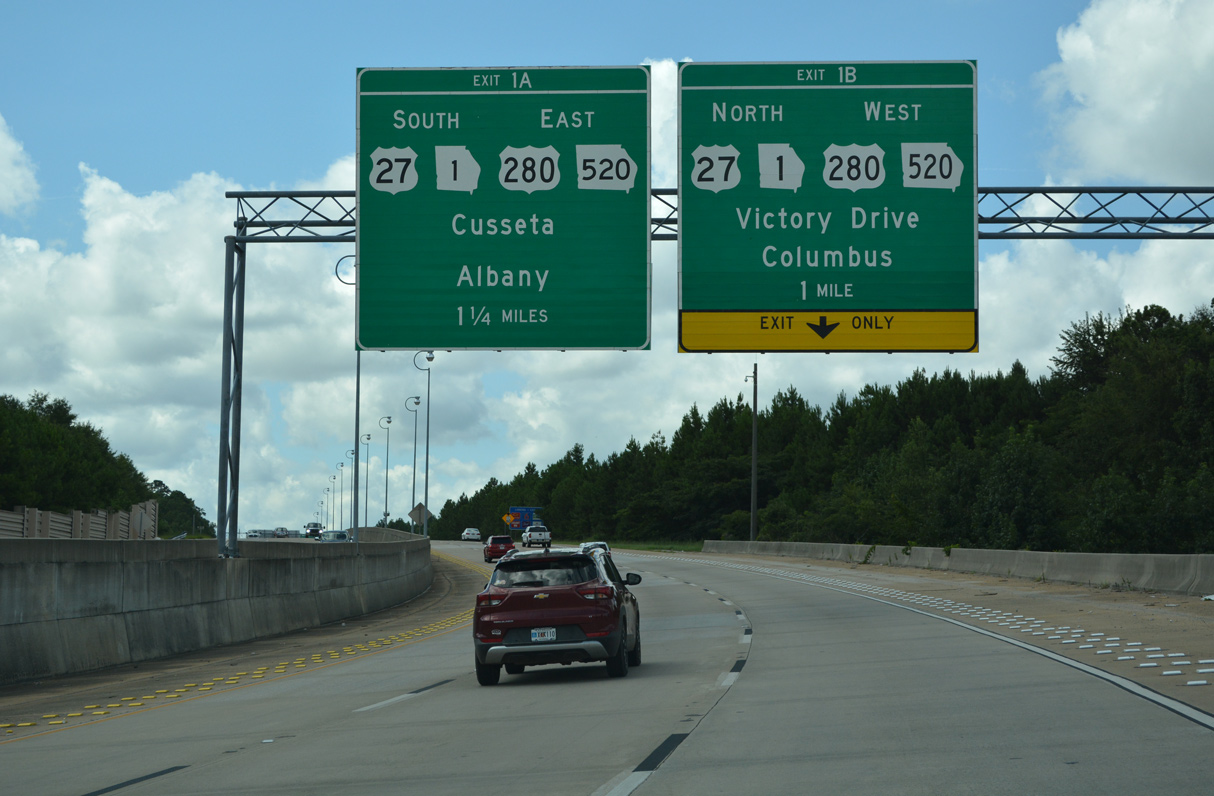
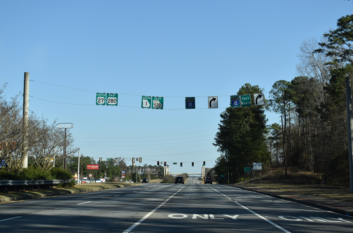
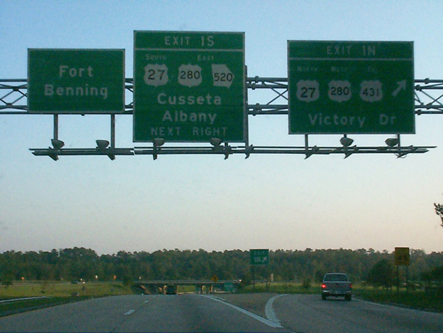
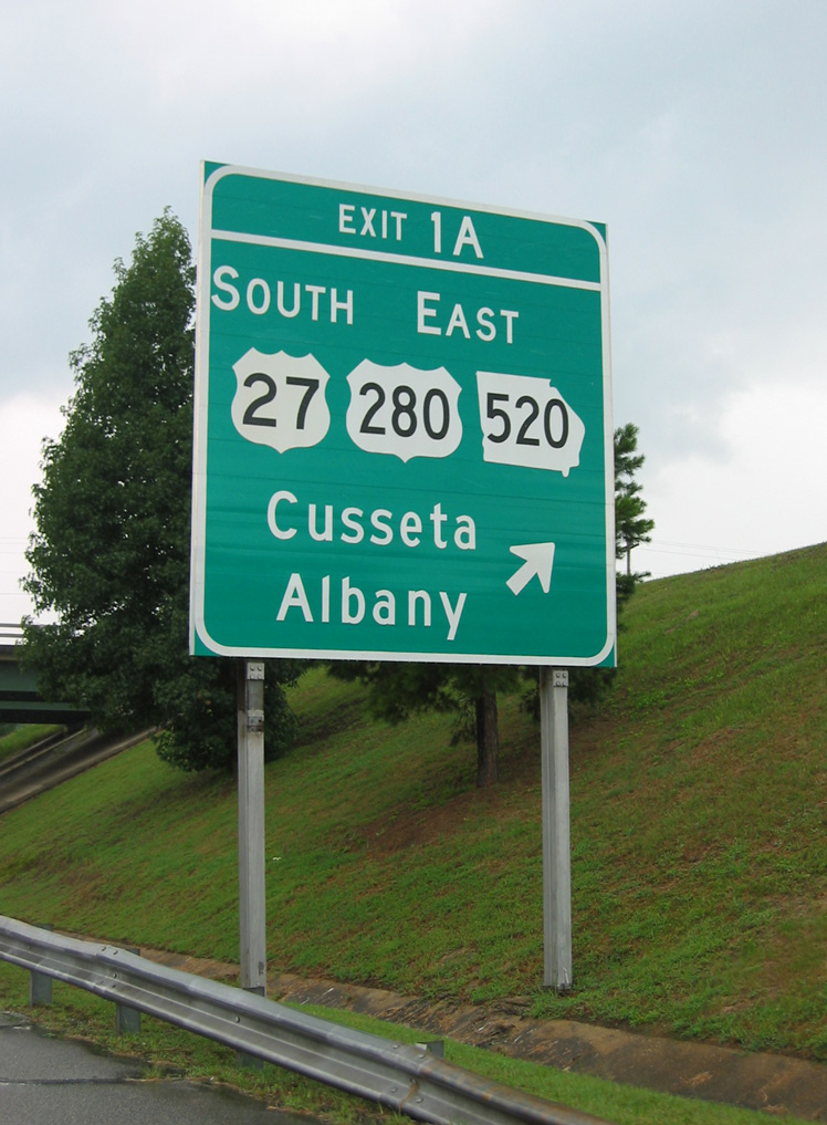
The south end of Interstate 185 partitions traffic at a directional cloverleaf interchange (Exits 1 A/B) for U.S. 27-280/SR 520 (Victory Drive) and Lindsey Creek Parkway south into Fort Moore. 07/27/22

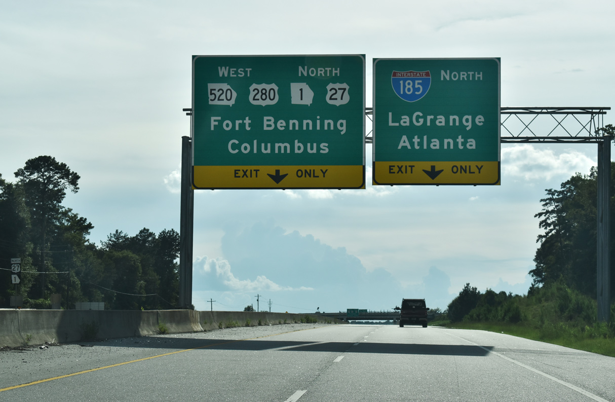
U.S. 27/280 overlap 17 miles southeast from Columbus to Cusseta. U.S. 27 branches south from there to Cuthbert, Bainbridge and Tallahassee, Florida. 07/27/22

Exit 1 B departs I-185 south for U.S. 27 north to Downtown Columbus and U.S. 280 west to U.S. 431 and Phenix City, Alabama. 07/27/22
U.S. 280 continues south from U.S. 27 at Cusseta to Richland and east to Americus while SR 520 travels southeast to Dawson and Albany. 07/27/22
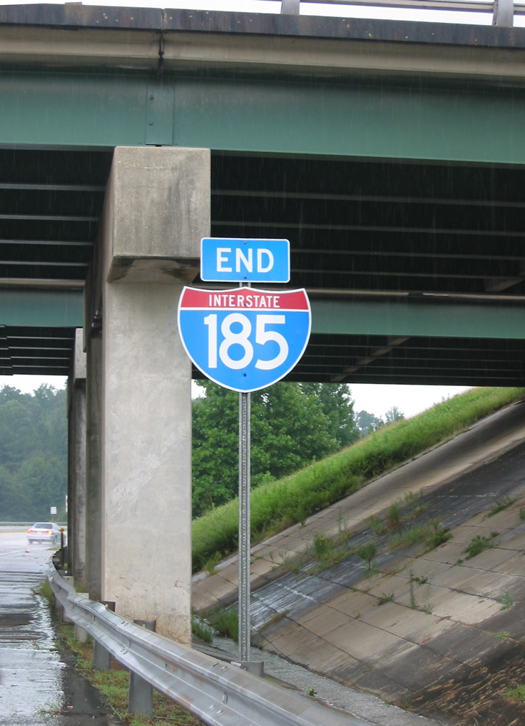
An end shield for I-185 appears at the overpass linking with U.S. 27-280/SR 520 east. 07/27/22

Lindsey Creek Parkway extends south to the gate for Fort Moore. 07/27/22
![]() South
South ![]()
![]() East at
East at ![]()
U.S. 27/280-SR 520 (Victory Drive) head southeast through Columbus to run alongside the north boundary of Fort Moore to the exchange with Interstate 185. 01/01/24
Two lanes separate from U.S. 27/280-SR 520 (Victory Drive) east beyond the signal with Border Drive for both I-185 north to Midtown Columbus and Lindsey Creek Parkway south into Fort Moore. 01/01/24
The entrance ramps for Lindsey Creek Parkway south and I-185 separate at a lone shield assembly. Lindsey Creek Parkway reaches the gate to Fort Moore beyond the Visitor Center. 07/25/22
![]() North
North ![]()
![]() West at
West at ![]()
U.S. 27 north / U.S. 280-SR 520 west follow a controlled access route through Fort Moore to Interstate 185 in the city of Columbus. 07/25/22
Restricted to Fort Moore traffic, a parclo interchange joins U.S. 27-280/SR 520 with Cusseta Road and Central Avenue just east of the exchange with Interstate 185. 07/25/22
A collector distributor roadway partitions traffic from U.S. 27-280/SR 520 west from Central Avenue to the cloverleaf interchange with Interstate 185. 07/25/22
Beyond the ramps for Interstate 185 north and Lindsey Creek Parkway south, U.S. 27-280/SR 520 (Victory Drive) transitions into a six lane commercial arterial. 07/25/22
![]() Lindsey Creek Parkway – North at
Lindsey Creek Parkway – North at ![]()
![]()
![]()
Lindsey Creek Parkway navigates through an S-curve from Fort Moore ahead of Exit 1 A for U.S. 27-280/SR 520 east to Cusseta and Albany. 07/27/22

Interstate 185 commences northward from Lindsey Creek Parkway at Exit 1 A. 01/12/19

A begin shield for Interstate 185 stands where the former loop ramp from U.S. 27-280/SR 520 east merged onto the freeway northbound. 07/27/22
Exit 1 B loops onto U.S. 27 north / U.S. 280-SR 250 (Victory Drive) west to Downtown Columbus and Phoenix City. 07/27/22
South End Throwback
![]() South at
South at ![]()
![]()
![]()
Cardinal direction based suffixes at the south end of I-185 where changed as part of the statewide Interstate exit renumbering program started in 1999. 10/15/99
A pair of end shields were previously posted at the U.S. 27-280/SR 520 (Victory Drive) overpass. 08/22/03
This ground level sign was posted for the original loop ramp (Exit 1 A) onto U.S. 27 south / U.S. 280-SR 520 east. 08/22/03
![]() North at
North at ![]()
![]()
![]()

A pair of begin shields were posted at the Lindsey Creek Parkway transition to Interstate 185 below Victory Drive. These were removed during work to add the new ramp from SR 520 east to I-185 north. 10/15/99
![]() South
South ![]()
![]() East at
East at ![]()
Former guide sign posted along U.S. 27 south / U.S. 280 (Victory Drive) east, one half mile ahead of the previous full cloverleaf interchange with Interstate 185. 08/22/03
This sign bridge was removed during work to construct the new ramp for I-185 north from Victory Drive eastbound. A span wire supported assembly precedes the two lane ramp departure for both the freeway north and Lindsey Creek Parkway south into Fort Benning. 10/15/99
![]() North
North ![]()
![]() West at
West at ![]()
This sign bridge was removed by 2007 as the ramps along the east side of I-185 were extended to Victory Drive. 08/22/03
Sources:
- “‘Scenic Byway’ created off I-185.” Times-Herald, The (Newnan, GA), October 21, 2007.
- “Will Bypass Lead LaGrange Down The Right Road? – City Officials Worry About Losing Business To Proposed U.S. 27 Bypass New Highway Would Also Affect Columbus Drivers Using I-85/I-185 Interchange.” Columbus Ledger-Enquirer (GA), September 5, 1999.
- “City mulls DOT plans.” LaGrange Daily News (GA), February 11, 2007.
- “How would you like to take I-185 from LaGrange to Florida?.” Times-Herald, The (Newnan, GA), November 30, 2006.
- “Albany leaders campaign for an interstate highway.” WALB 10 News, November 28, 2006.
- “Georgia’s Fort Benning renamed Fort Moore.” ABC News, May 11, 2023.
- “Would Four Lanes Drive Away Rural Lifestyle?, Supporters of Widening Georgia 85 Say it would Promote Safety, Business, but some along Road are Skeptical.” Columbus Ledger-Enquirer, September 18, 1994.
- “Happy Birthday to the open road.” Gwinnett Daily Post (Lawrenceville, GA), June 25, 2006.
- “I-185 construction : After years, end is in sight.” Ledger-Enquirer (Columbus, GA), June 15, 2011.
- “DOT Awards $69M in Contracts for I-185 – Columbus and Fortson Firms Win Project Bids.” Ledger-Enquirer (Columbus, GA), June 16, 2007.
- “Fort Benning completes $6.8 million gateway project; ribbon cutting today.” Ledger-Enquirer (Columbus, GA), October 13, 2011.
Page updated January 29, 2024.