Interstate 180 Wyoming
Overview

Interstate 180 is an urban arterial connecting I-80 with Downtown Cheyenne. It represents the only signed route within the Interstate Highway System that is not a limited access highway; unsigned Interstates in Alaska and Puerto Rico also include at-grade roads. Cosigned with Business Loop I-25, U.S. 85 and U.S. 87 Business, two grade separations and five signalized intersections line I-180 north from a diamond interchange with Interstate 80 to Business Loop I-80/U.S. 30 (16th Street / Lincolnway) in the Cheyenne central business district. I-180 splits into separate roadways across viaducts spanning the Union Pacific Railroad yards.
 History
I-180 Limited Access Highway
An improved connection to the Cheyenne central business district became necessary once the location for Interstate 80 was selected. Included in the 1965 Cheyenne Area Transportation Plan, three corridors were analyzed during the development of Interstate 180. The Central Avenue Corridor was selected because it provided direct access to Downtown. The other corridors considered were one leading northwest from I-80 to the vicinity of Missile Drive and another dog legging east from I-80 to U.S. 30 near the Norris Viaduct.
Route Information
North End – Cheyenne, WY
South End – Cheyenne, WY
Mileage – 1.09
Cities – Cheyenne
- Junctions –

Source: December 31, 2021 Interstate Route Log and Finders List
I-180 Annual Average Daily Traffic (AADT)
Source: 2016 AADT – WYODOT Interactive Transportation System Map, WYDOT 2016 Automatic Traffic Recorder Report
One block and two block wide alignments were studied and three grade concepts were considered for the freeway. The below grade concept included tunnels under the Union Pacific Railroad (UPRR) yards. However due to high ground water table and numerous utility lines in the project area, the depressed grade concept was dropped. The at-grade proposal required bridge structures for side streets and pedestrians. The large number of structures needed to accommodate the sloped approaches for these spans resulted in this option being discontinued.
Interstate 80 east from the Central Avenue Interchange with U.S. 85/87 was not completed until 1977. Options considered for modifying the half opened diamond interchange with Central Avenue for I-180 included a full cloverleaf, a folded diamond, and a directional interchange. The directional interchange was discarded due to terrain conditions at the site.
Prior to construction of Interstate 180, Central Avenue consisted of a two lane street and a narrow viaduct over the Union Pacific Railroad yards with two 14 foot wide lanes and 6.5 foot wide sidewalks. The Riner Viaduct was constructed in 1929 and maintained by the city of Cheyenne and the UPRR until the 1950s, when legislation passed shifted maintenance responsibilities to the Wyoming State Highway Department.1
A new viaduct connecting with the Central Avenue/Warren Avenue couplet was included in the 1965 recommended transportation plan for the Cheyenne Urban Area. Traffic volumes were high enough that a four lane facility was required. The Wyoming State Highway Department requested Interstate status for the improvement on November 27, 1967. Received on February 2, 1968, the new facility was to be a limited access highway with no at-grade intersections.1 I-180 was added to the Interstate system by the American Association of State Highway Officials (AASHO) on June 30, 1970.
The report covering the Central Avenue Corridor Study was submitted to the Federal Highway Administration (FHWA) on September 2, 1970. It specified that the proposed improvement be constructed as a freeway with full access control and that the Central Avenue Interchange be rebuilt as a cloverleaf. Following a right of way centered on Central Avenue between Capitol Avenue and Warren Avenue, the facility north from I-80 would be elevated to the UPRR yards, where it would partition into separate structures to 16th Street at Central and Warren Avenues. Service roads would also be built and an extra right of way would provide a buffer on either side of I-180.1
The elevated grade concept was proposed because it would cause the least community disruption, minimize impacts to utilities, and allow existing streets to remain open. The FHWA denied approval for the freeway on December 14, 1970 due to the cost, which was estimated at $16.77 million for the overall project.1
I-180 Expressway
A subsequent corridor study evaluated how to build the improvement at a lower cost while still serving public needs. A report on the study was submitted to the FHWA on February 11, 1971. The facility was redesigned from a fully access controlled freeway into an expressway permitting access at designated points. The change was made on assumptions that full control of access and a free flow interchange at the south end would not be required, building an elevated structure was cost prohititive and that it would be uneconomical to purchase a two block area for right of way.
Interstate 180 was outlined as follows:1
- Construct the facility as an at-grade, controlled access expressway south of the UPRR yards with access limited to two major street intersections.
- Modify the existing Central Avenue Interchange by adding a free flow right turn lane from I-80 west to I-180 north.
- Provide signalized intersections at 5th and 9th Streets.
- Repurpose Central and Warren Avenues as service roads.
- Build an elevated structure over the UPRR yards that diverges with one branch to Central Avenue at 16th Street and the other at Warren Avenue at 16th Street.
- Landscaping the right of way.
Using the existing Central Avenue Interchange reduced the right of way needed. Adding traffic lights provided adequate safety for motorists while the free flow turn from I-80 west to I-180 maintained mobility. With the expressway concept estimated to cost $8.63 million, overall costs for the I-180 improvements were reduced by $8.1 million. FHWA granted location approval for the route on March 11, 1971.1
The I-180, Cheyenne Interstate Spur: Environmental Impact Statement (EIS) submitted on April 14, 1975 indicated that the Wyoming State Highway Department intended to start construction in 1978 and finish work in 1984. Covered by Federal-aid Interstate funds matching state funds, costs were estimated at $14.25 million.
Construction for Interstate 180 got underway in 1977 with expansion of U.S. 85 (Central Avenue) to four lanes. The at-grade expressway was completed in 1979.2
Work on the replacement of the Riner Viaduct started in May 1980. The first span across the UPRR opened to traffic in 1982, at the same time shields for Interstate 180 were erected along Central Avenue. The second span was completed in Spring 1984.2
 Photo Guides
North End 
 – Cheyenne, WY
![]()
![]()
![]()
![]() North at
North at ![]()
![]()
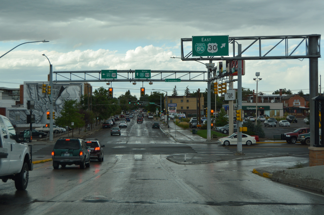
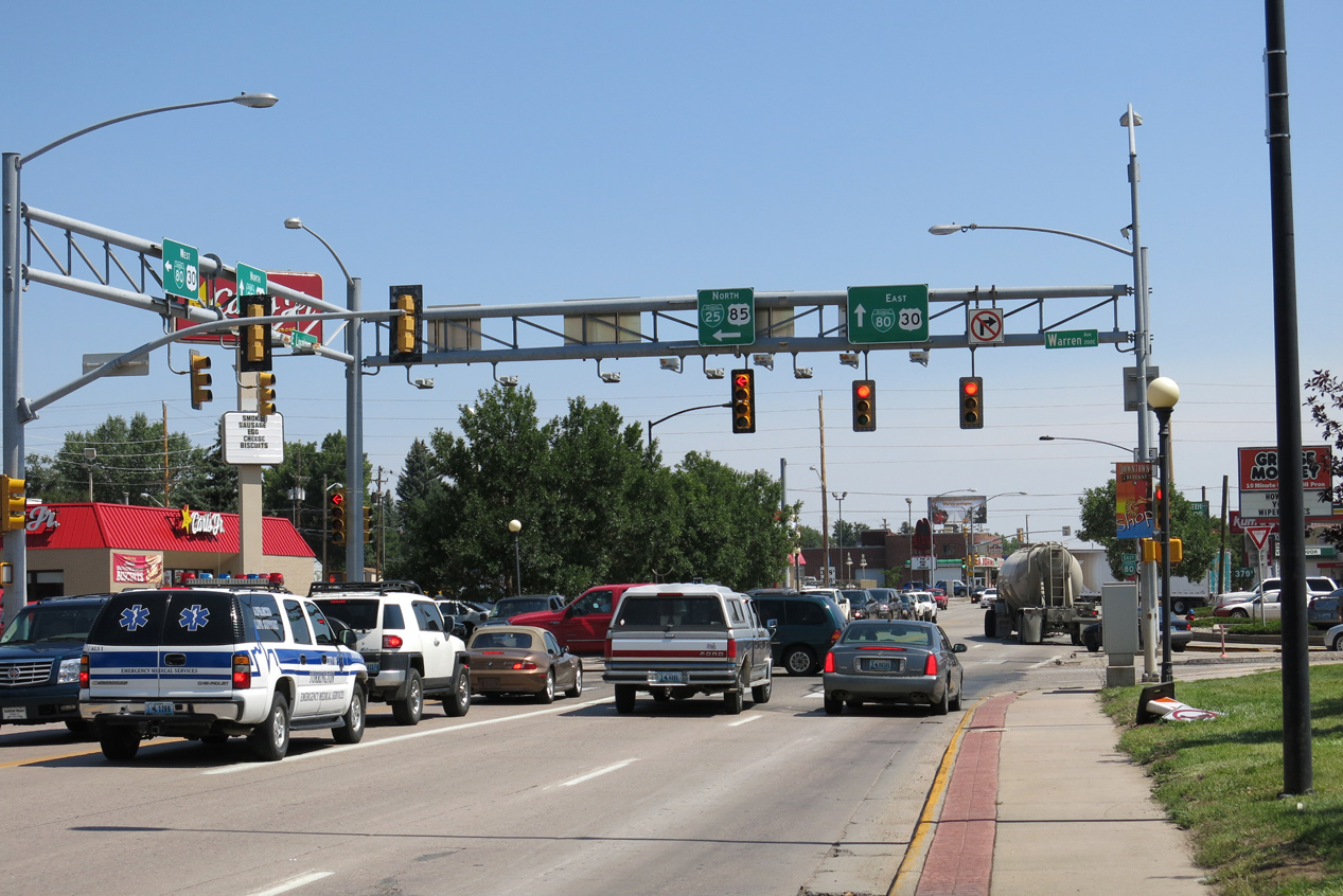
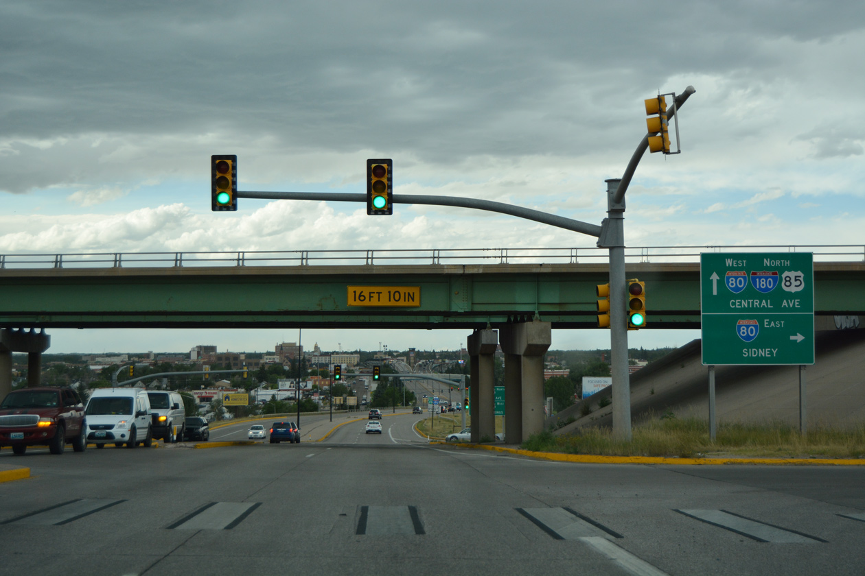
Interstate 180 lowers from the UPRR viaduct onto Warren Avenue at Business Loop I-80/U.S. 30 (Lincolnway). 08/11/16
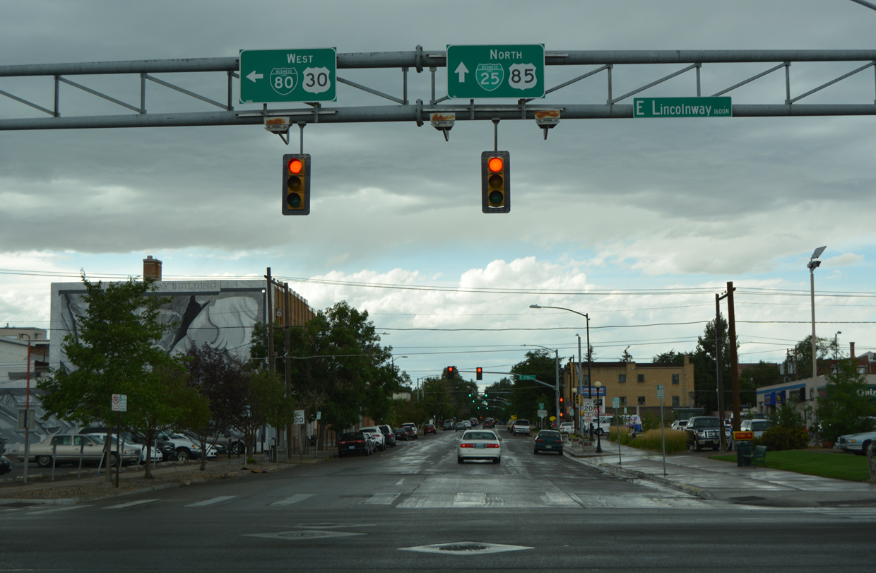
Business Loop I-25/U.S. 85 follow Warren Avenue north from the end of I-180 to Cheyenne Regional Airport (CYS). Warren Avenue merges with Central Avenue northwest along Sloan Lake to Interstate 25. 08/11/16
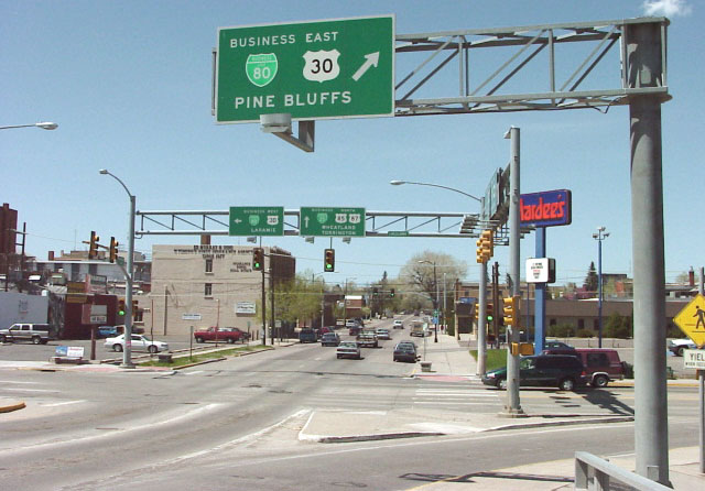
Overhead signage at Warren and 16th Street formerly referenced Pine Bluffs for Business Loop I-80 and U.S. 30 east from Downtown Cheyenne. Photo by Dale Sanderson (04/01).
![]()
![]()
![]() South at
South at ![]()
![]()
![]()
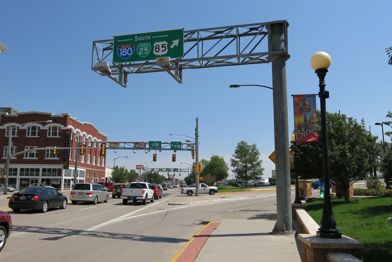
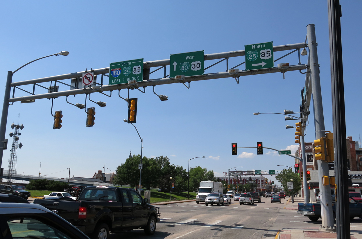
Business Loop I-25/U.S. 85-87 Business rise onto the UPRR viaduct from Business Loop I-80/U.S. 30 (Lincolnway) as southbound Interstate 180 begins. 08/11/16
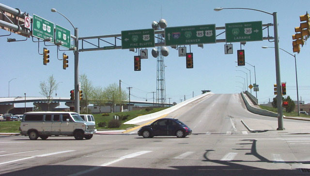
Older overheads at I-180 and U.S. 30 referenced U.S. 87, which bypasses Cheyenne to the west alongside Interstate 25. Photo by Dale Sanderson (04/01).
![]()
![]() East at
East at ![]()
![]()
![]()
![]()
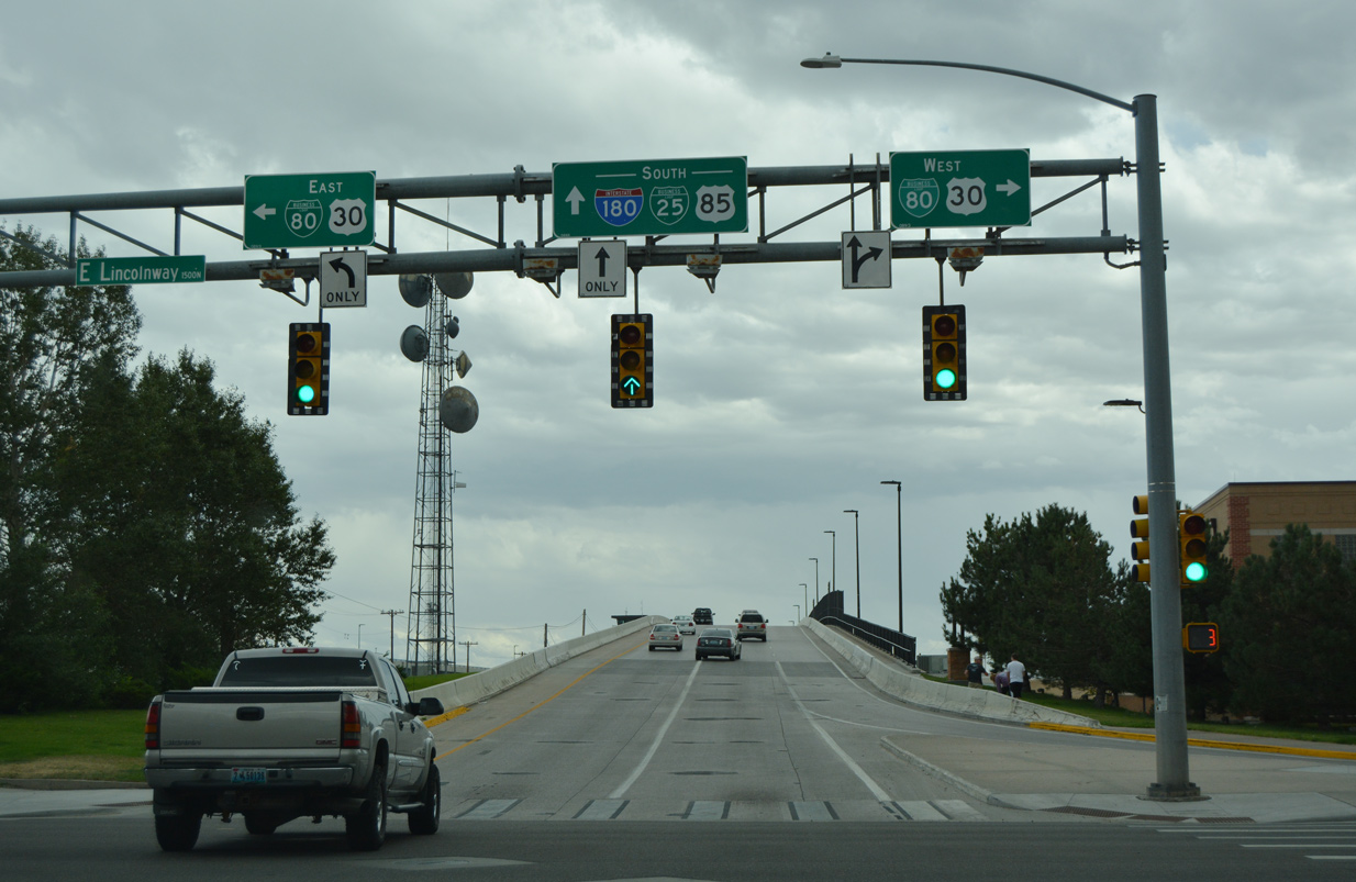
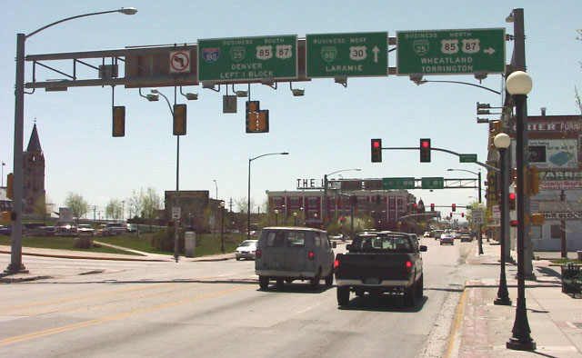
Business Loop I-80/U.S. 30 (Lincolnway) eastbound at Central Avenue and the turn for Interstate 180 south. 08/15/13
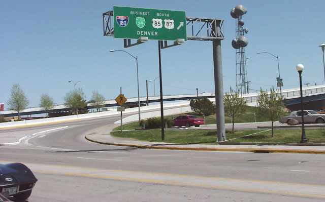
Replaced overhead along Lincolnway east for I-180 south referencing Denver. Photo by Dale Sanderson (04/01).
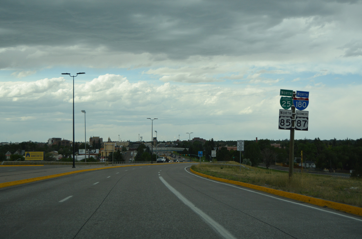
Business Loop I-25 continues eight blocks north from I-180 and U.S. 30 (Lincolnway) to 24th Street near the Wyoming State Capital Building. 08/15/13
![]()
![]() West at
West at ![]()
![]()
![]()
![]()
Lincolnway / 16th Street west at the north end of the I-180 viaduct spanning the UPRR. The expressway south begins in one block. 08/15/13
Replaced overhead along Lincolnway east for I-180 south referencing Denver. Photo by Dale Sanderson (04/01).
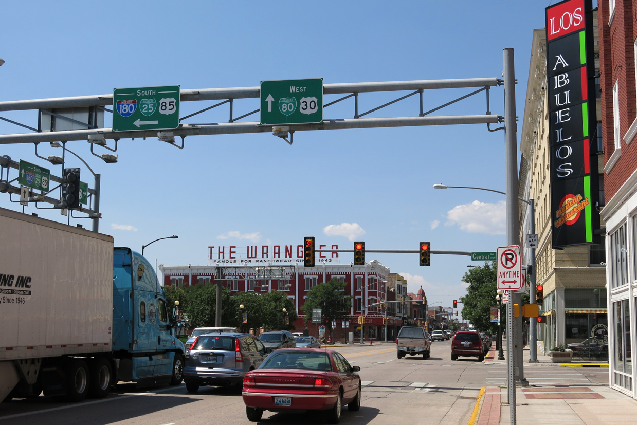
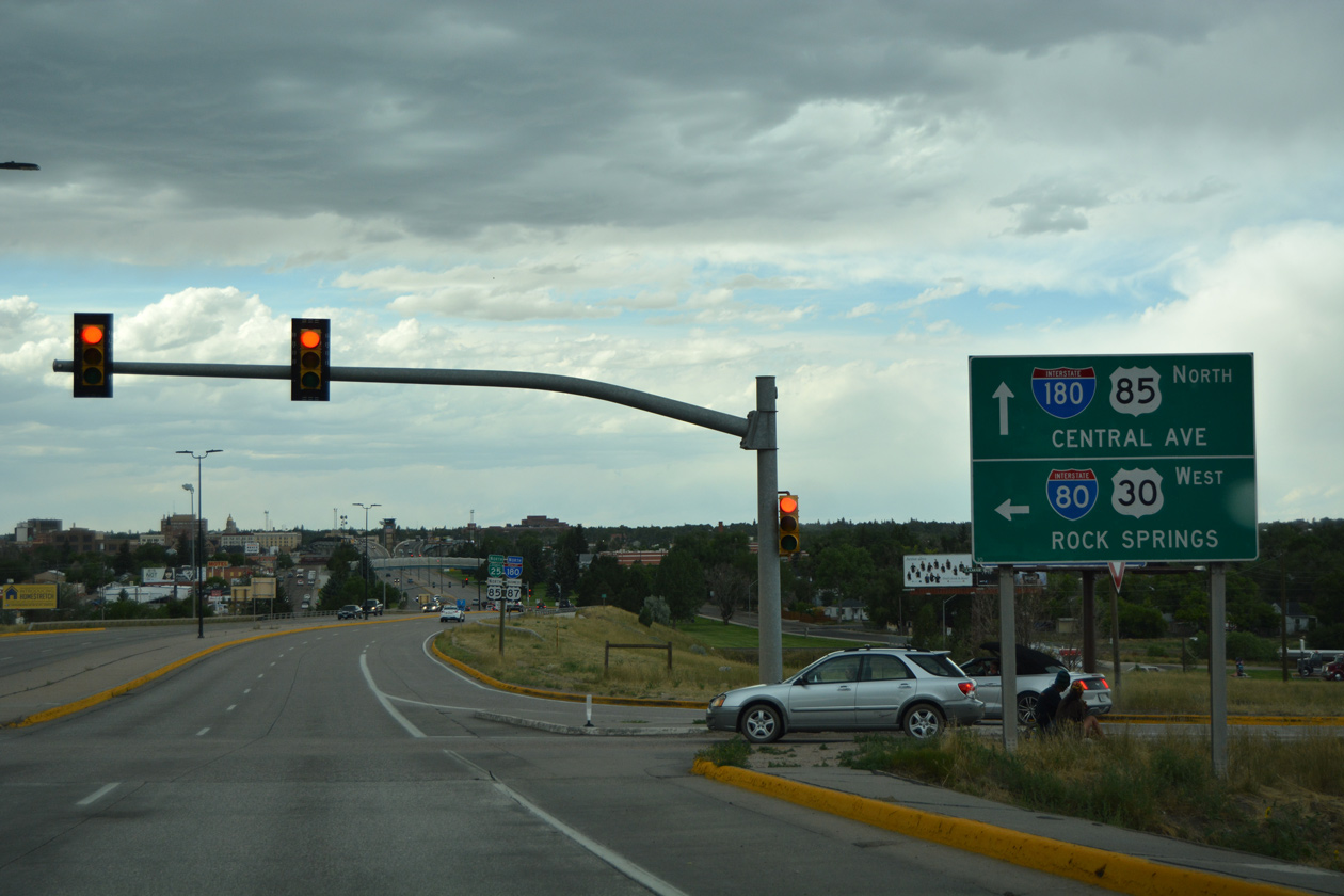
Westbound Business Loop I-80 and U.S. 30 at Interstate 180, Business Loop I-25, U.S. 85-87 Business (Central Avenue). 08/15/13
South End – Cheyenne, WY
![]() East at
East at ![]()
![]()
![]()
![]()
Interstate 80 heads east fromm a cloverleaf interchange with I-25/U.S. 87 through residential areas of south Cheyenne to meet I-180/U.S. 85 (Central Avenue) in one mile. 08/11/16
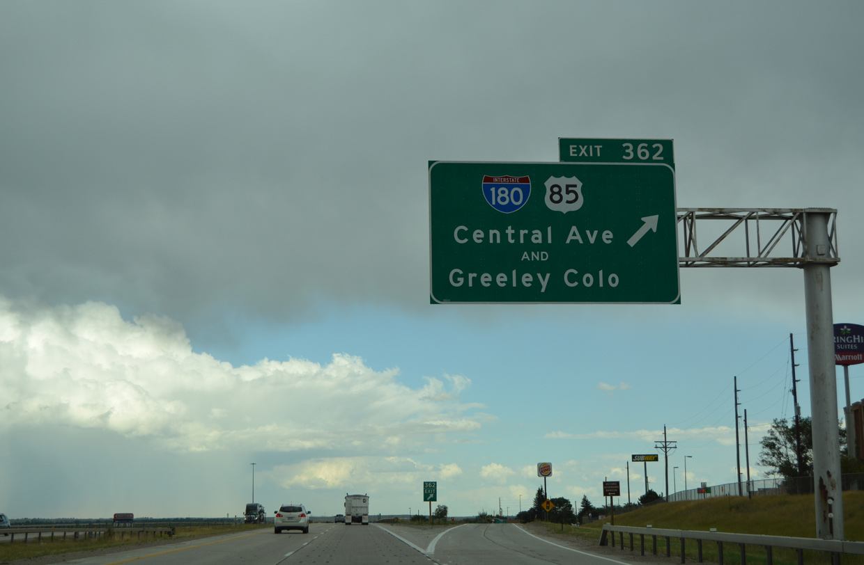
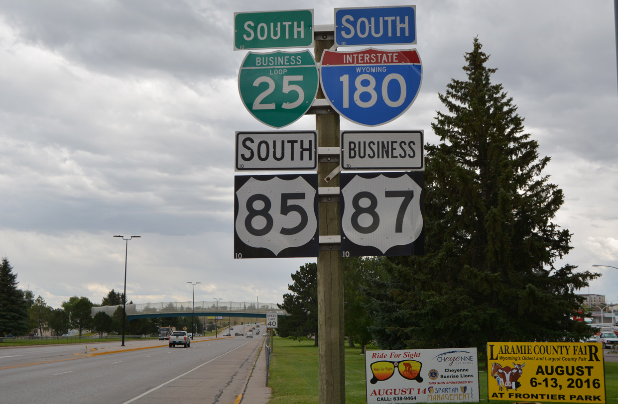
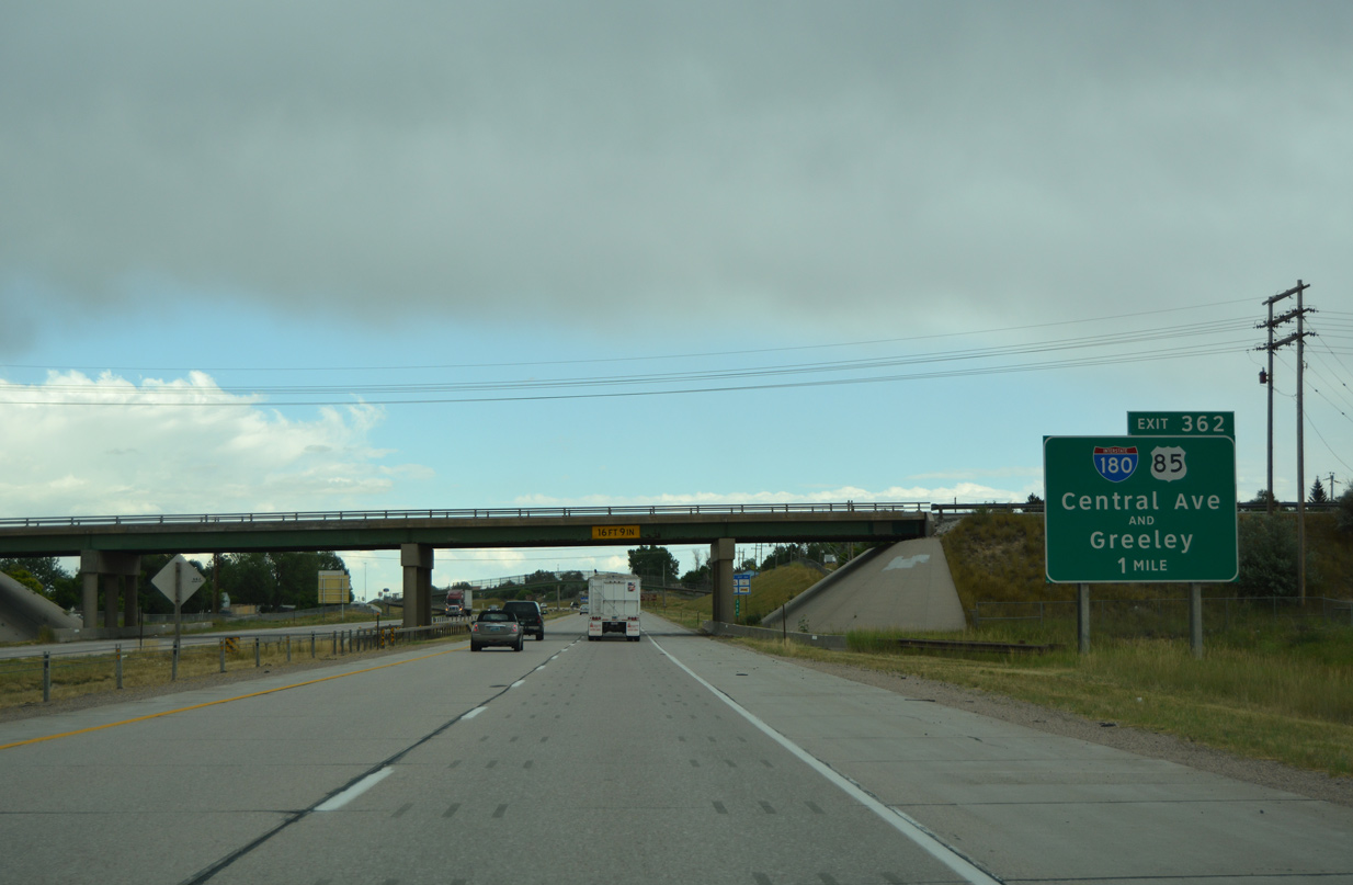
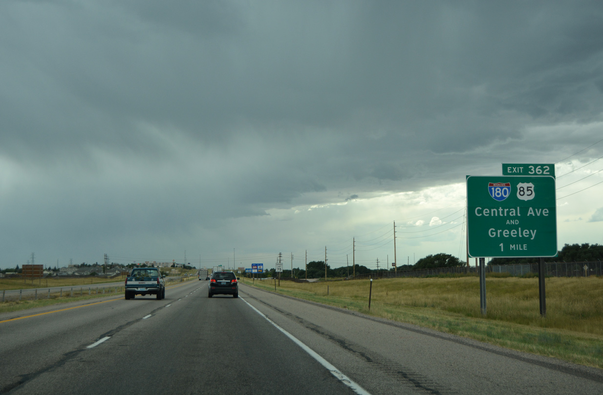
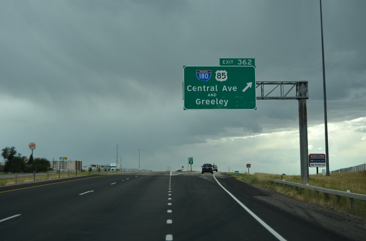
Entering the diamond interchange (Exit 362) with Interstate 180 north, Business Loop I-25 and U.S. 85-87 Business (Central Avenue). 08/11/16
![]() West at
West at ![]()
![]()
![]()
![]()
One mile east of the diamond interchange (Exit 362) with I-180, Business Loop I-25, U.S. 85-87 Business (Central Avenue) on westbound I-80. The freeway parallels Crow Creek west from WYO 212 (S College Drive) to Central Avenue. 08/11/16
Interstate 80 west at the south end of I-180 (Central Avenue). The Cheyenne central business district lies 1.1 miles to the north. 08/11/16
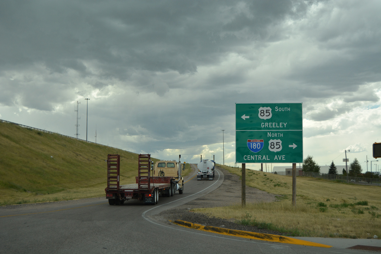
U.S. 85 extends south from Interstate 180 and Cheyenne to Greeley, Colorado. Business Loop I-25 and U.S. 87 Business accompany the route between WYO 212 (W College Drive) and Downtown Cheyenne. 08/11/16
![]()
![]()
![]()
![]() South at
South at ![]()
I-180 and U.S. 85 cross over Deming Drive leading into the exchange with Interstate 80. 08/11/16

Interstate 80 travels west from Cheyenne to Laramie and Rock Springs. 08/11/16
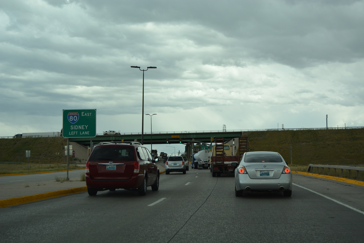
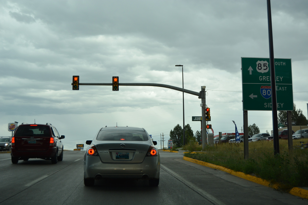
Sidney, Nebraska lies 100 miles east of the forthcoming entrance ramp to Interstate 80. 08/11/16
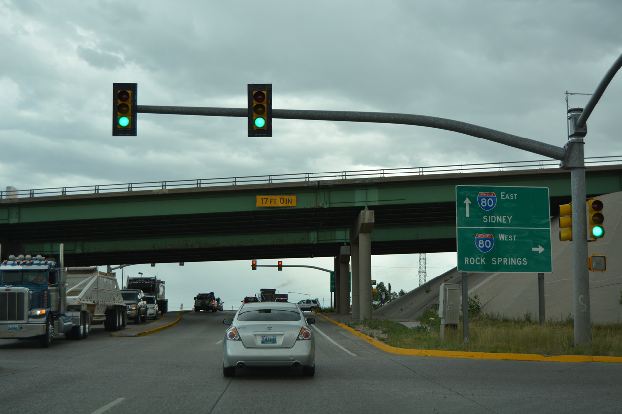
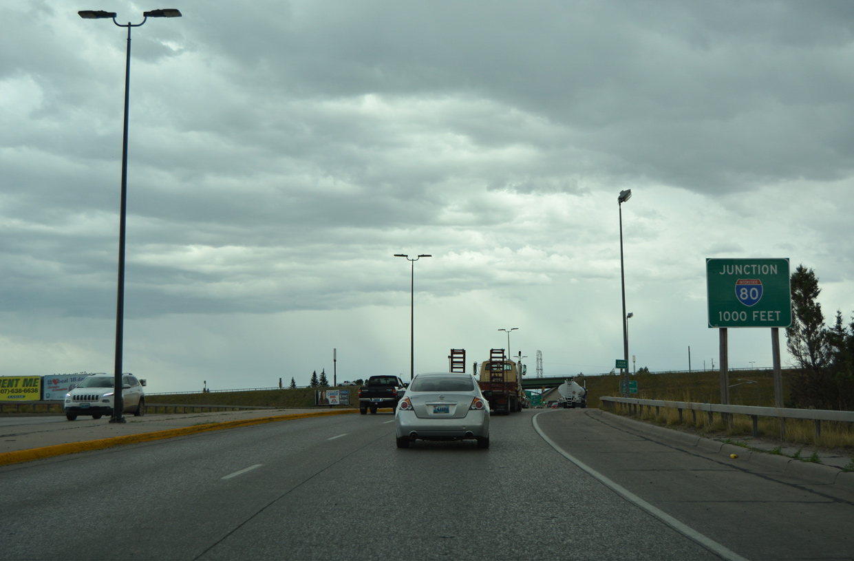
Interstate 180 ends at the signalized ramps for I-80. Interstate 80 meets I-25/U.S. 87 west in 2.5 miles. 08/11/16
U.S. 85-87 Business and Business Loop I-25 follow U.S. 85 (Greeley Highway) south another 1.1 miles to College Drive. The two routes conclude at a diverging diamond interchange (DDI) with I-25/U.S. 87, 3.8 miles to the southwest. 08/11/16
![]()
![]()
![]() North at
North at ![]()
![]()
Interstate 180 commences northbound from the south side ramps with I-80 along Central Avenue. I-80 generally bypasses Cheyenne and runs along the north side of suburban areas and the South Greeley community. 08/11/16
The westbound entrance ramp to I-80 from Central Avenue references U.S. 30, which follows 16th Street / Lincolnway through Downtown Cheyenne ahead. 08/11/16
Confirming markers for Interstate 180, Business Loop I-25, U.S. 85-87 Business stand ahead of the Deming Drive underpass and signalized intersection with 5th Street. 08/11/16
 South End Throwback


April 2001 photos from Dale Sanderson showing the diamond interchange joining Interstate 80 with the south end of I-180.
Sources:
Page updated November 11, 2020.