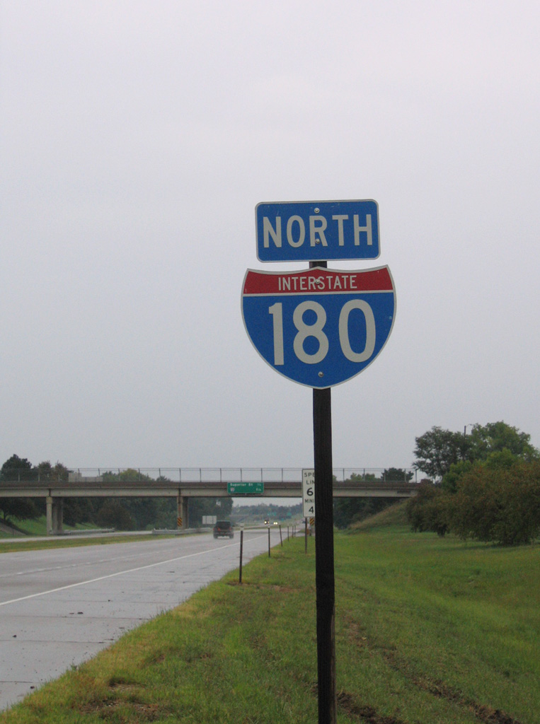
Interstate 180 Nebraska
Overview
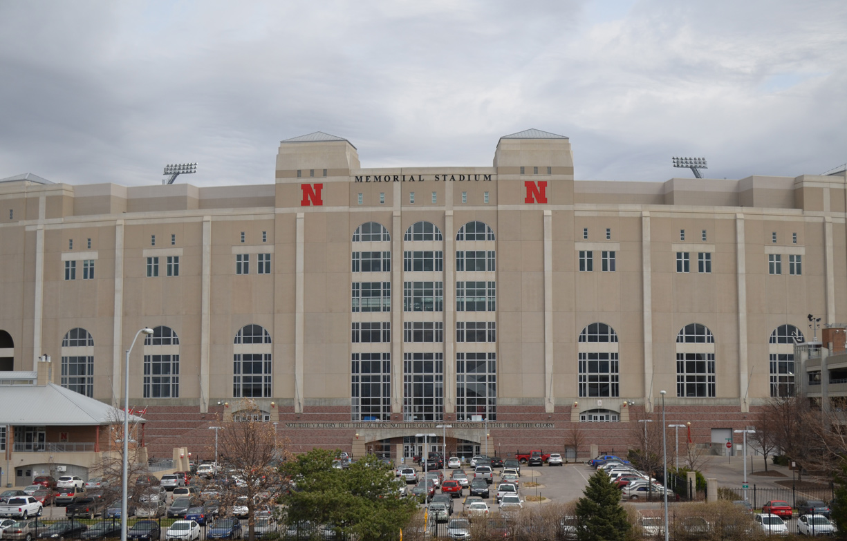
The destination for thousands of Nebraskans each year is to watch their beloved Cornhuskers play against the teams of the Big Ten, one of the oldest college football conferences in the country. Memorial Stadium is located to the east of Interstate 180 off of 10th Street in Lincoln. 03/29/16
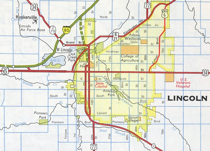
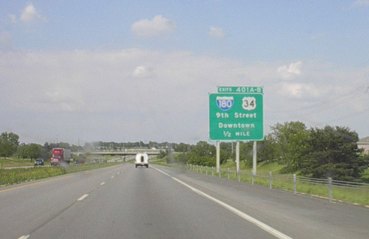
Interstate 180 connects I-80 with Downtown Lincoln, the state capitol and the campus of the University of Nebraska-Lincoln (UNL). The freeway spur doubles as U.S. 34, which ties into the north end from Woodlawn. Exit numbers along the route increase southward from Interstate 80.
Taking place over the course of three days in Spring 2018, the I-180/I-80 Interchange Signing project installed new overhead sign structures along both I-80 and Interstate 180 in Lincoln. New signs however were not updated to show the overlap of U.S. 77 along I-80.
 History
Interstate 180 opened south from I-80 to Oak Street, which connected with Cornhusker Highway by August 1963. An interchange was also added along Cornhusker Highway (U.S. 6/34/77) at N 14th Street near the original Nebraska Fair Grounds.1
Spanning 16 railroad tracks, the south end of Interstate 180 originally split between a 1,233 foot long viaduct southbound to 9th Street and a 1,152 foot long viaduct northbound from 10th Street. Costing $1.095 million, the bridge system’s superstructure comprised 1,045 tons of steel. They were scheduled to open in mid December 1963.2 I-180 leading south into Downtown Lincoln was completed by year’s end.3 The northbound bridge system was incomplete until January 1964.4
Completion of the Lincoln Interstate Spur in 19645 accelerated development of the adjacent Belmont community. Around 200 acres were developed with residential properties from 1954 to 1964, with another 400 purchased by builder Karl Witt. Additionally eight properties along I-180 were purchased by the city of Lincoln and Lancaster County for a mile long park at Belmont.6 Later named Max E. Roper Park, the linear parkland stretches north along I-180 from Cornhusker Highway to Superior Street.
The southern 1.2 miles of Interstate 180, including the viaducts at 9th and 10th Streets, were rebuilt during a $15 million project. The southbound bridge system closed to traffic on December 1, 1996, allowing the contractor, Hawkins Construction, to tear down and replace the 33 year old structure.7 Road crews completed work on the southbound roadway 61 days ahead of schedule, netting the contractor a $1.22 million bonus. I-180 south reopened on the evening of June 10, 1997.8
Construction to tear down and replace the I-180 northbound viaduct from 10th Street commenced November 16, 1997. Work was expected to take 266 days, ending on August 8, 1998.9 Hawkins Construction completed the project 72 days ahead of schedule, netting the contractor an extra $1.4 million. Lincoln Mayor Mike Johanns cut the ribbon at a ceremony held May 28, 1998 to reopen I-180 northbound.10
Route Information
North End – Lincoln, NE
South End – Lincoln, NE
Mileage – 3.18
Cities – Lincoln
- Junctions –

Source: December 31, 2021 Interstate Route Log and Finders List
I-180 Annual Average Daily Traffic (AADT)
| Location | Vehicles per day |
|---|---|
| Q St to Exit 2 | 29,643 |
| Exits 2 to 1 | 30,810 |
| Exit 1 to I-80 | 29,490 |
| I-80 to Fletcher Av | 24,555 |
Source: 2021 AADT Nebraska Department of Transportation Averal Annual Daily Traffic
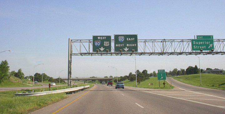
The six ramp parclo interchange between I-180 and Cornhusker Highway (Exit 1) was reconfigured to include two southbound off-ramps and a distributor roadway along northbound. Cornhusker Highway is the former route of U.S. 34 west from U.S. 6 at Belmont.
North End  – Lincoln, Nebraska
![]() North
North ![]() West at
West at ![]()
![]()
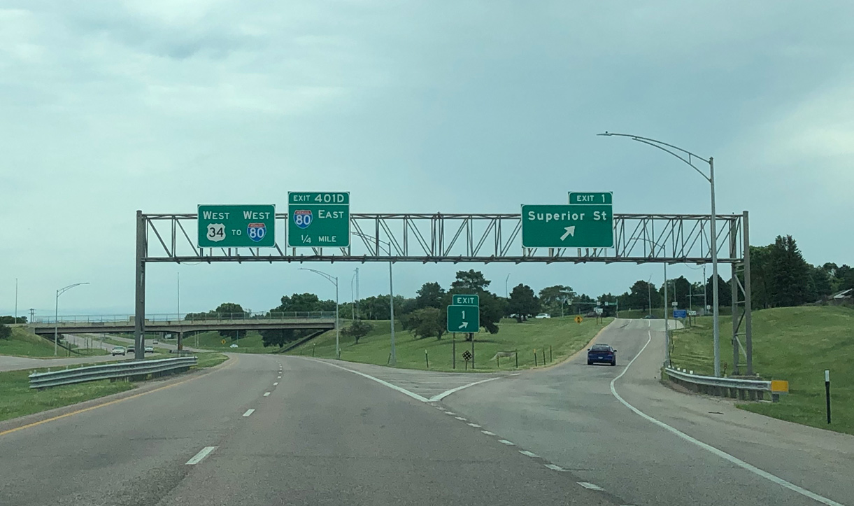
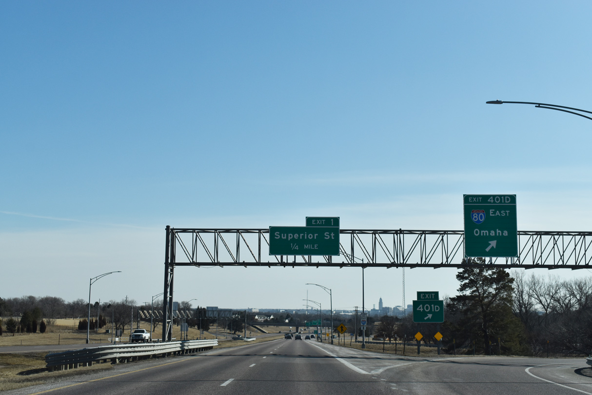
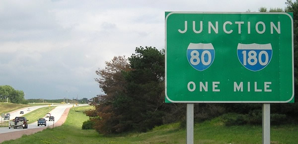
Exit 1 leaves I-180/U.S. 34 north for Superior Street and the Belmont community of Lincoln one quarter mile south of the cloverleaf interchange with I-80/U.S. 77. Photo by Peter Johnson (06/21/20).
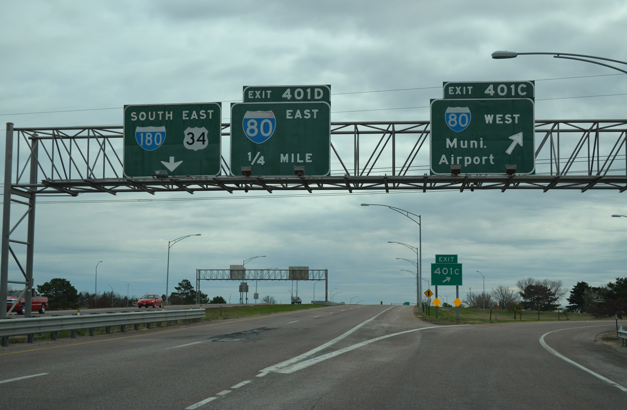
Entering the cloverleaf interchange (Exits 401D/C) with I-80/U.S. 77 at the north end of Interstate 180. Not acknowledged on overhead guide signs, U.S. 77 overlaps with I-80 between Exit 397 and Exit 405 as part its bypass of Lincoln. Photo by Peter Johnson (06/21/20).
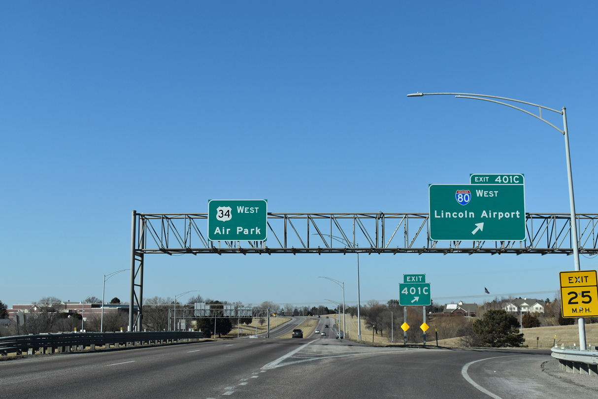
Exit 401C loops onto a c/d roadway along I-80/U.S. 77 west ahead of Lincoln Airport (LNK). U.S. 34 (Purple Heart Highway) continues northwest along an expressway to N-79. Reducing to two lanes, U.S. 34 leads west through Seward, York, Aurora and Grand Island, where it turns south to meet I-80 again at Exit 312. 02/22/20
![]() East at
East at ![]()
![]()
![]()
Curving southward from the Fallbrook community, U.S. 34 (Purple Heart Highway) intersects Fletcher Avenue on the one mile approach to I-80/U.S. 77 and I-180 south. 02/22/20
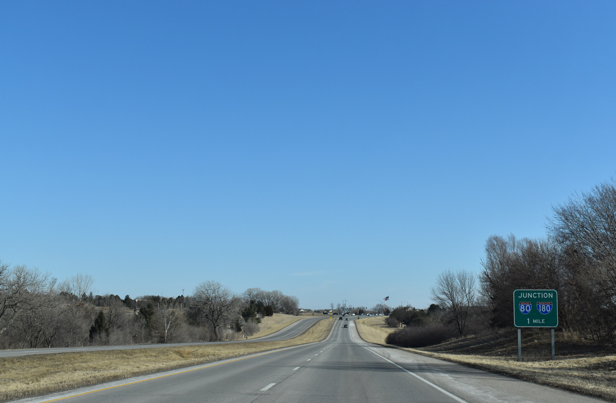
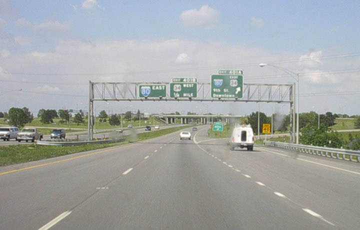
Exit numbers within the cloverleaf joining I-180/U.S. 34 with Interstate 80 use the mileage from I-80. 02/22/20
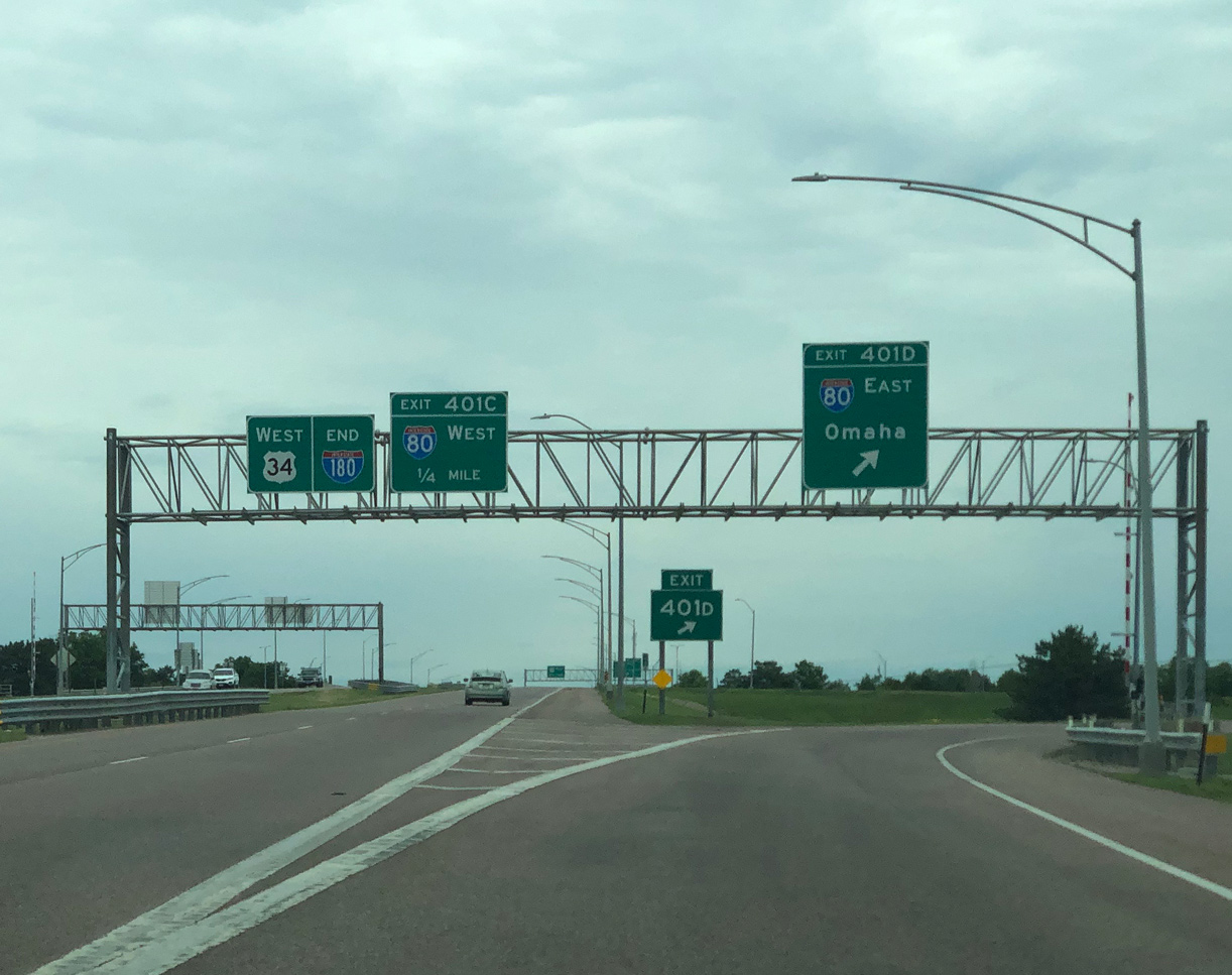
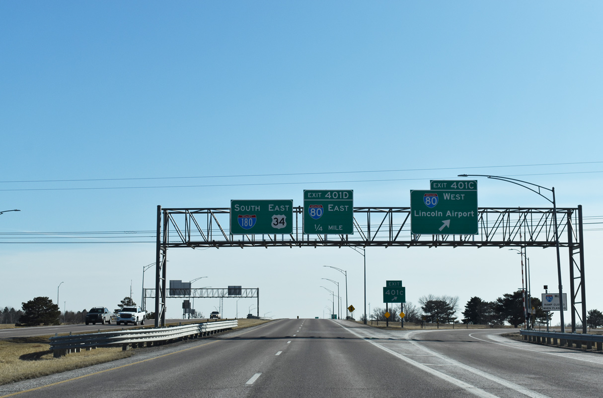
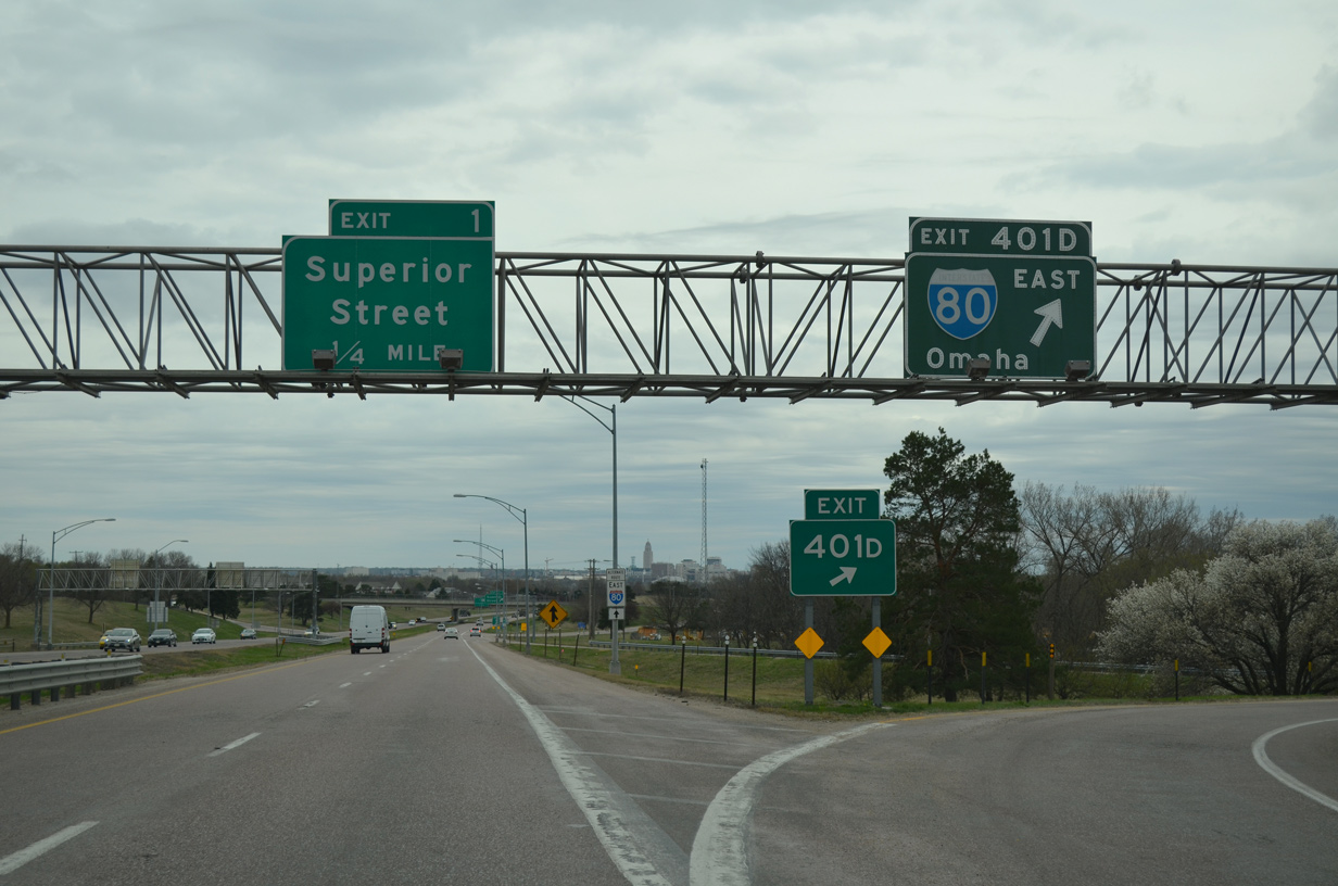
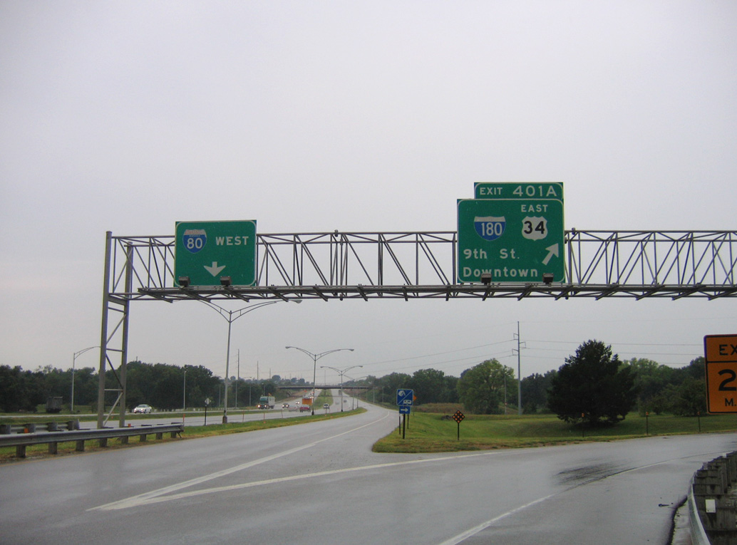
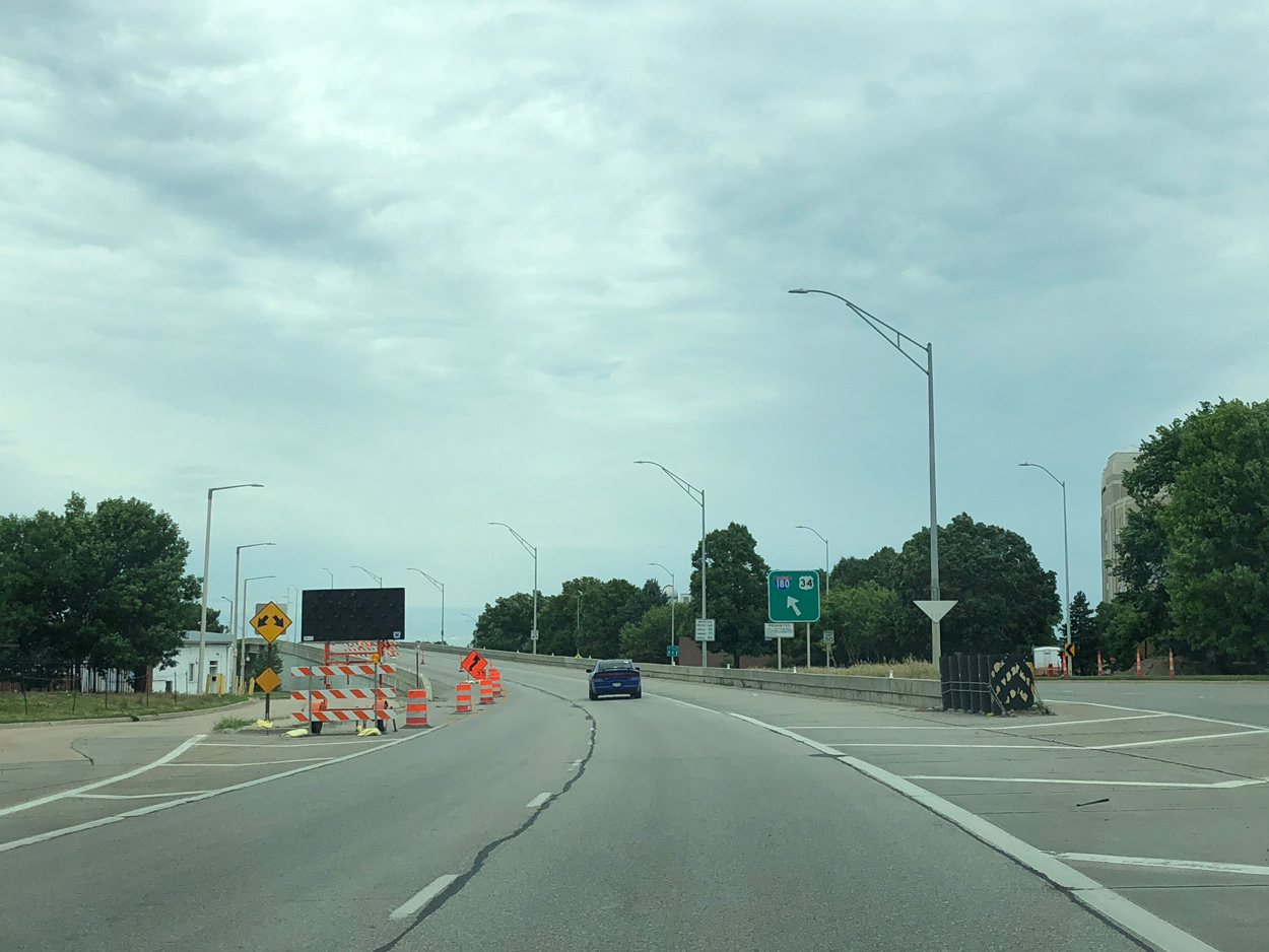
Interstate 180/U.S. 34 spur south into Lincoln beyond the loop ramp (Exit 401B) for I-80 east and U.S. 77 north to Omaha and Wahoo. 02/22/20
![]() East
East ![]() North at
North at ![]()
![]()
I-80/U.S. 77 travel northeast between Lincoln Airport (LNK) and the West Lincoln community to the cloverleaf interchange (Exits 401A/B) with Interstate 180 south and U.S. 34. Photo by Peter Johnson (06/21/20).
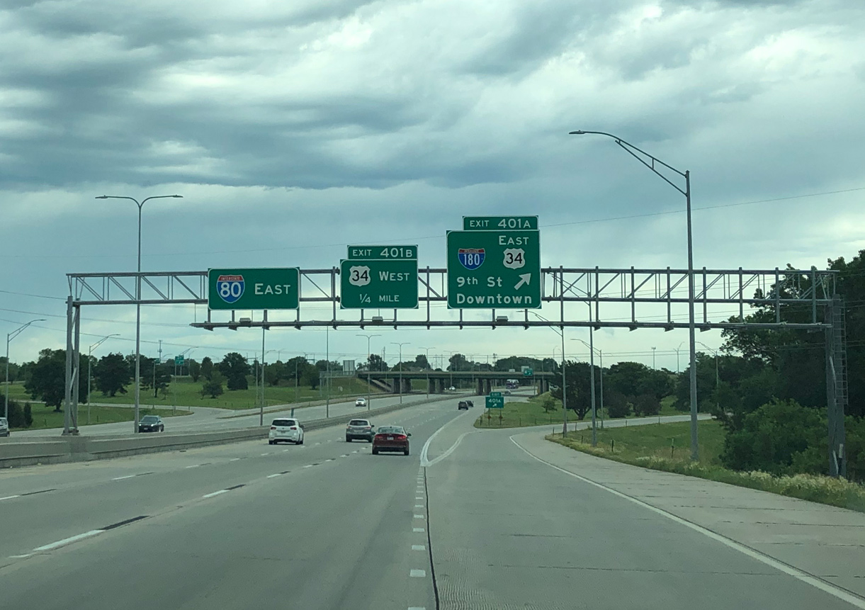
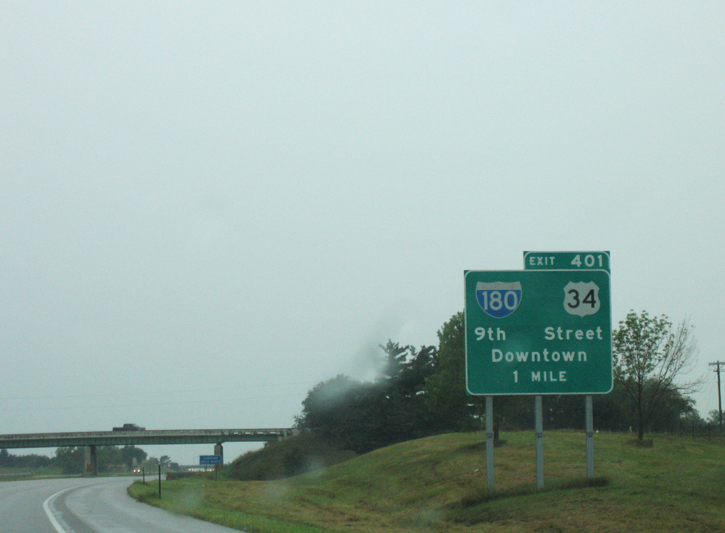
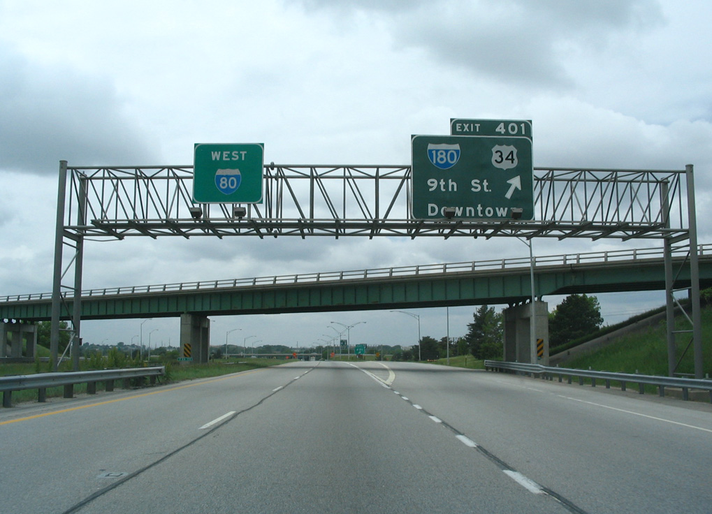
Exit 401A departs I-80/U.S. 77 east for I-180/U.S. 34 south to UNL and 9th Street in Downtown Lincoln. Photo by Peter Johnson (06/21/20).
![]() West
West ![]() South at
South at ![]()
![]()
I-80/U.S. 77 pass through suburban areas of north Lincoln from 27th Street southwest to Exit 401 with I-180 south and U.S. 34. 03/29/16
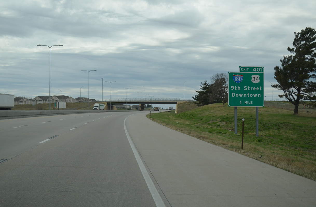
A collector distributor roadway separates from westbound I-80 at Exit 401. 03/29/16
U.S. 34 (Purple Heart Highway) arcs westward from the north end of I-180 between the Highlands and Fallbrook communities north of Lincoln Airport (LNK). 02/22/20

Interstate 180 south and U.S. 34 east run south from I-80/U.S. 77 between the Belmont and West Lincoln neighborhoods toward the Lincoln central business district and UNL. 02/22/20
 North End Throwback
![]() North
North ![]() West at
West at ![]()
![]()
Button copy signs previously posted along I-180 north for I-80 and U.S. 34. Photo taken by Rich Piehl (05/01).
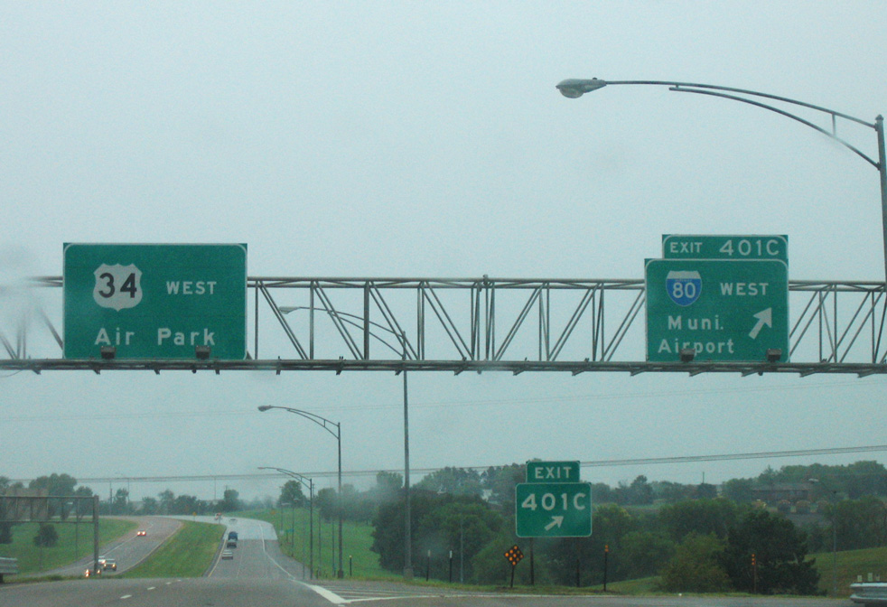
Sign replacements for I-80 west at Exit 401C changed Municipal Airport to Lincoln Airport (LNK). 09/05/05
![]() East at
East at ![]()
![]()
![]()
The initial sign for the exchange joining U.S. 34 with I-80/180 posted after Fallbrook Boulevard was replaced in kind by 2019. Photo by Jeff Morrison (07/29/07).
Button copy signs for I-80/180 on U.S. 34 east were replaced in Spring 2018 as part of an interchange wide sign replacement project. 03/29/16
![]() East
East ![]() North at
North at ![]()
![]()
Interstate 80 east at I-180 and U.S. 34 prior to six lane expansion. Photo taken by Rich Piehl (05/01).
Interstate 80 east at I-180 and U.S. 34 prior to six lane expansion. Photo taken by Rich Piehl (05/01).
![]() West
West ![]() South at
South at ![]()
![]()
Button copy sign for I-180 and U.S. 34 posted ahead of the original N 14th Street overpass. 09/05/05
The 7th Street overpass at the I-80 westbound split with the c/d roadway for I-180/U.S. 34 was demolished during six lane widening. Photo taken by Steve Hanudel (05/15/06).
The loop ramp from I-80 west to I-180 south was formerly assigned Exit 401A. Subsequent sign replacements did not include an exit tab. 09/05/05
South End – / 9th and 10th Streets – Lincoln, Nebraska
![]() South
South ![]() East
East
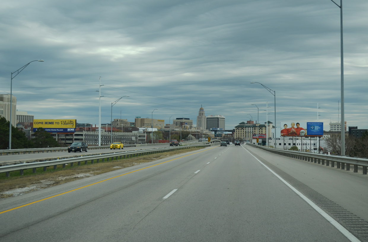
I-180/U.S. 34 curve southeast by Hawmarket Park toward the Nebraska State Capitol and Downtown Lincoln. 03/29/16
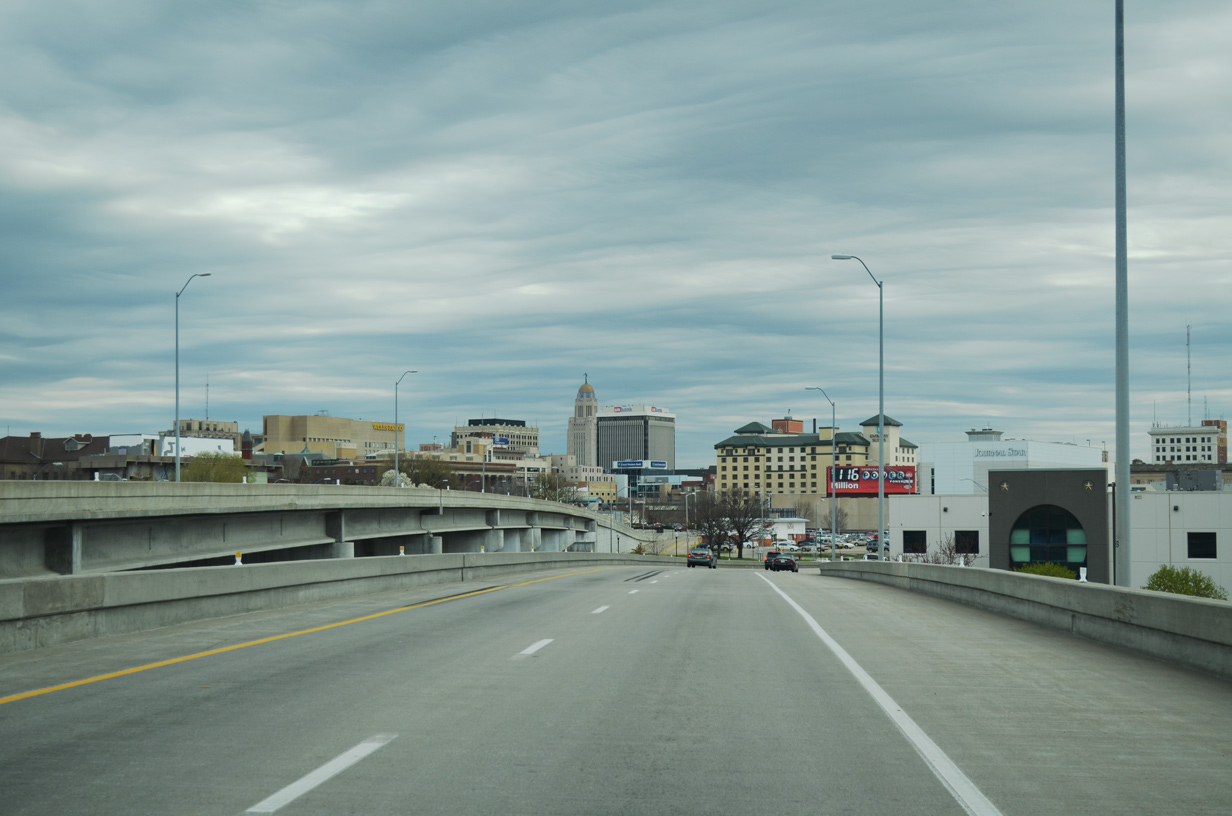
A 982 foot long viaduct11 takes I-180/U.S. 34 south across N 6th Street, Union Pacific Railroad lines, Salt Creek Roadway and a parking lot for nearby Memorial Stadium. 03/29/16
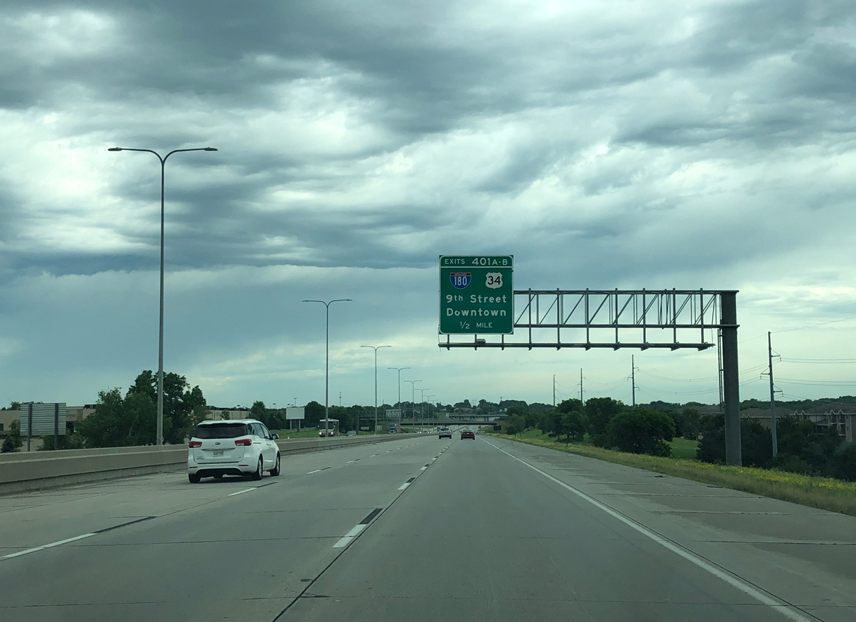
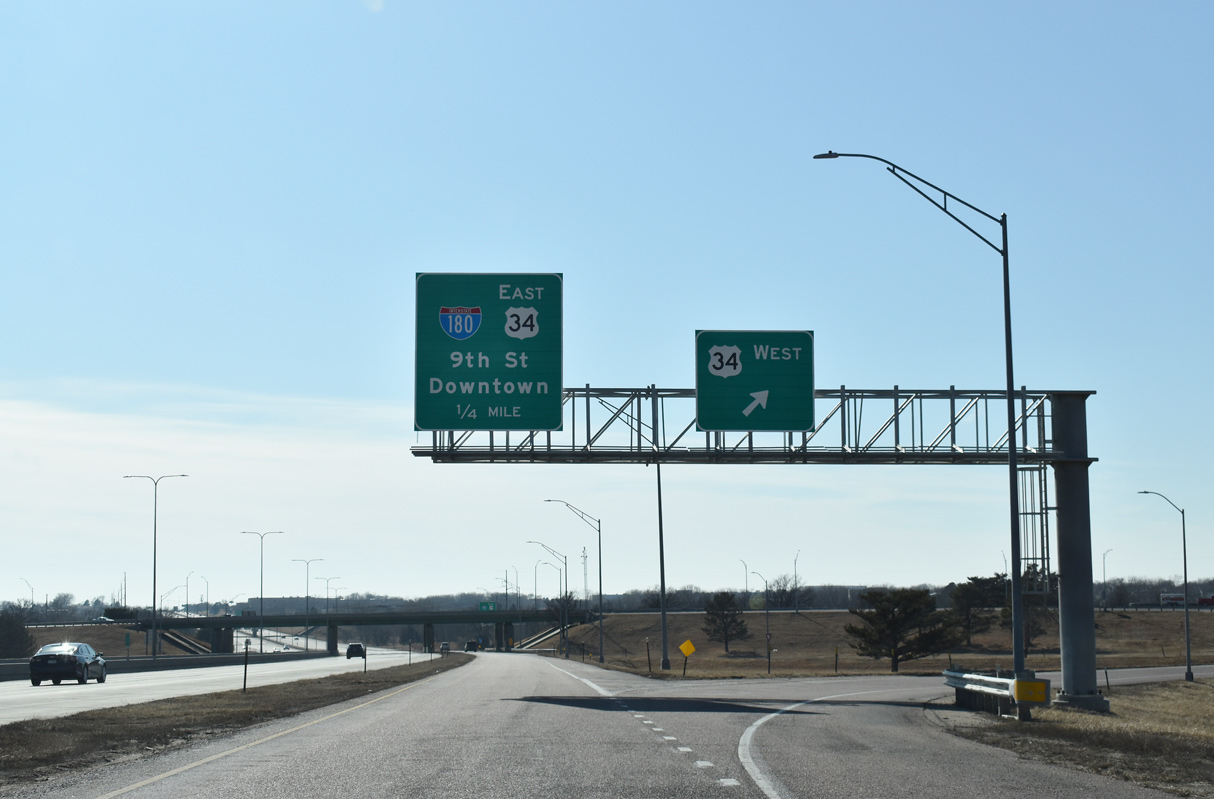
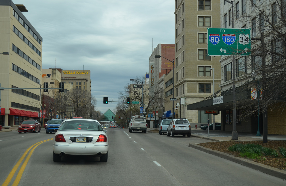
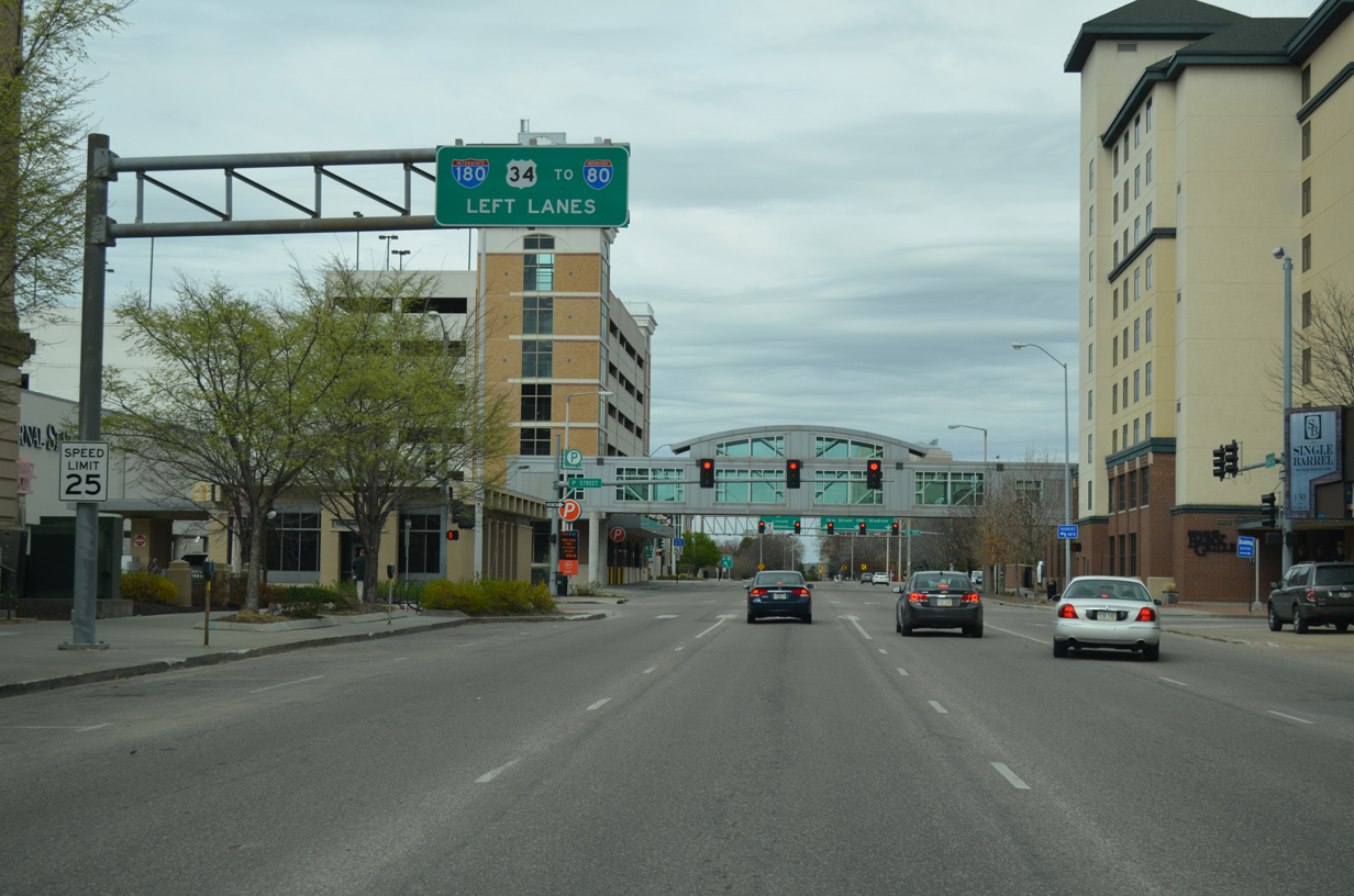
Interstate 180 concludes as U.S. 34 shifts onto N 9th Street. U.S. 34 heads four blocks south to O Street (former U.S. 6), where it turns east through Downtown. 02/22/20
![]() West at
West at ![]()
O Street (old U.S. 6) advances east into Downtown Lincoln from a viaduct spanning Union Pacific Railroad lines, Pinnacle Arena Drive and Canopy Street. Eastbound U.S. 34 follows Street eat from 9th Street, with westbound taking 10th Street north to I-180. 03/29/16
Westbound U.S. 34 follows 10th Street three blocks north from O Street to Interstate 180. 03/29/16
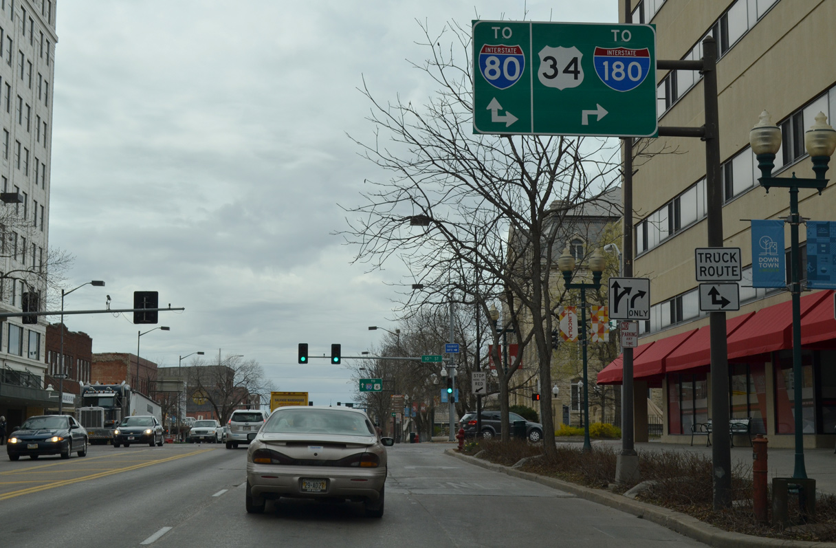
10th Street (U.S. 34) flows north with four lanes to Interstate 180 and the University of Nebraska-Lincoln (UNL). 03/29/16

U.S. 34 splits with 10th Street ahead of Memorial Stadium at UNL to accompany Interstate 180 north toward Lincoln Airport (LNK) and I-80. Photo by Peter Johnson (06/21/20).
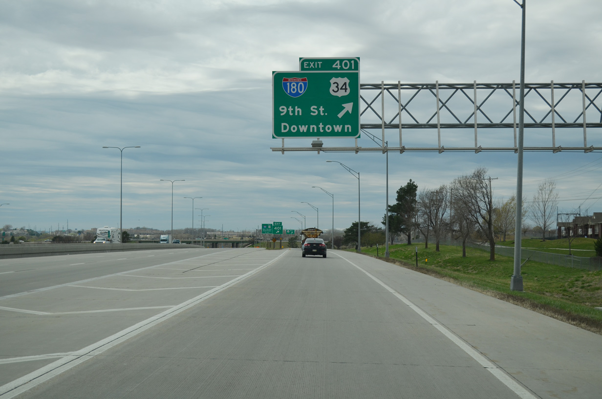
Leaving Downtown, Interstate 180/U.S. 34 rise onto a 1,227 foot long viaduct12 spanning 9th Street and UP Railroads. Photo by Peter Johnson (06/21/20).
Sources:
- “Interstate 180 Will Speed Fair Traffic.” Sunday Journal and Star (Lincoln, NE), August 25, 1963.
- “From New North Entrance, a Different Look at Lincoln.” Sunday Journal and Star (Lincoln, NE), June 23, 1963.
- “Chamber Reports Progress in 1963.” Sunday Journal and Star (Lincoln, NE), December 29, 1963.
- “City Grows, Problems Too.” Sunday Journal and Star (Lincoln, NE), January 26, 1964.
- 0 Years of Interstate – Nebraska and the Nation.
- “Interstate, New Building Interests Revive Belmont Dream.” Sunday Journal and Star (Lincoln, NE), December 29, 1963.
- “Plans for I – 180 Rile Lincoln Store Owners Tourists, Sales May Be Lost in Rebuilding.” Omaha World-Herald (NE), December 13, 1995.
- “I-180 reopens earlier than announced.” Lincoln Journal Star (NE), June 11, 1997.
- “Bridge building, Part II slated to begin Sunday.” Lincoln Journal Star (NE), November 12, 1997.
- “Workers end I-180 work months early.” Lincoln Journal Star (NE), May 29, 1998.
- I180/US34 over BNSF/UPRR 064-376-W, Lancaster County, Nebraska. BridgeReports.com.
- I180/US34 over BNSF/UPRR 064-376-W, Lancaster County, Nebraska. BridgeReports.com.
Page updated June 22, 2022.