Interstate 170 Missouri
Overview
Located in St. Louis County west of the city of St. Louis, Interstate 170 is the Inner Belt Expressway. I-170 is a commuter route serving suburban cities from Ladue and Clayton north to University City, Overland and Berkeley. The Inner Belt Expressway connects with I-270, St. Louis Lambert International Airport (STL) and the adjacent Boeing plant to the north and I-64/U.S. 40 at Brentwood and Richmond Heights to the south.
 History
Constructed during the 1960s, Interstate 170 was previously designated as Missouri Route 725. Route 725 was a part of a planned inner beltway that never made it to full fruition.1 The Federal Highway Administration (FHWA) approved adding 3.0 miles of the Inner Belt Highway, from I-70/Route 725 north to I-270, to the Interstate System on April 28, 1978 under the provisions of 23 U.S.C. 103(e)(1). 1979. The American Association of State Highway and Transportation Officials (AASHTO) approved the establishment of Interstate 170 on June 29, 1978. Expected to open by 1982, the application cited that I-170 will:
Facilitate North-South traffic movement between existing Interstate Routes 70 and 270 which are presently experiencing difficulties with this interchanging traffic.
The Missouri State Highway Commission subsequently applied for a southern extension of Interstate 170 over Route 725 to U.S. 40 at Richmond Heights.
On behalf of the Chief Engineer, Leland D. Fletcher, Assistant to the Chief Engineer – Planning and Design, advised the Commission that since the recent addition to the Interstate System of I-170 from I-70 to I-270, it was desirable to consider extending the I-170 marking over present Route 725 from I-70 southerly to U.S. Route 40 to provide a continuous single marking for the freeway facility.
The state advised that the extension would not incur additional responsibility for Federal funding and that the route would not be marked until the 3.03 mile long section under construction from I-70 and Page Avenue was completed. AASHTO approved the 7.7 mile long addition on June 25, 1979. The FHWA previously concurred that this section of Route 725 was a logical addition or connection to the Interstate System on June 15, 1979. 4.2 miles of Route 725 were open to traffic south from Page Avenue at the time.
Originally, the Inner Belt Expressway was proposed to continue further into the southern part of St. Louis County. However by the late 1990s, residents of neighborhoods in the project path voiced opposition. Ultimately plans were dropped and six months later, the Missouri Department of Transportation (MoDOT) sold the acquired right-of-way to a developer, which built a shopping center.2
The north end of Interstate 170 was reconstructed from the early 2000s to 2004. The project reconfigured the directional T interchange with I-270 to eliminate three left exits. Additionally the overpass carrying I-270 across Hanley and Graham Roads was replaced and widened to ten overall lanes.2
Route Information
North End – Hazelwood, MO
South End – Brentwood, MO
Mileage – 11.17
Cities – Richmond Heights, Clayton, Ladue, University City, Olivette, Overland, Berkeley, Hazelwood
- Junctions –


Source: December 31, 2021 Interstate Route Log and Finders List
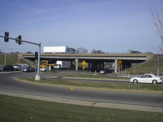
Eagar Road intersected the south end of Interstate 170 across from Brentwood Promenade shopping center. The connection was reconfigured into freeway exit ramps. Photo by Rich Piehl (12/00).
Eagar Road connected with the previous south end of I-170 just east of Brentwood Boulevard. Photo by Brian Dowd (06/02).
The “New I-64” project from 2000 to 2009 included a major overhaul of the exchange joining the south end of I-170 with I-64/U.S. 40 at Richmond Heights. The previous interchange lacked a direct connection from I-64 east to I-170 north, requiring motorists to navigate along Brentwood Boulevard to either Eagar Road or Galleria Parkway to access the Inner Belt Expressway northbound.2 A systems interchange with high speed ramps for all movements was built.
 Photo Guides
North End  – Hazelwood, Missouri
![]() North at
North at ![]()
Interstate 170 travels through the city of Berkeley east of St. Louis Lambert International Airport (STL) and Boeing north ahead of I-270. 10/16/04
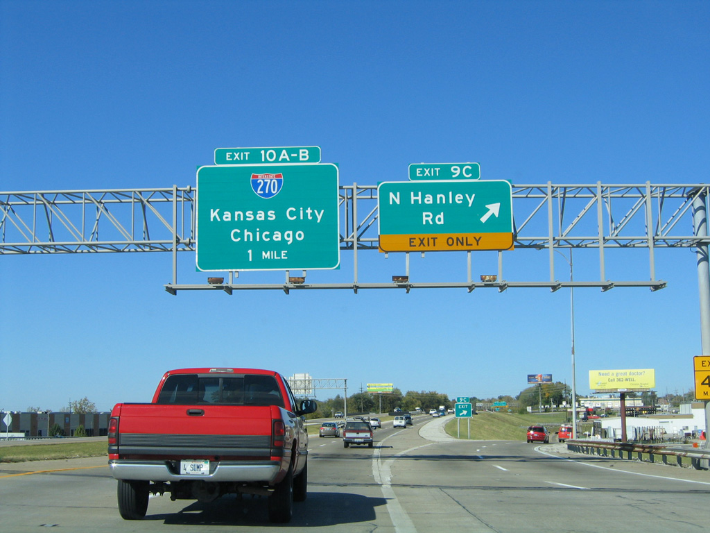
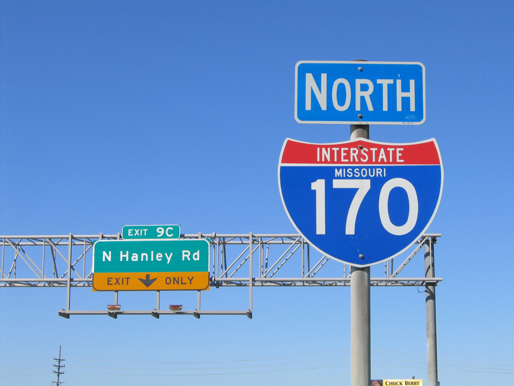
Exit 9C to Hanley Road is the final mainline off-ramp from I-170 north. Traffic partitions for I-270 west to Bridgeton and east to Bellefontaine Neighbors in one mile. 10/16/04
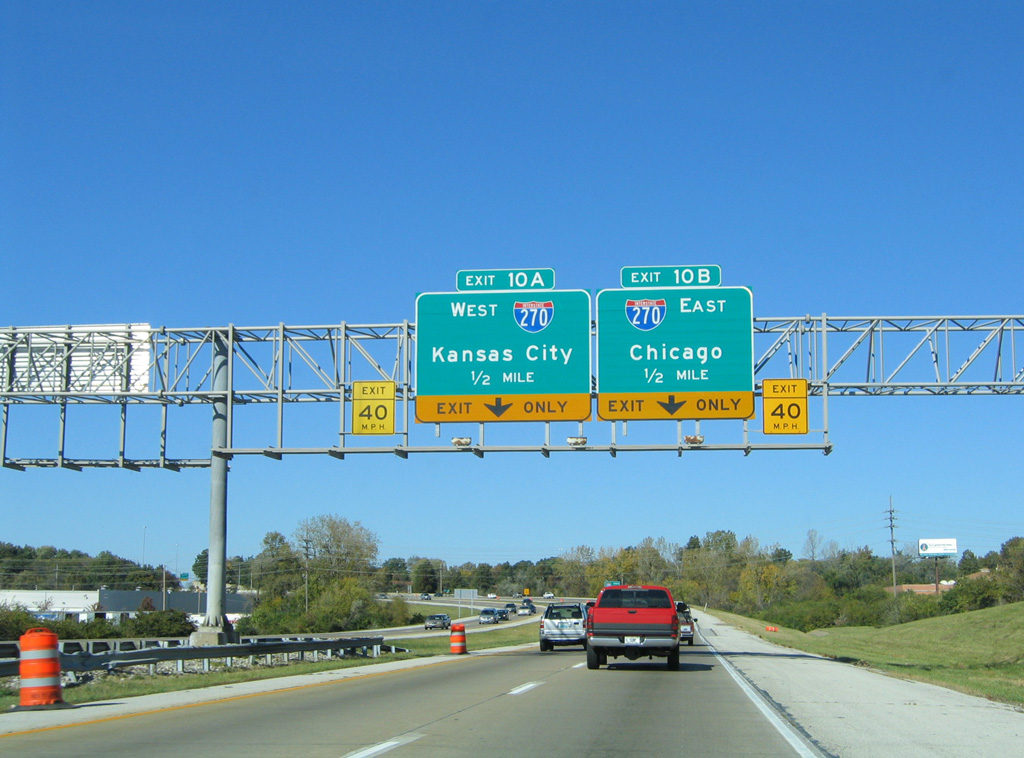
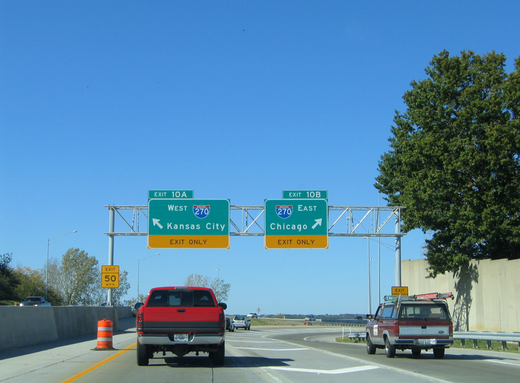
The Inner Belt Expressway makes an S-curve westward to the flyovers for Interstate 270. 10/16/04
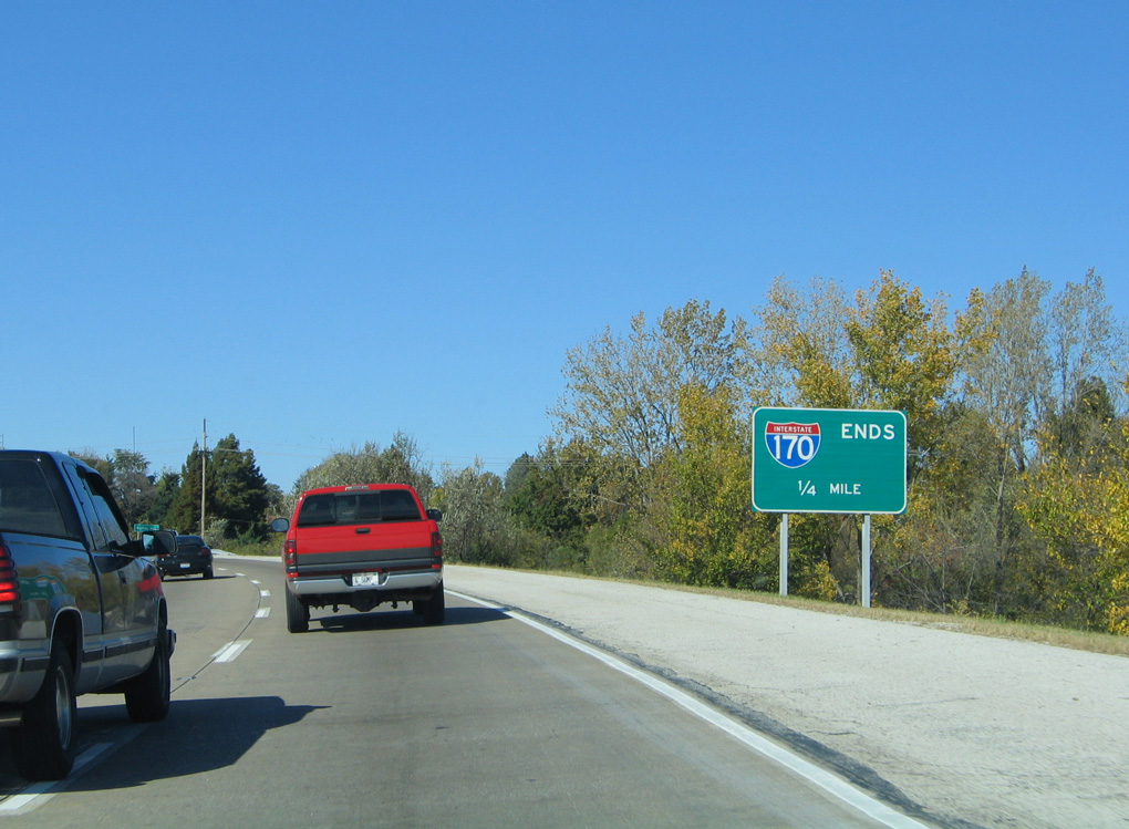
An end sign appears one quarter mile ahead of the exchange with Interstate 270. 10/16/04
Interstate 270 heads west 3.5 miles to Route 370 at Bridgeton, which provides a bypass around St. Charles. East from I-170, the outer belt continues nine miles to the Chain of Rocks Bridge across the Mississippi River. 10/16/04
![]() East at
East at ![]()
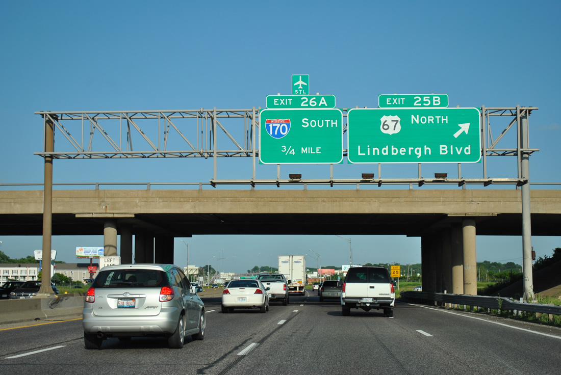
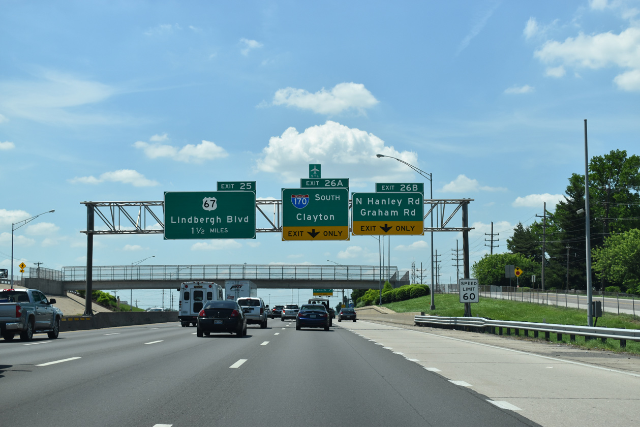
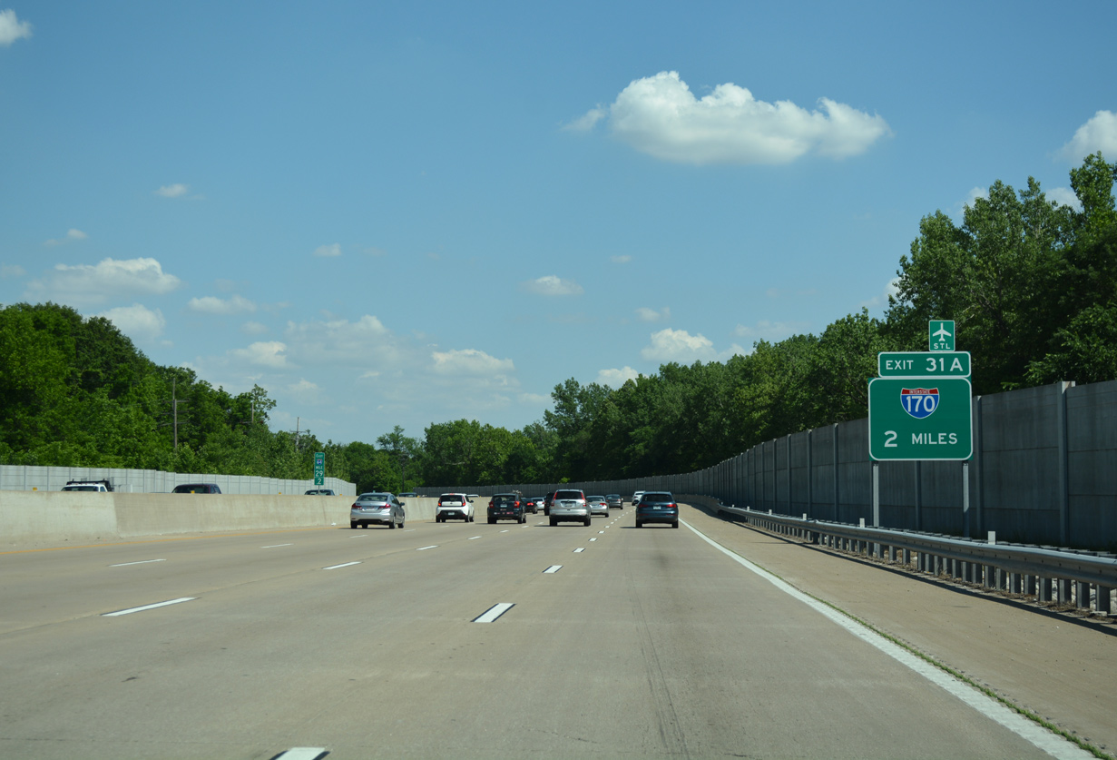
Interstate 270 and U.S. 67 converge at what was a cloverleaf interchange (Exit 25) just prior to I-170. The loop ramp for Lindbergh Boulevard north was removed by 2013. 05/03/12
Pershall and Dunn Roads accompany Interstate 270 east to the north end of I-170. No control cities are used for I-170, though the commuter freeway winds through a number of suburbs, including Overland, University City and Brentwood. 05/03/12
Interstate 170 runs along the east side of St. Louis Lambert International Airport (STL) south through Berkeley to I-70. 05/03/12
![]() West at
West at ![]()
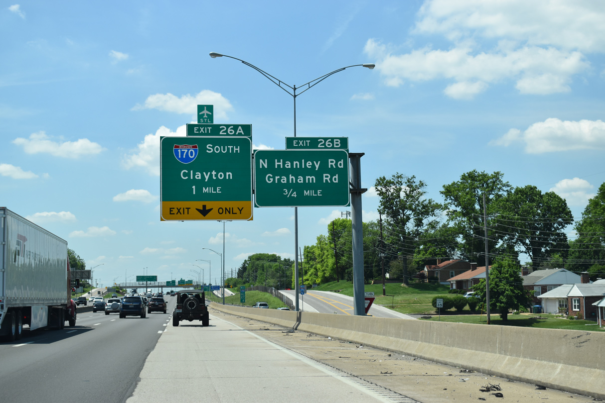
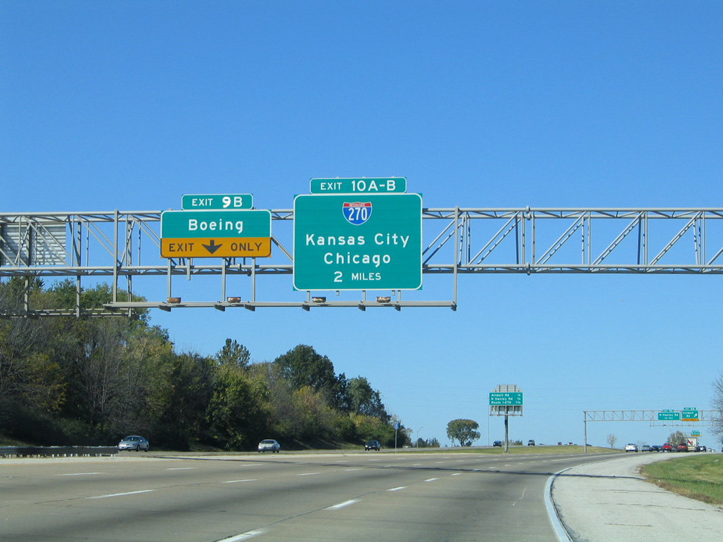
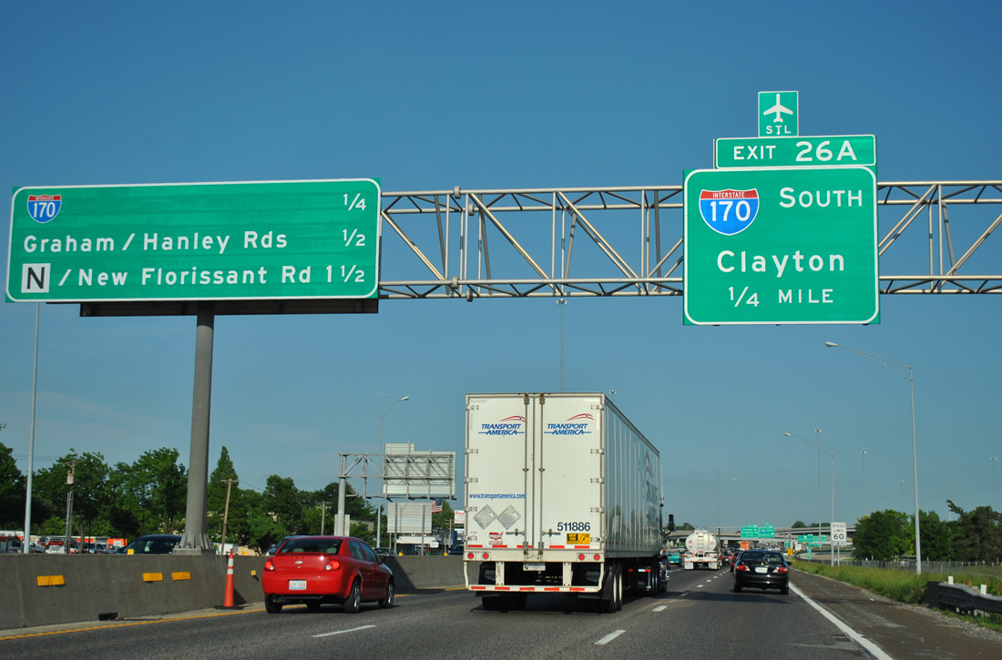
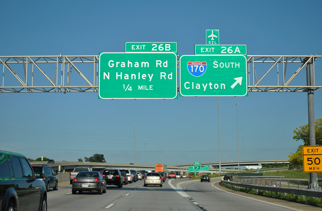
Succeeding ramps depart from Interstate 270 west for Graham Road / N Hanley Road to the cities of Hazelwood and Florissant and I-170 south to STL Airport over the next mile. 05/24/18
Reconstruction of the directional T interchange at Exit 26A with I-170 south included realigning ramps to eliminate left exits and the construction of expanded flyovers from I-270 west to I-170 south and from I-170 north to I-270 east. 05/24/18

An Arrow-Per-Lane sign replaced these overheads on I-270 west above N Hanley and Graham Roads. Photo by Jeff Morrison (04/19/08).
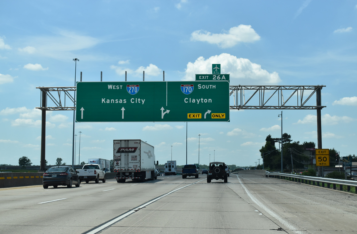
Taking place on the two lane flyover (Exit 26A) for Interstate 170 south, a ribbon cutting ceremony held on November 4, 2003 represented the completion for the upgrade project at I-170/270. Additional work included expansion of I-270 across N Hanley and Graham Roads to ten overall lanes. 05/24/18
South End  – Brentwood, Missouri
![]() South at
South at ![]()
![]()
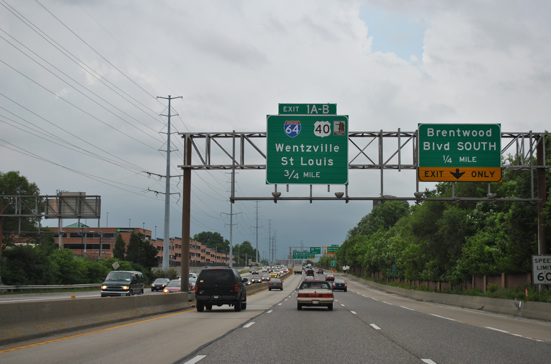
I-170 angles southeast through Clayton, 0.75 miles ahead of I-64/U.S. 40. Succeeding lane drops occur over the next half mile for Brentwood Boulevard. 05/04/12
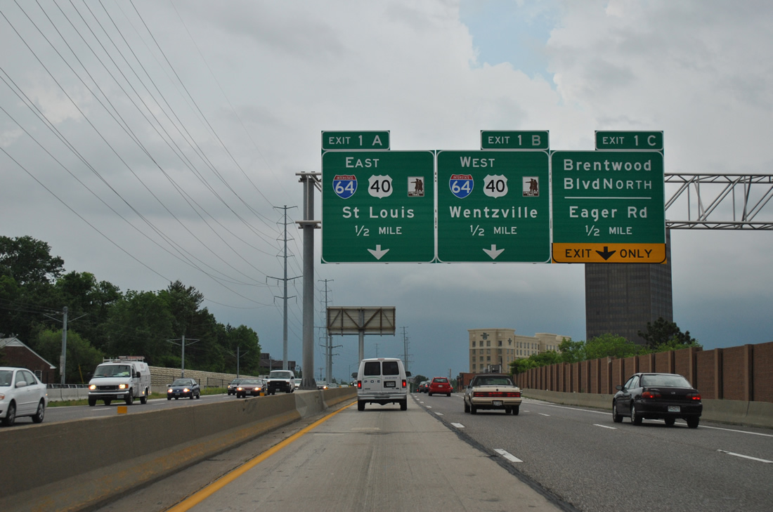
Crossing over Clayton Road, Interstate 170 enters the city of Richmond Heights. The freeway proceeds south by St. Louis Galleria mall to I-64/U.S. 40. 05/04/12
Two lanes descend from the south end of I-170 to connect with Eagar Road across from The Promenade at Brentwood retail complex. The mainline continues onto flyovers for I-64/U.S. 40. 05/04/12
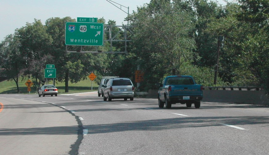
Interstate 64 extends west from the Poplar Street Bridge through St. Louis to Town and Country, Chesterfield, Weldon Spring and I-70/U.S. 61 (Avenue of the Saints) at Wentzville. 05/04/12
![]()
![]() East at
East at ![]()
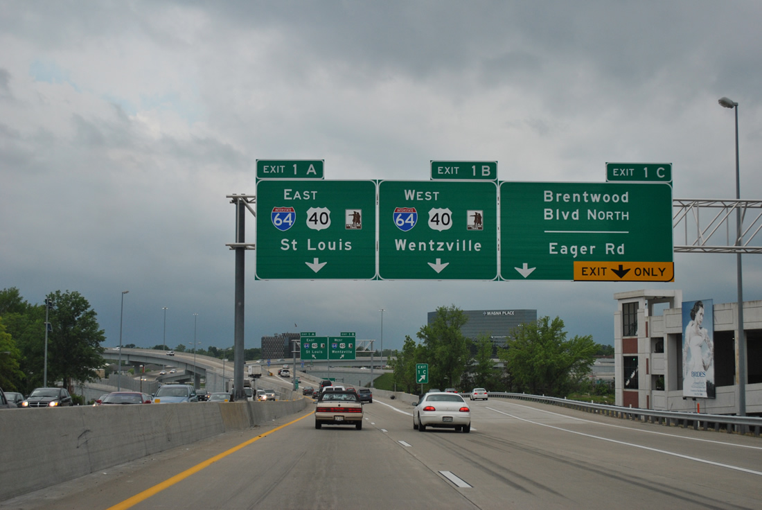
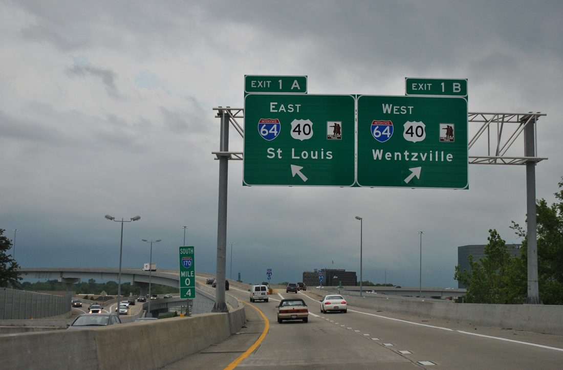
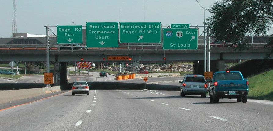
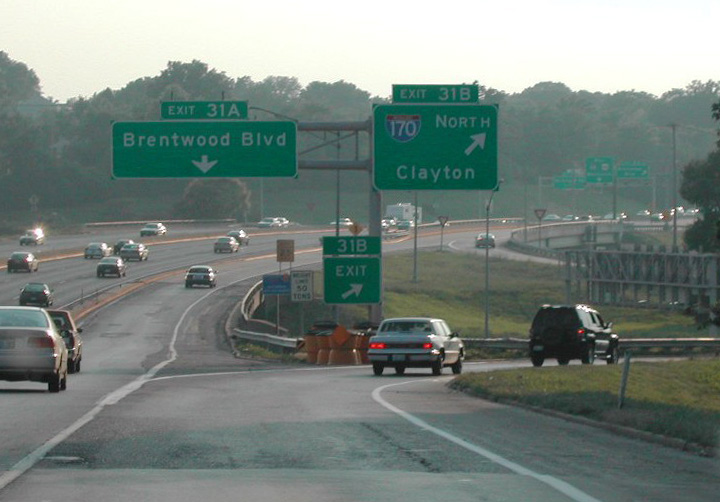
I-64/U.S. 40 navigate through a series of S-curves leading to the south end of I-170 at Exit 31A. 05/24/18
The fourth eastbound lane for I-64/U.S. 40 drops at the exit for both I-170 north to Clayton and Brentwood Boulevard. 05/24/18
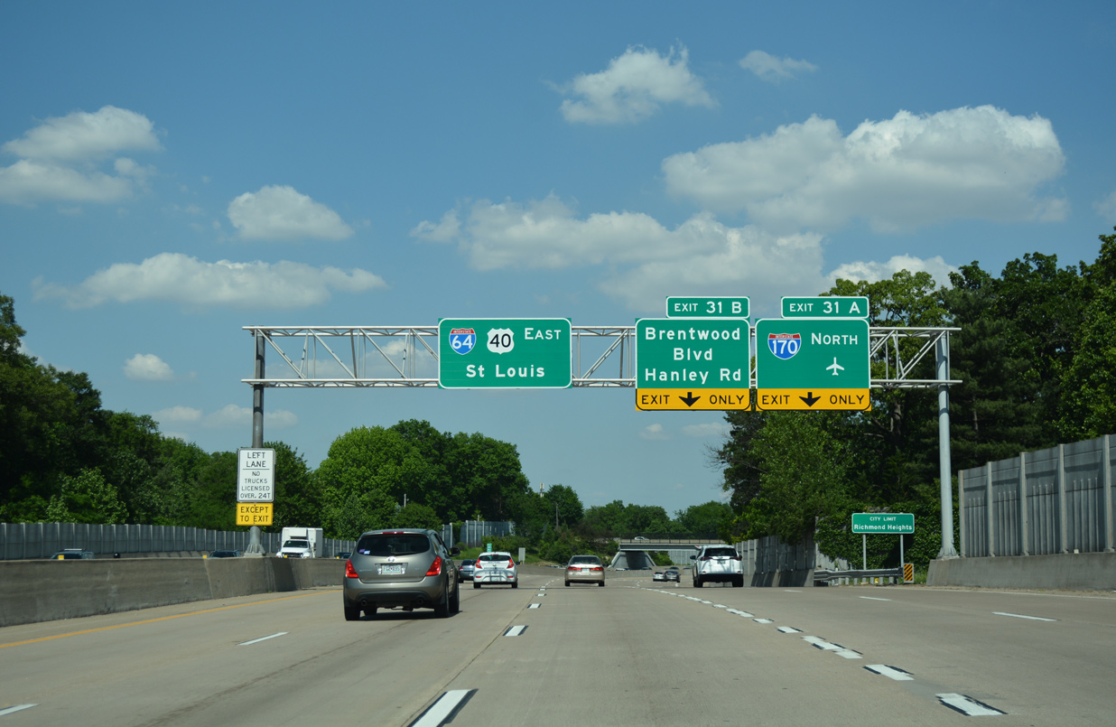
Interstate 170 (Inner Belt Expressway) connects a number of St. Louis County suburbs north to I-70 by STL Airport and I-270 at Florissant. No control city is used at the south end however. 05/24/18

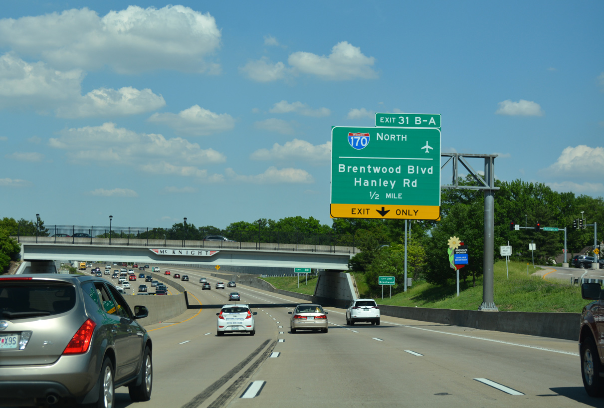
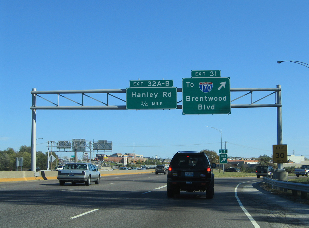
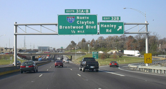
Exits 31A/B depart in unison from I-64/U.S. 40 east for I-170 north, Brentwood Boulevard to St. Louis Galleria mall and Hanley Road at Brentwood and Richmond Heights. 05/24/18
![]()
![]() West at
West at ![]()
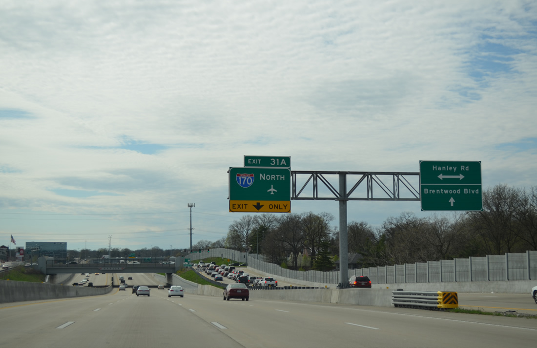
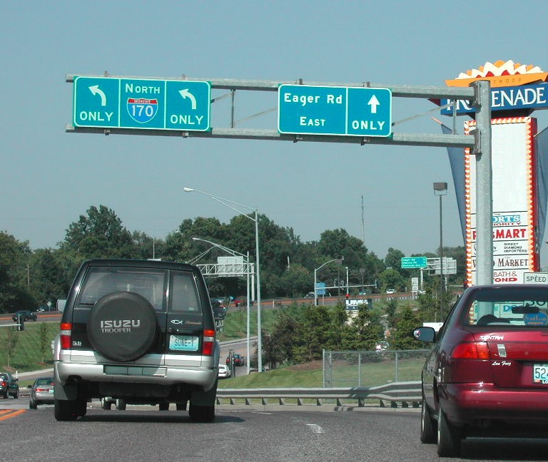
Exit 31B partitions with I-64/U.S. 40 west to both S Hanley Road and Brentwood Boulevard for the cities of Richmond Heights and Brentwood. The freeway mainline proceeds west to the systems interchange with I-170 north. 04/13/13

Interstate 170 (Inner Belt Expressway) heads north through Clayton, University City and Overland to I-70 near St. Louis Lambert International Airport (STL). 04/13/13
South End Throwback
![]() South at
South at ![]()
![]()
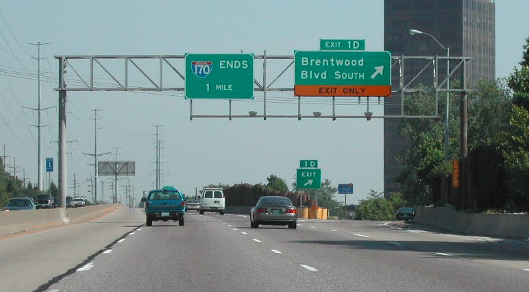
The end sign for I-170 at Exit 1D was amended from one to a half mile. The ramps for I-64 previously separated from I-270 three quarters of a mile south of Brentwood Boulevard. They split a quarter mile further north now. Photo by Brian Dowd (08/23/02).
The original traffic pattern at the south end of I-170 required all motorists headed for I-64/U.S. 40 shift to the right lane for low speed ramps west to Ladue and east to St. Louis. Photo by Brian Dowd (08/23/02).
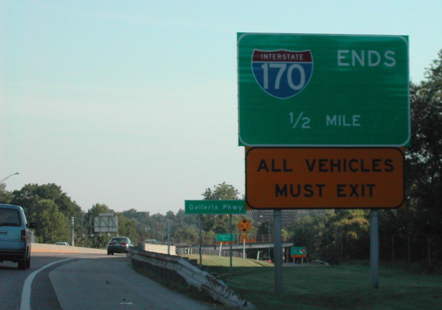
An end sign for I-170 stood by the Galleria Parkway underpass. An entrance ramp connected the adjacent retail area with the Inner Belt Expressway here. Photo by Brian Dowd (07/12/02).
A pedestrian overpass spanned I-170 south just ahead of the exit for I-64/U.S. 40 west to Wentzville. The freeway concluded south of I-64 to an at-grade intersection with Eagar Road. Photo by Brian Dowd (07/12/02).
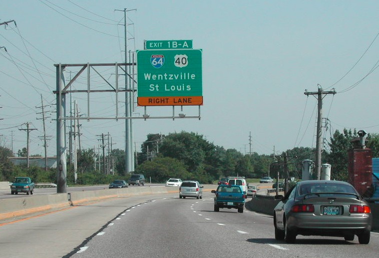
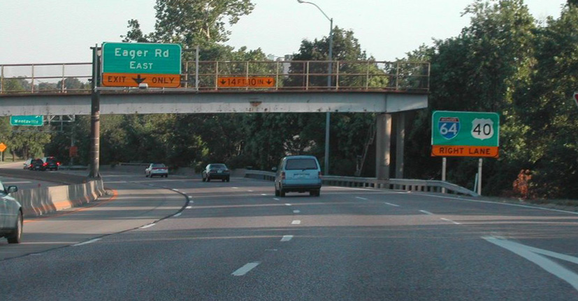
Exit 1B formerly joined a c/d roadway along I-64/U.S. 40 west through a folded diamond interchange with parallel Brentwood Boulevard. Photo by Brian Dowd (07/12/02).
A loop ramp joined I-170 with I-64/U.S. 40 east to Downtown St. Louis. Three lanes continued to Eagar Road at the entrance to Brentwood Promenade shopping center. Photo by Brian Dowd (07/12/02).
![]()
![]() East at
East at ![]()
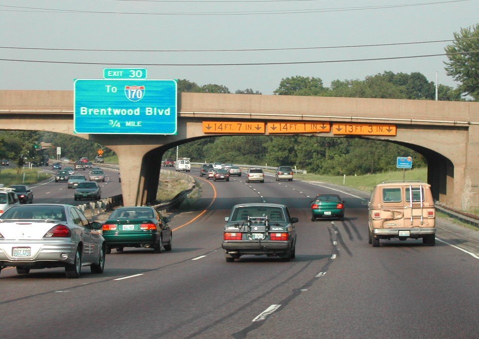
Prior to the New I-64 reconstruction project finished in 2009, a number of low clearance overpasses spanned the freeway east into St. Louis. The initial guide sign for I-170 was mounted on the McKnight Road overpass. Photo by Brian Dowd (06/02).
A Breezewood connection linked I-64/U.S. 40 east with Interstate 170 north via Exit 31 to Brentwood Boulevard and Galleria Parkway. 10/16/04
![]()
![]() West at
West at ![]()
A substandard six-ramp parclo interchange previously joined I-64/U.S. 40 with Hanley Road. Part of the New I-64 reconstruction project, work rebuilt this exchange into a split diamond interchange, with frontage roads extending past I-170 to Brentwood Boulevard. Photo by Rich Piehl (12/00).
A c/d roadway connected I-64/U.S. 40 westbound with both I-170 north to Clayton and Brentwood Boulevard to St. Louis Galleria mall. Photo by Brian Dowd (06/02).
Sources:
- Interstate 170. Wikipedia.org.
- Dowd, Brian.
Page updated July 23, 2021.