Interstate 140 North Carolina
Overview
Interstate 140 is the designation for the Northern Outer Loop / Wilmington Bypass in southeastern North Carolina. The freeway loop originates from a trumpet interchange with U.S. 17 to the west of Wilmington at Bishop in Brunswick County. I-140 heads north across an area of wetlands and forest to U.S. 74/76 at Leland, where it curves east toward Navassa and the viaduct system spanning the Cape Fear River.
East into New Hanover County, I-140 meets U.S. 421 at the western approach to the Dan Cameron Bridge, a high level span crossing the Northeast Cape Fear River. The bypass passes north of Wilmington International Airport (ILM) between Wrightsboro and Castle Hayne. Signs for I-140 end the route at the exchange with Interstate 40, just east of U.S. 117/NC 132. The remainder of the Wilmington Bypass east to U.S. 17 (Market Street) at Kirkland is marked as North Carolina State Route 140.
With full funding announced by Pender County on September 6, 2018, construction proceeded in 2019 on the Hampstead Bypass. Split into two sections, the $113 million project builds a 13 mile long limited access highway north from NC 140 to NC 210 at Hampstead, and from there northeast to U.S. 17 beyond Topsail. Work at NC 140 builds a half turbine interchange midway between I-40 and U.S. 17 at Scotts Hill. Completion of the bypass is anticipated for 2025 2030.10
 History
The state of North Carolina proposed designating Interstate 140 previously along the freeway on U.S. 1 from U.S. 421 at Sanford northeast to I-40 at Raleigh. The application sent to the American Association of State Highway Transportation Officials (AASHTO) was disapproved by the Route Numbering Subcommittee on April 16, 1999. The decision cited that significant portions of the route did not meet Interstate standards. Much of U.S. 1 was eventually upgraded during construction in the mid 2000s.
The Wilmington Bypass was preliminarily approved as an Interstate highway by the Federal Highway Administration on September 18, 2002. AASHTO approved Interstate 140 for the Northern Outer Loop on May 30, 2003. It was added to the North Carolina’s Strategic Highway Corridors map on November 12, 2004, including an unbuilt extension east from U.S. 17 at Bishop to U.S. 421 south of Wilmington.
The first section of Interstate 140 opened to traffic north of Wilmington on August 22, 2005. The three mile long freeway linked Interstate 40 with NC 133 (Castle Haynes Road) near Wrightsboro. Construction of the highway across the Cape Fear River to U.S. 421 continued with a scheduled opening expected in late 2005.1 However that segment was not ready for traffic until June 30, 2006.2 The section of freeway between I-40 and U.S. 17 at Scotts Hill also opened on June 30, 2006.2,3
Interstate 140 was designated initially along a 6.80 mile long segment of the Northern Outer Loop from U.S. 17-421 east across the Northeast Cape Fear River to Interstate 40 north of Wilmington. The remaining freeway east of I-40 to Scotts Hill was signed solely as U.S. 17 and later assigned as unmarked NC 140. The Federal Highway Administration (FHWA) concurred that the route met Interstate standards in a letter dated December 15, 2008.
The next section of the Northern Outer Loop constructed was the north-south stretch of freeway connecting U.S. 17 at Bishop / Town Creek with U.S. 74/76 west of Leland. It opened to traffic on October 16, 2014.4 Lacking the connection with the north leg of I-140, it was designated as North Carolina Route 140.
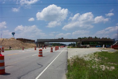
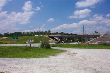
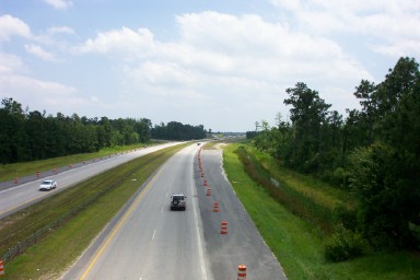
Under construction since 2011, the Leland stretch of the Wilmington Bypass was scheduled to open in September 2013. It was delayed. The final two sections, budgeted at nearly $246 million, linked the NC 140 segment south from Leland with the signed portion of I-140 east from U.S. 421 in New Hanover County.5 A $125 million contract was let in September 2013 on the section between Cedar Hill Road in Navassa and U.S. 421. This included the construction of a 65 foot high bridge over the Cape Fear River. A contract for work between U.S. 74/76, west of Leland, and Navassa was awarded by Spring 2014 as well. Completion of all work was scheduled for November 2017.6,7
Costing $211 million, the final section of I-140, between U.S. 74-76 at Leland and U.S. 421, opened to traffic on December 19, 2017. A ribbon cutting ceremony was held for the seven mile link on December 15.8 NC 140 south from Leland to U.S. 17 was subsequently renumbered as Interstate 140. Additional construction, including work on Mt. Misery and Cedar Hill Roads, continued as part of the Wilmington Bypass project through Spring 2018.9
Route Information
East End – Scotts Hill, NC
West End – Bishop, NC
Mileage – 12.69
Cities – Wilmington
- Junctions –

Source: December 31, 2021 Interstate Route Log and Finders List
I-140 Annual Average Daily Traffic (AADT)
Source: 2018 NCDOT AADT Mapping Application
Construction of the interchange joining U.S. 421 north with Interstate 140 northwest of Wilmington. Photo by Rob Murphy (06/03).
NC 133 north at the future folded diamond interchange with I-140 near Castle Hayne. Photo by Rob Murphy (06/03).
Looking south at Interstate 40 from the Sidbury Road overpass toward the directional cloverleaf interchange with I-140. Photo by Rob Murphy (06/03).
U.S. 17 was realigned to bypass Wilmington upon completion of the freeway east from U.S. 421 to Scotts Hill. This changed again with AASHTO approval on May 15, 2015 to restore U.S. 17 along what was U.S. 17 Business on Market Street and other roads through Wilmington. Sign changes however were not implemented until 2018, following the completion of I-140 across the Cape Fear River.
 Photo Guides
East End  – west of Scotts Hill, North Carolina
![]() East at
East at ![]()
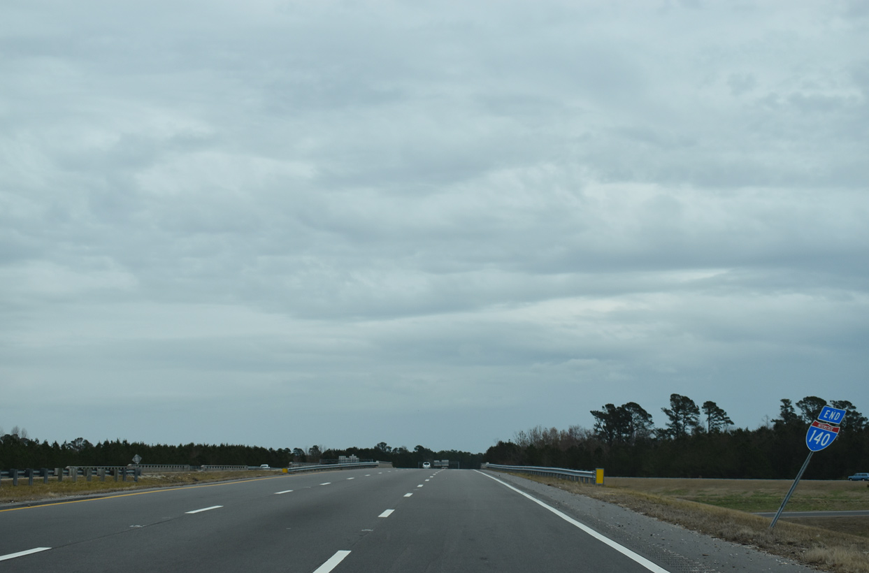
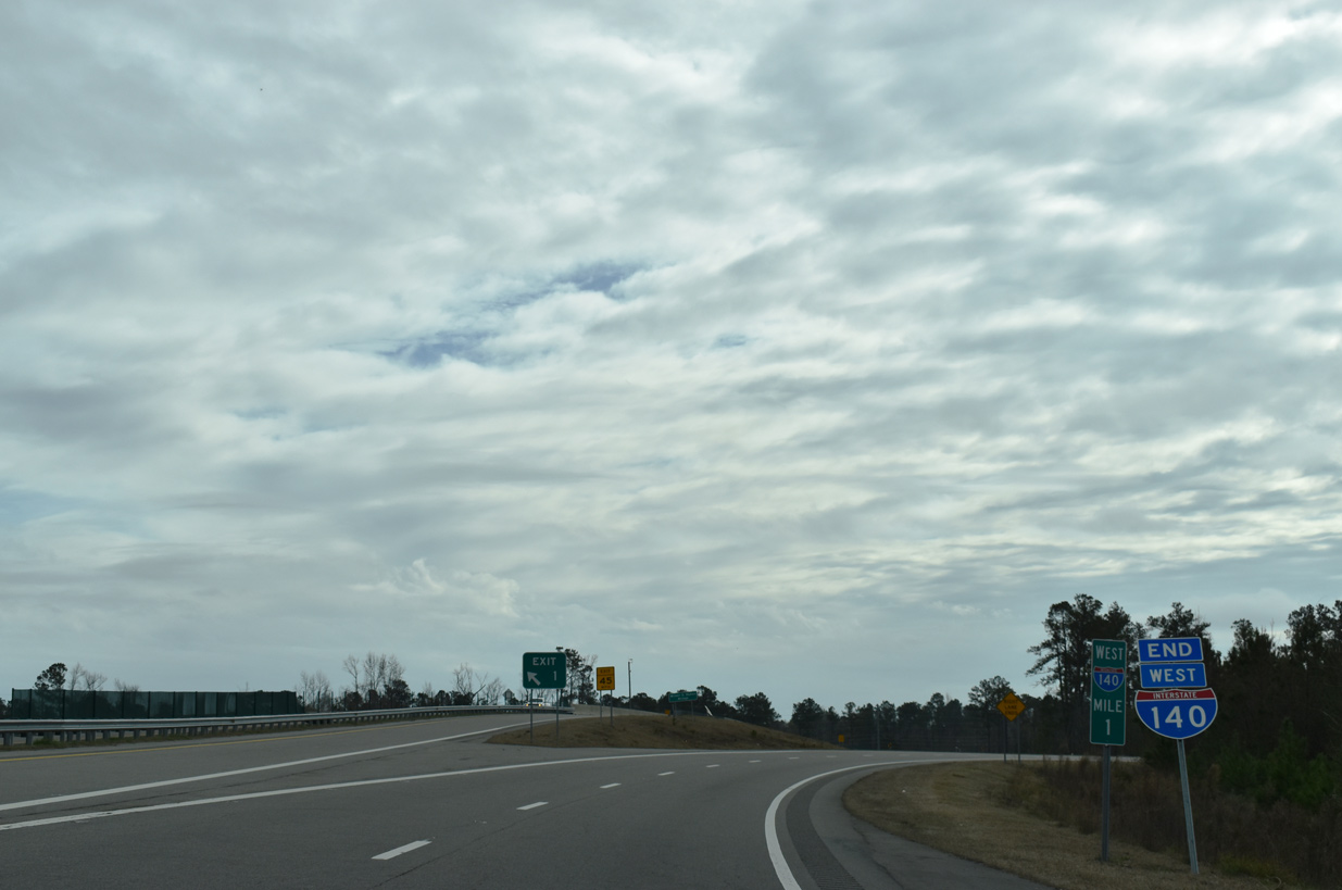
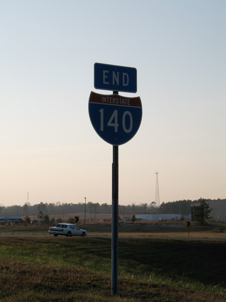
Signs for the Wilmington Bypass east of Interstate 40 reference the freeway as North Carolina State Route 140 instead of I-140. An end shield remains posted at the exchange with I-40. 01/19/19
NC 140 extends 5.2 miles east from the I-40 center line to converge with U.S. 17 north ahead of Scotts Hill. Construction started in 2018 along this stretch builds a half turbine interchange with the U.S. 17 Hampstead Bypass, a limited access highway extending north to NC 210. 01/19/19
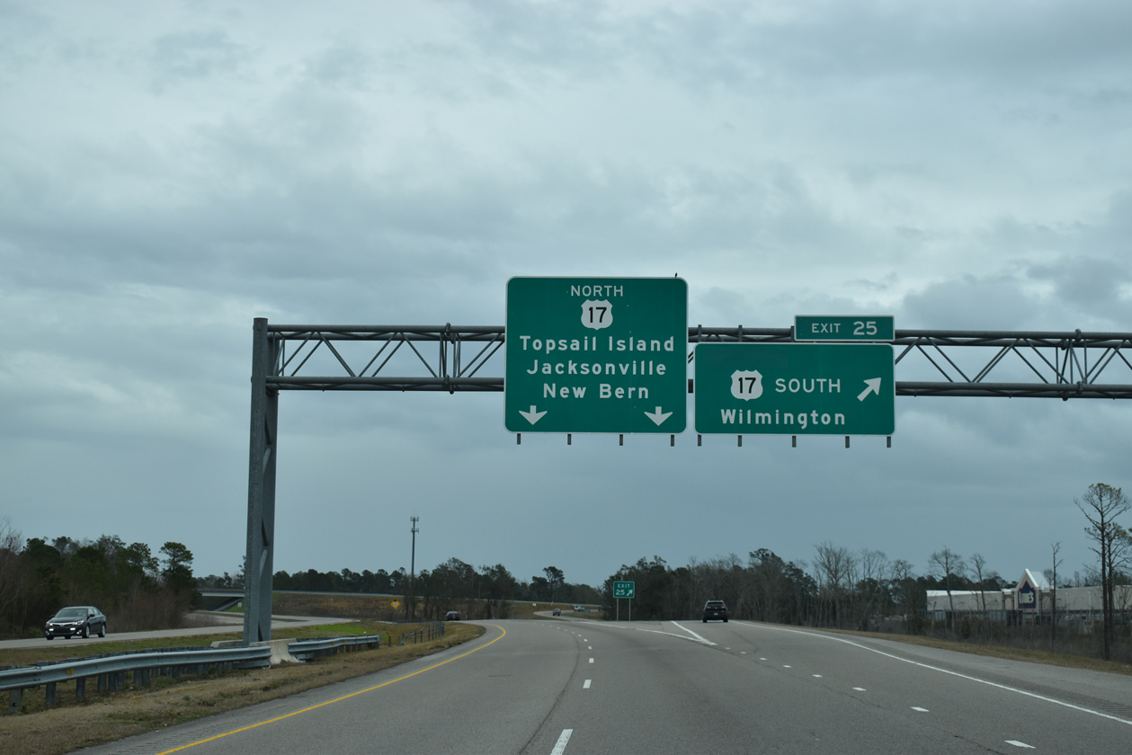
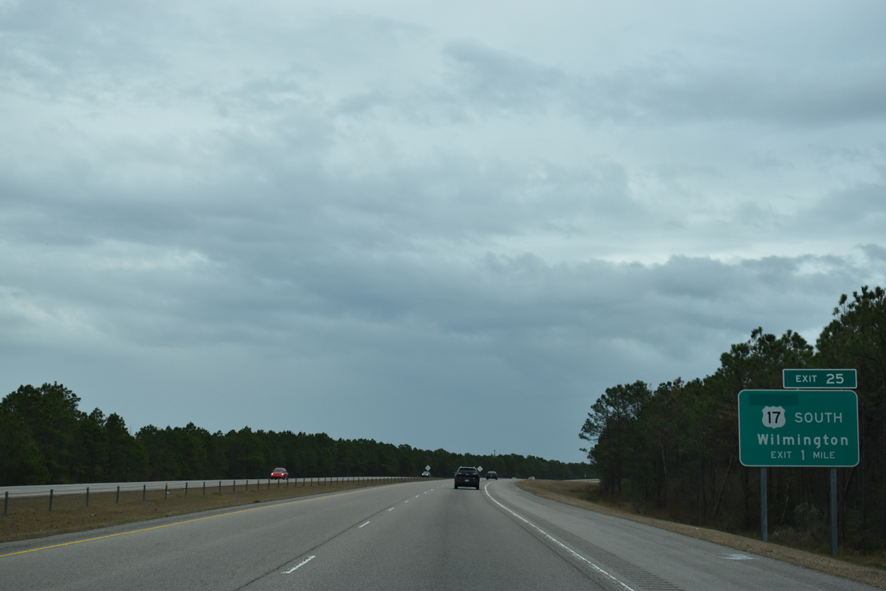
The John Jay Burney, Jr. Freeway (NC 140) concludes at the trumpet interchange with U.S. 17 (Market Street) leading southwest back into Wilmington and northeast to Scotts Hill and Jacksonville. 01/19/19
An end shield for NC 140 stands at the entrance ramp bringing U.S. 17 northward from Market Street at Kirkland. 01/19/19
![]() South at
South at ![]()
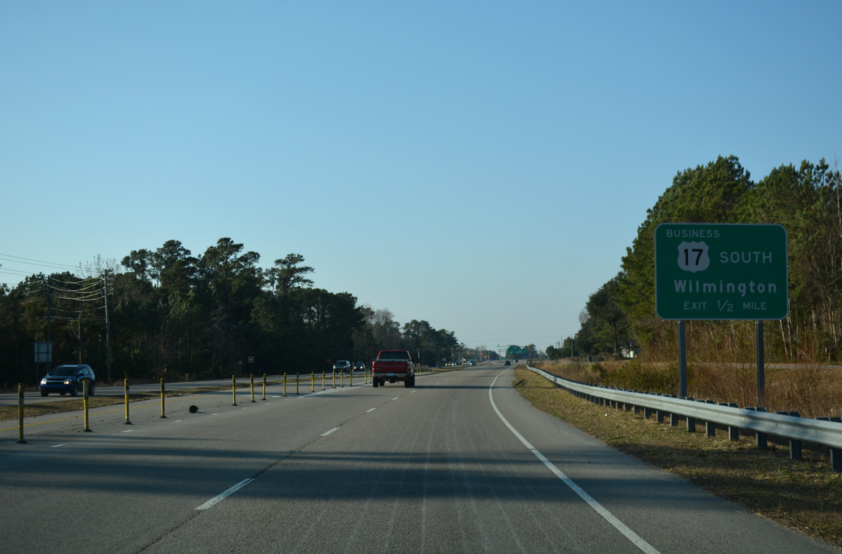
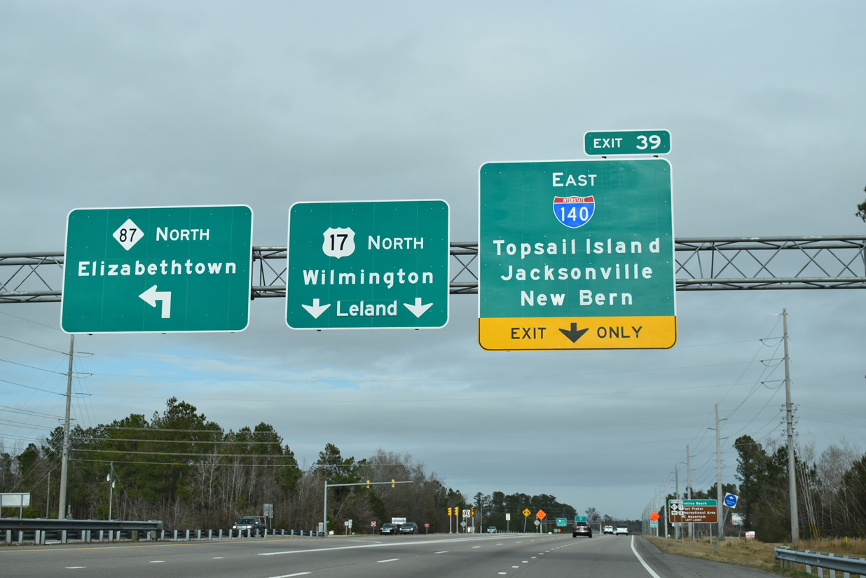
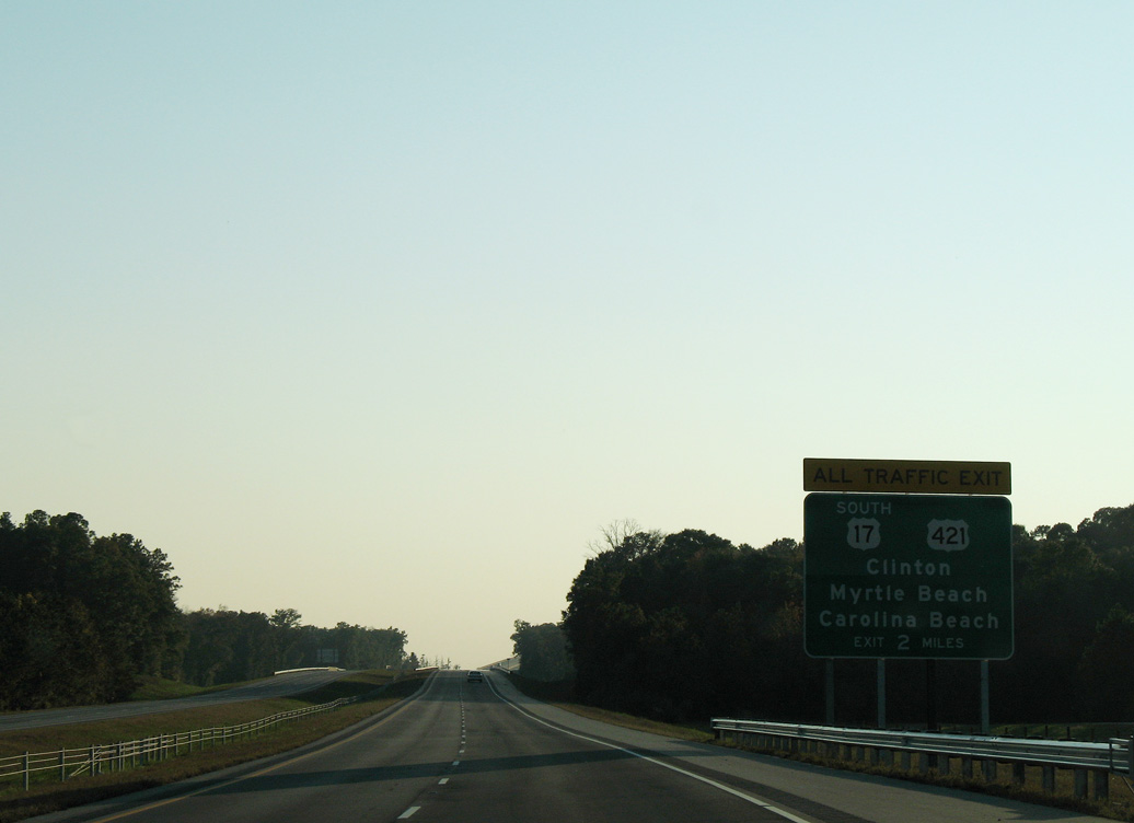
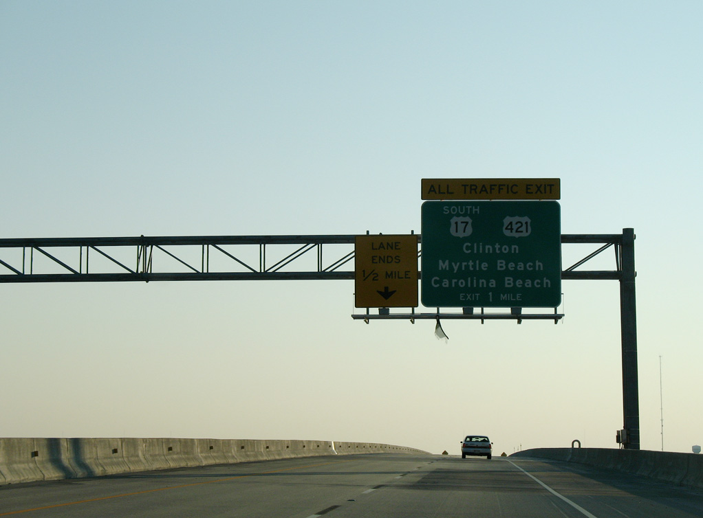
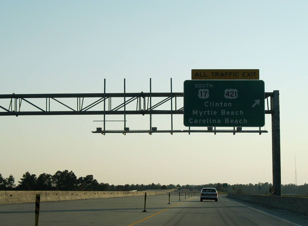
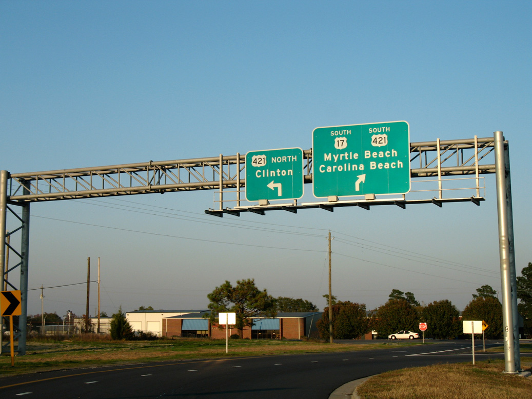
Crossing into New Hanover County, U.S. 17 advances south toward the split with NC 140 west. Interests to Carolina Beach, Fort Fisher State Recreation Area and the North Carolina Aquarium are directed onto the Wilmington Bypass. 12/31/17
A series of J-turns line U.S. 17 leading southwest to the exchange with NC 140. Prior to 2015, U.S. 17 accompanied the John Jay Burney, Jr. Freeway west to U.S. 421 to circumvent Wilmington. The former route along Market Street was U.S. 17 Business until the state returned U.S. 17 through the city. 01/19/19
![]() North at
North at ![]()

Market Street was realigned with construction of the trumpet interchange with NC 140. A loop ramp connects with NC 140 west to I-40 and I-140 while U.S. 17 continues north along a single lane ramp toward Scotts Hill. 12/31/17
![]() West at
West at ![]()
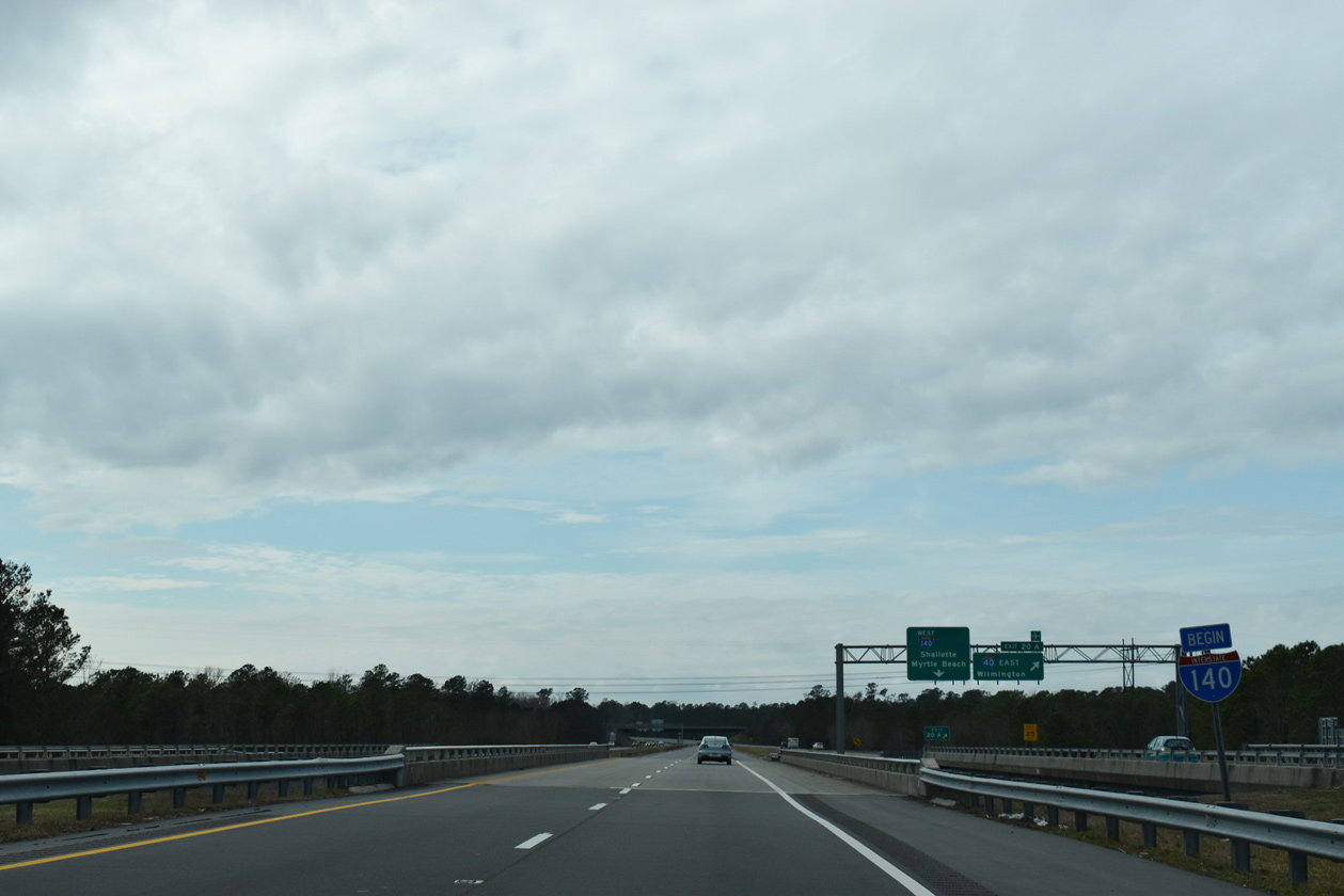
NC 140 west transitions to Interstate 140 at the overpasses spanning I-40 north of Wilmington. 01/19/19
Former East End – Wilmington, North Carolina
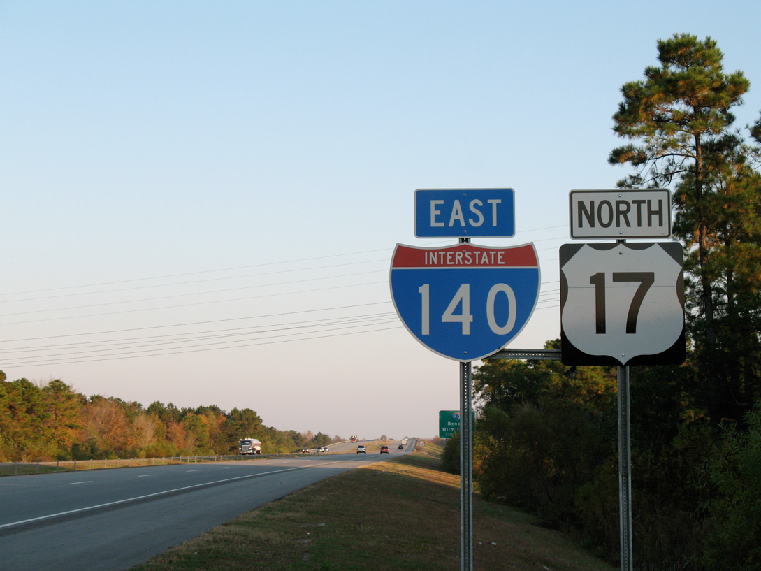
Exits 416 A/B join I-40 east with Interstate 140 west and U.S. 17 south, 1.25 miles from the Holly Shelter Road on-ramp. 11/11/06
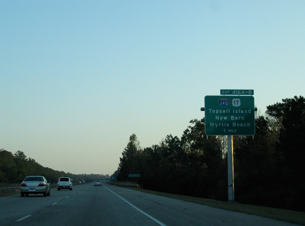
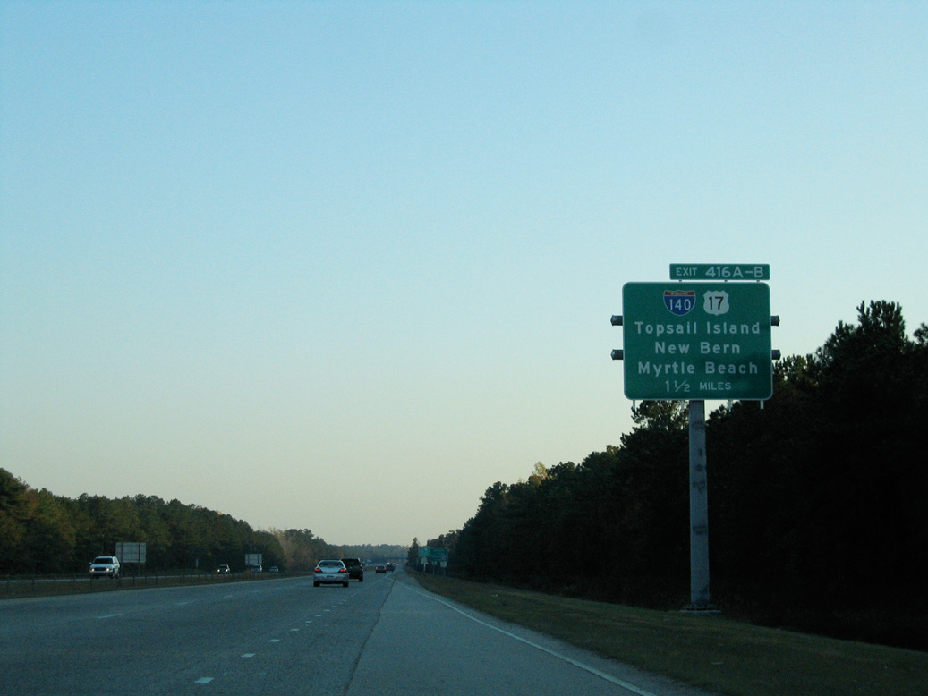
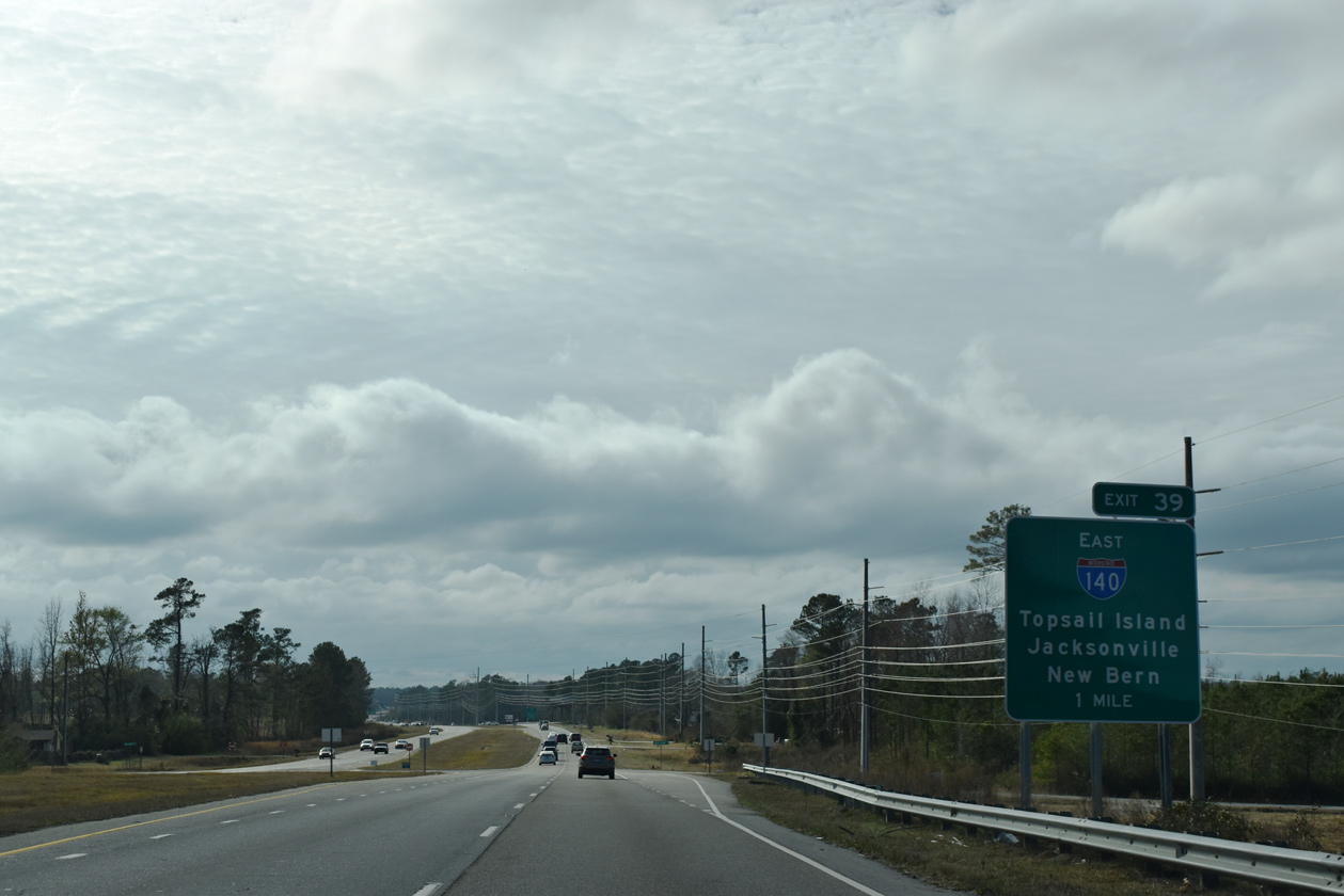
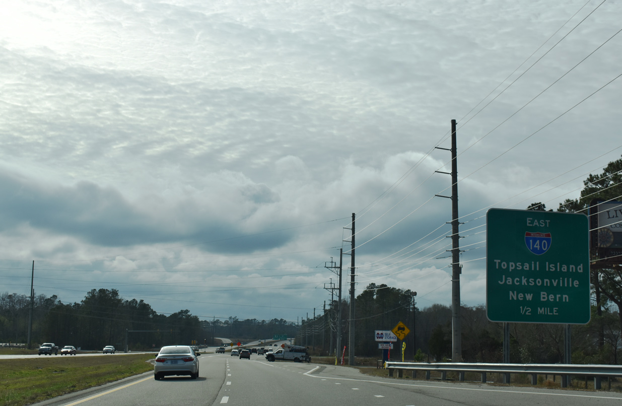
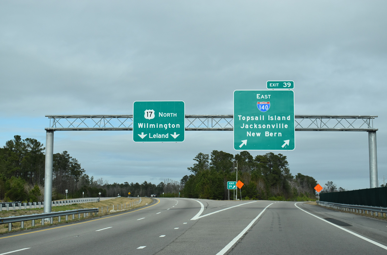
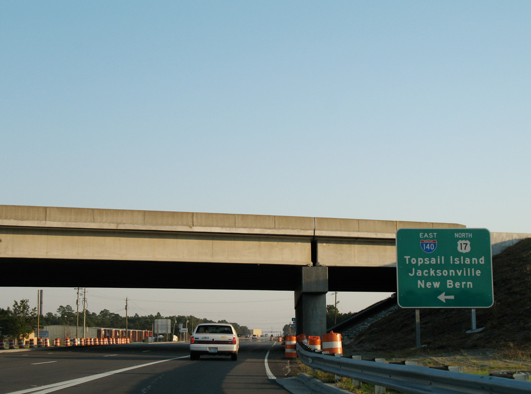
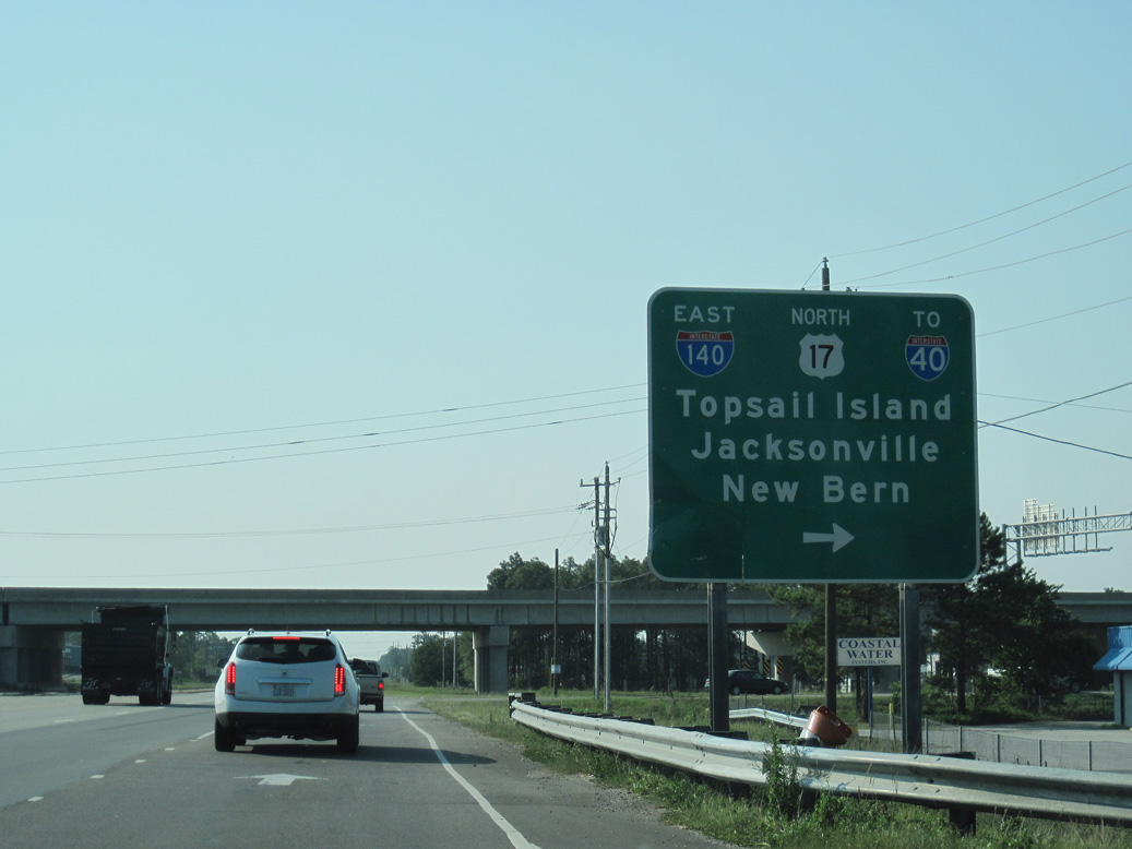
Interstate 140 provides a high speed route to U.S. 17 north to Topsail Beach and south to Myrtle Beach, South Carolina in addition to the inland cities of Jacksonville and New Bern. 11/11/06

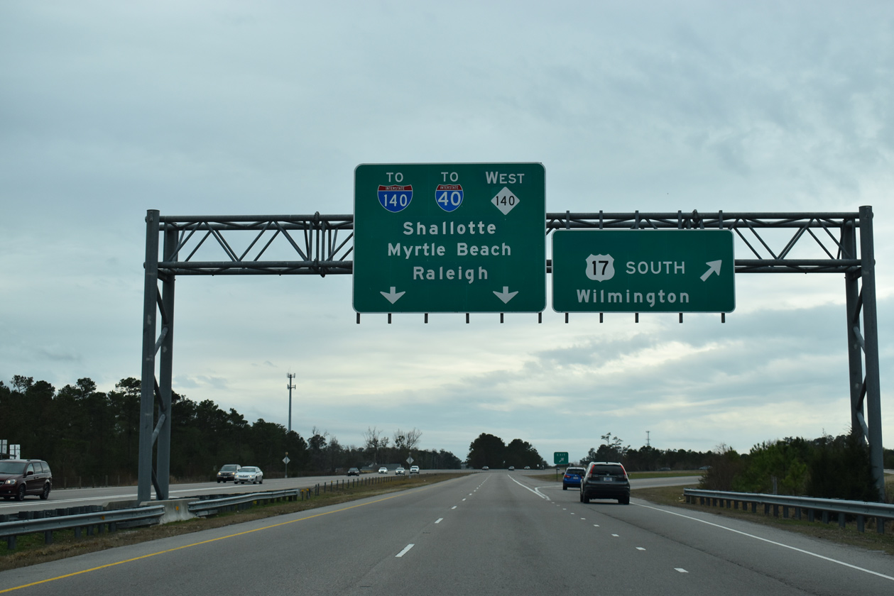
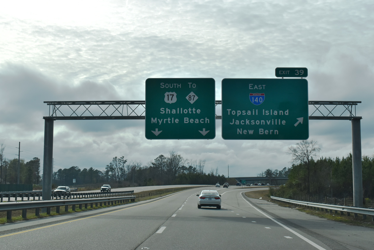
Exit 416 splits from the I-40 eastbound mainline as a c/d roadway for Interstate 140 west to Leland and Shallotte and east to Scotts Hill and Topsail Island. 11/11/06
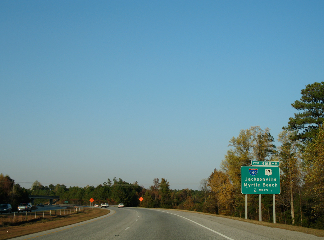
Leaving Wilmington on Interstate 40 west, two miles ahead of Exit 416 for U.S. 17 north to Jacksonville and U.S. 17 south to Myrtle Beach, South Carolina. 11/11/06
One mile south of the directional cloverleaf interchange (Exit 416) with I-140 west and U.S. 17 on I-40 west. I-140/U.S. 17 traveled six miles west to U.S. 421 (Independence Boulevard Extension). U.S. 17 continued six miles east to overtake U.S. 17 Business near Scotts Hill. 11/11/06
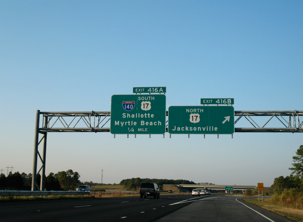
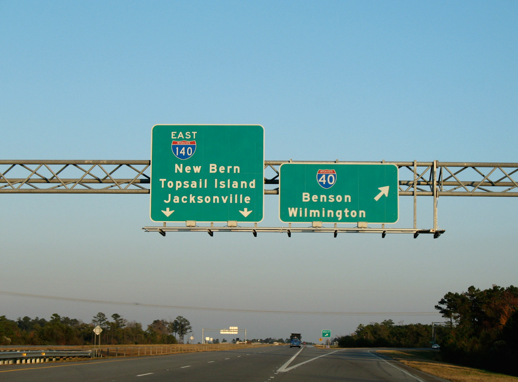
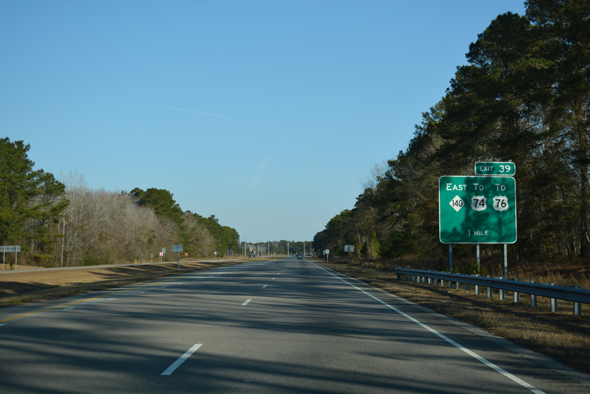
Exit 416 B departed I-40 westbound for the freeway along NC 140 east to Scotts Hill and Jacksonville. Jacksonville lies 42 miles northeastward at U.S. 258. 11/11/06
The eastern six miles of the Wilmington Bypass from Scotts Hill and the Pender County line west to I-40/140 were initially signed as U.S. 17 and later designated as NC 140. 11/11/06
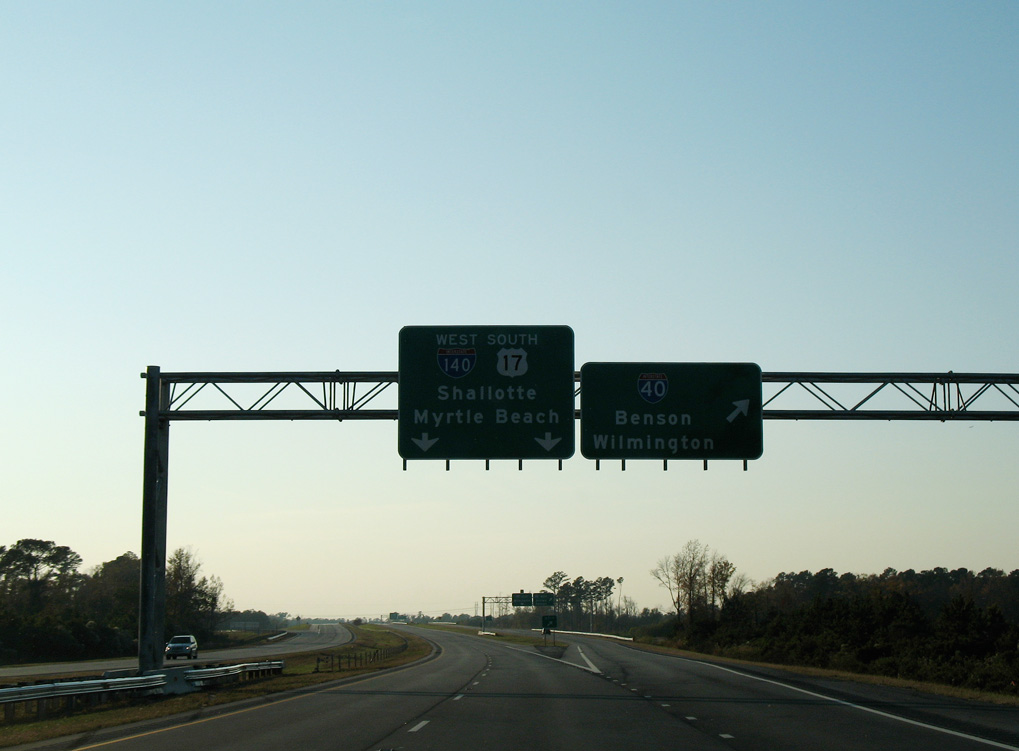
A collector distributor roadway separates from the freeway mainline for the ramps with Interstate 40. Shallotte accompanies Myrtle Beach as the control cities for the continuation of U.S. 17 south from Wilmington. 11/11/06
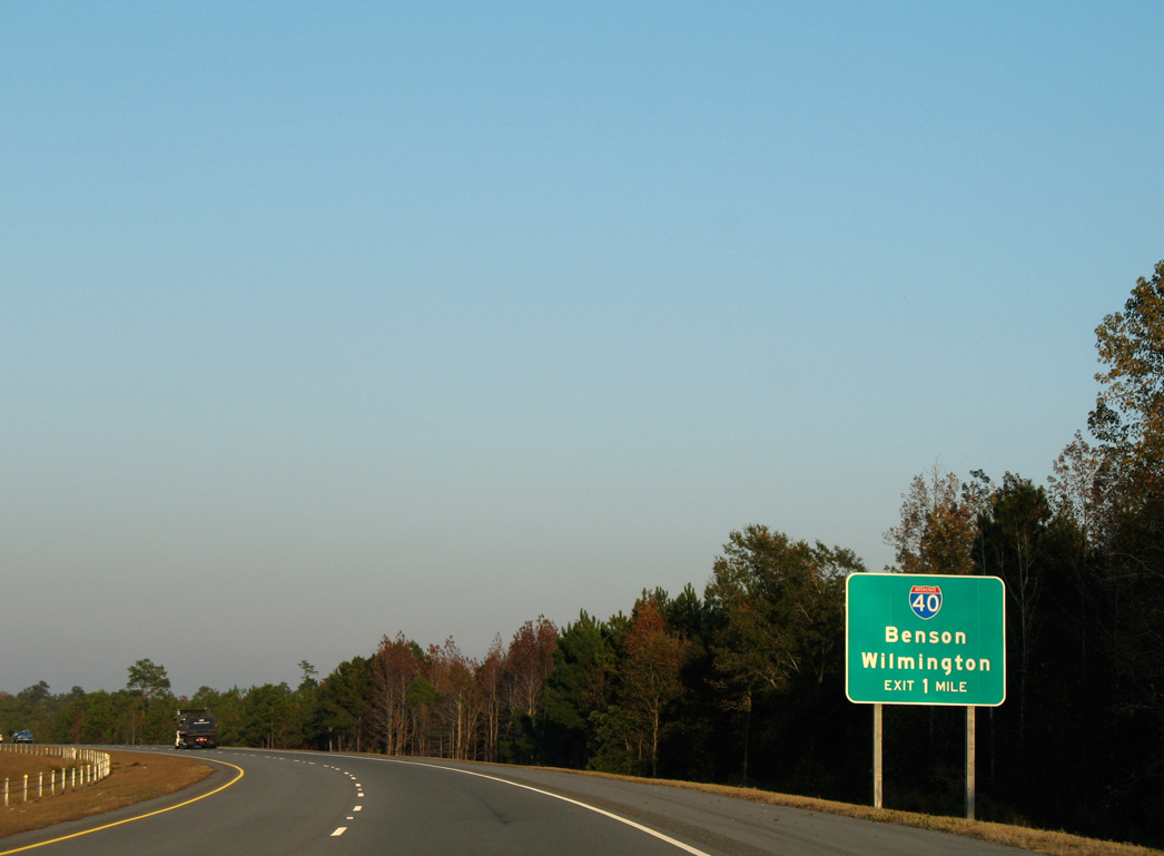
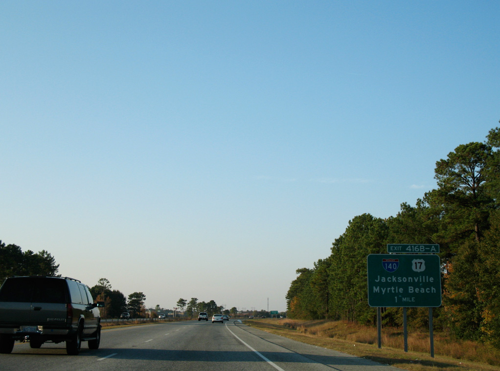
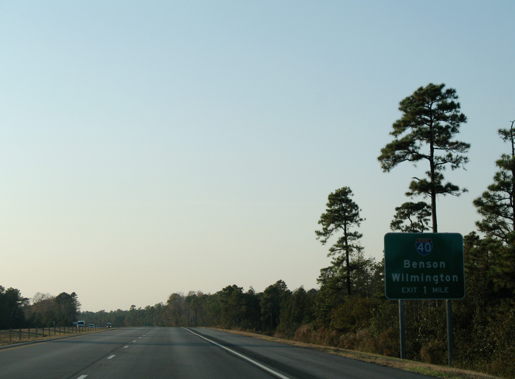
One mile ahead of I-40 on I-140 east / U.S. 17 north. Guide signs previously referenced Benson, the crossroads of I-40 and I-95, instead of Raleigh for Interstate 40 westbound. 11/11/06
An unnumbered exit departed from the east end of Interstate 140 to I-40. I-40 travels 3.75 miles south to conclude at U.S. 117/NC 132 outside Wilmington and 115 miles north to Raleigh. 11/11/06
West End – Bishop, North Carolina
![]() West at
West at ![]()
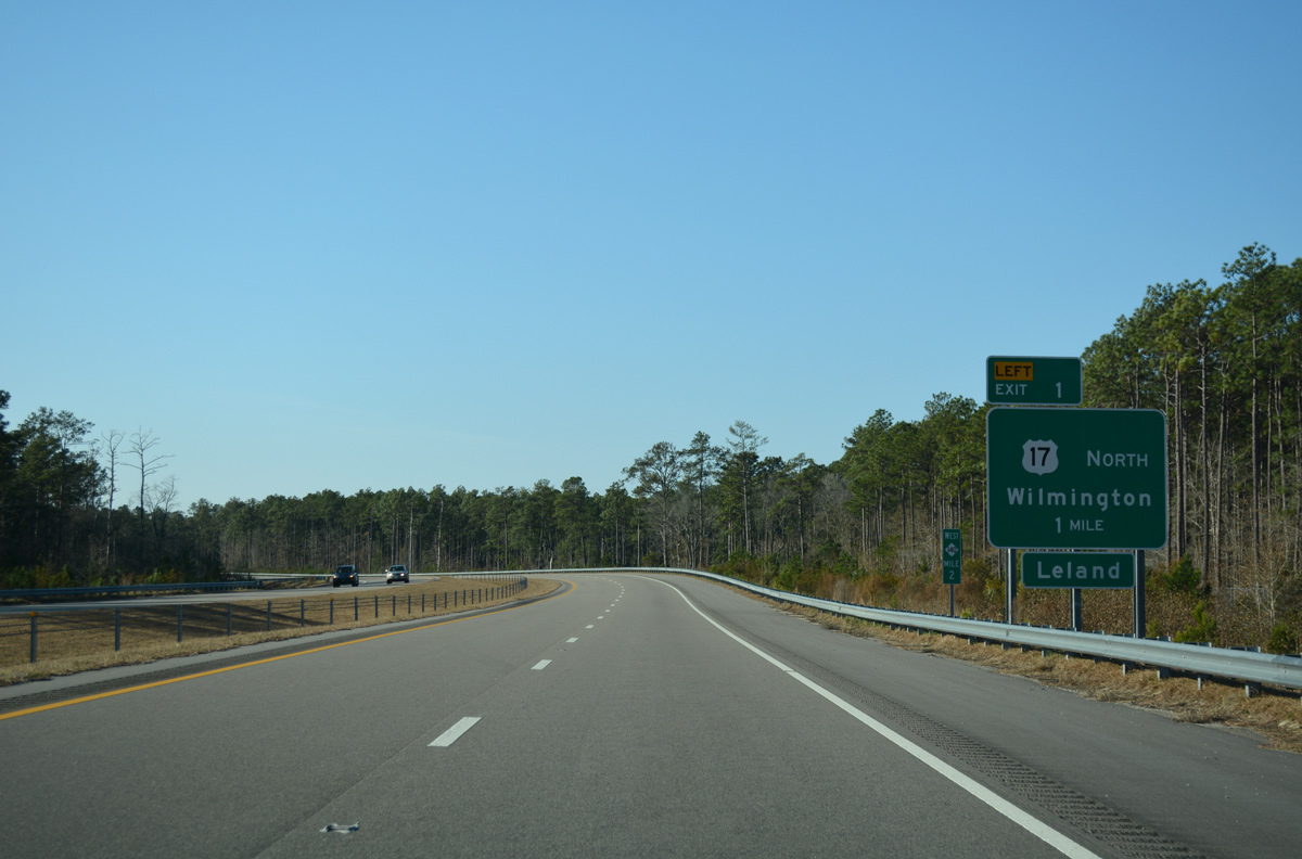
Interstate 140 makes a gradual S-curve one mile south to Exit 1 with U.S. 17 (Ocean Highway) north. 12/31/17
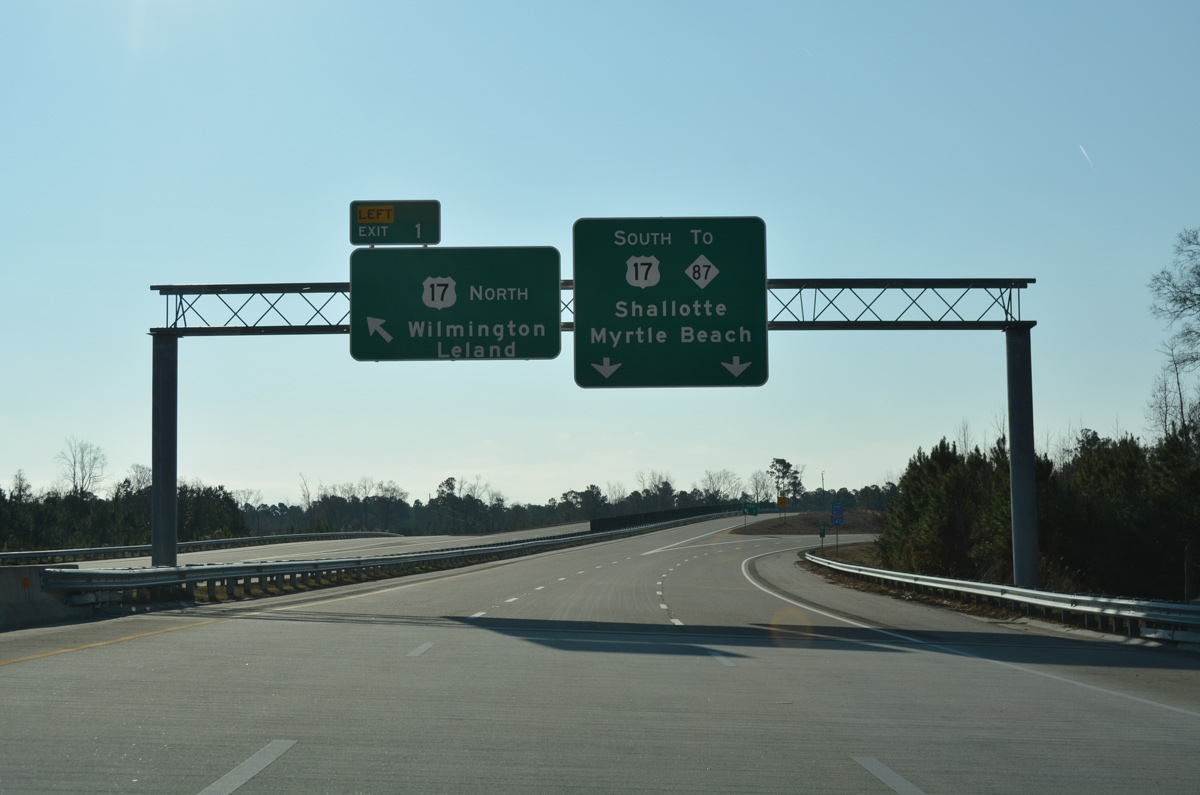
The freeway mainline defaults onto U.S. 17 south ahead of Bishop and Town Creek. Shallotte lies 25 miles to the southwest. 12/31/17
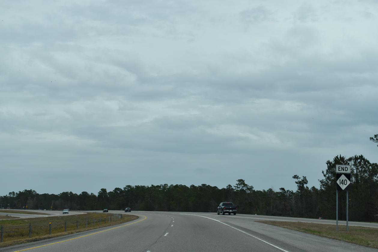
Although still posted as NC 140 when the last section of I-140 opened, an end shield for Interstate 140 was added at the trumpet interchange (Exit 1) with U.S. 17. 01/19/19
![]() South at
South at ![]()
Similar to the east end of I-140, construction of the trumpet interchange (Exit 39) with U.S. 17 west of Lanvale included the realignment of the US route to accommodate the exchange. 01/19/19
![]() North at
North at ![]()
Traveling north through Bishop along U.S. 17 one mile from Interstate 140 east. Previous signs for the freeway included green outs covering Benson for I-40 west from Wilmington. 12/31/17
NC 87 stems north from U.S. 17 just prior to Interstate 140. The rural state route winds northwesterly to U.S. 74/76 near Maco. Opening of I-140 provided a higher speed and more direct route to the US highways leading west to Whiteville. 01/19/19
Signed as Exit 39, two-lanes depart from U.S. 17 north for Interstate 140 to bypass Wilmington. U.S. 17 angles 5.4 miles northeast to combine with U.S. 74/76 at Belville. 01/19/19
Former West End  / Independence Boulevard Extension – Wilmington, North Carolina
The Dan Cameron Bridge connected the temporary west end of I-140 with U.S. 421 by industrial areas north of Wilmington. 11/11/06
End Interstate 140 marker posted along the loop ramp to U.S. 421 (Independence Boulevard Extension). 11/11/06
U.S. 17 previously overlapped with U.S. 421 two miles southward from I-140 to U.S. 76 west of Wilmington. 11/11/06
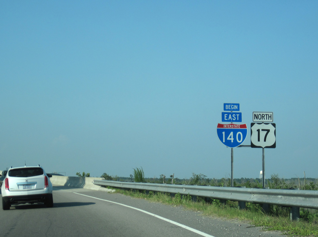
A begin shield for Interstate 140 stood along the entrance ramp from U.S. 421 to the Dan Cameron Bridge across the NE Cape Fear River. Until 2015, U.S. 17 followed all 12 miles of the freeway between U.S. 421 and U.S. 17 Business near Scotts Hill. 06/24/10
Joining Wilmington with Clinton to the north on a parallel alignment to I-40, U.S. 421 (Independence Boulevard Extension) connected with the temporary end of I-140 and U.S. 17 south of Wards Corner. 11/11/06
U.S. 421 follows Independence Boulevard Extension northward from U.S. 17/76 near Belville to Interstate 140 at the Dan Cameron Bridge. 06/24/10
Sources:
- “First leg of bypass set to open.” The Wilmington Star, August 19, 2005.
- “I-140 Wilmington Outer Loop,” Robert Malme.
- “Gov. Easley Opens First Stretch of I-140 Wilmington Bypass.” NC Office of the Governor News Release, August 22, 2005.
- “Southern section of Wilmington bypass to open.” StarNews (Wilmington, NC), October 15, 2014.
- “Opening delayed for Leland stretch of Wilmington Bypass.” Port City Daily (Wilmington, NC), August 28, 2013.
- “Leland officials pleased with I-140 plans.” StarNews (Wilmington, NC), September 29, 2013.
- “Brunswick County expected to benefit from I-140 bypass.” StarNews (Wilmington, NC), November 11, 2016.
- “Last stretch of I-140 opens.” StarNews (Wilmington, NC), December 19, 2017.
- “Wilmington I-140 bypass scheduled to open Dec. 15.". StarNews (Wilmington, NC), October 28, 2017.
- “Hampstead Bypass now fully funded, construction to begin soon.” Port City Daily (Wilmington, NC), September 6, 2018.
Page updated on August 22, 2019.