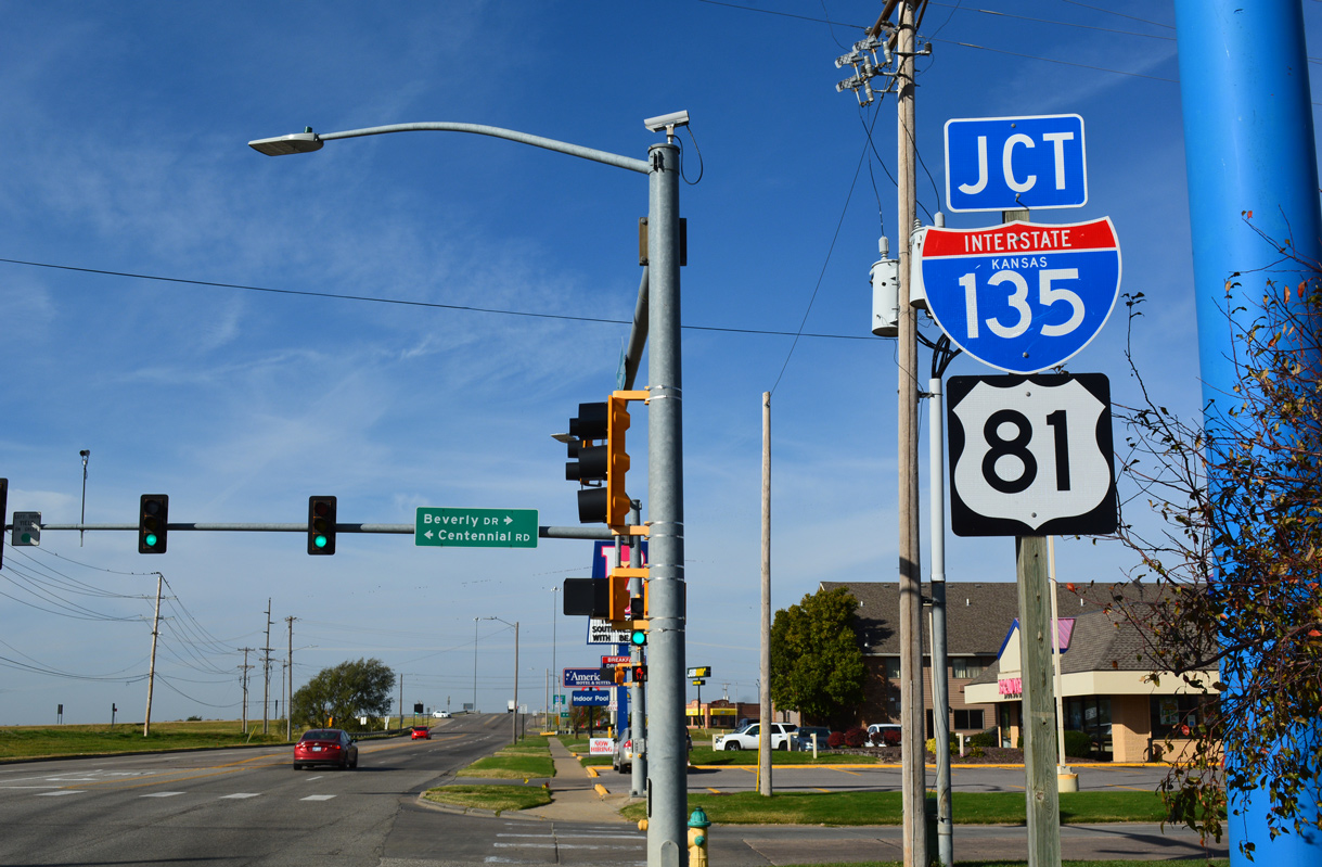
Interstate 135 Kansas
Overview
Interstate 135 overlays U.S. 81 from the Kansas Turnpike (I-35) and Wichita in south central Kansas to Salina and I-70. It is the fourth longest three-digit route within the Eisenhower Interstate System, following I-476 in Pennsylvania, I-495 in Massachusetts and I-287 around metro New York.
The freeway crosses Wichita mostly along the elevated Canal Route, a seven mile stretch paralleling or running above the culverted Chisholm Creek Canal. Accommodating six overall lanes, 95,700 vehicles per day (vpd) were recorded along a stretch north of U.S. 54/400 (Kellogg Avenue) and to the east of Downtown Wichita in 2015.
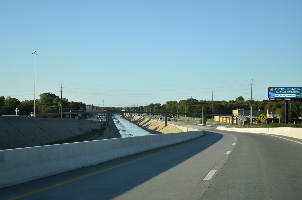
Interstate 135, U.S. 81 and K-15 along the Canal Route through Wichita. The flood control basin and drainage ditch network feeds into the canal running between the north and southbound roadways of the freeway. 10/04/21
The Wichita North Junction project is a four phase project underway through 2024. Completed in November 2021, the Green Project Phase 1 rebuilt I-235/K-96 west from the exchange with I-135/K-254 to the Arkansas River. The Gold Project Sub-Phase (Phase 2A) replaces the loop ramp from I-135/K-96 north to I-235 west with a two lane flyover. Costing $30.2 million, Phase 2A work commenced in April 2021 and is anticipated for completion by December 2023.
Gold Project (Phase 2B) separates traffic continuing from I-235 north onto K-96 east from I-135/U.S. 81 southbound by adding a two lane direct connection. It also replaces the loop ramp joining K-96 west and I-135 south with a two lane flyover and builds a new two lane ramp from K-96 west to I-135 north. Estimated to cost $86 million in 2020, Phase 2B is anticipated for construction letting in late 2022.
Purple Project (Phase 3) completes the systems interchange at I-135, I-235, K-96 and K-254. Eliminating left exit ramps, work includes realigning the mainlines of I-135 and the connection from I-235/K-254 so that both roadways run side by side. Estimated to cost $114 million in 2020, preliminary design for Phase 3 is complete with plans for construction uncertain as of Fall 2021.
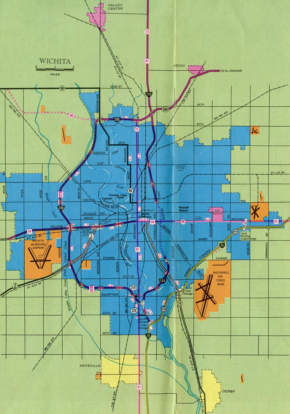
Remaining suburban through Park City and Valley Center, I-135-U.S. 81/K-15 leave the Wichita metropolitan area for a rural course to Newton and a 2.10 mile long overlap with U.S. 50. K-15 splits to the north from there as I-135 shifts northwest to McPherson and the north end of the expressway along K-61 connecting with Hutchinson.
Turning northward again, Interstate 135/U.S. 81 continue by Lindsborg to Salina. The freeway generally bypasses the city of nearly 50,000 to a rural cloverleaf interchange with I-70/U.S. 40. I-135 ends there, with U.S. 81 extending another 18 miles north as a freeway to Minneapolis then along an expressway to Concordia.
High Priority Corridor
I-135 in its entirety, along with the route served by U.S. 81 and U.S. 77 north to Sioux City, Iowa, is part of High Priority Corridor 23: Interstate Route 35 Corridor.
 History
Correspondence between the American Association of State Highway Officials (AASHO) and the State Highway Commission of Kansas in September 1957 presumed that FAI (Federal-aid Interstate System) No. 8, from Wichita to Salina, be numbered Interstate 35W. However following considerable study to suggestions and recommendations for route numbering of the Interstate Urban networks in Kansas, the State Highway Commission advocated to AASHO in a letter dated June 4, 1958
we wish to suggest that this route being some 103 miles in length, be designated as Route No. 27, with the route going through the heart of downtown Wichita. It is noted that Interstate Route No. 25 traverses north and south of Denver and that the next Interstate route to the east running north and south is Interstate route No. 29 beginning at Kansas City and proceeding northerly. Since the area between Denver and Kansas City and the areas both to the north and south of the area between these cities is sparsely settled, it would seem unlikely that another north and south route between these points would be established in the future. Also since this route follows or nearly parallels U.S. 81 and carries high volumes of traffic through Kansas and the other states though which U.S. 81 runs, it would seem reasonable to number this Interstate route No. 27, as some time in the future this route may be extended to the north.
In case the Interstate route from Wichita to Salina is desginated as No. 27, we recommend that the by-pass around the south, west and north portions of Wichita be designated as No. 27W.
Ultimately the State Highway Commission came into agreement with AASHO to designate the route from Wichita to Salina as Interstate 35W, and the loop around Wichita as Interstate 235. The urban Interstate numerology in Kansas was officially approved by AASHO on November 10, 1958.
Route Information
North End – Salina, KS
South End – Wichita, KS
Mileage – 95.74
Cities – Wichita, Newton, McPherson, Salina
- Junctions –


Source: December 31, 2021 Interstate Route Log and Finders List

Interstate 35W utilized the preexisting Newton bypass and was complete in the Salina vicinity by 1965. The Newton bypass was constructed in the 1950s initially as a connector from U.S. 81 on Kansas Avenue to U.S. 50 at the wye interchange (Exit 33) with I-135.
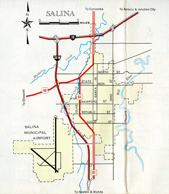
The north end of Interstate 135 consisted of a trumpet interchange with I-70 until construction of the U.S. 81 freeway to Minneapolis – 1967 Kansas Official Highway Map
The Canal Route in Wichita was the last section of Interstate 135 opened to traffic – 1977 Kansas Official Highway Map
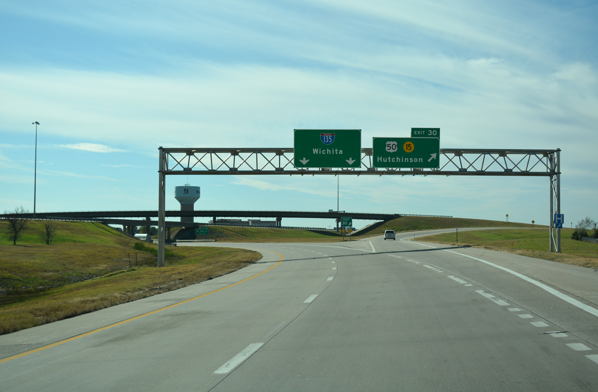
U.S. 50 overlaps with I-135/U.S/ 81 as part of a bypass around the Harvey County seat of Newton. K-15 accompanies the highway west from Exit 30 to connect with Kansas Avenue north into the city. 11/01/16
Interstate 35W represented a main route north from I-35 as it turned northeast from Wichita along the Kansas Turnpike to Emporia. The first section of the freeway was under construction around McPherson in 1968, with work on most of the remaining freeway getting underway by the early 1970s.1
The Canal Route section of I-135 through Wichita cost $32 million, with work there starting in 1971. This segment included the most expensive portion of the original Kansas Interstate system built at the time, the 2.2 mile long viaducts between Kellogg Avenue and 21st Street N. The northbound bridge is 12,111 feet long while the southbound span totals 12,497 feet.2 Technical issues extended work on the Canal Route to a December 1979 completion date.1
The Kansas Department of Transportation (KDOT) submitted an application to the American Association of State Highway and Transportation Officials (AASHTO) for the renumbering of I-35W to I-135 on April 7, 1976.
To comply with the Purpose and Policy of the markings of the National System of Interstate and Defense Highways it is requested the divided number (I35W) be changed. It is recommended that number I 135 be assigned to this route.
It is believed this route qualifies for a spur number off of Route I 35. This also provides a better arrangement in Wichita than assigning a new number. City officials, chambers of commerce and businesses along the route were notified of a proposed change. There was minimal response to a change of marking. Some made requests for a short time period of notification before signs are changed.
AASHTO approved the request on July 13, 1976 and I-35W was renumbered as Interstate 135 on September 13, 1976. There are two remaining I-35W’s nationally, one at Fort Worth, Texas and the other through Minneapolis, Minnesota.
U.S. 81 was wholly realigned onto Interstate 135 from 47th Street S in the South Area of Wichita to the north end at I-70 outside Salina with concurrence by AASHTO on October 13, 1979. Simultaneous action designated business routes for U.S. 81 off I-135 at McPherson and Lindsborg. The Lindsborg loop was subsequently decommissioned in 2011.
Funded by the American Recovery and Reinvestment Act (ARRA) in 2009, a $16.1 million project reconfigured the full cloverleaf interchange joining Interstate 135 with 47th Street (U.S. 81 to the west) in south Wichita. The two year project was unveiled on August 28, 2009 with construction commencing on September 8, 2009. It coincided with development of the South Fork retail and hotel complex at the southwest corner of the exchange. Project aspects included the rebuilding of four bridges for 47th Street S, over both I-135 and adjacent Big Slough Creek, and the removal of three ramps with the installation of three signalized intersections.3
A new diamond interchange was constructed along I-135/U.S. 81 at Mohawk Road to the north of McPherson. Serving an industrial park and provide additional access to the north side of McPherson, the $7.018 million project linked separate segments of Mohawk Road . The bid for the project was let on October 21, 2015. Scheduled work ran through May 26, 2017,4 and a ribbon cutting ceremony took place for the new ramps on April 4, 2017.6
North End  – Salina, Kansas
![]()
![]() North at
North at ![]()
![]()
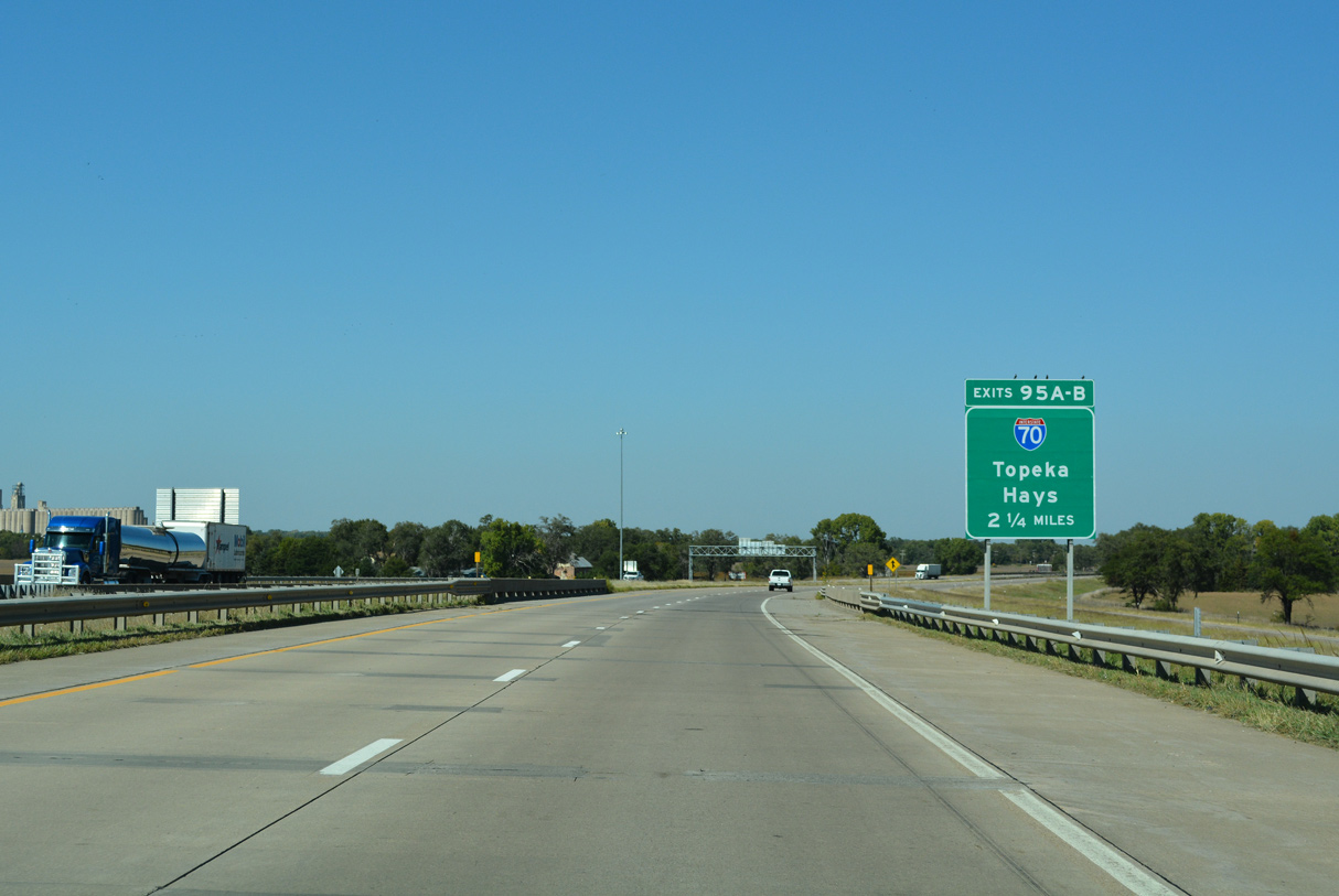
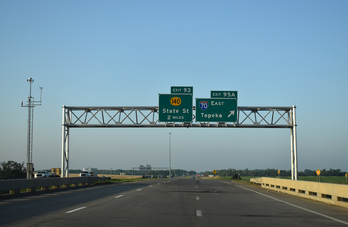
I-135/U.S. 81 advance north from the diamond interchange with K-140 west and State Street east 2.25 miles to I-70/U.S. 40 in rural Elm Creek township. 10/05/21
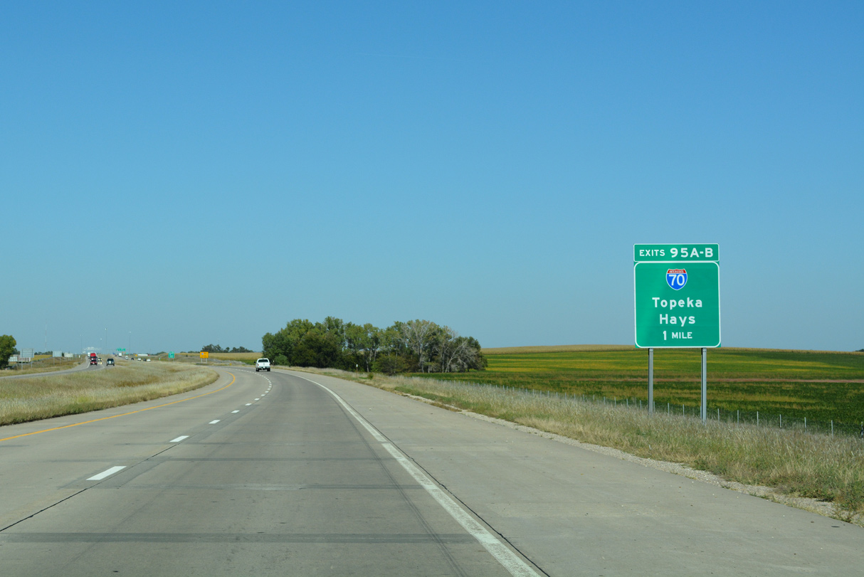
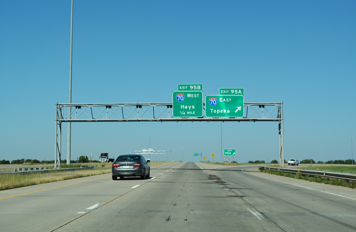
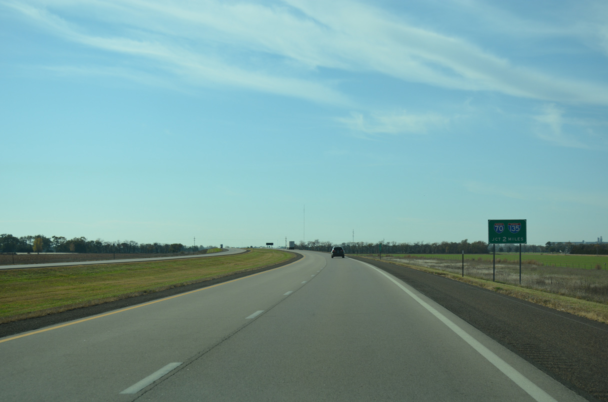
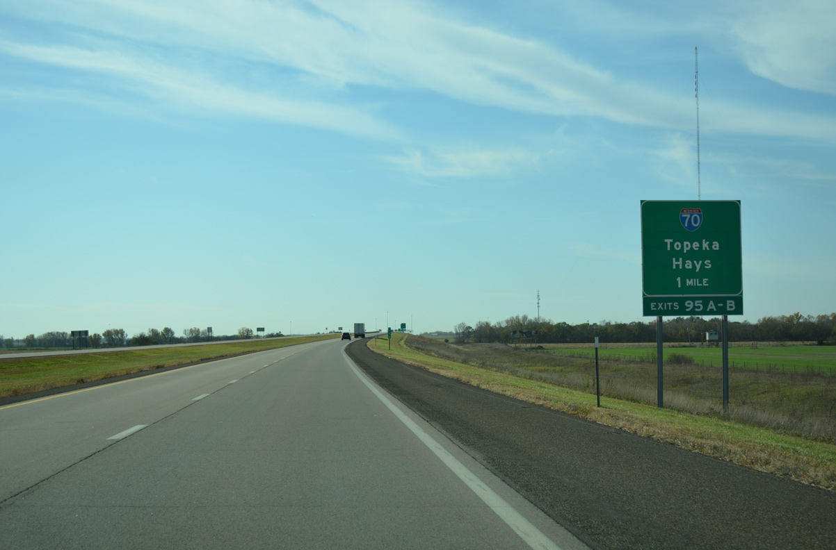
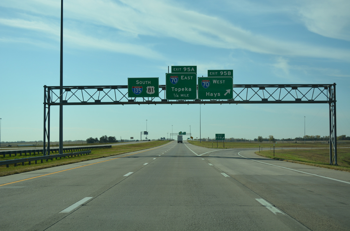
A nearly transcontinental route, Interstate 70 meets I-135 at a cloverleaf interchange (Exits 95 A/B). I-70 connects Denver with Kansas City across the width of Kansas. 10/05/21
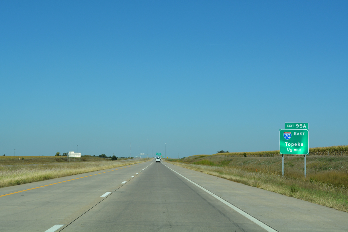
Exit 95 A departs in one half mile for I-70/U.S. 40 east to Abilene, Junction City and Manhattan. The two routes run concurrent to the East Topeka interchange of the Kansas Turnpike. 10/05/21
Travelers joining I-70/U.S. 40 east from I-135/U.S. 81 will reach I-470 and the capital city of Topeka in 105 miles. U.S. 81 continues north as a freeway for another 18 miles en route to Minneapolis and Concordia before entering Nebraska north of Belleville. 10/05/21
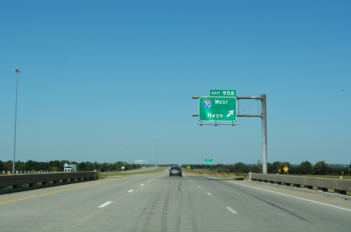
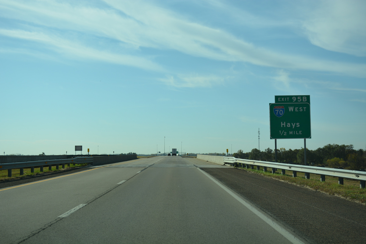
Exit 95 B loops onto I-70/U.S. 40 west towards the city of Hays. Roughly 420 miles separate Salina with Denver, Colorado via Interstate 70. 10/05/21
![]() South at
South at ![]()
![]()
![]()
U.S. 81 south makes a gradual curve from K-143 to cross the Saline River on the two mile approach to I-70/U.S. 40 and I-135. The city center of Salina is located 4.4 miles to the southeast of the forthcoming cloverleaf interchange. 11/01/16
Exit numbers appear for the U.S. 81 ramps to Interstate 70 west to Hayes and Colby and east to Manhattan and Topeka, on the one mile guide sign. 11/01/16
U.S. 81 spans Pleasant Hill Road south amid agricultural areas just ahead of Exit 95B for I-70/U.S. 40 west. The two routes overlap 174 miles westward to Exit 76 at Oakley. 11/01/16
Interstate 135 appears on the U.S. 81 pull through panel as Exit 95B parts ways for I-70/U.S. 40 west. U.S. 81 follows I-135 south for all but the southern link to the Kansas Turnpike in Wichita. 11/01/16
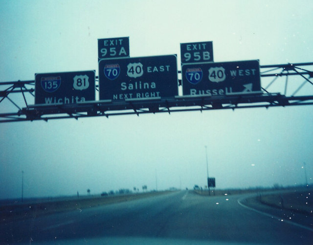
Prior signs for I-135 at I-70 both acknowledged the U.S. 40 concurrency and used local control cities. Russell, situated at U.S. 281 (Exit 184), was referenced for Exit 95B for westbound, while Exit 95A directed traffic to adjacent Salina to the east. Photo by Michael Summa (1986).
Leading east from Salina, I-70/U.S. 40 travel to Topeka, where they split at the Oakland Expressway and Kansas Turnpike for separate routes to Bonner Springs and the Kansas City metropolitan area. K-140, two miles to the south, represents the old U.S. 40 alignment leading west to Ellsworth. 05/09/22
![]()
![]() East at
East at ![]()
![]()
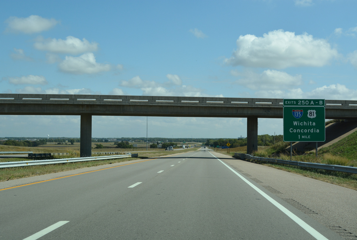
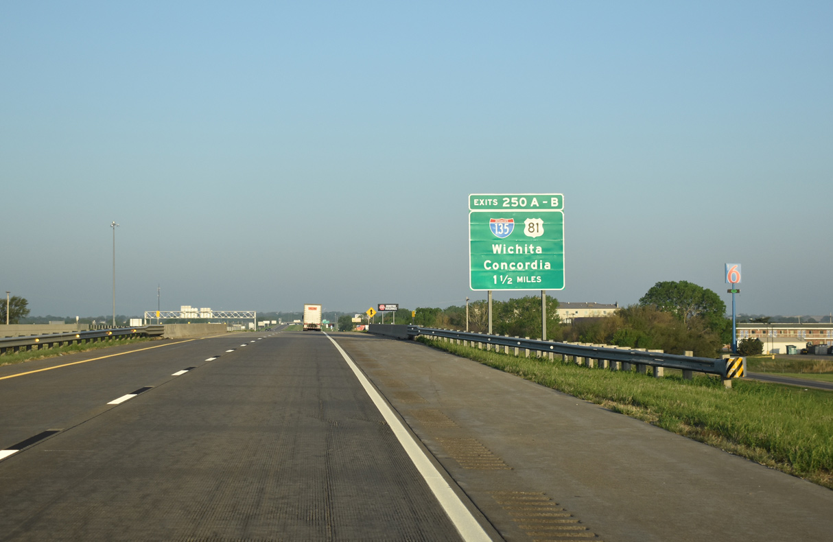
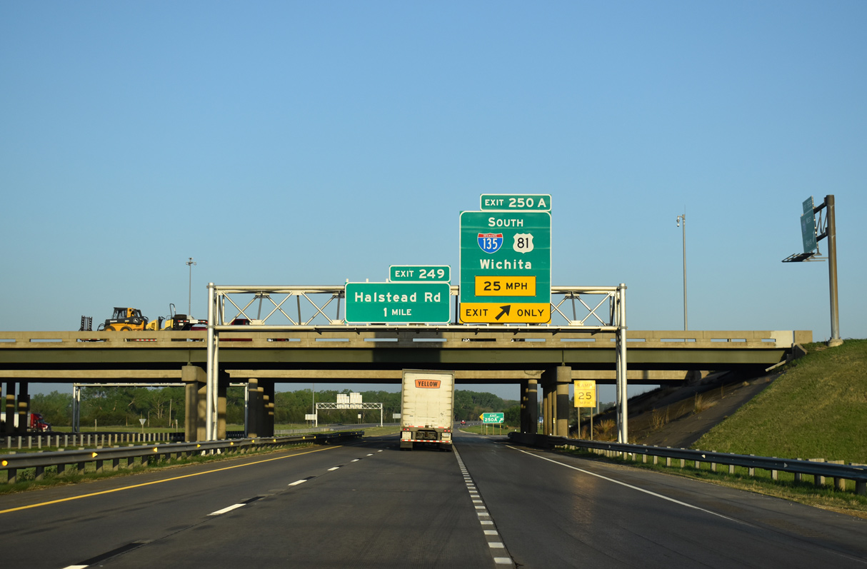
One mile separates Halstead Road from forthcoming Exit 250 A for I-135/U.S. 81 south along the west side of Salina. 10/06/21
I-135/U.S. 81 run south through Salina with five interchanges servicing the Saline County seat. Salina represents the largest collection of traveler services on I-70 east since Russell, 66 miles to the west. 10/06/21
The northern suburbs of Wichita lie 75 miles to the south of I-70/U.S. 40. 10/06/21
![]()
![]() West at
West at ![]()
![]()
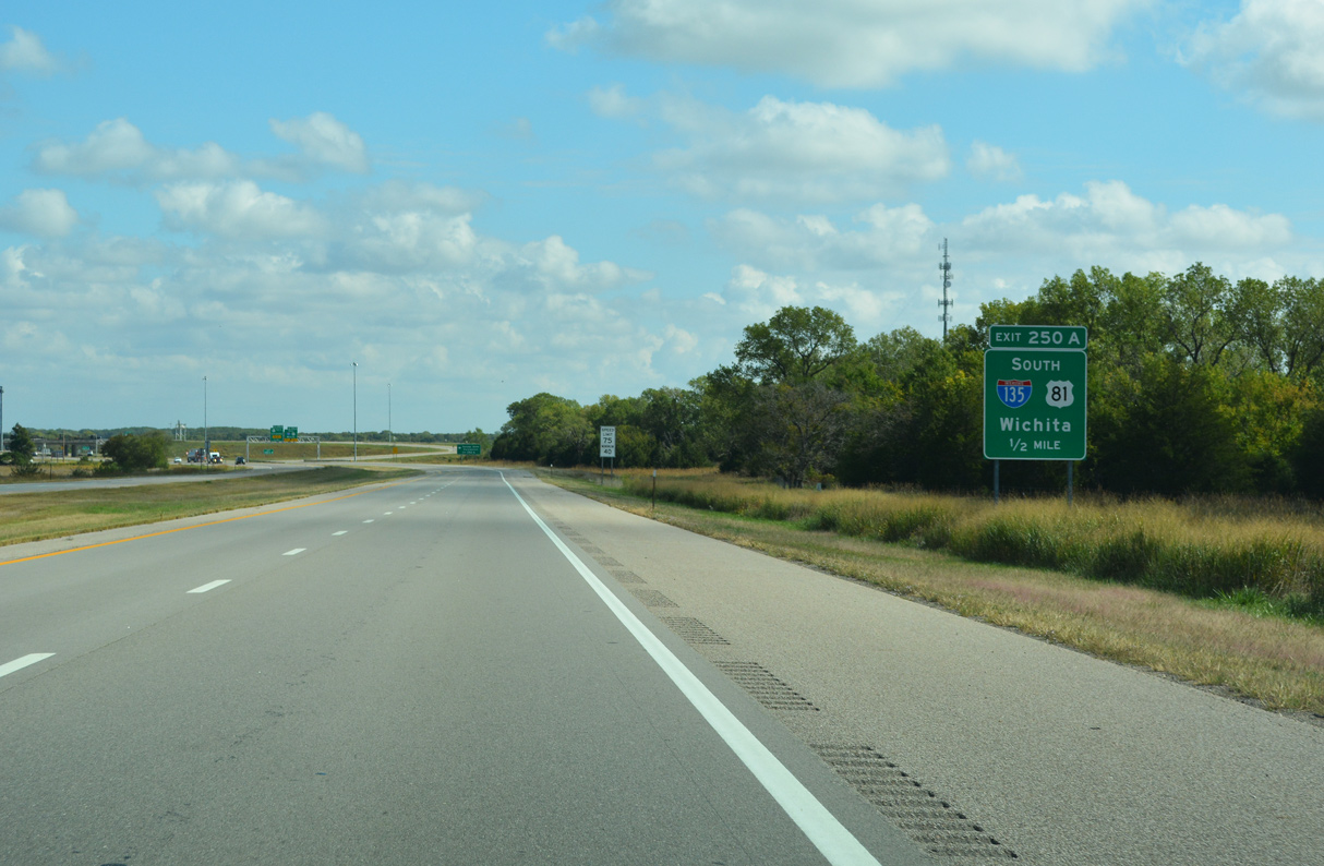
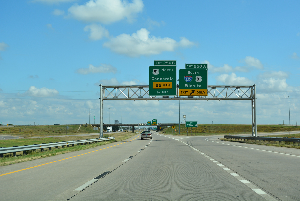
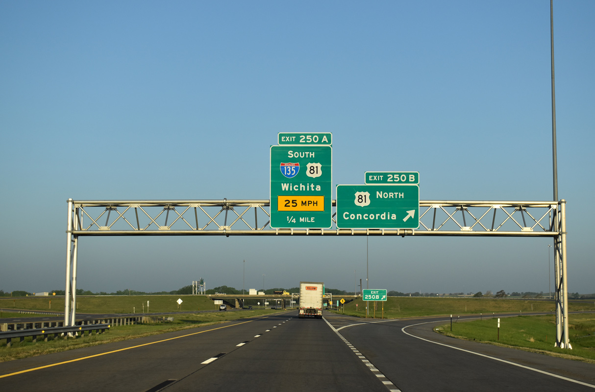
I-70/U.S. 40 progress west from the diamond interchange (Exit 252) with K-143 (old U.S. 81) to Exit 250 A with I-135/U.S. 81 south to Wichita and Exit 250 B for U.S. 81 north to Concordia. 05/09/22
U.S. 81 extends north from the end of I-135 as a freeway or expressway to Minneapolis, Concordia and Belleville. The route south combines with I-135 through Salina, Newton and Wichita. 05/09/22
Exit 250 A loops away from I-70/U.S. 40 west for I-135/U.S. 81 south. The freeway splits with the expressway along K-61 at McPherson to provide part of a high speed route to Hutchinson. 05/09/22
Throwback west at 

A previous set of signs posted along I-70 west for the 1979-completed route of Interstate 135. Minneapolis was replaced by Concordia on subsequent sign replacements. Photo by Michael Summa (1982).

Hays replaced Russell on the I-70 west pull through panel at Exit 250B. This panel was eventually dropped from sign plans. Photo by Dale Sanderson (10/02).
South End – Wichita, Kansas
![]()
![]() South at
South at ![]()
![]()
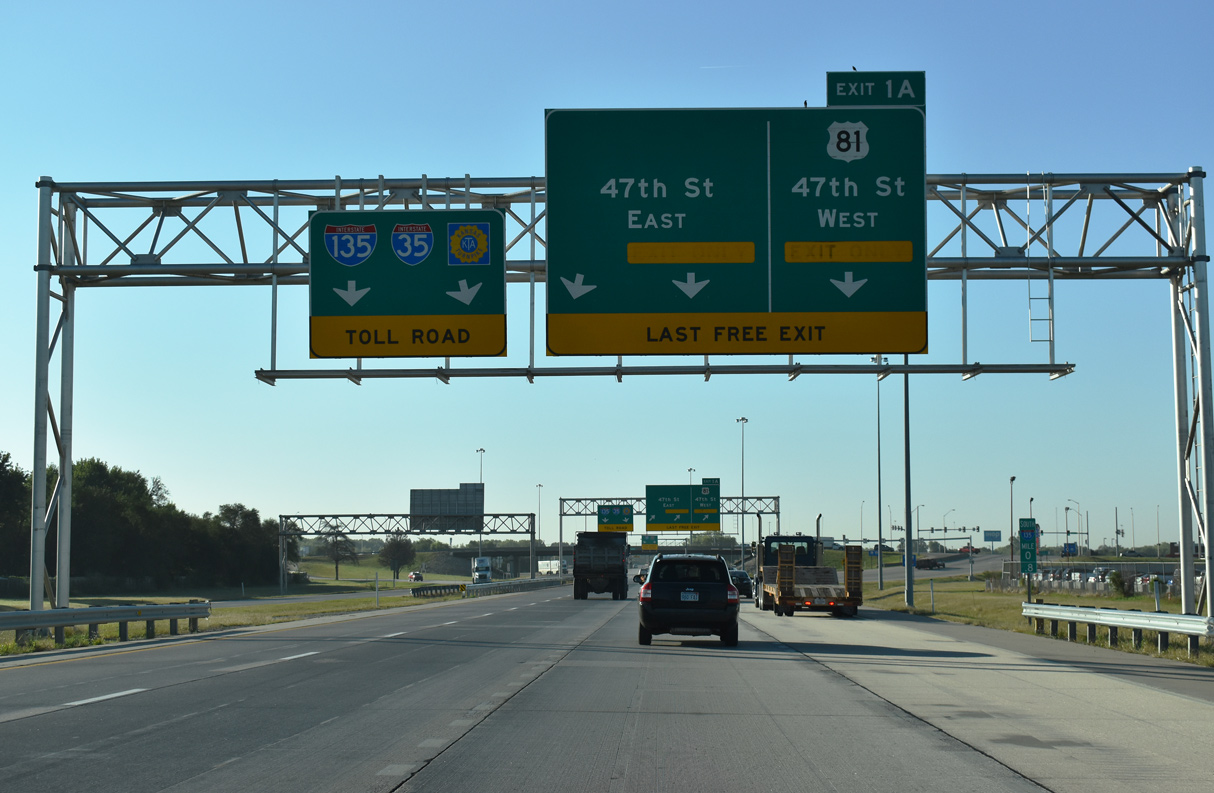
U.S. 81 separates from I-135 south along a three lane off-ramp to 47th Street S just after the exchange with I-235. 10/05/21
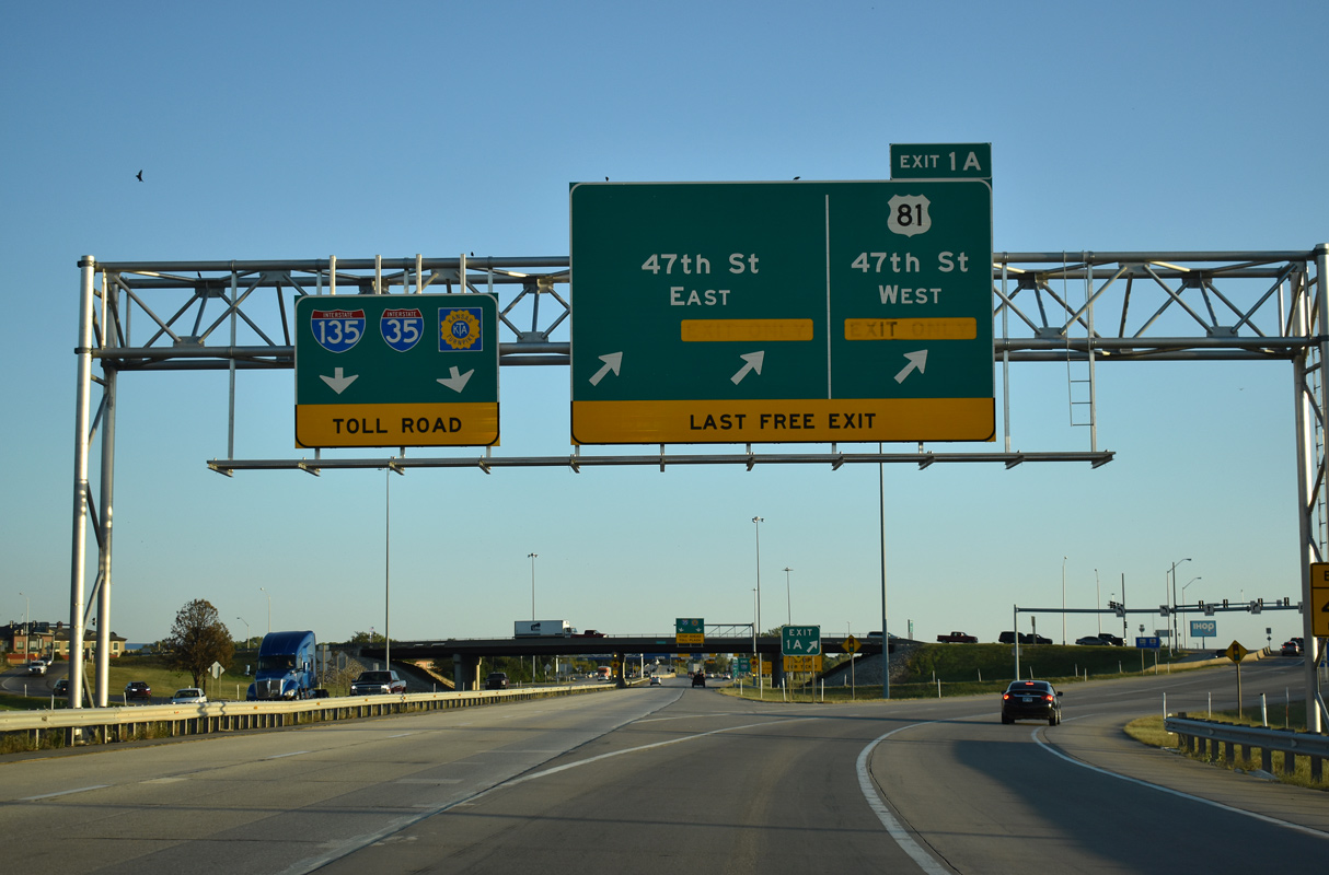
U.S. 81 dog legs west from Exit 1 A to rejoin Broadway south to Haysville via 47th Street S. 10/05/21
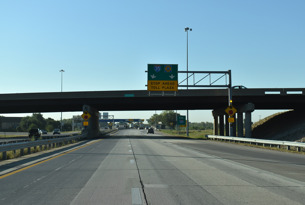
Traffic remaining along I-135 south defaults into the Kansas Turnpike toll plaza ahead of the trumpet interchange with I-35. 10/05/21
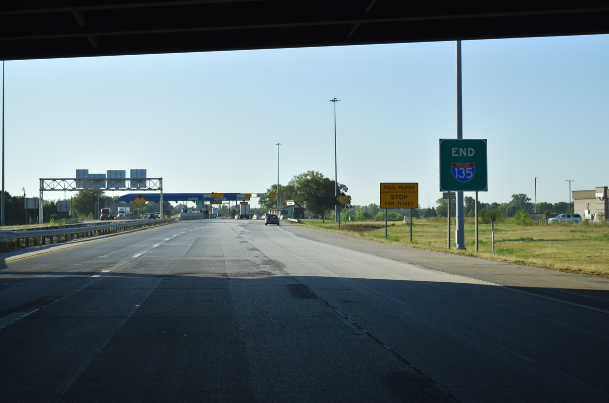
An end sign for I-135 stands at the 47th Street S overpass. 10/05/21

Interstate 35 heads south along the Kansas Turnpike and the Oklahoma city line northwest of Ponca City. 10/05/21
Interstate 35 follows the Kansas Turnpike northeast to El Dorado and Emporia. 10/05/21
Throwback – south at
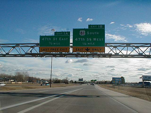
Prior to an ARRA funded redesign between 2009-11, I-135 and U.S. 81 south separated at a cloverleaf interchange (Exits 1B/A) with 47th Street. The 94 mile long overlap with U.S. 81 concludes at 47th Street S. U.S. 81 continues southward to Wellington, just west of the parallel Kansas Turnpike. The former alignment through Wichita followed Broadway. Photo by Ben Prusia (03/02).

Exit 1A was originally the loop ramp taking traffic from the ending I-135 south onto 47th Street east toward McConnell Air Force Base. The base was the site of an F4 tornado that struck the area in April of 1991. Photo by Richie Kennedy (03/01).
![]()
![]() North at
North at ![]()
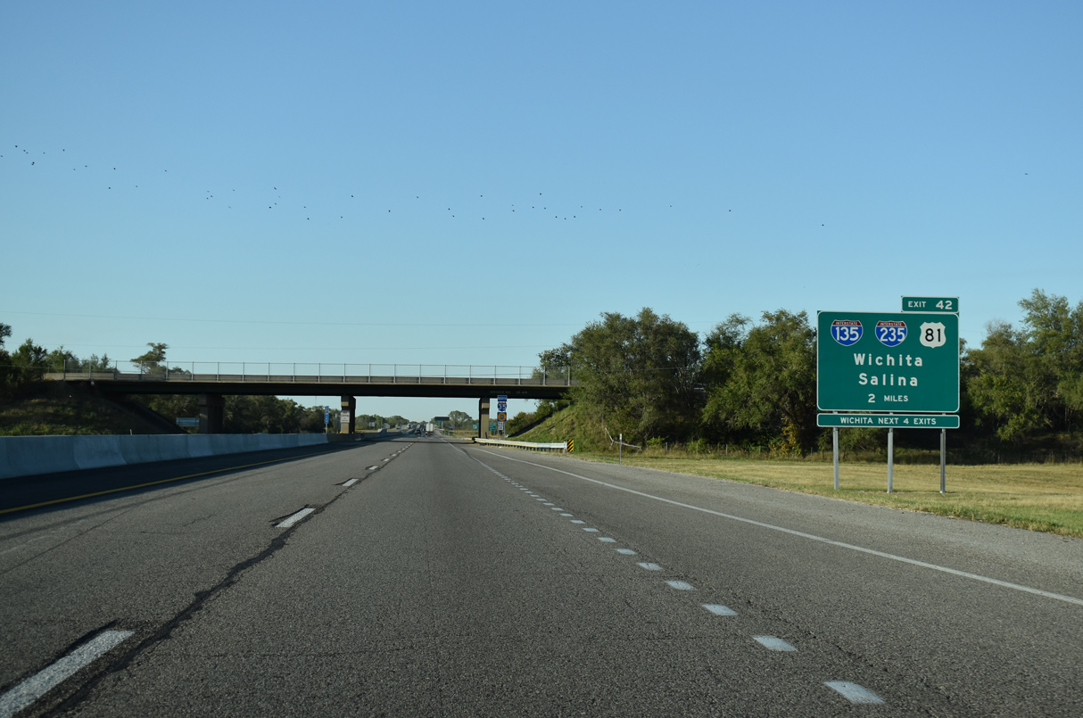
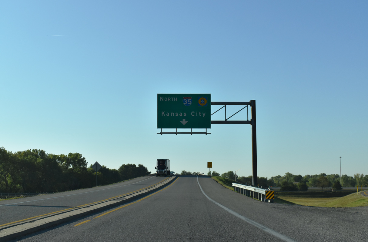
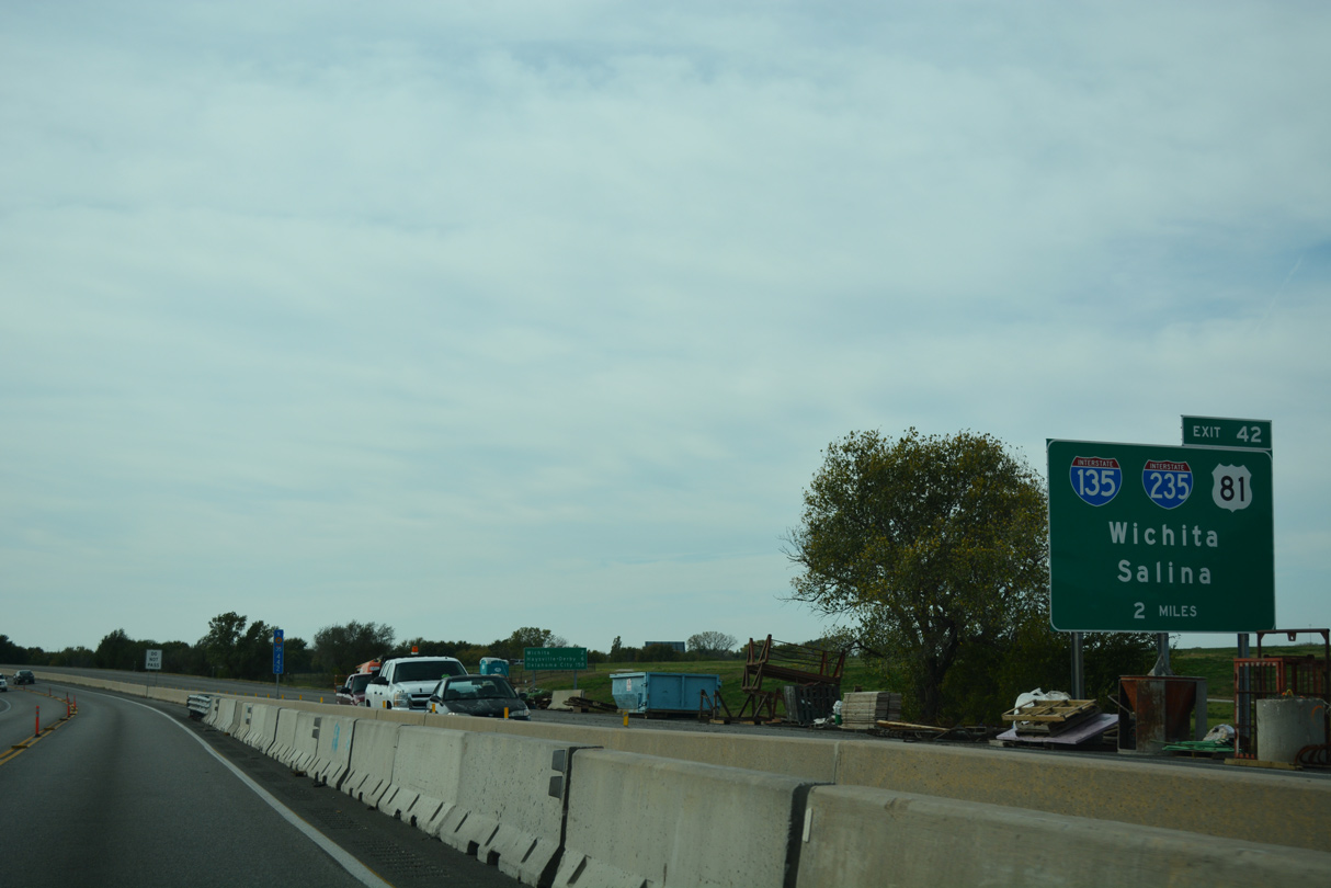
The Kansas Turnpike advances two miles north from the 71st Street S overpass and city of Haysville to Interstate 135 north at Exit 42. 10/04/21
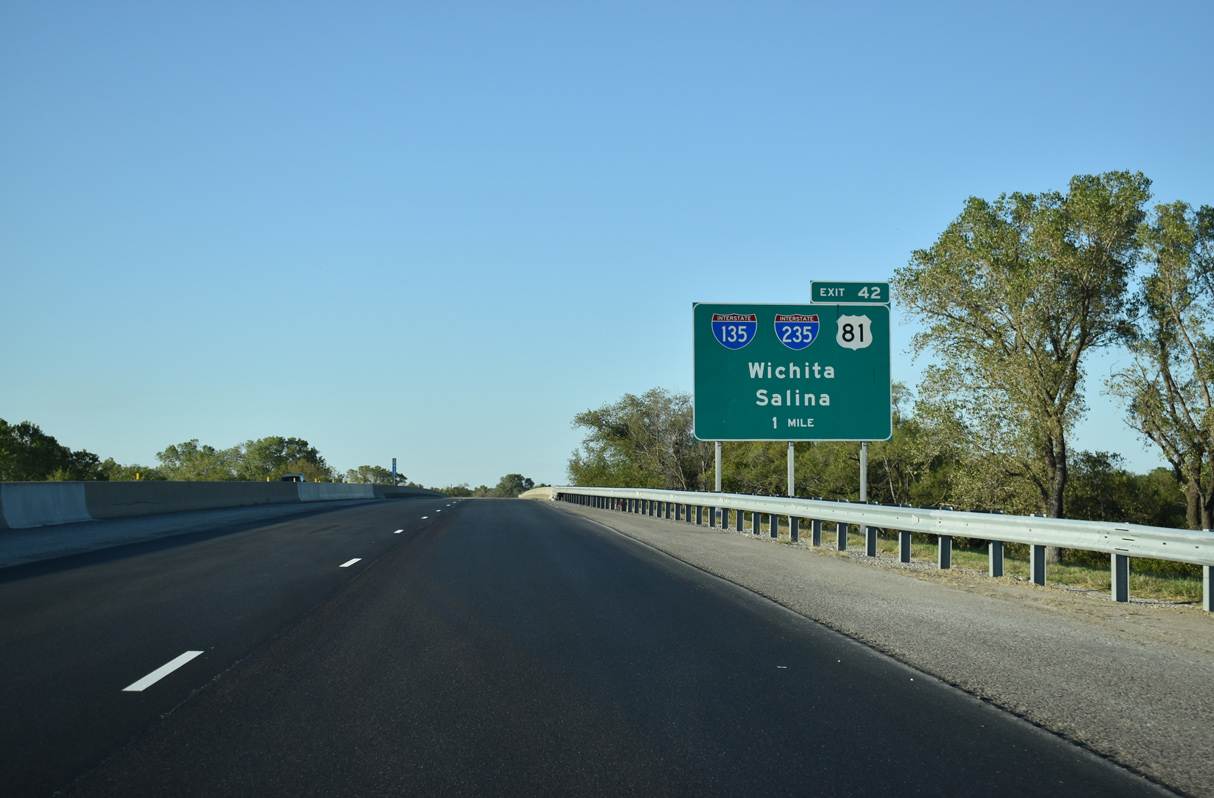
I-35 spans 63rd Street S one mile south of the trumpet interchange (Exit 42) with Interstate 135. 10/04/21
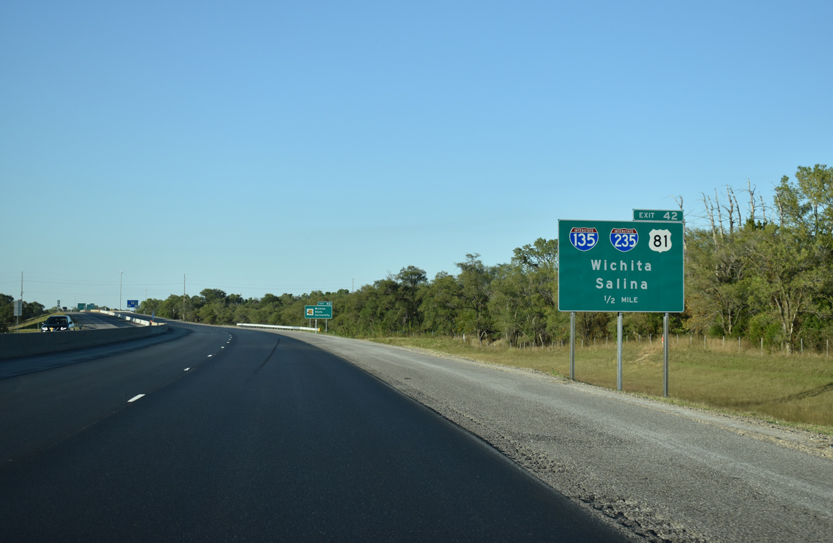
U.S. 81 accompanies I-135 from 47th Street S nearby, while I-235 forks west from the freeway to Eisenhower National Airport (ICT). 10/04/21
Interstate 35 turns northeastward towards El Dorado, Emporia, and Kansas City as Exit 42 parts ways for I-135 north through Wichita. 10/04/21
![]()
![]() South at
South at ![]()
Following the bridge across the Arkansas River, which was redecked during a two year project started on March 2, 2016,5 the Kansas Turnpike curves southwest on the two mile approach to Exit 42 with Interstate 135 in south Wichita. 10/31/16
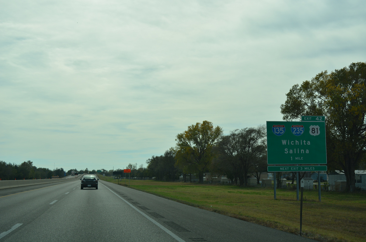
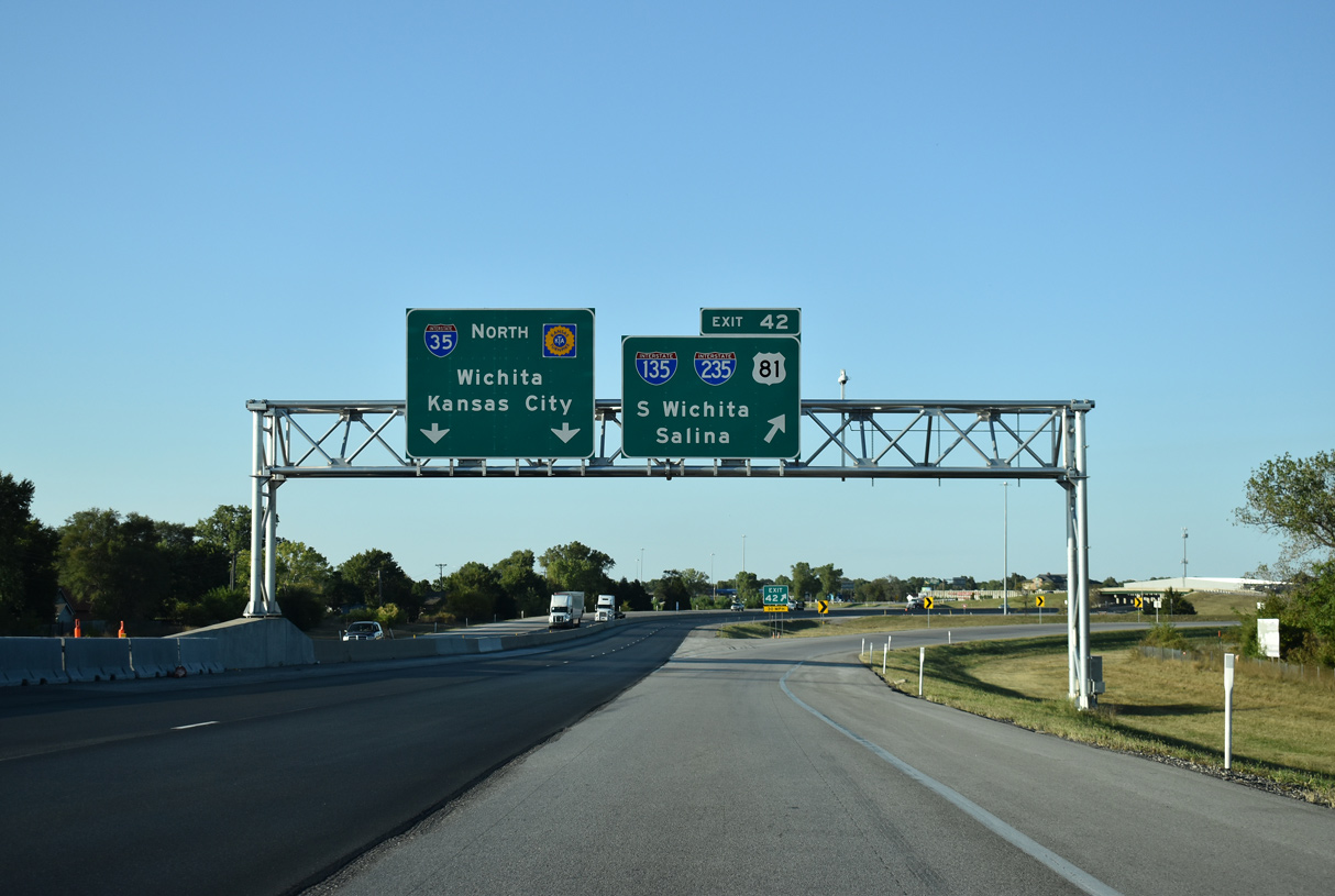
Exit 42 is the last of four Wichita exits along the Kansas Turnpike. Interstate 35 angles southwest from Andover through southeastern reaches of the city by McConnell Air Force Base to cross paths with K-15 ahead of I-135. K-15 merges with I-135 north along the Canal Route through central Wichita. 10/31/16
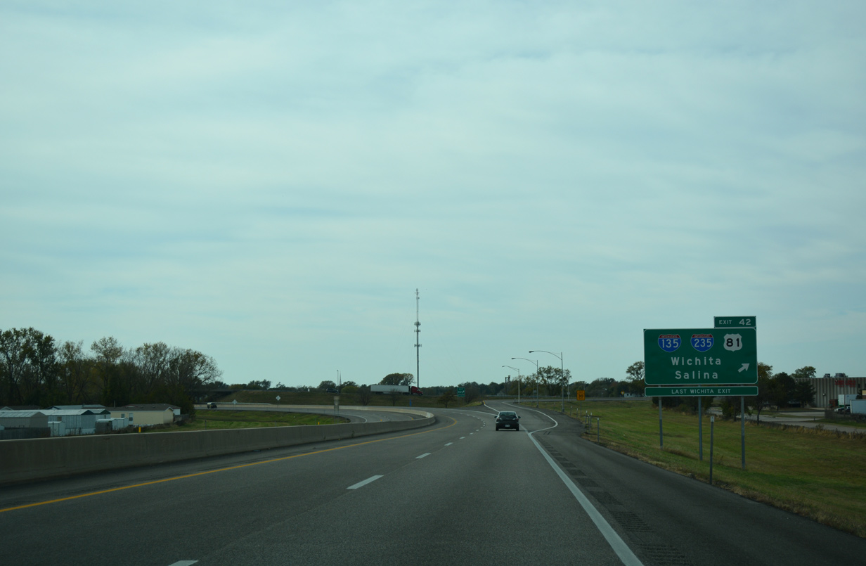
Exit 42 departs from I-35 (Kansas Turnpike) south for Interstate 135 north for the seven mile drive to Downtown Wichita. Connections with U.S. 81 lead motorists west to Broadway and I-235 to the western suburbs along U.S. 54/400 (Kellogg Avenue). 10/31/16
Sources:
- Kansas Interstate 50th Anniversary.
- “Big Ditch bridge art on city agenda.” Wichita Eagle, The (KS), October 3, 2011.
- “Stimulus Money Funding 2-Year Project.” Wichita Eagle, The (KS), August 29, 2009.
- “$2 million break marks winning bid for McPherson County I-135 interchange project.” Hutchinson News, The (KS), November 11, 2015.
- “Arkansas River Bridge project to begin March.” Kansas Turnpike Authority, news release. February 29, 2016.
- “Ribbon Cutting to Mark Completion of I-135 Interchange in McPherson County.” Salina Scoop (KS), March 31, 2017.
Page updated June 30, 2022.