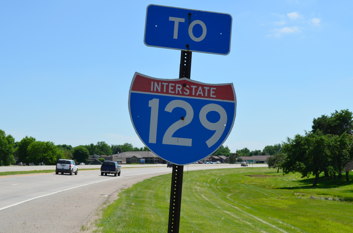
Interstate 129 Iowa / Nebraska
Overview
Interstate 129 crosses the Missouri River between Sioux City, Iowa, and southern reaches of South Sioux City, Nebraska. The freeway is cosigned with U.S. 20 and U.S. 75 for its short distance.
I-129 spans the Missouri River across the Sergeant Floyd Memorial Bridge, a 2,607 foot long steel plate girder bridge. The bridge accommodates four lanes of travel with a 79 foot deck at a height of 64 feet above the river.
 History
Mileage for the Sergeant Floyd Memorial Bridge was added to the Interstate Highway System in late 1968. The route was announced in Sioux City on December 13, 1968 and approved by the American Association of State Highway Officials (AASHO) on June 23, 1969. The 1.7 mile long approach on the Nebraska side of the river, the bridge and the interchange with I-29 cost $36,660,490. The span was dedicated on the morning of November 22, 1976.1 The Nebraska portion opened a year later.2
The east end of I-129 ties into the Sioux City bypass along U.S. 75. Conceptualized in the early 1970s, the bypass wraps around eastern reaches of the city to a point just south of the Plymouth County line. Earth work started on the route north of U.S. 20 in 1997.3
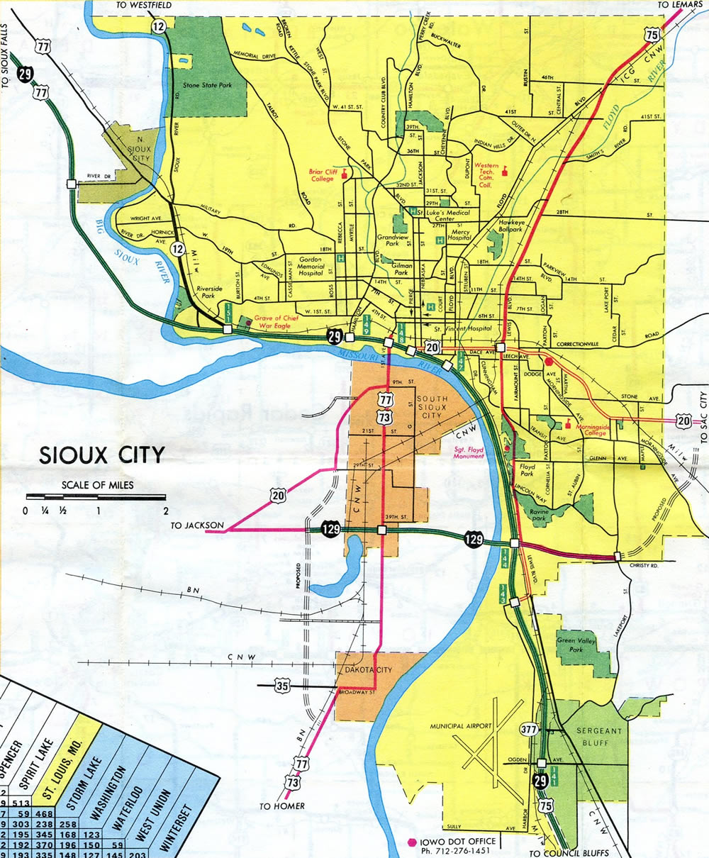
Totaling $45 million, with federal funding paying for 80% of the costs, the U.S. 75 bypass from U.S. 20 northward opened following a ribbon cutting ceremony held on November 19, 2001. The old route through the city was redesignated as U.S. 75 Business. Coupled with the project also was the $1.7 million construction of Outer Drive / 28th Street, a 1.3 mile long roadway linking north Sioux City with U.S. 75 at Exit 97.3
Signs for Interstate 129 posted on I-29 in Iowa referenced “I-129” in text in place of tri-color shields during the 2000s. An inquisition regarding the signing practice to IowaDOT netted this response in May 2007:
We received your comment concerning the use of the interstate shield for I-129 for southbound traffic and the use of letter text for I-129 for northbound traffic on I-29. Approximately 10+ years ago some motorists were getting confused with I-129 signing, thinking it was I-29 and taking the off ramp to US75 to Nebraska when they really wanted to stay on I-29. We thought we would try using the letter text I-129 to make it stand out different from the interstate shield of I-29.
Since then we have had a signing project on southbound I-29 and changed the letter text I-129 back to the interstate shield and have had no complaints or concerns that I’m aware of. The northbound signing on I-29 will be reviewed when we put our next project together.
All text-based signs for I-129 were replaced by June 2015 with the exception of a remaining panel over the southbound ramp split of Exit 144.
Interstate 429 Beltway
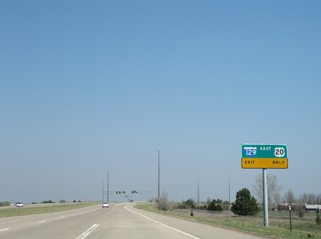
A post on the Usenet group misc.transport.road indicated that 7.2 mile bypass for U.S. 75 opened in 2001 was to become a part of Interstate 129 and that longer range plans for 2004-08 would extend the freeway west over ten miles to I-29 north of North Sioux City. Initial construction proposed for 2004 on the South Dakota side would construct the route as Interstate 429. Upon completion of the two sections, the beltway would be renumbered as just I-129.4
The Interstate 429 beltway was outlined by Don Willoughby, manager of government and community affairs for IBP, inc. Touting economic development and reduced congestion, Willoughby indicated that the proposal could take up to 20 years. The Tri-State Governors’s Conference held in South Sioux City, Nebraska on July 25, 2000 discussed various roads and infrastructure improvements including I-429. Sioux City Councilman Todd Moss asked the South Dakota Department of Transportation to conduct an interstate corridor study along Interstate 29 between Exit 4 (Northshore Drive) and milepost 6, including a new interchange (Exit 5) for the future beltway. Countering the proposal was South Dakota Governor Bill Janklow, who indicated that a lack of resources would prohibit any prospects for constructing the roadway.5
Interstate 129 was never extended north and the I-429 proposal never came to pass. The freeway along U.S. 75 defaults onto the divided highway leading northeast to Hinton and Le Mars. The US route in conjunction with Iowa 60, MN 60 and U.S. 59 provides an expressway grade corridor to Worthington, Minnesota and Interstate 90.
Route Information
Mileage
Nebraska – 3.21
Iowa – 0.27
Cities – Sioux City
- Junctions –

Source: December 31, 2021 Interstate Route Log and Finders List
I-129 Annual Average Daily Traffic (AADT)
Source: NDOT Interactive Statewide Traffic Flow Map 2018 AADT
IowaDOT Traffic Flow Map of Sioux City 2015 AADT
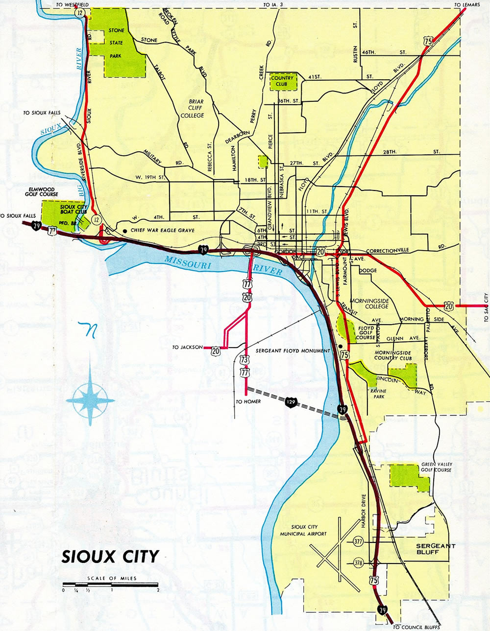
The completion of Interstate 129 led to the eventual relocation of U.S. 20 to bypass Downtown Sioux City and South Sioux City. This alignment is now a part of U.S. 20 Business, with the exception of the stretch along Dakota Avenue (former U.S. 73/77), which carries the business route south to I-129.
U.S. 73 was dropped from Winnebago, Nebraska northward to Sioux City on December 6, 1984. This left U.S. 77 to travel solo to its north end at Interstate 29 in Downtown Sioux City.
East End  – Sioux City, Iowa
![]()
![]() East
East ![]() North at
North at ![]()
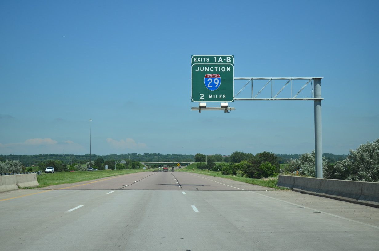
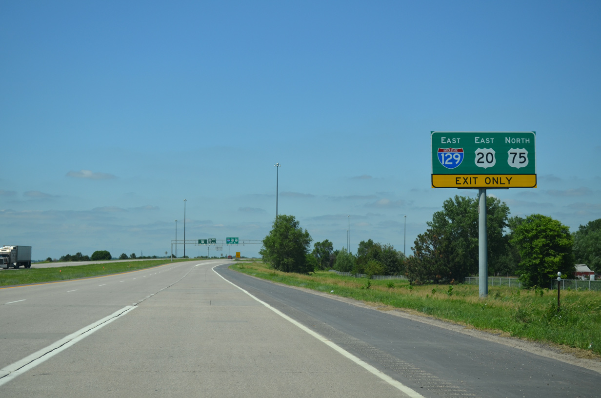
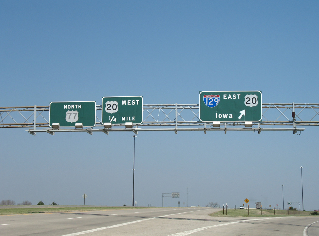
Passing over Dakota Avenue, a poorly signed Business route for U.S. 20, I-129/U.S. 20-75 eastbound advance two miles to Interstate 29. 06/17/15

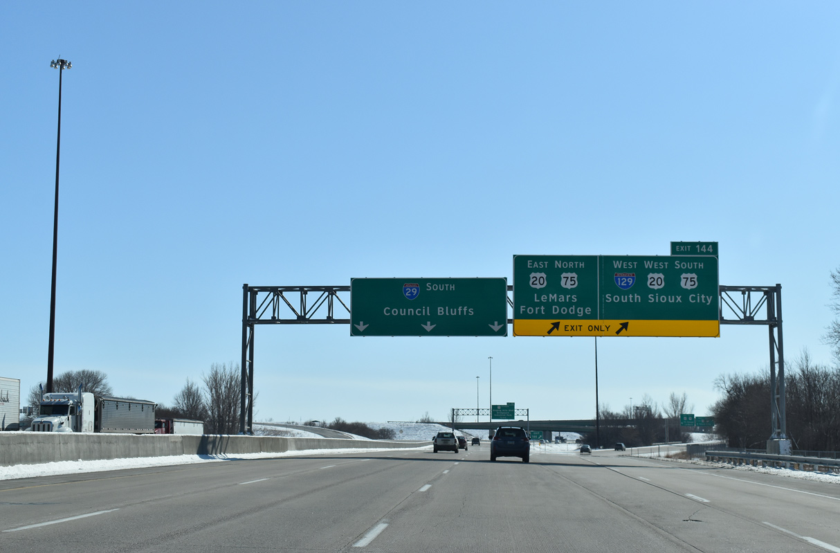
Interstate 129 bends slightly southward across agricultural areas preceding the Missouri River. Forthcoming I-29 is the first of five exits signed for Sioux City, Iowa along U.S. 20 east. 06/17/15
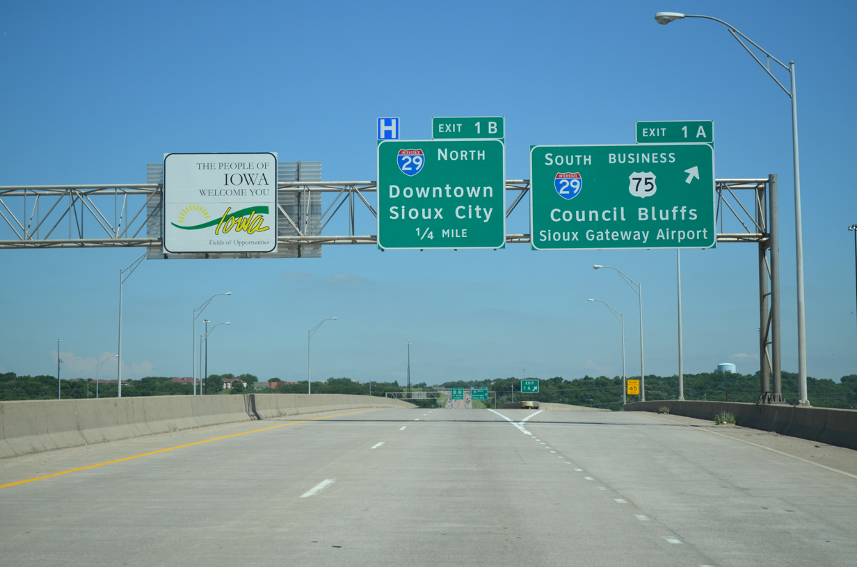
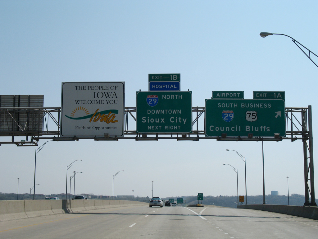
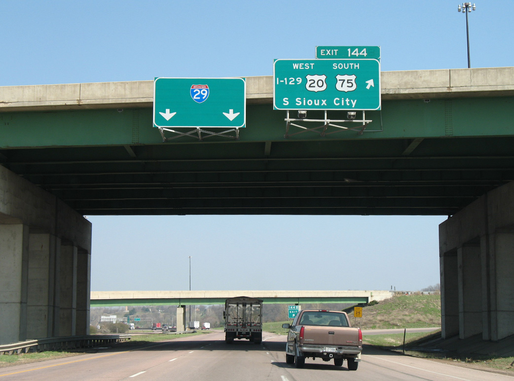
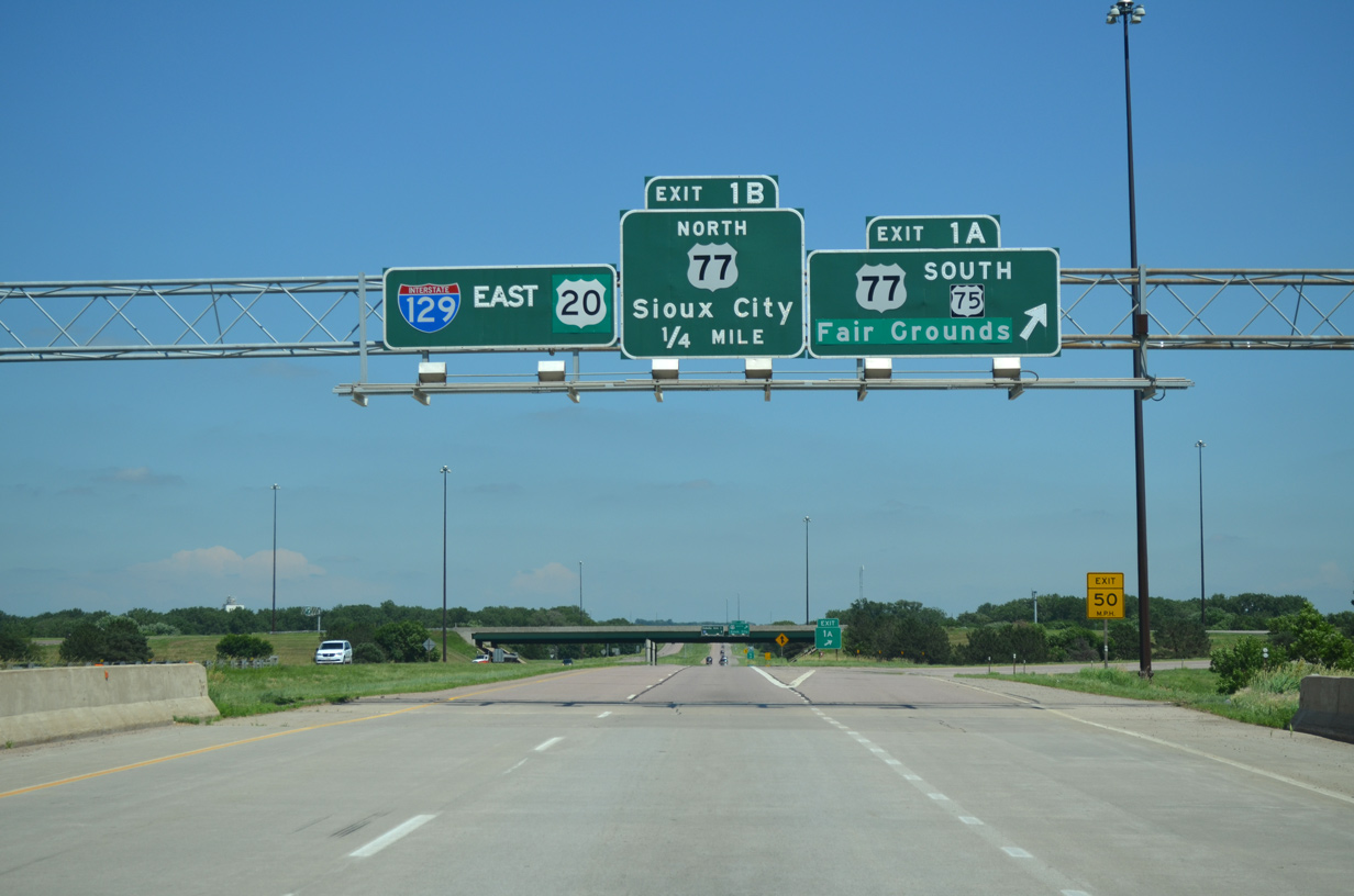
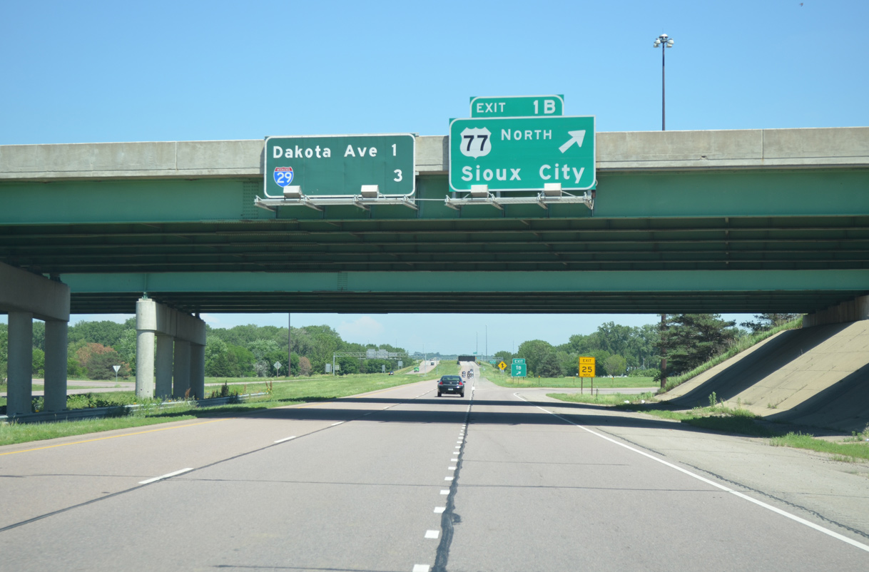
Crossing the Sergeant Floyd Memorial Bridge, travelers enter Woodbury County, Iowa. Exit 1A departs from mid-span for Interstate 29 south / U.S. 75 Business north. U.S. 75 Business uses the freeway south to Singing Hills Boulevard east to overtake Lewis Boulevard northward into Sioux City. 06/17/15
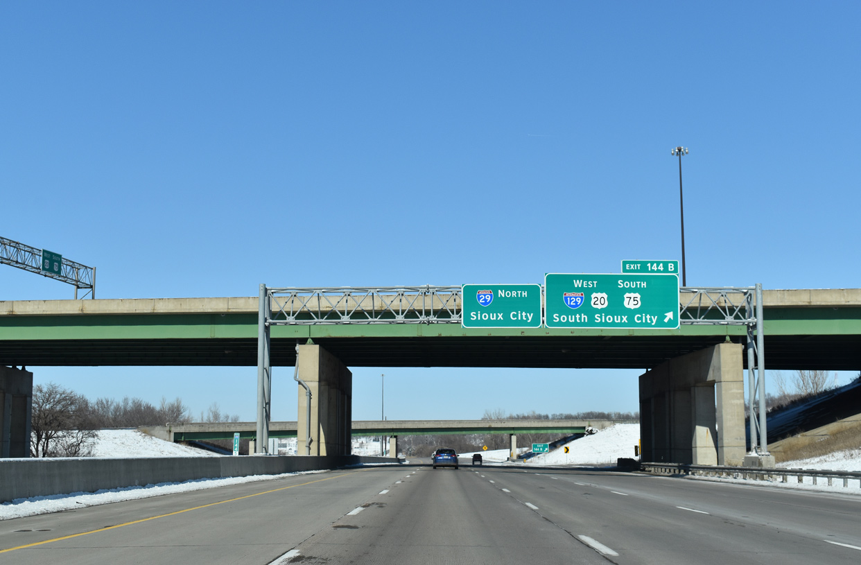
Interstate 29 straddles the east banks of the Missouri River northward from Exit 1B to Downtown Sioux City. I-129 ends as U.S. 20/75 remain east along the belt route for another 3.7 miles. 06/17/15
![]() North at
North at ![]()
![]()
![]()

Underway by August 2010, the Interstate 29 Improvement Project upgraded the freeway to six lanes south of I-129. 02/20/20
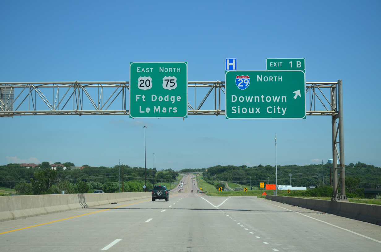
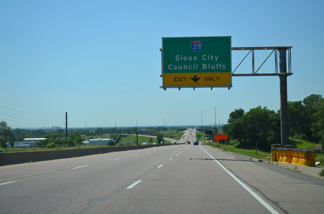
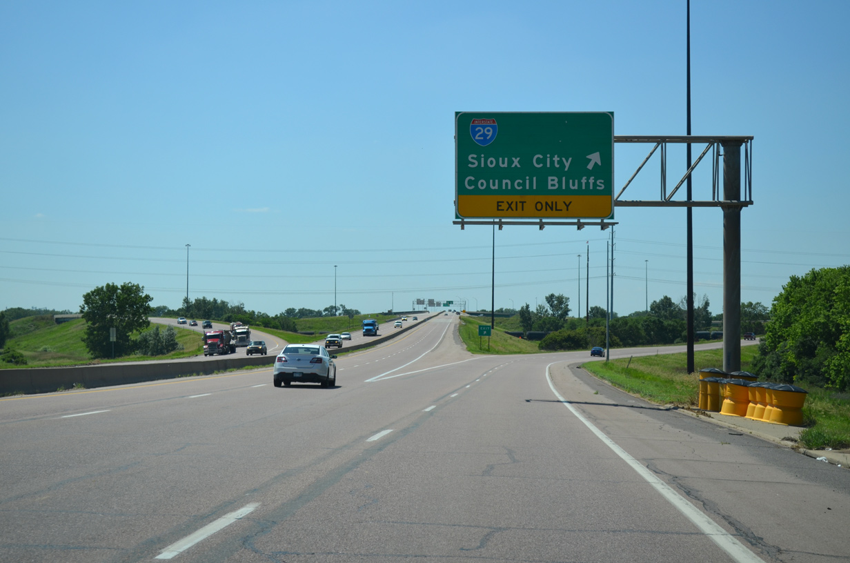
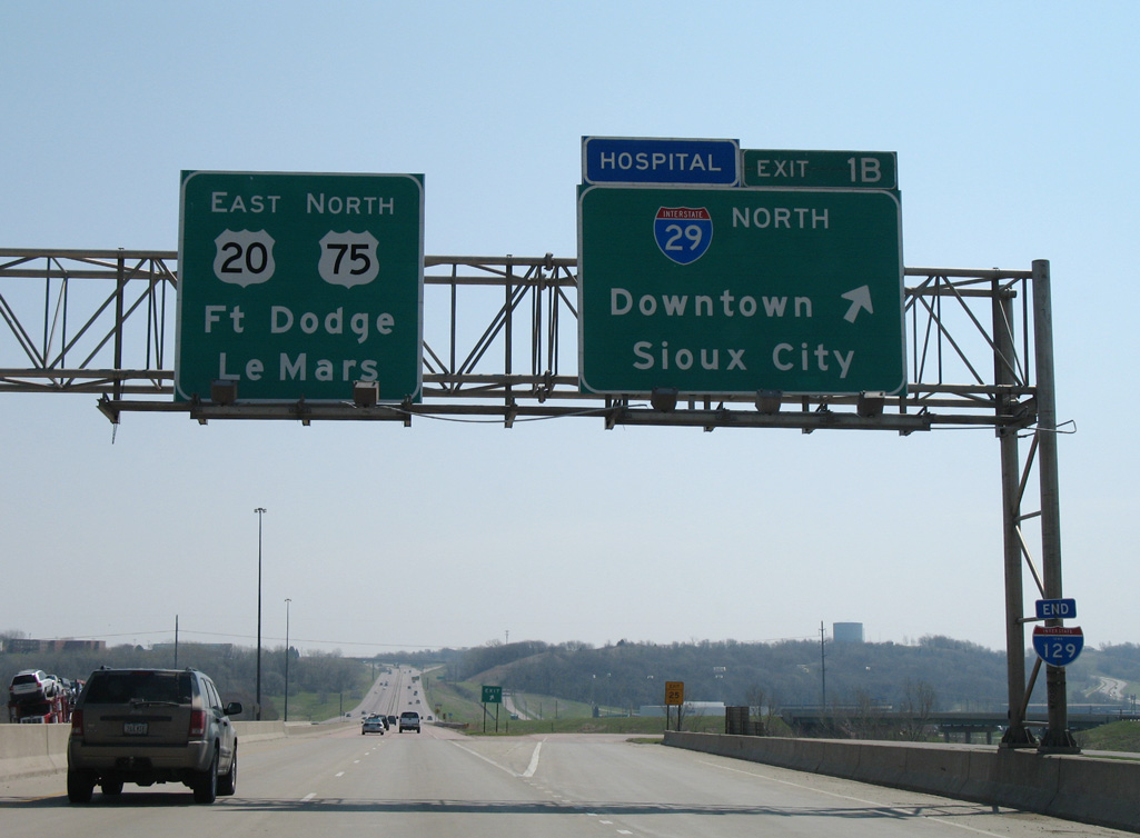
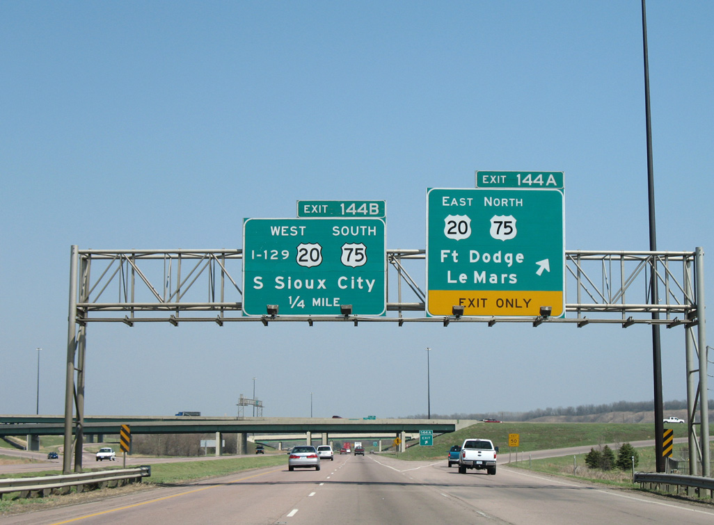
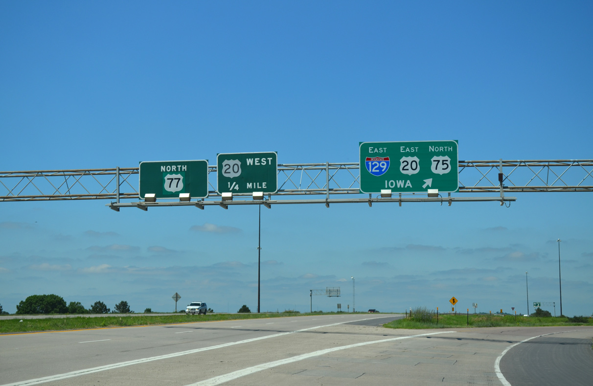
Exit 144A joins I-29 north with U.S. 20 east / U.S. 75 north along the Sioux City belt route freeway. 02/20/20
I-129/U.S. 20-75 west cross the Missouri River along a steel girder bridge to South Sioux City, Nebraska. 02/20/20
![]() South at
South at ![]()
![]()
![]()
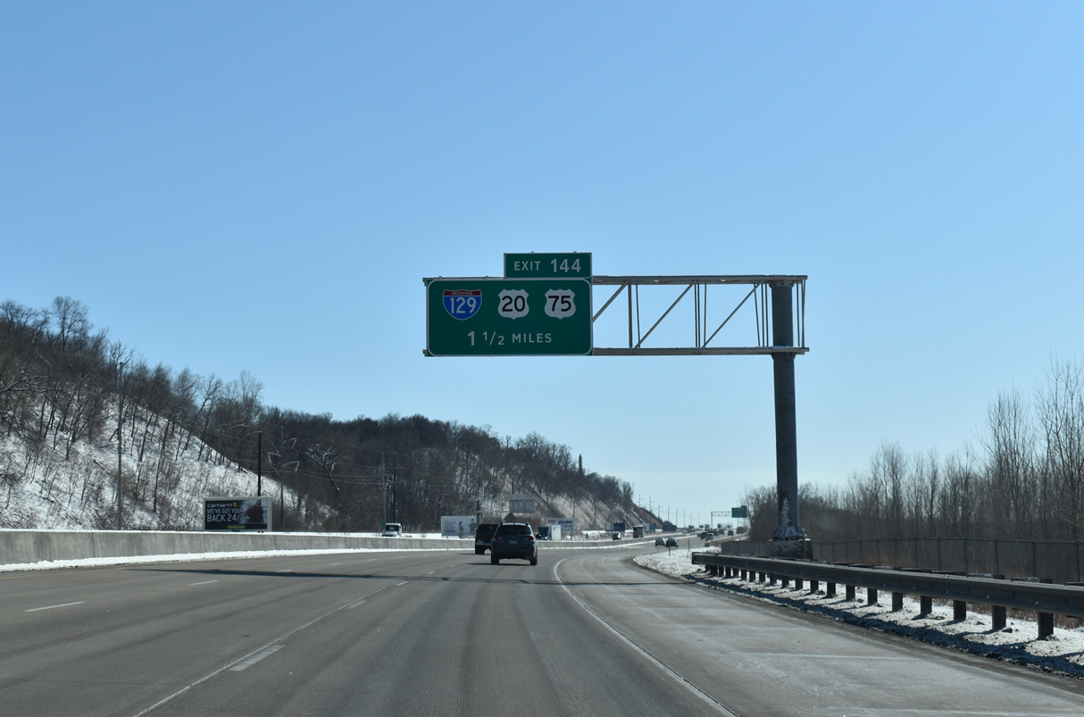
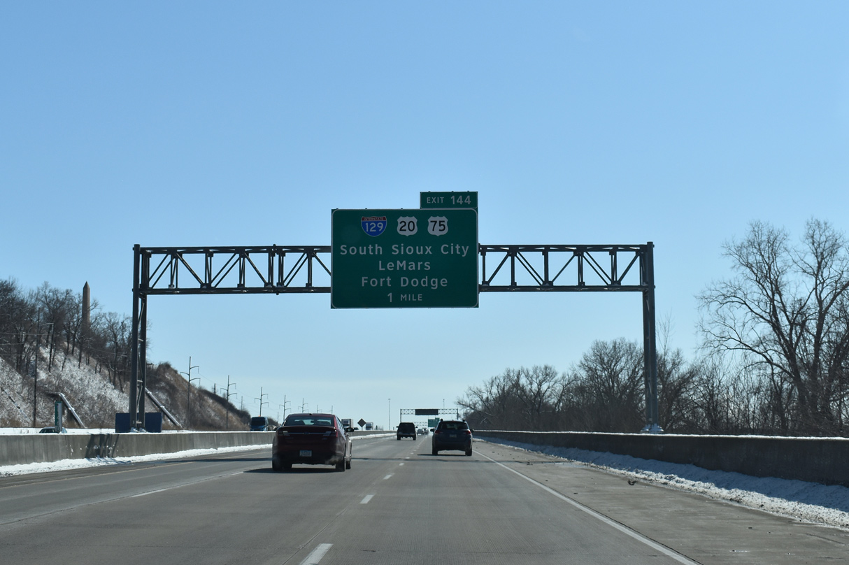
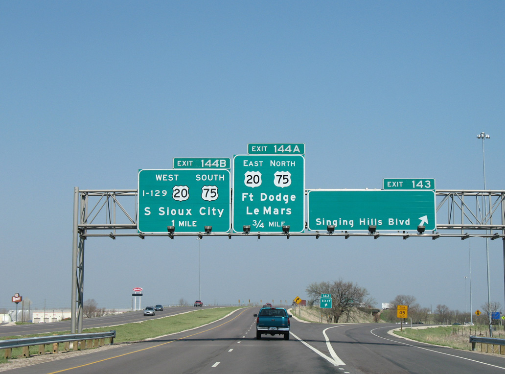
Segment 1 of the I-29 Improvement Project through Sioux City rebuilt the freeway to six overall lanes with a barrier median on the stretch leading south to Interstate 129 and U.S. 20-75. New signs were installed in 2015 as the project neared completion. 02/20/20
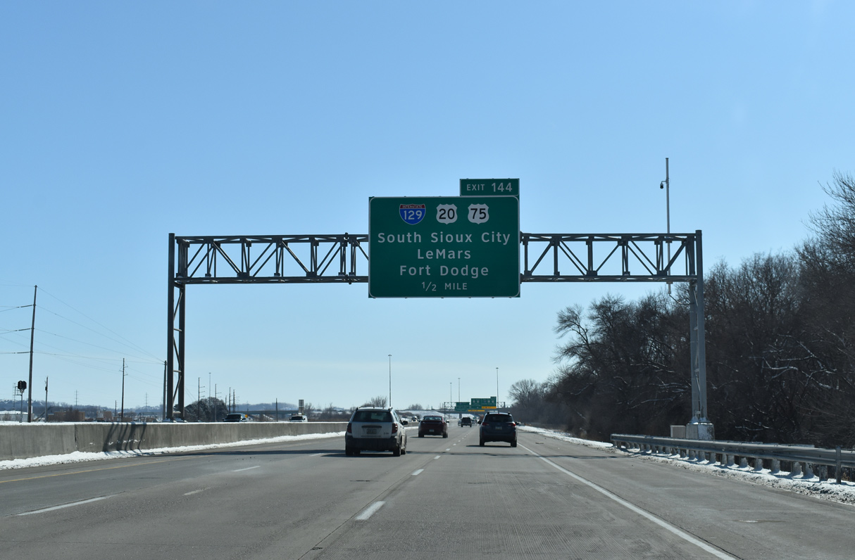
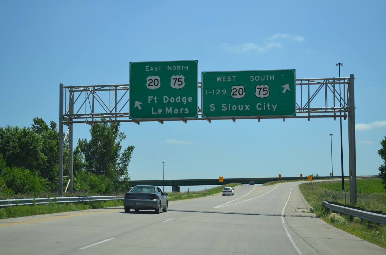
U.S. 20 east connects Sioux City with Fort Dodge and Waterloo while U.S. 75 heads northeast to the Plymouth County seat of LeMars. 02/20/20

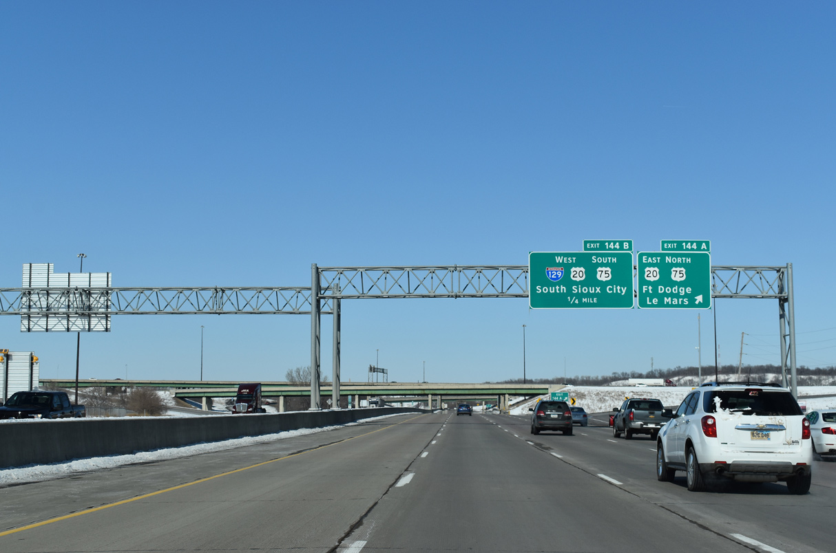
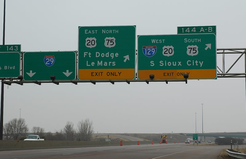
Interstate 29 maintains three through lanes southward to Sioux Gateway Airport (SUX) and Sergeant Bluff. Two lanes depart for I-129 west to South Sioux City, Nebraska and U.S. 20/75 northeast along the Sioux City belt route. 02/20/20
U.S. 20/75 overlap with Interstate 129 west across the Sergeant Floyd Memorial Bridge into South Sioux City, Nebraska. 02/20/20
The lone remaining sign referencing Interstate 129 in text appears at the Exit 144 ramp separation for I-129 and U.S. 20/75. All signs posted along I-29 used this format in 2001. 06/17/15
![]() West
West ![]() South at
South at ![]()
![]()
Lowering from the bluffs east of the Missouri River, an auxiliary lane opens along the U.S. 20/75 freeway west from the Lakeport Street on-ramp to the unnumbered exit for Interstate 29. I-129 is not acknowledged on any signs posted in this direction. 06/17/15
All traffic bound for Interstate 29 departs in unison as U.S. 20 west and U.S. 75 south enter the cloverstack interchange. Spanning U.S. 75 Business and I-29, Interstate 129 begins ahead of the Missouri River and South Sioux City, Nebraska. 06/17/15
 East End Throwback
![]()
![]() East
East ![]() North at
North at ![]()
Sign changes made after 2012 replaced this set of guide signs at Exit 1A to use Clearview font. Sioux Gateway Airport (SUX) was added below Council Bluffs for I-29 south. 04/20/07
The overhead for I-29 north was also replaced after 2012. U.S. 20 constitutes a freeway or expressway eastward across the northern tier of Iowa. 04/20/07
![]() South at
South at ![]()
![]()
![]()
Replacement signs posted along I-29 south at Interstate 129 when the freeway was still just four lanes wide. Photo by Jeff Royston (03/18/05).
![]() North at
North at ![]()
![]()
![]()
Work started in 2010 reconstructed the diamond interchange (Exit 143) joining I-29 with U.S. 75 Business (Singing Hills Boulevard). This sign bridge for I-129 and U.S. 20-75 was eventually replaced with Clearview font based signs. 04/20/07
Text based signs for I-129 were added in 2001 and removed during the Interstate 29 Improvement Project. The northbound freeway is now four lanes wide here. 04/20/07
This set of overheads at Exit 144 were taken down and replaced with a sign bridge. 04/20/07
West End – South Sioux City, Nebraska
![]()
![]() West
West ![]() South at
South at ![]()
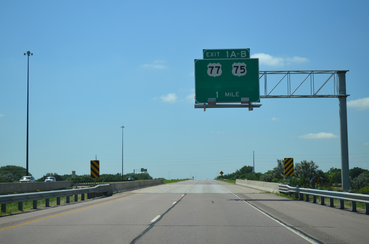
Interstate 129 proceeds west across a BNSF Railroad line one mile to the cloverleaf interchange (Exits 1B-A) with U.S. 77. U.S. 75 joins U.S. 77 south from the freeway toward Winnebago. 06/17/15
U.S. 77 north travels into Sioux City, Iowa, where it concludes at Interstate 29 (Exit 148). 06/17/15
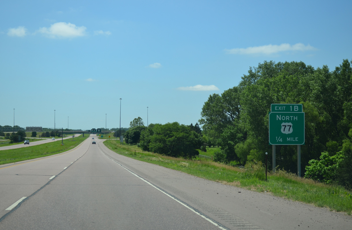
Exit 1B departs I-129/U.S. 20-75 west for U.S. 77 north. U.S. 77 follows a controlled access expressway bypassing U.S. 20 Business (Dakota Avenue) west of Dakota City and South Sioux City. 06/17/15
Non reflectorized signage at Exit 1A predated the renumbering of U.S. 73 to U.S. 75 made in 1984. U.S. 75 overtook all of U.S. 73 south to Omaha and Dawson. 06/17/15
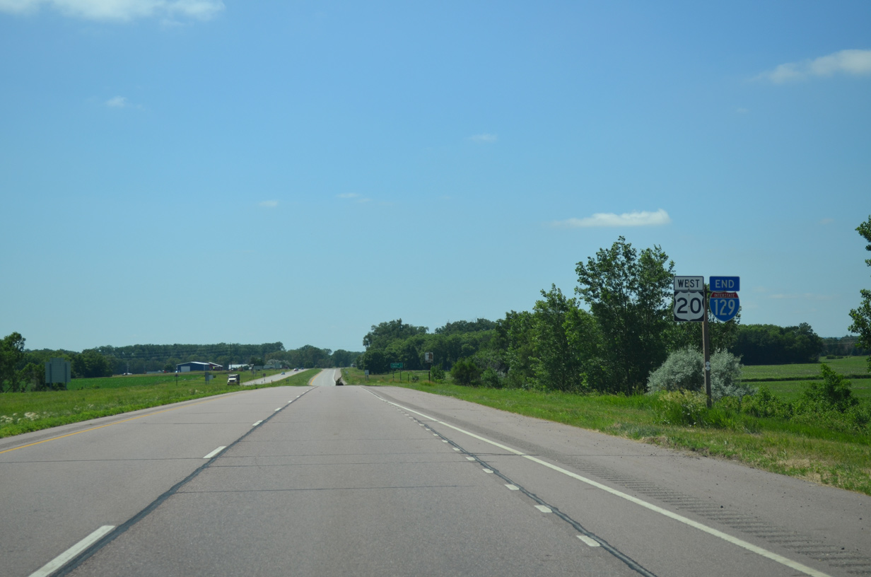
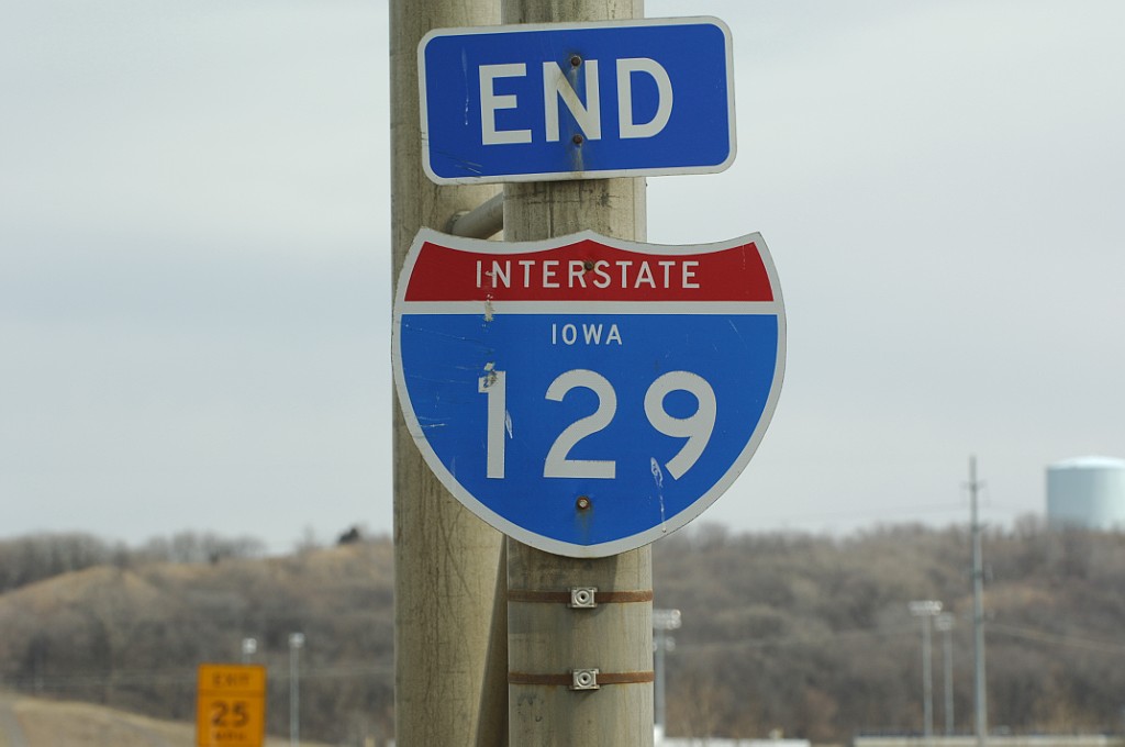
An end sign for Interstate 129 stands just west of the Lake Avenue underpass. U.S. 20 continues as an at-grade expressway six miles to Jackson. 06/17/15
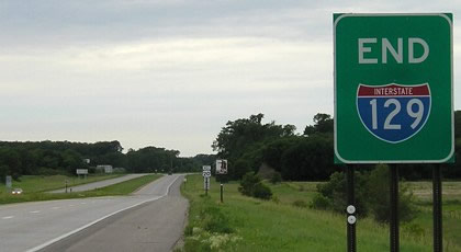
Replaced by 2007, this end sign was previously posted just west of U.S. 75/77. I-129 is one of a handful of branch routes that enters a state that its parent route does not. Photo by Jeff Morrison and Jason Hancock (06/12/05).
![]() South at
South at ![]()
![]()
![]()
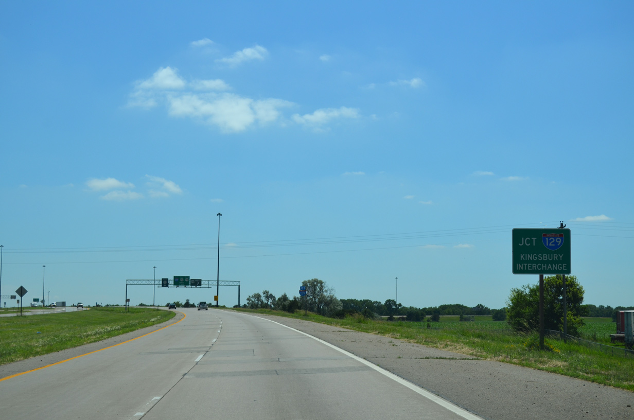
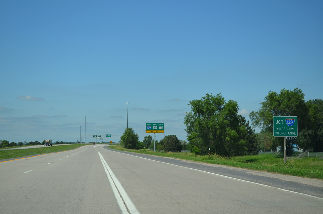
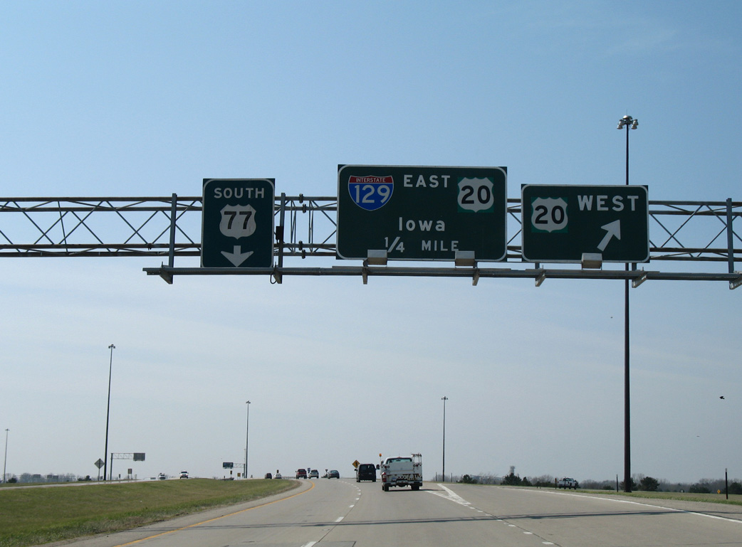
U.S. 77 angles southwest between an industrial park and Crystal Cove Park to meet Interstate 129 and U.S. 20-75 at the Kingsbury Interchange. 06/17/15
U.S. 20 leads motorists west 18 miles to the Dixon County seat of Ponca via Highway 12. Interstate 129 accompanies the US route east to I-29. 06/17/15
A trailblazer remains for U.S. 75 north at the loop ramp from U.S. 77 south to Interstate 129 east. Overheads for I-129 east on U.S. 77 were replaced in 2007 to finally reflect the 1984 relocation of U.S. 75. 06/17/15
![]()
![]() North at
North at ![]()
![]()
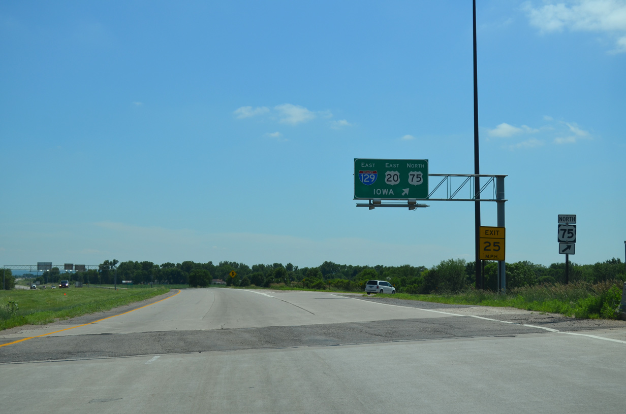
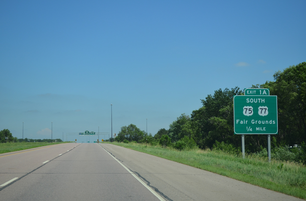
Leading north from the Fairgrounds area, U.S. 75/77 approach the Kingsbury Interchange with I-129. Merle Kingsbury was a member of the Nebraska Highway Commission from 1953 to 1987. He oversaw many of the public hearings involving the location of Interstate 80 across the state.6 06/17/15
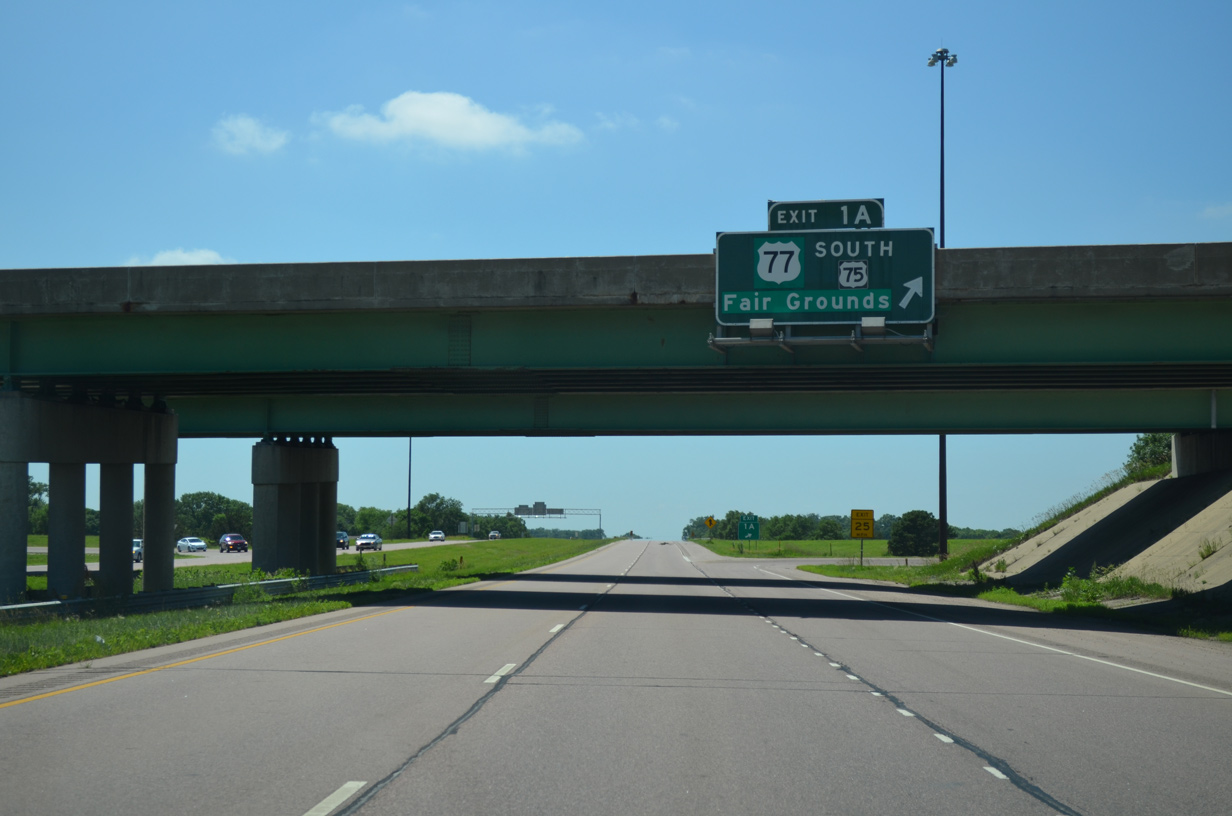
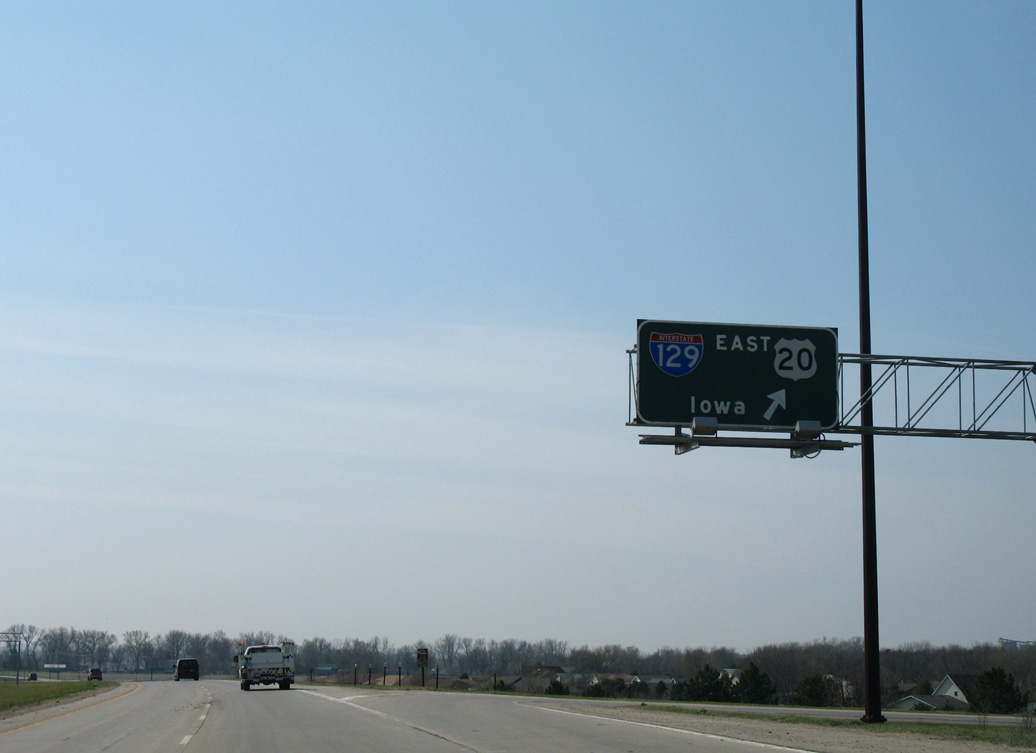
A third lane opens from the Fairgrounds access road to the eastbound exit ramp for I-129/U.S. 20. U.S. 75 accompanies the freeway east across the Sergeant Floyd Memorial Bridge into Sioux City, Iowa. 06/17/15
U.S. 20/75 overlap for 7.3 miles along the Sioux City belt route to the east end of U.S. 20 Business. U.S. 77 ends 3.7 miles to the north at Interstate 29 and Wesley Parkway outside Downtown Sioux City, Iowa. 06/17/15
![]() East at
East at ![]()
![]()
![]()
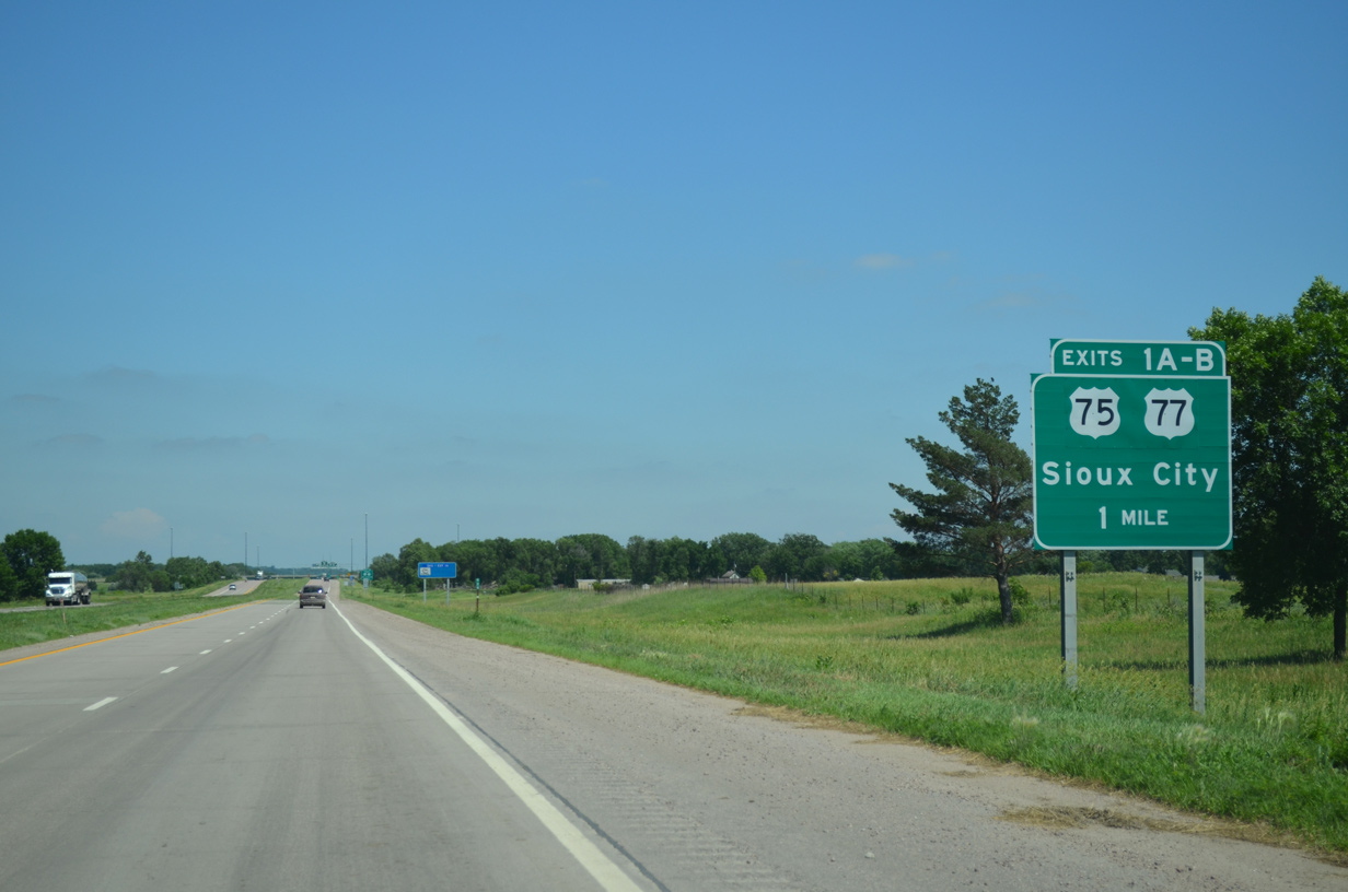
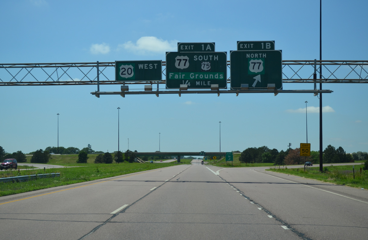
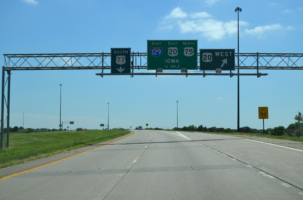
U.S. 20 upgrades to a freeway east of the intersection with Elgin Avenue. The cloverleaf interchange (Exits 1A/B) with U.S. 77 and U.S. 75 south lies one mile ahead. 06/17/15
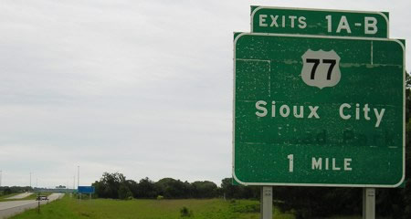
Replaced button copy sign posted one mile ahead of the U.S. 20 transition to I-129 at U.S. 75/ 77. A label scar alludes at Atokad Park, a horse racing facility that closed in 2012 and was later torn down. Photo by Jeff Morrison and Jason Hancock (06/12/05).
U.S. 75/77 overlap 16 miles south from Interstate 129/U.S. 20 to Winnebago. The two travel rural routes south to Decatur and Oakland respectively. 06/17/15
Interstate 129 begins as motorists along U.S. 20 east reach Exit 1A for U.S. 75/77 south. Fairgrounds references the site surrounding the former Atokad Park just to the southeast. 06/17/15
U.S. 77 travels along a commercialized route north to Klasey Park and Dakota Avenue. Dakota Avenue leads the route north to the Siouxland Veterans Memorial Bridge spanning the Missouri River into Iowa. 06/17/15
West End Throwback
This guide sign was replaced later in 2007 to reflect the overlap of U.S. 75 north on I-129/U.S. 20 east. 04/20/07
A reflectorized overhead including U.S. 75 north replaced the sign for I-129/U.S. 20 east. The section of U.S. 75 south from Sioux City in Iowa was decommissioned in 1984. 04/20/07
The overhead for I-129/U.S. 20 east was replaced later in 2007 to show U.S. 75 north. The control point remains Iowa. 04/20/07
U.S. 75 south departs from I-129/U.S. 20 west to overlap with U.S. 77 south to Homer and Winnebago. 04/20/07
Sources:
- Interstate 129 Sergeant Floyd Memorial Bridge Dedication. N.p.: Siouxland Interstate Metropolitan Planning Council, 1976. Print.
- 50 Years of Interstate – Nebraska and the Nation.
http://www.transportation.nebraska.gov/ docs/interstate-history-bk.pdf - “Highway opens to traffic.” Sioux City Journal (IA), November 20, 2001.
- Henjes, Jeff “I-129 Loop.” Online posting. July 25, 2000. news misc.transport.road.
- “Governors consider infrastructure requests.” Sioux City Journal (IA), July 26, 2000.
- “50 Years of Interstate – Nebraska and the Nation.”
http://nlc1.nlc.state.ne.us/epubs/R6000/T040-2006.pdfNebraska Department of Roads, June 29, 2006.
Page updated November 4, 2020.