Interstate 124
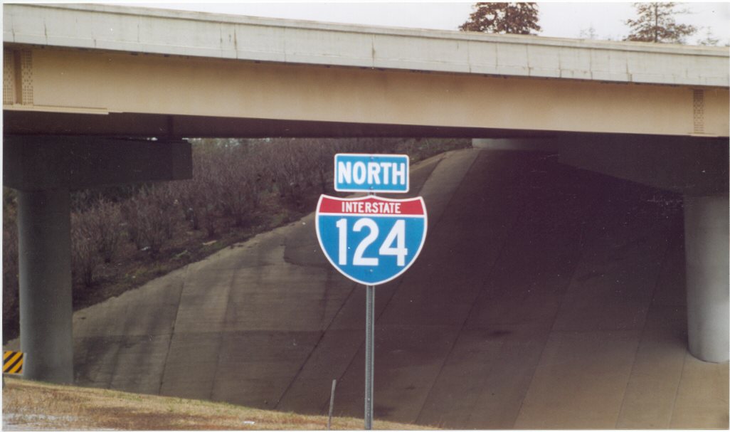
This Interstate 124 reassurance marker was posted by November 1999 along the transition ramp from I-24 east to U.S. 27 north. Removed by 2003, it was the lone northbound shield at the time. Photo by Philip Hart (11/21/99).
Overview
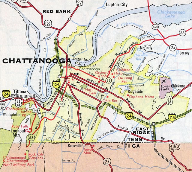
U.S. 27 lines a freeway north from the Big Scramble Interchange with Interstate 24 in Chattanooga to Soddy-Daisy and Tennessee State Route 111 by Chickamauga Lake in southeastern Tennessee. The southern portion of the route, between I-24 and the Olgiati Bridge, doubles as unsigned Interstate 124. The interstate portion runs between Downtown and Westside Chattanooga.
The Mayor Peter Rudolph “Rudy” Olgiati River Bridge is a steel deck girder bridge spanning the Tennessee River from Downtown to Hill City. Olgiati was noted for several public works projects completed during his term including a second tunnel for McCallie Avenue (U.S. 11/64) through Missionary Ridge, widening of U.S. 27 along Rossville Boulevard and completion of the third Downtown bridge across the Tennessee River (named the Olgiati Bridge in 1959).1
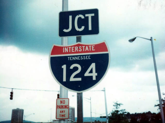
Interstate 124 has disappeared and reappeared on the Tennessee Official State Highway maps since 1986. The Tennessee Department of Transportation (TDOT) replaced most of the Interstate 124 signs in the mid 1990s due to some confusion among non local motorists over the difference between I-24 and I-124.2 There was one remaining reassurance shield until 1999, when a second marker was added in the northbound direction. However the 1999 Tennessee Official State Highway Map again omitted Interstate 124. William Burmaster confirmed this change after a June 2003 visit to the area revealed no I-124 shields or signs posted in either direction of U.S. 27.3 Furthermore William received an email response from the TDOT regarding I-124:4
Interstate 124 signs were not re-installed when the major directional interchange improvements [at I-24] were made some years ago.
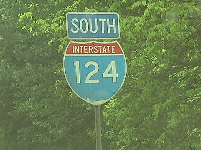
A southbound reassurance marker for Interstate 124 once stood just beyond the P.R. Olgiati Bridge adjacent to a ground level sign for Exit 1C. Photo by Jim K. Georges (05/98).
Another possible reason why TDOT dropped signs for Interstate 124 was due to the northward extension of the freeway along U.S. 27 beyond the Signal Mountain interchange with U.S. 127. Scott Boles wrote in 2003 that the only portion of the U.S. 27 freeway in southern Tennessee that did not meet Interstate standards at the time was the section assigned to Interstate 124.
Major Projects
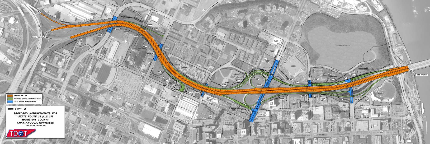
The final phase of U.S. 27 (I-124) Reconstruction in Downtown Chattanooga, estimated to cost $98 million in 2012,8 was planned to run in tandem with work north of the river to 2017.11 Work was previously halted in 2002 due to opposition during the Urban Design Challenge presentation for the Fourth Street corridor regarding pedestrian accessibility.6 Uncertainty of available funds from the Highway Trust Fund further delayed the project in 2015.11
The contract to bring Interstate 124 to modern safety standards was eventually awarded by November 2015 at $126.3 million. It was the most expensive project in TDOT history at the time. Construction included the redesign of interchanges with Martin Luther King Boulevard and 4th Street, the elimination of the S-curve at 4th Street, and the addition of new frontage roads. Additionally crews expanded the Olgiati Bridge by a lane in each direction. Design work on this project started in 2006 and rights of way were purchased in 2015.13 Work on the 2.3 mile long project was targeted for completion on July 31, 2019,8 but later amended to January 2020.
Work on the northbound lanes for I-124/U.S. 27 was completed first, allowing crews to shift southbound traffic to the new roadway with two-way traffic. Construction on the southbound lanes, the new exchange at 4th Street and MLK Boulevard continued from 2018 to 2019. Final paving and striping work was to be completed between late 2019 and January 2020, but continued into Fall 2020.
Route Information
North End – Chattanooga, TN
South End – Chattanooga, TN
Mileage – 1.97
Cities – Chattanooga
- Junctions –

Source: December 31, 2021 Interstate Route Log and Finders List
I-124 Annual Average Daily Traffic (AADT)
Source: Tennessee Department of Transportation (TDOT) Transportation Data Management System 2021 AADT
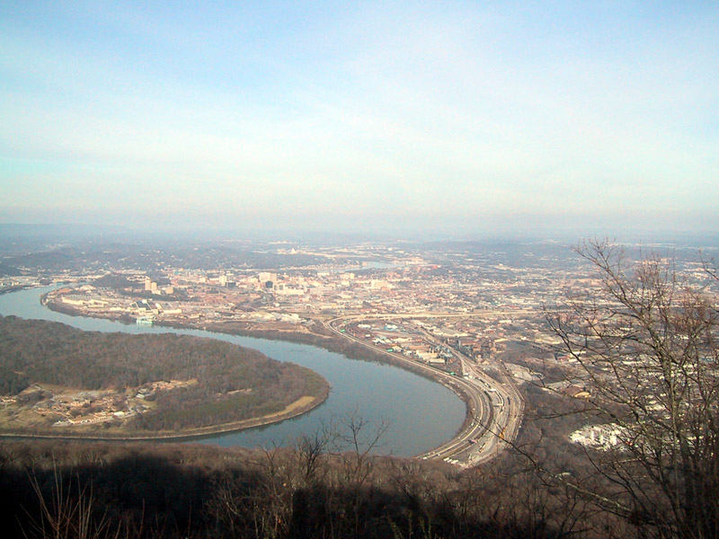
Interstate 124 opened initially between West 9th Street (M.L. King Boulevard) and the Olgiati Bridge. By 1964, I-124 was extended southward to the new stretch of I-24 leading east.
As approved by AASHTO on June 26, 1985, U.S. 27 was relocated from the surface route between East Lake/Clifton Hills in Chattanooga to Red Bank onto an overlap with I-24 through Southside and I-124 by Downtown.
The interstate portion of U.S. 27 never extended all the way to U.S. 127 (a distance of approximately four miles), even though the Rand McNally Northern American Road Atlas from 1980 to 1987 mistakenly showed it beyond the Tennessee River. I-124 was removed from the Chattanooga inset in the 1988 edition.
 History
The section of Interstate 124 from Main Street to Dr. Martin Luther King, Jr. Boulevard was constructed and opened to traffic by 1960. The connection from Interstate 24 north to Main Street was opened thereafter, likely in December 1966 in conjunction with the completion of I-24 between the Georgia State Line and I-124.5
1990s Expansion plans for U.S. 27 at Downtown Chattanooga included an option to replace the freeway along I-124 with a tree lined, at-grade boulevard. The year long study completed by 1999 recommended an eight lane boulevard acting as a gateway to Downtown with heavy landscaping, signalized intersections and a 35 mile per hour speed limit.6 The $110 million TDOT plan would expand U.S. 27 between I-24 and Signal Mountain Road (U.S. 127) from four to six lanes and add collector distributor roads to the freeway at Downtown. The boulevard option, estimated to cost $29.9 million, drew concerns over funding. The Chattanooga-Hamilton County Regional Planning Agency indicated that if that option was chosen, due to the removal of the Interstate designation, state funding for the project would double from 10 to 20 percent. Additionally estimated travel times were forecast to increase from 1 to 2 minutes on an expanded U.S. 27 (I-124) to 4 to 10 minutes on a boulevard.7
The boulevard option was never enacted upon and instead TDOT moved forward with plans to both widen and modernize the freeway along U.S. 27. William Burmaster added that construction during June 2003 involved deck rehabilitation and improvements to the approaches for the Olgiati Bridge.4 The $26.9 million project included provisions for eventual expansion of U.S. 27 between Downtown and the North Shore.8 With an anticipated completion by June 2001, construction on the span started in February 1999. Setbacks due to utility work, right of way acquisition and materials resulted in delays to 2003.9
Narrow shoulders and a tight curve south of the river remained after the Olgiati Bridge upgrade. Additionally the substandard Signal Mountain Interchange with U.S. 127 included ramps with sharp geometry and no side lanes allocated for merging traffic.4 Early 2000s plans outlined continuing reconstruction of Interstate 124 and U.S. 27 both north and south of the Tennessee River. The second phase of work involved reconstructing and widening U.S. 27 from the Olgiati Bridge north to U.S. 127. The third phase was proposed to reconstruct U.S. 27 southward from the bridge to Interstate 24. Funds for both phases were programmed in Fiscal Years 2008 and 2009.10
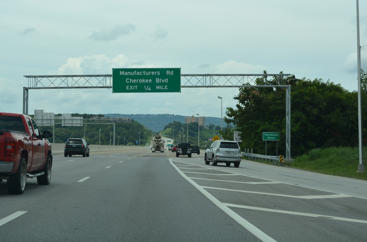
Work finally commenced on the U.S. 27 reconstruction north of the river in December 2011. The $105.8-million project expanded 1.62-miles of the 1960s-built freeway to six and eight overall lanes. Included was construction of six new bridges, 33 retaining walls and redesign of interchanges with Manufacturers Road, Dayton Boulevard, and U.S. 127 (Signal Mountain Road). Work was slated for completion in October 2013, but the addition of an unplanned retaining wall over concerns for hill stability, pushed back completion to February 2015.11
Interstate 175
Proposed spending of the US Department of Transportation for Fiscal Year 2002 included $2.4 million for a feasibility and planning study for an Interstate corridor between Chattanooga, Tennessee and Lexington, Kentucky. Designated as Interstate 175, the corridor followed the route of U.S. 27 and may have incorporated I-124 via the U.S. 27 freeway from I-24 to Soddy-Daisy. The final Transportation spending bill passed by the U.S. House of Representatives and Senate in late 2001 however omitted funding for the route.12
 Photo Guides
North End  / P.R. Olgiati Bridge – Chattanooga, Tennessee
![]()
![]() North
North
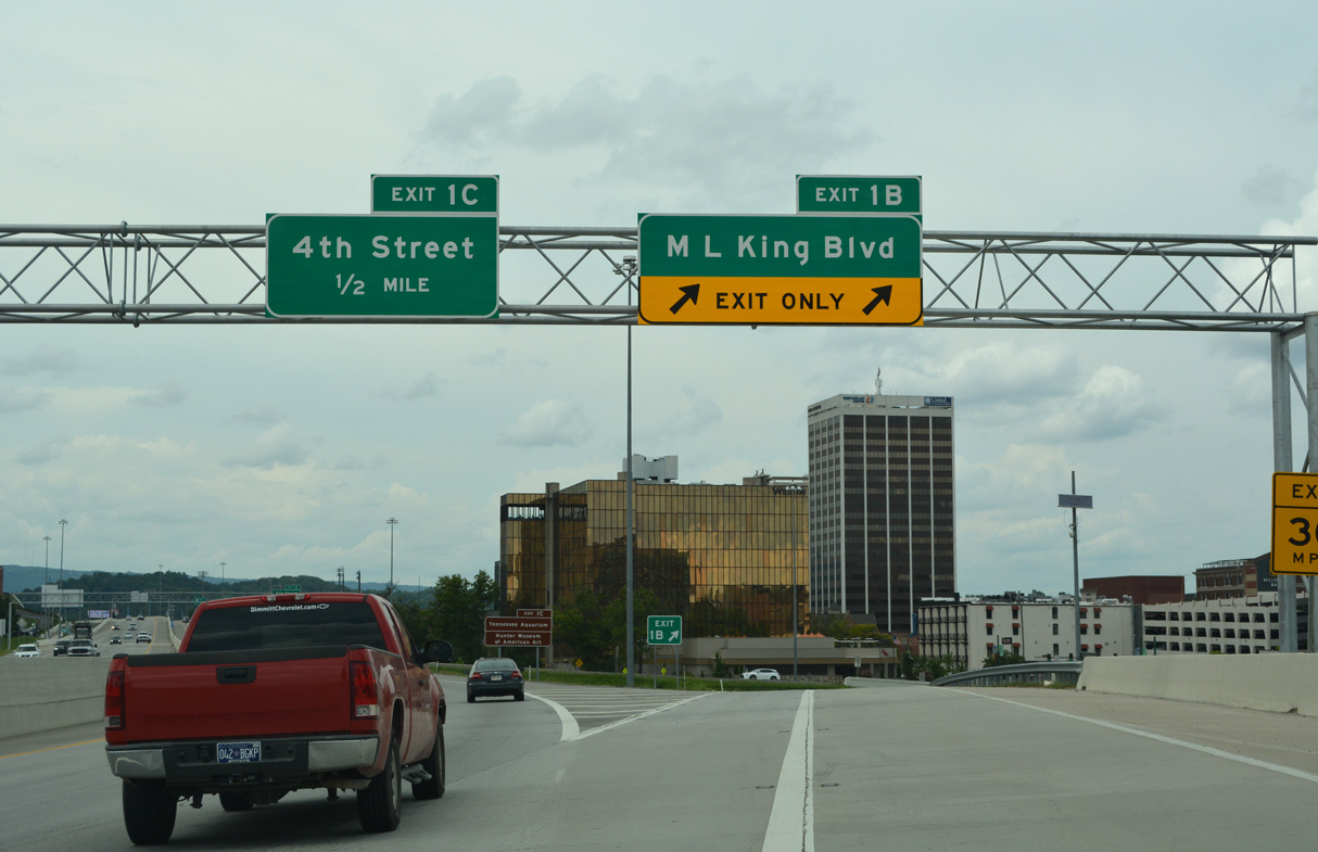
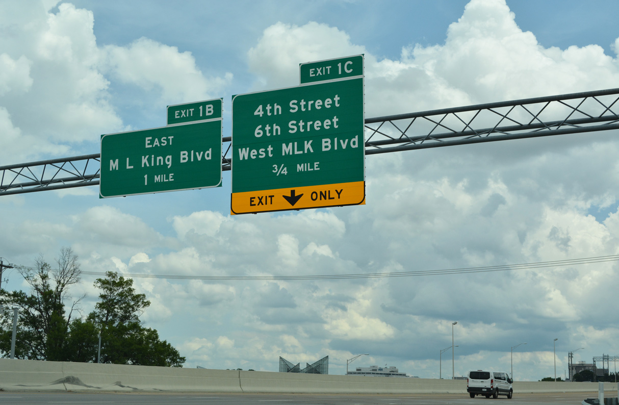
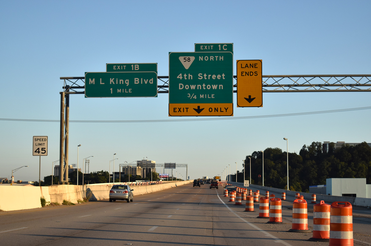
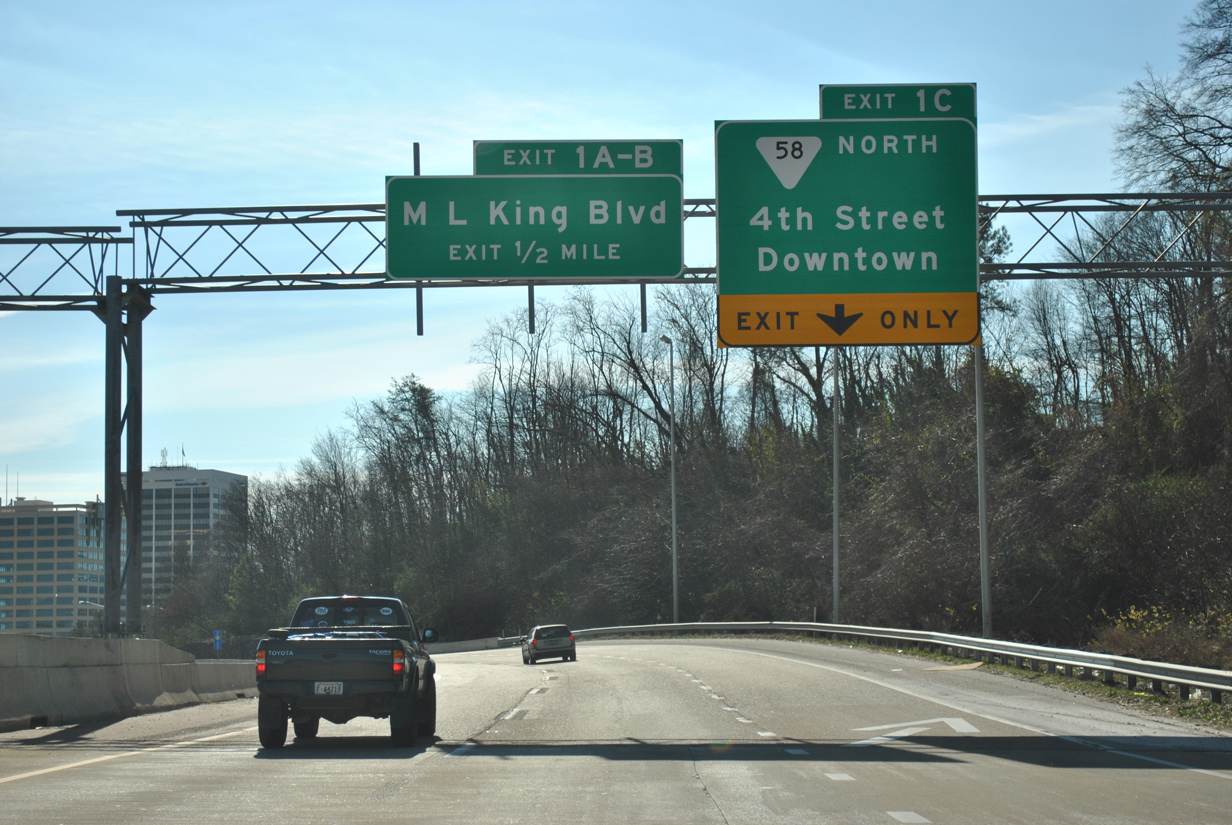
A six-ramp parclo interchange links I-124/U.S. 27 with Martin Luther King Boulevard at Exit 1 B. A third loop ramp at this exchange previously linked MLK Boulevard west with the freeway south. 07/26/22
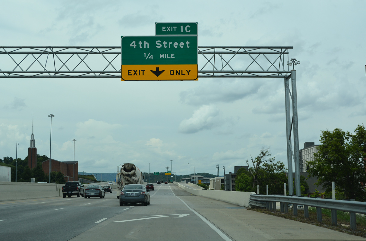
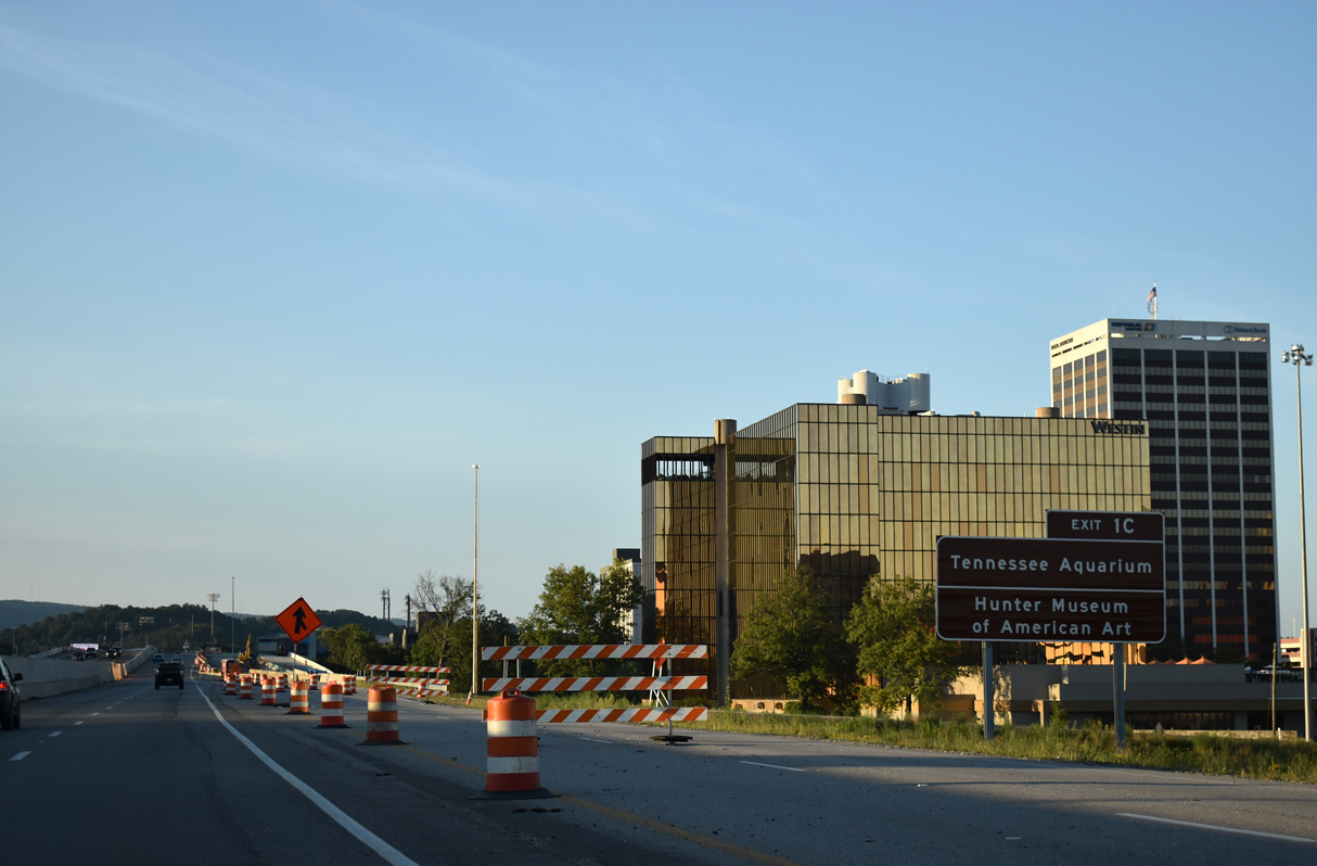
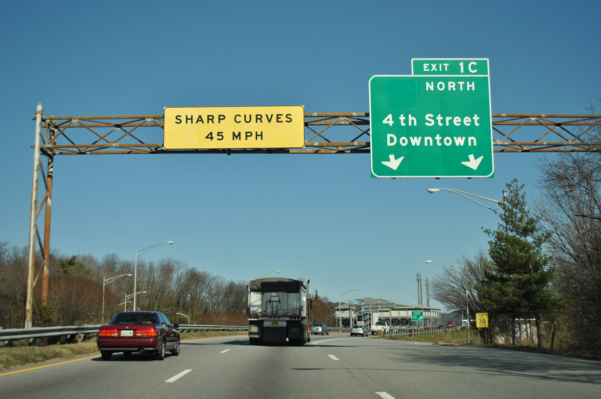
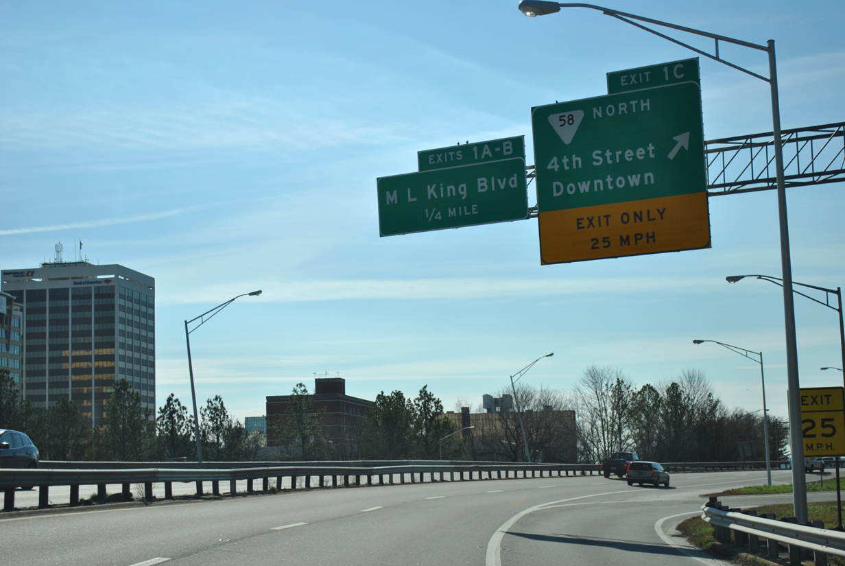
The U.S. 27 Reconstruction in Downtown Chattanooga project rebuilt the trumpet interchange (Exit 1 C) joining Interstate 124 with W 4th Street into a modified diamond interchange. 07/26/22
W 4th Street (SR 389) connects I-124/U.S. 27 with the north end of the Chattanooga central business district. 07/26/22
Interstate 124 ends and U.S. 27 continues north across the Mayor Peter Rudolph “Rudy” Olgiati Bridge over the Tennessee River. Succeeding interchanges are unnumbered as U.S. 27 advances north to Hill City in Chattanooga and Red Bank. 07/26/22
![]() South at
South at ![]()
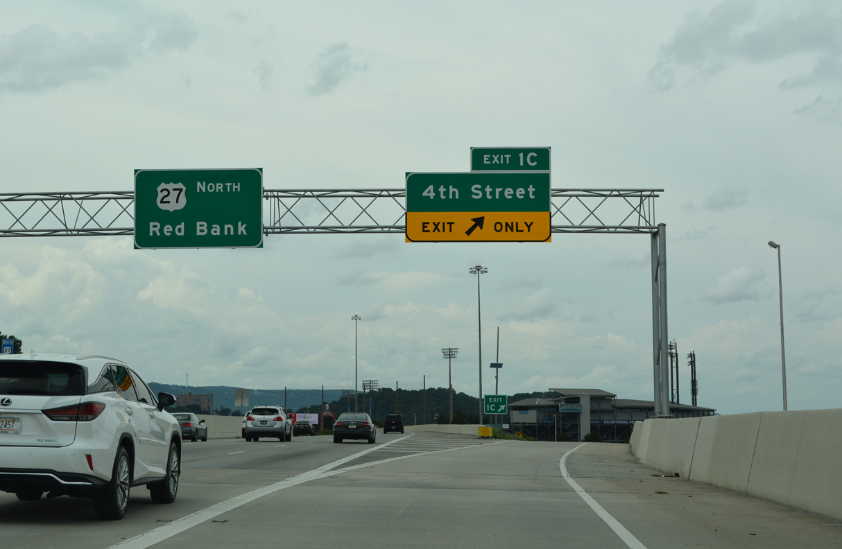
U.S. 27 south crosses the Tennessee River from Hill City to Downtown and Westside Chattanooga on the Olgiati Bridge. The freeway heads to Exit 1 C / 4th Street and Exit 1 B / Martin Luther King, Jr. Boulevard as unsigned I-124. 07/26/22
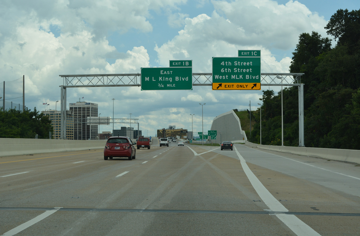
The trumpet interchange (Exit 1 C) joining I-124 and U.S. 27 with 4th Street (SR 389) east into Downtown was replaced with a modified diamond interchange in 2019. 07/26/22
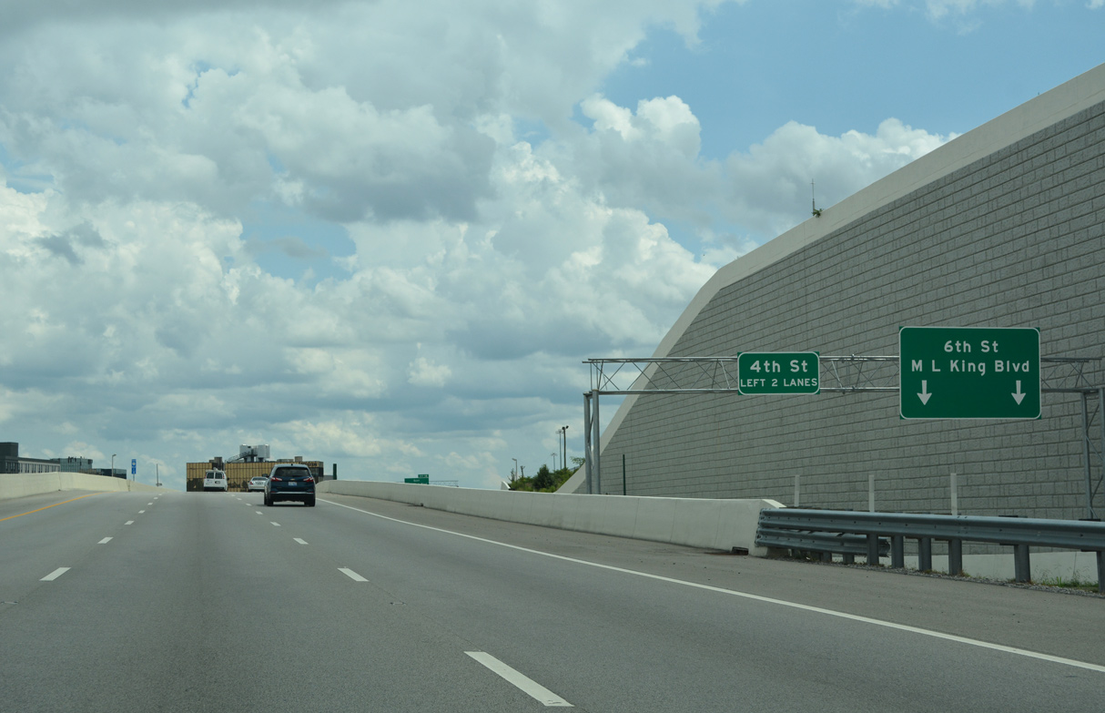
A frontage road links Exit 1 C and W 4th Street with W 6th Street and Martin Luther King Boulevard. Exit 1 B links I-124/U.S. 27 with MLK Boulevard east directly. 07/26/22
 North End Throwback
![]()
![]() North
North
Interstate 124 north during late stages of the U.S. 27 Reconstruction in Downtown Chattanooga project. 09/06/20
2016-20 construction at Exit 1 C straightened out the freeway and widened I-124 to six lanes over 4th Street and eight lanes across the Olgiati Bridge. 01/21/13
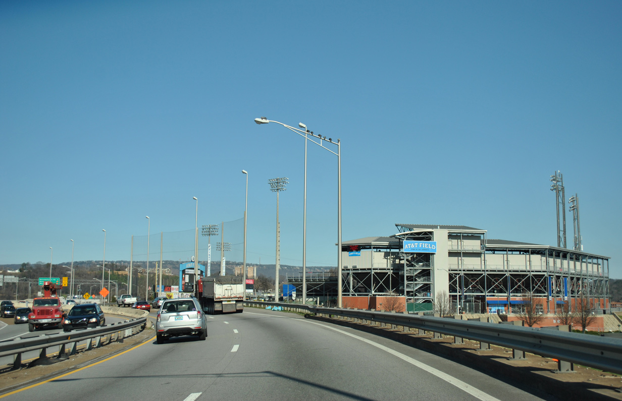
U.S. 27 navigated through a narrow S-curve at the exchange with 4th Street adjacent to AT&T Field. 01/21/13
![]() South at
South at ![]()
Construction consolidated the succeeding ramps at Exit 1 C for SR 389 / 4th Street and Exit 1 B for Martin Luther King Boulevard west into a single ramp as part of the U.S. 27 Reconstruction in Downtown Chattanooga project. 09/06/20
The loop ramp at Exit 1 A for Martin Luther King Boulevard east into Downtown was retained during 2016-20 road work. 01/21/13
The Downtown Chattanooga skyline appeared as I-124/U.S. 27 continued through the S-curve by AT&T Field to 4th Street. Construction through March 2020 straightened out the curve here. 01/21/13
South End – Chattanooga, Tennessee
![]()
![]() South at
South at ![]()
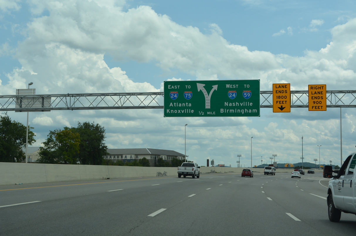
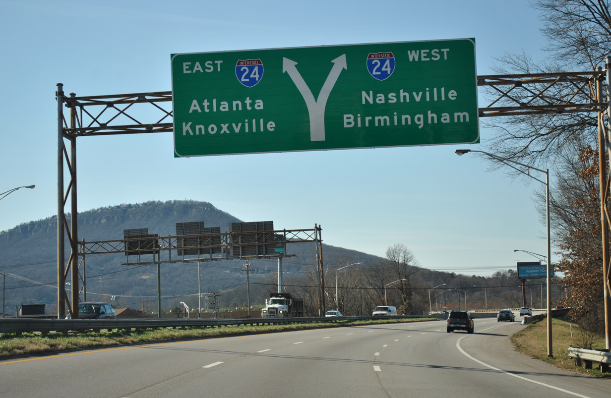
An unnumbered three-wye interchange joins I-124/U.S. 27 with Interstate 24 in 0.75 miles. Construction underway from 2016-20 expanded the southbound freeway between three and five lanes. 07/26/22
Forthcoming I-24 east ends in seven miles at Interstate 75. Westbound I-24 straddles Raccoon Mountain south into north Georgia. 07/26/22
Unmarked here, U.S. 27 combines with I-24 east for two miles from the south end of Interstate 124. U.S. 27 leaves the Interstate system at Exit 180 for Rossville Boulevard to East Lake/Clifton Hills and Rossville, Georgia. 07/26/22
U.S. 27 south joins Interstate 24 east beyond the exit ramp for U.S. 11-41-64-72 (Broad Street) at Southside Chattanooga. The four US routes lead south to Alton Park and St. Elmo in Chattanooga, and west to Lookout Mountain. 07/26/22
A $31.99 million contract was let on June 26, 2020 for the I-24 Interchanges at Broad and Market Streets project. Work from September 14, 2020 to August 2023 removes loop ramps along I-24 eastbound and adds a frontage road linking the new ramps at I-124 with Broad and Market Streets. 01/21/13
Milepost zero for the freeway along U.S. 27 stands at the gore point connecting I-124 south with Interstate 24 east. 01/21/13
![]() West at
West at ![]()
![]()
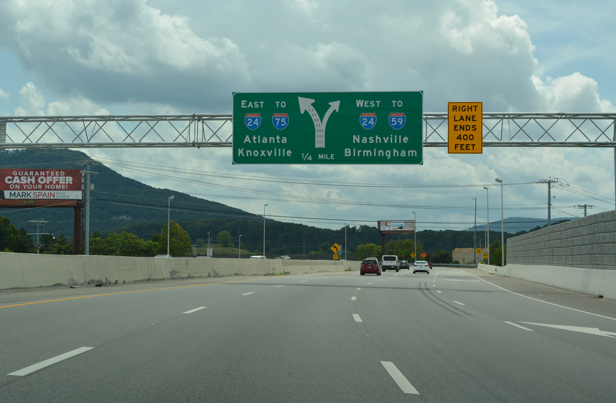
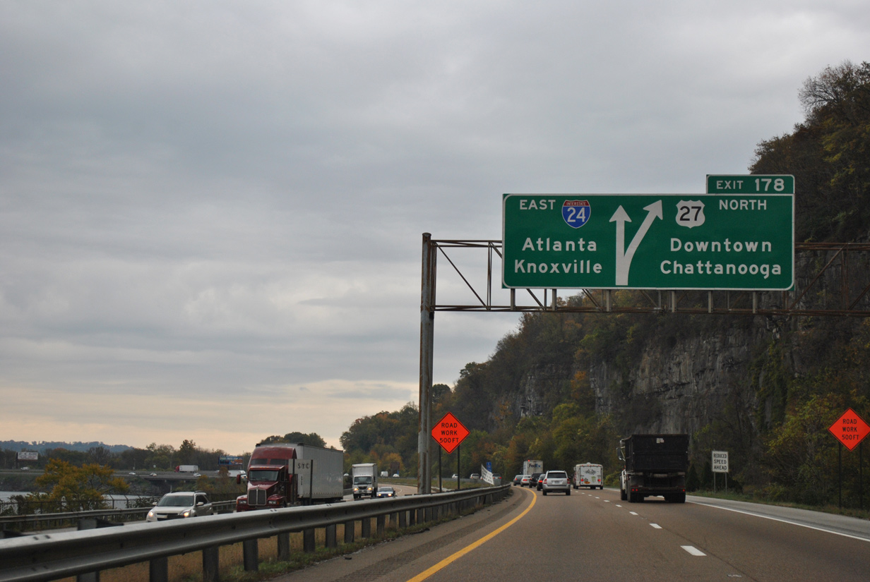
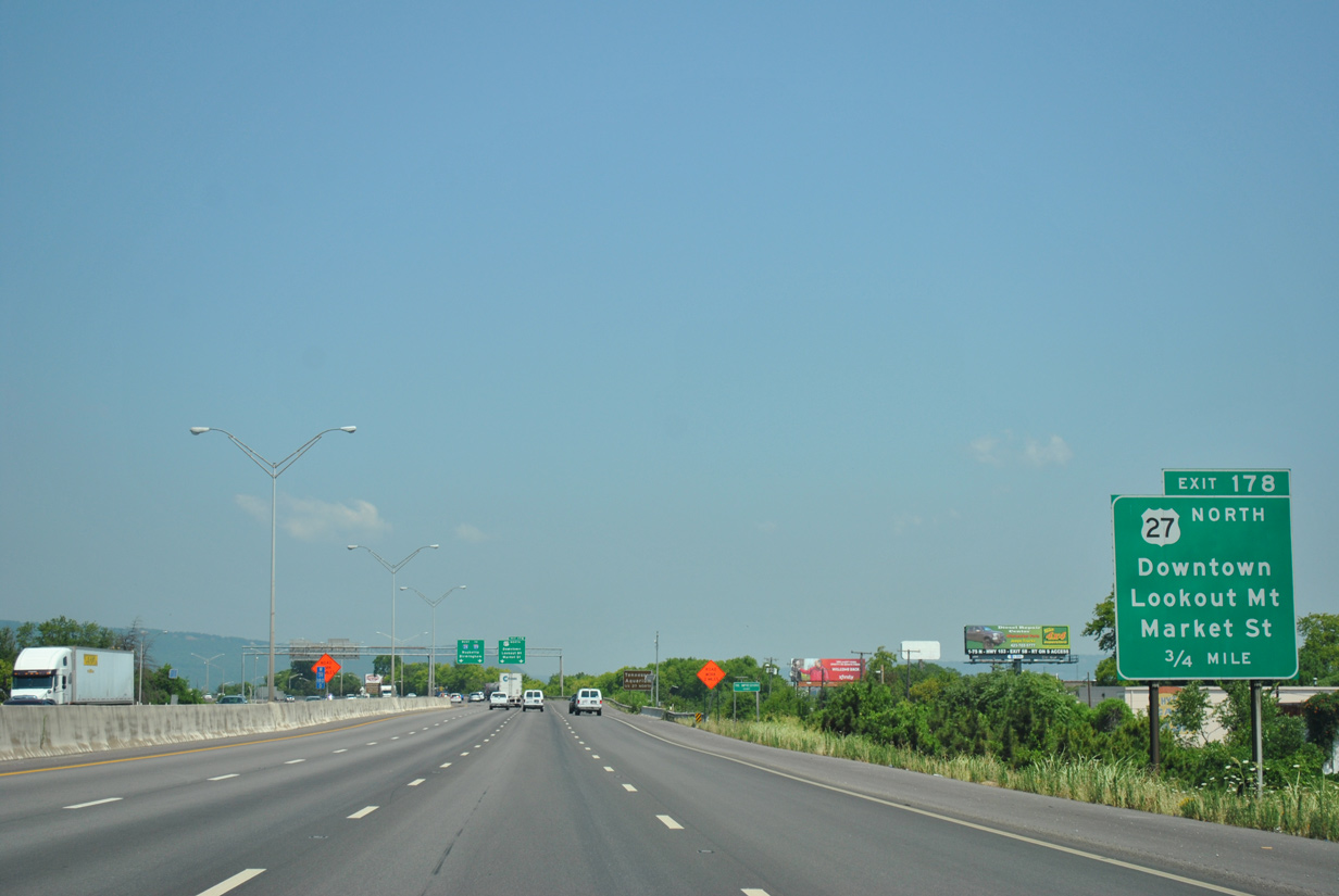
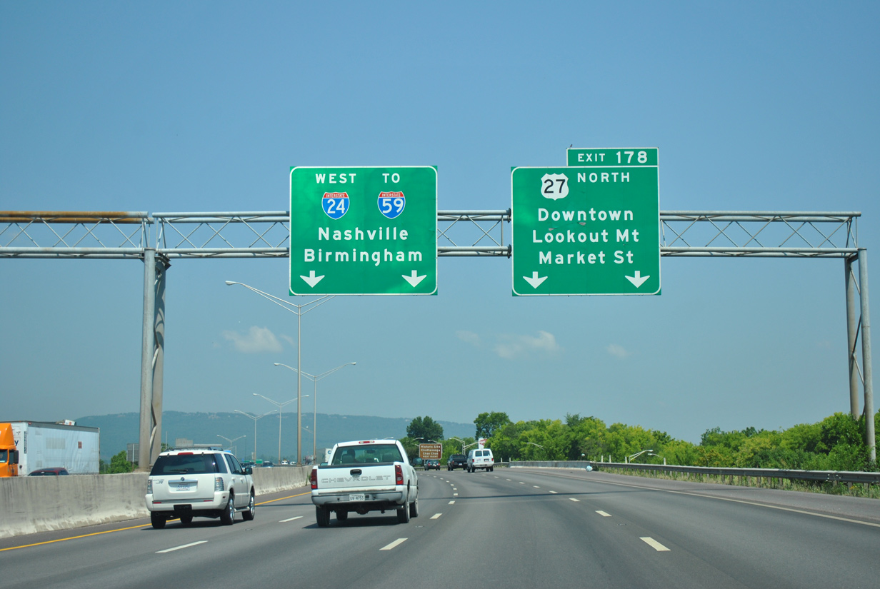
U.S. 27 north combines with Interstate 24 from Rossville Boulevard for a brief overlap west to Exit 178 for unsigned I-124. 09/06/20
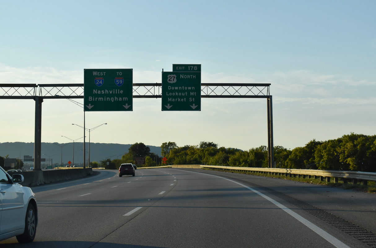
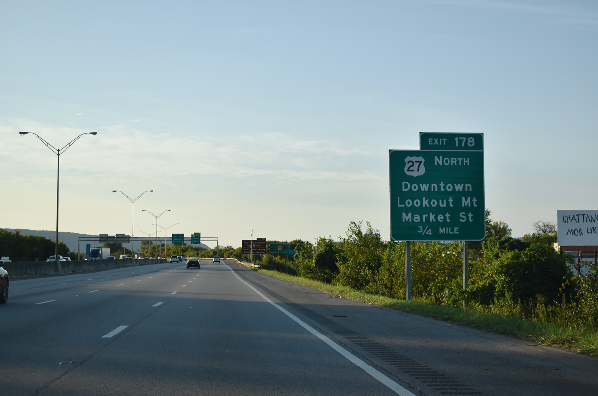
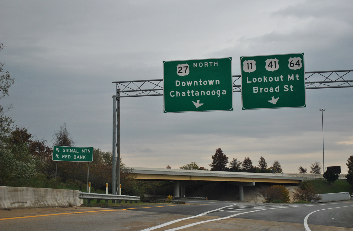
A distributor roadway (Exit 178) separates traffic from I-24 west to Market Street north for Downtown, 21st Street west for U.S. 11-41-64-72 (Broad Street) to Lookout Mountain and U.S. 27 leading north to Hill City and Soddy-Daisy. Beyond I-124, I-24 travels westward 11 miles to the north end of I-59. 09/06/20
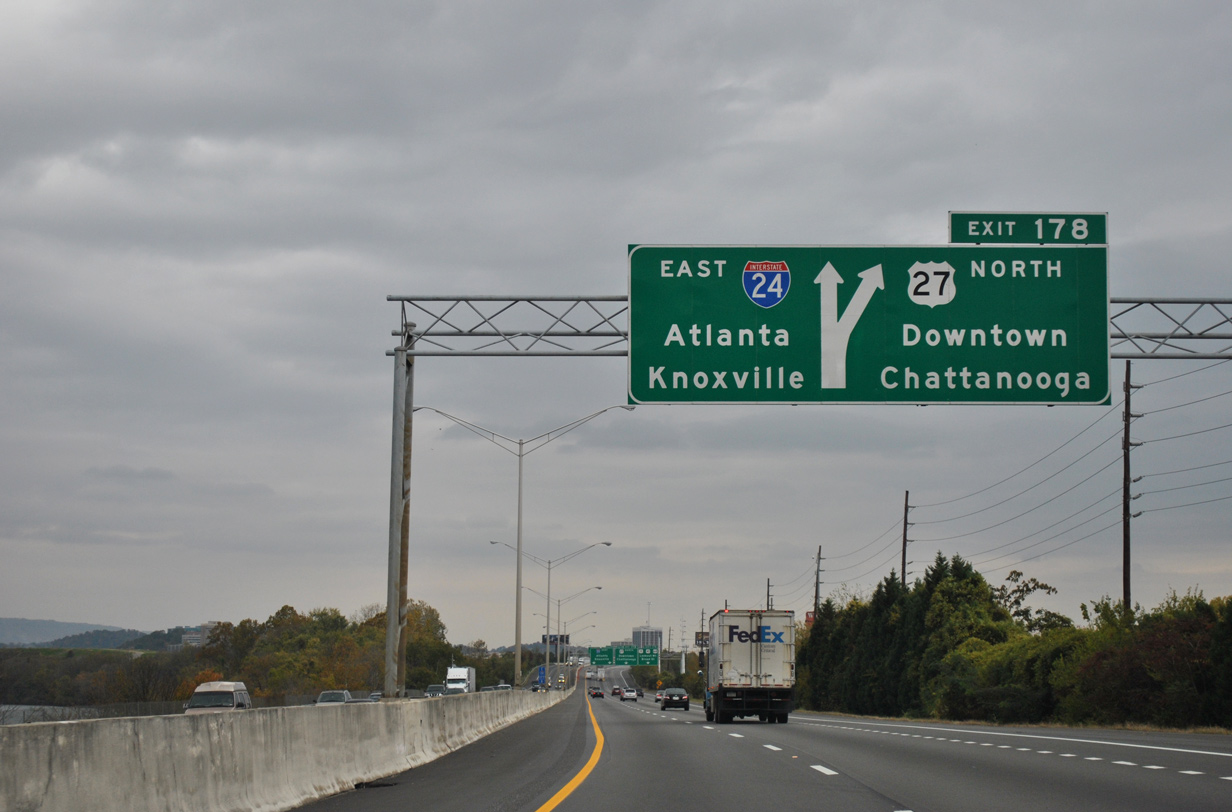
Three lanes partition from the I-24 westbound mainline for U.S. 27/I-124 north to Downtown Chattanooga. Succeeding ramps quickly depart for Market and 21st Streets while U.S. 27 north parallels I-24 west to Chestnut Street. 09/06/20
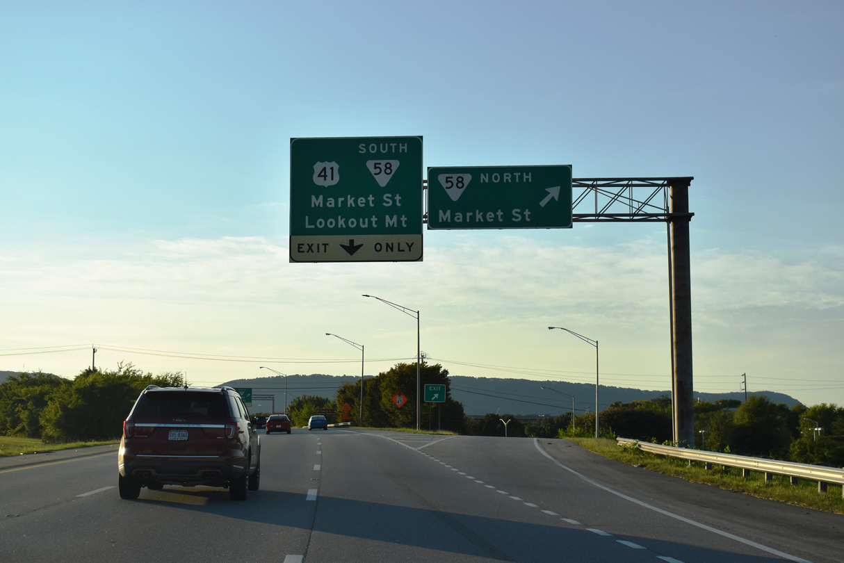
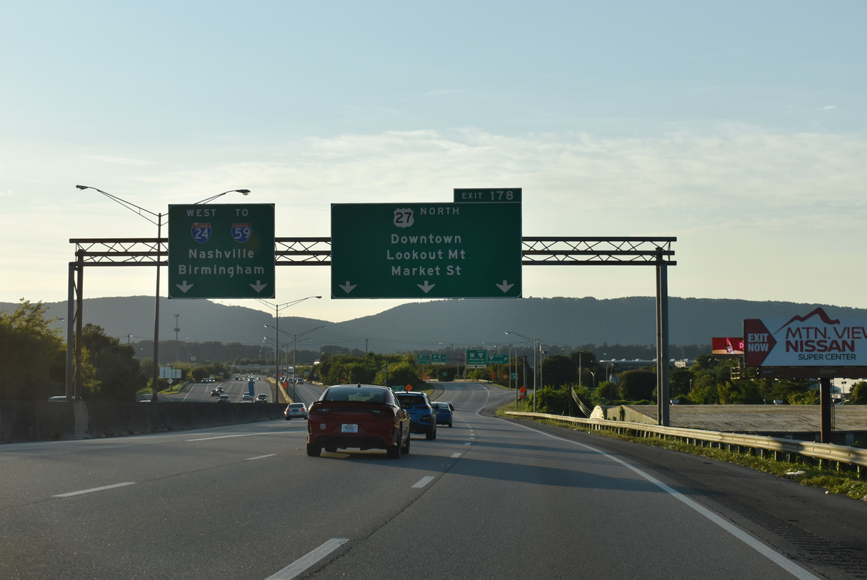
Continuing along the c/d roadway, the next off-ramp connects with SR 58 (Market Street) north to adjacent U.S. 11/64 (20th Street) at Southside Chattanooga. U.S. 27 north stays west another 0.6 miles along side I-24 to I-124. 09/06/20
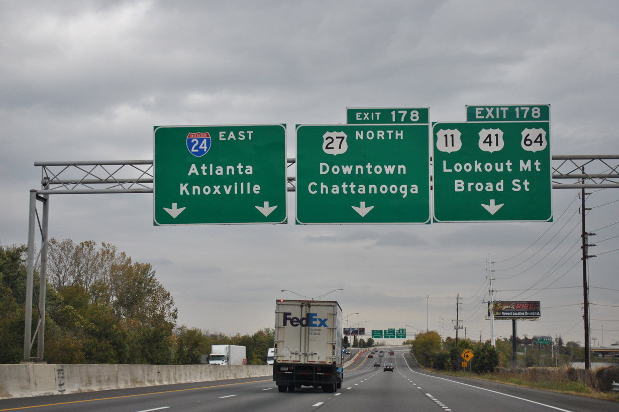
A loop ramp follows onto SR 58 (Market Street) south through Alton Park in Chattanooga and 21st Street west to U.S. 11-41-64-72 (Broad Street). The four US routes overlap along Broad Street south to St. Elmo, where they turn west to encircle Lookout Mountain. 09/06/20
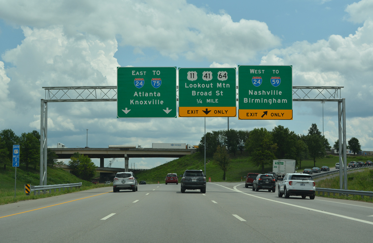
![]() East at
East at ![]()
![]()
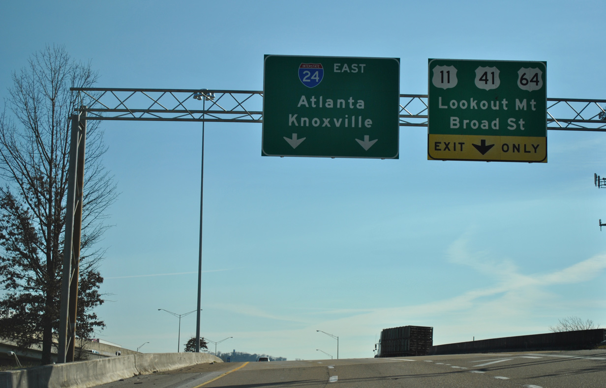
Interstate 24 straddles the Tennessee River south of Moccasin Bend on the two miles leading to Exit 178 for I-124 and U.S. 27. 11/03/11
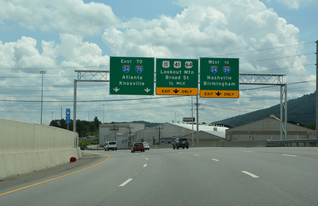
Interstate 24 runs between the Tennessee River and the L and N Railroad, which disappears at the Lookout Mountain Tunnel through the adjacent rock facade. A diagrammatic sign outlines the forthcoming split with Exit 178 for U.S. 27 (I-124) north and Broad Street (U.S. 11-41-64-72) to Downtown Chattanooga. 11/03/11
Curving northward through industrial Southside in Chattanooga, I-24 and I-124 separate with two lanes serving each route. 11/03/11
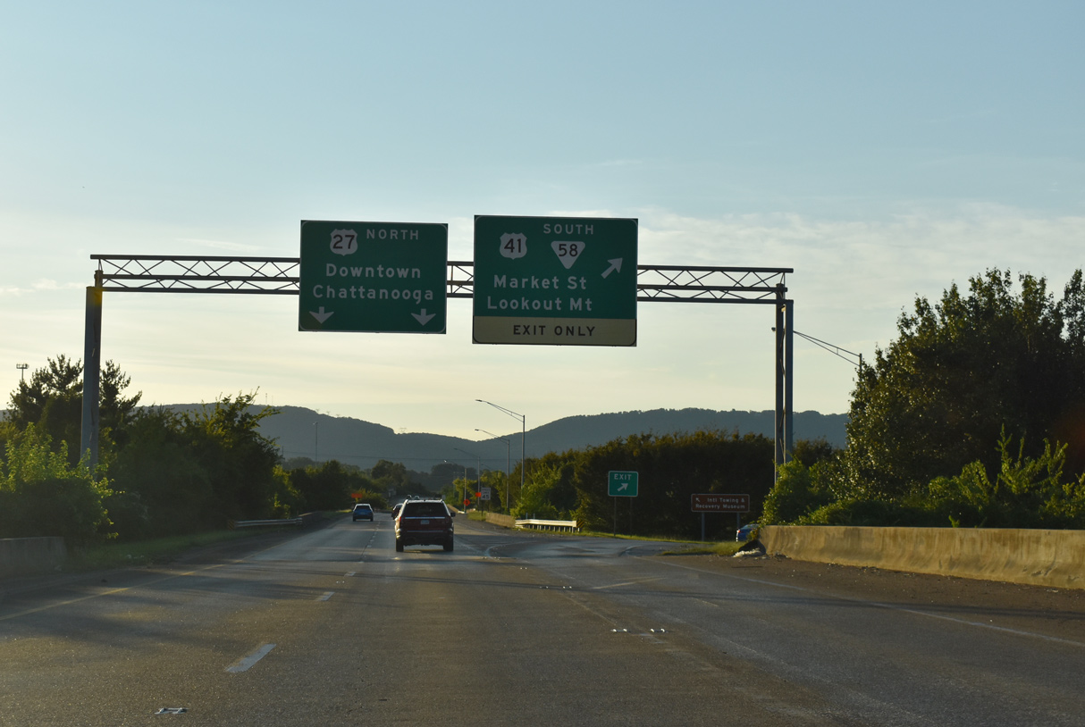
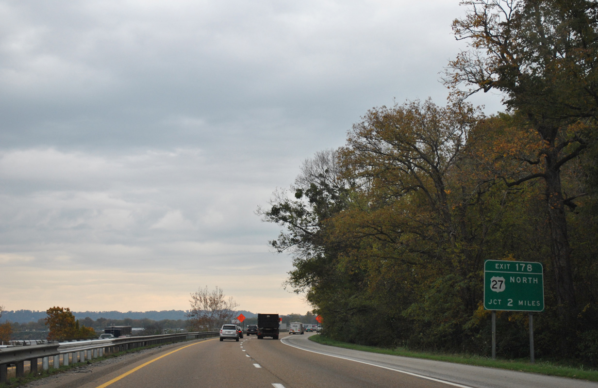
Exit 178 departs as a collector distributor roadway for I-124/U.S. 27 north to Westside, Downtown and Hill City across the Olgiati Bridge and U.S. 11-41-64-72 (Broad Street) at Southside. U.S. 27 south combines with I-24 east to Rossville Boulevard at East Lake/Clifton Hills. 11/03/11
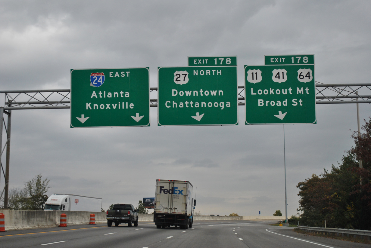
Exit 178 leaves Interstate 24 east for I-124/U.S. 27 north and U.S. 11-41-64-72 (Broad Street). I-24 ends in 7.3 miles at Interstate 75. 11/03/11
Passing over the L and N Railroad, Exit 178 separates into single lane ramps for U.S. 27 north and the c/d roadway east to Broad Street. The freeway along U.S. 27 joins Chattanooga with Signal Mountain via U.S. 127 at Red Bank and Soddy-Daisy. U.S. 11-41-64-72 combine at Tiftonia and parallel I-24 east to Southside Chattanooga. There U.S. 72 ends and U.S. 76 begins, while U.S. 11-64 and U.S. 41 turn east through the Highland Park/Oak Grove neighborhood adjacent to I-24. 11/03/11
South End Throwback
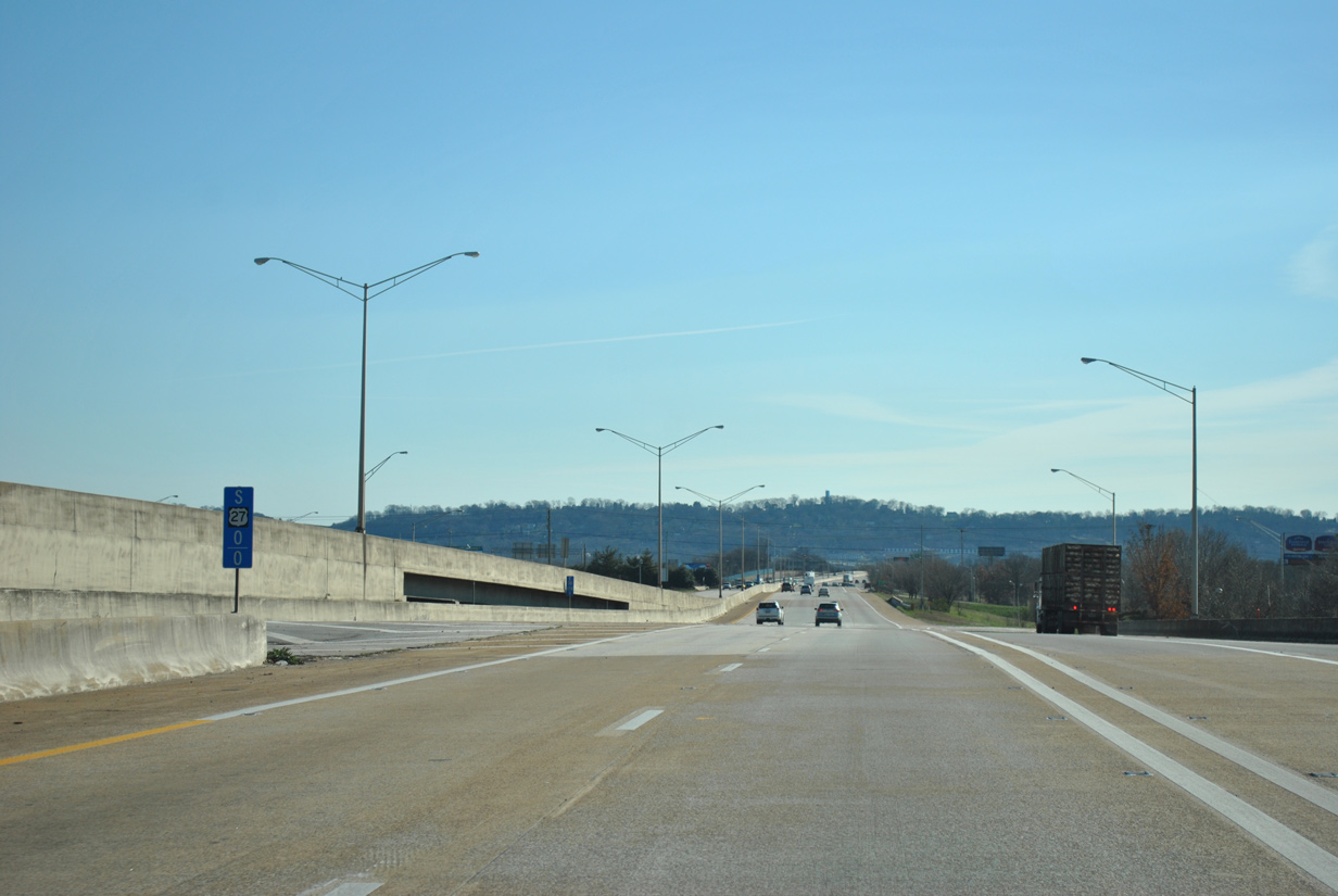
Milepost one appeared along the I-124/U.S. 27 southwestern curve over 12th Street. 01/21/13

This diagrammatic sign replaced a pair of separate panels for Interstate 24 on the curve preceding the Main Street on-ramp. The overhead here was damaged when a vehicle struck the left side of the sign by 2007. A replacement was made by 2008. 06/18/05
Lookout Mountain, home to Chickamauga and Chattanooga National Military Park, rises to the south as I-124/U.S. 27 weave southwest across Main Street and Riverfront Parkway. 01/21/13
The lone guide signs posted at the south end of I-124 during the U.S. 27 Reconstruction in Downtown Chattanooga project were these overheads for I-24. 01/21/13
The initial guide sign for U.S. 27 on I-24 west was missing in 2017. A carbon copied replacement was added by 2018. 06/25/12
The overheads preceding the split of U.S. 27 north from I-24 west were replaced in kind by August 2019. 06/25/12
Sources:
- 1951-1963 Peter Rudolph “Rudy” Olgiati, city of Chattanooga web site.
- “No Signs, But It’s Still There.” Chattanooga Times Free Press (TN), September 2, 1998.
- William Burmaster, email: “I-124” July 1, 2003.
- William Burmaster, email: “Fwd: FW: just a question” September 10, 2003.
- Chattanooga Flag Map (1960). Interstate 50th Anniversary web site
http://www.tninterstate50.com/maps/easttn.htm. - “Boulevard Proposal Studied for U.S. 27.” Chattanooga Times Free Press (TN), April 19, 1999.
- “state officials explain their concerns to city planners.” Chattanooga Times Free Press (TN), July 5, 1998.
- “BIG ROAD REMAKE – U.S. 27 REBUILD FROM OLGIATI TO I-24 ABOUT TO BEGIN.” Chattanooga Times Free Press (TN), November 15, 2015.
- “Another setback for Olgiati? – Bridge work could stretch through 2003.” Chattanooga Times Free Press (TN), July 13, 2002.
- Fiscal Years 2007-2009 Transportation Improvement Program (as of 05/23/06)
http://www.tdot.state.tn.us/roadprojects/road/default.htm– under Hamilton County: Interstate 124/U.S. 27 were proposed for preliminary engineering and right of way acquisition funding for additional lanes from north of Interstate 24 to south of the Tennessee River Bridge, a distance of 1.5 miles. - “SMOOTH SAILING AHEAD – The three-year project to rebuild U.S. 27 led to some rough patches for motorists. But at last, completion is at hand.” Chattanooga Times Free Press (TN), January 5, 2015.
- KentuckyRoads.com – Interstate 175 (Jeffrey Carlyle)
- “2 Traffic Lanes To Be Left Open Each Way During Construction Of $126 Million Downtown Freeway Makeover Featuring “Monster Wall”.” The Chattanoogan (TN), January 7, 2016.
Page updated July 29, 2022.