Interstate 115 Montana
Overview

Interstate 115, similar to unsigned I-315 at Great Falls to the north, comprises a short freeway spur with a lone interchange. Totaling just 1.197 miles per the Montana Department of Transportation (MDT) 2022 Route Log, I-115 doubles as the westernmost section of the Butte Business Loop for I-15/90. The business routes extend 0.539 miles east along Iron Street to Montana Street north beyond Exit 1.
Route Information
East End – Butte, MT
West End – Butte, MT
Mileage – 1.19
Cities – Butte
- Junctions –

Source: December 31, 2021 Interstate Route Log and Finders List
I-115 Annual Average Daily Traffic (AADT)
| Location | Vehicles per day |
|---|---|
| I-15/90 to Excelsior Av | 4,357 |
| Excelsior Av to Washington St | 3,303 |
| Washington St to Montana St | 3.754 |
Source: 2021 AADT – MDT’s Interactive Traffic web map
 History
Interstate 115 was part of the proposed urban Interstate numerology for Montana submitted to the American Association of State Highway Officials (AASHO) on July 31, 1958. AASHO approved the proposal on November 10, 1958.
Construction contracts to build Interstate 115 ran concurrent with the those for the I-15/90 overlap through Butte. Contracts to build a 2.6 mile long section of roadway, including all of I-115, and five bridge structures ran simultaneously with completion by September 30, 1964. Contracts to construct the western 2.7 miles of I-15/90 were scheduled to December 31, 1963, and the 5.5 mile section to the east through October 15, 1964.1
The eight mile long stretch of I-15/90 was dedicated on September 24, 1964. Work on the four lane, concrete freeway started in 1960 and cost $8 million.2
 Photo Guides
East End  – Butte, Montana
![]()
![]() East
East ![]() North at Iron Street
North at Iron Street
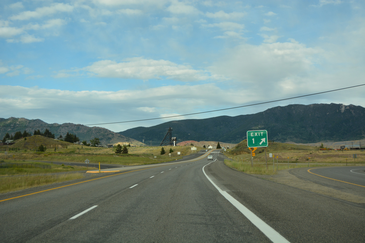
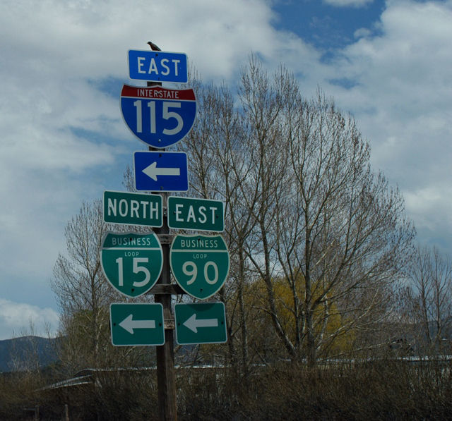
A concrete median more in line with an at-grade arterial separates the roadways of I-115 at Exit 1 for Excelsior Avenue. 07/05/16
The second and final reassurance marker for Interstate 115 stands east of the Excelsior Avenue underpass. 07/05/16
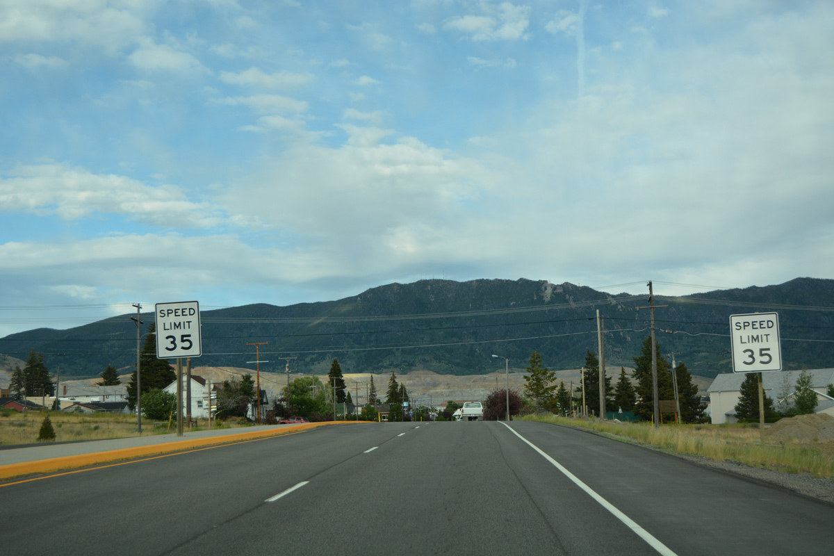
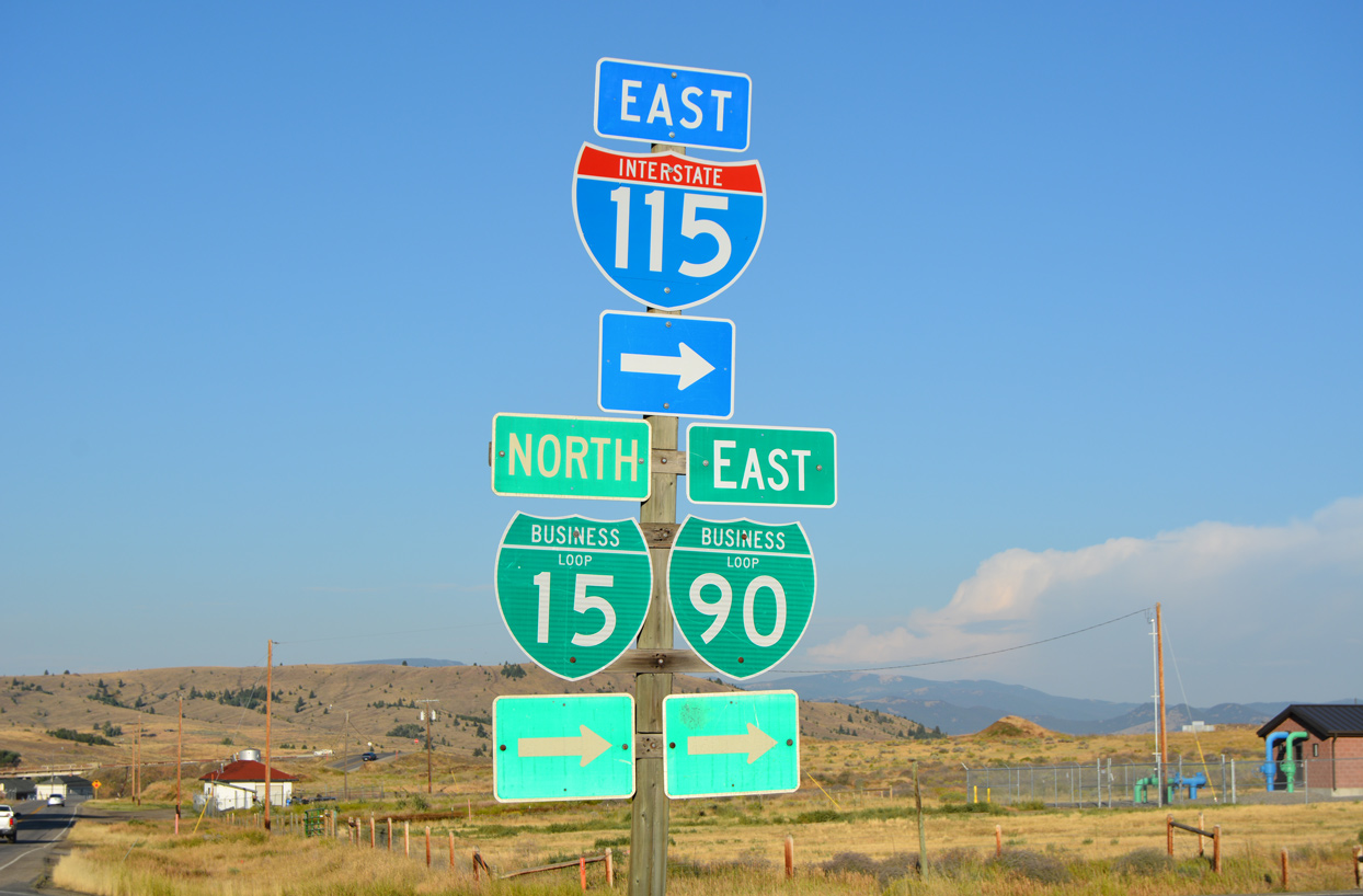
The speed limit drops to 35 miles per hour as the freeway portion of eastbound Business Loop I-15-90 transitions to Iron Street. Sidewalks and homes line the ensuing stretch to Montana Street. 07/05/16
![]() South
South ![]() West at
West at ![]()

Iron Street expands into a four lane boulevard west from Montana Street. Westbound Business Loop I-15/90 transitions into I-115 beyond the end of on-street parking at Clark Street. The first shield for Interstate 115 follows. 07/07/16
Shields for I-115 and Business Loops I-15/90 posted at the eastbound entrance ramp from Excelsior Avenue north. A folded diamond interchange joins the two roads. These Business Loop shields were replaced by 2012. Photo by Jeff Royston (05/17/03).
West End – Butte, Montana
![]() North
North ![]() East at
East at ![]()
![]()
![]()
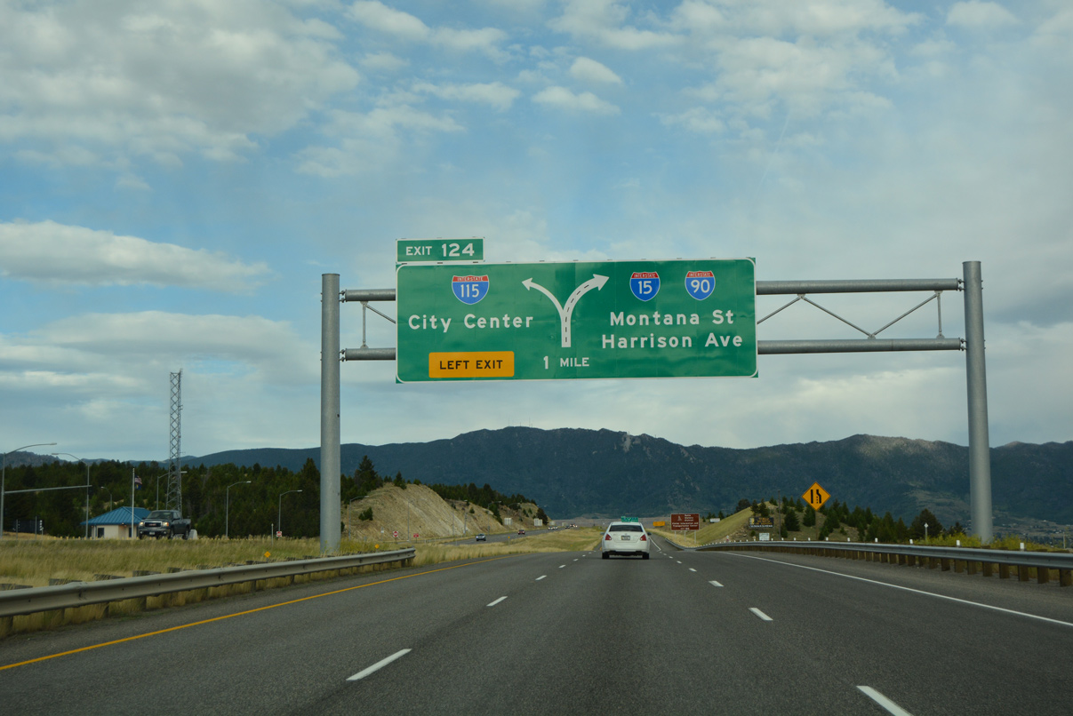
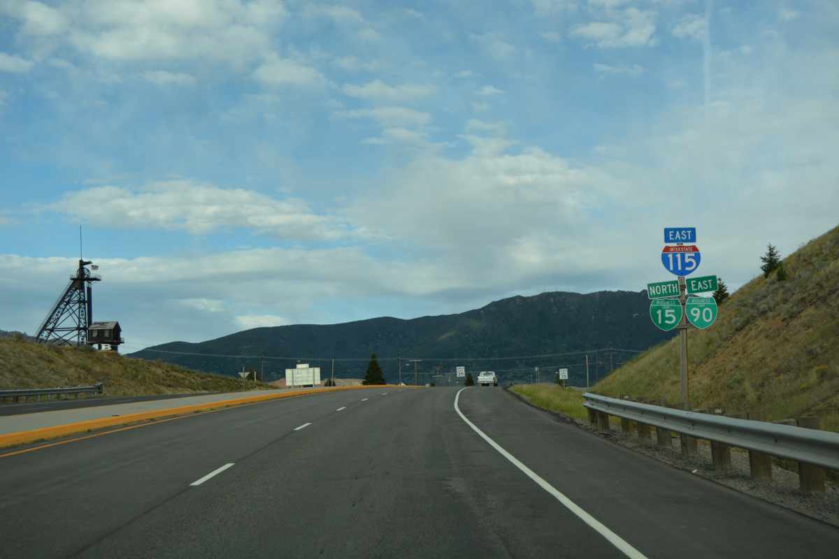
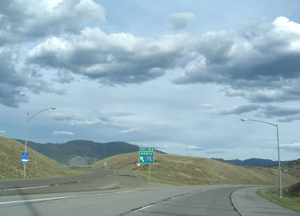
Traveling east from Rocker, I-15 north / I-90 east run along a ridge above parallel Silver Bow Creek to Left Exit 124 for Interstate 115 east. 07/05/16
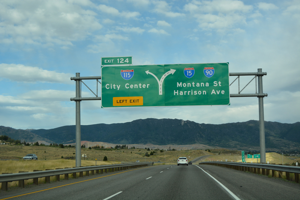
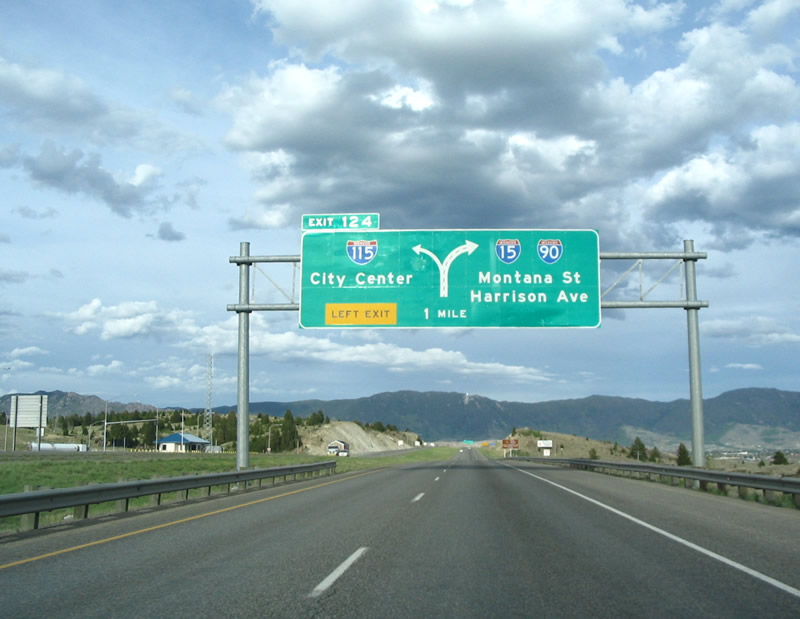
A second diagrammatic sign precedes the wye interchange (Exit 124) with I-115 east. The local exits to Montana Street and Harrison Avenue (MT 2) appear in place of Billings and Bozeman for the continuation of I-15/90 east. 07/05/16
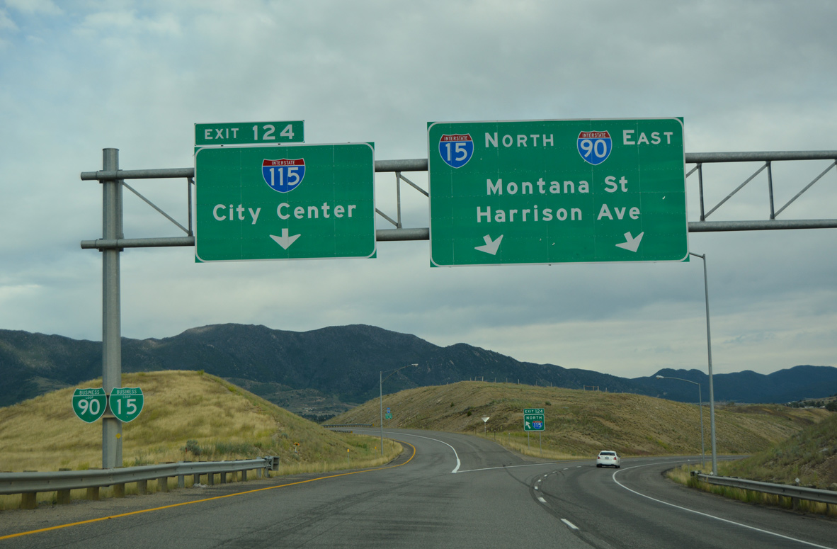
Interstate 115 and Business Loop I-15/90 branch east to Iron Street in Butte as I-15/90 shifts southeast to cross Silver Bow Creek ahead of Williamsburg. The business loops return to the freeway via Harrison Avenue south at Exit 127. 07/05/16
Exit 124 departs for I-115 north as the roadways of I-15/90 separate. Photo by Steve Hanudel (05/21/06).

Confirming markers for I-115 and Business Loops I-15/90 appear just ahead of the underpass carrying motorists westward along I-15/90. The roadways of the Butte freeway spur stay separate due to the terrain on the initial stretch. Photo by Jeff Royston (05/17/03).
![]()
![]() West
West ![]() South at
South at ![]()
![]()
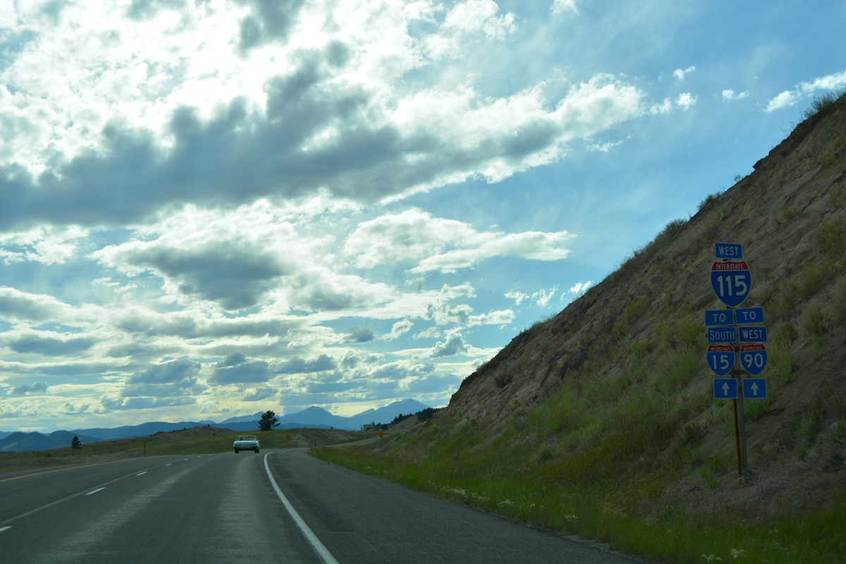
I-15/90 trailblazers appearing beyond the Excelsior Avenue entrance ramp take the place of confirming markers for Business Loop I-15/I-90 along I-115. 07/05/16
A lane drop precedes the west end of Interstate 115 onto I-15 south / I-90 west. 07/05/16
Traffic from I-115 west lowers onto I-15/90, 1.5 miles ahead of the Rocker interchange. The forthcoming exit hosts a pair of truck stops. 07/05/16
 West End Throwback
Expansion of I-15 north / I-90 east from the Rocker interchange included the replacement of the initial sign bridge for I-115. The added eastbound lane ends a short distance ahead. Photo by Steve Hanudel (05/21/06).
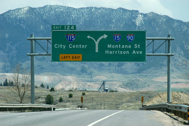
The subsequent diagrammatic sign for Exit 124 and I-115 was carbon copied by 2015. Photo by Jeff Royston (05/17/03).
Sources:
- Montana Highway Department. (1963). The Center line: Montana Highway Commission. Helena, MT.
- Montana Highway Department. (September, 1964). The Center line: Montana Highway Commission. Helena, MT.
Page updated June 30, 2022.