Interstate 110 Florida
Overview
Interstate 110 facilitates traffic from I-10 to Downtown Pensacola and the Pensacola Bay Bridge (U.S. 98) south to Gulf Breeze and Pensacola Beach. The urban freeway serves Pensacola Naval Air Station traffic via connections with SR 295 (Fairfield Road) and SR 296 (Brent Lane) and Pensacola International Airport (PNS) via ramps with SR 750 (Airport Boulevard) and SR 291 (Davis Highway).
I-110 from Maxwell Street south 1.6 miles to U.S. 98 Business (Chase/Gregory Streets) is an elevated freeway with four lanes. The remainder of the route north to Brent and I-10 at Ferry Pass is six lanes wide.
 History
I-110 was one of three proposed urban Interstates proposed by the Florida State Road Department to the American Association of State Highway Officials (AASHO) on August 8, 1958. The Pensacola spur was included in the Florida State Road Department’s 503-mile, $300 million interstate highway construction program announced on September 16, 1961. $4.7 million in funds were allocated for construction of I-110 from I-10 five miles south to Maxwell Street.1
Construction started on the northernmost 2.31 miles of Interstate 110 on July 19, 1962. Costing $3.71 million, the project was 75% complete as of August 31, 1963. The north end of I-110 at that time connected to an 8.13 mile long section of Interstate 10 between U.S. 90 Alternate (Nine Mile Road) and SR 291 (Davis Highway), with construction lengthening I-10 in both directions starting in 1964. Right of way acquisition was underway along the succeeding 1.1 mile segment extending south in 1963.2
Following two years of construction, Interstate 110 was completed south from I-10 to Fairfield Drive (then SR 289) on June 23, 1964. Costing $1.86 million, the 3.1 mile section was finished slightly ahead of schedule.3
The U.S. Bureau of Public Roads approved an extension of I-110 south from Maxwell Street to U.S. 98 Business (Garden Street) at Downtown Pensacola on April 25, 1967. The decision came after local and state officials and member of the Pensacola Area Chamber of Commerce conferred with bureau officials and Florida Congressmen on April 11, 1967.4
A 1.05 mile section of Interstate 110 opened without fanfare south from SR 295 (Fairfield Drive) to Maxwell Street in Pensacola on February 12, 1970. The section was previously scheduled to open on January 17, 1970, but bad weather pushed it back. Costing $1.3 million, bids on the segment were let in August 1968, with work commencing in October 1968. The city of Pensacola converted Maxwell and Jordan Streets into a one way couplet to accommodate the expected traffic flow in mid January 1970.5
Construction on the next section of I-110 commenced in Summer 1976 with a scheduled completion in late 1979.6 Extending 14 blocks closer to Downtown Pensacola, Interstate 110 opened south from Maxwell and Jordan Streets to U.S. 90/98 (Cerventes Street) on August 17, 1978.7 Delays due to flooding rains and Hurricane Frederic in September 1979 pushed back work on the last phase, taking I-110 another six blocks south, to July 16, 1980.5 This was after previous attempts to open the segment on May 16 and then May 30, 1980, were delayed due to sign and traffic signal installation and painting of the roadway due to inclement weather.8 The final estimated cost of I-110 from Maxwell Street to Gregory Street was near $44 million.6
Work finished in July 2009 expanded the freeway to six overall lanes from the half diamond interchange (Exit 3) with Maxwell/Jordan Street northward to the SR 742 (Creighton Road) overpass. Costing $58 million, the reconstruction of the freeway included expanding Exit 5 with SR 296 into a split diamond interchange with SR 750 (Airport Boulevard) and redesigning the exchange (Exit 4) with SR 295 (Fairfield Drive) into a parclo interchange with ramps tieing into adjacent SR 291 (Davis Highway). This project coincided with the I-10/110 improvement program from early 2007 onward.
Costing $76 million, the I-10/110 project was completed in Fall 2008. Construction widened Interstate 10 to six lanes from east of the Old Palafox Highway (Escambia County Road 95A) overpass to a point beyond the interchange (Exit 13) with Davis Highway (SR 291). I-110 was expanded to six lanes from I-10 southward to just north of the Airport Road overpass. Improvements at the trumpet interchange joining I-10/110 included the addition of a flyover ramp from I-10 west to I-110 south and collector distributor roadways separating local and through traffic between I-10, I-110 and SR 291. SR 291 was also widened to six lanes from I-10 south to University Town Plaza (formerly University Mall) as well. Construction began in 2002.9
Associated with the I-10/110 project was the construction of a new overpass and extension of Creighton Road (SR 742) over Interstate 110 west to Hilburn Road. SR 742 comprises a five lane arterial east from Hilburn Road to SR 289 (Ninth Avenue). Creighton Road was previously widened between SR 291 (Davis Highway) and Ninth Avenue by 1996. Future plans, though not yet funded by the state legislature, call for extending Creighton Road further west to U.S. Highway 29.
Route Information
North End – Ferry Pass, FL
South End – Pensacola, FL
- Mileage – 6.94
- Cities – Pensacola
- Junctions –

Source: December 31, 2021 Interstate Route Log and Finders List
I-110 Annual Average Daily Traffic (AADT)
Source: 2019 AADT – Florida Traffic Online (FDOT)
Airport Boulevard west at the northbound entrance ramp to I-110. 03/20/12

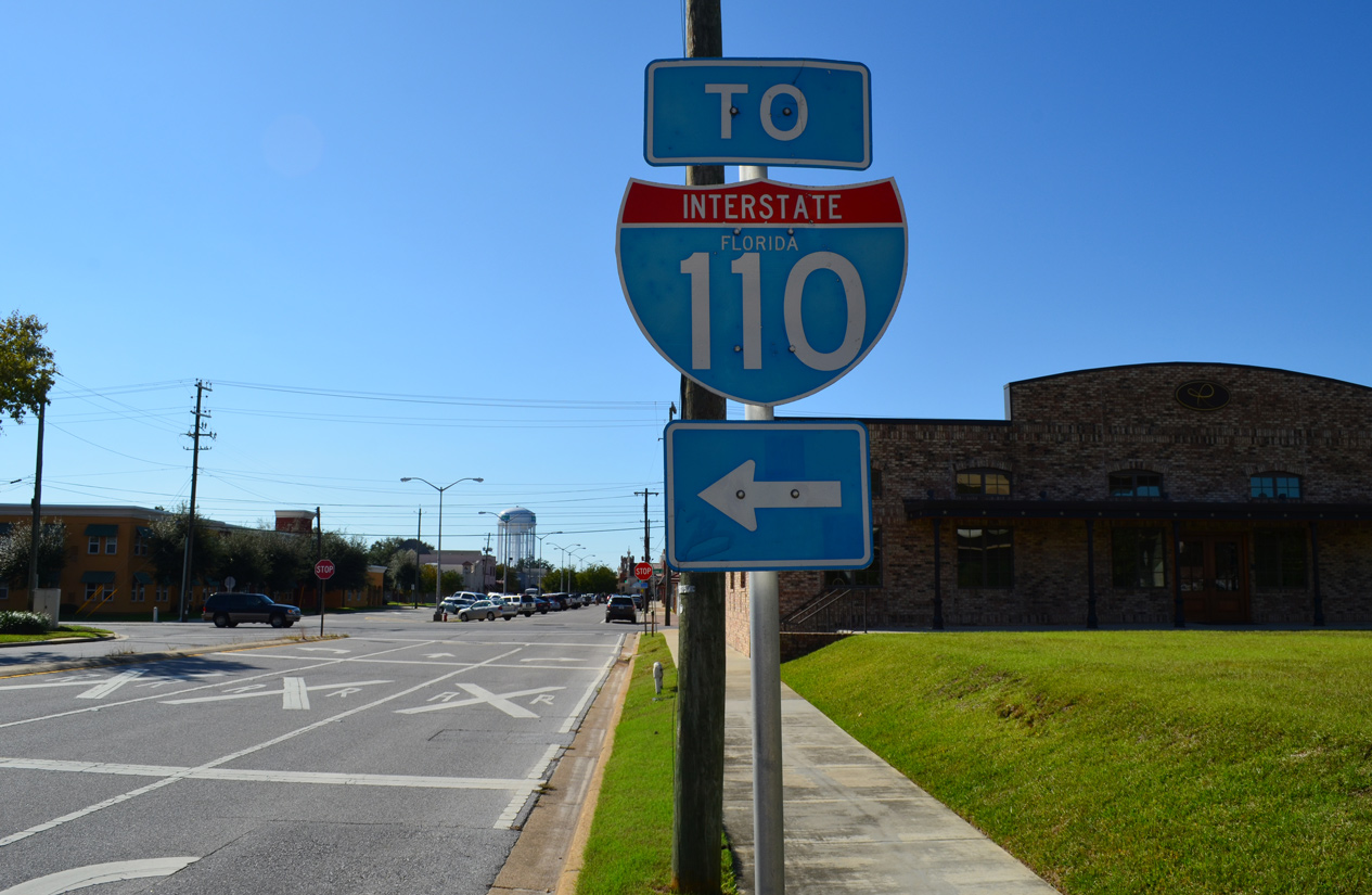
I-110 is assigned the hidden Florida State Road number of 8A. The suffixed route is derived from State Road 8, the counterpart of Interstate 10 across the state.
Cancelled Extensions
Early 2000s plans for a northward extension of Interstate 110 to Nine Mile Road (U.S. 90 Alternate) were dropped due to funding related issues. Long range plans at the time continued on a further extension of the freeway to Interstate 65 in lower Alabama.
A report pertaining to a possible replacement of the four lane U.S. 98 Pensacola Bay Bridge was issued in 2001. Two plans outlined a six lane crossing. One alternative involved widening the existing bridge, while the other called for construction of a new span, with the possibility of retaining the old one as well. A new or upgraded bridge may have directly connected with Interstate 110 via a limited access viaduct.
Construction of the new Pensacola Bay Bridge underway in Spring 2017 replaced the Pensacola Bay Bridge built in 1960. The first span opened with four lanes and two-way traffic on September 8, 2019. Due to damage from Hurricane Sally on September 15, 2020, the new span closed for emergency repairs. Subsequent delays on work for the second span pushed completion back from mid 2021 to late 2022. Upon completion, the $427 million project will accommodate six overall lanes with full inside and outside shoulders, and a ten foot wide multi use path in each direction.
A separate project underway through Fall 2021 Fall 2022 replaced the signalized intersection joining U.S. 98 (Gregory Street / Bayfront Parkway) and 17th Avenue. Construction built a three lane westbound flyover for U.S. 98 spanning a roundabout joining Bayfront Parkway and 17th Avenue. The eastbound roadway for U.S. 98 was realigned to bypass the roundabout as well. Traffic was in the new configuration at the exchange by May 2022.
 Photo Guides
North End  – Ferry Pass
![]() North at
North at ![]()
I-110 advances two miles north from the SR 296 (Brent Lane) under crossing to Interstate 10. 05/11/22
Reconstruction of the exchange joining I-10/110 between 2002 and 2008 expanded the northern extent of I-110 to as many as ten overall lanes. 05/11/22
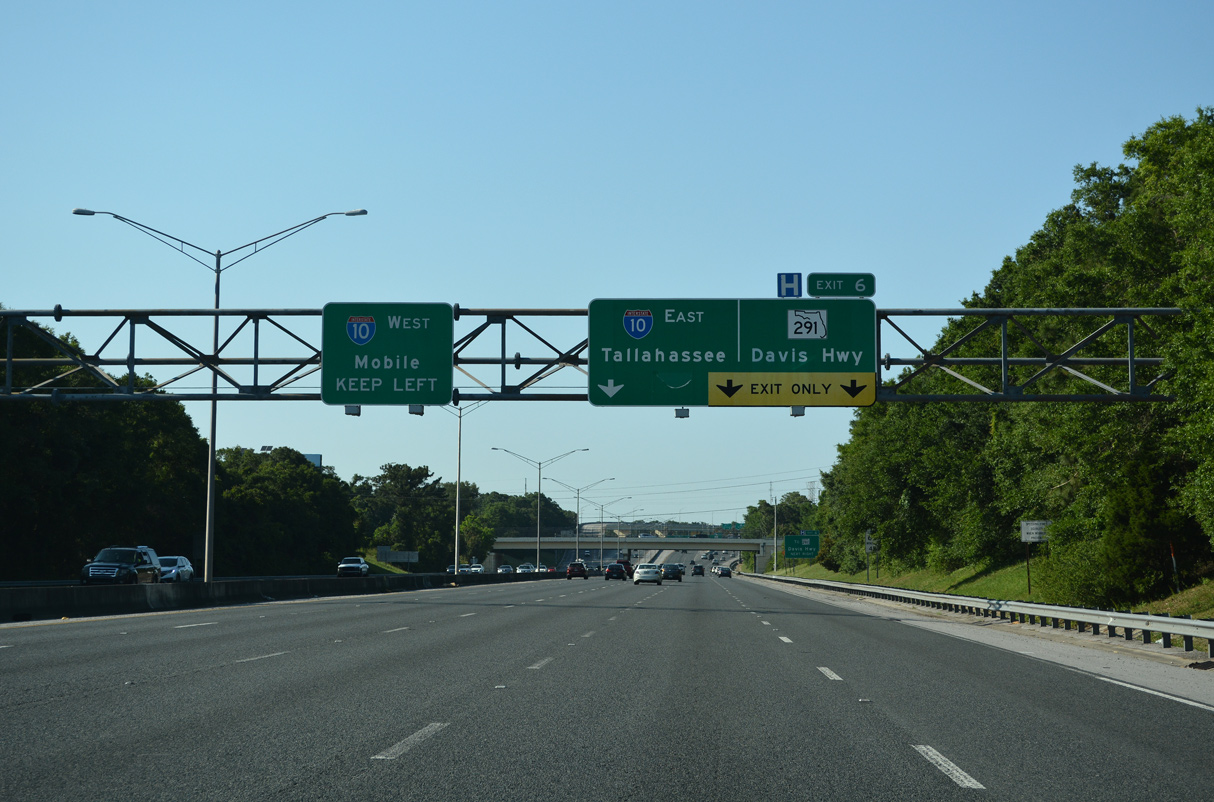
The Interstate 110 mainline defaults onto I-10 west with one overall lane while three lanes connect with a distributor roadway along I-10 east to SR 291 (Davis Highway). 05/11/22
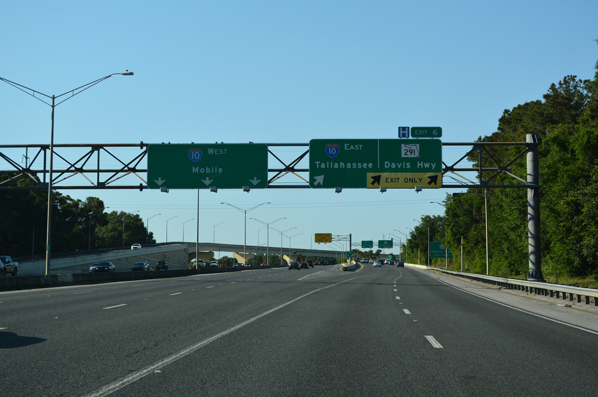
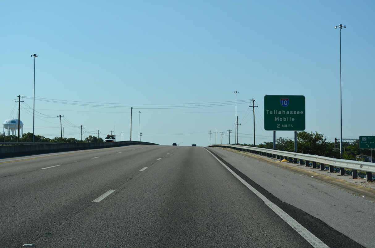
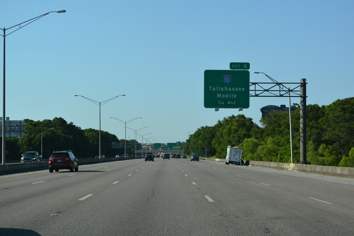
Interstate 110 ends as Exit 6 departs for Interstate 10 east to Tallahassee. I-10 joins the Pensacola area with Mobile 58 miles to the west. 05/11/22
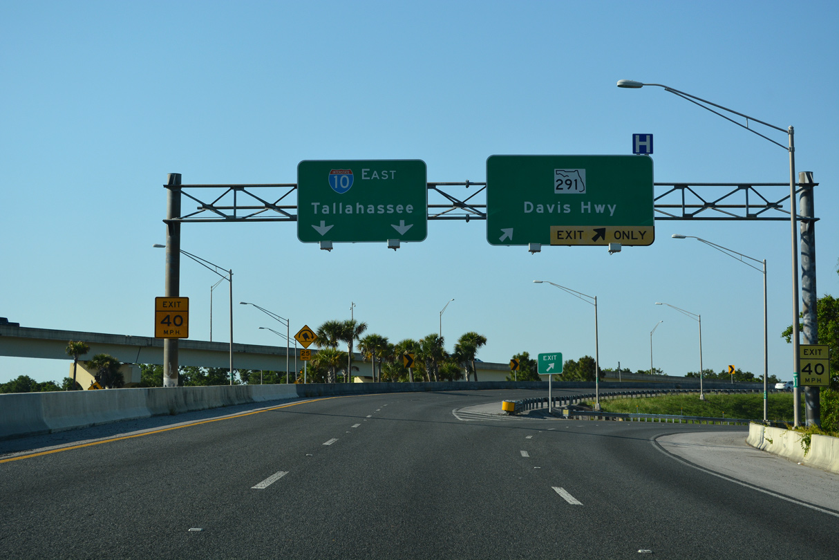
SR 291 (Davis Highway) is a heavily traveled commuter route north to U.S. 90 Alternate (Nine Mile Road) near the University of West Florida (UWF). I-10 east travels 190 miles to Tallahassee. 05/11/22
![]() East at
East at ![]()
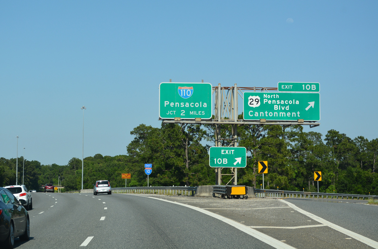
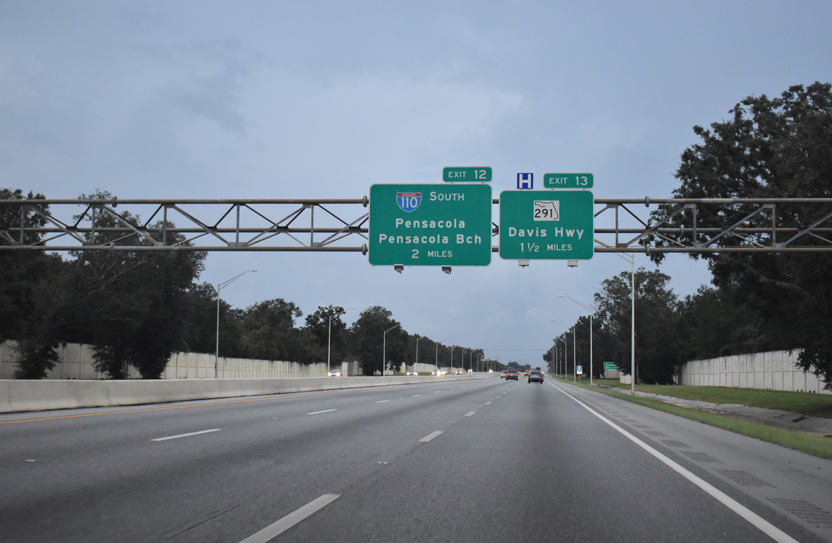
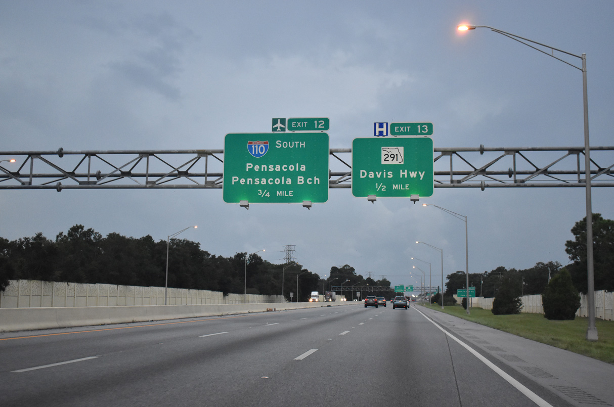
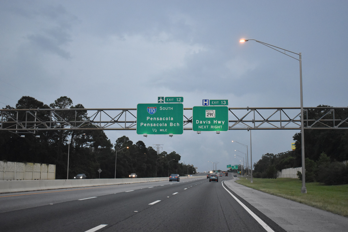
I-10 converges with U.S. 29 at Exit 10, two miles ahead of Interstate 110 south. Construction programmed for Fiscal Year 2023 reconfigures this exchange to eliminate left side ramps. 05/11/22
Construction from Spring 2016 to Summer 2017 extended a third eastbound lane from U.S. 29 to Interstate 110. 05/11/22
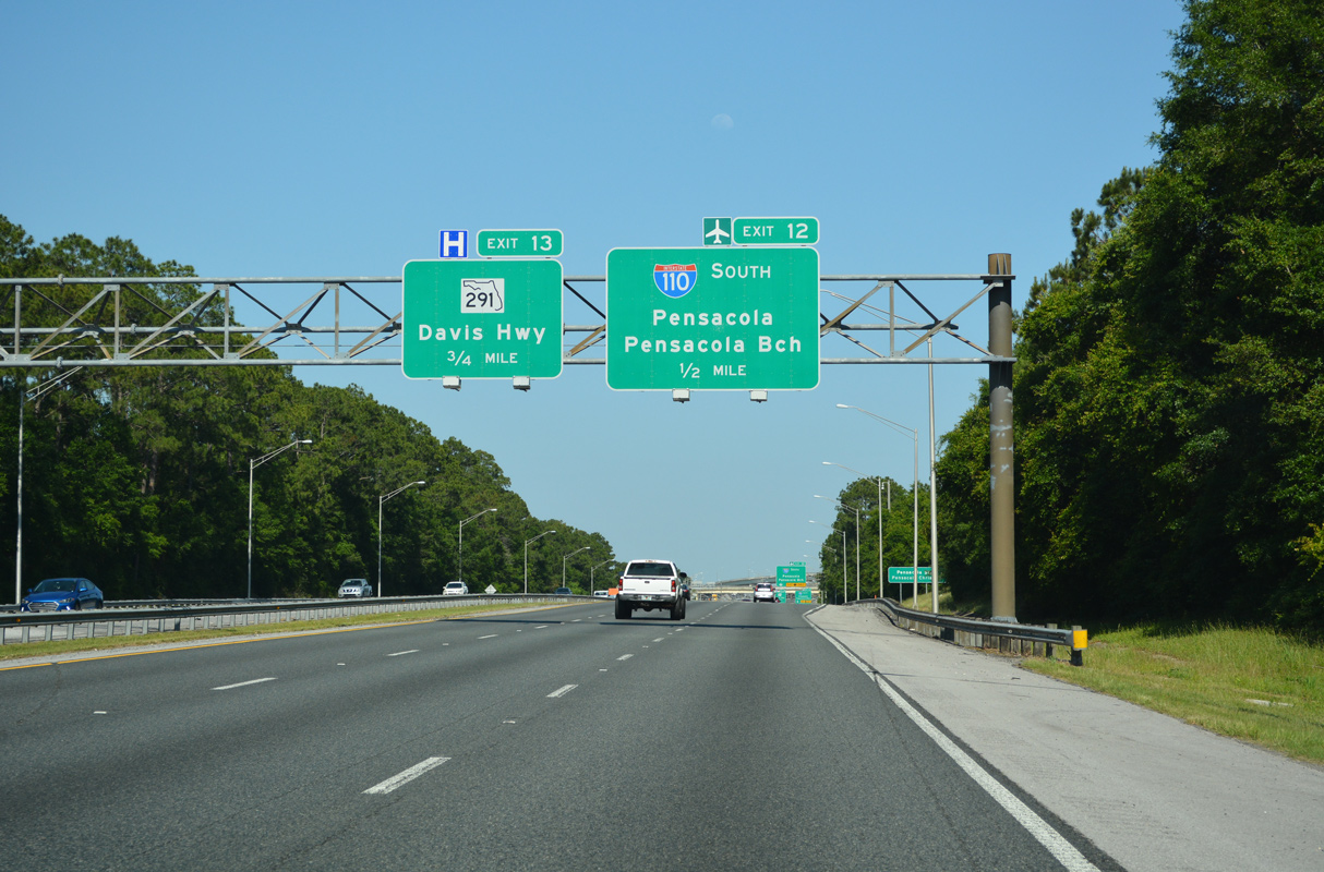
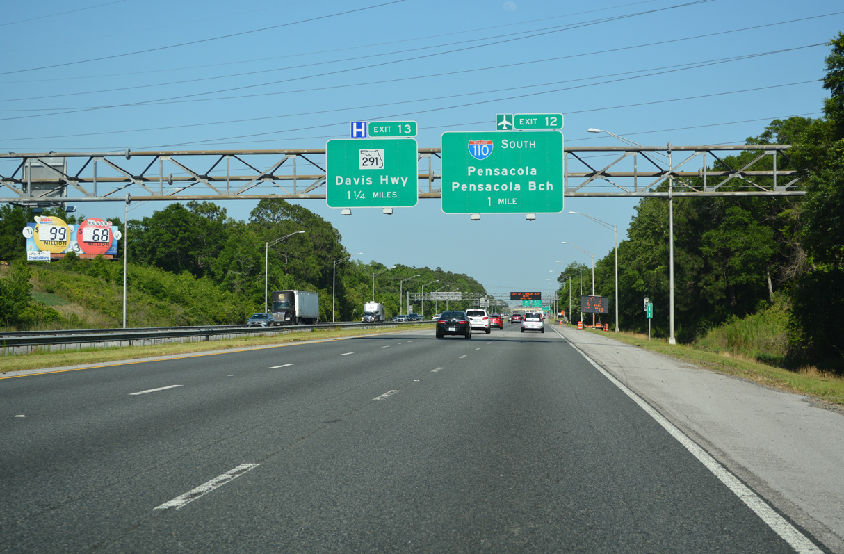
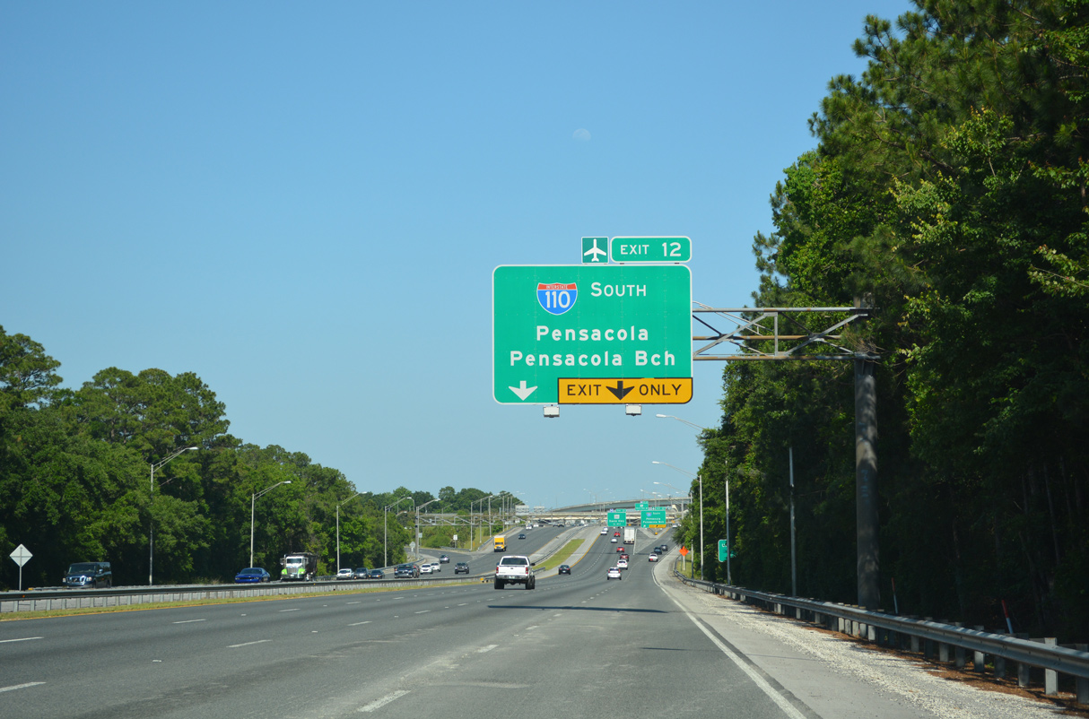
Completed in 2008, construction at the trumpet interchange (Exit 12) with I-110 added a c/d roadway (Exit 13) east to SR 291 (Davis Highway). 05/11/22
Pensacola Beach is 14.5 miles to the south via I-110, the Pensacola Bay Bridge (U.S. 98) and the Bob Sikes Bridge (County Road 399). 05/11/22
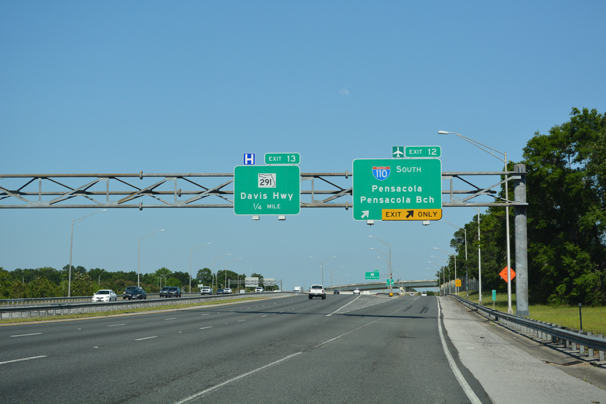
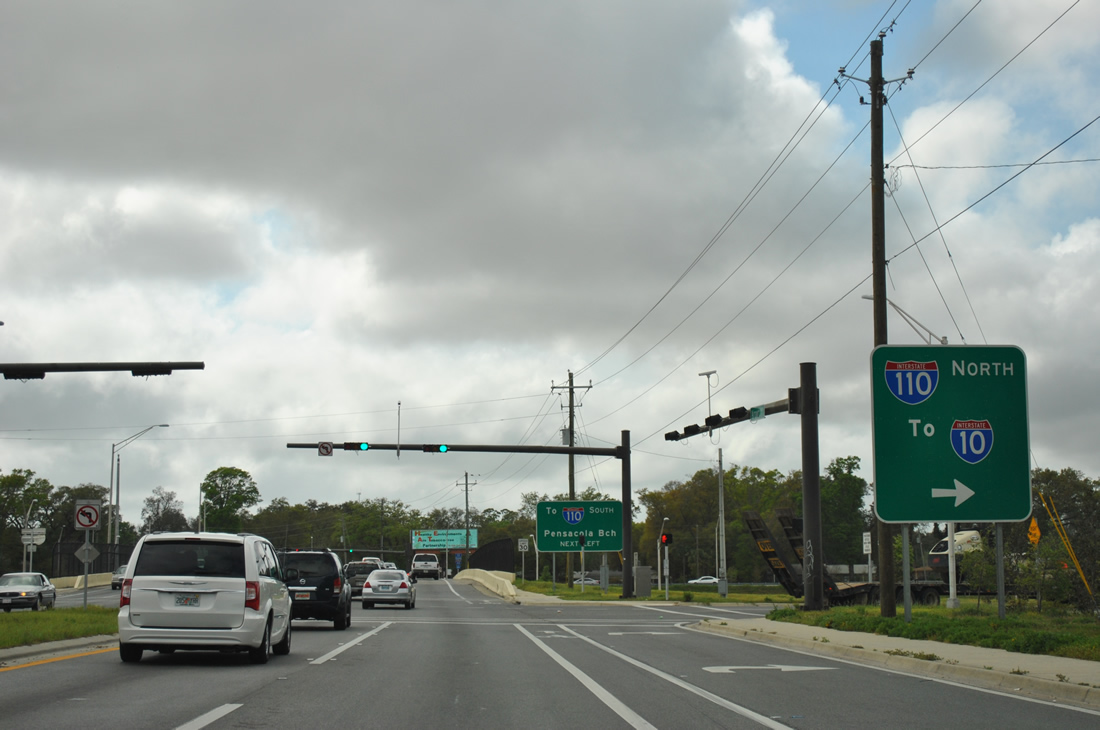
I-110 south connects with SR 750 (Airport Boulevard) east to Pensacola International Airport (PNS) at the succeeding exit from Interstate 10. 05/11/22
![]() West to
West to ![]()
Construction through 2017 expanded I-10 to six overall lanes from SR 281 (Avalon Boulevard) west to SR 291 (Davis Highway) and I-110. 10/02/21
Separating local traffic from I-10, 2002-08 widening added a distributor roadway from SR 291 to the original trumpet interchange with Interstate 110 south. 10/02/21
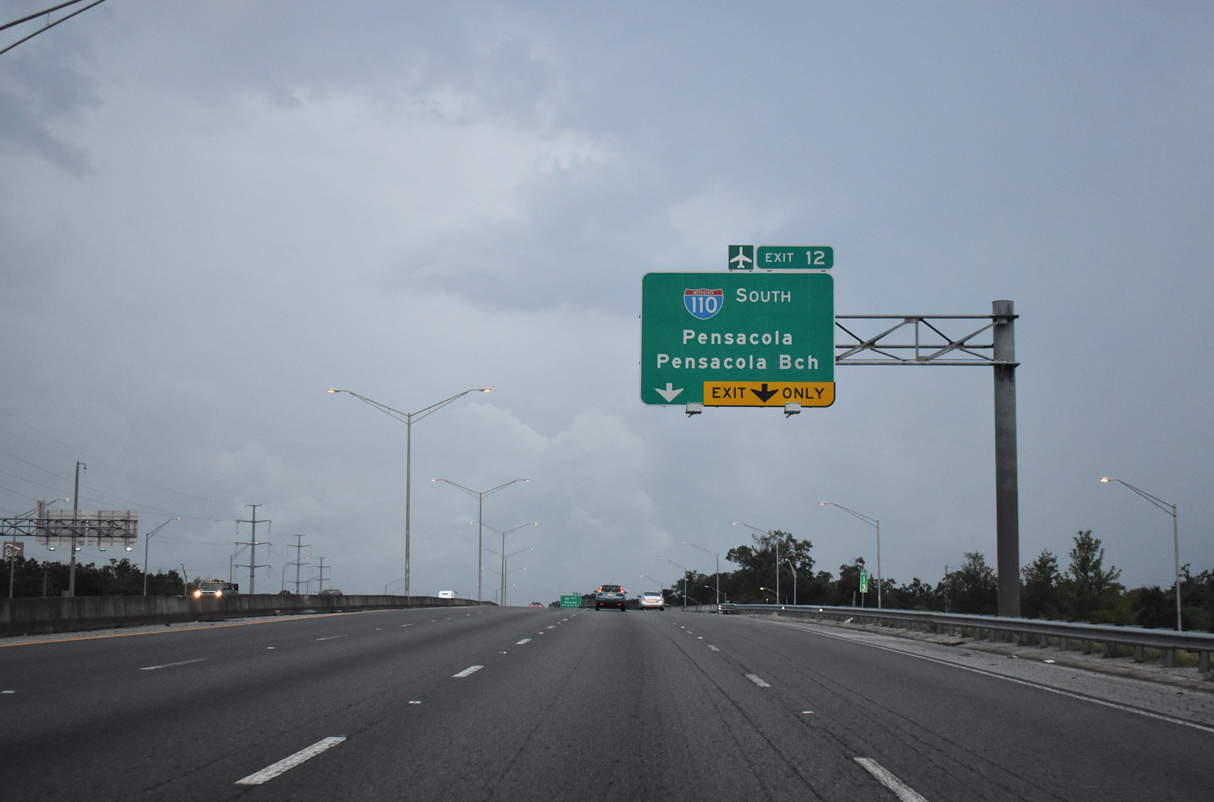
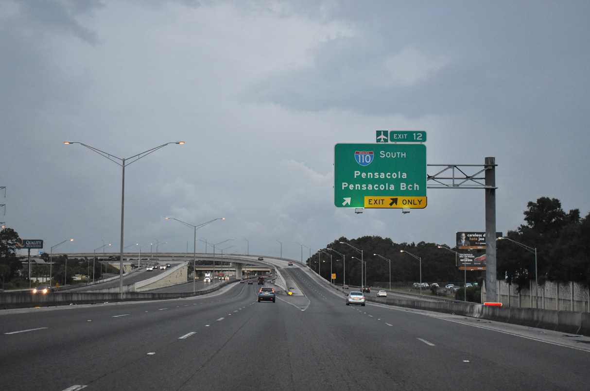
A two lane flyover connects I-10 west with Interstate 110 south to Pensacola at Exit 12. 10/02/21
South End  – Pensacola
![]() South at
South at ![]()
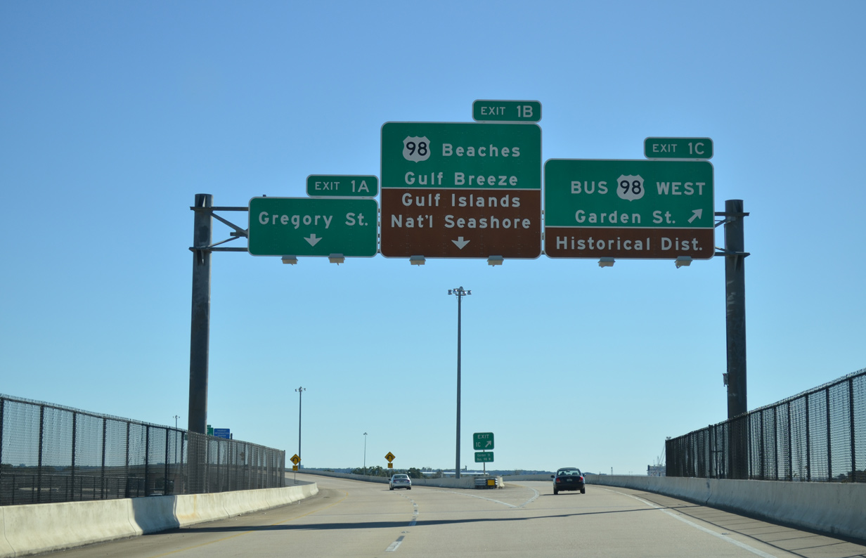
Exit 1A separates from the I-110 southbound viaduct above Jackson Street to U.S. 98 Business (Garden Street) west into Downtown Pensacola. 11/22/15
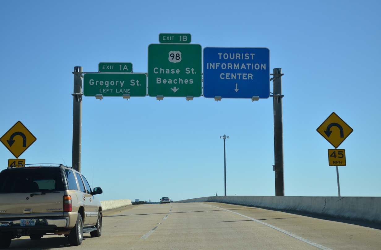
A high flyover curves onto Chase Street (U.S. 98 Business) eastbound beyond the loop ramp (Exit 1A) to Gregory Street (U.S. 98 Business) westbound. 11/22/15
Westbound U.S. 98 Business follows Gregory Street from U.S. 98 at Ninth Avenue by the Pensacola Bay Center to Alcaniz Street south toward Downtown Pensacola. 11/22/15
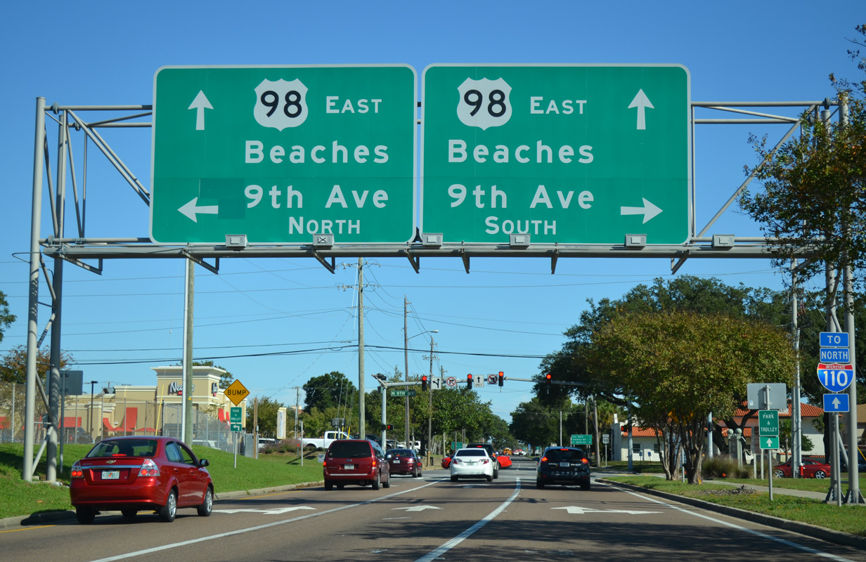
Exit 1B merges with Chase Street (U.S. 98 Business) east ahead of the U.S. 98 turn from Ninth Avenue (SR 289). U.S. 98 partitions along a one-way couplet between Ninth Avneue and the Pensacola Bay Bridge. 11/19/15
![]() / Gregory Street – West at
/ Gregory Street – West at ![]()
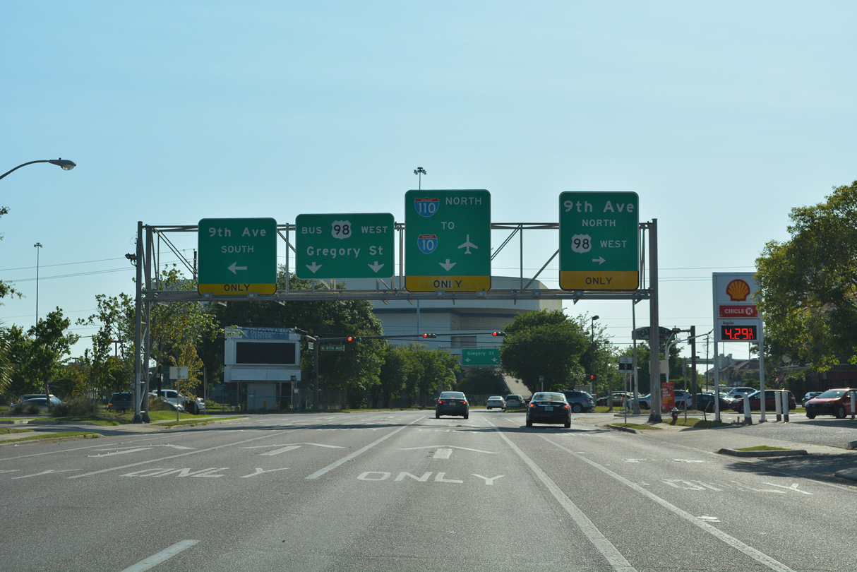
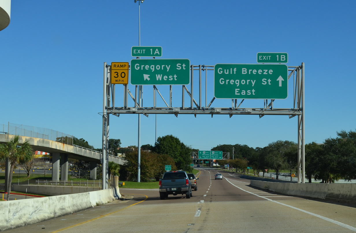
Gregory Street extends from U.S. 98 (Ninth Avenue) as U.S. 98 Business westbound to Interstate 110 and Alcaniz Street. 05/11/22
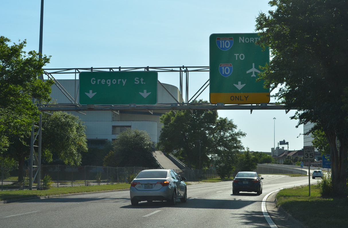
Interstate 110 begins from U.S. 98 Business (Gregory Street) west along a single lane flyover. 05/11/22
Chase Street – East at ![]()
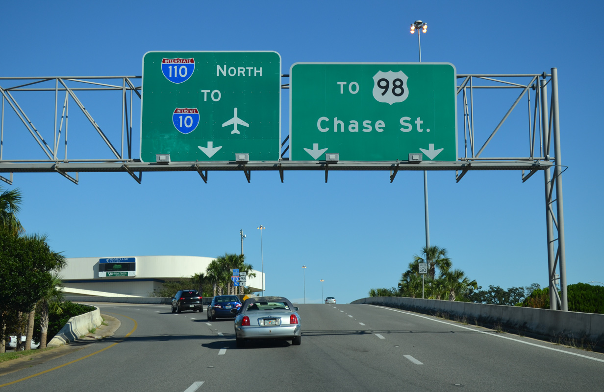
Chase Street flows east from Downtown Pensacola into the directional T interchange with I-110 north. Flyovers partition beyond Tarragona Street for the freeway and the continuation of Chase Street onto U.S. 98 Business east. 11/19/15
Sources:
- “SRD Submits Its Interstate Road Plans.” St. Petersburg Times (FL), September 17, 1961.
- “Florida’s Superhighway to Nowhere.” St. Petersburg Times (FL), September 22, 1963.
- “I-10 Spur Announced Complete.” Pensacola Journal (FL), June 24, 1964.
- “The Spur Will Go Here.” Pensacola Journal (FL), April 30, 1967.
- “Interstate Spur Opens Quietly.” Pensacola Journal (FL), February 12, 1970.
- “Patchwork to arrow, I-110 is ready.” Pensacola Journal (FL), June 15, 1980.
- “I-110 Segment Opens Today.” Pensacola Journal (FL), August 17, 1978.
- “I-110 Opening Set for May 30.” Pensacola Journal (FL), May 15, 1980.
i10-i110.com. Florida Department of Transportation (FDOT), web site.
Page updated June 15, 2022.